
Airports

Tokyo Area
- Narita International Airport (NRT): Located in Chiba Prefecture, about 60km from central Tokyo. This remains Japan’s primary international gateway despite being farther from the city center. Connected to Tokyo by the Narita Express (N’EX) train, Keisei Skyliner, limousine buses, and regular train services.
- Haneda Airport (HND): Officially Tokyo International Airport, located just 14km from central Tokyo. Originally primarily a domestic airport, it now handles numerous international flights and is preferred by many travelers due to its proximity to the city. Connected by Tokyo Monorail and Keikyu Line trains.
Other Major International Airports
- Kansai International Airport (KIX): Built on an artificial island in Osaka Bay, serving the Kansai region (Osaka, Kyoto, Kobe). Connected to the mainland by the Haruka Express train and airport limousine buses.
- Chubu Centrair International Airport (NGO): Serving Nagoya and the Chubu region, also built on an artificial island. Connected to Nagoya via the Meitetsu Airport Line.
- New Chitose Airport (CTS): The main gateway to Hokkaido, located near Sapporo. Connected to Sapporo by the JR rapid train service.
- Fukuoka Airport (FUK): The main gateway to Kyushu, unusually located very close to downtown Fukuoka (only 2km). Connected directly to the city center by subway.
Major Train Stations and Railway Companies in Japan

Major Railway Companies
JR Group (Japan Railways)
The JR Group consists of six regional companies that operate the majority of Japan’s intercity rail service:
- JR East – Serves Tokyo, northeastern Honshu
- JR Central – Serves central Japan, operates the Tokaido Shinkansen
- JR West – Serves western Honshu including Osaka, Kyoto
- JR Kyushu – Serves Kyushu island
- JR Hokkaido – Serves Hokkaido island
- JR Shikoku – Serves Shikoku island
Major Private Railway Companies
Several private railway companies operate significant networks, particularly in metropolitan areas:
- Tokyo Metro (Tokyo subway system)
- Toei Subway (Tokyo metropolitan government subway)
- Tokyu Corporation (Tokyo area)
- Keio Corporation (Tokyo area)
- Odakyu Electric Railway (Tokyo area)
- Hankyu Railway (Osaka/Kyoto/Kobe area)
- Hanshin Electric Railway (Osaka/Kobe area)
- Kintetsu Railway (Osaka/Kyoto/Nara/Nagoya area)
- Keihan Electric Railway (Kyoto/Osaka area)
Major Train Stations
Tokyo Metropolitan Area
- Tokyo Station – Main intercity terminal, Shinkansen hub
- Shinjuku Station – World’s busiest station by passenger numbers
- Shibuya Station – Major commercial and entertainment district hub
- Ikebukuro Station – Major commuter and shopping district hub
- Shinagawa Station – Important Shinkansen and commuter rail station
- Ueno Station – Major terminal for northern Japan routes
Other Major Cities
- Osaka Station/Umeda – Main terminal in Osaka
- Shin-Osaka Station – Shinkansen station in Osaka
- Kyoto Station – Main station in Kyoto, cultural tourism hub
- Nagoya Station – Main terminal in Nagoya, Shinkansen hub
- Hakata Station – Main station in Fukuoka, Kyushu Shinkansen terminal
- Sapporo Station – Main station in Hokkaido’s capital
- Kanazawa Station – Important station on the Hokuriku Shinkansen line
The Japanese railway system is renowned for its punctuality, efficiency, and extensive coverage, connecting virtually all urban and rural areas throughout the country.
Bus Terminals
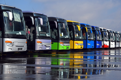
Bus terminals serve as important hubs particularly for reaching areas not directly served by train:
- Shinjuku Expressway Bus Terminal (Busta Shinjuku): Japan’s largest bus terminal, located above Shinjuku Station, serving highway buses to destinations throughout Japan.
- Tokyo Station Yaesu Exit Bus Terminal: Major departure point for highway buses from central Tokyo.
- Osaka Umeda (Hankyu Bus Terminal): Main highway bus hub in Osaka.
- Kyoto Station Bus Terminal: Located directly in front of Kyoto Station, serving both long-distance and city buses.
Port Facilities

Japan’s island geography means ferry terminals play an important role in the transportation network:
- Yokohama Port: Japan’s largest seaport, serving both passenger and cargo vessels.
- Kobe Port: Historic port with ferry connections to various domestic destinations and some international routes.
- Hakata Port: Important gateway for ferries connecting to South Korea and other Asian destinations.
- Tokushima Port: Key ferry terminal connecting Shikoku with mainland Japan.
These transportation hubs form the backbone of Japan’s interconnected transit system, allowing for seamless transfers between different modes of transportation and enabling efficient travel throughout the country.
Understanding how to get around Japan begins with mastering Tokyo’s comprehensive yet complex public transportation system. As one of the world’s most efficient urban transit networks, Tokyo’s interconnected web of trains, subways, and buses can take you virtually anywhere in this sprawling metropolis, though it might seem overwhelming to first-time visitors.
Tokyo’s transportation system represents Japanese efficiency at its finest—clean, punctual, and remarkably extensive. With over 60 subway and train lines operated by multiple companies, 13 subway lines, numerous bus routes, and even water buses traversing Tokyo Bay and its rivers, you have countless options for reaching your destination.
The Railway Network: Understanding the Players
Tokyo’s rail system can initially seem overwhelming because it’s operated by multiple companies that function as an integrated network:
JR East (Japan Railways)
The JR Yamanote Line forms the backbone of Tokyo’s railway system, running in a loop around central Tokyo and connecting most major districts. This light green line on maps is often the first orientation point for visitors. Key JR lines include:
- Yamanote Line: The circular loop connecting Tokyo, Shinjuku, Shibuya, Ikebukuro and other major centers
- Chuo Line: The orange line bisecting the Yamanote loop east to west
- Keihin-Tohoku Line: The blue north-south line paralleling parts of the Yamanote
- Sobu Line: The yellow line connecting eastern Tokyo and Chiba Prefecture
JR trains are distinguished by their typically white exterior with colored stripes indicating the line.
For more details visit: https://www.jreast.co.jp/multi/en/
Tokyo Metro and Toei Subway
These two subway systems form the underground backbone of Tokyo transportation:
- Tokyo Metro: Operates 9 lines denoted by letter codes and colors (e.g., Ginza Line is G and orange, Marunouchi Line is M and red)
- Toei Subway: Operates 4 lines, also with designated letters and colors
Together, these 13 subway lines create a comprehensive underground network reaching most parts of central Tokyo. The systems are separately operated, which matters for ticketing purposes.
For more details about Metro visit: https://www.tokyometro.jp/en/index.html
For more details about Subway visit: https://www.kotsu.metro.tokyo.jp/eng/
Private Railway Companies
These companies operate lines that typically start at a terminal within the Yamanote loop and extend outward to the suburbs:
- Tokyu: Serving southwest areas including Shibuya to Yokohama
For more details visit: https://www.tokyu.co.jp/global/
- Keio: Serving western areas from Shinjuku
For more details visit: https://www.keio.co.jp/global/
- Odakyu: Connecting Shinjuku to southwestern suburbs
For more details visit: https://www.odakyu.jp/english/
- Seibu: Operating from Ikebukuro to northwestern areas
For more details visit: https://www.seiburailway.jp/en/
- Tobu: Connecting Asakusa and Ikebukuro to northern areas
For more details visit: https://www.tobu.co.jp/en/
- Keisei: Linking eastern Tokyo and Narita Airport
For more details visit: https://www.keisei.co.jp/keisei/tetudou/skyliner/us/index.php
Understanding Tokyo’s Fare System
Tokyo’s transportation uses a distance-based fare system. The longer your journey, the more you pay. Here’s how it works:
Single Tickets
- Locate your destination on the fare map above the ticket machines
- Note the fare required to reach that station
- Purchase a ticket for that amount using the machine
- Insert your ticket at the entry gate (it will be retained)
- If traveling between different systems (e.g., JR to Metro), you’ll need to purchase separate tickets or use an IC card
The ticket machines have an English option and accept both cash and cards. They can seem complicated at first but become intuitive with practice.
IC Cards: The Essential Travel Tool
The most convenient way to navigate Tokyo is with an IC (Integrated Circuit) card, which eliminates the need to purchase individual tickets for each journey:
- Suica: Issued by JR East
- PASMO: Issued by Tokyo Metro and private railways
These cards are functionally identical—you can use either one across all train and bus systems in Tokyo and most major cities in Japan. Here’s why they’re essential:
- Convenience: Just tap in and out at station gates; the correct fare is automatically calculated and deducted
- Transfers: Simplified transfers between different railway companies
- Small discounts: IC card fares are slightly cheaper than paper tickets
- Secondary uses: Can be used at convenience stores, vending machines, and many shops
- Reloadable: Easily add value at any station ticket machine, convenience store, or fare adjustment machine
To get an IC card, purchase one at any major station from a ticket machine or manned booth. The card itself costs 1,000 yen (500 yen deposit plus 500 yen initial credit). You can top up in denominations starting from 1,000 yen.
Tokyo Metro and Subway Navigation
The subway system is often the most efficient way to travel within central Tokyo:
Finding Your Way
Stations use a consistent color-coding and numbering system to help with navigation:
- Each line has a letter code and color (e.g., Ginza Line is G and orange)
- Each station has a number (e.g., Shimbashi on the Ginza Line is G08)
- Signs are color-coded based on the line they refer to
- Exits are numbered and often include information about nearby landmarks
Most subway stations have detailed area maps near the exits showing the surrounding blocks with major buildings and landmarks clearly marked.
Making Transfers
Transfer stations are clearly marked, with signs showing the walking route between lines. Some transfers can be lengthy—up to 5-10 minutes of walking at major interchange stations like Shinjuku or Tokyo Station. Signs indicate the approximate walking time for longer transfers.
Bus System
While trains and subways form the primary transportation network, buses serve as valuable complements, especially for areas between train stations or neighborhoods less covered by rail:
Toei Buses
The main city bus network is operated by Toei (the same company that runs some subway lines). These green buses run numerous routes throughout Tokyo, with bus stops marked by green signs showing route numbers and destinations.
For more details visit: https://www.kotsu.metro.tokyo.jp/
How to Ride City Buses
Tokyo city buses typically follow these procedures:
- Board from the middle or rear door
- Take a numbered ticket when boarding (this shows where you got on)
- A display at the front shows the current fare for each ticket number (increases as the bus travels)
- Pay as you exit from the front door, either with your IC card or exact change
- Push the stop button when approaching your desired stop
Some newer bus routes use a flat fare system, where you pay a fixed amount when boarding from the front door.
Bus Information
Bus stops have route maps, but they’re often only in Japanese. The Japan Transit Planner app or Google Maps can help identify which bus routes to take. Announcements on buses are typically in Japanese and sometimes English.
Taxis: When and How to Use Them
Taxis in Tokyo are clean, safe, and plentiful, though relatively expensive compared to public transportation:
When to Consider Taxis
- When carrying heavy luggage
- After the last trains (approximately midnight to 5 AM)
- When traveling in groups of 3-4 people (making the cost more reasonable per person)
- For short distances in bad weather
- When you need door-to-door service
Starting fare is typically around 410-420 yen for the first 1.052 kilometers, then approximately 80-90 yen for each additional 237 meters.
Special Passes and Discounts
For Visitors
- Tokyo Subway Ticket: Unlimited rides on Tokyo Metro and Toei Subway lines (24, 48, or 72 hours)
- Tokyo Free Kippu: One-day pass covering JR trains, Metro and Toei subways, and buses within central Tokyo
- JR Tokyo Wide Pass: Three-day unlimited travel on JR lines in the greater Tokyo area
Digital Assistance
Several apps can make Tokyo navigation much easier:
- Japan Transit Planner: Comprehensive route planning with accurate timetables
- Tokyo Subway Navigation: Official app from Tokyo Metro
- Google Maps: Works well in Tokyo with accurate transit information
- JR East App: Provides real-time train information and platform guides for JR stations
Welcome to Kyoto, the cultural heart of Japan where ancient traditions meet modern convenience. Navigating this historic city is made seamless through its well-organized public transportation system, an essential component of understanding How to Get Around Japan. While not as extensive as Tokyo’s network, Kyoto’s buses, subways, and trains provide efficient access to its world-renowned temples, shrines, and traditional neighborhoods, allowing visitors to experience the city’s 1,200 years of history without transportation challenges.
Kyoto’s transportation network centers on its comprehensive bus system, with color-coded routes connecting major attractions and residential areas. The Kyoto City Bus network features the convenient visitor-oriented routes 100 and 101, circling the most popular destinations. The subway system, though limited to just two lines, offers quick transit between the central station and northern districts.
For more details visit: https://www2.city.kyoto.lg.jp/kotsu/webguide/en/
https://kyoto.travel/en/info/transportation/index.html
Understanding Kyoto’s Layout
Before diving into transportation options, it helps to understand that Kyoto is laid out in a grid pattern, similar to a chessboard. The city is relatively flat (except for the eastern and western edges) and compact compared to Tokyo, with many key attractions concentrated in specific areas. This grid layout makes the city relatively easy to navigate once you grasp the basics.
The Kamo River runs north-south through the city, serving as a natural dividing line. Many locals use directions like “Kawaramachi” (the downtown area along the river) or “Higashiyama” (eastern mountains) as reference points.
The Bus Network: Kyoto’s Transportation Backbone
Unlike many major Japanese cities where railways dominate, Kyoto’s bus system forms the backbone of public transportation. This is partly due to the city’s conservation efforts to maintain its historical character by limiting underground construction.
City Bus System
Kyoto City operates an extensive network of buses that reach virtually every tourist attraction:
- Bus Types and Routes:
- Green and White Buses (Kyoto City Bus): These are the main city buses that cover central Kyoto.
- Raku Bus (Routes 100, 101, 102): Special tourist-oriented buses connecting major sightseeing spots.
- Kyoto Bus (Blue and White): These buses primarily serve the outskirts and suburbs.
- Understanding Bus Routes:
- Bus stops display route maps with all stops listed
- Electronic displays at major stops show waiting times
- The most useful bus routes for tourists include:
- Route 100: Circular route connecting Kyoto Station with eastern Kyoto (Ginkakuji, Kiyomizudera)
- Route 101: Western Kyoto loop (Kinkakuji, Ryoanji)
- Route 102: Northern Kyoto (Kitano Tenmangu, Kinkakuji)
- Route 205: Connects Kyoto Station with downtown and Gion
- For more details visit: https://www2.city.kyoto.lg.jp/kotsu/busdia/keitou/keitou.htm
Subway System: Fast Travel on Limited Routes
Kyoto’s subway system is much smaller than Tokyo’s, with just two lines, but these lines provide fast travel through the city center:
For more details visit: https://www2.city.kyoto.lg.jp/kotsu/tikadia/tikatime.htm
Karasuma Line (North-South)
- Runs from Kyoto Station northward under Karasuma Street
- Connects major areas including downtown (Shijo), the Imperial Palace area (Marutamachi), and northern Kyoto
- Marked in green on maps
- Most useful for reaching downtown, Nijo Castle, and the Imperial Palace
Tozai Line (East-West)
- Runs east-west through the city center
- Connects eastern Kyoto (near Heian Shrine) with western areas (Uzumasa Tenjingawa)
- Marked in red on maps
- Useful for reaching Higashiyama area and Keihan line transfer
Fare System: Distance-based, ranging from 220-350 yen for most journeys within the city. Ticket machines have English options and display fare maps.
JR Lines: Connecting to the Suburbs and Beyond
Japan Railways (JR) operates several lines in Kyoto that are useful for specific destinations:
JR Nara Line
- Runs southeast from Kyoto Station toward Nara
- Useful for reaching Fushimi Inari Shrine (Inari Station, just 5 minutes from Kyoto Station)
- Also serves Uji, famous for tea and the Byodoin Temple
JR Sagano/San-in Line
- Runs west and north from Kyoto Station
- Serves Arashiyama (Saga-Arashiyama Station), one of Kyoto’s most scenic districts
- The scenic Sagano Romantic Train (a separate sightseeing train) operates along this route
JR Biwako Line
- Heads northeast toward Lake Biwa
- Less useful for tourists unless heading to Shiga Prefecture
Private Railways: Accessing Key Tourist Areas
Several private railway companies operate lines that reach important areas not covered by JR or the subway:
Keihan Railway
- Runs north-south along the Kamo River on the east side
- Connects Gion, Shichijo (for Sanjusangendo), and continues to Fushimi
- Extends all the way to Osaka
- Especially useful for reaching Gion/Higashiyama area from downtown
- For more details visit: https://www.keihan.co.jp/travel/en/
Hankyu Railway
- Connects Kyoto with Osaka and Kobe
- The Kyoto Line’s Kawaramachi terminal station is in downtown Kyoto
- Serves the Arashiyama area via the Arashiyama Line
- Often preferred by locals for its comfortable trains and convenient downtown location
- For more details visit: https://www.hankyu.co.jp/en/
Keifuku Randen Tram
- One of Japan’s few remaining streetcar lines
- Connects central Kyoto with Arashiyama in the west
- A charming, nostalgic way to travel with old-fashioned trams
- Consists of two lines: Arashiyama Line and Kitano Line
Eizan Railway
- Runs from Demachiyanagi Station (north-central Kyoto) to northeastern suburbs
- Serves Kurama and Kibune, popular for hiking and natural hot springs
- Especially beautiful during autumn foliage season
- For more details visit: https://eizandensha.co.jp/en/
IC Cards and Day Passes: Maximizing Value
IC Cards
ICOCA, Suica, or PASMO cards work across all transportation systems in Kyoto:
- Purchase at major stations for 2,000 yen (500 yen refundable deposit plus 1,500 yen credit)
- Simply tap when entering and exiting services
- Can be used on buses, subways, and all train lines
- Also accepted at convenience stores and many vending machines
Special Passes for Visitors
- Kyoto City Bus & Subway Pass
- One-day pass: 900 yen
- Two-day pass: 1,700 yen
- Offers unlimited rides on Kyoto city buses and subways
- Available at Kyoto Station, major subway stations, and tourist information centers
- Excellent value if making 4+ trips in a day
- Kyoto Sightseeing Pass
- One-day pass: 1,200 yen (central area) or 1,600 yen (wider area)
- Two-day pass: 2,000 yen (central area) or 2,500 yen (wider area)
- Covers buses, subways, and private railways within specified zones
- The wider area version includes trips to Arashiyama and other outlying attractions
- JR Pass Benefits
- The national Japan Rail Pass covers JR lines in Kyoto
- Useful for trips to Arashiyama, Fushimi Inari, and Nara
- Regional passes like Kansai Area Pass also cover these routes
Walking: The Best Way to Experience Kyoto
Kyoto is an eminently walkable city, and for many areas, walking is not just transportation but part of the experience:
Prime Walking Areas
- Higashiyama: The eastern district from Kiyomizudera to Ginkakuji is perfect for walking
- Philosopher’s Path: A famous cherry-lined canal path connecting Ginkakuji with Nanzenji
- Arashiyama: The bamboo groves and temple area reward unhurried exploration
- Gion: Best experienced on foot to absorb the atmosphere of historic streets
- Kawaramachi-Pontocho: Downtown shopping and dining district along the river
Walking Routes and Considerations
- The numbered streets running east-west make navigation straightforward (Shijo = 4th Street, Gojo = 5th Street)
- During summer (July-August), heat and humidity can make walking strenuous; carry water and use morning hours
- Many temples are within walking distance of each other, forming natural walking circuits
- Kyoto Walking Map guides are available at tourist information centers, highlighting recommended routes
Special Transportation Options
Kyoto Skybus
- Double-decker open-top bus offering 90-minute sightseeing tours
- Departs from Kyoto Station
- Provides unique elevated views of city landmarks
- Advance reservations recommended (2,000 yen for adults)
Rickshaws (Jinrikisha)
- Traditional two-wheeled carts pulled by runners
- Available in historic districts like Arashiyama and Higashiyama
- Expensive (approximately 8,000-12,000 yen for 30 minutes) but offers memorable experience
- Runners often speak basic English and provide commentary about the area.
Transportation Apps and Resources
- Japan Transit Planner: Offers comprehensive route planning specific to Kyoto
- Google Maps: Works well for Kyoto public transportation
- Kyoto City Bus & Subway Map App: Official app with real-time bus locations
- Arukumachi KYOTO: Official Kyoto tourism app with transport information
- Kyoto Transportation Bureau Website: English-language information about routes and schedules (https://www.city.kyoto.lg.jp/kotsu/index.html)
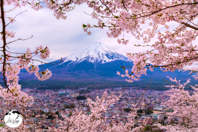
Mount Fuji, Japan’s iconic 3,776-meter volcano, attracts millions of visitors annually for climbing, sightseeing, and exploring the surrounding Fuji Five Lakes region. While the mountain itself is a natural wonder, navigating the transportation system around it requires understanding several interconnected networks. This guide provides detailed information about public transportation options for reaching and exploring the Mount Fuji area.
Understanding the Mount Fuji Region
Mount Fuji spans parts of both Yamanashi and Shizuoka Prefectures. The main access points and surrounding areas include:
- Fuji Five Lakes (Fujigoko): The northern side in Yamanashi Prefecture includes Lake Kawaguchi, Lake Yamanaka, Lake Sai, Lake Shoji, and Lake Motosu. This area is popular for sightseeing and serves as a major gateway to climbing routes.
- Hakone: Located to the east, this hot spring resort area offers spectacular views of Mount Fuji across Lake Ashi.
- Gotemba: On the southeastern side, known for its outlet shopping mall and climbing trail.
- Fujinomiya: On the southwestern side in Shizuoka Prefecture, offering another popular climbing route.
- Suruga Bay: The southern coastal area where Mount Fuji can be viewed from the sea.
Getting to Mount Fuji from Major Cities
From Tokyo
- By Express Train (Recommended)
The most convenient route is via the Fuji Excursion limited express train:
- Departs from Shinjuku Station
- Direct service to Kawaguchiko Station (primary gateway to Fuji Five Lakes)
- Travel time: Approximately 2 hours
- Cost: Around 4,000 yen one-way
- Frequency: Several departures daily, but seats require reservations
- For more details visit: https://world.jorudan.co.jp/mln/en/?sub_lang=ja
- By JR Train + Bus
A more economical but time-consuming option:
- Take JR Chuo Line from Tokyo/Shinjuku to Otsuki Station
- Transfer to the Fujikyu Railway Line to Kawaguchiko Station
- Total travel time: 2.5-3 hours
- Cost: Approximately 2,500-3,000 yen one-way
- Suitable for JR Pass holders as the first leg is covered by the pass
- By Highway Bus
A convenient and economical option with multiple providers:
- Buses depart from multiple Tokyo locations (Shinjuku, Tokyo Station, Shibuya)
- Direct service to Kawaguchiko Station and other Fuji Five Lakes locations
- Travel time: 2-2.5 hours (depending on traffic)
- Cost: 1,800-2,500 yen one-way (varies by company and season)
- Providers include Fujikyu, Keio, and JR Buses
- Reservation recommended, especially during climbing season (July-September)
- English booking available through Willer Express: https://willerexpress.com/en/
From Osaka/Kyoto
- By Shinkansen + Bus
The fastest option:
- Take Tokaido Shinkansen to Mishima, Shin-Fuji, or Shizuoka Station
- Transfer to local bus services to reach desired area around Mount Fuji
- Total travel time: 3-4 hours
- Cost: 15,000-18,000 yen one-way (covered partially by JR Pass)
- By Highway Bus
Direct overnight buses are available:
- Depart from Osaka/Kyoto stations
- Arrive at Kawaguchiko Station or Fujisan Station
- Travel time: 8-10 hours
- Cost: 5,000-9,000 yen one-way
- Reservation required
- Comfortable option with reclining seats
From Nagoya
- By Limited Express Train
- Take the Wide View Fuji express train from Nagoya to Kawaguchiko
- Travel time: Approximately 3 hours
- Requires reservation
- Cost: Around 6,000 yen one-way
- By Shinkansen + Local Transportation
- Take Tokaido Shinkansen to Mishima or Shin-Fuji Station
- Transfer to bus services to reach Mount Fuji area
- Total travel time: 2.5-3.5 hours
- Cost: 9,000-12,000 yen one-way
Transportation Around the Mount Fuji Area
Fuji Five Lakes Region (Northern Side)
- Fujikyu Railway
This local railway connects the broader rail network to the Fuji Five Lakes area:
- Runs between Otsuki and Kawaguchiko stations
- Connects with JR Chuo Line at Otsuki Station
- Travel time: 55 minutes from Otsuki to Kawaguchiko
- Cost: 1,140 yen one-way
- Frequency: Hourly service
- Scenic views of Mount Fuji during the journey
- Retro Bus (Kawaguchiko & Saiko)
These distinctive red buses connect major sightseeing spots:
- Three routes: Red Line (Kawaguchiko), Green Line (Saiko), and Blue Line (Aokigahara/Ice Cave)
- Red Line runs every 15 minutes, other lines less frequently
- Cost: 1,500 yen for unlimited day pass, or 150-350 yen per ride
- Stops at major attractions, museums, and cable car stations
- Announcements in Japanese and English
- Official website: https://www.fujikyu.co.jp/en/
Eastern Side (Gotemba/Hakone)
- Hakone Tozan Railway
A scenic mountain railway that is part of the journey to Hakone:
- Runs from Odawara to Gora
- Connects with Odakyu Line from Shinjuku
- Features switchbacks climbing the mountain
- Travel time: 40 minutes from Odawara to Gora
- Cost: 400 yen one-way
- Hakone Ropeway
Provides aerial views of Mount Fuji and the surrounding area:
- Connects Sounzan with Togendai via Owakudani
- Travel time: 30 minutes for the entire route
- Cost: 1,500 yen one-way
- Frequency: Every 15-20 minutes
- Offers spectacular views of Mount Fuji on clear days
- Gotemba Bus Network
Buses connect Gotemba Station with attractions:
- Services to Gotemba Premium Outlets, Subashiri climbing trail, and Hakone
- Frequency varies by route (30-60 minutes)
- Cost: 300-1,200 yen depending on distance
- Timetables available at Gotemba Station information desk
Southern Side (Fujinomiya/Shizuoka)
- Mount Fuji Shizuoka Airport Shuttle
Connects the airport to various Mount Fuji access points:
- Services to Fujinomiya, Fuji City, and Shizuoka City
- Schedules aligned with flight arrivals/departures
- Reservation required
- Cost: 1,000-2,000 yen depending on destination
- Fujisan Shizuoka Bus
Provides service between Shin-Fuji Station and Fujinomiya:
- Connects JR Tokaido Line with Mount Fuji’s southern access points
- Service to Fujinomiya 5th Station (climbing trailhead)
- Frequency: Hourly during climbing season, less frequent off-season
- Cost: 1,000-1,500 yen one-way
Seasonal Bus Services to Climbing Stations
Summer Climbing Season (July-September)
During the official climbing season, special bus services operate to the fifth stations (trailheads):
- Fujisan Express Bus (Fujikyu)
Connects Kawaguchiko Station with Fuji Subaru Line 5th Station (Yoshida Trail):
- Frequent service during climbing season (every 30-60 minutes)
- Travel time: 50-60 minutes one-way
- Cost: 1,540 yen one-way, 2,100 yen round-trip
- Reservation recommended on weekends and during peak season
- Operates from early July to mid-September with extended hours
- Gotemba Trail Buses
Serves the Subashiri and Gotemba climbing routes:
- Departs from Gotemba Station
- Less frequent than Yoshida Trail buses
- Travel time: 60-90 minutes to respective 5th stations
- Cost: 1,500-2,000 yen one-way
- Operates only during climbing season with limited schedules
- Fujinomiya Trail Buses
Connects Fujinomiya Station with Fujinomiya 5th Station:
- Travel time: Approximately 1 hour
- Cost: Around 1,500 yen one-way
- Limited service outside of climbing season
- Reservation recommended during peak periods
Off-Season Access
Outside the official climbing season (October-June):
- Fuji Subaru Line 5th Station still accessible via limited bus service
- Other trails typically have very limited or no public transportation
- Private tours or taxis may be the only option for certain routes
- Check Fujikyu or local tourism websites for current schedules
Multi-Day Passes and Discount Tickets
Several discount passes make exploring more economical:
- Fujigoko Enjoy Ticket
- Available at Otsuki Station and Kawaguchiko Station
- Includes round-trip train fare from Otsuki to Kawaguchiko and unlimited bus rides on designated routes
- Cost: 4,800 yen for adults (valid for 2 days)
- Offers significant savings for visitors planning to use public transportation extensively
- Hakone Free Pass
- Provides unlimited travel on designated transportation in the Hakone area
- Includes discount admission to many attractions
- 2-day and 3-day versions available
- Cost: 5,000-6,000 yen depending on starting point
- Ideal for visitors combining Mount Fuji with Hakone exploration
- Mount Fuji Pass
- Covers transportation from Tokyo to Mount Fuji area and selected local services
- Valid for 2 consecutive days
- Cost: 8,000 yen for adults
- Available from major travel agencies and online
- Includes some discounts at attractions
Useful Websites and Apps
- Fujikyu Railway: (trains and buses in Fuji Five Lakes area)
- Odakyu Railway: https://www.odakyu.jp/english/ (transportation from Tokyo to Hakone)
- Japan Transit Planner: https://www.hyperdia.com/ (comprehensive train and bus schedules)
- Fujisan Climbing Official Website: https://www.fujisan-climb.jp/en/ (climbing information with transportation details)
- Japan National Tourism Organization: https://www.japan.travel/en/ (general travel information)
Emergency Transportation Information
- Weather Disruptions: Heavy snow in winter and typhoons in late summer/autumn can cause transportation suspensions. Monitor local news for updates.
- Volcanic Activity: Mount Fuji is an active volcano. In case of increased activity, transportation to certain areas may be restricted.
- Emergency Numbers: Police (110), Ambulance/Fire (119), Japan Helpline (0570-000-911) for English assistance
- Evacuation Routes: Major visitor centers display evacuation information in multiple languages. Familiarize yourself upon arrival.
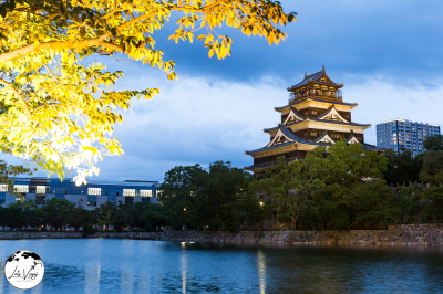
Hiroshima offers a well-integrated public transportation network that efficiently connects the city’s historical sites, modern districts, and surrounding areas. As a mid-sized Japanese city, Hiroshima’s transportation system is easier to navigate than Tokyo’s or Osaka’s while still providing comprehensive coverage. This guide will walk you through all available options, practical tips, and essential information for navigating Hiroshima using public transportation.
Hiroshima’s Streetcar Network: The Heart of City Transportation
The most distinctive aspect of Hiroshima’s public transportation system is its extensive streetcar (tram) network, which survived the atomic bombing and continues to serve as the primary mode of transport within the city.
Hiroshima Electric Railway (Hiroden)
Operating since 1912, Hiroden manages one of Japan’s most extensive streetcar systems:
- Network Coverage:
- 8 lines covering most major tourist destinations
- 282 streetcars including historic models and modern low-floor vehicles
- 139 stops throughout the city
- Main Lines for Tourists:
- Line 2: Connects Hiroshima Station with the Peace Memorial Park
- Line 5: Runs from Hiroshima Station to Miyajima-guchi (for ferry to Miyajima)
- Line 1: Serves downtown and the Atomic Bomb Dome area
- Line 9: Loops through the city center (useful for sightseeing)
- Using the Streetcars:
- Board through the rear door
- Take a paper ticket when boarding (flat fare zones) or tap your IC card
- Pay when exiting from the front door
- Flat fare of 180 yen for most city routes (200 yen for Line 7)
- Line 5 to Miyajima-guchi uses distance-based fares (220-290 yen)
- Announcements are made in Japanese and English for major stops
Bus System: Reaching Beyond the Streetcar Network
While streetcars form the backbone of Hiroshima’s public transportation, buses serve areas not covered by the tram network, particularly the northern and eastern parts of the city.
Hiroshima Bus Company and Others
- City Bus Network:
- Operated primarily by Hiroshima Bus Company
- Complemented by Chugoku JR Bus and other regional operators
- Routes are numbered and color-coded on maps
- Key Bus Routes for Tourists:
- Route 24: Connects Hiroshima Station with Shukkeien Garden
- Meipuru-pu Loop Bus: Tourist-oriented loop with stops at major attractions
- Route 50: Serves Hiroshima Port and southern areas
- Meipuru-pu Tourist Loop Bus:
- Distinctive orange buses with hop-on, hop-off capabilities
- Connects Hiroshima Station with major tourist sites
- Operates every 30 minutes from 9:00 AM to 6:00 PM
- Multilingual announcements for tourist convenience
- Route map and schedule available at Hiroshima Station tourist information center
Ferry Services: Accessing Miyajima and Port Areas
Ferries play an important role in Hiroshima’s transportation network, particularly for reaching Miyajima (Itsukushima), one of Japan’s most famous scenic spots.
Miyajima Ferry
- JR Ferry:
- Departs from Miyajima-guchi Ferry Terminal
- Connected to Miyajima-guchi Station (reached via JR Sanyo Line or Hiroden Line 5)
- Runs every 15 minutes from 6:25 AM to 10:15 PM
- Costs 180 yen one-way (covered by JR Pass)
- Features spacious indoor seating and outdoor viewing decks
- Matsudai Ferry:
- Private company operating parallel service to JR Ferry
- Same price and similar schedule
- Not covered by JR Pass
- Slightly different pier location at Miyajima
- World Heritage Sea Route:
- Direct boat from Hiroshima Peace Memorial Park to Miyajima
- Operated by Aqua Net Hiroshima
- More scenic route with views of the Seto Inland Sea
- Reduced operation during winter months
- Reservation recommended during peak tourist seasons
JR Train Network: Regional Connections
The Japan Railways (JR) network connects Hiroshima with surrounding regions and provides service within parts of the city.
JR Lines in Hiroshima
- Sanyo Main Line:
- Connects Hiroshima Station with key destinations including Miyajima-guchi Station
- Provides service to nearby cities (Iwakuni, Mihara, Fukuyama)
- Kabe Line:
- Runs north from Hiroshima Station to suburban areas
- Useful for accessing northern parts of the city
- Limited appeal for most tourists unless visiting specific destinations
- Shinkansen (Bullet Train):
- Hiroshima Station is a major stop on the Sanyo Shinkansen line
- Connects Hiroshima with major cities (Osaka: 1h30m, Tokyo: 4h)
- Reserved and non-reserved seating available
- Covered by JR Pass (except fastest Nozomi trains)
Astram Line: Modern Transit to Northern Suburbs
The Astram Line is Hiroshima’s automated guideway transit system connecting the city center with northern residential areas.
- Route and Stations:
- Runs from Hondori (downtown) to Koiki-koen-mae
- 22 stations along a 18.4 km route
- Primarily serves commuters from northern suburbs
- Limited usefulness for tourists except for accessing Hiroshima Municipal Stadium and Large-Scale Greenery Park
- Service Information:
- Trains run every 3-4 minutes during peak hours
- First train: 6:00 AM, Last train: midnight
- Distance-based fares ranging from 180-470 yen
- IC cards accepted (ICOCA, Suica, etc.)
- Modern, clean trains with automated operation
IC Cards and Day Passes: Making Travel Easier
Several payment options make navigating Hiroshima’s transportation network more convenient.
IC Cards
- ICOCA:
- JR West’s regional IC card
- Purchasable at Hiroshima Station (2,000 yen minimum with 500 yen refundable deposit)
- Usable on all trains, buses, and streetcars in Hiroshima
- Also accepted at convenience stores and many vending machines
- Compatible with other IC cards (Suica, PASMO, etc.)
- Other IC Cards:
- All major Japanese IC cards (Suica, PASMO, TOICA, etc.) work throughout Hiroshima
- Simply tap when boarding and exiting transportation
- Automatic fare calculation eliminates confusion with ticket machines
Special Passes for Visitors
- Visit Hiroshima Tourist Pass:
- 1-day (700 yen) or 2-day (1,400 yen) versions
- Unlimited travel on streetcars and buses within the designated area
- Available at Hiroshima Station tourist information center, major hotels, and online
- Not valid for JR trains or ferries
- Hiroshima Free Pass:
- 3-day pass offering unlimited rides on streetcars, buses, and ferries
- Includes discounts at various tourist attractions
- Costs 1,500 yen for adults
- Not valid for JR trains
- Hiroshima-Miyajima Pass:
- 2-day pass covering streetcars, buses, ferry to Miyajima, and Miyajima Ropeway
- Costs 2,000 yen for adults
- Available at major stations and tourist information centers
- Excellent value for visitors planning to visit Miyajima
- JR Pass Benefits:
- The national Japan Rail Pass covers JR trains and the JR Ferry to Miyajima
- Regional JR West Passes also provide good value for visitors exploring the wider region
Navigational Resources and Apps
Several tools can help visitors navigate Hiroshima’s transportation system more easily.
- Official Resources:
- Hiroshima Tourism Website: http://www.visithiroshima.net/
- Hiroden Website (streetcars): https://www.hiroden.co.jp/en/
- Hiroshima Prefecture Tourism Association: https://www.hiroshima-navi.or.jp/en/
- Useful Apps:
- Japan Transit Planner: Comprehensive schedule and routing information
- Google Maps: Reliable for Hiroshima’s public transportation
- Hiroshima Tourist Map App: Official app with transportation information
- Japan Taxi: English-language taxi booking
- Tourist Information Centers:
- Hiroshima Station (South Exit): Staff provide English transportation guidance
- Peace Memorial Park: Information on local transportation options
- SIGHTSEEING INFORMATION CENTER in Hondori shopping street
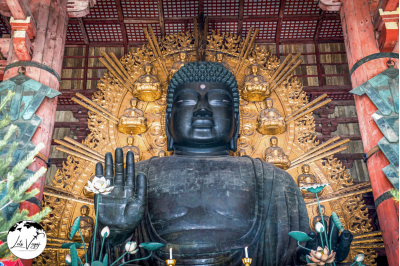
Nara is a historically significant city in Japan with excellent public transportation options that make exploring its ancient temples, shrines, and parks convenient for visitors. Here’s a comprehensive overview of how to navigate Nara using public transportation.
Rail Services to Nara
JR Lines
The Japan Railways (JR) network connects Nara to major cities:
- JR Nara Line: Connects Kyoto to Nara (45-60 minutes)
- Yamatoji Line: Connects Osaka/JR Namba to Nara (35-45 minutes)
- JR Pass: Valid on these lines, making them economical for tourists with rail passes
Kintetsu Railways
Kintetsu provides faster and more direct service to Nara:
- Kintetsu Nara Line: Connects Osaka (Namba) to Kintetsu-Nara Station (about 35 minutes)
- Kintetsu Kyoto Line: Connects Kyoto to Kintetsu-Nara (about 35-45 minutes on limited express trains)
- Station Location: Kintetsu-Nara Station is more centrally located than JR Nara Station, placing you closer to Nara Park and major attractions
It’s worth noting that while JR Nara and Kintetsu-Nara are different stations, they’re only about a 15-minute walk apart.
Within Nara City
City Buses
Nara has an extensive bus network that reaches all major tourist destinations:
- Nara City Loop Bus (Gurutto Bus): Circular route connecting major attractions like Todai-ji, Kasuga Taisha, and Nara Park
- Frequency: Every 15 minutes during peak hours
- One-day pass available (¥500-600) for unlimited rides
- Numbered stops with multilingual information
- Regular City Buses: Connect train stations to various parts of the city
- Routes 1, 2, and 5 are particularly useful for tourists
- Bus stops have electronic displays showing wait times
Payment Systems
- IC Cards: Rechargeable smart cards like ICOCA, PASMO, or Suica work on all trains and buses
- One-Day Passes:
- Nara City Bus One-Day Pass (¥500-600)
- Nara Park & Yamato Sightseeing Pass (covers wider area)
- Kintetsu Rail Pass (if also visiting other areas like Ise or Yoshino)
Specialized Tourist Services
- Nara Kotsu Sightseeing Bus: Hop-on-hop-off service with commentary (some in English)
- Jinrikisha (Rickshaw): Available near Nara Park for short scenic rides
- Taxi Stands: Located at both JR and Kintetsu stations, with some drivers speaking basic English
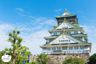
Osaka has one of Japan’s most comprehensive public transportation systems, making it easy to navigate despite its large size.
For more details visit: https://www.osakametro.co.jp/en/
https://www.city.osaka.lg.jp/contents/wdu020/enjoy/en/content_b.html
Railway Network
JR Lines
The JR (Japan Railways) network forms the backbone of Osaka’s rail system. The JR Osaka Loop Line (環状線, Kanjō-sen) circles the city center and serves as a reference point for navigation.
Key JR lines in Osaka:
- Osaka Loop Line: Connects major hubs like Osaka Station, Tennoji, and Kyobashi
- JR Kyoto Line: For travel to/from Kyoto
- JR Kobe Line: For travel to/from Kobe
Subway System
Osaka Municipal Subway operates 8 lines covering most of the city:
- Midosuji Line (red): The main north-south artery through downtown
- Tanimachi Line (purple): Runs northeast to southwest
- Yotsubashi Line (blue): Serves the western part of downtown
- Chuo Line (green): East-west line through central Osaka
- Sakaisuji Line (brown): Connects northern and southern districts
- Sennichimae Line (pink): Runs through entertainment districts
- Nagahori Tsurumi-ryokuchi Line (purple-brown): East-west line in central Osaka
- Imazatosuji Line (light green): Northeastern areas
Private Railways
- Hankyu Railways: Connects to Kyoto and Kobe through upscale neighborhoods
- Hanshin Electric Railway: Another option for Kobe, passes through working-class areas
- Kintetsu Railway: Connects to Nara and Mie Prefecture
- Nankai Electric Railway: Serves southern Osaka and provides access to Kansai International Airport
Bus Network
Osaka’s bus network complements the rail system, reaching areas not served by trains.
- Osaka City Bus: Operates throughout the city
- Kintetsu Bus: Covers areas in the northeast
- Nankai Bus: Serves southern districts
Buses display destinations in both Japanese and English. Board from the rear door and pay when exiting from the front.
Ticketing and Payment
IC Cards
The most convenient way to pay for transportation is with an IC card:
- ICOCA: The regional IC card issued by JR West
- PiTaPa: Another regional IC card
- Suica, PASMO, etc.: Cards from other regions also work in Osaka
These rechargeable cards allow you to tap in and out of stations and buses without purchasing individual tickets.
Day Passes
Several day passes offer unlimited travel:
- Osaka Amazing Pass: Includes subway, bus, and entry to 40+ attractions
- Osaka Metro 1-Day Pass: Unlimited subway travel
- Kansai Thru Pass: Covers non-JR trains and buses in the Kansai region
- ICOCA & HARUKA: Combines airport express train with an IC card
Transportation Apps and Websites
Essential Apps
- Japan Transit Planner: Comprehensive route planning for all of Japan
- Google Maps: Reliable for transit directions with accurate times
- Navitime Japan Travel: Specialized for tourists with English support
- Osaka Metro Navi: Official app for the subway system
Useful Websites
- Hyperdia: hyperdia.com – The most comprehensive train schedule search
- Japan Guide: japan-guide.com – Detailed transportation guides for tourists
- Osaka Metro Official: osakametro.co.jp/en – Maps, schedules, and fare information
Airport Transportation
From Kansai International Airport (KIX)
- JR Haruka Express: Direct train to Osaka Station (about 50 minutes)
- Nankai Rapi:t: Limited express to Namba Station (about 45 minutes)
- Limousine Buses: Connect to major hotels and stations
From Itami Airport (Osaka International Airport)
- Osaka Monorail: Connects to the subway system
- Airport Limousine Buses: Direct service to major stations
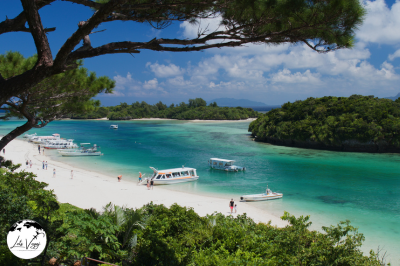
Okinawa presents unique transportation challenges compared to Japan’s major metropolitan areas like Tokyo and Osaka. As a chain of islands with more rural and spread-out development, getting around requires different strategies.
For more details visit: https://www.kotsu-okinawa.org/en/
https://visitokinawajapan.com/plan-your-trip/getting-around-okinawa/
Understanding Okinawa’s Geography
Before discussing transportation options, it’s important to understand that Okinawa Prefecture consists of multiple islands spanning over 1,000 kilometers. The main island (Okinawa Island or “Honto”) is where most visitors spend their time, but transportation needs vary significantly depending on whether you’re:
- Traveling within Naha (the capital city)
- Exploring the main island beyond Naha
- Island-hopping to other parts of the prefecture
Public Transportation on Okinawa Main Island
Monorail (Yui Rail)
Okinawa’s only rail system is the Yui Rail monorail in Naha. While limited in scope compared to mainland Japan’s extensive networks, it serves as an important transportation backbone for the capital city.
The monorail runs from Naha Airport through downtown to Shuri (home of Shuri Castle), covering 17 stations along its 12.9 km route. Trains arrive approximately every 10 minutes, making this the most reliable public transit option in Okinawa.
Key stations include:
- Naha Airport Station
- Asahibashi Station (for Kokusai-dori, the main shopping street)
- Miebashi Station (for Tomari Port, where ferries depart)
- Shuri Station (for Shuri Castle)
The fare ranges from ¥230 to ¥330 depending on distance, and a one-day pass costs around ¥800.
Bus System
The bus network is the primary public transportation system throughout Okinawa Island, operated mainly by Ryukyu Bus Kotsu and Naha Bus.
Types of Buses:
- Local buses: Serve routes throughout the island but make frequent stops
- Express buses: Connect major destinations with fewer stops
- Highway buses: Long-distance routes with minimal stops
Key Bus Routes:
- Route 20: Connects Naha Bus Terminal to American Village/Chatan
- Route 120: Naha to Ocean Expo Park/Churaumi Aquarium (northern Okinawa)
- Route 28: Naha to Itoman (southern Okinawa)
- Route 29: Naha to Yomitan
Unlike in mainland Japan, buses in Okinawa often run less frequently (some routes only once per hour), and service typically ends earlier in the evening. Planning ahead is essential.
Bus Payment Systems
The payment system on Okinawa buses can be confusing for first-time visitors:
- Urban routes (mainly in Naha): Flat fare system. Board from the front door, pay as you enter.
- Longer routes: Distance-based fare. Take a numbered ticket when boarding from the rear door. When exiting from the front, match your ticket number with the fare displayed on the electronic board above the driver, and pay that amount.
Buses accept cash and IC cards (including OKICA, the local IC card, as well as Suica, PASMO, and ICOCA from mainland Japan).
Rental Cars
Due to the limited public transportation outside of Naha, renting a car is the most practical option for exploring Okinawa Island thoroughly. Consider these facts:
- International Driver’s Permit (IDP) is required for foreign visitors
- Okinawans drive on the left side of the road
- Expressway tolls are electronic (ETC)
- Gas stations often close early in rural areas
- Navigation apps can be set to English
Major rental companies include OTS Rent-a-Car, Times Car Rental, and Nippon Rent-a-Car, with prices starting around ¥4,000-5,000 per day for a compact car.
Island Hopping Transportation
Ferries
Ferries connect Okinawa Island to many other islands in the prefecture:
- High-speed ferries: Faster but more expensive, may be canceled in rough weather
- Car ferries: Slower but more stable, can transport vehicles
Major ferry ports include:
- Tomari Port (Naha) – services to Kerama Islands
- Motobu Port – services to Ie Island
- Naha Port – services to Kumejima and other destinations
Flights
Small airports connect the major islands within the prefecture:
- Naha Airport (OKA) – Main hub
- Miyako Airport (MMY)
- Ishigaki Airport (ISG)
- Kumejima Airport (UEO)
- Yonaguni Airport (OGN)
Airlines like JAL, ANA, and Ryukyu Air Commuter operate these inter-island routes. Flights are short (30-60 minutes) but can be expensive. Booking well in advance is recommended, especially during holiday seasons.
Transportation Apps and Websites
Essential Apps
- Google Maps: Works reasonably well in Okinawa for basic navigation, though bus schedules may not always be accurate.
- Japan Transit Planner: Includes Okinawa bus routes and schedules.
- Ryukyu Bus Route Map: Official app showing real-time locations of Ryukyu buses (limited English support).
- NAVITIME for Japan Travel: Comprehensive transportation guide with English support.
- OkiNavi: Official Okinawa tourism app with transportation information.
Useful Websites
- Okinawa Monorail: yui-rail.co.jp/en – Official website with schedules and maps.
- Okinawa Story: okinawastory.jp/en/transport – Official tourism website with transportation guides.
- Japan Guide Okinawa: japan-guide.com/e/e7200.html – Detailed transportation information for tourists.
Transportation Day Passes and Money-Saving Options
- One-day Monorail Pass: Unlimited rides on the Yui Rail for one day (¥800).
- Okinawa Bus Pass: Multiple-day passes available for tourists.
- Okinawa Enjoy Pass: Combines admission to attractions with some transportation options.
- OKICA IC Card: Prepaid transportation card usable on buses and the monorail.
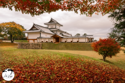
Kanazawa, a beautifully preserved historical city on Japan’s west coast, offers a more compact and navigable transportation system compared to larger Japanese metropolises. Despite its smaller size, the city provides efficient public transportation options that connect all major attractions while maintaining the charm of a traditional Japanese city.
For more details visit: https://visitkanazawa.jp/en/index.html
https://www.kanazawastation.com/kanazawa-tourist-bus-services/
https://kanazawaadventures.com/
City Layout and Geography
Understanding Kanazawa’s layout helps with transportation planning. The city is roughly divided into these key areas:
- City Center/Station Area: Modern commercial district surrounding Kanazawa Station
- Higashi Chaya District: Eastern geisha district with preserved historical streets
- Kenrokuen Garden/Castle Area: Central cultural heart containing the city’s most famous attractions
- Nagamachi Samurai District: Western area with former samurai residences
- Nishi Chaya District: Smaller western geisha district
- Teramachi Temple Area: Southwestern district with numerous temples
Most tourist attractions are within a 3-4 km radius of Kanazawa Station, making the city relatively compact compared to larger Japanese cities.
Loop Bus System
Kanazawa’s loop bus system forms the backbone of tourist transportation and is specifically designed to connect major sightseeing spots. There are three color-coded loop routes:
- Kanazawa Loop Bus (Kenrokuen Shuttle)
This is the most useful bus for tourists, operating three distinct routes:
- Left Loop (Red Route): Clockwise route visiting Kenrokuen Garden, 21st Century Museum, and Higashi Chaya District
- Right Loop (Green Route): Counter-clockwise route visiting Omicho Market, Nagamachi Samurai District, and Nishi Chaya District
- Flat Bus (Blue Route): Route connecting the station area with the modern southern district
Key facts:
- Frequency: Approximately every 15 minutes (may be less frequent on weekends)
- Operating hours: 8:30 AM to 6:00 PM
- Fare: ¥200 per ride or ¥500 for a day pass
- All buses have announcements and displays in English and Japanese
- Buses are designed to be easily identifiable with their colorful exteriors
- Kanazawa One-Day Pass
This pass offers excellent value for tourists:
- Cost: ¥500
- Coverage: Unlimited travel on all three loop bus routes
- Additional benefit: Discounted admission to some attractions including Kenrokuen Garden
- Purchase locations: Kanazawa Station tourist information center, major hotels, and on buses
Regular City Buses
Beyond the tourist loop buses, Kanazawa has an extensive network of regular city buses operated by Hokuriku Railroad (also called Hokutetsu):
- Coverage: Extends to all residential areas and suburbs
- Fare: Starts at ¥200 for short distances, increases based on distance
- Payment: Board from the rear door, take a numbered ticket, and pay the fare shown on the electronic display when exiting from the front
- IC Cards: ICOCA, Suica, and other Japanese IC cards are accepted
- Frequency: Varies by route, typically every 15-30 minutes on main routes
- Most useful regular routes for tourists:
- Route 93, 94, 97: Connect to areas beyond the loop bus routes
- Airport Shuttle: Direct service to Komatsu Airport (approximately 40 minutes)
JR Train System
While Kanazawa doesn’t have a subway, it does have several train lines radiating from Kanazawa Station:
- Hokuriku Shinkansen: Connects to Tokyo (2.5 hours)
- JR Hokuriku Line: Services to Fukui, Toyama, and other regional cities
- IR Ishikawa Railway: Local train service to surrounding towns
For tourists staying within Kanazawa city, these trains are primarily useful for day trips rather than intracity transportation.
Transportation Apps and Websites
Essential Apps
- Japan Transit Planner: Comprehensive route planning covering all buses and trains
- Google Maps: Generally reliable for Kanazawa public transportation directions
- Navitime Japan Travel: Specialized for tourists with excellent English support
- Hokutetsu Bus App: Official app for Kanazawa’s bus company (limited English)
Useful Websites
- Hokutetsu Bus Information: https://www.hokutetsu.co.jp/en – Official bus company site with timetables
- Japan Guide Kanazawa: japan-guide.com/e/e2167.html – Detailed transportation information for tourists
 Nikko, a historic mountain town and UNESCO World Heritage site in Tochigi Prefecture, presents unique transportation challenges due to its mountainous topography and spread-out attractions. Understanding the transportation systems will significantly enhance your visit to this culturally rich destination.
Getting to Nikko from Tokyo
Nikko is approximately 150 kilometers north of Tokyo, and there are several well-established routes to reach it:
By Train
JR and Tobu Railway Options:
- JR Route: Take the JR Tohoku Shinkansen from Tokyo to Utsunomiya Station (about 50 minutes), then transfer to the JR Nikko Line to Nikko Station (45 minutes). Total journey time is approximately 1 hour and 45 minutes.
- Tobu Railway Direct Route: The most convenient option is the limited express “Spacia” train from Tobu Asakusa Station in Tokyo directly to Tobu-Nikko Station. This takes about 1 hour and 45 minutes. The standard express “Kegon” also runs this route.
- Tobu Railway with Transfer: A more economical option involves taking a rapid train from Asakusa to Shimo-Imaichi Station, then transferring to a local train to Tobu-Nikko. This takes about 2 hours but costs significantly less than the limited express.
Useful Railway Passes:
- Tobu Nikko Pass: Covers round-trip travel between Asakusa and Nikko plus unlimited bus rides in the Nikko area for 2 days.
- Nikko All Area Pass: More comprehensive, including round-trip train travel, unlimited bus access in wider areas including Okunikko, and discounts at various attractions.
- JR Pass holders: Your pass covers the JR portion of the journey, but not the Tobu Railway if you choose that route.
By Highway Bus
Direct highway buses operate between Tokyo (Shinjuku or Tokyo stations) and Nikko. The journey takes approximately 2-3 hours depending on traffic. These buses are often more economical than express trains but require advance reservations, especially during peak seasons.
Getting Around Nikko
Nikko’s attractions are divided into two main areas: the shrine/temple complex near Nikko Station and the natural attractions of Okunikko (Lake Chuzenji area and beyond).
Local Bus System
The bus network is the backbone of transportation within Nikko:
- World Heritage Sightseeing Bus: Circulates among the major shrines and temples near Nikko Station, including Toshogu Shrine, Rinnoji Temple, and Futarasan Shrine.
- Okunikko-bound Buses: Regular services connect Nikko Station with Lake Chuzenji, Kegon Falls, and Yumoto Onsen. The journey to Lake Chuzenji takes about 50 minutes and involves winding mountain roads with spectacular views at Irohazaka, the famous switchback road.
- Lake Chuzenji Area Buses: Circulate around Lake Chuzenji and connect major attractions like Kegon Falls, the Italian Embassy Villa, and various hiking trailheads.
Bus Pass Options:
- World Heritage Area Pass: Unlimited bus travel within the shrine and temple area
- Okunikko Area Pass: Unlimited travel on buses to and around the Lake Chuzenji area
- All Nikko Pass: Comprehensive pass covering all bus routes in Nikko
Transportation Apps and Websites
Essential Apps
- Japan Transit Planner/Hyperdia: These apps provide detailed train and bus schedules, including connections between different lines and transportation modes. Hyperdia is particularly useful for planning train journeys to Nikko.
- Google Maps: While less detailed than specialized transit apps, Google Maps provides reliable navigation information for Nikko, including walking directions between attractions and bus stop locations.
- Tobu Railway Official App: Offers real-time information about Tobu trains, including delays and schedule changes.
- Japan Official Travel App: Developed by the Japan National Tourism Organization, this app includes transportation information along with other useful travel resources.
Useful Websites
- Tobu Railway Official Website (www.tobu.co.jp/foreign/): Provides comprehensive information about train services to Nikko, including timetables and pass options. Available in multiple languages.
- Nikko City Tourism Association (https://www.nikko-kankou.org/): Offers detailed bus timetables and route maps specific to Nikko.
- Japan-Guide’s Nikko Transportation Page (www.japan-guide.com/e/e3800.html): An English-friendly resource with practical transportation information and tips.
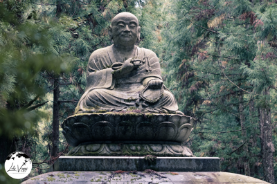
Kōya-san, or Mount Kōya, is a sacred Buddhist mountain in Wakayama Prefecture, Japan. As a UNESCO World Heritage Site and the headquarters of the Shingon Buddhist sect, it’s a popular destination for both spiritual pilgrims and tourists.
Getting to Kōya-san from Major Cities
From Osaka
The most common route to Kōya-san begins in Osaka:
- Take a Nankai Railway train from Osaka’s Namba Station to Gokurakubashi Station
- The Limited Express (Kōya) takes about 80 minutes and costs approximately ¥1,650
- The regular express takes about 100 minutes and costs around ¥870
- At Gokurakubashi, transfer to the Kōyasan Cable Car (funicular railway)
- The cable car climbs 328 meters up the mountain in about 5 minutes (¥390)
- At the top station (Kōyasan Station), connect to local buses to reach your final destination
From Kyoto
- Take a JR train from Kyoto Station to Osaka Station (about 30 minutes)
- Transfer to the subway and head to Namba Station
- Follow the Osaka route described above
- Alternatively, take a JR train to Shin-Osaka, then the subway to Namba
From Tokyo
- Take a Shinkansen to Shin-Osaka Station (about 2.5 hours)
- Transfer to local trains to reach Namba Station
- Follow the Osaka route described above
The Kōya-san World Heritage Ticket
Consider purchasing the “Kōya-san World Heritage Ticket” if coming from Osaka. This discount pass includes:
- Round-trip transportation from Osaka (Namba) to Kōya-san
- Cable car ride
- Unlimited bus travel around Kōya-san for two days
- Discounts at select attractions and shops
The ticket costs approximately ¥2,860 for adults, offering significant savings over purchasing tickets separately.
Getting Around Kōya-san
Local Bus System
Once you’ve arrived at Kōyasan Station:
- Buses depart from outside the cable car station
- The main bus route forms a loop connecting major temples and attractions
- A one-day bus pass costs around ¥800
- Single rides typically cost ¥220-¥420 depending on distance
- Most buses stop at or near Danjō Garan (temple complex) and Okunoin (cemetery)
The main bus line runs approximately every 20-30 minutes, with more frequent service during peak tourist seasons. The last bus typically departs around 9:00 PM in summer and 6:00 PM in winter.
Useful Transportation Apps and Websites
Japan-wide Transportation Apps
- Japan Transit Planner: Comprehensive train and bus scheduling
- Google Maps: Works well in Japan and shows public transportation options
- Hyperdia: The most accurate train scheduling tool
- Jorudan: Simple interface for planning train trips
Specific to Kōya-san
- Nankai Railway Website https://www.nankai.co.jp/en_railway
- Kōya-san Tourist Association Website https://www.koyasan.or.jp/en/
- NAVITIME for Japan Travel: Includes specialized information for tourist areas including Kōya-san