

Hagia Sophia (Ayasofya)

The Hagia Sophia represents perhaps the most profound architectural achievement in Istanbul. Originally built as a Byzantine cathedral in 537 CE under Emperor Justinian I, it later served as an Ottoman mosque and then a museum before returning to mosque status in 2020.
What makes the Hagia Sophia truly exceptional is its massive dome, which appears to float above the interior space due to ingenious architectural techniques. Inside, visitors can admire the harmonious blend of Islamic and Christian elements—ornate Ottoman calligraphy medallions hang alongside uncovered Byzantine mosaics depicting Jesus, Mary, and various saints.
The building tells the story of Istanbul itself through its evolution over centuries, making it not just a beautiful structure but a living historical document.
Address
- Official Name: Hagia Sophia Grand Mosque (Ayasofya-i Kebir Camii)
- Address: Sultan Ahmet Mahallesi, Ayasofya Meydanı No:1, 34122 Fatih/Istanbul, Turkey
- Website: ayasofyacamii.gov.tr
Opening Hours & Visitor Information
- Open daily: 9:00 AM – 7:00 PM (Summer); 9:00 AM – 5:00 PM (Winter)
- Prayer Times: Closed to tourists approximately 30 minutes before and after each of the five daily prayer times
- Friday Prayer: Extended closure from 11:30 AM to 2:30 PM
- Entry: Free admission (since its reconversion to a mosque)
Detailed Transportation Information
Metro/Subway/Tram
- T1 Tram Line: Most convenient option, stops at “Sultanahmet” station
- Frequency: Every 3-5 minutes during peak times
- Operating hours: 6:00 AM – 12:00 AM
- Journey time from Kabataş: 25 minutes
- Journey time from Eminönü: 7 minutes
- Marmaray Line: Cross-continental undersea rail line
- Stop at “Sirkeci” station, then 15-minute walk or transfer to T1 tram
- Connects European and Asian sides of Istanbul
- M2 Metro Line: Get off at “Vezneciler” station, then take T1 tram or walk (25 minutes)
Bus Lines
- Lines: 66- stops at Elmadağ – Taksim Yönü
- Lines: 256- stops at Gümüşsuyu Peron
- Lines: DT1- stops at Gümüşsuyu Peron – Peron Yönü
- Bus Operating Hours: 6:00 AM – 12:00 AM (night buses available)
Ferries
- Eminönü Dock:
- Services from Kadıköy (Asian side): Every 20 minutes, journey time 25 minutes
- Services from Üsküdar (Asian side): Every 15 minutes, journey time 25 minutes
- Services from Princes’ Islands: Multiple daily departures, seasonal schedule
- Karaköy Dock:
- Services from various points along the Bosphorus
- Within 20-minute walk to Hagia Sophia or short tram ride
By Car
Navigation
- GPS coordinates: 41.008587, 28.980175
- Many GPS systems and apps recognize “Hagia Sophia” or “Ayasofya” as a destination
- Traffic restrictions may apply in the historical peninsula
Detailed Parking Options
- Sultanahmet Square Underground Parking
- Capacity: 300 vehicles
- Hours: 24/7
- Rate: Approximately 30 TL per hour
- Distance to Hagia Sophia: 5-minute walk
- Gülhane Park Parking Area
- Capacity: 200 vehicles
- Hours: 8:00 AM – 11:00 PM
- Rate: Approximately 25 TL per hour
- Distance to Hagia Sophia: § 12-minute walk
- Forum Istanbul Shopping Mall Parking
- Capacity: 2,500 vehicles
- Hours: 10:00 AM – 10:00 PM
- Rate: Free for first 3 hours with purchase
- Transport to Hagia Sophia: Take M1 metro to Yenikapı, transfer to T1 tram
- İSPARK Eminönü Parking Lot
- Capacity: 400 vehicles
- Hours: 24/7
- Rate: Approximately 20 TL per hour
- Distance to Hagia Sophia: 20-minute walk or short tram ride
From Istanbul Airport (New Airport)
- By Airport Shuttle (Havaist):
- Line: IST-19 to Sultanahmet
- Frequency: Every 30 minutes
- Journey time: 60-90 minutes depending on traffic
- Cost: Approximately 45 TL
- First shuttle: 4:00 AM; Last shuttle: 1:00 AM
- By Taxi:
- Journey time: 45-60 minutes (can be longer during peak traffic)
- Cost: Approximately 150-200 TL
- Ask for metered fare or use BiTaksi/iTaksi apps
- By Public Transit:
- Take M11 metro to Kağıthane (30 minutes)
- Transfer to M7 metro to Mecidiyeköy (10 minutes)
- Transfer to M2 metro to Yenikapı (15 minutes)
- Transfer to T1 tram to Sultanahmet (10 minutes)
- Total journey time: Approximately 80-90 minutes
From Sabiha Gökçen Airport
- By Airport Shuttle (Havabus):
- Line to Taksim, then T1 tram or taxi to Sultanahmet
- Frequency: Every 30 minutes
- Journey time to Taksim: 90 minutes (can be longer in traffic)
- By Taxi:
- Journey time: 60-90 minutes (can exceed 2 hours in heavy traffic)
- Consider fixed price options during rush hour
- By Public Transit:
- Take SG-1 bus to Kadıköy (60 minutes)
- Take ferry to Eminönü (25 minutes)
- Take T1 tram to Sultanahmet (7 minutes)
- Total journey time: Approximately 2 hours
Transportation Companies & Services
Public Transportation Operators
- IETT (Istanbul Electric Tramway and Tunnel Establishments)
- Operates city buses and metrobuses
- Website: iett.istanbul
- Mobile app: MobilIETT
- Customer service: +90 212 588 9999
- Metro Istanbul
- Operates metro, tram, funicular, and cable car lines
- Website: metro.istanbul
- Mobile app: Metro Istanbul
- Customer service: +90 212 588 7000
- Şehir Hatları (City Lines)
- Operates ferry services
- Website: sehirhatlari.istanbul
- Mobile app: Şehir Hatları
- Customer service: +90 212 444 1851
Airport Transfer Services
- Havaist
- Official Istanbul Airport shuttle service
- Website: hava.ist
- Mobile app: Havaist
- Customer service: +90 212 444 1878
- Havabus
- Official Sabiha Gökçen Airport shuttle service
- Website: havabus.com
- Customer service: +90 212 444 0487
Taxi Services
- BiTaksi
- Licensed taxi booking app
- Website: bitaksi.com
- Mobile app: BiTaksi
- Customer service: +90 212 444 0188
- iTaksi
- Official Istanbul Metropolitan Municipality taxi app
- Website: itaksi.com
- Mobile app: iTaksi
- Customer service: +90 212 444 1453
Private Tour Companies
- Istanbul Welcome Card
- Offers guided tours and fast-track entry to museums
- Website: istanbulwelcomecard.com
- Istanbul Tourist Pass
- Multi-day passes with guided tour options
- Website: istanbultouristpass.com
- Gray Line Turkey
- International tour operator with Istanbul city tours
- Website: graylineturkey.com
Nearby Attractions
Within 5-Minute Walk
- Blue Mosque (Sultan Ahmed Mosque)
- Hours: Outside prayer times, closed during Friday prayers
- Distance: 300 meters
- Entry: Free
- Basilica Cistern
- Hours: 9:00 AM – 7:00 PM
- Distance: 200 meters
- Sultanahmet Square
- Ancient Hippodrome with Egyptian Obelisk and Serpent Column
- Distance: 200 meters
- Entry: Free, open 24/7
Within 10-Minute Walk
- Topkapi Palace
- Hours: 9:00 AM – 6:00 PM (closed Tuesdays)
- Distance: 600 meters
- Istanbul Archaeological Museums
- Hours: 9:00 AM – 7:00 PM (closed Mondays)
- Distance: 800 meters
- Gülhane Park
- Hours: 6:00 AM – 10:30 PM
- Distance: 700 meters
- Entry: Free
Within 15-Minute Walk
- Grand Bazaar (Kapalıçarşı)
- Hours: 9:00 AM – 7:00 PM (closed Sundays)
- Distance: 1.1 kilometers
- Over 4,000 shops
- Süleymaniye Mosque
- Hours: Outside prayer times
- Distance: 1.2 kilometers
- Entry: Free
Within 20-Minute Walk
- Spice Bazaar (Egyptian Bazaar)
- Hours: 9:00 AM – 7:00 PM
- Distance: 1.5 kilometers
- Traditional spices, Turkish delight, and souvenirs
- Galata Bridge
- Distance: 1.6 kilometers
- Connects old city to Karaköy district
- Famous for fishermen and restaurants underneath
Museum Passes & Transit Cards
- Museum Pass Istanbul:
- Includes entry to multiple museums but not Hagia Sophia (now free)
- Valid for 5 days
- Purchase at museums or online
- Istanbulkart:
- Rechargeable transit card for all public transportation
- Purchase at airport, major transit stations, or convenience stores
- Initial cost: 13 TL for the card plus your balance
Blue Mosque (Sultan Ahmed Mosque)

Facing the Hagia Sophia across a pleasant park sits the Blue Mosque, named for the blue İznik tiles adorning its interior. Built between 1609 and 1616 during the rule of Ahmed I, this functioning mosque features six minarets (unusual for the time) and a cascading series of domes and half-domes that create a magnificent silhouette.
When visiting, you’ll experience the tranquil atmosphere of its spacious prayer hall illuminated by 260 windows. The mosque’s interior combines Ottoman architecture with Byzantine elements, demonstrating how Islamic architects built upon earlier traditions while creating something distinctly new.
Remember that as an active place of worship, the mosque closes to tourists during prayer times, and modest dress is required for entry.
Topkapı Palace

For nearly 400 years, Topkapı Palace served as the administrative center and residence of the Ottoman sultans. This sprawling complex provides fascinating insights into the lives of the imperial family and the empire’s governance.
The palace is organized around four courtyards, each more private than the last. Highlights include:
- The Imperial Treasury housing the 86-carat Spoonmaker’s Diamond
- The sacred relics collection containing items believed to belong to Islamic prophets
- The Harem section where the sultan’s family lived
- The Imperial Council chamber where the empire’s most important decisions were made
The palace offers stunning views of the Bosphorus and Golden Horn from its terraces, combining magnificent architecture with historical significance.
The Palace at a Glance
Topkapı Palace (Topkapı Sarayı) served as the main residence and administrative headquarters of the Ottoman sultans for nearly 400 years (15th-19th centuries). This sprawling complex covers approximately 700,000 square meters and offers visitors a fascinating glimpse into Ottoman history, architecture, and culture through its courtyards, gardens, treasuries, and harem quarters. The palace now functions as one of Istanbul’s most important museums, housing significant collections of Ottoman artifacts, holy relics, and imperial treasures.
Address & Contact Details
- Official Name: Topkapı Palace Museum (Topkapı Sarayı Müzesi)
- Address: Cankurtaran Mahallesi, 34122 Fatih/Istanbul, Turkey
- Website: https://topkapipalacemuseum.com/
Opening Hours
- Main Palace: 9:00 AM – 6:00 PM (April-October); 9:00 AM – 4:30 PM (November-March)
- Harem Section: 9:00 AM – 5:00 PM (April-October); 9:00 AM – 4:00 PM (November-March)
- Closed Days: Tuesdays (year-round)
Getting to Topkapı Palace
Tram
The tram offers the most convenient public transit access to Topkapı Palace:
- T1 Tram Line: Get off at “Gülhane” station (250 meters from the entrance gate)
- Service frequency: Every 3-5 minutes during peak hours
- Operating hours: 6:00 AM – 12:00 AM
- Journey time from Kabataş: 20 minutes
- Journey time from Sultanahmet: 3 minutes
- From Gülhane station, walk up the slight hill toward the palace walls
Metro
- Marmaray Line: Exit at “Sirkeci” station, then either:
- Walk uphill for approximately 15 minutes to reach the palace
- Transfer to T1 tram for one stop to Gülhane station
- M2 Line: Get off at “Vezneciler” station, then:
- Transfer to T1 tram toward Kabataş (4 stops to Gülhane)
- Or walk approximately 25-30 minutes through the historical district
Bus
Nearest Bus stop: Akbiyik – Eminönü (Sahil) Yönü, Sarayburnu Station
Lines Serving: 28T, 30D, 46Ç, 47E, 99A, BN1, or EM1
Ferry
- Eminönü Dock: Ferries arrive from:
- Kadıköy (Asian side): Every 20 minutes, journey time 25 minutes
- Üsküdar (Asian side): Every 15 minutes, journey time 25 minutes
- Princes’ Islands: Multiple daily departures, seasonal schedule
- From Eminönü dock, either:
- Walk approximately 20 minutes uphill
- Take T1 tram for 2 stops to Gülhane station
By Car
Routes
- From European side: Follow Kennedy Avenue (coastal road) to Gülhane Park area
- From Asian side: Cross either the Bosphorus Bridge or Eurasia Tunnel, then follow the coastal road
- From northern districts: Take Tarlabaşı Boulevard toward Eminönü
Navigation Tips
- GPS coordinates: 41.011667, 28.983333
- Set navigation to “Topkapı Palace” or “Topkapı Sarayı”
- The historical peninsula has frequent traffic restrictions and one-way streets
- Consider parking outside the peninsula and using public transportation
Parking Options
- Gülhane Park Underground Parking
- Capacity: 200 vehicles
- Distance to palace: 300 meters
- Hours: 8:00 AM – 11:00 PM
- Rate: Approximately 30 TL per hour
- Address: Hoca Paşa Mahallesi, Kennedy Caddesi
- Sirkeci İSPARK
- Capacity: 180 vehicles
- Distance to palace: 800 meters
- Hours: 24/7
- Rate: Approximately 25 TL per hour
- Address: Hoca Paşa Mahallesi, Ankara Caddesi
- Sultanahmet Square Parking
- Capacity: 300 vehicles
- Distance to palace: 600 meters
- Hours: 24/7
- Rate: Approximately 35 TL per hour
- Address: Sultanahmet Mahallesi, Kabasakal Caddesi
Nearby Attractions
Within 5-Minute Walk
- Gülhane Park
- Former imperial garden of Topkapı Palace
- Hours: 6:00 AM – 10:30 PM
- Entry: Free
- Beautiful gardens with seasonal tulip displays
- Istanbul Archaeological Museums
- Three museums in one complex
- Hours: 9:00 AM – 7:00 PM (closed Mondays)
- Entry: Approximately 100 TL
- Houses over one million artifacts from various civilizations
Within 10-Minute Walk
- Hagia Sophia Grand Mosque
- Hours: 9:00 AM – 7:00 PM (closed during prayer times)
- Distance: 600 meters
- Entry: Free
- Byzantine cathedral turned mosque with stunning mosaics
- Basilica Cistern
- Underground Byzantine water reservoir
- Hours: 9:00 AM – 7:00 PM
- Distance: 700 meters
- Entry: Approximately 190 TL
- Sultanahmet Square
- Ancient Hippodrome with Egyptian Obelisk and Serpent Column
- Distance: 800 meters
- Entry: Free, open 24/7
Within 15-Minute Walk
- Blue Mosque (Sultan Ahmed Mosque)
- Hours: Outside prayer times, closed during Friday prayers
- Distance: 900 meters
- Entry: Free
- Famous for its blue Iznik tiles and six minarets
- Grand Bazaar (Kapalıçarşı)
- Hours: 9:00 AM – 7:00 PM (closed Sundays)
- Distance: 1.2 kilometers
- Over 4,000 shops in one of the world’s oldest covered markets
Within 20-Minute Walk
- Spice Bazaar (Egyptian Bazaar)
- Hours: 9:00 AM – 7:00 PM
- Distance: 1.3 kilometers
- Traditional spices, Turkish delight, and souvenirs
- Süleymaniye Mosque
- Hours: Outside prayer times
- Distance: 1.5 kilometers
- Entry: Free
- Masterpiece of Ottoman architecture by Mimar Sinan
Grand Bazaar (Kapalı Çarşı)

Dating back to 1461, the Grand Bazaar represents one of the oldest and largest covered markets in the world, with over 4,000 shops spread across 61 covered streets. More than just a shopping destination, this maze-like structure offers a sensory immersion into Turkish commercial culture.
Walking through the Grand Bazaar, you’ll encounter merchants selling everything from intricately patterned carpets and glimmering gold jewelry to aromatic spices and handcrafted ceramics. The bazaar is organized by trade, with different sections devoted to specific goods—a tradition dating back centuries.
Beyond shopping, the Grand Bazaar serves as a social institution where centuries of bargaining customs, craftsmanship, and hospitality converge. Take time to accept offers of tea and engage in conversation with shopkeepers to experience the full cultural dimension of this remarkable place.
Address & Contact Details
- Official Name: Grand Bazaar (Kapalı Çarşı)
- Address: Beyazıt Mh., Kalpakçılar Caddesi No:22, 34126 Fatih/Istanbul, Turkey
- Main Entrance: Beyazıt-Nuruosmaniye-Mahmutpaşa-Örücüler Gates
- Website: kapalicarsi.com.tr
Opening Hours
- Monday to Saturday: 8:30 AM – 7:00 PM
- Sunday: 10:00 AM – 6:00 PM (Many shops may be closed or have limited hours)
- Religious Holidays: Shortened hours or complete closure
- Special Periods: Ramadan may have modified hours
- Annual Closures: Closed on January 1 and during first day of religious holidays
Getting to the Grand Bazaar
Tram
The T1 tram line provides the most convenient access to the Grand Bazaar:
- Beyazıt-Kapalıçarşı Station: Located directly at the Grand Bazaar’s Beyazıt entrance
- Service frequency: Every 3-5 minutes during peak hours
- Operating hours: 6:00 AM – 12:00 AM
- Journey time from Kabataş: 28 minutes
- Journey time from Sultanahmet: 8 minutes
- From the station, follow signs to “Kapalıçarşı” or “Grand Bazaar” (100 meters)
- Çemberlitaş Station: Near the Nuruosmaniye entrance of the Grand Bazaar
- One stop before Beyazıt-Kapalıçarşı when coming from Sultanahmet
- 300 meters walking distance to Nuruosmaniye entrance
Metro
Several metro lines connect to the Grand Bazaar area:
- M2 Line: Exit at “Vezneciler” station
- 500 meters walking distance to Beyazıt entrance
- Follow signs toward Istanbul University, then to Grand Bazaar
- Marmaray Line: Exit at “Sirkeci” station
- Transfer to T1 tram heading toward Bağcılar (4 stops to Beyazıt-Kapalıçarşı)
- Or walk approximately 20 minutes uphill through the historical district
Bus
Numerous bus lines serve the Grand Bazaar area:
- 30D, 36V, 38B, 50V, 54E.
- Beyazıt Square Bus Stop:
- Lines 28, 36, 56, 61, 71, 81, 87, 89, 97, 99A
- Direct access to Beyazıt entrance (100 meters walking)
- Çemberlitaş Bus Stop:
- Lines 20, 21, 28T, 36, 38, 56, 57, 59, 60, 61, 81
- 300 meters walking to Nuruosmaniye entrance
- Istanbul University Bus Stop:
- Lines 28, 30D, 32, 37, 38, 47, 89, 97
- 250 meters walking to Beyazıt entrance
Most buses operate from 6:00 AM to 11:00 PM with frequencies varying from 5-15 minutes depending on the line and time of day.
Ferry
From Asian side and various points around Istanbul:
- Eminönü Dock: Ferries arrive from:
- Kadıköy (Asian side): Every 20 minutes, journey time 25 minutes
- Üsküdar (Asian side): Every 15 minutes, journey time 25 minutes
- Princes’ Islands: Multiple daily departures, seasonal schedule
- From Eminönü dock:
- Take T1 tram for 4 stops to Beyazıt-Kapalıçarşı
- Or walk approximately 25 minutes uphill through the historical district
By Car
Routes
- From European side: Follow Vatan Caddesi or Kennedy Avenue toward Beyazıt Square
- From Asian side: Cross either the Bosphorus Bridge or Eurasia Tunnel, then follow the coastal road to Eminönü, then up to Beyazıt
- From northern districts: Take Tarlabaşı Boulevard toward Unkapanı Bridge, then follow signs to Beyazıt
Navigation Tips
- GPS coordinates: 41.010700, 28.968055
- Set navigation to “Grand Bazaar” or “Kapalı Çarşı” or “Beyazıt Square”
- The historical peninsula has frequent traffic restrictions and one-way streets
- Expect heavy traffic, especially during weekends and tourist season
- Consider parking outside the peninsula and using public transportation
Parking Options
- Beyazıt Square Underground Parking
- Capacity: 340 vehicles
- Distance to Grand Bazaar: 200 meters
- Hours: 24/7
- Rate: Approximately 30 TL per hour
- Address: Beyazıt Mh., Prof. Dr. Cemil Birsel Caddesi
- Forum Istanbul Shopping Mall Parking
- Capacity: 2,500 vehicles
- Distance to Grand Bazaar: Requires public transit connection
- Hours: 10:00 AM – 10:00 PM
- Rate: Free for first 3 hours with purchase
- Public transit: Take M1 metro to Vezneciler, walk 500 meters
- İSPARK Çemberlitaş Parking
- Capacity: 120 vehicles
- Distance to Grand Bazaar: 300 meters to Nuruosmaniye entrance
- Hours: 24/7
- Rate: Approximately 25 TL per hour
- Address: Binbirdirek Mahallesi, Peykhane Sokak
- İSPARK Sultanahmet Parking
- Capacity: 300 vehicles
- Distance to Grand Bazaar: 850 meters (or take tram one stop)
- Hours: 24/7
- Rate: Approximately 35 TL per hour
- Address: Sultanahmet Mahallesi, Kabasakal Caddesi
Grand Bazaar Structure and Layout
Understanding the bazaar’s layout will help you navigate its vast complex:
Main Entrances
- Beyazıt Gate (Beyazıt Kapısı): Main entrance near Beyazıt Square and Istanbul University
- Nuruosmaniye Gate (Nuruosmaniye Kapısı): Near Çemberlitaş, closest to Sultanahmet
- Mahmutpaşa Gate (Mahmutpaşa Kapısı): Southern entrance leading to Mahmutpaşa market street
- Örücüler Gate (Örücüler Kapısı): Northern entrance near the Spice Bazaar
Main Streets Inside
- Kalpakçılar Caddesi: The primary thoroughfare connecting Nuruosmaniye and Beyazıt gates
- Sahaflar Çarşısı: Book market section near Beyazıt entrance
- Sandal Bedesteni: Original core of the bazaar, now housing antique shops
- İç Bedesten: Inner bedesten, the oldest part of the bazaar with valuable items
Product Sections (Traditionally Organized)
- Jewelry: Near Nuruosmaniye entrance (Look for “Kuyumcular”)
- Carpets: Central area (Look for “Halıcılar”)
- Leather: Northern section (Look for “Dericiler”)
- Antiques: Near Sandal Bedesteni
- Textiles: Throughout, but concentrated in eastern section
- Souvenirs: Most heavily concentrated near main entrances
Nearby Attractions
Within 5-Minute Walk
- Beyazıt Square and Istanbul University
- Historic square with Ottoman Imperial Gate
- Distance: 100 meters from Beyazıt entrance
- Beautiful historic architecture
- Sahaflar Çarşısı (Book Bazaar)
- Traditional book market dating back to Byzantine times
- Distance: Adjacent to Grand Bazaar’s Beyazıt entrance
- Hours: 9:00 AM – 6:00 PM (closed Sundays)
- Çemberlitaş (Constantine’s Column)
- Ancient Roman column erected by Constantine the Great
- Distance: 300 meters from Nuruosmaniye entrance
- Always visible, illuminated at night
Within 10-Minute Walk
- Süleymaniye Mosque
- Masterpiece of Ottoman architecture by Mimar Sinan
- Hours: Outside prayer times
- Distance: 700 meters from Beyazıt entrance
- Entry: Free
- Nuruosmaniye Mosque
- Beautiful Ottoman baroque style mosque
- Hours: Outside prayer times
- Distance: 200 meters from Nuruosmaniye entrance
- Entry: Free
- Mahmutpaşa Market Street
- Bustling open-air market extending from Grand Bazaar
- Hours: Generally 9:00 AM – 7:00 PM
- Distance: Begins at Mahmutpaşa Gate
- Known for budget-friendly textiles and clothing
Within 15-Minute Walk
- Spice Bazaar (Egyptian Bazaar)
- Famous covered market specializing in spices and Turkish delights
- Hours: 9:00 AM – 7:00 PM
- Distance: 900 meters from Mahmutpaşa entrance
- Follow signs to “Mısır Çarşısı” or “Eminönü”
- Cağaloğlu Hamam
- Historic Turkish bath dating from 1741
- Hours: 9:00 AM – 10:00 PM
- Distance: 800 meters from Nuruosmaniye entrance
- Reservations recommended
Within 20-Minute Walk
- Hagia Sophia Grand Mosque
- Hours: 9:00 AM – 7:00 PM (closed during prayer times)
- Distance: 1.2 kilometers from Nuruosmaniye entrance
- Entry: Free
- Topkapı Palace
- Hours: 9:00 AM – 6:00 PM (closed Tuesdays)
- Distance: 1.3 kilometers from Nuruosmaniye entrance
- Entry: Approximately 650 TL
- Blue Mosque (Sultan Ahmed Mosque)
- Hours: Outside prayer times, closed during Friday prayers
- Distance: 1.2 kilometers from Nuruosmaniye entrance
- Entry: Free
Bosphorus Cruise

No visit to Istanbul is complete without experiencing the city from the water. The Bosphorus Strait not only divides Europe and Asia but also showcases Istanbul from its most flattering angle.
A cruise along these historic waters reveals:
- Ottoman-era wooden mansions (yalıs) lining the shores
- Imposing fortresses like Rumeli Hisarı built by Mehmed the Conqueror
- The magnificent Dolmabahçe Palace with its crystal-laden interiors
- Dramatic suspension bridges connecting the two continents
- Fishing villages that maintain traditions dating back generations
The cruise provides context for understanding Istanbul’s strategic importance throughout history and offers breathtaking panoramic views that help you appreciate the city’s vast scale and dramatic setting.
Basilica Cistern (Yerebatan Sarnıcı)

Beneath the bustling streets of Istanbul lies a captivating underground world dating back to the 6th century. The Basilica Cistern, constructed during Emperor Justinian’s reign, served as a water filtration and storage system for the Great Palace and surrounding buildings.
This subterranean marvel features 336 marble columns arranged in 12 rows, many salvaged from earlier Roman structures. The most famous features are the two Medusa head column bases—one positioned upside down and the other sideways—whose mysterious placement has generated countless theories over the centuries.
Walking along wooden platforms above the shallow water, visitors experience a hauntingly beautiful atmosphere as soft lighting illuminates the columns and their reflections ripple across the water’s surface. The cistern’s remarkable acoustics and cool temperature create an almost mystical environment that stands in stark contrast to the busy city above.
Address & Contact Details
- Official Name: Basilica Cistern (Yerebatan Sarnıcı)
- Address: Alemdar Mahallesi, Yerebatan Caddesi, No:1/3, 34110 Fatih/Istanbul, Turkey
- Main Entrance: Located on Yerebatan Street, across from Hagia Sophia
- Website: yerebatan.com
Opening Hours
- Daily: 9:00 AM – 7:00 PM (Last entry at 6:15 PM)
- Extended Hours (Summer): Until 8:00 PM (June-September)
- Closed Days: No regular closure days, but may close for special events or maintenance
Getting to the Basilica Cistern
Tram
The T1 tram line provides the most convenient access to the Basilica Cistern:
- Sultanahmet Station: Located 300 meters from the Basilica Cistern
- Service frequency: Every 3-5 minutes during peak hours
- Operating hours: 6:00 AM – 12:00 AM
- Journey time from Kabataş: 22 minutes
- Journey time from Eminönü: 5 minutes
- From the station, walk toward Hagia Sophia and look for signs to “Yerebatan Sarnıcı”
Metro
- Marmaray Line: Exit at “Sirkeci” station
- 15-minute uphill walk to the cistern
- Or transfer to T1 tram toward Kabataş (2 stops to Sultanahmet)
- M2 Line: Exit at “Vezneciler” station
- Transfer to T1 tram toward Kabataş (3 stops to Sultanahmet)
- Or walk approximately 25 minutes through the historical district
Bus
Several bus lines serve the Sultanahmet area with stops near the Basilica Cistern:
- 146B, 30D, 50E, 54E, 66
- Sultanahmet Bus Stop:
- Lines 36, 47, 47Ç, 47E, 49, 61B
- 300 meters walking distance to the cistern entrance
- Most frequent: Line 47 (every 15 minutes)
- Divanyolu Bus Stop:
- Lines 20, 21, 28T, 36, 38, 60, 61, 81
- 500 meters walking distance to the cistern
- Most frequent: Line 36 (every 12 minutes)
Most buses operate from 6:00 AM to 11:00 PM with frequencies varying from 10-20 minutes depending on the line and time of day.
Ferry
From Asian side and various points around Istanbul:
- Eminönü Dock: Ferries arrive from:
- Kadıköy (Asian side): Every 20 minutes, journey time 25 minutes
- Üsküdar (Asian side): Every 15 minutes, journey time 25 minutes
- Princes’ Islands: Multiple daily departures, seasonal schedule
- From Eminönü dock:
- Take T1 tram for 2 stops to Sultanahmet
- Or walk approximately 20 minutes uphill through the historical district
By Car
Routes
- From European side: Follow Kennedy Avenue (coastal road) toward Sultanahmet
- From Asian side: Cross either the Bosphorus Bridge or Eurasia Tunnel, then follow the coastal road toward Sultanahmet
- From northern districts: Take Tarlabaşı Boulevard toward Unkapanı Bridge, then follow signs to Sultanahmet
Navigation Tips
- GPS coordinates: 41.008377, 28.977983
- Set navigation to “Yerebatan Sarnıcı” or “Basilica Cistern”
- The historical peninsula has frequent traffic restrictions and one-way streets
- Expect heavy traffic, especially during weekends and tourist season
- Consider parking outside the peninsula and using public transportation
Parking Options
- Sultanahmet Square Parking (İSPARK)
- Capacity: 300 vehicles
- Distance to Basilica Cistern: 350 meters
- Hours: 24/7
- Rate: Approximately 35 TL per hour
- Address: Sultanahmet Mahallesi, Kabasakal Caddesi
- Gülhane Park Underground Parking
- Capacity: 200 vehicles
- Distance to Basilica Cistern: 800 meters
- Hours: 8:00 AM – 11:00 PM
- Rate: Approximately 30 TL per hour
- Address: Hoca Paşa Mahallesi, Kennedy Caddesi
- Eminönü İSPARK
- Capacity: 400 vehicles
- Distance to Basilica Cistern: 1.5 kilometers (or take tram)
- Hours: 24/7
- Rate: Approximately 25 TL per hour
- Address: Hobyar Mahallesi, Hamidiye Caddesi
What to See Inside the Basilica Cistern
The Basilica Cistern offers a unique subterranean experience with several notable features:
Main Attractions
- 336 Marble Columns: Each 9 meters tall, arranged in 12 rows of 28 columns
- Medusa Heads: Two column bases carved with the head of Medusa, positioned upside down and sideways
- Weeping Column: A column with tear-like water droplets and eye designs
- Peacock-eyed Column: A column with distinctive eye-like patterns
- Illuminated Pathways: Wooden walkways with atmospheric lighting
- Carp Fish Pool: A small pool where visitors traditionally make wishes
Nearby Attractions
Within 5-Minute Walk
- Hagia Sophia Grand Mosque
- Hours: 9:00 AM – 7:00 PM (closed during prayer times)
- Distance: 200 meters across the square
- Entry: Free
- Byzantine cathedral turned Ottoman mosque with stunning mosaics
- Sultanahmet Square (Hippodrome)
- Ancient Roman hippodrome with historical monuments
- Distance: 300 meters
- Entry: Free, open 24/7
- Features Egyptian Obelisk, Serpentine Column, and German Fountain
Within 10-Minute Walk
- Blue Mosque (Sultan Ahmed Mosque)
- Hours: Outside prayer times, closed during Friday prayers
- Distance: 500 meters
- Entry: Free
- Famous for its blue Iznik tiles and six minarets
- Topkapı Palace
- Hours: 9:00 AM – 6:00 PM (closed Tuesdays)
- Distance: 700 meters
- Entry: Approximately 650 TL
- Former imperial residence with extensive collections
- Istanbul Archaeological Museums
- Hours: 9:00 AM – 7:00 PM (closed Mondays)
- Distance: 750 meters
- Entry: Approximately 100 TL
- Three museums housing over one million artifacts
Within 15-Minute Walk
- Grand Bazaar (Kapalı Çarşı)
- Hours: 9:00 AM – 7:00 PM (closed Sundays)
- Distance: 1 kilometer
- Over 4,000 shops in one of the world’s oldest covered markets
- Gülhane Park
- Hours: 6:00 AM – 10:30 PM
- Distance: 800 meters
- Entry: Free
- Former imperial garden with beautiful landscaping
Within 20-Minute Walk
- Spice Bazaar (Egyptian Bazaar)
- Hours: 9:00 AM – 7:00 PM
- Distance: 1.2 kilometers
- Traditional spices, Turkish delights, and souvenirs
- Süleymaniye Mosque
- Hours: Outside prayer times
- Distance: 1.5 kilometers
- Entry: Free
- Masterpiece of Ottoman architecture by Mimar Sinan
Chora Church (Kariye Museum)

The Chora Church represents one of the most extraordinary surviving examples of Byzantine art in the world. Though less famous than the Hagia Sophia, its interior contains what many art historians consider the finest Byzantine mosaics and frescoes ever created.
Dating primarily from the 14th century, these artworks survived the Ottoman period because they were plastered over when the church was converted to a mosque. The mosaics depict elaborate biblical narratives and the life of the Virgin Mary with remarkable detail and emotional expression. The frescoes in the side chapel (parekklesion) present powerful images of the Last Judgment and Resurrection.
What makes these works particularly special is how they demonstrate the humanist revolution in Byzantine art just before Constantinople’s fall—figures show greater naturalism and emotional depth than earlier, more stylized Byzantine works. For anyone interested in art history or religious iconography, the Chora Church provides an unparalleled visual feast that illuminates the spiritual and artistic sensibilities of the late Byzantine period.
Address & Location.
- Full Name: Kariye Museum (Chora Church) / Kariye Müzesi (Kariye Camii)
- Address: Kariye Cami Sokak No:18, Edirnekapı, Fatih, Istanbul, Turkey
- Neighborhood: Located in the Edirnekapı district of Fatih, in Istanbul’s historic peninsula
Opening Hours
- Open daily except Wednesdays
- Summer hours (April 15 – October 30): 8:30 AM – 7:00 PM
- Winter hours (October 31 – April 14): 8:30 AM – 5:30 PM
- Last entry is 30 minutes before closing time
Contact Information
Transportation Options
Metro/Subway:
- Take the M2 line to Yenikapı station
- Transfer to the T1 tram line to Topkapı station
- From there, take bus 36T or 37E (see bus details below)
Tram:
- T1 Line: Get off at Topkapı station
- From there, take bus 36T, 37E, or 38Z to Edirnekapı
Bus Lines:
- 36T (Cevizlibağ – Edirnekapı)
- 37E (Cevizlibağ – Edirnekapı)
- 38Z (Zeytinburnu – Edirnekapı)
- 80 (Eminönü – Edirnekapı)
- 89C (Beyazıt – Alibeyköy)
- 89T (Taksim – Alibeyköy)
- 37A, 38, 39, 28, 31E, 32, 336E, 35D
- These buses stop at “Kariye Müzesi” or “Edirnekapı” stops
Metrobus:
- Take the metrobus to Cevizlibağ station
- Transfer to bus 36T or 37E to Edirnekapı
Taxi Services
- Available throughout Istanbul
- Major companies include BiTaksi, iTaksi, and Uber
- Show the driver this address: “Kariye Müzesi, Kariye Cami Sokak No:18, Edirnekapı, Fatih”
By Car:
- GPS coordinates: 41.0319° N, 28.9402° E
- Follow signs to Fatih/Edirnekapı
- Note that Istanbul traffic can be congested, especially during rush hours
Parking:
- Edirnekapı Public Parking (5-minute walk)
- Kariye Parking Lot (next to the museum)
- Street parking available in the neighborhood (limited)
From Popular Tourist Areas:
From Sultanahmet (Blue Mosque/Hagia Sophia):
- Take tram T1 to Topkapı, then bus 36T or 37E
- Alternatively, take a taxi (approximately 15-20 minutes without traffic)
From Taksim Square:
- Take bus 89T directly to Edirnekapı
- Alternatively, take the funicular to Karaköy, then tram T1 to Topkapı, then bus to Edirnekapı
From Grand Bazaar:
- Take bus 80 or 87 directly to Edirnekapı
- Alternatively, walk to Beyazıt tram station, take T1 to Topkapı, then take connecting bus
Nearby Attractions
Within Walking Distance (10-15 minutes):
- Tekfur Palace (Byzantine Palace)
- Mihrimah Sultan Mosque
- Byzantine City Walls of Theodosius
- Edirnekapı Martyr’s Cemetery
- Fethiye Mosque (another Byzantine church conversion)
Short Bus/Taxi Ride Away:
- Eyüp Sultan Mosque (historic Islamic site)
- Pierre Loti Hill (panoramic view of the Golden Horn)
- Fener and Balat neighborhoods (historic Jewish and Greek Orthodox districts)
- Pammakaristos Church (Fethiye Mosque)
Süleymaniye Mosque Complex

The masterpiece of legendary Ottoman architect Sinan, the Süleymaniye Mosque stands as perhaps the most harmonious expression of Ottoman imperial architecture. Built between 1550-1557 for Sultan Süleyman the Magnificent, this complex exemplifies the mature Ottoman architectural style that Sinan perfected.
Unlike the Blue Mosque, which impresses through ornate decoration, the Süleymaniye achieves beauty through perfect proportions, masterful spatial organization, and subtle details. The mosque’s interior feels expansive yet unified, with light streaming through 138 windows that create an ethereal atmosphere. The acoustic design allows the imam’s voice to carry evenly throughout the space without modern amplification.
What truly distinguishes the Süleymaniye is that it was designed as a külliye (complex) integrating religious, educational, commercial, and charitable functions. The grounds include madrasas (theological schools), a hospital, a medical school, a public kitchen for the poor, a caravanserai for travelers, a hammam, and the tombs of Süleyman and his beloved wife Hürrem Sultan. This comprehensive design illustrates how Ottoman urban planning created institutions that served the community’s spiritual and material needs.
Address
- Full Name: Süleymaniye Camii ve Külliyesi (Süleymaniye Mosque and Complex)
- Address: Süleymaniye Mahallesi, Prof. Sıddık Sami Onar Caddesi No:1, 34116 Fatih, Istanbul, Turkey
- Neighborhood: Located in the Fatih district on Istanbul’s historic peninsula, perched on the Third Hill of Istanbul overlooking the Golden Horn
Opening Hours
- Mosque: Open daily for visitors outside of prayer times
- Visiting hours: 9:00 AM – 5:30 PM
- Closed to tourists during prayer times (five times daily)
- Friday midday prayer time has extended closure for tourists (approximately 11:30 AM – 1:30 PM)
- During Ramadan, visiting hours may be modified
Transportation Options
Metro/Subway:
- Take the M2 Metro line to Vezneciler station
- From Vezneciler, it’s approximately a 10-15 minute uphill walk to the mosque complex
- Alternatively, take the T1 tram line to Beyazıt-Kapalıçarşı station, then walk about 15 minutes northward
Tram:
- T1 Line: Get off at Beyazıt-Kapalıçarşı station
- Walk northward up the hill for approximately 15 minutes
- You can also disembark at Eminönü station and take buses 56, 81, or 82 uphill
Bus Lines:
- 56 (Eminönü – Eyüp): Stop at “Süleymaniye”
- 81 (Eminönü – Edirnekapı): Stop near “Süleymaniye”
- 82 (Eminönü – Edirnekapı): Stop near “Süleymaniye”
- 87 (Taksim – Zeytinburnu): Stop at “Beyazıt”
- 28, 30D, 50E, 66, 33B, 50E, 66, BN1, EM1
- These buses stop within walking distance of the complex
Ferry:
- Take a ferry to Eminönü dock from various points along the Bosphorus
- From Eminönü, either walk uphill for approximately 20-25 minutes or take bus 56, 81, or 82
By Car:
- GPS coordinates: 41.0161° N, 28.9639° E
- Follow signs to Fatih/Beyazıt area
- Be aware that the area has restricted traffic zones and one-way streets
Parking:
- Süleymaniye Parking Lot (located at the western entrance of the complex)
- Istanbul University Parking (nearby, about 5-minute walk)
- Several small paid parking areas along Prof. Sıddık Sami Onar Caddesi
- Limited street parking in the surrounding neighborhoods
From Popular Tourist Areas:
From Sultanahmet (Blue Mosque/Hagia Sophia):
- Walk: Approximately 25-30 minutes walking distance (1.5 km) via Alemdar Caddesi and through the Grand Bazaar
- Tram: Take T1 tram from Sultanahmet to Beyazıt-Kapalıçarşı station, then walk
- Taxi: 10-minute ride without traffic
From Taksim Square:
- Bus: Take bus 87 directly to Beyazıt, then walk uphill
- Metro: Take funicular to Kabataş, then T1 tram to Beyazıt-Kapalıçarşı, then walk
- Taxi: 15-20 minute ride without traffic
From Grand Bazaar:
- Walking distance: Approximately 10-15 minutes uphill walking (750 meters)
- Follow signs toward Istanbul University, then continue to Süleymaniye
Nearby Attractions
Within Walking Distance (5-15 minutes):
- Grand Bazaar (Kapalıçarşı)
- Istanbul University (historic campus)
- Spice Bazaar (Mısır Çarşısı)
- Beyazıt Square and Beyazıt Tower
- Şehzade Mosque (another Sinan masterpiece)
- Vefa Bozacısı (historic boza shop since 1876)
- The Tombs of Süleyman the Magnificent and Roxelana
Short Tram/Bus/Taxi Ride Away:
- Hagia Sophia and Blue Mosque
- Topkapı Palace
- Basilica Cistern
- Galata Bridge and Tower
- Eminönü waterfront and ferry docks
- Rustem Pasha Mosque (famous for its Iznik tiles)
Additional Information
The Complex Components:
- Main Mosque Building
- Four Madrasas (Islamic schools)
- Hospital (Darüşşifa)
- Medical Madrasa (Tıp Medresesi)
- Public Kitchen (İmaret)
- Caravanserai (Tabhane)
- Public Bath (Hamam)
- Library (Kütüphane)
- Mausoleum of Sultan Süleyman and his wife Hürrem Sultan (Roxelana)
Dolmabahçe Palace

When the Ottoman Empire embarked on a modernization program in the 19th century, Sultan Abdulmejid I commissioned this opulent palace as a symbol of the empire’s embrace of Western aesthetics and technology. Completed in 1856, Dolmabahçe Palace combines Baroque, Rococo, and Neoclassical elements with traditional Ottoman architecture.
The palace’s most breathtaking feature is the Ceremonial Hall with its massive crystal chandelier—a gift from Queen Victoria weighing 4.5 tons with 750 lamps. Throughout the palace, visitors encounter lavish interiors featuring Baccarat crystal chandeliers, Sèvres porcelain vases, and furniture upholstered in silk and velvet. The palace contains 285 rooms, 46 halls, and 6 hammams, with 600 oil paintings adorning its walls.
Dolmabahçe holds special significance in modern Turkish history as the place where Mustafa Kemal Atatürk, founder of the Turkish Republic, spent his final days. The clock in his room remains set to 9:05, marking the moment of his death on November 10, 1938.
Visiting this palace helps you understand the Ottoman Empire’s later period when rulers attempted to blend Eastern and Western influences—a tension that continues to shape Turkish identity today.
Address
- Full Name: Dolmabahçe Palace (Dolmabahçe Sarayı)
- Address: Vişnezade Mahallesi, Dolmabahçe Caddesi No:1, 34357 Beşiktaş, Istanbul, Turkey
- Neighborhood: Located in Beşiktaş district along the European shore of the Bosphorus Strait
Opening Hours
- Open Tuesday through Sunday: 9:00 AM – 4:00 PM (last entry at 3:00 PM)
- Closed on Mondays and national holidays
- The palace must be visited as part of a guided tour (included with admission)
- The palace is divided into two sections: Selamlık (Administrative Quarters) and Harem (Imperial Residential Quarters)
- Note: Visitors must join one of the scheduled tours to enter the palace
Transportation Options
Tram:
- T1 Line: Take to Kabataş station (terminus), which is a 5-minute walk from the palace entrance
- From Kabataş, walk northward along the Bosphorus shore
Metro:
- M2 Line: Get off at Taksim station, then either:
- Walk downhill for approximately 20 minutes to the palace
- Take the F1 Funicular from Taksim to Kabataş, then walk 5 minutes
- Take buses 30M, 40T, or DT1 from Taksim Square to Dolmabahçe
Funicular:
- F1 Line: Connects Taksim Square with Kabataş
- From Kabataş, it’s a short 5-minute walk to the palace entrance
Bus Lines:
- Lines: 22, 22B, 30D, DT1, D31, BSK1, and BSK2
- These buses stop at “Dolmabahçe” or “Kabataş” stations
Ferry:
- Numerous ferries stop at Kabataş pier from various points like Kadıköy, Üsküdar, and the Princes’ Islands
- From Kabataş pier, walk northward along the shore for about 5 minutes
Sea Bus (Deniz Otobüsü):
- Sea buses operated by İDO (Istanbul Sea Buses) stop at Kabataş
- Routes connect from various points around the Sea of Marmara and the Bosphorus
Taxi Services
- Available throughout Istanbul
- Major companies include BiTaksi, iTaksi, and Uber
- Show the driver this address: “Dolmabahçe Sarayı, Dolmabahçe Caddesi No:1, Beşiktaş”
- Tell the driver “Dolmabahçe Sarayı” which is universally recognized
By Car:
- GPS coordinates: 41.0391° N, 29.0006° E
- Follow signs to Beşiktaş/Dolmabahçe
- The palace is located on Dolmabahçe Caddesi which runs along the waterfront
- Be aware that traffic along the Bosphorus coast roads can be very heavy
Parking:
- Dolmabahçe Palace Parking Area (limited spaces, fills quickly)
- Beşiktaş Public Parking (approximately 15-minute walk)
- Kabataş Public Parking (approximately 10-minute walk)
- Underground parking at Vodafone Park Stadium (15-minute walk)
- Limited street parking in surrounding areas (pay attention to parking restriction signs)
From Popular Tourist Areas:
From Sultanahmet (Blue Mosque/Hagia Sophia):
- Tram: Take T1 tram directly to Kabataş terminus station, then walk 5 minutes
- Taxi: 15-20 minute ride without traffic (may be longer during peak hours)
From Taksim Square:
- Walking: 20-minute downhill walk via Sıraselviler Caddesi and İnönü Caddesi
- Funicular: Take F1 funicular to Kabataş, then walk 5 minutes
- Bus: Take 30M, 40T, DT1, or 42T directly to Dolmabahçe stop
From Grand Bazaar/Spice Bazaar:
- Tram: Take T1 tram from Eminönü or Karaköy to Kabataş, then walk 5 minutes
- Ferry: Take a ferry from Eminönü to Kabataş, then walk 5 minutes
Nearby Attractions
Within Walking Distance (5-15 minutes):
- Beşiktaş Marketplace and neighborhood
- Yıldız Park and Palace
- Çırağan Palace (now a luxury hotel)
- Naval Museum (Deniz Müzesi)
- Vodafone Park Stadium (Beşiktaş Football Club)
- Kabataş Ferry Terminal
Short Tram/Bus/Taxi Ride Away:
- Taksim Square and İstiklal Avenue (cultural and shopping district)
- Ortaköy Mosque and square (famous for waterfront views and street food)
- Nişantaşı (upscale shopping neighborhood)
- Galata Tower and neighborhood
- Istanbul Modern Art Museum
- Palais de France (French Consulate in a historic building)
Additional Information
Palace Sections & Collections:
- Selamlık (Administrative Quarters) – Contains state rooms and ceremonial halls
- Harem (Imperial Residential Quarters) – Private family rooms of the Sultan
- Crystal Staircase – Famous for its Baccarat crystal balustrades
- Grand Ceremonial Hall – Features one of the world’s largest chandeliers (4.5 tons)
- Clock Collection – One of the world’s most important collections of antique clocks
- Palace Gardens – Beautifully landscaped grounds along the Bosphorus
Galata Tower and Neighborhood

Rising dramatically above Istanbul’s skyline, the medieval Galata Tower offers perhaps the most spectacular panoramic view of the city. Built by the Genoese in 1348 when they controlled this district, the tower stood as the tallest structure in Istanbul for centuries.
From its observation deck, visitors gain a unique perspective that helps make sense of Istanbul’s complex geography—the Golden Horn, the Bosphorus, the historic peninsula, and the modern districts all unfold before you in a breathtaking 360-degree view.
Beyond the tower itself, the surrounding Galata neighborhood rewards exploration with its narrow winding streets, historic buildings, and vibrant contemporary culture. Once home to European traders and diplomats during the Ottoman period, today it’s filled with boutique shops, cafés, and music venues. Nearby Istiklal Avenue, Istanbul’s premier pedestrian boulevard, pulses with energy as locals and tourists enjoy shopping, dining, and cultural attractions.
The neighborhood epitomizes Istanbul’s evolving identity—historic architecture houses modern businesses, traditional craftspeople work alongside contemporary artists, and ancient traditions blend with global influences. Spending time in this district helps visitors understand Istanbul not just as a museum of the past but as a living, breathing city continuously reinventing itself while honoring its heritage.
Address
Galata Tower (Galata Kulesi) Bereketzade Mahallesi, Galata Kulesi Sk. Beyoğlu/Istanbul, Turkey Postal Code: 34421
Opening Hours
- Daily: 8:30 AM – 11:00 PM
- Last entry is typically 30 minutes before closing time
- Open year-round including most holidays
Getting There
Metro
- M2 Line (Green Line): Get off at “Şişhane” station, then walk approximately 500 meters (7 minutes) to reach Galata Tower.
Tram
- T1 Line: Alight at “Karaköy” station, then walk uphill for about 15 minutes or take the historical Tünel funicular.
Funicular
- Tünel: One of the world’s oldest funiculars connects Karaköy (lower station) with Tünel Square near İstiklal Avenue. From Tünel Square, walk about 5 minutes to Galata Tower.
Ferries
- Karaköy Ferry Terminal: Multiple ferries from Asian side (Kadıköy, Üsküdar) and Princes’ Islands arrive here. From Karaköy, walk uphill for 15 minutes or take the Tünel funicular.
Buses
Several buses, including 28, 30D, 32T, 74A, and 66, stop at or near Şişhane or Tepebaşı. From these stops, it’s a 5 to 8 minute walk to Galata Tower, depending on your exact drop-off point.
Parking Facilities
- Karaköy Parking Garage: Large underground parking about 10 minutes walking distance
- Tophane Parking Lot: About 15 minutes walking distance
- Tepebaşı Parking: Near Pera Museum, about 10 minutes walk
- Gümüşsuyu Parking: Slightly further but less crowded
By Taxi
- Taxis are readily available throughout Istanbul
- Show the driver “Galata Kulesi” written down if there’s a language barrier
- From Sultanahmet/Old City: 15-25 minutes depending on traffic
- From Taksim Square: 5-10 minutes
- From Istanbul Airport: 45-60 minutes
Nearby Attractions
Within 5-10 Minutes Walking Distance
- Galata Mevlevihanesi Museum: Historical dervish lodge
- Kamondo Stairs: Elegant historical staircase
- Jewish Museum of Turkey: Chronicles Jewish history in Turkey
- St. Anthony of Padua Church: Largest Roman Catholic church in Istanbul
Within 10-15 Minutes Walking Distance
- İstiklal Avenue: Famous pedestrian shopping street
- Pera Museum: Art museum housing Orientalist paintings and Anatolian weights
- SALT Galata: Contemporary art space housed in the former Ottoman Bank
- Nardis Jazz Club: Renowned jazz venue
Within 15-20 Minutes Walking Distance
- Istanbul Modern Art Museum: Turkey’s first private museum of modern art
- Tophane-i Amire: Former Ottoman cannon foundry, now exhibition space
- Karaköy Fish Market: Bustling traditional market
- Crimea Memorial Church: Anglican church built in the 1860s
Across the Golden Horn (via Bridge or Ferry)
- Sultanahmet Historical District: Includes Hagia Sophia, Blue Mosque, Topkapı Palace
- Spice Bazaar: Historical spice and delicacy market
- Eminönü Square: Hub of traditional Istanbul life
Neighborhood Highlights
Galata District
- Historical gentrified neighborhood with narrow cobblestone streets
- Mix of Ottoman, Genoese, Jewish, Greek, and Armenian heritage
- Known for boutique shops, cafés, art galleries, and music stores
- Center of Istanbul’s artistic community
Culinary Scene
- Numerous rooftop restaurants with panoramic views
- Traditional meyhanes (Turkish taverns)
- Specialty coffee shops
- Street food vendors
Shopping
- Serdar-ı Ekrem Street: Designer boutiques and vintage shops
- Musical instrument shops specializing in traditional instruments
- Artisanal craft stores and workshops
Göreme Open-Air Museum

The Göreme Open-Air Museum stands as Cappadocia’s most visited attraction and for good reason. This UNESCO World Heritage site preserves a monastic complex dating from the 10th-12th centuries, when Cappadocia served as an important Byzantine religious center. Within a compact area, you’ll find more than 30 rock-cut churches and chapels, many containing remarkably preserved Byzantine frescoes.
The most impressive spaces include the Dark Church (Karanlık Kilise), whose name comes from the small window that limited light exposure, helping to preserve its vibrant frescoes depicting scenes from the life of Christ. The Apple Church (Elmalı Kilise) features striking reds and greens in its paintings, while the Snake Church (Yılanlı Kilise) contains a fascinating depiction of St. George slaying the dragon.
What makes this site particularly valuable is how it demonstrates the evolution of Byzantine religious art over centuries. The earliest churches feature simple red ochre designs with geometric patterns, while later ones display increasingly sophisticated figurative paintings with complex narratives and emotional expressiveness. Walking through these spaces, you’re witnessing the development of an artistic tradition that would eventually influence the Renaissance.
Address
Göreme Open-Air Museum (Göreme Açık Hava Müzesi) Merkez Mahallesi, Müze Caddesi 50180 Göreme/Nevşehir, Turkey
Opening Hours
- Summer Season (April 1 – October 31): 8:00 AM – 7:00 PM
- Winter Season (November 1 – March 31): 8:00 AM – 5:00 PM
- Open seven days a week
- Last entry is approximately 30 minutes before closing time
Getting to Göreme Open-Air Museum
From Major Cities in Turkey
By Air
The closest airports to Göreme are:
- Nevşehir Kapadokya Airport (NAV)
- Located approximately 40 km (25 miles) from Göreme
- Airlines serving this airport include Turkish Airlines and AnadoluJet
- Transfer options from the airport:
- Airport shuttle services (need to be pre-booked)
- Taxis available outside the terminal
- Car rental services available at the airport
- Kayseri Erkilet Airport (ASR)
- Located approximately 80 km (50 miles) from Göreme
- Served by more airlines including Turkish Airlines, Pegasus, and SunExpress
- Transfer options similar to Nevşehir Airport, though journey time is longer
By Bus
Turkey has an extensive intercity bus network connecting Cappadocia to major cities:
- From Istanbul: 10-12 hour journey, overnight buses available
- From Ankara: 4-5 hour journey
- From Antalya: 8-9 hour journey
- From Izmir: 10-11 hour journey
Major bus companies serving these routes include:
- Metro Turizm
- Kamil Koç
- Nevşehir Seyahat
- Süha Turizm
All these companies drop passengers at Göreme Bus Station (Otogar), from where you can take local transport to the museum.
From Göreme Town Center
Walking
- The Open-Air Museum is located approximately 1.5 km east of Göreme town center
- Walking time is about 20-25 minutes along a mostly uphill but well-marked path
- This is a popular option as the walk offers beautiful views of the surrounding landscape
By Taxi
- Taxis are readily available in Göreme town center
- Journey time is approximately 5 minutes
- You can ask your accommodation to call a taxi for you
By Dolmuş (Minibus)
- Local minibuses run between Göreme town center and Nevşehir
- These pass by the Open-Air Museum
- Frequency: Every 30 minutes during high season
- Journey time: Approximately 5-7 minutes from town center
By Rental Vehicle
- Numerous car and scooter rental services in Göreme town
- Scooters and ATVs are popular for exploring the region’s terrain
- Companies include Ride in Cappadocia, Göreme Scooter Rental, and Cappadocia Riders
From Other Towns in Cappadocia
From Ürgüp
- Distance: 10 km (6.2 miles)
- By Dolmuş: Minibuses run between Ürgüp and Göreme, stop at the museum on request
- By Taxi: Approximately 15-minute journey
From Avanos
- Distance: 9 km (5.6 miles)
- By Dolmuş: Take minibuses heading to Göreme and ask to be dropped at the museum
- By Taxi: Approximately 15-minute journey
From Nevşehir (Provincial Capital)
- Distance: 13 km (8 miles)
- By Dolmuş: Regular minibuses between Nevşehir and Göreme pass by the museum
- By Taxi: Approximately 20-minute journey
Parking Facilities
- Main Museum Parking Lot: Located directly across from the museum entrance
- Capacity for approximately 50 cars and 10 buses
- Usually fills up quickly during peak season mornings
- Overflow Parking Area: About 200 meters before the main entrance
- Used primarily during high season
- Can accommodate additional 30-40 vehicles
- Göreme Town Parking: For those who prefer to walk to the museum
- Several public parking areas available in town
- Walking distance: 20-25 minutes to museum
Transportation Companies & Services
Airport Shuttle Services
- Argeus Tourism: Offers shared and private transfers from both airports
- Contact: +90 384 341 46 88
- Website: https://argeus.com/
- Heritage Travel: Specializes in airport transfers to Göreme
- Contact: +90 384 271 2687
- Website: www.goreme.com
Local Transportation Services
- Göreme Tourism Office: Can arrange local transportation
- Located in town center
- Contact: +90 384 271 2166
Rental Services
- Ride in Cappadocia: Scooters, bicycles, and cars
- Avis: Car rental in Göreme town
- ZDK Rent a Car: Local car rental company
Nearby Attractions
Within Walking Distance (Less than 30 minutes)
- El Nazar Church: 10-minute walk from the museum
- Features impressive biblical scenes in fresco form
- Zemi Valley: Starts near the museum
- Beautiful hiking trail with interesting rock formations
- Göreme Panorama Point: 15-minute walk uphill from the museum
- Offers spectacular views of Göreme valley and the town
Short Drive Away (5-15 minutes)
- Love Valley: Famous for its distinctive fairy chimneys
- 5-minute drive from the museum
- Pasabag (Monks Valley): Notable for multi-headed fairy chimneys
- 10-minute drive
- Site of St. Simeon’s hermitage
- Devrent Valley (Imagination Valley): Rock formations resembling animals
- 15-minute drive
- Avanos: Town famous for pottery-making tradition
- 15-minute drive
- Located along the Red River (Kızılırmak)
Further Afield (15-30 minutes)
- Uçhisar Castle: Highest point in the region
- 15-minute drive
- Panoramic views of Cappadocia
- Ortahisar Castle: Rock fortress in traditional village
- 20-minute drive
- Underground Cities:
- Kaymaklı Underground City: 30-minute drive
- Derinkuyu Underground City: 35-minute drive
- Multi-level ancient underground settlements
Hot Air Balloon Ride

While not a physical location, a hot air balloon flight over Cappadocia has become perhaps the most iconic experience the region offers. Floating silently above the otherworldly landscape at sunrise provides a perspective that reveals the true scale and complexity of Cappadocia’s geological formations.
The experience begins before dawn as hundreds of balloons inflate simultaneously, creating a magical atmosphere as their burners illuminate the pre-dawn darkness. As you ascend, the first rays of sunlight gradually reveal the landscape below—honeycombed hills, rippling valleys, and fairy chimneys stretching to the horizon. The balloons themselves become part of this spectacle, with dozens of colorful spheres dotting the sky.
What makes this experience educational as well as beautiful is how it helps visitors understand the geographical relationship between Cappadocia’s various valleys and settlements. Features that seem isolated when explored on foot reveal themselves as part of an interconnected whole when seen from above. The bird’s-eye view also reveals numerous cave dwellings and pigeon houses cut into the rock that would otherwise remain hidden.
Derinkuyu Underground City

Descending into Derinkuyu offers a profound contrast to Cappadocia’s open skies and a fascinating glimpse into human ingenuity driven by necessity. This remarkable underground city—the deepest in Cappadocia—extends eight levels (approximately 85 meters) below the surface and could shelter up to 20,000 people along with their livestock and food stores.
Originally built by the Phrygians in the 8th-7th centuries BCE and later expanded by early Christians fleeing Roman persecution, Derinkuyu features all the elements necessary for long-term underground habitation: ventilation shafts, water wells, communal kitchens, storage rooms, churches, and even wine and oil presses. The complex security system included massive stone doors that could seal off passages from within, protecting inhabitants during invasions.
What makes Derinkuyu particularly educational is how it illuminates the historical periods when religious minorities lived under threat, developing elaborate systems for self-preservation. The engineering achievement is remarkable considering the tools available at the time—the precisely carved ventilation system maintains air quality even at the deepest levels, and the entire complex was designed to prevent collapse despite the removal of vast amounts of rock.
Address
Derinkuyu Underground City (Derinkuyu Yeraltı Şehri) Kaymakamlık Caddesi 50700 Derinkuyu/Nevşehir, Turkey
Opening Hours
- Summer Season (April 1 – October 31): 8:00 AM – 7:00 PM
- Winter Season (November 1 – March 31): 8:00 AM – 5:00 PM
- Open seven days a week including holidays
- Last entry is typically 30-45 minutes before closing time
Contact Information
Getting to Derinkuyu Underground City
From Major Turkish Cities
By Air
The closest airports to Derinkuyu are:
- Nevşehir Kapadokya Airport (NAV)
- Located approximately 30 km (19 miles) from Derinkuyu
- Airlines: Turkish Airlines and AnadoluJet operate regular flights
- Transfer options from the airport:
- Airport shuttle services (reservation recommended)
- Taxis available at the terminal
- Car rental agencies operate at the airport
- Kayseri Erkilet Airport (ASR)
- Located approximately 90 km (56 miles) from Derinkuyu
- More flight options with Turkish Airlines, Pegasus, and SunExpress
- Transfer options include shuttle services, taxis, and car rentals
- Journey time to Derinkuyu is about 1.5 hours
By Bus
Turkey’s extensive intercity bus network provides service to Cappadocia region:
- From Istanbul: 10-12 hour journey, many overnight options
- From Ankara: 4-5 hour journey, frequent daily departures
- From Antalya: 8-9 hour journey
- From Izmir: 10-12 hour journey
Major bus companies serving these routes:
- Metro Turizm
- Kamil Koç
- Nevşehir Seyahat
- Süha Turizm
Most intercity buses will arrive at Nevşehir Central Bus Station, from where you’ll need to transfer to local transportation to reach Derinkuyu.
From Nearby Towns in Cappadocia
From Nevşehir (Provincial Capital)
- Distance: 29 km (18 miles)
By Dolmuş (Minibus):
- Regular dolmuş services run from Nevşehir Bus Station to Derinkuyu
- Frequency: Approximately every 30-45 minutes
- Journey time: About 30-40 minutes
- Look for minibuses with “Derinkuyu” signs in the front window
By Taxi:
- Available at Nevşehir Bus Station
- Journey time: Approximately 25-30 minutes
From Göreme (Tourist Hub)
- Distance: 30 km (19 miles)
By Dolmuş:
- Take a dolmuş from Göreme to Nevşehir, then transfer to a Derinkuyu-bound dolmuş
- Total journey time: Approximately 1 hour including transfer time
By Taxi:
- Direct journey time: Approximately 30-35 minutes
- Many hotels can arrange taxi service
By Tour:
- Many tour agencies in Göreme offer day tours that include Derinkuyu
- These typically combine multiple underground cities and other attractions
From Ürgüp
- Distance: 35 km (22 miles)
By Dolmuş:
- Take a dolmuş to Nevşehir first, then change to a Derinkuyu-bound minibus
- Total journey time: Approximately 1 hour with transfer
By Taxi:
- Direct journey time: Approximately 35-40 minutes
Local Transportation Options
By Rental Vehicle
Renting a vehicle provides the most flexibility for exploring Cappadocia, including Derinkuyu:
- Car Rental Agencies in the Region:
- Avis (branches in Nevşehir and Ürgüp)
- Budget (available at Nevşehir Kapadokya Airport)
- Local companies such as Cappadocia Car Rental and Göreme Car Rental
- Scooter/ATV Rentals:
- Popular in Göreme but less practical for reaching Derinkuyu due to distance
- Better suited for exploring nearby attractions once you’ve arrived
By Organized Tour
- Daily Tours from Major Cappadocia Towns:
- “South Cappadocia Tour” or “Green Tour” typically includes Derinkuyu
- These tours usually combine Derinkuyu with Ihlara Valley, Selime Monastery, and Pigeon Valley
- Tour operators include:
- New Göreme Tours:
- Heritage Travel:
- Butterfly Balloons (tours division):
Parking Facilities
- Main Parking Area: Located directly in front of the entrance
- Capacity for approximately 15-20 cars and 5-8 buses
- Unattended but generally safe
- Derinkuyu Town Center Parking: Additional parking available throughout the town
- Walking distance to the underground city: 5-10 minutes
- Free street parking available on many side streets
Nearby Attractions
Within 10 km
- Kaymaklı Underground City: 9 km (5.5 miles)
- Second largest underground city in the region
- Different architectural style than Derinkuyu
- Connected to Derinkuyu by underground tunnels (not accessible to visitors)
- Derinkuyu Town Center: Walking distance
- Traditional Turkish town with local restaurants
- Derinkuyu Mosque (worth a quick visit)
Within 20-30 km
- Soğanlı Valley: 27 km (17 miles)
- Rock-hewn churches and pigeon houses
- Less crowded than other Cappadocia attractions
- Beautiful hiking opportunities
- Nar Lake: 23 km (14 miles)
- Volcanic crater lake
- Peaceful natural setting
Within 30-40 km
- Göreme Open-Air Museum: 30 km (19 miles)
- UNESCO World Heritage site
- Byzantine rock-cut churches with well-preserved frescoes
- Uçhisar Castle: 35 km (22 miles)
- Highest point in Cappadocia
- Panoramic views of the entire region
- Ihlara Valley: 40 km (25 miles)
- Canyon with rock-cut churches
- Beautiful hiking trail along a river
- Selime Monastery: 45 km (28 miles)
- Largest religious structure in Cappadocia
- Used as a filming location for Star Wars
Uçhisar Castle

Uçhisar Castle represents the highest point in Cappadocia, standing like a natural fortress atop a massive rock formation visible from miles away. Unlike conventional castles built of transported materials, Uçhisar was carved directly from the existing rock, with rooms and passages hollowed out of the tuff.
Used for defensive purposes throughout various historical periods, the castle’s chambers are connected by stairs, tunnels, and passages that wind through the rock. Many of these spaces served as residences until the 1950s when concerns about erosion led to relocation of the inhabitants to safer ground.
Climbing to the summit rewards visitors with panoramic views that help contextualize Cappadocia’s landscape. From this vantage point, you can see Rose Valley, Pigeon Valley, and Göreme spread out below, with Mount Erciyes (the volcano responsible for much of Cappadocia’s tuff deposits) visible in the distance. This perspective helps visitors understand how the region’s settlements developed in relation to the topography, with defensive considerations often determining their locations.
Address
Uçhisar Castle (Uçhisar Kalesi) Tekelli Mahallesi, Kale Sokak 50240 Uçhisar/Nevşehir, Turkey
Opening Hours
- Summer Season (April 1 – October 31): 8:00 AM – 7:30 PM
- Winter Season (November 1 – March 31): 8:00 AM – 5:00 PM
- Open seven days a week
- Last entry is typically 30 minutes before closing time
Contact Information
- Website: https://nevsehir.ktb.gov.tr
From Nearby Towns in Cappadocia
From Nevşehir (Provincial Capital)
- Distance: 7 km (4.3 miles)
By Dolmuş (Minibus):
- Regular dolmuş services run from Nevşehir to Uçhisar
- Frequency: Every 30-60 minutes depending on the season
- Journey time: Approximately 15-20 minutes
- Look for minibuses with “Uçhisar” displayed in the front window
- These typically depart from near the main bus station in Nevşehir
By Taxi:
- Available at Nevşehir Bus Station and throughout the city
- Journey time: Approximately 10-15 minutes
From Göreme (Tourist Hub)
- Distance: 5 km (3.1 miles)
By Dolmuş:
- Regular dolmuş services connect Göreme and Uçhisar
- Frequency: Approximately every 30 minutes during high season
- Journey time: About 10 minutes
- Depart from Göreme’s central transportation hub
By Taxi:
- Journey time: Approximately 7-10 minutes
- Many hotels in Göreme can arrange taxi service
By Walking/Hiking:
- For the adventurous, walking between Göreme and Uçhisar is possible via hiking trails through Pigeon Valley
- Duration: 1-1.5 hours one way
- Offers stunning views of the landscape
- Best attempted in the cooler morning or late afternoon hours
From Avanos
- Distance: 12 km (7.5 miles)
By Dolmuş:
- Take a dolmuş to Göreme first, then change to an Uçhisar-bound minibus
- Total journey time: Approximately 30-40 minutes including transfer
By Taxi:
- Direct journey time: Approximately 15-20 minutes
From Ürgüp
- Distance: 13 km (8 miles)
By Dolmuş:
- Direct dolmuş services are limited; often requires transfer in Göreme
- Total journey time: Approximately 30-40 minutes including transfer
By Taxi:
- Direct journey time: Approximately 15-20 minutes
Parking Facilities
- Castle Main Parking Area: Located approximately 100 meters from the castle entrance
- Capacity for about 20-25 cars and 3-4 buses
- Attended during daytime hours
- Well-signposted from the main approach roads
- Town Center Parking: Additional parking available throughout Uçhisar town
- Multiple small lots within 5-10 minutes walking distance of the castle
- Free street parking available on many side streets, but spaces can be limited during peak season
- Panoramic Viewpoint Parking: Located on the road approaching Uçhisar from Göreme
- Popular for photography of the castle
- Space for approximately 10-15 vehicles
- About 15 minutes walking distance to the castle entrance
Transportation Companies & Services
Local Tour Companies
- Travel Atelier
- Contact: +90 384 341 65 20
- Website: www.travelatelier.com
- Offers private custom tours including Uçhisar
- Middle Earth Travel
- Website: www.middleearthtravel.com
- Specializes in hiking tours that often include Uçhisar
- Euphrates Tours
- Contact: +90 384 341 7485
- Website: https://www.cappadociatours.com/
- Provides comprehensive Cappadocia tours
Taxi Services
- Uçhisar Taxi Stand
- Located in the town center
- Göreme Taxi Association
- Can arrange pickups from Göreme to Uçhisar
- Nevşehir Taxi Stand
- For transfers from Nevşehir city or bus station
Nearby Attractions
Within 5 km
- Pigeon Valley (Güvercinlik Vadisi): 2 km (1.2 miles)
- Beautiful hiking trail connecting Uçhisar and Göreme
- Named for the thousands of pigeon houses carved into the rocks
- Excellent for photography and nature walks
- Love Valley (Aşk Vadisi): 3 km (1.9 miles)
- Famous for its distinctive fairy chimneys
- Popular hiking location and photography spot
- White Valley (Aktepe): 4 km (2.5 miles)
- Known for its white volcanic tufa formations
- Connected to Love Valley with hiking trails
Within 5-10 km
- Göreme Open-Air Museum: 5 km (3.1 miles)
- UNESCO World Heritage site
- Collection of rock-cut Byzantine churches with ancient frescoes
- One of Cappadocia’s most visited attractions
- Çavuşin: 7 km (4.3 miles)
- Ancient cave village with rock-cut churches
- St. John the Baptist Church from the 5th century
- Ortahisar Castle and Town: 7 km (4.3 miles)
- Similar rock formation castle to Uçhisar
- Less touristy traditional town
- Known for its apple and citrus storage caves
Within 10-20 km
- Zelve Open-Air Museum: 10 km (6.2 miles)
- Former monastic valley settlement
- Complex of rock houses and churches
- Avanos: 12 km (7.5 miles)
- Famous for pottery making tradition
- Located along the Red River (Kızılırmak)
- Opportunity to try pottery workshops
- Paşabağ (Monks Valley): 13 km (8 miles)
- Famous for multi-headed fairy chimneys
- Historical hermit dwellings
- Derinkuyu Underground City: 20 km (12.4 miles)
- Ancient multi-level underground settlement
- One of the deepest underground cities in Cappadocia
Site Features
- Multiple chambers and rooms carved into the massive rock formation
- Series of tunnels connecting different levels
- Strategic holes and windows used for defense and observation
- A climb to the summit reveals 360-degree panoramic views of Cappadocia including:
- Mount Erciyes in the distance
- Red and Rose Valleys
- Pigeon Valley
- Göreme town and surrounding fairy chimneys
Rose Valley (Güllüdere Vadisi)

Rose Valley showcases some of Cappadocia’s most striking rock formations and colors, with stone that takes on enchanting pink and rose hues, particularly beautiful during sunset when the entire valley seems to glow. Unlike some of the more developed tourist areas, Rose Valley offers a more serene experience with well-marked hiking trails winding between fairy chimneys and cave dwellings.
What makes this valley educationally valuable are the hidden rock-cut churches sprinkled throughout. The Column Church (Kolonlu Kilise) features remarkable columns carved directly from the rock, while the Cross Church (Haçlı Kilise) contains frescoes that have retained their vibrant colors. These smaller, less-visited churches provide insight into how Christian communities adapted their worship spaces to the local geography.
The valley also demonstrates the ongoing process of erosion that continues to shape Cappadocia. In many areas, you can observe various stages of fairy chimney formation—from solid rock outcroppings to fully formed columns topped with harder capstones. This visual evidence helps visitors understand the geological processes that created this landscape over millions of years.
Address
Rose Valley is situated between the towns of Göreme and Çavuşin in the Cappadocia region of Turkey. While there isn’t a formal street address, the valley is well-known and marked on maps as:
Güllüdere Vadisi (Rose Valley)
Between Göreme and Çavuşin villages
Nevşehir Province, Turkey
Coordinates: approximately 38°38’N, 34°50’E
Opening Hours and Access Information
Rose Valley is a natural attraction with:
- Opening Hours: Open 24/7, year-round
- Best Time to Visit: Early morning or late afternoon for the best light and to avoid midday heat, especially in summer
- Entry Points: Main entrances are near Çavuşin village and from the Panoramic Viewpoint
- Hiking Time: The complete valley trail takes approximately 2-4 hours depending on your pace and stops
Transportation Options
By Air
The closest airports to Rose Valley are:
- Nevşehir Kapadokya Airport (NAV) – Located about 40 km from Rose Valley. This is the closest airport, but it handles fewer flights than Kayseri.
- Kayseri Erkilet Airport (ASR) – About 80 km from Rose Valley. This is a larger airport with more connections to Istanbul and other major cities.
From either airport, you can:
- Take an airport shuttle service to Göreme
- Hire a private transfer
- Rent a car
- Take a taxi
By Bus
Turkey has an extensive intercity bus network:
- Intercity Buses – Companies like Metro Turizm, Kamil Koç, and Nevşehir Seyahat operate buses to Nevşehir and Göreme from major cities like Istanbul (12 hours), Ankara (4-5 hours), and Izmir (10-11 hours).
- Local Buses – From Nevşehir city center, local minibuses (dolmuş) run regularly to Göreme, which is the closest town to Rose Valley.
By Car
If you’re driving:
- From Ankara: Take the O-21 highway east, then route D765 to Nevşehir, followed by D302 to Göreme (approximately 4 hours)
- From Istanbul: Take the O-4 highway east, then connect to the O-21 toward Ankara, and follow directions as above (approximately 8-9 hours)
- From Izmir: Take route D300 east toward Afyon, then connect to routes toward Konya and Nevşehir (approximately 10 hours)
Local Transportation to Rose Valley
Once you’ve reached Göreme, you have several options to get to Rose Valley:
- Walking – The valley entrance is approximately 2-3 km from Göreme town center, making it walkable for many visitors. The main entrance is near the Çavuşin village.
- Local Minibuses (Dolmuş) – These run between Göreme and Çavuşin/Avanos and can drop you near the valley entrance.
- Taxi – Readily available in Göreme, a taxi can take you directly to the valley entrance.
- Rental Vehicles – Options include:
- Car rental (available in Göreme)
- Scooter rental
- ATV rental (popular in Cappadocia)
- Mountain bike rental
- Guided Tours – Many local tour companies offer guided tours of Rose Valley as part of their Red Tour or dedicated hiking tours.
Parking
There are several parking areas near Rose Valley entrances:
- Panoramic Viewpoint Parking – Located near the main entrance, this offers panoramic views of the valley.
- Çavuşin Village Parking – If approaching from Çavuşin, there’s parking near the old village.
- Kızılçukur (Red Valley) Parking – When approaching from the Red Valley side, there’s a dedicated parking area.
None of these parking areas are formal facilities with attendants, but they are recognized spots where visitors typically park.
Nearby Attractions
Within walking distance or a short drive from Rose Valley:
- Red Valley (Kızılçukur) – Connected to Rose Valley, known for spectacular sunset views
- Çavuşin Old Village – Ancient cave dwellings and churches
- Paşabağı (Monks Valley) – Famous fairy chimneys
- Göreme Open Air Museum – UNESCO World Heritage site with cave churches
- Love Valley – Known for its distinctive rock formations
- Uçhisar Castle – Highest point in the region with panoramic views
- Zelve Open Air Museum – Ancient cave town
- Avanos – Town famous for pottery, situated along the Kızılırmak River
Zelve Open-Air Museum

The Zelve Open-Air Museum preserves an entire abandoned troglodyte village that was inhabited until 1952. Unlike the primarily religious focus of the Göreme Open-Air Museum, Zelve offers insight into the everyday life of Cappadocia’s cave-dwelling communities through the centuries.
Spread across three interconnected valleys, this complex contains numerous living spaces, storage areas, mills, wineries, and churches. The site is significant for understanding the interfaith history of Cappadocia, as it was home to a mixed community of Muslims and Christians who lived together harmoniously for centuries until exchange of populations between Greece and Turkey in the 1920s.
The mosque and church standing near each other symbolize this coexistence. The Christian inhabitants eventually moved to nearby Aktepe while Muslim residents remained until 1952 when erosion made the settlement unsafe. Walking through these abandoned dwellings provides a powerful understanding of how people adapted to this unusual environment, developing architectural solutions and social structures suited to troglodyte living.
Address
Zelve Open-Air Museum Aktepe Mahallesi 50180 Avanos/Nevşehir Turkey
Opening Hours
The museum is typically open:
- Summer (April 1 – October 31): 8:00 AM – 7:00 PM
- Winter (November 1 – March 31): 8:00 AM – 5:00 PM
- Open seven days a week
Transportation Options
By Air
The nearest airport is Nevşehir Kapadokya Airport (NAV), approximately 40 km away. Alternatively, Kayseri Erkilet Airport (ASR) is about 80 km from Zelve.
By Bus
- Long-distance buses from major Turkish cities arrive at Nevşehir Central Bus Station or Göreme Bus Station
- From these stations, you can take local minibuses (dolmuş) or taxis to Zelve
By Car
- From Göreme: Take the road toward Avanos for about 10 km
- From Ürgüp: Drive north toward Avanos for approximately 15 km
- From Nevşehir city center: Drive northeast for about 25 km
Dolmuş (Minibuses):
Frequent services connect Göreme, Avanos, and Ürgüp to Zelve
- Transit schedule: Minibuses usually run every 30-60 minutes during daytime hours
- The closest minibus stop is at the Zelve junction, about 1 km from the museum entrance
Nearby Stations
- Göreme Bus Station: 10 km away
- Avanos Bus Station: 7 km away
- Ürgüp Bus Station: 15 km away
Parking Information
- Main Parking Lot: Located directly in front of the museum entrance
- Capacity: Approximately 50 vehicles
- Amenities: Basic facilities including restrooms nearby
- Alternative Parking: Available along the main road, about 200 meters from the entrance
Nearby Attractions
Within Walking Distance (1-3 km)
- Paşabağı (Monks Valley): Famous for fairy chimneys, 2 km away
- Devrent Valley (Imagination Valley): Known for animal-shaped rock formations, 3 km away
- Çavuşin Old Village: Ancient settlement with rock-cut churches, 5 km away
Short Drive (5-15 km)
- Göreme Open-Air Museum: UNESCO World Heritage site with rock churches
- Avanos: Famous for pottery workshops and the Red River
- Love Valley: Distinctive tall rock formations
- Uçhisar Castle: Highest point in the region with panoramic views.
Paşabağı (Monks Valley)

Paşabağı contains some of Cappadocia’s most distinctive fairy chimneys—tall, cone-shaped formations with large caps or boulders perched on top. These mushroom-like structures form when erosion wears away the softer rock underneath while leaving the harder basalt caps intact, creating the whimsical shapes that have made Cappadocia famous.
What makes Paşabağı particularly interesting is the evidence of human habitation visible within these formations. Hermit monks associated with St. Simeon carved cells inside many of these fairy chimneys, creating small chapels and living quarters. One of the most remarkable examples contains a chapel, living space, and kitchen stacked vertically inside a single chimney, demonstrating how these early ascetics adapted natural formations to serve their spiritual needs.
Address
Paşabağı (Monks Valley) Zelve Yolu 50180 Avanos/Nevşehir Turkey
Opening Hours
The site generally operates with these hours:
- Summer season (April 1 – October 31): 8:00 AM – 7:00 PM
- Winter season (November 1 – March 31): 8:00 AM – 5:00 PM
- Open seven days a week including holidays
Transportation Options
By Bus
Long-distance buses connect major Turkish cities to the Cappadocia region. These buses arrive at:
- Nevşehir Central Bus Station: From here, you’ll need to take a local minibus or taxi to Paşabağı
- Göreme Bus Station: Closer to Paşabağı, making for a shorter onward journey
- Avanos Bus Station: Also relatively close to the site
The main national bus companies serving these routes include Metro Turizm, Kamil Koç, and Nevşehir Seyahat.
By Car
Driving to Paşabağı is straightforward and well-signposted:
- From Göreme: Drive north on the Zelve Road for about 5 km
- From Avanos: Drive south toward Göreme for approximately 7 km
- From Nevşehir city center: Drive northeast for about 20 km following signs to Avanos/Göreme, then look for the Paşabağı signposts
Minibuses (dolmuş) connect the nearby towns to Paşabağı:
- Göreme-Avanos line: This dolmuş passes by Paşabağı. Simply ask the driver to stop at “Paşabağı” or “Monks Valley”
- Frequency: These minibuses typically run every 30-60 minutes during daylight hours
- The dolmuş stop is located directly on the main road, approximately 300 meters from the site entrance
Nearby Stations
- Göreme Bus Station: Approximately 5 km away
- Avanos Bus Station: About 7 km away
- Çavuşin Junction: About 3 km away, where some regional minibuses stop
Parking Information
- Main Parking Area: Spacious parking lot located directly in front of the site entrance
- Capacity: Can accommodate approximately 40-50 vehicles including buses
- Overflow Parking: Additional parking spaces available along the main road during peak season
Nearby Attractions
Within Walking Distance (1-3 km)
- Zelve Open-Air Museum: An extraordinary troglodyte village, approximately 2 km north
- Devrent Valley (Imagination Valley): Known for animal-shaped rock formations, about 1 km east
- Çavuşin Old Village: Ancient settlement with impressive rock-cut churches, 3 km southwest
Short Drive (5-15 km)
- Göreme Open-Air Museum: UNESCO World Heritage site featuring remarkable rock churches
- Avanos: Famous for traditional pottery and the Red River
- Uçhisar Castle: The highest point in the region offering spectacular panoramic views
- Love Valley: Known for its distinctive phallic-shaped rock formations
- Red Valley: Offering some of the most beautiful sunset views in Cappadocia
Ihlara Valley

Ihlara Valley offers a dramatic departure from the open landscapes found elsewhere in Cappadocia. This 16-kilometer canyon was formed by the Melendiz River cutting through volcanic rock, creating steep walls rising up to 150 meters from the lush valley floor. The microclimate within the canyon supports rich vegetation, with poplar trees, grape vines, and fruit orchards flourishing along the riverbank.
What makes Ihlara historically significant are the more than 60 rock-cut churches and about 4,000 cave dwellings dating from the Byzantine period that line its walls. These served as places of refuge for early Christians and monastic communities seeking seclusion. The Churches of St. George (Ağaçaltı Kilise) and Hyacinth (Sümbüllü Kilise) preserve colorful frescoes with distinctive Syrian influences that differ stylistically from those found in Göreme.
The valley demonstrates how early Christian communities selected settlement locations based on both defensive considerations and practical needs—the river provided water, the fertile valley supported agriculture, and the high cliffs offered protection and seclusion. Hiking along the valley floor with the river burbling alongside while exploring ancient churches carved into towering cliffs creates a powerful sensory experience that connects visitors to both natural and human history.
Address
Ihlara Valley (Ihlara Vadisi) Ihlara Mahallesi 68500 Güzelyurt/Aksaray Turkey
Opening HoursThe valley typically operates with these seasonal hours:
- Summer season (April 1 – October 31): 8:00 AM – 7:00 PM
- Winter season (November 1 – March 31): 8:00 AM – 5:00 PM
- Open daily throughout the year, including holidays
Transportation Options
By Bus
Long-distance buses connect major Turkish cities to the towns near Ihlara Valley:
- From Istanbul, Ankara, or Izmir: Take a bus to Aksaray city
- From Aksaray: Take a minibus to Güzelyurt or Ihlara village
- From Cappadocia region (Göreme, Ürgüp, etc.): Take a bus to Aksaray, then transfer to a local minibus
The main bus companies serving these routes include Metro Turizm, Kamil Koç, and Süha Turizm. These companies operate from:
- Aksaray Central Bus Station: The main regional hub for buses
- Güzelyurt Bus Station: A smaller station closer to the valley
By Car
Driving to Ihlara Valley offers flexibility and is relatively straightforward:
- From Cappadocia: Take the Nevşehir-Aksaray highway (D300) west, then follow signs to Güzelyurt and Ihlara
- From Konya: Take the Konya-Aksaray highway (D715) north, then turn east toward Güzelyurt
- From Ankara: Take the Ankara-Aksaray highway (E90) southeast, then follow signs to Güzelyurt and Ihlara
Specific driving distances and times:
- Aksaray to Ihlara Valley: 55 km (approximately 45-60 minutes)
- Nevşehir to Ihlara Valley: 80 km (approximately 1 hour 15 minutes)
- Göreme to Ihlara Valley: 95 km (approximately 1 hour 30 minutes)
Public Transportation
Local public transportation options are somewhat limited but available:
- Minibuses (Dolmuş): Regular services connect Aksaray to Güzelyurt and Ihlara village
- Frequency: Minibuses typically run every 1-2 hours during daylight hours
- Route: Aksaray → Güzelyurt → Ihlara Village
- Journey time: Approximately 1 hour from Aksaray to Ihlara Village
Taxi Services
Taxis are available from nearby towns:
- From Aksaray: A 45-60 minute journey
- From Güzelyurt: Approximately 15-20 minutes
- From Cappadocia region: About 1.5 hours, though this would be a relatively expensive option
Nearby Stations
- Aksaray Central Bus Station: The main regional transportation hub, approximately 55 km from Ihlara Valley
- Güzelyurt Bus Station: Located about 14 km from the valley entrance
- Ihlara Village Bus Stop: The closest public transportation stop, located at the north entrance of the valley
Parking Information
Ihlara Valley has multiple entrances, each with its own parking facilities:
Main Entrance (Ihlara Village)
- Capacity: Large parking area accommodating approximately 30-40 cars and several buses
- Surface: Paved and well-maintained
- Facilities: Near the main visitor center with restrooms, small shops, and cafes
- Location: Directly adjacent to the northern entrance with the 400-step staircase descending into the valley
Southern Entrance (Belisırma)
- Capacity: Medium-sized parking area for about 20-25 vehicles
- Facilities: Basic restrooms and small refreshment stands
- Location: Near the village of Belisırma, allowing easier access to the middle section of the valley
Eastern Entrance (Selime)
- Capacity: Smaller parking area for approximately 15-20 vehicles
- Location: Near the Selime Monastery, at the eastern end of the valley
Nearby Attractions
Within Short Distance (5-15 km)
- Selime Monastery: An impressive rock-cut cathedral at the eastern end of the valley
- Güzelyurt Underground City: A smaller but fascinating underground settlement
- Hasan Mountain: A prominent extinct volcano offering hiking opportunities
- Yaprakhisar Village: A traditional village with distinctive fairy chimneys, featured in Star Wars films
Medium Distance (15-50 km)
- Lake Tuz (Salt Lake): One of the largest salt lakes in the world
- Derinkuyu Underground City: One of the largest underground settlements in Cappadocia
- Güzelyurt Historic Center: A well-preserved old town with Greek influences
- Aksaray Museum: Houses archaeological finds from the region
Cappadocia Region (50-100 km)
- Göreme Open-Air Museum: UNESCO World Heritage site featuring remarkable rock churches
- Uçhisar Castle: The highest point in Cappadocia offering spectacular views
- Paşabağı (Monks Valley): Famous for its fairy chimney formations
- Avanos: Known for traditional pottery workshops
Library of Celsus

The Library of Celsus represents one of the most visually striking and historically significant structures in Ephesus. Built between 110-135 CE by Consul Gaius Julius Aquila as a monumental tomb for his father, Celsus Polemaeanus, the building combined functions as both a library housing approximately 12,000 scrolls and a mausoleum, with Celsus buried in a sarcophagus beneath the main floor.
What makes this structure architecturally innovative is its sophisticated design elements. The façade’s optical illusions—slightly curved bases and inward-leaning columns—create an impression of greater size when viewed from the main square. The two-story façade features four pairs of columns framing niches that contain copies of the original female statues representing virtues associated with Celsus: Wisdom (Sophia), Knowledge (Episteme), Intelligence (Ennoia), and Valor (Arete).
The building also demonstrates how Roman architecture incorporated symbolic elements. The egg-and-dart decorative motifs represent life and death, while the acanthus leaves symbolize resurrection—appropriate themes for a structure serving as both library and tomb. Although the interior reading room was destroyed by fire in 262 CE, the façade was carefully reconstructed in the 1970s using original materials, providing visitors with a faithful representation of Roman architectural splendor.
Great Theater

The Great Theater of Ephesus exemplifies how ancient cities created spaces for mass entertainment and civic gathering. Originally constructed during the Hellenistic period (3rd century BCE) and later expanded under Roman rule, this massive theater could accommodate approximately 25,000 spectators, making it one of the largest in the ancient world.
The theater’s acoustics demonstrate sophisticated understanding of sound engineering. A performer speaking at normal volume from the stage can be heard clearly even in the uppermost rows due to the precisely calculated curve of the seating area (cavea) and the acoustic properties of the stage building (skene). The semicircular design focuses sound waves while minimizing external noise interference.
Beyond entertainment, the theater served crucial political and social functions. This is where the famous riot mentioned in the New Testament’s Book of Acts occurred, when silversmiths who made shrines of Artemis felt threatened by the spread of Christianity. The theater thus connects visitors to specific historical events while illustrating how urban spaces in ancient cities served multiple purposes—entertainment, political assembly, and religious demonstration.
Terrace Houses (Slope Houses)

The Terrace Houses provide perhaps the most intimate glimpse into daily life among Ephesus’s wealthy elite during the Roman period. These luxurious urban villas, built in tiers on the slope opposite the Temple of Hadrian, belonged to the city’s most affluent citizens from the 1st through 7th centuries CE.
Unlike many ancient sites that preserve only public buildings, these residential structures reveal private spaces with an extraordinary level of preservation. Visitors can observe heating systems running under floors and within walls, sophisticated indoor plumbing with hot and cold running water, and lavish decorative elements including intricate mosaic floors, marble panels, and frescoed walls depicting mythological scenes, still vibrant with their original colors.
The houses demonstrate how Roman architectural innovations enhanced quality of life. Atriums provided light and air circulation, while carefully planned water and sewage systems created an urban comfort level that wouldn’t be matched in European cities until the 19th century. Personal items found within—jewelry, cookware, furniture—connect visitors directly to the individuals who occupied these spaces nearly two millennia ago.
Temple of Artemis Site
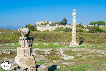
While only a single column remains standing today, the Temple of Artemis site represents one of the Seven Wonders of the Ancient World and provides insight into the religious foundations of Ephesus. The temple underwent multiple rebuilding phases, with its most magnificent incarnation constructed around 550 BCE, featuring 127 marble columns each standing 18 meters tall.
What makes this site historically significant is how it demonstrates the religious syncretism characteristic of ancient Mediterranean societies. The Ephesian Artemis differed markedly from the virgin huntress known elsewhere in Greece, instead appearing as a fertility goddess with multiple breast-like protuberances (possibly eggs or bull testicles, according to some scholars). This distinctive representation shows how Greek colonists adapted their deities to incorporate characteristics of local Anatolian goddesses.
The temple also illustrates the economic function of ancient sanctuaries. It served as a bank where valuable items could be securely stored, and the cult generated significant revenue through sacrifices, offerings, and festivities. This economic power explains why silversmiths who made Artemis shrines felt threatened by early Christianity, leading to the confrontation recorded in the Book of Acts.
Ephesus Archaeological Museum

Located in the nearby town of Selçuk, the Ephesus Archaeological Museum houses many of the most significant artifacts discovered during excavations of the ancient city. While the outdoor ruins give visitors a sense of urban structures, the museum provides crucial context by preserving smaller items that illuminate daily life, religious practices, and artistic achievements.
Particularly notable collections include:
The Artemis statues that show the goddess’s evolving representation across different periods, from early stylized versions to more naturalistic Hellenistic interpretations. These sculptures help visitors understand the religious traditions that made Ephesus a pilgrimage center for the ancient world.
The finds from the terrace houses include delicate glassware, jewelry, cosmetic implements, and cooking utensils that provide intimate glimpses into domestic life. These artifacts help visitors imagine the daily routines of Ephesus’s inhabitants—their meals, their self-care practices, their decorative preferences.
The museum also preserves an extraordinary collection of medical instruments discovered in what archaeologists identified as a physician’s residence, providing insight into ancient medical practices. The sophistication of these tools challenges common assumptions about ancient healthcare capabilities.
Basilica of St. John

Built by Emperor Justinian in the 6th century CE, the Basilica of St. John marks the supposed burial site of John the Evangelist, who according to tradition spent his final years in Ephesus. Although now in ruins, the cruciform basilica was once one of the most important Christian pilgrimage sites in the Byzantine Empire, its massive dimensions (130 meters long) reflecting its significance.
The basilica demonstrates how Christianity transformed the urban landscape of late antique cities. Built on a hill overlooking Ephesus, it represented a physical shift of focus away from the pagan city center toward new Christian monuments. Construction materials salvaged from earlier structures—columns, decorative elements—show how early Christians both literally and figuratively built their institutions upon classical foundations.
What makes this site educationally valuable is how it illuminates the transition from classical to Christian civilization. The baptistery, with its immersion pool for adult baptism, illustrates early Christian practices, while Byzantine architectural elements and fragments of mosaic decoration reveal aesthetic and symbolic developments that would influence medieval European art and architecture.
House of the Virgin Mary (Meryem Ana Evi)

Located on Mount Koressos (Bülbül Dağı) overlooking ancient Ephesus, this modest stone house has become a significant pilgrimage site based on the tradition that Mary, the mother of Jesus, spent her final years here under the care of John the Evangelist.
While archaeological evidence cannot conclusively confirm this tradition, the site’s ancient origins are apparent. The stone foundation dates to the 1st century CE, with the current structure representing centuries of rebuilding and modification. What makes this location historically interesting is how it illustrates the development of religious traditions. The belief that Mary lived here emerges from apocryphal texts and was reinforced through visions reportedly experienced by the German nun Anne Catherine Emmerich in the early 19th century.
The site gained formal recognition when Pope Paul VI visited in 1967, and subsequent papal visits have further elevated its status. Today, it functions as a place where Christians, Muslims (who revere Mary as the mother of the prophet Jesus), and others gather, demonstrating how sacred sites can transcend religious boundaries. The wall covered with prayers written on scraps of cloth and paper creates a powerful visual testament to the continuing human impulse to seek connection with the divine through physical places.
Gate of Mazeus and Mithridates

This monumental triple archway built in 3 BCE served as the southern entrance to the Commercial Agora, Ephesus’s main marketplace. The gate’s inscription reveals it was constructed by two freed slaves, Mazeus and Mithridates, in honor of their former master Emperor Augustus and his family.
What makes this structure historically significant is how it embodies the complex social dynamics of the Roman Empire. The freed slaves’ dedication to Augustus (“their benefactor and patron who had granted liberty to them”) demonstrates how the patronage system functioned—former slaves maintained obligations to their former masters even after manumission. The elaborate monument also shows how wealthy freedmen could achieve considerable social status and economic power while still acknowledging their subordinate position in the Roman social hierarchy.
Architecturally, the gate represents a fine example of Roman monumental construction techniques. The precisely cut marble blocks fit together without mortar, while decorative elements including Corinthian capitals and ornate friezes demonstrate high-quality craftsmanship. The structure’s solid condition after two millennia testifies to Roman engineering expertise.
Commercial Agora

The Commercial Agora or marketplace of Ephesus provides insight into the economic life that sustained this prosperous ancient city. This massive square (154 x 160 meters) surrounded by colonnaded porticoes contained hundreds of shops and stalls where merchants sold goods from throughout the Mediterranean world and beyond.
What makes this space particularly valuable for understanding ancient urban economies is the physical evidence of commercial infrastructure. Water channels and drainage systems show how public utilities supported commercial activities. The porticoes provided shade for shoppers and protection for merchandise, while the central open area could accommodate temporary stalls for visiting merchants.
Archaeological finds from this area—including weights and measures, coins from various regions, and specialized tools—illuminate how trade functioned in the ancient world. The discovery of imported items such as African pottery, Egyptian glass, and goods from as far as India demonstrates Ephesus’s integration into vast trade networks that connected the Mediterranean to Asia and Africa. The agora thus helps visitors understand how globalization is not exclusively a modern phenomenon, but has ancient roots in cities like Ephesus that functioned as commercial hubs.
Harbor Street and Arcadian Way
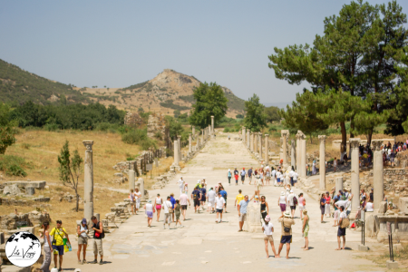
The marble-paved Harbor Street (Arcadian Way) connected the Great Theater to the now-silted ancient harbor, serving as Ephesus’s main ceremonial avenue. Named for Emperor Arcadius who ordered its renovation in the late 4th century CE, this impressive 11-meter-wide boulevard was flanked by colonnades, shops, and monumental gates.
What makes this thoroughfare archaeologically significant is how it illuminates urban planning principles in Roman cities. The street was equipped with a sophisticated infrastructure including a covered sewage system running beneath the pavement and street lighting provided by oil lamps placed in niches carved into the columns. Wheel ruts visible in the marble demonstrate centuries of use by carts and chariots.
The Harbor Street also reveals social and ceremonial aspects of Roman urban life. This was where processions took place during religious festivals, particularly those honoring Artemis, when her sacred image would be carried from the temple through the city. The street was designed to impress visitors arriving by sea, creating a grand first impression of the city through careful urban choreography. Walking this ancient boulevard today, visitors can imagine the sensory experience of ancient Ephesians—the sounds of commerce, the smells of nearby food stalls, and the visual impact of monumental architecture designed to communicate imperial power and urban prosperity.
These ten sites collectively offer a comprehensive understanding of Ephesus as a dynamic urban center that evolved over centuries. From the religious foundations that established its importance to the sophisticated infrastructure that sustained its population, from monumental public buildings to intimate private spaces, each location reveals another aspect of this extraordinary city where Greek, Roman, and early Christian civilizations intersected and transformed one another, creating a heritage site of unparalleled educational value.
The Travertine Terraces

The travertine terraces form Pamukkale’s most iconic feature—a cascade of mineral pools descending 200 meters down the mountainside like a frozen waterfall. These natural formations developed as warm, calcium-saturated water from thermal springs cooled upon reaching the surface, depositing calcium carbonate that gradually hardened into travertine.
The science behind this process is fascinating. The thermal waters contain high concentrations of calcium bicarbonate. When this water reaches the surface, carbon dioxide degasses from the solution, causing calcium carbonate to precipitate. Over time, these deposits build up, creating the terraced pools and flowing formations that resemble solidified waterfalls or melted wax sculptures.
What makes these terraces particularly remarkable is their color. The pure white calcium carbonate reflects the full spectrum of light, creating a dazzling white appearance that contrasts dramatically with the blue water in the pools and the surrounding green landscape. At sunset, these formations take on golden and pink hues as they reflect the changing light.
Visitors can wade through designated sections of the travertines, feeling the warm, mineral-rich water that continues the formation process today. This interactive experience connects people directly to the ongoing geological phenomena. The water temperature typically remains around 35°C (95°F), providing a comfortable, therapeutic bathing experience that visitors have enjoyed for thousands of years—a rare opportunity to participate in an experience essentially unchanged since ancient times.
Hierapolis Ancient Theater

The theater of Hierapolis represents one of the best-preserved ancient Roman theaters in Turkey. Built during the 2nd century CE during the reign of Emperor Hadrian and later restored under Septimius Severus after earthquake damage, this impressive structure could accommodate approximately 12,000 spectators.
What makes this theater architecturally significant is its thoughtful integration into the natural landscape. Built against the slope of the hill, its architects utilized the natural incline for the seating area (cavea), reducing construction requirements while maximizing acoustic properties. The theater offers spectacular views across the ruins of Hierapolis and the Lycus River valley beyond.
The stage building (skene) preserves elaborate decorative elements including marble reliefs depicting mythological scenes related to Apollo and Dionysus—deities associated with the arts and theater. These decorative elements demonstrate the sophisticated artistic traditions of imperial Roman architecture while providing insight into the religious and cultural values that informed ancient entertainment.
The theater’s current excellent state of preservation allows visitors to experience the space much as ancient spectators would have. The orchestra area, entrance passages (parodoi), and seating sections remain clearly defined, helping modern visitors understand how these complex entertainment venues functioned in antiquity.
Antique Pool (Cleopatra’s Pool)

Perhaps the most direct way to experience the convergence of natural and historical elements at Pamukkale is through the Antique Pool, also known as Cleopatra’s Pool. This thermal swimming area formed when a series of earthquakes caused ancient Roman columns and architectural fragments to collapse into the naturally occurring hot spring, creating a unique swimming experience amid classical ruins.
The pool maintains a constant temperature of around 36°C (97°F) and contains high concentrations of minerals including calcium, magnesium, bicarbonate, and sulfate. These compounds give the water therapeutic properties that have attracted health-seekers for millennia. The ancient physician Galen, who visited Hierapolis in the 2nd century CE, documented the water’s healing qualities for various ailments including cardiovascular issues and rheumatic diseases.
While swimming, visitors can observe marble column fragments, capitals, and other architectural elements lying underwater—tangible reminders of the ancient city’s prosperity and subsequent destruction. Small bubbles continuously rise from the spring source at the bottom of the pool, creating a gentle natural effervescence that enhances the otherworldly bathing experience.
The nickname “Cleopatra’s Pool” derives from a tradition that the Egyptian queen once bathed here, though historical evidence doesn’t support this claim. Nevertheless, the setting provides an extraordinary opportunity to literally immerse oneself in both natural phenomena and ancient history simultaneously.
Martyrium of St. Philip

Perched on the eastern hill above Hierapolis stands the Martyrium of St. Philip, an unusual octagonal church built in the 5th century CE to commemorate the location where the apostle Philip was allegedly martyred. The distinctive architecture represents an important transition in early Christian building traditions.
According to Christian tradition, Philip came to Hierapolis to preach in the late 1st century CE and was executed there (though scholarly opinions differ on whether this refers to Philip the Apostle or Philip the Evangelist). The martyrium’s prominent position, visible from throughout the ancient city, demonstrates how Christian sacred topography began to transform urban landscapes during the Byzantine period.
The octagonal design holds particular theological significance, as eight represented resurrection and new creation in early Christian symbolism. This architectural choice directly communicated the Christian message of triumph over death—appropriate for a martyrium commemorating someone executed for their faith. The central octagonal chamber was surrounded by rooms for pilgrims, indicating this was an important early Christian pilgrimage destination.
The structure’s excellent preservation allows visitors to understand how early Christians adapted Roman architectural techniques to express new religious concepts. The martyrium thus illustrates the cultural and religious transition from classical paganism to Christianity that transformed Mediterranean societies in late antiquity.
Northern Necropolis

Stretching for nearly two kilometers along the ancient road leading north from Hierapolis, the Northern Necropolis contains over 1,200 tombs dating from the late Hellenistic period through Byzantine times. This extensive cemetery provides invaluable insight into ancient attitudes toward death and commemorative practices across multiple centuries.
The necropolis features diverse tomb types reflecting different periods and social statuses:
- Tumuli (earthen burial mounds) representing Phrygian influences from the pre-Hellenistic period
- Simple sarcophagi for middle-class citizens
- Elaborate house-shaped tombs mimicking domestic architecture
- Monumental family tombs resembling small temples for wealthy elites
- Christian tombs with distinctive iconography from the Byzantine period
Many tombs preserve their original inscriptions, providing biographical information about the deceased and sometimes including warnings against tomb desecration or expressions of grief. These texts offer direct insight into ancient individuals’ lives, family relationships, professions, and beliefs about the afterlife.
The necropolis’s organization along the main road entering the city was intentional—placing tombs where travelers would see them ensured the deceased would be remembered by passersby. This location demonstrates how ancient cities integrated commemorative spaces into urban planning, with necropoleis serving as transitional zones between countryside and urban center.
Frontinus Gate and Street

The tripartite Frontinus Gate marked the northern entrance to Hierapolis, welcoming visitors arriving via the ancient road from Philadelphia (modern Alaşehir). Built during the 1st century CE and named for Julius Frontinus, the Roman proconsul of Asia, this monumental entrance created a magnificent first impression of the city.
The gate’s archaeological significance lies in how it demonstrates urban planning principles. Rather than standing as an isolated monument, it formed part of an integrated system including:
- A defensive wall circuit protecting the city
- A monumental fountain (nymphaeum) providing fresh water to travelers
- A broad colonnaded street that organized movement through the urban space
The main colonnaded street (plateia) stretched approximately one kilometer from this northern gate to the southern city limits. This remarkably well-preserved thoroughfare retains its original marble paving in many sections, with wheel ruts visible from centuries of cart traffic. Colonnades that once supported covered walkways lined both sides, protecting pedestrians from sun and rain while housing shops and workshops.
Walking this ancient street today allows visitors to experience the sophisticated urban design that characterized Roman provincial capitals. The street’s generous width (11 meters), careful drainage system, and incorporation of public monuments reveal how Roman cities created functional yet impressive public spaces that facilitated both practical movement and ceremonial processions.
Southern Hot Springs and Pamukkale Village

At the base of the travertine terraces lies the modern village of Pamukkale and a series of thermal facilities that continue the area’s ancient tradition of therapeutic bathing. These modern facilities offer visitors the opportunity to experience the same mineral-rich waters that attracted health-seekers in antiquity, creating a connection across millennia of continuous human use.
Scientific analysis reveals why these waters have been valued for so long—they contain high concentrations of calcium, magnesium, bicarbonate, and sulfate, along with trace elements including iron, potassium, and silicon. Modern medical research confirms benefits for certain rheumatic conditions, circulatory problems, and some skin disorders, validating what ancient visitors experienced empirically.
The village itself, while primarily oriented toward tourism today, maintains elements of traditional Turkish rural life. Local handicrafts, particularly cotton textiles (appropriate given Pamukkale’s “cotton castle” name), provide insight into regional cultural traditions that have evolved alongside the more dramatic natural and archaeological attractions.
This area completes the visitor’s experience by demonstrating the living connection between past and present. The continued use of thermal waters for health and recreation illustrates how some human practices transcend specific cultural or historical periods, responding to fundamental physical needs and environmental opportunities that remain constant despite social and political transformations.
Kaleiçi (Old Town)

Antalya’s historic heart, Kaleiçi, provides an immersive journey through the city’s multi-layered past within a remarkably preserved urban fabric. The neighborhood’s name means “within the castle,” referring to the ancient walls that once completely encircled this original core of Antalya.
What makes Kaleiçi architecturally distinctive is how it showcases multiple historical periods in a concentrated area. Roman-era structures like Hadrian’s Gate (built in 130 CE to commemorate the emperor’s visit) serve as a monumental entrance to narrow winding streets lined with Ottoman-era houses. These traditional dwellings feature distinctive wooden upper stories that project over the streets, creating shaded walkways below—an architectural adaptation to the Mediterranean climate that predates modern air conditioning by centuries.
The district’s social history remains visible in its diverse religious structures. The 18th-century Tekeli Mehmet Paşa Mosque with its elegant minaret stands near the Byzantine-era Kesik Minare (Broken Minaret) Mosque, originally built as a Roman temple, later converted to a church, and finally transformed into a mosque—a single building that encapsulates the region’s religious transformations.
Today, these historical structures have been thoughtfully adapted to contemporary uses. Ottoman mansions now house boutique hotels, historical hammams (bathhouses) offer traditional Turkish bathing experiences, and ancient commercial buildings have become cafés and artisan shops. This adaptive reuse has revitalized the district while preserving its historical character.
Walking through Kaleiçi provides a sensory education in Mediterranean urban development—from the sound of calls to prayer echoing off stone walls to the scent of jasmine climbing over courtyard gates, from the feel of worn marble steps beneath your feet to the visual harmony of weathered wooden balconies against whitewashed walls. The neighborhood demonstrates how urban spaces evolve organically over centuries while maintaining their essential character.
Location & General Information
Address: Kaleiçi, Selçuk Mahallesi, Muratpaşa, Antalya, Turkey
Opening Hours: The district itself is accessible 24/7, though individual attractions, shops, and restaurants within Kaleiçi have their own operating hours. Most shops typically open around 9:00 AM and close between 7:00-10:00 PM, with longer hours during summer tourist season.
Transportation Options
From Antalya Airport
By Bus:
- Take the Havaş airport shuttle or public bus line 600 (Airport-Otogar) to Antalya Bus Terminal (Otogar)
- From the Bus Terminal, take bus lines KL08 or LC07 which go directly to Kaleiçi
- Journey time: approximately 45-60 minutes depending on traffic
By Taxi:
- Taxis are readily available outside the airport terminal
- Journey time: approximately 25-30 minutes depending on traffic
- Ask the driver to take you to “Kaleiçi” or “Antalya Old Town”
By Private Transfer:
- Companies offering private transfers include Antalya Transfer, Holiday Transfers, and Antalya Airport Transfers
- Pre-booking is recommended for these services
Within Antalya
By Tram:
- The Nostalgic Tram (AntRay) runs along the coast and stops at “Kale Kapısı” (Castle Gate), the main entrance to Kaleiçi
- Trams run approximately every 30 minutes
By Public Bus:
- Bus lines CV14, KC06, KL08, KL21, MK80, TC16.all stop near Kaleiçi
By Dolmuş (Shared Minibus):
- Numerous dolmuş routes from different parts of Antalya pass near Kaleiçi
- Look for minibuses with “Kale Kapısı” or “Merkez” (Center) displayed
By Bicycle:
- Antalya has a public bike sharing system called ANTBIS
- Several bike rental shops are available near the marina and along the coast
Walking:
- If staying in central Antalya, walking to Kaleiçi is convenient and pleasant
- The old town is connected to the modern city center and can be easily reached on foot
Nearby Stations and Transit Points
Tram Stations:
- Kale Kapısı (nearest to the main entrance)
- İsmetpaşa (slightly further but still walkable)
- Hadrian’s Gate (for the eastern entrance)
Bus Stops:
- Belediye is 341 meters away, 5 min walk.
- 10039 – Işiklar Cd-1 is 506 meters away, 7 min walk.
- 15066 – Üç Kapilar 3 is 519 meters away, 7 min walk.
- 10282 – Demirciler Çarşisi is 634 meters away, 9 min walk.
- 10326 – Şehit Binbaşi Cengiz Toytunç Cd-1 is 742 meters away, 10 min walk.
Taxi Stands:
- Cumhuriyet Meydanı (Republic Square) Taxi Stand
- Marina Taxi Stand
- Kale Kapısı Taxi Stand
Parking Information
Public Parking Areas:
- Karaalioğlu Park Parking Area (short walk to Kaleiçi)
- Marina Parking Area (at the bottom of the old town)
- Cumhuriyet Meydanı Underground Parking
- Kale Kapısı Parking Area
Street Parking:
- Limited street parking is available on roads surrounding Kaleiçi
- Note that many streets within Kaleiçi itself are pedestrianized or too narrow for vehicles
Important Note: Parking can be challenging during peak tourist season (June-September). It’s advisable to arrive early or use public transportation.
Main Entrances to Kaleiçi
- Hadrian’s Gate (Hadrian Kapısı) – The grand Roman triumphal arch on the eastern side
- Kale Kapısı (Clock Tower Gate) – The main northern entrance near Republic Square
- Marina Entrance – The southern entrance from the harbor area
Nearby Attractions
Within Walking Distance:
- Hadrian’s Gate (Ancient Roman triumphal arch)
- Antalya Archaeological Museum
- Karaalioğlu Park
- Yivli Minare (Fluted Minaret)
- Antalya Marina and Harbor
- Republic Square (Cumhuriyet Meydanı)
- Kesik Minare (Broken Minaret Mosque)
- Hıdırlık Tower
- Yat Limanı (Yacht Harbor)
- Mermerli Beach
Transportation Companies Serving the Area
Bus Companies:
- Antalya Ulaşım A.Ş. (Municipal transportation company)
- Website: www.antalyaulasim.com.tr
Taxi Services:
- Antalya Taxi Association:
- Taksi Durağı:
Bicycle Rentals:
- ANTBIS (Public bike sharing system)
- Kaleiçi Bike Rental
- Marina Bicycle Tours & Rentals
Tour Companies:
- Antalya City Tour
- Old Town Guided Tours
- Kaleiçi Walking Tours
Antalya Archaeological Museum
The Antalya Archaeological Museum houses one of Turkey’s most important collections of antiquities, systematically presenting the region’s historical development from prehistoric times through the Ottoman period. What distinguishes this museum from many others is how thoroughly it contextualizes its artifacts, helping visitors understand not just what objects look like but how they functioned within their original societies.
The collection’s particular strengths include:
The Statuary Hall containing remarkable Roman marble sculptures discovered in nearby Perge. The craftsmanship of these works—including the massive “Hercules” statue and the “Dancing Girl” series—demonstrates the sophisticated artistic traditions that flourished in the region during the 2nd century CE. The subtle details of muscle definition, cloth draping, and facial expressions reveal the technical mastery of ancient sculptors.
The sarcophagi collection provides insight into ancient attitudes toward death and commemoration. The elaborately carved stone coffins—many featuring mythological scenes or portraits of the deceased—show how ancient Mediterranean cultures invested heavily in funerary art as a means of preserving memory and status.
The prehistoric gallery chronicles human development in the region from Paleolithic hunter-gatherers through early agricultural settlements. The carefully arranged chronological displays help visitors understand how technologies and social structures evolved over thousands of years.
The museum’s educational approach extends beyond the artifacts themselves. Scale models of ancient sites, clear explanatory panels, and multimedia presentations provide important context for understanding the objects. The museum thus serves as an essential preliminary to visiting the ancient sites themselves, giving visitors the background knowledge to interpret what they will see at places like Perge, Aspendos, and Side.
General Information
Official Name: Antalya Müzesi (Antalya Archaeological Museum)
Address: Konyaaltı Caddesi No:88, Bahçelievler, 07050 Muratpaşa/Antalya, Turkey
Opening Hours:
- Summer season (April 1 – October 31): 8:30 AM – 7:00 PM
- Winter season (November 1 – March 31): 8:30 AM – 5:30 PM
- Closed on Mondays (except during peak tourist seasons)
Transportation Options
From Antalya City Center
By Public Bus:
The Antalya public transportation system operates several bus routes that serve the museum area. Look for buses heading toward Konyaaltı Beach or the museum specifically. The museum is located on Konyaaltı Avenue, a major road in Antalya.
Several bus lines connect central Antalya to the museum area, including those departing from areas like Kaleiçi (Old Town) and the main bus terminal (Otogar). When boarding, you can ask the driver to notify you when you reach the museum stop.
By Tram:
The Antalya Tram system (AntRay) has two main lines:
- The Heritage Tram (Nostaljik Tramvay) runs along the coastal route
- The modern Antray line connects various parts of the city
The nearest tram station to the museum is the “Müze” (Museum) station, which is just a short walk from the entrance. The tram is a convenient option if you’re coming from the city center or coastal areas.
By Taxi:
Taxis are readily available throughout Antalya. Any taxi driver will know the museum’s location when you request “Antalya Müzesi” or “Archaeological Museum.” The journey from the city center typically takes about 10-15 minutes, depending on traffic conditions.
By Dolmuş (Shared Minibus):
These shared minibuses operate on fixed routes throughout Antalya. Look for dolmuşes that travel along Konyaaltı Avenue. They’re an economical option and often have “Müze” (Museum) marked on their route displays.
Walking:
If you’re staying in the Konyaaltı district or western parts of central Antalya, the museum is within comfortable walking distance. The pleasant coastal promenade offers scenic views for those walking from the direction of the city center.
Nearby Transportation Hubs
Bus Stops:
- “Antalya Müzesi Durağı” (Antalya Museum Stop) – directly in front of the museum
- “Konyaaltı Caddesi” stops – along the main avenue
- 600, KC06, KC34, KL21, LF09, MC68, VF01, VF66.
Tram Stations:
- “Müze” (Museum) Station – the closest tram stop, on the T2 Antray line
Parking Facilities
Museum Parking Lot: The museum has its own dedicated parking area for visitors, located directly in front of the main entrance. This is the most convenient option but can fill up during peak tourist season.
Street Parking: Paid street parking is available along Konyaaltı Avenue and surrounding streets. Be mindful of parking regulations and restrictions.
Nearby Public Parking: Several public parking lots are located within walking distance of the museum, particularly in the direction of Konyaaltı Beach.
Nearby Attractions
When planning your visit, you might want to combine your trip to the museum with these nearby points of interest:
- Konyaaltı Beach – One of Antalya’s most popular beaches, located just west of the museum
- Antalya Aquarium – One of the world’s largest tunnel aquariums, a short distance from the museum
- Minicity – A miniature park featuring scale models of famous Turkish landmarks
- Beach Park – A recreational area with various activities and dining options
- Karaalioğlu Park – A beautiful park with panoramic views, slightly further but reachable by public transport
- Atatürk Culture Park – A green space with various recreational facilities
Perge Ancient City
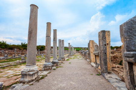
Located about 15 kilometers east of Antalya’s center, Perge represents one of the most important ancient cities in Pamphylia and offers visitors an extensive archaeological site where multiple layers of history remain visible. Originally a Hittite settlement dating to at least 1500 BCE, Perge reached its greatest prosperity under Roman rule in the 2nd century CE.
What makes Perge archaeologically significant is how clearly it demonstrates ancient urban planning principles. The city was designed on a rigid grid system with two main colonnaded streets intersecting at the center. These broad avenues featured covered walkways for pedestrians, shops fronting the streets, and an elaborate central water channel that provided both practical water distribution and aesthetic beauty—a sophisticated integration of functionality and design.
The site’s extensive ruins include:
The stadium, which could seat approximately 12,000 spectators, remains one of the best-preserved ancient sports venues in the Mediterranean. Unlike many ancient stadiums that have been partially dismantled or built over, Perge’s stadium retains its original seating, track dimensions, and structural elements.
The theater, though partially restored, provides insight into ancient performance traditions. Its distinctive architectural elements include the elaborate stage building (skene) that would have provided both a backdrop for performances and acoustic enhancement.
The extensive bath complex demonstrates Roman hygiene practices and social customs. The various chambers—frigidarium (cold room), tepidarium (warm room), and caldarium (hot room)—illustrate how these facilities served not just for cleanliness but as important social gathering spaces.
Most distinctive is Perge’s sophisticated water management system. The city featured an elaborate network of aqueducts, distribution channels, fountains, and drainage systems that together created a level of infrastructure not seen again in the region until modern times. This system enabled an urban population density that would have been impossible without such careful water engineering.
Walking through Perge today, visitors can observe how the city evolved over time, with Byzantine modifications to earlier Roman structures and evidence of changing religious practices as Christianity gradually replaced pagan traditions. The site thus provides a physical record of the transition from classical antiquity to the early medieval period.
Address
Address: Perge Antik Kenti, Aksu Mahallesi, 07112 Aksu/Antalya, Turkey GPS Coordinates: 36.9613° N, 30.8539° E
Opening Hours
- April 1 – October 31 (Summer Season): 8:30 AM – 7:00 PM
- November 1 – March 31 (Winter Season): 8:30 AM – 5:30 PM
- Closed: During major religious holidays
Transportation Options
From Antalya City Center
- Public Bus:
- Take Bus Line 528, AC03, AF04A, BA22, SA19. (Aksu-Kundu line) from Antalya city center
- Departs from Meydan station in central Antalya
- Journey time: 45-60 minutes
- Get off at the “Perge Örenyeri” stop
- Taxi:
- Available throughout Antalya
- Journey time: 25-30 minutes from the city center
- Recommended to agree on fare before departure
- Rental Car:
- Follow D400 highway eastward from Antalya
- Turn north at Aksu town following signs for Perge/Perge Antik Kenti
- Journey time: 25-30 minutes
- Distance: Approximately 18 km from Antalya center
- Organized Tours:
- Many tour operators in Antalya offer day trips to Perge
- Often combined with other nearby attractions like Aspendos and Side
Nearby Stations/Transport Hubs
- Aksu Bus Station: Local hub with connections to Antalya city center
- Antalya Bus Terminal (Otogar): Main intercity bus terminal, 15 km from Perge
- Antalya Airport: International airport, approximately 10 km from Perge
Parking Information
- Main Archaeological Site Parking: Located at the entrance to Perge
- Capacity: Approximately 50 vehicles
- Security: Guarded during opening hours
- Suitable for: Cars, minibuses, and coaches
- Overflow Parking Area: Located 300 meters from the entrance
- Used during peak tourist season (May-September)
- Capacity: Approximately 30 additional vehicles
Nearby Attractions
- Aspendos Ancient Theater:
- Distance from Perge: 16 km (20 minutes by car)
- Famous for its remarkably preserved Roman theater
- Side Ancient City:
- Distance from Perge: 50 km (45 minutes by car)
- Coastal ruins with temples and an amphitheater
- Kurşunlu Waterfall:
- Distance from Perge: 12 km (15 minutes by car)
- Natural park with picturesque waterfalls
- Antalya Archaeological Museum:
- Distance from Perge: 17 km (25 minutes by car)
- Houses many artifacts discovered at Perge
- Düden Waterfalls:
- Distance from Perge: 25 km (30 minutes by car)
- Impressive waterfalls flowing directly into the Mediterranean
Aspendos Theater
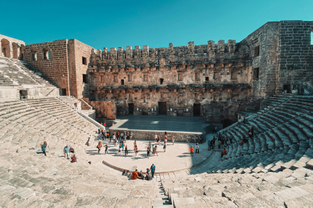
The ancient theater at Aspendos stands as perhaps the most perfectly preserved Roman theater in the world. Built during the reign of Marcus Aurelius (161-180 CE) by the architect Zeno, this remarkable structure has survived nearly two millennia with its stage building, seating sections, and acoustic properties intact.
What makes Aspendos Theater architecturally exceptional is how completely it retains its original structural elements. Unlike many ancient theaters that lost their stage buildings (skene) to earthquakes or stone-robbing, Aspendos preserves this two-story façade with its original decorative elements, including columns, capitals, and friezes. The theater could accommodate approximately 12,000 spectators, with seating arranged in a semicircular pattern that creates exceptional acoustics—even today, a normal speaking voice from the stage can be heard clearly at the highest tier of seating.
The theater’s preservation is partly due to repurposing rather than abandonment. During the Seljuk period in the 13th century, the structure was converted into a caravanserai (roadside inn) with the stage building serving as a palace. This continuous use, along with its solid construction, protected it from the decay that affected many other ancient sites.
Aspendos Theater remains a living performance venue, hosting ballet and opera performances during the annual Aspendos International Opera and Ballet Festival. This continued use for its original purpose creates a direct connection between contemporary visitors and ancient theatergoers who sat on these same stone seats two thousand years ago.
Beyond its architectural significance, the theater provides insight into how entertainments functioned in ancient provincial cities. Inscriptions and architectural elements reveal information about how performances were funded, who attended, and what types of productions were staged—from Greek tragedies and comedies to musical performances and gladiatorial contests.
Address
Address: Aspendos Antik Tiyatrosu, Belkıs Mahallesi, 07500 Serik/Antalya, Turkey
GPS Coordinates: 36.9391° N, 31.1728° E
Opening Hours
- April 1 – October 31 (Summer Season): 8:30 AM – 7:00 PM
- November 1 – March 31 (Winter Season): 8:30 AM – 5:30 PM
- Closed: During major religious holidays
Transportation Options
From Antalya City Center
- Public Bus:
- Take the Antalya-Serik intercity bus from Antalya Bus Terminal (Otogar)
- Journey time: Approximately 45-60 minutes
- Get off at Belkıs/Aspendos stop
- Walk about 1 kilometer to the theater or take a local taxi
- Dolmuş (Shared Minibus):
- Take a dolmuş heading to Serik from Antalya city center
- Make sure to inform the driver you want to stop at Aspendos
- Journey time: 40-50 minutes
- Service frequency: Every 20-30 minutes during daytime
- Taxi:
- Available throughout Antalya
- Journey time: 35-40 minutes from the city center
- Distance: Approximately 47 km
- Consider arranging with the driver to wait or return at a specific time
- Rental Car:
- Follow the D400 highway eastward from Antalya
- Take the Serik exit and follow signs for Aspendos/Belkıs
- Journey time: 35-40 minutes
- Well-signposted route with brown tourism signs
- Organized Tours:
- Multiple tour operators in Antalya offer daily trips to Aspendos
- Often combined with other nearby attractions like Perge, Side, or the Manavgat Waterfall
- These typically include transportation, guide services, and sometimes meals
From Side and Belek (Nearby Resort Areas)
- Public Transportation:
- From Side: Take a dolmuş to Serik, then transfer to Aspendos
- From Belek: Take a dolmuş directly to Aspendos
- Journey times: 30-45 minutes from either location
- Taxi/Rental Car:
- From Side: 25-30 minutes (25 km)
- From Belek: 15-20 minutes (12 km)
Parking Information
- Main Archaeological Site Parking:
- Located approximately 200 meters from the theater entrance
- Capacity: Approximately 40-50 vehicles (cars and buses)
- Security: Monitored during opening hours
- Surface: Paved with designated areas for tour buses
- Overflow Parking Area:
- Available during peak tourist season (May-September)
- Located about 400 meters from the main entrance
- Capacity: Approximately 25-30 additional vehicles
Nearby Attractions
- Aspendos Aqueduct:
- Distance from the theater: 1.5 km (15-minute walk)
- Ancient Roman aqueduct system that supplied water to the city
- Perge Ancient City:
- Distance from Aspendos: 30 km (30-35 minutes by car)
- Extensive Greco-Roman ruins including an impressive stadium
- Kurşunlu Waterfall:
- Distance from Aspendos: 40 km (45 minutes by car)
- Beautiful natural park with cascading waterfalls
- Side Ancient City:
- Distance from Aspendos: 25 km (30 minutes by car)
- Coastal archaeological site with temples and an amphitheater
- Köprülü Canyon National Park:
- Distance from Aspendos: 35 km (40 minutes by car)
- Popular for rafting and natural beauty
- Sillyon Ancient City:
- Distance from Aspendos: 15 km (20 minutes by car)
- Less-visited but impressive ancient city on a plateau
Düden Waterfalls
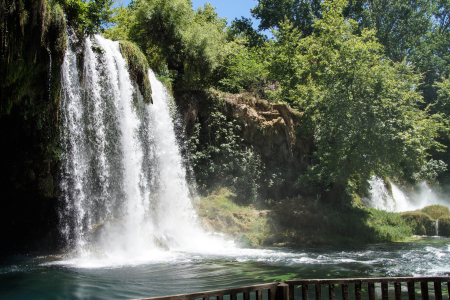
The Düden Waterfalls showcase how natural processes have sculpted Antalya’s landscape over millennia. Consisting of two separate cascades—the Upper Düden and Lower Düden—these falls derive their waters from the Düden River, which flows underground for part of its course before dramatically emerging at the karst formations that create the upper falls.
The Upper Düden (Düdenbaşı) features multiple cascades flowing through a lush garden setting. What makes this location geologically interesting is how it demonstrates the region’s karst topography, where water dissolves limestone over time to create underground rivers, caves, and sinkholes. The river actually disappears underground several kilometers before the falls, then resurfaces dramatically at this point.
The Lower Düden (Karpuzkaldıran) provides an even more spectacular display where the river plunges approximately 40 meters directly into the Mediterranean Sea. This dramatic intersection of freshwater and saltwater creates not just a visual spectacle but an important ecological transition zone.
The falls have shaped human settlement patterns throughout history. Archaeological evidence indicates that early inhabitants established communities near these reliable water sources, while later civilizations constructed aqueducts and water management systems to harness the river’s power for agriculture and urban use.
Today, the waterfalls remain vital to local ecology, supporting diverse plant and animal communities in what might otherwise be a more arid environment. The microclimate created by the constant moisture supports lush vegetation that contrasts with drier surrounding areas, demonstrating how water availability determines ecological systems in Mediterranean landscapes.
Address
Upper Düden Waterfall (Düdenbaşı): Address: Varsak Mahallesi, Düdenbaşı Caddesi, Kepez/Antalya, Turkey GPS Coordinates: 37.0788° N, 30.7830° E
Lower Düden Waterfall (Karpuzkaldıran): Address: Çağlayan Mahallesi, Lara Caddesi, Muratpaşa/Antalya, Turkey GPS Coordinates: 36.8514° N, 30.8390° E
Opening Hours
Upper Düden Waterfall:
- Daily: 8:00 AM – 7:00 PM (April to October)
- Daily: 8:00 AM – 5:00 PM (November to March)
Lower Düden Waterfall:
- Open 24 hours as it’s located in a more public area
- Best viewed during daylight hours
- Illuminated in the evening during summer months
Contact:
Antalya Tourism Information Office:
- Website: www.antalyakulturturizm.gov.tr
Transportation Options
From Antalya City Center to Upper Düden
- Public Bus:
- Take bus lines FL82, KL08, LF09, TL94, VML54A and KL08 from Antalya city center (Konyaaltı direction)
- Get off at “Düdenbaşı” stop
- Walk approximately 400 meters to the entrance
- Journey time: 30-40 minutes depending on traffic
- Frequency: Every 15-20 minutes during daytime hours
- Taxi:
- Available throughout Antalya
- Journey time: 20-25 minutes from city center
- Distance: Approximately 9 km from central Antalya
- Rental Car:
- Follow signs for Varsak/Düdenbaşı from central Antalya
- Take the D650 highway north from the city center
- Well-signposted with brown tourism signs
- GPS navigation recommended
- Organized Tours:
- Many tour operators in Antalya offer half-day or full-day tours
- Often combined with other attractions like the Lower Düden Waterfall
From Antalya City Center to Lower Düden
- Public Bus:
- Take bus lines VC55, KL11, or KL94 from central Antalya
- Get off at “Lara Şelalesi” stop
- Walk approximately 300 meters to the viewing area
- Journey time: 30-40 minutes
- Frequency: Every 15-30 minutes depending on the line
- Taxi:
- Journey time: 15-20 minutes from city center
- Distance: Approximately 10 km from central Antalya
- Rental Car:
- Follow signs for Lara Beach/Airport
- Take Lara Caddesi eastward and follow signs for “Düden Şelalesi”
- Parking available near the viewing platforms
- Boat Tours:
- Available from Antalya Marina/Old Harbor (Kaleiçi)
- Provides spectacular views of the Lower Düden from the sea
- Typically 1-2 hour boat trips along the coastline
Parking Information
Upper Düden Waterfall:
- Main parking area located at the entrance
- Capacity: Approximately 100 vehicles
- Security: Monitored during opening hours
- Additional overflow parking available during peak season
- Designated areas for tour buses
Lower Düden Waterfall:
- Street parking along Lara Caddesi
- Dedicated parking area near the viewing platforms
- Capacity: Approximately 50-60 vehicles
- Busier during sunset hours when views are most spectacular
Nearby Attractions
- Kurşunlu Waterfall:
- Distance from Upper Düden: 18 km (25 minutes by car)
- Another beautiful waterfall set in a natural park environment
- Lara Beach:
- Distance from Lower Düden: 3 km (5 minutes by car)
- Popular sandy beach with numerous resort hotels
- Antalya Aquarium:
- Distance from Lower Düden: 5 km (10 minutes by car)
- One of the world’s largest tunnel aquariums
- Sandland:
- Distance from Lower Düden: 4 km (8 minutes by car)
- Sand sculpture exhibition on Lara Beach
- Antalya Old Town (Kaleiçi):
- Distance from Upper Düden: 10 km (20 minutes by car)
- Distance from Lower Düden: 12 km (25 minutes by car)
- Historic district with Ottoman-era houses, shops, and restaurants
- Perge Ancient City:
- Distance from Upper Düden: 18 km (30 minutes by car)
- Well-preserved Greco-Roman ruins
- Antalya Archaeological Museum:
- Distance from Upper Düden: 8 km (15 minutes by car)
- Houses artifacts from the region’s ancient civilizations
Termessos Ancient City
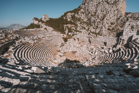
Perched dramatically at an altitude of 1,050 meters in the Taurus Mountains, Termessos offers visitors an unparalleled combination of natural beauty and ancient architecture. This remote mountain city remained unconquered even by Alexander the Great, who described it as an “eagle’s nest” too difficult to capture.
What makes Termessos archaeologically unique is how the city was constructed in harmony with its challenging mountain topography. Unlike many ancient sites built on relatively flat terrain, Termessos integrated its structures with the rocky landscape, creating an urban environment that seems to grow organically from the mountain itself. The city’s buildings, including temples, administrative structures, and residential quarters, were constructed on different levels connected by stepped pathways that followed the natural contours of the mountain.
The city’s remoteness and difficult access have protected it from extensive looting and stone-robbing that affected more accessible sites. Consequently, many structures retain their original architectural elements, providing clear examples of Hellenistic and Roman provincial building techniques. The theater, built into a natural bowl in the mountainside, offers breathtaking views across the Mediterranean coast—a dramatic backdrop that must have enhanced ancient performances.
Termessos also illuminates how ancient people adapted to and utilized challenging environments. The city’s sophisticated water management system collected rainwater in cisterns carved from the living rock, enabling a substantial population to thrive in this seemingly inhospitable location. The defensive advantages of the site—steep approaches, narrow passes easily guarded by small forces, excellent visibility across surrounding territories—demonstrate how security concerns influenced ancient settlement patterns.
The site’s relative isolation has also preserved its natural environment. The surrounding Güllük Mountain National Park contains diverse ecosystems with numerous endemic plant species and wildlife including ibex, wild boar, and various birds of prey. This combination of natural and cultural heritage creates an immersive experience that helps visitors understand how ancient communities existed in relationship with their natural surroundings.
Address
Address: Termessos Antik Kenti, Güllük Dağı Milli Parkı, Döşemealtı/Antalya, Turkey
GPS Coordinates: 36.9803° N, 30.4639° E
Region: Located within Güllük Mountain National Park, approximately 34 km northwest of Antalya city center
Opening Hours
- April 1 – October 31 (Summer Season): 8:00 AM – 7:00 PM
- November 1 – March 31 (Winter Season): 8:30 AM – 5:30 PM
- Closed: During severe weather conditions (especially snow in winter)
Transportation Options
From Antalya City Center
- Public Bus:
- Take bus from Antalya city center heading toward Korkuteli
- Get off at the “Güllük Dağı Milli Parkı” or “Termessos” stop
- Journey time: Approximately 45-60 minutes
- From the bus stop, walk approximately 1 km uphill to the park entrance
- Note: Bus service is limited, with only 3-4 buses per day
- Taxi:
- Available from anywhere in Antalya
- Journey time: 45-50 minutes from city center
- Distance: Approximately 37 km
- Consider arranging for the taxi to wait or return at a specific time, as getting a return taxi from Termessos can be difficult
- Rental Car (Recommended):
- Follow the D650 highway northwest from Antalya
- Take the exit marked for “Termessos/Güllük Dağı Milli Parkı”
- Follow the signs along the winding mountain road to the entrance
- Journey time: 45-50 minutes from Antalya center
- Note: The final 8 km involves driving up a narrow mountain road with switchbacks
- Organized Tours:
- Multiple tour operators in Antalya offer day trips to Termessos
- Often combined with other nearby attractions like Karain Cave or the Düden Waterfalls
- These typically include transportation, guide services, and sometimes meals
- Advantage: Guides can provide historical context and help navigate the expansive ruins
Parking Information
- Main Parking Area:
- Located at the terminus of the access road
- Capacity: Approximately 40-50 vehicles
- Surface: Unpaved but relatively level
- From the parking area, visitors begin a 1 km uphill hike to reach the city ruins
- No separate fee for parking (included in park entrance)
- Overflow Parking:
- Limited additional space along the access road when the main lot is full
- Used primarily during peak tourist season (May-September)
Nearby Attractions
- Karain Cave:
- Distance from Termessos: 19 km (25 minutes by car)
- Prehistoric cave with evidence of human habitation dating back 25,000 years
- Düden Waterfalls:
- Distance from Termessos: 40 km (50 minutes by car)
- Upper and Lower sections, with the lower falls dramatically plunging into the Mediterranean
- Antalya Archaeological Museum:
- Distance from Termessos: 30 km (40 minutes by car)
- Houses artifacts from many archaeological sites in the region, including some from Termessos
- Konyaaltı Beach:
- Distance from Termessos: 35 km (45 minutes by car)
- Popular beach area with restaurants and amenities
- Karaalioğlu Park:
- Distance from Termessos: 32 km (40 minutes by car)
- Beautiful clifftop park with panoramic views of the Mediterranean
- Antalya Old Town (Kaleiçi):
- Distance from Termessos: 34 km (45 minutes by car)
- Historic district with Ottoman-era architecture and charming streets
Side Ancient City and Temple of Apollo
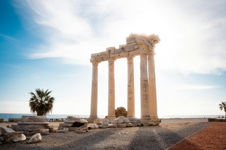
Side (pronounced “see-deh”) presents a remarkable example of an ancient harbor city where archaeological remains are integrated with a modern resort town. The name derives from the ancient Anatolian word for pomegranate, which was considered a symbol of fertility and prosperity.
What distinguishes Side archaeologically is the exceptional preservation of its monumental structures within a peninsula setting bounded by ancient walls. The city’s layout remains clearly visible, with two main colonnaded streets intersecting at a central nymphaeum (fountain complex). The substantial theater, which could seat approximately 15,000 spectators, features distinctive architectural elements including an elaborate stage building whose decorative elements have been partially reconstructed.
The Temple of Apollo occupies a dramatic position at the peninsula’s tip overlooking the Mediterranean. This 2nd-century CE structure demonstrates the continuing importance of traditional religious practices even as Christianity began spreading throughout the region. The temple’s current fragmentary state—with five columns re-erected in the 20th century—creates a romantic silhouette against the sea that has become emblematic of Side. The temple location demonstrates the ancient practice of positioning important religious structures at prominent points in the landscape, creating visual connections between natural and constructed environments.
Side’s ancient harbor facilities remain partially visible beneath the waters of the modern marina, providing insight into ancient maritime technology and trade networks. The city thrived as a commercial center, particularly during the 2nd and 3rd centuries CE when it became notorious as a center for the Mediterranean slave trade. This darker aspect of ancient economic history provides important context for understanding how wealth was generated in ancient urban centers.
The site’s educational value is enhanced by how clearly it demonstrates the transition from paganism to Christianity. The transformation of the former commercial agora into a 5th-century Byzantine basilica physically embodies the religious and social changes that reshaped Mediterranean societies in late antiquity. Standing in this space, visitors can observe how the architectural elements and spatial organization of the marketplace were adapted to serve new religious functions.
Address
Address: Side Mahallesi, 07330 Manavgat/Antalya, Turkey
Coordinates: 36.7667° N, 31.3889° E
Opening Hours
- April to October: 8:30 AM – 7:00 PM
- November to March: 8:30 AM – 5:30 PM
- Open daily (including weekends and most holidays)
Contact Information
- Website: www.muze.gov.tr
How to Get There
From Antalya City Center
By Public Bus:
- Take a bus from Antalya Bus Terminal to Manavgat (runs every 30 minutes)
- From Manavgat, take a local dolmuş (minibus) to Side (runs every 15-20 minutes)
- Total journey time: approximately 1.5-2 hours
By Direct Shuttle:
- Direct shuttles run from Antalya city center to Side during tourist season
- Departure points include Antalya bus terminal and some major hotels
- Journey time: approximately 1 hour
By Taxi:
- Available from Antalya city center or airport
- Journey time: approximately 1 hour
By Rental Car:
- Follow the D400 coastal highway east from Antalya
- Well-signed route, distance approximately 75km
- Journey time: approximately 1 hour
From Nearby Towns
From Manavgat:
- Regular dolmuş (minibus) services run from Manavgat to Side
- Journey time: approximately 15 minutes
- Frequency: every 15-20 minutes during daytime
From Belek/Kadriye:
- Dolmuş connections available
- Journey time: approximately 30-40 minutes
Nearby Stations
Bus Stations:
- Manavgat Bus Terminal (15km from Side)
- Side Bus Stop (located at the entrance to the old town)
Parking Information
- Main Parking Area: Large public parking lot at the entrance to the Side peninsula
- Old Town Parking: Limited parking spaces near the museum entrance
- Beach Parking: Several paid parking areas along the coastal road
- East Beach Parking: Parking available near the Temple of Apollo
Nearby Attractions
Within Side Ancient City:
- Side Archaeological Museum (housed in a restored Roman bath)
- Ancient Theater of Side (capacity of 15,000 people)
- Agora (ancient marketplace)
- Byzantine Basilica
- City Walls and Main Gate
- Nymphaeum (monumental fountain)
- Harbor area with restaurants
- Manavgat Waterfall (12km from Side)
- Titreyengöl Nature Reserve (7km)
- Sorgun Forest (8km)
- Köprülü Canyon National Park (55km)
- Aspendos Ancient Theater (35km)
- Perge Ancient City (90km)
Olympos and Çıralı
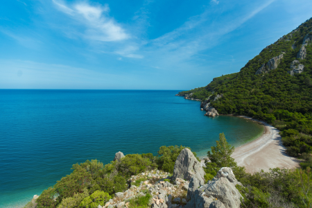
The adjacent coastal settlements of Olympos and Çıralı offer complementary experiences that together provide insight into both ancient history and contemporary conservation efforts along Turkey’s Mediterranean coast.
Ancient Olympos occupies a river valley opening onto a sheltered bay. Founded in the Hellenistic period and reaching its peak in Roman times, the city is distinguished by how its structures integrate with the natural environment. The ruins, including a theater, bathhouse, and temple tombs, are partially overgrown and intermixed with forest vegetation, creating an atmospheric setting that demonstrates how natural systems reclaim built environments over time.
What makes Olympos historically significant is its connection to the ancient Lycian League—one of the earliest known democratic federations, which influenced later democratic systems. The site preserves numerous Lycian sarcophagi and rock-cut tombs with distinctive architectural features that differ from Greek and Roman funerary monuments. These distinctive mortuary practices provide insight into the indigenous Lycian culture that maintained its identity even as the region came under successive foreign controls.
Nearby Çıralı beach represents one of Turkey’s most important sea turtle nesting sites. The protected status of this 3.5-kilometer beach has preserved both natural habitat and limited development, creating a model for sustainable tourism. The beach’s protection stems from its importance to endangered loggerhead turtles (Caretta caretta), who have nested here for millions of years. Conservation efforts include night patrols during nesting season, protected incubation areas, and education programs that demonstrate contemporary approaches to balancing tourism with environmental protection.
Both locations share access to the Yanartaş (Chimera)—a natural eternal flame created by methane gas seeping through vents in the mountainside. This unusual geological phenomenon has burned continuously for thousands of years and inspired ancient myths about fire-breathing creatures. The site was once home to a temple of Hephaestus (god of fire and metallurgy), demonstrating how ancient cultures integrated unusual natural phenomena into their religious worldviews.
Address
Olympos: Address: Olympos Mahallesi, 07350 Kumluca/Antalya, Turkey Coordinates: 36.3992° N, 30.4745° E
Çıralı: Address: Çıralı Mahallesi, 07980 Kemer/Antalya, Turkey Coordinates: 36.4181° N, 30.4762° E
These two locations are about 3.5 km apart, connected by a beautiful beach. Çıralı is the more developed settlement with road access, while Olympos ancient ruins are nestled in a valley with the beach at one end.
Opening Hours
Olympos Ancient City:
- Summer season (April-October): 8:30 AM – 7:00 PM
- Winter season (November-March): 8:30 AM – 5:00 PM
- Open daily year-round
Chimaera/Yanartaş (Eternal Flames):
- Open 24 hours (though visiting after sunset is recommended to best see the flames)
- Accessible year-round
Beaches:
- Always accessible, no time restrictions
- Lifeguards usually on duty 9:00 AM – 6:00 PM during summer season
How to Get There
From Antalya City Center
By Public Bus:
- Take a bus from Antalya Bus Terminal to Kumluca or Kaş
- Ask the driver to drop you at the Çıralı/Olympos junction on the D400 highway
- From the junction, take a dolmuş (minibus) down to Çıralı village (8 km from the highway)
- For Olympos, either walk from Çıralı (3.5 km) or take a dolmuş to the Olympos entrance
- Total journey time: approximately 2-3 hours
By Direct Shuttle:
- Seasonal direct minibuses run from Antalya city center to Çıralı/Olympos
- Usually depart from near Hadrian’s Gate or the Antalya Bus Terminal
- Journey time: approximately 1.5-2 hours
- Limited schedule outside of peak tourist season (May-October)
By Taxi:
- Available from Antalya city center or airport
- Journey time: approximately 1.5 hours
- Consider arranging a return time or alternative transportation back as taxis are not always readily available in Çıralı or Olympos
By Rental Car:
- Follow the D400 coastal highway southwest from Antalya
- Turn off at the Çıralı/Olympos junction (well-signed)
- For Çıralı, follow the winding road about 8 km down to the village
- For Olympos, continue past Çıralı turn-off for another 5 km and follow signs
- Journey time: approximately 1.5 hours
- The roads are well-maintained but can be winding, especially the descent to Çıralı
From Nearby Towns
From Kemer:
- Regular dolmuş services run from Kemer to Çıralı/Olympos during summer
- Journey time: approximately 45 minutes
- Frequency: every 1-2 hours during daytime (more frequent in summer)
Nearby Stations
Bus Stops:
- Çıralı/Olympos Junction (on D400 highway)
- Çıralı Village Center
- Olympos Entrance Gate
Main Bus Terminals:
- Antalya Bus Terminal (80 km northeast)
- Kemer Bus Terminal (35 km northeast)
- Kumluca Bus Terminal (25 km southwest)
Airports:
- Antalya International Airport (AYT) – 95 km northeast
- Gazipaşa-Alanya Airport (GZP) – 200 km east
Parking Information
Çıralı:
- Free parking available throughout the village
- Most pensions and accommodations offer parking for guests
- Public parking area near the beach entrance
- Additional parking near the start of the Chimaera/Yanartaş trail
Olympos:
- Paid parking lot at the entrance to the ancient city
- Limited roadside parking near the ticket office
- Overflow parking available during peak season
Nearby Attractions
Within Olympos:
- Olympos Ancient City ruins (Lycian, Roman, Byzantine remains)
- Olympos Beach (pebble and sand beach)
- Ancient harbor remains
- Necropolis (ancient cemetery)
- Roman-era baths
- Byzantine basilica
Within Çıralı:
- Çıralı Beach (2.5 km of pristine shoreline)
- Chimaera/Yanartaş (natural eternal flames on mountainside)
- Caretta caretta sea turtle nesting area (seasonal – May to September)
- Ulupınar river restaurants (famous for fresh trout)
- Phaselis Ancient City (25 km north)
- Mount Olympos/Tahtalı (cable car available, 30 km northeast)
- Three Islands area for boat trips (5 km by sea)
- Adrasan Bay (13 km south by road)
- Göynük Canyon (45 km northeast)
- Porto Ceneviz ancient harbor (10 km south)
- Gelidonya Lighthouse (30 km south)
Konyaaltı and Lara Beaches
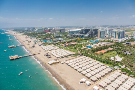
Antalya’s two main urban beaches—Konyaaltı extending west from the city center and Lara stretching eastward—offer contrasting coastal experiences that showcase different aspects of Mediterranean shore environments.
Konyaaltı Beach features a distinctive shoreline of smooth pebbles rather than sand, stretching for approximately 7 kilometers with the dramatic backdrop of the Beydağları mountains. This geological composition creates exceptionally clear water, as the pebble substrate doesn’t cloud the water like fine sand can when disturbed by waves. The beach demonstrates the characteristic Mediterranean coastal formation known as a “shingle beach,” where wave action sorts stones by size and gradually rounds them through continuous motion.
The beach promenade (designed as part of the “Beach Park” urban renewal project) illustrates contemporary approaches to integrating public spaces with natural coastal features. The design incorporates native plant species, permeable surfaces that allow rainwater absorption, and structures that minimize environmental impact while providing public amenities. This thoughtful development demonstrates how modern urban planning can enhance rather than degrade natural coastal environments.
Lara Beach, in contrast, features golden sand extending for 12 kilometers, with portions developed as a high-end tourism zone known as the “Turkish Riviera.” The beach’s natural sand dunes have been partially preserved, protecting the shoreline from erosion while supporting specialized plant communities adapted to the challenging conditions of sandy coastal environments. These dune ecosystems illustrate natural adaptation strategies for plants dealing with salt spray, shifting substrates, and limited freshwater availability.
Both beaches have been awarded Blue Flag status for their environmental management, water quality, and safety provisions. This international certification program demonstrates how global standards for sustainable beach management are being implemented in Turkey’s tourism industry.
The coastal waters off these beaches support important marine ecosystems including seagrass meadows (primarily Posidonia oceanica) that serve as nursery areas for numerous fish species. These underwater habitats face threats from climate change, pollution, and anchor damage, highlighting the challenges of balancing tourism with conservation in heavily visited coastal areas.
Anıtkabir (Atatürk’s Mausoleum)
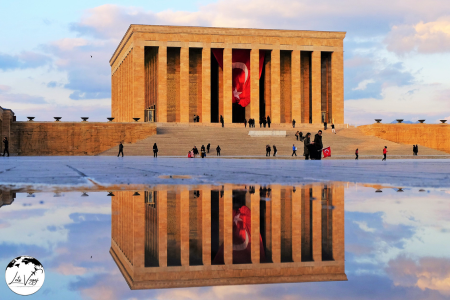
This monumental tomb spans 750,000 square meters and was completed in 1953. The approach begins at the Lion Road, a 262-meter path flanked by 24 lion statues representing Turkish strength. The main complex includes the Hall of Honor housing Atatürk’s tomb, the Peace Park with thousands of plants from across Turkey, and the Atatürk Museum displaying his personal belongings, wardrobe, and even his impressive book collection.
The changing of the guard ceremony occurs every hour and is a solemn, impressive military display. Allow at least 2-3 hours to fully explore this national shrine.
Address
Official Name: Anıtkabir (Atatürk’s Mausoleum)
Address: Anıttepe Mahallesi, Akdeniz Caddesi, No:31, 06520 Çankaya/Ankara, Turkey
Coordinates: 39.9253° N, 32.8361° E
Opening Hours
- April 15 – October 31: 9:00 AM – 5:00 PM
- November 1 – April 14: 9:00 AM – 4:30 PM
- Open daily throughout the year
- The mausoleum complex is closed during official ceremonies
Special note: The ceremonial changing of the guard occurs every hour and is worth watching if your visit coincides with this event.
How to Get There
From Ankara City Center
By Metro:
- Take Ankara Metro Line M1 (Kızılay-Batıkent) to Tandoğan Station (recently renamed Anadolu Station)
- Exit the station and walk approximately 15-20 minutes uphill to reach Anıtkabir
- Follow the signs or simply head toward the monument visible on the hilltop
By Bus:
- Multiple municipal bus lines serve Anıtkabir, including:
- 220-7, 339-7, 445, 608
- Exit at “Anıtkabir” bus stop
By Ankaray (Light Rail):
- Take the Ankaray line to Maltepe Station
- From Maltepe, walk approximately 20-25 minutes or take a connecting bus
By Taxi:
- Available throughout Ankara city
- Journey time from Kızılay Square: approximately 10 minutes
- Journey time from Ankara Train Station: approximately 15 minutes
- Journey time from Ankara Bus Terminal (AŞTİ): approximately 20 minutes
By Private Vehicle:
- Located in central Ankara, easily accessible via major roads
- From Kızılay Square: Follow Atatürk Boulevard toward Maltepe, then turn onto Akdeniz Street
- From the airport: Follow the city center signs, then Eskişehir Road toward Maltepe
By Walking:
- Walkable from central Ankara neighborhoods like Maltepe, Tandoğan, and parts of Çankaya
- The walk involves uphill sections but offers pleasant urban views
From Ankara Esenboğa Airport (ESB)
By Airport Shuttle:
- Take the Havaş or Belko Air airport shuttle to central Ankara (AŞTİ or Kızılay)
- Transfer to metro, bus, or taxi as described above
By Direct Bus:
- EGO Bus Line 442 connects the airport to the city center
- Transfer to a local bus or metro to reach Anıtkabir
By Taxi:
- Direct taxis available from the airport arrival area
- Journey time: approximately 45-60 minutes depending on traffic
- Consider using the official airport taxi service
By Rental Car:
- Multiple car rental agencies available at the airport
- Follow signs to city center, then to Anıtkabir or use GPS navigation
- Journey time: approximately 45 minutes depending on traffic
Nearby Stations
Metro Stations:
- Tandoğan (Anadolu) Station (M1 Line) – 15-minute walk
- Maltepe Station (Ankaray Line) – 20-minute walk
Bus Terminals:
- Anıtkabir Bus Stop – directly adjacent to the complex
- Tandoğan (Anadolu) Bus Terminal – 15-minute walk
- Maltepe Bus Stops – 20-minute walk
Train Stations:
- Ankara Main Train Station (Gar) – approximately 4 km away (short taxi ride)
- YHT (High-Speed Train) Station – approximately 4 km away
Airport:
- Ankara Esenboğa International Airport (ESB) – 28 km northeast
Parking Information
Official Anıtkabir Parking:
- Large designated parking area at the northern entrance (Tandoğan side)
- Capacity for approximately 300 vehicles
- Separate areas for cars, buses, and motorcycles
- Open during the same hours as the mausoleum
Nearby Public Parking:
- Maltepe Underground Parking Garage – 20-minute walk
- Tandoğan Square Parking Area – 15-minute walk
- Various private parking facilities in the Maltepe area
Transportation Companies
Municipal Transportation:
- EGO (Electricity, Gas and Bus Operations) – Ankara’s public transportation authority
- Website: www.ego.gov.tr
- Mobile App: EGO Cepte (for real-time bus tracking)
Metro/Subway Operator:
- Ankara Metro Inc.
- Website: www.ankarametrosu.com.tr
Taxi Services:
- Ankara Taxi Association
- BlueTaxi Ankara
- Taxi stands available throughout central Ankara
Airport Transfer Services:
- Havaş Airport Shuttle
- Belko Air
- Various private transfer companies bookable online
Tour Operators:
- Ankara City Tours
- Turkey Travel Group
- Daily Ankara Tours
- Several hotels offer organized excursions to Anıtkabir
Rental Car Agencies:
- Major international companies (Avis, Hertz, Europcar, Budget) have offices at the airport and city center
- Local rental agencies like Central, Garenta, and Ottoman Car Rental
Nearby Attractions
Within Walking Distance (under 30 minutes):
- Ankara Ethnography Museum (15-minute walk)
- Gençlik Park (20-minute walk)
- Maltepe Mosque (15-minute walk)
- Botanic Park (25-minute walk)
- Ankara University Tandoğan Campus (10-minute walk)
Nearby Attractions (requiring transportation):
- Museum of Anatolian Civilizations (3 km)
- Kocatepe Mosque (2.5 km)
- Ankara Castle (4 km)
- Rahmi M. Koç Museum (3.5 km)
- CerModern Art Gallery (2 km)
- Kuğulu Park (3 km)
- Independence War Museum (Ankara’s first Parliament Building) (3.5 km)
- Republic Museum (Second Parliament Building) (3 km)
- Atakule Tower (4.5 km)
- involve special ceremonies and larger crowds
- Weekdays generally see fewer visitors than weekends
- Spring and fall offer the most pleasant weather conditions
Museum of Anatolian Civilizations

Housed in a restored 15th-century Ottoman bedesten (covered bazaar), this world-class museum won the European Museum of the Year award in 1997. The chronologically arranged exhibits include remarkably preserved artifacts dating back to 8000 BCE.
Highlights include Hittite hieroglyphic tablets, Phrygian wooden furniture, ornate Urartian jewelry, and the famous Çatalhöyük wall paintings and mother goddess figurines. The building itself is architectural heritage, featuring beautiful stone archways and courtyards. Audio guides are available in multiple languages.
Address
Official Name: Anadolu Medeniyetleri Müzesi (Museum of Anatolian Civilizations)
Address: Gözcü Sokak No:2, 06240 Ulus, Altındağ/Ankara, Turkey
Coordinates: 39.9375° N, 32.8647° E
The museum is situated at the entrance to Ankara Castle (Ankara Kalesi), on the south side of Atpazarı Street in the historical Atpazarı area of the Ulus district.
Opening Hours
- April 1 – October 31: 8:30 AM – 7:00 PM
- November 1 – March 31: 8:30 AM – 5:00 PM
- Closed on the first day of religious holidays until 1:00 PM
- The ticket office closes one hour before the museum
Special note: The museum may have extended hours during special exhibitions or cultural events.
How to Get There
From Ankara City Center
By Metro:
- Take Ankara Metro Line M1 (Kızılay-Batıkent) to Ulus Station
- Exit the station and walk approximately 15 minutes uphill toward Ankara Castle
- Follow the signs to “Anadolu Medeniyetleri Müzesi”
By Bus:
- Multiple EGO municipal bus lines serve the Ulus area, including:
- 365, 377, 334, 367, 353,381, 351, 361, 338, 357
- Exit at “Ulus” or “Ankara Kalesi” stops
- Walk uphill approximately 10-15 minutes following signs
By Ankaray (Light Rail):
- Take the Ankaray line to Kızılay Station
- Transfer to Metro Line M1 toward Batıkent
- Exit at Ulus Station and follow directions above
By Taxi:
- Available throughout Ankara city
- Journey time from Kızılay Square: approximately 10 minutes
- Journey time from Ankara Train Station: approximately 5 minutes
- Ask specifically for “Anadolu Medeniyetleri Müzesi” or “Museum of Anatolian Civilizations”
By Private Vehicle:
- From Kızılay: Follow Atatürk Boulevard northward to Ulus
- At Ulus Square, turn right onto Anafartalar Street, then follow signs to Ankara Castle
- The museum is located just before reaching the castle entrance
By Walking:
- From Ulus Square: Walk uphill along Gözcü Street toward the castle (approximately 15 minutes)
- From Kızılay: A longer walk of approximately 30-40 minutes through central Ankara
From Ankara Esenboğa Airport (ESB)
By Airport Shuttle:
- Take the Havaş or Belko Air airport shuttle to central Ankara (AŞTİ or Kızılay)
- Transfer to metro, bus, or taxi as described above
By Direct Bus:
- Take EGO Bus Line 442 from the airport to Ulus
- From Ulus, walk uphill as described above
By Taxi:
- Direct taxis available from the airport arrival area
- Journey time: approximately 45-60 minutes depending on traffic
- Ask specifically for the Museum of Anatolian Civilizations
By Rental Car:
- Multiple car rental agencies available at the airport
- Follow signs to city center/Ulus, then to Ankara Castle
- Journey time: approximately 45 minutes depending on traffic
Nearby Stations
Metro Stations:
- Ulus Station (M1 Line) – 15-minute walk
- Sıhhiye Station (M1 Line) – 25-minute walk
Bus Terminals:
- Ulus Bus Stops – multiple stops throughout the Ulus district, 10-15 minute walk
- Ankara Castle Bus Stop – 5-minute walk
Train Stations:
- Ankara Main Train Station (Gar) – approximately 1.5 km away (20-minute walk or short taxi ride)
- YHT (High-Speed Train) Station – approximately 1.5 km away
Airport:
- Ankara Esenboğa International Airport (ESB) – 28 km northeast
Parking Information
Museum Parking:
- Small dedicated parking area near the museum entrance
- Limited capacity (approximately 20-30 vehicles)
- Often fills quickly during peak tourist season
Nearby Public Parking:
- Ankara Castle Parking Area – adjacent to the castle entrance, 5-minute walk to museum
- Ulus Square Underground Parking – 15-minute walk uphill to the museum
- Various private parking lots in the Ulus district
Street Parking:
- Limited street parking available on roads surrounding the museum
- Pay attention to local parking restrictions and regulations
- Note that many streets in the old town are narrow and may have parking limitations
Nearby Attractions
Within Walking Distance (under 15 minutes):
- Ankara Castle (Ankara Kalesi) – 5-minute walk
- Rahmi M. Koç Museum – 10-minute walk
- Roman Theatre ruins – 10-minute walk
- Cenab-ı Ahmet Paşa Mosque – 5-minute walk
- Traditional Ankara Houses (historical district) – surrounding area
Within Walking Distance (15-30 minutes):
- Haci Bayram Mosque and Augustus Temple – 15-minute walk
- Column of Julian – 20-minute walk
- Ankara Ethnography Museum – 25-minute walk
- Roman Baths – 20-minute walk
- Suluhan (historical caravanserai) – 15-minute walk
- Kurşunlu Mosque – 15-minute walk
Nearby Attractions (requiring transportation):
- Anıtkabir (Atatürk’s Mausoleum) – 3 km
- Independence War Museum (First Parliament Building) – 1.5 km
- Republic Museum (Second Parliament Building) – 1.5 km
- CerModern Art Gallery – 2 km
- Kocatepe Mosque – 2.5 km
- Atakule Tower – 5 km
- Ethnography Museum – 2 km
Additional Information
Museum Collections:
The museum houses chronologically arranged exhibits from these main periods:
- Paleolithic Age (8000 BC and earlier)
- Neolithic Age (8000-5500 BC)
- Chalcolithic Age (5500-3000 BC)
- Early Bronze Age (3000-1950 BC)
- Assyrian Trading Colonies Period (1950-1750 BC)
- Hittite Period (1750-1200 BC)
- Phrygian Period (1200-700 BC)
- Urartian Period (900-600 BC)
- Lydian Period (600-300 BC)
- Greek and Hellenistic Periods (330-30 BC)
- Roman Period (30 BC-395 AD)
- Byzantine Period (395-1453)
- Seljuk Period (1075-1308)
- Ottoman Period (1299-1923)
Ankara Castle (Hisar)
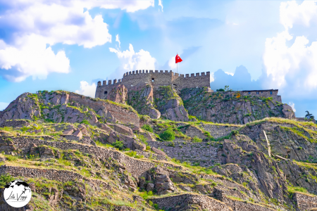
This imposing fortress dates back to the Byzantine era, though its foundations may be even older (possibly Hittite or Phrygian). The castle walls extend for about 43 meters with 42 pentagonal towers. Inside the citadel, you’ll find narrow cobblestone streets lined with restored Ottoman-era houses, traditional craft workshops, and small cafes serving authentic Turkish tea and coffee. The eastern tower offers the best panoramic views of the city. The nearby Rahmi M. Koç Museum exhibits vintage automobiles, industrial machinery, and scientific instruments.
Address
Official Name: Ankara Kalesi (Ankara Castle)
Address: Kale Mahallesi, Gözcü Sokak, 06240 Altındağ/Ankara, Turkey
Coordinates: 39.9394° N, 32.8644° E
The castle is located in the old town district of Ulus, atop a prominent hill approximately 978 meters above sea level.
Opening Hours
- April 1 – October 31: 8:00 AM – 7:00 PM
- November 1 – March 31: 8:00 AM – 5:00 PM
- Open daily throughout the year
While the castle grounds themselves maintain these hours, the surrounding neighborhood with its traditional houses, shops, and cafes often operates on varied schedules. The outer castle area remains accessible even after the inner citadel closes.
How to Get There
From Ankara City Center
By Metro:
- Take Ankara Metro Line M1 (Kızılay-Batıkent) to Ulus Station
- Exit the station and walk approximately 15-20 minutes uphill toward the castle
- Follow signs to “Ankara Kalesi” or ask locals for directions
- The walk involves an uphill climb through the historic district
By Bus:
- Several EGO municipal bus lines serve the Ulus area, including:
- 361, 353, 365, 351, 343, 381, 377, 349, 334, 367, 350,357, 358 Exit at “Ulus” stop and walk uphill approximately 15 minutes
- Some bus routes (such as Line 13) have stops closer to the castle entrance labeled “Hisar” or “Kale”
By Ankaray (Light Rail):
- Take the Ankaray line to Kızılay Station
- Transfer to Metro Line M1 toward Batıkent
- Exit at Ulus Station and follow directions as above
By Taxi:
- Available throughout Ankara city
- Journey time from Kızılay Square: approximately 10-15 minutes
- Journey time from Ankara Train Station: approximately 5-10 minutes
- Ask the driver for “Ankara Kalesi” or simply “Kale”
- Some narrow streets near the castle may require a short walk from the taxi drop-off point
By Private Vehicle:
- From Kızılay: Follow Atatürk Boulevard northward to Ulus
- At Ulus Square, turn right onto Anafartalar Street
- Continue uphill following signs to “Ankara Kalesi”
- The approach involves narrow, sometimes steep roads through the old district
Nearby Stations
Metro Stations:
- Ulus Station (M1 Line) – 15-20 minute uphill walk
- Sıhhiye Station (M1 Line) – 25-30 minute walk
Bus Terminals:
- Ulus Bus Stops – multiple stops throughout the Ulus district, 15-20 minute walk
- Hisar/Kale Bus Stop – closest bus stop, 5-10 minute walk (limited bus lines)
Train Stations:
- Ankara Main Train Station (Gar) – approximately 2 km away (25-minute walk or short taxi ride)
- YHT (High-Speed Train) Station – approximately 2 km away
Airport:
- Ankara Esenboğa International Airport (ESB) – 28 km northeast
Parking Information
Castle Parking:
- Small designated parking area near the castle entrance
- Very limited capacity (approximately 20-30 vehicles)
- Often fills quickly, especially on weekends and holidays
Nearby Public Parking:
- Museum of Anatolian Civilizations Parking Area – 5-minute walk to castle
- Ulus Square Underground Parking – 15-20 minute uphill walk to the castle
- Various small private parking lots in the lower parts of the Ulus district
Street Parking:
- Limited street parking available on roads approaching the castle
- Many streets in the old town are narrow, steep, and may have parking restrictions
- Pay close attention to local parking signs and regulations
Nearby Attractions
Within Walking Distance (under 10 minutes):
- Museum of Anatolian Civilizations – 5-7 minute walk
- Traditional Ankara Houses (historical district) – surrounding the castle
- Cenab-ı Ahmet Paşa Mosque – 5-minute walk
- Şengül Hamamı (historical Turkish bath) – 10-minute walk
- Local crafts and souvenir shops – throughout the castle district
Within Walking Distance (10-20 minutes):
- Hacı Bayram Mosque and Augustus Temple – 15-minute walk
- Column of Julian – 15-minute walk
- Suluhan (historical caravanserai) – 15-minute walk
- Roman Theatre ruins – 10-minute walk
- Rahmi M. Koç Museum – 15-minute walk
Nearby Attractions (requiring transportation):
- Anıtkabir (Atatürk’s Mausoleum) – 4 km
- Independence War Museum (First Parliament Building) – 2 km
- Republic Museum (Second Parliament Building) – 2 km
- Roman Baths – 1.5 km
- CerModern Art Gallery – 2.5 km
- Kocatepe Mosque – 3 km
- Ethnography Museum – 2.5 km
- Atakule Tower – 5 km
Kocatepe Mosque
Completed in 1987 after 20 years of construction, this modern mosque’s design was inspired by Ottoman-era Sinan architecture. The central dome reaches 48.5 meters high, supported by four 88-meter minarets. The interior can accommodate 24,000 worshippers and features impressive calligraphy, intricate marble work, and 20 smaller secondary domes. The mosque complex includes a library, conference hall, and parking facility. Visit between prayer times to fully appreciate the serene interior and magnificent chandelier. Female visitors are provided with headscarves if needed.
Address
Kocatepe Mosque (Kocatepe Camii) is located at:
- Address: Kültür Mahallesi, Mevlana Blv., 06420 Çankaya/Ankara, Turkey
- Coordinates: 39.9078° N, 32.8538° E
- District: Kocatepe neighborhood in Çankaya district
Opening Hours
- Prayer times: Open for the five daily prayers (times vary seasonally)
- Tourist visits: Generally open from morning until late evening (approximately 8:30 AM to 10:00 PM)
- Friday prayer: Especially crowded during Friday noon prayers
- Ramadan: Extended hours during the holy month
Transportation Options
Metro
- Kızılay Station (Red Line): Approximately 10-15 minutes walking distance
- Transfer point: This is a major interchange where multiple metro lines meet
Bus
- Numerous bus lines pass near Kocatepe Mosque:
- Lines 125, 140, 420, 430, and 435 stop at Kocatepe or nearby
- Ankaray light rail connects with buses at Kızılay
Dolmuş (Shared Minibus)
- Several dolmuş routes pass through Kızılay area with stops near the mosque
- Look for dolmuş marked “Kızılay-Kocatepe” or those heading to Çankaya
By Car
- Located close to Mevlana Boulevard and Atatürk Boulevard, two major thoroughfares
- GPS navigation is recommended due to Ankara’s complex road system
- Travel time from Ankara city center: approximately 5-10 minutes depending on traffic
Nearby Parking
- Kocatepe Mosque Underground Parking: Located directly under the mosque complex
- İzmir-1 Street Parking Area: 3-minute walk
- Kumrular Street Parking: 5-minute walk
- Kızılay Shopping Center Parking: 10-minute walk, paid parking
- Street parking: Limited availability on surrounding streets (pay attention to parking signs)
Nearby Attractions
Within Walking Distance (10-15 minutes)
- Kızılay Square: Major gathering point and shopping area
- Güvenpark: Public park adjacent to Kızılay
- Karum Shopping Center: Upscale shopping mall
- Turkish State Art and Sculpture Museum: Cultural institution
- Atakule Tower: Iconic observation tower with panoramic views
Short Transit Distance (15-30 minutes)
- Ankara Castle (Hisar): Historic fortress with panoramic views
- Anıtkabir: Mausoleum of Mustafa Kemal Atatürk, founder of modern Turkey
- Museum of Anatolian Civilizations: World-class archaeological museum
- Ethnography Museum of Ankara: Cultural heritage museum
- Gençlik Park: Large urban park with recreational facilities
Architectural Information
- Kocatepe Mosque is one of the largest mosques in Turkey and a significant landmark in Ankara
- Construction began in 1967 and was completed in 1987
- Features four minarets, each 88 meters tall
- The central dome reaches 48.5 meters in height
- Can accommodate approximately 24,000 worshippers at one time
- Interior features traditional Ottoman-style decorations, impressive chandeliers, and calligraphy
Haci Bayram Mosque and Augustus Temple

This unique site exemplifies Turkey’s layered history. The Augustus Temple was built between 25-20 BCE with inscriptions of Emperor Augustus’s achievements (the famous Monumentum Ancyranum). Adjacent stands the 15th-century Hacı Bayram Mosque, dedicated to the Sufi saint Hacı Bayram Veli. The surrounding neighborhood, Hacı Bayram, is one of Ankara’s oldest, with restored Ottoman houses, traditional restaurants serving Ankara’s famous tava (pan) dishes, and shops selling religious items and local handicrafts. During religious holidays, this area becomes especially lively.
Address
Official Name: Hacı Bayram-ı Veli Camii ve Augustus Tapınağı (Hacı Bayram Mosque and Temple of Augustus)
Address: Hacı Bayram Mahallesi, Hacı Bayram Veli Caddesi, No:11, 06050 Altındağ/Ankara, Turkey
Coordinates: 39.9415° N, 32.8593° E
The complex is located in the Ulus district of Ankara, on a hill that has served as a religious site since ancient times.
Opening Hours
Hacı Bayram Mosque:
- Open daily for visitors outside prayer times
- Typically accessible from 8:30 AM until the evening prayer (varies seasonally)
- Closed to tourists during prayer times (five daily prayers)
- Friday afternoon prayer time (approximately 1:00 PM – 2:30 PM) has extended closure for visitors
Augustus Temple:
- April 15 – October 31: 8:30 AM – 7:00 PM
- November 1 – April 14: 8:30 AM – 5:00 PM
- Open daily throughout the year
During religious holidays, visiting hours may be adjusted, and mosque access may be limited to worshippers.
How to Get There
From Ankara City Center
By Metro:
- Take Ankara Metro Line M1 (Kızılay-Batıkent) to Ulus Station
- Exit the station and walk approximately 10-15 minutes toward Hacı Bayram Square
- Follow signs or ask locals for “Hacı Bayram Camii”
- The walk involves a moderate uphill climb through the historical district
By Bus:
- Multiple EGO municipal bus lines serve the Ulus area, including:
- 343,349,350, 334, 367, 365
- Exit at “Ulus” or ” Anafartalar ” stops and walk approximately 10 minutes
- Some bus routes have stops labeled “Hacı Bayram” which are closer to the complex
By Ankaray (Light Rail):
- Take the Ankaray line to Kızılay Station
- Transfer to Metro Line M1 toward Batıkent
- Exit at Ulus Station and follow directions as above
By Taxi:
- Available throughout Ankara city
- Journey time from Kızılay Square: approximately 10 minutes
- Journey time from Ankara Train Station: approximately 5 minutes
- Ask for “Hacı Bayram Camii” or “Hacı Bayram ve Augustus Tapınağı”
By Private Vehicle:
- From Kızılay: Follow Atatürk Boulevard northward to Ulus
- At Ulus Square, follow signs to “Hacı Bayram” or “Ankara Kalesi”
- The approach involves some narrow roads through the historical district
By Walking:
- From Ulus Square: Walk uphill along Çankırı Avenue and follow signs (approximately 15 minutes)
- From Ankara Castle: Walk downhill toward the city center (approximately 10-15 minutes)
- From the Museum of Anatolian Civilizations: A 10-minute walk
Parking Information
Official Parking:
- Small parking area near Hacı Bayram Square
- Limited capacity (approximately 20-30 vehicles)
- Often filled, especially during prayer times and weekends
Nearby Public Parking:
- Ulus Square Underground Parking – 15-minute walk
- Various small private parking lots in the Ulus district
Street Parking:
- Limited street parking available on roads surrounding the complex
- Pay attention to local parking restrictions
- Some areas have time limitations or are reserved for residents
Nearby Attractions
Within Walking Distance (under 15 minutes):
- Ankara Castle (Ankara Kalesi) – 10-15 minute walk
- Museum of Anatolian Civilizations – 10 minute walk
- Column of Julian – 5 minute walk
- Roman Theatre ruins – 10 minute walk
- Traditional bazaar district – surrounding area
- Suluhan (historical caravanserai) – 5 minute walk
- Kurşunlu Mosque – 7 minute walk
- Zincirli Mosque – a few minutes walk
Within Walking Distance (15-30 minutes):
- Ethnography Museum of Ankara – 20 minute walk
- Rahmi M. Koç Museum – 15 minute walk
- Roman Baths – 15 minute walk
- Cenab-ı Ahmet Paşa Mosque – 15 minute walk
Nearby Attractions (requiring transportation):
- Anıtkabir (Atatürk’s Mausoleum) – 3.5 km
- Independence War Museum (First Parliament Building) – 1.5 km
- Republic Museum (Second Parliament Building) – 1.5 km
- CerModern Art Gallery – 2 km
- Kocatepe Mosque – 2.5 km
- Atakule Tower – 5 km
Ethnography Museum of Ankara

Opened in 1927, this neoclassical building first served as Atatürk’s temporary mausoleum before Anıtkabir was completed. The museum showcases cultural artifacts organized by themes including Turkish nomadic cultures, coffee ceremonies, hamam (bath) traditions, and wedding rituals. Highlights include intricately woven carpets from central Anatolia, ornate silver jewelry, traditional musical instruments, and a fully reconstructed 19th-century Ottoman room. The museum’s collection includes over 30,000 items, though only about 3,000 are on display at any time.
Transportation Options
Metro System
- Ankara Metro Red Line (M1): The closest station is Ulus, approximately 800 meters (10-15 minute walk) from the museum
- Operating Hours: 6:00 AM to 12:00 AM daily
- Frequency: Trains arrive every 3-5 minutes during peak hours, 7-10 minutes during off-peak hours
- Connections: The Red Line connects with other metro lines at Kızılay station, making it accessible from most parts of the city
- Accessibility: Elevators and escalators are available at Ulus station for those with mobility concerns
Bus Network
- EGO City Buses: Routes 357, 355,367, 367 all stop at Opera Square (Opera Meydanı)
- Bus Stop: The “Opera” bus stop is directly in front of the museum
- EGO City Buses: Routes 415, 288, 405, 418 all stop at Ankara Mesleki Teknik Anadolu Lisesi
- Bus Stop: The “ Ankara Mesleki Teknik Anadolu Lisesi” bus stop is directly in front of the museum
- Operating Hours: Most routes operate from 5:30 AM until 11:00 PM
- Ankaray: The Ankaray light rail system connects with bus routes at main transfer stations
- Real-time Tracking: Download the EGO Cepte mobile app for real-time bus tracking and journey planning
- Payment: Use AnkaraKart contactless cards (available at metro stations and many kiosks)
Dolmuş (Shared Minibuses)
- Routes: Available from Kızılay, AŞTI (main bus terminal), and various neighborhoods to Ulus area
- Identification: Yellow minibuses with route names displayed on front windows
- Frequency: Depart when full, typically every 5-15 minutes depending on time of day
- Payment: Cash only, pay as you exit
- Operation: Flag them down along their routes or board at designated stops
- Convenience: More flexible than buses but can be crowded during peak hours
Driving & Parking
Navigating to the Museum
- Major Approach Roads:
- From the west: Atatürk Boulevard
- From the east: Talat Paşa Boulevard
- From the south: Hipodrom Street
- GPS Navigation: “Etnografya Müzesi, Ankara” or coordinates 39.9394° N, 32.8553° E
- Traffic Considerations: Heaviest between 8:00-9:30 AM and 5:00-7:00 PM
- Restricted Zones: Some surrounding areas have traffic limitations or one-way systems
Parking Options
- Opera Square Parking Lot:
- 100 meters from museum entrance
- Capacity: Approximately 120 vehicles
- Security: Attended during operating hours
- Type: Underground parking
- Ulus Square Underground Parking:
- 500 meters from museum
- Capacity: 350+ vehicles
- Open 24/7
- Security cameras and attendants
- Gençlik Park Parking:
- 800 meters from museum
- Larger capacity for busier days
- Slightly lower rates than central parking options
- Street Parking:
- Limited availability on Türkocağı Street and surrounding areas
- Metered parking enforced 8:00 AM – 8:00 PM
- Payment via parking meters or ParkAnkara mobile app
Gençlik Park

Established in 1943, this 69-acre urban park was one of the first major public works of the Turkish Republic. The centerpiece is a large artificial lake offering paddleboat rentals. The park contains numerous attractions including a small amusement park with a historic ferris wheel, an open-air theater hosting summer concerts, several cafes and tea gardens, and extensive rose gardens. The miniature train that circles the park is especially popular with families. During summer evenings, the musical fountains create a colorful water show synchronized to music.
Address
Address: Doğanbey Mahallesi, Ulus, 06050 Altındağ/Ankara, Turkey
GPS Coordinates: 39.9372° N, 32.8526° E
District: Located in Altındağ, central Ankara, directly opposite the main train station
Opening Hours
- Park Grounds: Open 24 hours daily, year-round
- Amusement Area (Luna Park): 10:00 AM – 10:00 PM (Extended to 11:00 PM during summer months)
- Cafés and Restaurants: Generally 8:00 AM – 11:00 PM (may vary by establishment)
- Note: While the park never officially closes, visiting after midnight is not recommended for safety reasons
Transportation Options
- Metro:
- Ulus Station (Red Line/Ankaray Line): Located directly adjacent to the park’s eastern entrance
- Kızılay Station (Red Line/Ankaray Line): 10-minute walk from the park’s southern entrance
- Frequency: Trains run every 5-7 minutes during peak hours, 8-12 minutes during off-peak times
- Hours: 6:00 AM – 12:00 AM daily
- City Buses (EGO):
- Numerous bus lines stop at Ulus Square, Ankara Spor Salonu and near the train station adjacent to the park
- Major Routes Serving the Area:
- Lines 309, 450, 528-3, 339-7, 392, 349, 321
- All routes connecting to Ulus Square and Ankara Spor Salonu provide access to the park
- Bus stops surround all sides of the park for convenient access
- Dolmuş (Shared Minibus):
- Several dolmuş routes from different parts of Ankara include stops at Ulus
- Look for dolmuş services with “Ulus” signage
- Major dolmuş routes connect Kızılay, Sıhhiye, Demetevler, and other districts to Ulus
- Ankaray Light Rail:
- The Ankaray line connects directly to Ulus Station adjacent to the park
- Connects Dikimevi to AŞTİ (main bus terminal) via the city center
- Interchange with other public transport lines at Kızılay Station
From Ankara City Center (Kızılay)
- Walking:
- Approximately 20-25 minutes from Kızılay Square
- Follow Atatürk Boulevard northward toward Ulus
- Metro/Ankaray:
- Take the Red Line from Kızılay Station to Ulus Station (2 stops)
- Journey time: 5 minutes
- Bus:
- Take any bus heading to Ulus from Kızılay
- Journey time: 10-15 minutes depending on traffic
Parking Information
- Gençlik Park Official Parking:
- Located at the main entrance near Ulus
- Capacity: Approximately 150 vehicles
- Operated by Ankara Municipality
- Security: 24-hour surveillance
- Ulus Square Underground Parking:
- Located across from the park’s main entrance
- Capacity: Approximately 400 vehicles
- Walking distance to park: 2-3 minutes
- Security: 24-hour surveillance and security personnel
- Train Station Parking Area:
- Adjacent to Ankara Train Station, opposite the park
- Capacity: Approximately 100 vehicles
- Walking distance to park: 3-4 minutes
- Street Parking:
- Limited street parking available along Cumhuriyet Boulevard and surrounding streets
- Be aware of parking restrictions and regulations
- Pay attention to no-parking zones which are strictly enforced
Nearby Attractions
- Ankara Train Station (Historic Building):
- Distance from park: Directly across the street
- Notable Art Deco architecture from 1937
- Historical significance in Turkish Republic’s development
- Museum of Anatolian Civilizations:
- Distance from park: 1.5 km (20-minute walk or 5-minute taxi ride)
- One of Turkey’s premier museums with artifacts dating back to Paleolithic era
- Houses collections from Hittite, Phrygian, Urartian, and other ancient Anatolian civilizations
- Ankara Castle (Hisar):
- Distance from park: 1.7 km (25-minute walk or 7-minute taxi ride)
- Byzantine fortification offering panoramic views of the city
- Surrounding area features traditional Ottoman houses and crafts
- Anıtkabir (Atatürk’s Mausoleum):
- Distance from park: 3 km (10-minute taxi ride or 20 minutes by bus)
- Final resting place of Mustafa Kemal Atatürk, founder of modern Turkey
- Museum complex with exhibits on Turkish War of Independence
- Kocatepe Mosque:
- Distance from park: 2.3 km (30-minute walk or 8-minute taxi ride)
- Largest mosque in Ankara with impressive architecture
- Beautiful interior with traditional Ottoman design elements
- Hamamönü Historical District:
- Distance from park: 1.2 km (15-minute walk)
- Restored Ottoman neighborhood with traditional architecture
- Cafés, restaurants, and artisan shops
- Ethnography Museum:
- Distance from park: 2.5 km (10-minute taxi ride)
- Collection showcasing Turkish cultural artifacts and folk traditions
- Notable exhibits on traditional clothing, crafts, and customs
Additional Information
Park Facilities and Attractions
- Luna Park (Amusement Park):
- Various rides suitable for different age groups
- Includes a Ferris wheel offering panoramic city views
- Games and activities for children and adults
- Artificial Lakes:
- Boat rentals available for paddling around the scenic lakes
- Decorative fountains and water features
- Popular for photography and relaxation
- Cafés and Restaurants:
- Several establishments serving Turkish cuisine, tea, coffee, and snacks
- Outdoor seating available with views of the park
- Range from simple tea gardens to full-service restaurants
- Walking Paths:
- Well-maintained routes throughout the park
- Suitable for jogging, casual strolls, and exercise
- Shaded by mature trees in many sections
- Cultural Centers:
- Occasional exhibitions and events
- Seasonal festivals and celebrations
- Check municipal website for current programming
Kuğulu Park (Swan Park)
This intimate 2.5-acre park in the upscale Çankaya district has been home to swans since the 1970s. Beyond the famous swans and ducks that inhabit the central pond, the park features impressive seasonal flower displays, particularly tulips in spring. Surrounding the park are some of Ankara’s finest cafes and restaurants. Local musicians often perform informally in the park during weekends. The nearby Tunalı Hilmi Street offers excellent shopping opportunities with both international brands and local boutiques.
Address
Address: Tunalı Hilmi Caddesi, Kavaklıdere Mahallesi, 06700 Çankaya/Ankara, Turkey
GPS Coordinates: 39.9059° N, 32.8659° E
District: Located in Kavaklıdere neighborhood of Çankaya district, central Ankara
Opening Hours
- Park Grounds: Open 24 hours daily, year-round
- Best Visiting Hours: 8:00 AM – 10:00 PM
- Note: While the park never officially closes, park staff feed the swans and maintain the area primarily during daylight hours
Transportation Options
- Metro/Subway:
- Nearest Metro Station: Kızılay Station (Red Line)
- Walking distance from Kızılay Station: Approximately 2 kilometers (25-30 minute walk)
- From Kızılay Station, you can take a connecting bus or taxi to reach the park more quickly
- City Buses (EGO):
- Key Bus Lines: 413-7, 440-5, 408, 413 Nearest Bus Stops:
- “Kuğulu Park” stop directly in front of the park on Tunalı Hilmi Caddesi
- “Kavaklıdere” stop about 100 meters from the park
- Buses run frequently (every 10-15 minutes) during day hours
- Key Bus Lines: 413-7, 440-5, 408, 413 Nearest Bus Stops:
- Dolmuş (Shared Minibus):
- Several dolmuş routes operate along Tunalı Hilmi Caddesi
- Look for routes marked “Kavaklıdere” or “Tunalı Hilmi”
- Can be flagged down along their route or boarded at designated stops
- Convenient option from Kızılay area
Parking Information
- Street Parking:
- Limited street parking available along Tunalı Hilmi Caddesi
- Paid parking zones with meters or mobile payment options
- Often difficult to find open spaces during peak hours
- Time limits typically apply (usually 1-2 hours maximum)
- Nearby Public Parking:
- Karum Shopping Center Underground Parking:
- Located approximately 300 meters from the park
- Large capacity parking garage
- Open daily from 10:00 AM – 10:00 PM
- Secure and monitored
- Kuğulupark Residence Parking:
- Located opposite the park
- Limited public spaces available
- Hourly rates apply
- Tunalı Hotel Parking:
- Located approximately 200 meters from the park
- Available for public use (with fee)
- Limited capacity
- Karum Shopping Center Underground Parking:
- Private Lots:
- Several private parking lots within 5-10 minutes walking distance
- Generally open 24 hours
- Located off side streets from Tunalı Hilmi Caddesi
Nearby Attractions
- Tunalı Hilmi Shopping Street:
- Immediately adjacent to the park
- One of Ankara’s premier shopping and dining destinations
- Numerous cafés, restaurants, boutiques, and international brands
- Vibrant street life and people-watching opportunities
- Seğmenler Park:
- Distance from Kuğulu Park: 700 meters (10-minute walk)
- Larger urban park with extensive walking paths and picnic areas
- Popular with locals for outdoor recreation
- Ankara State Art and Sculpture Museum:
- Distance from park: 1.2 km (15-minute walk)
- Houses important collections of Turkish art from the early republic to present
- Notable for sculpture garden and rotating exhibitions
- Atakule Tower:
- Distance from park: 1.5 km (20-minute walk or 5-minute taxi ride)
- Iconic Ankara landmark offering panoramic views of the city
- Observation deck and revolving restaurant
- Botanik Park (Botanical Garden):
- Distance from park: 1.7 km (25-minute walk or 7-minute taxi ride)
- Extensive collection of plant species in a serene setting
- Popular for nature enthusiasts and peaceful walks
- Ankara Ethnography Museum:
- Distance from park: 2.3 km (30-minute walk or 10-minute taxi ride)
- Collection showcasing Turkish cultural artifacts and folk traditions
- Notable exhibits on traditional clothing, crafts, and customs
- Karum Shopping Center:
- Distance from park: 300 meters (4-minute walk)
- Multi-level shopping mall with local and international brands
- Food court and cinema complex
Additional Information
Park Features and Attractions
- Swan Pond:
- The centerpiece of the park featuring resident swans, ducks, and other waterfowl
- Small bridges cross the ornamental pond
- Feeding the birds is generally permitted (though bread is discouraged; grain or special bird food is preferred)
- Seating Areas:
- Numerous benches positioned throughout the park
- Particularly popular for people-watching along the pond edges
- Shaded seating available under mature trees
- Landscaping:
- Seasonal flower displays maintained throughout the year
- Mix of native and ornamental plants
- Mature trees providing shade during summer months
- Sculptures and Art:
- Several modern art installations and sculptures
- Thematic displays changed periodically
- Cafés and Refreshments:
- No permanent cafés within the park boundaries
- Numerous cafés and restaurants immediately adjacent to the park on Tunalı Hilmi Caddesi
- Street vendors occasionally sell snacks and drinks nearby
Atakule Tower

Completed in 1989, this 125-meter communications and observation tower has become one of Ankara’s most recognizable landmarks. The high-speed elevators reach the observation deck in just 32 seconds.
The tower features a 360-degree viewing platform and a rotating restaurant that completes a full rotation every 90 minutes. The recently renovated shopping center at its base houses upscale stores and restaurants. At night, the tower is illuminated with changing LED light displays, especially impressive during national holidays. On clear days, visitors can see as far as the Ankara Castle and the presidential palace.


