Airports

Frankfurt Airport (FRA)
Frankfurt Airport stands as Germany’s largest aviation hub and one of Europe’s busiest airports. It serves as the main base for Lufthansa and handles approximately 70 million passengers annually under normal operations.
- Features connections to over 300 destinations worldwide
- Has two major terminals with excellent rail connections to the national network
- Official website: www.frankfurt-airport.com
Munich Airport (MUC)
Munich Airport functions as Germany’s second-largest airport and Lufthansa’s secondary hub.
- Features the award-winning Terminal 2 operated in partnership with Lufthansa
- Connects to approximately 250 destinations globally
- Official website: www.munich-airport.com
Berlin Brandenburg Airport (BER)
Opened in 2020 to replace the former Tegel and Schönefeld airports, Berlin Brandenburg serves as the capital’s primary international gateway.
- Connected to Berlin city center via express trains and regional services
- Serves as a hub for various airlines including easyJet and Eurowings
- Official website: www.berlin-airport.de
Düsseldorf Airport (DUS)
A major international airport serving western Germany and the densely populated Rhine-Ruhr metropolitan region.
- Important for business travelers due to its proximity to Germany’s industrial heartland
- Offers connections to approximately 200 destinations
- Official website: www.dus.com
Hamburg Airport (HAM)
Serving northern Germany, Hamburg Airport is the oldest airport in Germany still in operation.
- Connects to about 130 destinations
- Important gateway for Scandinavian connections
- Official website: www.hamburg-airport.de
Other Significant Airports
- Stuttgart Airport (STR) – www.flughafen-stuttgart.de
- Cologne Bonn Airport (CGN) – www.cologne-bonn-airport.com
- Hannover Airport (HAJ) – www.hannover-airport.de
- Nuremberg Airport (NUE) – www.airport-nuernberg.de
- Leipzig/Halle Airport (LEJ) – www.leipzig-halle-airport.de
Major Train Stations

Berlin Hauptbahnhof
Berlin’s central station is Europe’s largest two-level station, serving approximately 300,000 passengers daily.
- Connects long-distance, regional, S-Bahn, U-Bahn, tram, and bus services
- Features a five-story shopping mall with numerous retail and dining options
Frankfurt Hauptbahnhof
One of Europe’s busiest railway stations, Frankfurt’s main station serves as a critical junction in Germany’s rail network.
- Handles approximately 450,000 passengers daily
- Connects to Frankfurt Airport via regular service
- Features 25 platforms serving long-distance and regional trains
Munich Hauptbahnhof
Munich’s central station serves as a major transportation hub for southern Germany.
- Features 32 platforms serving domestic and international destinations
- Direct connection to Munich Airport via S-Bahn
- Undergoes significant modernization program planned through 2028
Hamburg Hauptbahnhof
Hamburg’s main station is among Europe’s busiest, connecting northern Germany and Scandinavian destinations.
- Serves approximately 500,000 passengers daily
- Houses 8 long-distance and 12 S-Bahn platforms
- Central hub for regional connections throughout northern Germany
Cologne Hauptbahnhof
Located directly next to Cologne Cathedral, this major hub connects western Germany and international destinations.
- Features 11 platforms serving ICE, IC, and regional trains
- Important junction for trains to Belgium, the Netherlands, and France
- Connects to Cologne/Bonn Airport via S-Bahn
Other Important Train Stations
- Stuttgart Hauptbahnhof (undergoing major reconstruction as part of Stuttgart 21 project)
- Hannover Hauptbahnhof (important north-south and east-west junction)
- Leipzig Hauptbahnhof (Europe’s largest terminal station by floor area)
- Dresden Hauptbahnhof (key station for connections to Eastern Europe)
- Nuremberg Hauptbahnhof (important hub for Bavaria and connections to Czech Republic)
Bus Terminals
Berlin Central Bus Station (ZOB)
Germany’s largest long-distance bus terminal located in western Berlin.
- Serves approximately 5 million passengers annually
- Connects to destinations throughout Europe
Munich Central Bus Station (ZOB)
Located near Hackerbrücke, this station serves as the main bus hub for southern Germany.
- Connected to Munich Hauptbahnhof via a short walk or S-Bahn connection
- Serves both domestic and international routes
- Handles approximately 40 bus companies
Hamburg Central Bus Station (ZOB)
Located adjacent to Hamburg Hauptbahnhof, serving northern Germany and Scandinavian connections.
- Renovated and expanded in recent years to handle increased demand
- Serves approximately 8 million passengers annually
- Offers connections to over 30 countries
Frankfurt Bus Station (Hauptbahnhof)
Located near Frankfurt’s main train station, serving as a central hub for FlixBus and other carriers.
- Direct connections to Frankfurt Airport
- Serves domestic and international routes
- Integrated with the city’s public transportation system
Integrated Transportation Hubs
Berlin Südkreuz
An important intermodal transportation hub in southern Berlin.
- Connects regional, S-Bahn, and long-distance trains
- Features integrated bus connections and car/bike sharing services
- Test site for intelligent mobility concepts
Leipzig City Tunnel
An underground railway tunnel system connecting Leipzig Hauptbahnhof with other stations.
- Created a unified S-Bahn network for the Leipzig-Halle metropolitan region
- Significantly improved transit times across the region
- Integrated with tram and bus connections
Frankfurt Airport Long-Distance Station
A dedicated long-distance train station at Frankfurt Airport.
- Serves ICE high-speed trains connecting the airport directly to major cities
- Separate from the regional train station at the airport
- Functions as an air-rail hub allowing seamless transitions between modes
Munich Airport Center (MAC)
Located between the two terminals at Munich Airport.
- Features shopping, dining, and services connecting both terminals
- Houses the airport’s train station with S-Bahn connections to Munich
- Functions as a central gathering and distribution point for passengers
Germany’s transportation hubs exemplify integrated planning and interconnectivity, allowing travelers to switch between modes of transportation efficiently. The country continues to invest in modernizing and expanding these facilities to meet growing demand and enhance the traveling experience while improving sustainability and reducing environmental impact.

Berlin offers one of Europe’s most efficient and comprehensive public transportation systems, making it easy to navigate this sprawling capital city without a car. The integrated network consists of several modes of transport that work together seamlessly to help you reach virtually any part of the city and its surroundings.
For more details visit: https://www.bvg.de/en
Berlin’s Public Transportation Network
Berlin’s public transportation system is operated primarily by BVG (Berliner Verkehrsbetriebe) and S-Bahn Berlin, and includes:
U-Bahn (Underground)
The U-Bahn is Berlin’s metro system, consisting of 9 lines (U1-U9) marked by blue signs. Trains run frequently—every 3-5 minutes during peak hours and every 5-10 minutes during off-peak times. The U-Bahn operates from approximately 4:30 AM until 1:00 AM on weekdays, with 24-hour service on weekends (Friday and Saturday nights). The network covers most of central Berlin with approximately 173 stations across approximately 152 kilometers of track.
Subway Line U1: S+U Warschauer Str.◄►U Uhlandstr.
Subway Line U12: S+U Warschauer Str.◄►U Ruhleben
Subway Line U2: S+U Pankow◄►U Ruhleben
Subway Line U3: S+U Warschauer Str.◄►U Krumme Lanke
Subway Line U4: U Nollendorfplatz◄►S+U Innsbrucker Platz
Subway Line U5: U Hönow◄►S+U Hauptbahnhof
Subway Line U6: U Kurt-Schumacher-Platz◄►U Alt-Mariendorf
Subway Line U7: S+U Rathaus Spandau◄►U Rudow
Subway Line U8: S+U Wittenau◄►S+U Hermannstr.
Subway Line U9: U Osloer Str.◄►S+U Rathaus Steglitz
S-Bahn (Suburban Railway)
For more details visit: https://sbahn.berlin/en/
The S-Bahn, identified by green signs with a white “S”, connects the city center with outer districts and suburbs. It includes 15 lines and is particularly useful for longer journeys across the city. Many S-Bahn lines converge at the Stadtbahn, which runs east-west through central Berlin. The “Ring” (S41 clockwise and S42 counterclockwise) circles the inner city and is an excellent way to travel between neighborhoods without going through the center.
Buses
Berlin’s extensive bus network fills gaps between rail services and reaches areas not covered by trains. Key bus routes include:
- MetroBuses (M11-M85): High-frequency routes operating every 10 minutes
- Express buses (X11-X83): Faster services with fewer stops
- Regular buses (100-399): Standard services throughout the city
- Night buses (N1-N9): Replace U-Bahn services when they’re not running
The 100 and 200 bus routes are particularly popular with tourists as they pass many major landmarks, effectively serving as informal city tours.
Trams (Straßenbahn)
Trams operate primarily in the eastern parts of Berlin, with some lines running 24 hours. The “MetroTram” lines (M1-M17, 12,16, 18, 21, 27, 37, 50, 60, 61, 62, 63, 67, 68) offer frequent service day and night. Trams are an excellent way to get around neighborhoods like Prenzlauer Berg, Friedrichshain, and Pankow.
Regional Trains (RE/RB)
Regional Express (RE) and Regional Bahn (RB) trains connect Berlin with Brandenburg and other surrounding regions. These trains can also be useful for traveling quickly across different parts of Berlin, as they make fewer stops than the S-Bahn.
Ferries
Berlin also operates several ferry routes across lakes and rivers as part of the public transportation network. These are particularly useful in the southeastern parts of the city, around Müggelsee and Wannsee.
Lines: F10, F11, F12, F21, F23, F24
Ticketing System
Berlin uses an integrated ticketing system across all modes of public transport, organized into three fare zones:
- Zone A: Central Berlin (within the S-Bahn ring)
- Zone B: Urban areas outside the ring to the city limits
- Zone C: Surrounding suburbs, including Potsdam and Schönefeld Airport
Most visitors will only need tickets for zones A and B, which cover all major attractions and Berlin Brandenburg Airport.
Validating Tickets
After purchasing a ticket, you must validate it before your first journey by stamping it in the yellow or red validation machines found on platforms or inside buses and trams. Failure to validate tickets can result in a fine. Digital tickets purchased through apps are usually validated automatically.
Additional Transportation Options
Bike Sharing
Berlin is a very bike-friendly city with excellent cycling infrastructure. Several bike-sharing services operate throughout the city:
- Nextbike: The largest system with stations throughout Berlin
- LIDL-Bike: Formerly Call a Bike, operated by Deutsche Bahn
- Donkey Republic: Distinctive orange bikes available via app
E-Scooter Sharing
Several e-scooter services operate in Berlin, including Tier, Lime, Voi, and Bird. These can be rented through their respective apps and are particularly useful for short journeys.
Car Sharing
Services like SHARE NOW, Miles, and WeShare offer flexible car rentals by the minute or hour, with vehicles found throughout the city.
Transportation Apps and Websites
Essential Apps
- BVG Fahrinfo: The official BVG app provides real-time information, journey planning, ticket purchasing, and service disruption updates.
- DB Navigator: The Deutsche Bahn app covers all public transportation in Berlin plus long-distance trains throughout Germany. It offers real-time information and mobile ticket purchasing.
- Jelbi: Berlin’s mobility app that integrates public transport with sharing services (bikes, scooters, cars) for multimodal journey planning.
- Moovit: An international app with excellent coverage of Berlin’s public transport, featuring offline capabilities and community-based service updates.
- Google Maps: While not specifically designed for Berlin, Google Maps provides reliable public transport directions and timing information.
- CityMapper: Offers comprehensive journey planning with real-time data and interesting features like “rain-safe” routes.
Useful Websites
- BVG.de: The official website of Berlin’s main transport authority with timetables, network maps, and ticket information.
- S-Bahn Berlin: Information specific to the S-Bahn network, including service updates.
- VBB.de: The Berlin-Brandenburg transport association website covering the entire region’s public transport network.
- Berlin.de/en/public-transportation: The city’s official guide to public transport with useful information for visitors.

For more details visit: https://www.mvv-muenchen.de/en/index.html
Reaching Munich
By Air
Munich International Airport (MUC) is located about 28 kilometers northeast of the city center. From the airport, you can reach the city by:
- S-Bahn: Lines S1 and S8 connect the airport directly to the city center in about 40 minutes. The S-Bahn station is located directly beneath the central terminal area.
- Lufthansa Airport Bus: Operates between the airport and Munich’s main train station (Hauptbahnhof) with departures every 15 minutes during peak hours.
- Taxi: Available outside both terminals, though more expensive than public transportation.
By Train
Munich has excellent rail connections to other German cities and European destinations:
- Munich Hauptbahnhof (Main Station): The central hub for local, regional, and international trains, located in the city center.
- Munich Ostbahnhof (East Station): Secondary hub serving eastern destinations.
- Munich-Pasing: Important station in western Munich.
Deutsche Bahn operates high-speed ICE trains connecting Munich with other major German cities like Berlin (4 hours), Hamburg (6 hours), and Frankfurt (3.5 hours).
By Car
Munich is well-connected by several autobahns (highways):
- A8 from Stuttgart and Salzburg
- A9 from Nuremberg and Berlin
- A95 from Garmisch-Partenkirchen
- A96 from Lindau and Lake Constance
Public Transportation Network (MVV)
U-Bahn (Subway)
- 8 lines (U1-U8) with trains running every 5 minutes during peak hours and 10 minutes during off-peak times
- Service hours: 4:45 AM until 1:30 AM (Friday and Saturday until 2:30 AM)
- Recognizable by blue signs with a white “U”
S-Bahn (Suburban Trains)
- 8 lines (S1-S8) that run through the city center in a tunnel (the “Stammstrecke”)
- Connect the city with suburbs and nearby towns like Dachau, Freising, and Starnberg
- Recognizable by green signs with a white “S”
- Trains run approximately every 20 minutes per line, with more frequent service in the central corridor
Trams
- 13 lines covering many inner-city areas where U-Bahn and S-Bahn don’t reach
- Night trams (N17, N19, N20, N27) operate when regular service ends
- Modern, accessible vehicles with frequent stops
Buses
- Extensive network of regular and express (MetroBus and ExpressBus) lines
- Fill gaps between rail services and reach areas not covered by rail transport
- Night buses (N40-N81) operate when regular service ends
Additional Transportation Options
Bike Sharing
- MVG Rad: The city’s official bike-sharing service with over 1,200 bicycles available.
- Call a Bike: Deutsche Bahn’s bike-sharing service.
- Extensive network of cycling paths throughout the city.
E-Scooters
Several operators like Tier, Lime, and Voi offer e-scooters throughout the city center.
Car Sharing
- SHARE NOW: Free-floating car sharing service.
- Sixt Share: Car sharing service with flexible pickup and return locations.
- StadtAuto München: Traditional station-based car sharing.
Transportation Apps and Websites
Official MVV Apps
- MVV Companion: The official app for planning journeys, buying tickets, and real-time updates on service disruptions.
- MVV Fahrinfo: Journey planner with real-time departure information and disruption alerts.
Third-Party Apps
- München Navigator: Comprehensive city guide with integrated public transport information.
- DB Navigator: Deutsche Bahn’s app works well for all public transportation in Munich, not just trains.
- Google Maps: Offers reliable public transportation directions in Munich.
- Moovit: Provides detailed journey planning with real-time information.
Useful Websites
- MVV website (www.mvv-muenchen.de): Official site with journey planner, network maps, and service updates.
- Deutsche Bahn website (www.bahn.de): For long-distance train connections to/from Munich.
- MVG website (www.mvg.de): Information about Munich’s subway, tram, and bus services.
Navigation Tips
Zones and Rings
The MVV network is divided into rings (zones) radiating outward from the city center. When purchasing tickets, you’ll need to know which zones your journey covers.
Airport Connections
The S1 and S8 lines connect the airport to the city center, taking approximately 40 minutes. These trains depart every 10 minutes during the day.
IsarCard
For longer stays, consider purchasing an IsarCard weekly or monthly pass, which offers unlimited travel within your selected zones.
English Support
All ticket machines have English language options, and most transportation staff speak basic English. Station announcements on S-Bahn and U-Bahn trains are often made in both German and English.
Navigation Within Stations
Major stations like Hauptbahnhof, Marienplatz, and Odeonsplatz are large with multiple levels and connections. Look for the color-coded directional signs to navigate between different lines.
Tourist Areas Coverage
The main tourist attractions are well-served by public transportation:
- Marienplatz: U3, U6, S1-S8
- English Garden: U3, U6, Tram 16
- Olympic Park: U3
- Museums Quarter: Tram 27, Bus 100
- Nymphenburg Palace: Tram 17
Munich’s efficient and comprehensive transportation system makes it one of Europe’s most accessible cities for visitors and residents alike.
Reaching the Rhine Valley
By Air
The Rhine Valley is accessible through several international airports:
Frankfurt Airport (FRA):
As Germany’s largest airport, Frankfurt serves as the main gateway to the Rhine Valley. From the airport:
- Take a direct train (ICE, IC, or Regional) from the airport’s long-distance train station to major Rhine Valley cities like Koblenz, Bingen, or Mainz
- The journey to Mainz takes approximately 30 minutes by regional train
- The journey to Koblenz takes about 1.5 hours by direct train
Cologne-Bonn Airport (CGN):
Serves the northern section of the Rhine Valley:
- The S-Bahn line S13 connects the airport to Cologne’s main station (Köln Hauptbahnhof)
- From Cologne, regional trains travel south along the Rhine Valley
- Airport shuttle buses also operate to various Rhine Valley destinations
Düsseldorf Airport (DUS):
Convenient for the northern Rhine region:
- The airport has its own train station with connections to Düsseldorf Hauptbahnhof
- From there, trains travel along the Rhine Valley cities
- Regional Express trains offer direct connections to cities like Koblenz
Hahn Airport (HHN):
Though technically farther from the Rhine, this airport is used by some budget airlines:
- Bus services connect the airport to Rhine cities like Mainz, Koblenz, and Frankfurt
- Requires longer transfer times than major airports
By Train
The Rhine Valley has excellent rail coverage, with tracks running along both banks of the river:
Western Bank Railway (Linke Rheinstrecke):
- Runs between Cologne and Mainz via Bonn, Remagen, Andernach, and Koblenz
- Offers spectacular views of the Rhine and its castles
- Generally more scenic than the eastern route
Eastern Bank Railway (Rechte Rheinstrecke):
- Connects Cologne with Wiesbaden via Königswinter, Bad Hönningen, and Rüdesheim
- Serves many small wine villages and heritage sites
- Slightly less frequent service than the western bank
High-Speed Routes:
- ICE trains connect major cities near the Rhine Valley like Frankfurt, Cologne, and Mannheim
- These fast trains don’t follow the scenic river route but provide quick access to the region
By Car
Major highways connecting to the Rhine Valley:
- A3: Connects Frankfurt to Cologne, passing near the Rhine
- A61: Runs parallel to the Rhine on the western side
- A5: Runs along the eastern side of the Rhine
- B9: Scenic route closely following the western bank of the Rhine
- B42: Follows the eastern bank of the Rhine
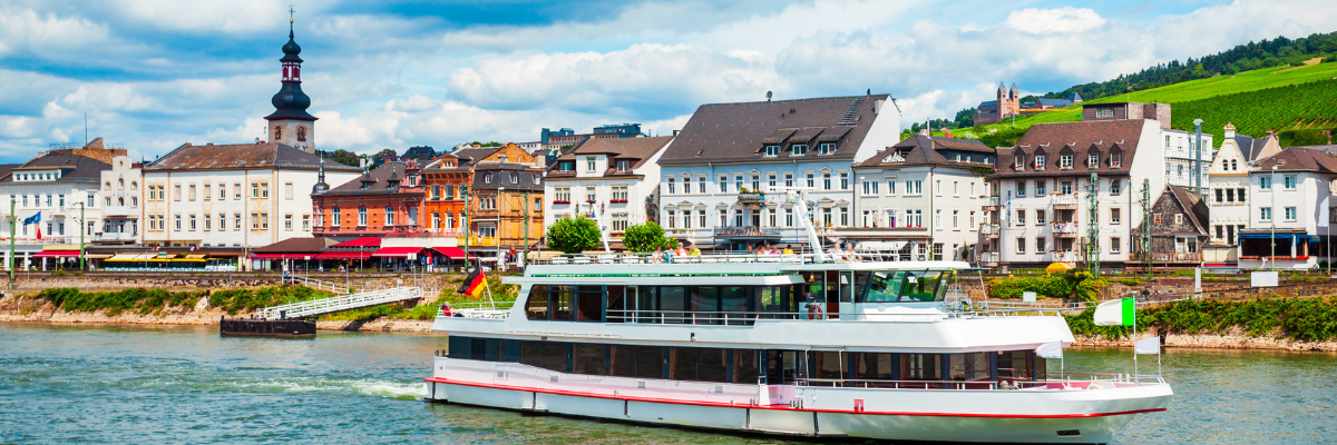
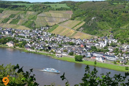
By River Cruise
Many visitors experience the Rhine Valley via river cruises:
- Major cruise operators have services between Amsterdam and Basel
- Day cruises operate between popular sections like Bingen to St. Goar or Koblenz to Cologne
- Cruise ships dock at numerous towns, allowing for embarkation and disembarkation at multiple points
Public Transportation Within the Rhine Valley
Regional Train Network
The backbone of Rhine Valley transportation consists of:
Regional Express (RE): Fast regional trains connecting major cities along the Rhine with limited stops.
RegionalBahn (RB): Local trains stopping at smaller stations along the river.
S-Bahn: Suburban train networks around the larger cities like Cologne, Frankfurt, and Mainz that extend into parts of the Rhine Valley.
MittelrheinBahn: Operates every hour between Cologne and Mainz, stopping at all stations along the UNESCO World Heritage section of the Rhine Valley.
Bus Services
Complementing the rail network:
Public Buses: Most Rhine Valley towns have local bus services connecting town centers with railway stations and nearby villages.
Tourist Shuttle Buses: Seasonal services in popular areas like the Upper Middle Rhine Valley, connecting major attractions and hiking trailheads.
WeinBus: Specialized services in wine regions connecting various vineyards and wine villages, particularly useful during wine festival seasons.
Ferries and River Transportation
The Rhine River itself serves as a transportation route:
Car Ferries:
- Regular services cross the Rhine at multiple points, connecting towns across the river where bridges are distant.
- Notable crossings include St. Goar to St. Goarshausen, Bingen to Rüdesheim, and Linz to Remagen
Passenger Ferries: Smaller boats offering pedestrian crossings between towns.
Rhine Water Taxis: Seasonal services in tourist areas allowing hop-on, hop-off travel between riverside towns.
KD Rhine Cruises: While primarily offering tourist cruises, these ships can also be used for point-to-point transportation between Rhine towns.
Cycling Infrastructure
The Rhine Valley features excellent cycling options:
Rhine Cycle Route: One of Europe’s most popular long-distance cycling paths running the entire length of the Rhine, with well-maintained dedicated paths.
Bike Rental Services: Available in most towns along the Rhine, often at or near train stations.
Bike-Friendly Transportation: Regional trains and many ferries accommodate bicycles, making it easy to combine cycling with other transportation modes.
Transportation Apps and Websites
Official Transportation Apps
- Deutsche Bahn (DB) Navigator: The essential app for all train travel in Germany, including the Rhine Valley region.
- VRM App: For the Middle Rhine Valley region, offering local bus and train connections.
- VRS App: Covers the northern Rhine Valley including Cologne and Bonn.
- RMV App: For the southern Rhine region including Frankfurt and Mainz.
Third-Party and Multi-Modal Apps
- Moovit: Comprehensive public transport app covering the entire Rhine Valley with real-time updates.
- Google Maps: Reliable for basic navigation but may miss some local transportation options.
- Rome2Rio: Excellent for planning multi-modal journeys throughout the Rhine region.
- Komoot: Particularly useful for hiking and cycling routes along the Rhine.
- FlixBus: For budget long-distance bus travel to and between major Rhine Valley cities.
Useful Websites
- German Railways (www.bahn.com/en): The official Deutsche Bahn website with English language option, essential for train planning.
- Romantic Rhine Tourism (www.romantischer-rhein.de/en): Tourism website with transportation information for the UNESCO Middle Rhine section.
- KD Rhine (www.k-d.com/en): Information on passenger ships and cruises operating as public transportation on the Rhine.
- Rheinland-Pfalz Mobility Portal (www.rolph.de): Comprehensive public transportation information for the Rhineland-Palatinate state.
- ADAC Route Planner (www.adac.de/reise-freizeit/routenplaner): Detailed driving directions if traveling by car.
Additional Transportation Details
Regional Transport Associations
The Rhine Valley is covered by several regional transport associations, each with its own ticketing system:
- VRM (Verkehrsverbund Rhein-Mosel): Covers the Middle Rhine Valley including Koblenz.
- VRS (Verkehrsverbund Rhein-Sieg): Covers the northern Rhine including Cologne and Bonn.
- RMV (Rhein-Main-Verkehrsverbund): Covers Frankfurt, Mainz, and surrounding areas.
- VRN (Verkehrsverbund Rhein-Neckar): Covers the southern Rhine region including Mannheim.
Special Tourist Transportation
- Sesselbahn Rüdesheim: Cable car from Rüdesheim up to the Niederwald Monument with Rhine views.
- Drachenfels Railway: Historic cog railway in Königswinter ascending to Drachenfels castle ruins.
- RheinBurgenWeg Shuttle: Seasonal hiking shuttle connecting various sections of the Rhine Castle Trail.
- Wine Village Shuttles: Seasonal services during wine festivals connecting multiple wine villages.
Navigation Tips
- Station Naming: Some Rhine Valley stations are named differently from their towns (e.g., Bacharach station is called “Bacharach Bf”).
- River Bank Identification: Always note which side of the Rhine your destination is on, as crossing points are limited.
- UNESCO Middle Rhine Section: The most scenic portion lies between Bingen and Koblenz, with the highest concentration of castles and historic towns.
- Train Platform Information: Smaller stations may have limited announcements, so confirm platform numbers via the DB app.
- Seasonal Considerations: Some ferry services and tourist transportation options operate with reduced schedules or close entirely during winter months.
- Integrated Day Tickets: Various regional day tickets allow unlimited travel on all public transportation within certain zones, ideal for exploring multiple Rhine towns in one day.
The Rhine Valley’s comprehensive transportation network makes it possible to explore this historic and scenic region efficiently without a car, connecting medieval castles, vineyards, historic towns, and natural landscapes through an integrated system of trains, buses, and boats.

Neuschwanstein Castle is one of Germany’s most iconic landmarks, located near the town of Füssen in southwest Bavaria. Here’s a comprehensive guide on how to reach the castle and navigate the area effectively.
Getting to Füssen (The Gateway to Neuschwanstein)
By Train
Germany has an excellent rail network that makes reaching Füssen straightforward:
- From Munich: Direct regional trains (operated by Deutsche Bahn) run approximately every two hours from Munich Hauptbahnhof (main station) to Füssen. The journey takes about 2 hours.
- From other German cities: Connect via Munich or Augsburg to reach Füssen.
- The Bayern Ticket is valid on these regional trains and also covers local buses to the castle (though not the shuttle bus directly at the castle).
By Bus
- Long-distance bus companies like FlixBus offer services to Füssen from various German cities and neighboring countries.
From Füssen to Neuschwanstein Castle
Once you arrive in Füssen, you have several options to reach the castle:
Local Bus (Recommended Option)
- Bus 73 or 78 runs from Füssen train station to Hohenschwangau village (the base of the castle). The journey takes about 10 minutes.
- Buses are timed to meet arriving trains from Munich.
- During peak season, buses run approximately every 30 minutes.
Taxi
- Taxis are readily available at Füssen train station.
- The journey to Hohenschwangau takes about 5-10 minutes.
Walking
- It’s possible to walk from Füssen to Hohenschwangau in about 40-50 minutes.
- The route is scenic and well-marked.
From Hohenschwangau Village to the Castle
Once you reach Hohenschwangau village at the base of the mountain, you still need to ascend to the castle:
Shuttle Bus
- A shuttle bus runs from the ticket center in Hohenschwangau up to Marienbrücke (Mary’s Bridge), which offers the classic postcard view of the castle.
- From Marienbrücke, it’s a 10-minute downhill walk to the castle entrance.
- Note: The shuttle only operates when weather conditions permit.
Horse-Drawn Carriage
- Carriages depart near the Hotel Müller in Hohenschwangau.
- They go uphill but stop below the castle, requiring a 10-15 minute uphill walk to reach the entrance.
Walking
- The walk from the village to the castle takes about 30-40 minutes uphill.
- The path is paved and offers beautiful views of the surrounding landscape.
- This option requires moderate fitness but is manageable for most visitors.
Useful Transportation Apps and Websites
Deutsche Bahn (DB Navigator)
- Official app of the German railway system
- Features: Real-time schedules, platform information, delay notifications, mobile tickets
- Website: bahn.com
- Available for iOS and Android
Bayern Fahrplan
- Comprehensive public transportation planner for all of Bavaria
- Includes trains, buses, and local transportation options
- Website: bayern-fahrplan.de
- Available for iOS and Android
Google Maps
- Offers reliable public transportation directions in this area
- Shows walking routes around the castle and surrounding areas
- Available for iOS and Android
ÖPNV Bayern
- Official public transportation app for Bavaria
- Provides real-time information for all forms of public transportation
- Website: bayern-fahrplan.de/en/apps
- Available for iOS and Android
FlixBus
- For long-distance bus travel to Füssen
- Website: flixbus.com
- Available for iOS and Android
Additional Tips for Getting Around
Best Times to Visit
- Early morning (before 10:00) or late afternoon (after 15:00) to avoid the largest crowds
- Weekdays are generally less crowded than weekends
Planning Your Visit
- Reserve your castle tickets online in advance through the official website (neuschwanstein.de)
Accessibility
- The castle itself has many stairs and is not wheelchair accessible
- The shuttle bus can accommodate visitors with limited mobility
- Horse carriages are an alternative for those who cannot walk uphill
Exploring Beyond Neuschwanstein
- Consider also visiting nearby Hohenschwangau Castle (in the same village)
- Local buses connect to other attractions in the area, including the Tegelberg cable car and the town of Schwangau
Regional Transportation Passes
- The Füssen Card is available if you stay overnight in Füssen and provides free local bus travel
- The aforementioned Bayern Ticket covers all regional trains and most buses in Bavaria for a full day
By planning your transportation carefully, you can make your visit to Neuschwanstein Castle both enjoyable and efficient. The German public transportation system is reliable, punctual, and comprehensive, making it relatively straightforward to reach this spectacular landmark even without a car.
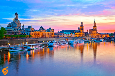
Dresden, the capital of Saxony, is a beautifully restored historic city located in eastern Germany. The city offers a well-developed public transportation system that makes exploring both the city center and surrounding areas convenient and efficient. This guide will help you navigate Dresden’s transportation options with confidence.
For more information visit: https://www.dvb.de/en-gb/
Getting to Dresden
By Train
Dresden is well-connected to Germany’s rail network, making train travel one of the most convenient ways to reach the city:
- Long-distance trains (ICE, IC) connect Dresden to major German cities like Berlin (approximately 2 hours), Leipzig (1 hour), Munich (about 6 hours), and Frankfurt (about 6 hours).
- Dresden has two main railway stations:
- Dresden Hauptbahnhof (main station) in the southern part of the city center
- Dresden-Neustadt station in the northern part of the inner city
- International connections are available to Prague (2.5 hours), Vienna, Budapest, and other European cities.
By Air
- Dresden Airport (DRS) is located about 9 km north of the city center.
- The S-Bahn line S2 connects the airport directly to Dresden Hauptbahnhof and Dresden-Neustadt station, with trains departing every 30 minutes. The journey takes approximately 20-25 minutes to the main station.
By Bus
- Long-distance bus companies like FlixBus and Eurolines offer connections to Dresden from various European cities.
- These buses typically arrive at Dresden’s central bus station (ZOB), located near the main train station.
Dresden’s Public Transportation System
Dresden has an integrated public transportation network operated by Dresdner Verkehrsbetriebe (DVB), which includes:
Trams (Straßenbahn)
- The backbone of Dresden’s public transportation with 12 lines crisscrossing the city
- Trams run frequently (every 10 minutes during the day on main lines)
- Most tram lines operate daily from approximately 4:30 AM until midnight (with reduced night services)
- Lines 3, 7, 8, and 9 are particularly useful for tourists as they connect many major attractions
Buses
- Complement the tram network, reaching areas not served by trams
- Over 33 bus routes throughout the city and surroundings
- Regular city buses, regional buses, and night buses (identified with an “N” prefix)
S-Bahn (Suburban Railway)
- Operated by DB Regio (part of Deutsche Bahn)
- Connects Dresden with surrounding towns and regions
- S1 runs from Meißen to Schöna (along the Elbe Valley)
- S2 connects Dresden Airport to the city center and continues to Pirna
Elbe Ferries
- Several ferry connections across the Elbe River
- Part of the public transportation network (included in DVB tickets)
- Particularly useful for accessing hiking areas in Saxon Switzerland
Funicular Railways and Suspension Railway
- Standseilbahn Dresden (funicular railway) connects Dresden-Loschwitz with Weißer Hirsch district
- Schwebebahn Dresden (suspension railway) connects Loschwitz with Oberloschwitz
- Both are not only transportation options but also historic attractions in themselves
Navigating Dresden by Zone
Dresden’s public transportation system is divided into fare zones:
- Zone Dresden covers the entire city area
- Zone Freital and other surrounding zones for trips to neighboring areas
- Most tourist activities will only require Zone Dresden
Digital Tools for Navigation
DVB App
- Official app of Dresden’s transport company
- Features: Real-time departures, route planning, mobile tickets
- Available for iOS and Android
VVO Mobil
- App for the broader Verkehrsverbund Oberelbe network (which includes Dresden)
- Offers comprehensive coverage of the entire region, including regional trains
- Available for iOS and Android
Deutsche Bahn (DB Navigator)
- Essential for long-distance train travel to Dresden
- Also useful for S-Bahn connections within the city
- Features: Real-time information, platform changes, delay notifications
- Available for iOS and Android
Google Maps
- Works well for public transportation in Dresden
- Shows walking directions to and from stops
- Available for iOS and Android
ÖPNV Navigator
- National public transportation navigator with good coverage in Dresden
- Available for iOS and Android
Easy.GO
- Mobile ticketing app for Dresden and the Oberelbe region
- Purchase tickets directly through the app
- Available for iOS and Android
Useful Transportation Websites
- DVB (Dresdner Verkehrsbetriebe): www.dvb.de/en-gb/ – Official site with timetables, route planning, and service updates
- VVO (Verkehrsverbund Oberelbe): www.vvo-online.de/en – Regional transport association site
- Deutsche Bahn: www.bahn.com – For national and international train connections
- Dresden Airport: www.dresden-airport.de/en/ – Flight information and airport services
Key Transportation Hubs
Postplatz
- Central transfer point where many tram lines intersect
- Located in the heart of the historic center
Hauptbahnhof (Main Station)
- Major hub for trams, buses, and trains
- Connected to the Prager Straße shopping district
Albertplatz
- Important transfer point in Dresden-Neustadt
- Gateway to the alternative and vibrant Outer Neustadt district
Pirnaischer Platz
- Key transfer point on the eastern edge of the Old Town
- Access point for city buses and trams
Tips for Navigating Dresden
Understanding Tram and Bus Indicators
- Electronic displays show destination, line number, and minutes until arrival
- Yellow signs at stops provide timetables and network maps
Using Day Tickets Effectively
- Day tickets are valid from validation until 4 AM the following day
- Validate your ticket in the yellow machines on trams and buses when first boarding
Night Transportation
- Night lines (GuteNachtLinie) operate after regular service ends
- Main night bus and tram lines meet at Postplatz for transfers
Bicycle Integration
- Most trams and S-Bahn trains have designated spaces for bicycles
- Bicycles are permitted outside of peak hours
Accessibility
- Most modern trams are low-floor vehicles for easy boarding
- Major stops have been upgraded with tactile guidance systems for visually impaired travelers
- Electronic announcements and displays on vehicles provide information about upcoming stops
Exploring Beyond Dresden
To Saxon Switzerland National Park
- Take S-Bahn S1 from Dresden Hauptbahnhof to Bad Schandau or Schöna
- Journey time: approximately 45 minutes to 1 hour
- The route along the Elbe Valley is particularly scenic
To Meissen
- Take S-Bahn S1 from Dresden Hauptbahnhof in the direction of Meißen
- Journey time: approximately 40 minutes
- Famous for its porcelain and historic old town
To Moritzburg Castle
- Take tram 3 to Wilden Mann, then bus 326 to Moritzburg
- Total journey time: approximately 45 minutes
To Radebeul (Saxon Wine Route)
- Take S-Bahn S1 from Dresden Hauptbahnhof
- Journey time: approximately 15-20 minutes
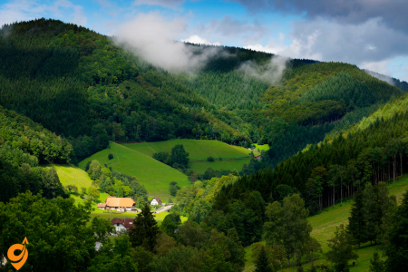
The Black Forest (Schwarzwald) is a magnificent mountain range and forest in southwestern Germany, spanning approximately 160 km from north to south. While renowned for its dense evergreen forests, picturesque villages, and cuckoo clocks, navigating this vast region requires some planning. Here’s a comprehensive guide to reaching and exploring the Black Forest using public transportation.
Major Gateway Cities
The Black Forest is accessible via several gateway cities that serve as transportation hubs:
Freiburg im Breisgau
- Located at the southwestern edge of the Black Forest
- Major railway hub with excellent connections
- Ideal starting point for exploring the southern Black Forest
Baden-Baden
- Northern gateway to the Black Forest
- Well-connected spa town with rail and bus links
- Good base for exploring the northern Black Forest
Karlsruhe
- Northern access point with excellent rail connections
- Connection to high-speed trains (ICE)
Stuttgart
- Major city northeast of the Black Forest
- International airport with good rail connections to the region
Basel (Switzerland)
- International access point at the southern edge
- EuroAirport Basel-Mulhouse-Freiburg nearby
Getting to the Black Forest
By Train
Germany’s efficient rail network makes reaching the Black Forest straightforward:
Long-Distance Trains
- ICE/IC/EC trains connect major German cities to Black Forest gateway cities
- Main railway stations serving the Black Forest:
- Freiburg Hauptbahnhof
- Baden-Baden Bahnhof
- Offenburg Hauptbahnhof
- Karlsruhe Hauptbahnhof
Regional Trains
- RegionalExpress (RE) and RegionalBahn (RB) trains connect smaller towns throughout the region
- The Black Forest Railway (Schwarzwaldbahn) runs from Offenburg to Konstanz through spectacular scenery
By Air
Several airports provide access to the Black Forest:
- Stuttgart Airport (STR): Connected to Stuttgart Hauptbahnhof by S-Bahn (S2, S3)
- EuroAirport Basel-Mulhouse-Freiburg (BSL): Bus connection to Freiburg (approximately 1 hour)
- Frankfurt Airport (FRA): High-speed ICE trains to Karlsruhe, Baden-Baden, and Freiburg
- Karlsruhe/Baden-Baden Airport (FKB): Shuttle bus to Baden-Baden and Karlsruhe
Navigating Within the Black Forest
Regional Train Lines
Several scenic railway lines traverse the Black Forest:
Schwarzwaldbahn (Black Forest Railway)
- Runs from Offenburg to Konstanz
- One of Germany’s most scenic rail routes
- Passes through Triberg, Hornberg, St. Georgen, and Villingen
- Stunning viaducts and tunnels with breathtaking views
Höllentalbahn (Hell Valley Railway)
- Connects Freiburg to Donaueschingen
- Steepest standard-gauge railway in Germany
- Passes through dramatic Höllental (Hell Valley) gorge
- Stops include Kirchzarten, Hinterzarten, and Titisee
Murgtalbahn (Murg Valley Railway)
- Runs from Rastatt to Freudenstadt
- Picturesque route through the northern Black Forest
- Follows the Murg river valley
Bus Networks
The Black Forest has an extensive bus network that reaches areas not served by trains:
SüdbadenBus (SBG)
- Comprehensive network in the southern Black Forest
- Connects train stations to smaller villages and attractions
- Line 7300 (Freiburg to Feldberg) is particularly useful for hikers
Regionalbusverkehr Südwest (RVS)
- Serves the central and northern Black Forest
- Connects with train stations in Baden-Baden, Freudenstadt, and Offenburg
National Park Shuttle
- Seasonal shuttle service in the Black Forest National Park
- Connects parking areas with hiking trails and attractions
Specialized Tourist Transportation
Konus Guest Card
- Available to tourists staying overnight in participating accommodations
- Enables free use of public transportation throughout the Black Forest region
- Valid on buses, trams, and regional trains (excluding IC/ICE)
Black Forest Panorama Route
- Circular bus route (Bus 73) from Freiburg through the southern Black Forest
- Operates during summer months
- Stops at major attractions including Titisee and Feldberg
Key Transportation Routes for Tourists
Southern Black Forest
- Freiburg to Titisee/Feldberg: Train on Höllentalbahn to Titisee, then bus 7300 to Feldberg
- Freiburg to Schauinsland: Tram 2 to Denzlingen, then Schauinslandbahn cable car
- Basel to Todtnau: Train to Zell im Wiesental, then bus 7300
Central Black Forest
- Offenburg to Triberg: Direct train on Schwarzwaldbahn
- Freudenstadt to Baiersbronn: Train on Murgtalbahn
- Baden-Baden to Mummelsee: Bus 245 (Black Forest Line)
Northern Black Forest
- Karlsruhe to Baden-Baden: Direct train, then local buses to forest attractions
- Stuttgart to Calw: Train to Pforzheim, then connecting train to Calw
- Karlsruhe to Freudenstadt: Train via Rastatt and Murgtalbahn
Digital Tools and Information Sources
Deutsche Bahn (DB Navigator)
- Essential app for all train travel in Germany
- Features: Real-time schedules, platform information, delay notifications, mobile tickets
- Available for iOS and Android
- Website: bahn.com
NVBW – “Fahrplan & Tickets”
- Comprehensive app for Baden-Württemberg public transportation
- Includes rural bus routes often missing from other apps
- Available for iOS and Android
- Website: nvbw.de
Ortenau S’Cool Card
- Regional transportation app for the Ortenau district in the central Black Forest
- Website: ortenaulinie.de
VVS (Verkehrs- und Tarifverbund Stuttgart)
- Transportation app for the Stuttgart region and eastern Black Forest
- Available for iOS and Android
- Website: vvs.de
RVF (Regio-Verkehrsverbund Freiburg)
- Transportation app for Freiburg and the southern Black Forest
- Available for iOS and Android
- Website: rvf.de
Useful Websites
- schwarzwald-tourismus.info: Official Black Forest tourism website with transportation information
- schwarzwaldbahn.de: Information on the Black Forest Railway
- bahn.com: German railway website for schedules and tickets
- europapark.de/en/service/arrival: Information on reaching Europa-Park (popular destination near the Black Forest)
- hochschwarzwald.de: Tourism website for the High Black Forest with transportation tips

For more information visit: https://www.hvv.de/en
Reaching Hamburg
By Air
Hamburg Airport (Flughafen Hamburg, HAM) is located about 8.5 kilometers north of the city center. To reach the city from the airport:
- S-Bahn: The S1 line connects the airport directly with Hamburg Central Station (Hauptbahnhof) and continues through the city center. Trains run every 10 minutes during peak hours, and the journey to the central station takes approximately 25 minutes. The S-Bahn station is located directly in front of the terminals, clearly marked with signs.
- Taxi: Taxis are available at designated stands outside both terminals. The journey to the city center takes about 20-30 minutes depending on traffic.
- Bus: Several bus lines (e.g., 274, 292) connect the airport to various parts of the city, though the S-Bahn is typically faster for reaching the city center.
By Train
Hamburg is a major railway hub with excellent connections throughout Germany and to neighboring countries:
- Hamburg Hauptbahnhof (Central Station): The main railway station serves long-distance ICE, IC, and EC trains connecting Hamburg to cities like Berlin (1.5-2 hours), Munich (5.5-6 hours), and Frankfurt (3.5-4 hours). The station is located right in the city center.
- Hamburg-Altona: A secondary long-distance station in the western part of the city, serving some north-south routes.
- Hamburg-Harburg: Located south of the Elbe river, this station serves some long-distance trains, particularly those coming from the south.
By Bus
Hamburg’s central Bus station (ZOB Hamburg) is located near the Central Station (Hauptbahnhof):
- Long-distance coach services like FlixBus connect Hamburg with other major European cities.
- Upon arrival, you can easily transfer to the city’s public transportation system.
By Car
Hamburg is connected to Germany’s extensive autobahn network:
- A1: Connects to Lübeck/Baltic Sea and Bremen/Ruhr Valley
- A7: North-south route connecting to Denmark and southern Germany
- A24: Connects to Berlin
- A23: Connects to the North Sea coast
Public Transportation Network (HVV)
Hamburg’s integrated public transport network (Hamburger Verkehrsverbund, HVV) consists of the following services:
U-Bahn (Subway)
Hamburg’s U-Bahn system consists of four lines (U1-U4):
- U1 (Blue Line): Connects the northeast suburbs through the city center to the northwest suburbs, running from Norderstedt Mitte to Ohlstedt/Großhansdorf.
- U2 (Red Line): Runs from Niendorf Nord to Mümmelmannsberg, connecting northern and eastern districts.
- U3 (Yellow Line): A circular line that follows a ring around the city center and passes many tourist attractions including the harbor area.
- U4 (Teal Line): Connects the city center with the HafenCity and the Elbbrücken (Elbe bridges) area.
Trains run frequently (every 5 minutes during peak hours, 10 minutes during off-peak) and operate from approximately 4:30 AM until 1:00 AM on weekdays and all night on weekends.
S-Bahn (Suburban Train)
The S-Bahn system comprises six lines (S1-S6) connecting the city center with outer districts and surrounding communities:
- S1: Airport – City Center – Wedel
- S2: Altona – City Center – Bergedorf – Aumühle
- S3: Pinneberg – City Center – Harburg – Stade
- S21/S31: Circular routes connecting various parts of the city
- S5: Connects Stade to Central Station via a different route
S-Bahn trains generally run every 10-20 minutes, with more frequent service where lines overlap.
A-Bahn (Regional Train)
These are regional trains that are integrated into the HVV network, connecting Hamburg with surrounding towns and regions.
Buses
Hamburg has an extensive bus network with several types of services:
- MetroBus: Main routes with frequent service (lines 1-29)
- Express Buses: Faster connections with fewer stops (lines X1-X99)
- Regular Buses: Standard service covering most areas (lines 100-999)
- Night Buses: Operating when U-Bahn and S-Bahn are not running (lines 600-688)
Ferries
Hamburg’s ferry services are fully integrated into the public transportation system and are particularly useful for harbor areas:
- Line 62: Landungsbrücken – Finkenwerder
- Line 62: Landungsbrücken – Neumühlen/Övelgönne
- Line 72: Landungsbrücken – Elbphilharmonie
- Line 72 > 72: Landungsbrücken – Arningstraße
- Line 73: Landungsbrücken – Ernst-August-Schleuse
Ferries are a great way to see Hamburg from the water and are particularly popular with tourists, especially routes 61 and 62 which offer excellent views of the harbor and the Elbe River.
AKN
The AKN is a regional railway company operating lines connecting Hamburg with Schleswig-Holstein. The AKN lines are integrated into the HVV tariff system.
Additional Transportation Options
Bike Sharing
Hamburg offers several bike-sharing options:
- StadtRAD Hamburg: The city’s official bike-sharing service with over 3,000 bicycles at approximately 250 stations throughout Hamburg. Registration is required but can be done via the StadtRAD app.
- Donkey Republic: Another bike-sharing service with distinctive orange bicycles.
Hamburg is increasingly bicycle-friendly, with dedicated bike lanes and paths throughout the city, though some areas have more comprehensive cycling infrastructure than others.
E-Scooters
Several operators offer e-scooters throughout Hamburg:
- Tier
- Lime
- VOI
- Bird
These are available through their respective apps and can be located, unlocked, and paid for via smartphone.
Car Sharing
Hamburg has several car-sharing services:
- SHARE NOW: Free-floating car sharing service allowing one-way trips within the service area.
- Cambio: Station-based car sharing with designated pickup and return locations.
- SIXT share: Flexible car sharing service with a variety of vehicle types.
MOIA
MOIA is a ride-pooling service operating in Hamburg with electric vehicles. It works similar to a shared taxi service where you book via an app, and the vehicle might pick up other passengers headed in a similar direction.
Transportation Apps and Websites
Official HVV Apps
- HVV App: The official app by Hamburg’s public transport authority offers comprehensive journey planning, real-time departure information, and service disruption alerts. It provides detailed maps and has an English interface option.
- HVV switch: A mobility platform app that integrates not only public transportation but also sharing services like car-sharing, bike-sharing, and e-scooters in Hamburg.
Third-Party and Multi-Modal Apps
- DB Navigator: Deutsche Bahn’s app works well for planning journeys that include regional and long-distance trains as well as local public transportation in Hamburg.
- Google Maps: Offers reliable public transportation directions in Hamburg with real-time updates.
- Moovit: Provides detailed journey planning with real-time information and service alerts.
- MOIA: App for Hamburg’s ride-pooling service, which offers shared rides in electric vehicles.
Useful Websites
- HVV Website (www.hvv.de): Available in English, provides comprehensive information about Hamburg’s public transportation system, including network maps, timetables, journey planner, and service updates.
- Deutsche Bahn Website (www.bahn.de): For long-distance train connections to/from Hamburg.
- Hamburg Tourism Website (www.hamburg-travel.com): Offers transportation information specifically tailored for tourists.
Navigation Tips
HVV Ring System
Hamburg’s public transportation network uses a ring system for ticketing:
- Ring A: Covers the city center
- Ring B: Includes inner suburban areas
- Ring C: Covers outlying suburban areas
- Rings D-E: Cover more distant areas in the metropolitan region
Understanding this ring system is important when purchasing tickets, although the journey planner apps will automatically calculate the correct ticket type needed.
Hamburg Card
For tourists, the Hamburg Card combines public transportation with discounts on attractions and is available for 1-5 days.
Major Transit Hubs
- Hauptbahnhof (Central Station): Main hub connecting all U-Bahn and S-Bahn lines with regional and long-distance trains.
- Jungfernstieg: Important interchange between U1, U2, U4, and S-Bahn lines in the city center.
- Altona: Major station in western Hamburg connecting U-Bahn, S-Bahn, and regional/long-distance trains.
- Landungsbrücken: Hub for U3, S-Bahn, and all harbor ferries.
English Support
Most ticket machines, digital displays, and important announcements on trains and at major stations are available in English. Station staff at larger stations typically speak English, and all official apps have English language options.
Tourist Area Coverage
Hamburg’s main tourist attractions are well-connected by public transportation:
- HafenCity and Elbphilharmonie: U4 to Überseequartier or HafenCity Universität, or Ferry 72 from Landungsbrücken
- Reeperbahn and St. Pauli: S1/S2/S3 to Reeperbahn or U3 to St. Pauli
- Harbor and Fish Market: U3 or S1/S2/S3 to Landungsbrücken
- Alster Lakes: U1/U2/U3 to Jungfernstieg
- Planten un Blomen Park: U1 to Stephansplatz or U2 to Messehallen
- Miniatur Wunderland and Speicherstadt: U3 to Baumwall or U4 to Überseequartier
For more information visit : https://www.kvb.koeln/
Reaching Cologne
By Air
Cologne Bonn Airport (CGN) is the main gateway to the city, located approximately 15 kilometers southeast of the city center:
- S-Bahn: The S13 and S19 lines connect the airport directly with Cologne’s main train station (Köln Hauptbahnhof). The journey takes about 15 minutes, with trains departing every 20 minutes. The S-Bahn station is located in Terminal 2, directly beneath the arrivals area.
- Bus: Bus line 161 connects the airport to Porz and Cologne-Deutz, operating every 30 minutes. Though less direct than the S-Bahn for reaching the city center, it’s useful for specific destinations in the eastern parts of the city.
- Regional Trains: The RE6 and RE8 regional express trains stop at the airport and connect to both Cologne Hauptbahnhof and Cologne Messe/Deutz stations.
- Taxi: Taxis are available outside both terminals. The journey to the city center takes approximately 20 minutes, depending on traffic.
Düsseldorf Airport (DUS) is another option, located about 60 kilometers north of Cologne:
- Regional Express (RE): Direct trains connect Düsseldorf Airport with Cologne Hauptbahnhof in approximately 45 minutes.
By Train
Cologne is a major rail hub with excellent connections throughout Germany and to neighboring countries:
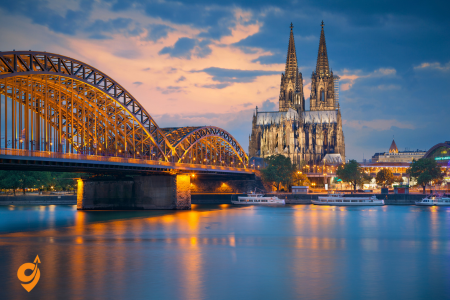
- Köln Hauptbahnhof (Central Station): Located directly next to the famous Cologne Cathedral in the heart of the city, this is the main arrival point for long-distance ICE, IC, and EC trains. The station connects Cologne with cities like Berlin (4.5 hours), Munich (4.5 hours), Hamburg (4 hours), and Frankfurt (1 hour).
- Köln Messe/Deutz: A secondary major station on the eastern bank of the Rhine, serving some high-speed and regional trains. It’s particularly convenient for the Koelnmesse exhibition center.
- Köln-Ehrenfeld, Köln-West, and Köln Süd: Smaller stations serving specific areas of the city with regional trains and S-Bahn connections.
International train connections include:
- Paris (3.5 hours via Thalys)
- Brussels (2 hours via ICE/Thalys)
- Amsterdam (2.5 hours via ICE)
- London (4.5 hours via Eurostar with one change in Brussels)
By Bus
Cologne’s central bus station (ZOB) is located near Breslauer Platz, adjacent to the main train station:
- Long-distance coach services like FlixBus connect Cologne with other major European cities.
- Upon arrival, you can easily transfer to the city’s public transportation system.
By Car
Cologne is well-connected to Germany’s autobahn network:
- A1: Connects to the Ruhr Valley in the north and Saarbrücken in the south
- A3: Runs northeast to Frankfurt and southwest to the Netherlands
- A4: Connects to Aachen and Belgium in the west and to eastern Germany
- A57: Links to the Netherlands in the northwest
- A59: Provides access to Cologne Bonn Airport
- A555: Connects Cologne with Bonn to the south
Public Transportation Network (KVB/VRS)
Cologne’s public transport system is operated primarily by the Kölner Verkehrs-Betriebe (KVB) under the regional transport association Verkehrsverbund Rhein-Sieg (VRS).
U-Bahn/Stadtbahn (Light Rail)
Cologne’s Stadtbahn is a hybrid system combining elements of subway and tram systems:
- Underground sections: Primarily in the city center
- Street-level sections: In outer districts
- 12 lines (numbered 1, 3, 4, 5, 7, 9, 12, 13, 15, 16, 17, 18)
Key Stadtbahn lines include:
- Line 1: Connects Weiden West to Bensberg via the city center
- Line 5: Links Sparkasse Am Butzweilerhof to Heumarkt
- Line 16: Connects Niehl to Bonn, running through both city centers
- Line 18: Connects Thielenbruch to Bonn, providing another cross-city route
Trains run every 5-10 minutes during peak hours (Monday to Friday, 6:30-19:00) and every 10-15 minutes during off-peak times. Night service operates on weekends.
S-Bahn (Suburban Train)
The S-Bahn network consists of 5 lines connecting Cologne with surrounding cities and suburbs:
- S6: Köln-Nippes – Essen
- S11: Bergisch Gladbach – Düsseldorf Airport
- S12: Köln-Ehrenfeld – Au (Sieg)
- S13: Troisdorf – Horrem via Cologne Bonn Airport
- S19: Düren – Troisdorf via Cologne Bonn Airport
S-Bahn trains generally run every 20-30 minutes, with more frequent service where lines overlap.
Buses
Cologne has an extensive bus network complementing the rail system:
- 142 lines covering the entire city and surrounding areas
- MetroBus lines (designated with an M prefix) offer high-frequency service on main routes
- Regular bus lines cover less frequented routes
- Night buses (designated with an N prefix) operate when rail services are reduced or not running
Regional Trains
Regional Express (RE) and Regional Bahn (RB) trains connect Cologne with towns and cities throughout North Rhine-Westphalia and are fully integrated into the local transportation fare system.
Additional Transportation Options
Bike Sharing
Cologne is a bicycle-friendly city with several bike-sharing options:
- KVB Rad: The city’s official bike-sharing service operated in partnership with nextbike. Stations are located throughout the city, with higher concentration in the center.
- Donkey Republic: Another bike-sharing service with distinctive orange bicycles.
Cologne has an expanding network of cycling paths, particularly along the Rhine river, making cycling a pleasant option for exploring the city.
E-Scooters
Several operators offer e-scooters throughout Cologne:
- Tier
- Lime
- Bird
- Voi
These are available through their respective apps and can be located, unlocked, and paid for via smartphone.
Car Sharing
Cologne has several car-sharing services:
- Cambio: Station-based car sharing with designated pickup and return locations.
- SHARE NOW: Free-floating car sharing service allowing one-way trips within the service area.
- Miles: Another flexible car sharing option in Cologne.
Transportation Apps and Websites
Official Apps
- KVB App: The official app of Cologne’s public transport operator offers journey planning, real-time departure information, and service disruption alerts.
- VRS App: The regional transport association’s app covers not just Cologne but the entire Rhine-Sieg region, including surrounding cities like Bonn.
- DB Navigator: Deutsche Bahn’s app works well for planning journeys that include regional and long-distance trains as well as local public transportation in Cologne.
Third-Party and Multi-Modal Apps
- Google Maps: Offers reliable public transportation directions in Cologne with real-time updates.
- Moovit: Provides detailed journey planning with real-time information and service alerts.
- Citymapper: Covers Cologne with excellent user interface and additional features like calorie counting for walking portions of journeys.
- KVB Widget: Not a standalone app but a homescreen widget showing upcoming departures from selected stops.
Useful Websites
- KVB Website (www.kvb.koeln): Available in English, provides information about Cologne’s public transportation system, including network maps, timetables, and service updates.
- VRS Website (www.vrs.de): Covers the entire Rhine-Sieg transport region with comprehensive journey planning tools.
- Deutsche Bahn Website (www.bahn.de): For long-distance train connections to/from Cologne.
- Cologne Tourism Website (www.cologne-tourism.com): Offers transportation information specifically tailored for tourists.
Navigation Tips
Rhine River Orientation
The Rhine River divides Cologne into western and eastern sections:
- Western bank (left bank): Contains the historic city center (Altstadt), the main train station (Hauptbahnhof), the cathedral, and most tourist attractions.
- Eastern bank (right bank): Features the Deutz district, the Koelnmesse exhibition center, and the Lanxess Arena.
Understanding which side of the river your destination is on will help with navigation. The river can be crossed by several bridges, with the Hohenzollern Bridge being the most central and iconic.
Major Transit Hubs
- Köln Hauptbahnhof: Main hub connecting all forms of transportation, located directly next to the cathedral.
- Neumarkt: Central interchange for multiple Stadtbahn lines in the heart of the shopping district.
- Ebertplatz: Important Stadtbahn junction in the northern part of the city center.
- Deutz/Messe: Major hub on the eastern bank, convenient for the exhibition center and arena.
- Appellhofplatz/Zeughaus: Central interchange serving the old town area.
Tourist Area Coverage
Cologne’s main tourist attractions are well-connected by public transportation:
- Cathedral (Dom): Directly at Hauptbahnhof station, served by almost all Stadtbahn and S-Bahn lines
- Old Town (Altstadt): Served by stops Dom/Hauptbahnhof, Heumarkt, and Rathaus
- Rhine River Promenade: Accessible from Dom/Hauptbahnhof or Rhine Garden (Rheinpark) via the cable car
- Belgian Quarter: Served by Stadtbahn stations Friesenplatz and Rudolfplatz
- Cologne Zoo: Served by Stadtbahn station Zoo/Flora
- Chocolate Museum: Near Heumarkt or Severinstrasse stations
- Museum Ludwig and Philharmonic: At Dom/Hauptbahnhof station
KölnTag (Cologne Day)
For tourists staying in hotels in Cologne, ask if your accommodation offers the “KölnTag” card, which provides free public transportation on a specific day.
Accessibility
Most Stadtbahn stations in Cologne are accessible for wheelchair users, with elevators or ramps. Buses are equipped with ramps and designated spaces for wheelchairs. The KVB app and website provide specific information about accessibility at each station and on each vehicle.
River Transportation
While not part of the regular public transportation system, tourist boats operate on the Rhine River, offering sightseeing cruises as well as scheduled services to nearby towns and attractions. These depart from landings near the Altstadt and Deutz.
Guided Tours on Public Transportation
The KölnTour, operated by KVB, is a guided tour on a special Stadtbahn vehicle that covers major attractions in the city. This combines sightseeing with an introduction to the public transportation system.
Night Service
On weekends (Friday and Saturday nights), Cologne offers extensive night service:
- All Stadtbahn lines operate through the night at 30-minute intervals
- Night bus routes (N lines) fill gaps in the network
- During weeknights, night buses replace Stadtbahn services after midnight
Cologne’s comprehensive and efficient public transportation system makes it easy to explore the city without a car, connecting all major attractions, business districts, and residential areas through a well-integrated network of trains, buses, and trams.
For more details visit: https://www.vgn.de/en/
Reaching Nuremberg
By Air
Nuremberg Airport (NUE) is located approximately 5 kilometers north of the city center, making it one of Germany’s most conveniently situated airports in relation to its city:
U-Bahn: The U2 subway line connects the airport directly with the city center. Trains run every 10 minutes during peak hours and the journey to the main train station (Hauptbahnhof) takes just 12 minutes. The U-Bahn station is located directly in front of the terminal building, clearly marked with signs.
Bus: Bus lines 30, 43, 44, 45, 65, also serve the airport, connecting it to other parts of the city network not directly reached by the U-Bahn.
Taxi: Taxis are available at designated stands outside the terminal. The journey to the city center takes approximately 15 minutes depending on traffic.
By Train
Nuremberg is a significant railway hub in southern Germany with excellent connections:
Nuremberg Hauptbahnhof (Central Station): Located at the edge of the Old Town (Altstadt), this major station is served by numerous high-speed ICE, IC, and EC trains connecting Nuremberg to cities like Munich (1 hour), Berlin (3-4 hours), Frankfurt (2 hours), and Vienna (4-5 hours). The station features multiple platforms, shopping facilities, and direct access to the city’s U-Bahn system.
Nuremberg-Nordostbahnhof: Secondary station serving northeastern districts.
Nuremberg-Stein: Station serving the western suburbs.
International train connections include direct services to:
Prague (4-5 hours)
Vienna (4-5 hours)
Zurich (5-6 hours)
Budapest (7-8 hours via Vienna)
By Bus
Nuremberg’s central bus station (ZOB) is located next to the main train station:
Long-distance coach services like FlixBus connect Nuremberg with other German and European cities.
The location provides easy transfer to all forms of local public transportation.
By Car
Nuremberg sits at the intersection of several major autobahns:
A3: Connects Frankfurt to Passau (Austrian border)
A6: Runs from the French border near Saarbrücken to the Czech border
A9: Links Berlin with Munich via Nuremberg
A73: Connects Nuremberg with Bamberg and Suhl
Public Transportation Network (VGN)
Nuremberg’s public transport system is operated under the Verkehrsverbund Großraum Nürnberg (VGN), which covers not just Nuremberg but the entire metropolitan region including nearby cities like Fürth, Erlangen, and Schwabach.
U-Bahn (Subway)
Nuremberg’s U-Bahn system consists of three lines:
- U1 (Red Line): Runs from Langwasser Süd to Hardhöhe (Fürth), connecting the southeastern districts through the city center to the neighboring city of Fürth.
- U2 (Blue Line): Connects the Airport with Röthenbach via the central station and city center.
- U3 (Green Line): Runs from Nordwestring to Grobreuth, partially sharing tracks with U2. This is one of Germany’s first automated subway lines operating without drivers.
Trains run frequently (every 5 minutes during peak hours, 10 minutes during off-peak) and operate from approximately 5:00 AM until 1:00 AM (with extended hours on weekends).
Trams (Straßenbahn)
Nuremberg’s tram network consists of 7 lines complementing the U-Bahn system:
- Line 4: Gibitzenhof – Am Wegfeld
- Line 5: Tiergarten – Worzeldorfer Straße
- Line 6: Documentation Center – Westfriedhof
- Line 7: Main Station – Tristanstraße
- Line 8: Documentation Center – Erlenstegen
- Line 10: Dutzendteich – Am Wegfeld
- Line 11: Zoo – Gibitzenhof
Trams generally run every 10 minutes during peak hours and every 15 minutes during off-peak times.
Buses
An extensive bus network complements the rail-based transportation:
- Regular City Buses: Numbered lines covering the entire city, with higher frequency on main routes.
- Night Buses (N-lines): Operating when U-Bahn and trams are not running, primarily on weekend nights.
- Express Buses: Faster connections with fewer stops on certain routes.
S-Bahn (Suburban Train)
The S-Bahn network connects Nuremberg with surrounding towns and cities in the metropolitan area:
- S1: Bamberg – Forchheim – Erlangen – Fürth (Bay) Hbf – Nürnberg Hbf* – Lauf (links Pegnitz)* – Hersbruck (links Pegnitz)* – Hartmannshof*
- S2: Roth – Schwabach – Nürnberg Hbf – Feucht – Altdorf
- S3: Nürnberg Hbf – Feucht – Neumarkt (Oberpf)
- S4: Nürnberg Hbf – Ansbach – Crailsheim
- S5: Nürnberg Hbf – Allersberg (Rothsee)
- S6: Nürnberg Hbf – Neustadt an der Aisch
Regional Trains
Regional Express (RE) and Regional Bahn (RB) trains connect Nuremberg with towns and cities throughout Bavaria and neighboring states, providing service to destinations not covered by the S-Bahn network.
Additional Transportation Options
Bike Sharing
Nuremberg offers several bike-sharing options:
- VAG_Rad: The city’s official bike-sharing service operated in partnership with nextbike. Stations are located throughout the city, with higher concentration in the center.
- Tier: Also offers bicycles in addition to e-scooters in Nuremberg.
Nuremberg has made significant investments in cycling infrastructure with dedicated bike lanes and paths throughout the city. The area around the Old Town walls features a particularly scenic cycling route.
E-Scooters
Several operators offer e-scooters throughout Nuremberg:
- Tier
- Lime
- Bird
- Voi
These are available through their respective apps and can be located, unlocked, and paid for via smartphone.
Car Sharing
Nuremberg has several car-sharing services:
- Stadtmobil: Station-based car sharing with designated pickup and return locations.
- SCOUTER: Free-floating car sharing service focusing on electric vehicles.
- Miles: Another flexible car sharing option available in Nuremberg.
Transportation Apps and Websites
Official Apps
- VGN Fahrplan & Tickets: The official app of the Nuremberg metropolitan transport association offers journey planning, real-time departure information, and service disruption alerts. Available in English.
- DB Navigator: Deutsche Bahn’s app works well for planning journeys that include regional and long-distance trains as well as local public transportation in Nuremberg.
- VAG Fahrinfo: Focused specifically on Nuremberg’s city transportation (U-Bahn, trams, and buses) with real-time information.
Third-Party and Multi-Modal Apps
- Google Maps: Offers reliable public transportation directions in Nuremberg with real-time updates.
- Moovit: Provides detailed journey planning with real-time information and service alerts.
- Öffi: Popular open-source app that works well for Nuremberg’s public transportation system.
Useful Websites
- VGN Website (www.vgn.de): Available in English, provides comprehensive information about Nuremberg’s public transportation system, including network maps, timetables, journey planner, and service updates.
- VAG Website (www.vag.de): The website of Nuremberg’s main transport operator, with detailed information about U-Bahn, tram, and bus services.
- Deutsche Bahn Website (www.bahn.de): For long-distance train connections to/from Nuremberg.
- Nuremberg Tourism Website (www.nuernberg.de/internet/tourismus_en): Offers transportation information specifically tailored for tourists.
Navigation Tips
Old Town Orientation
Nuremberg’s historic Old Town (Altstadt) is relatively compact and encircled by medieval walls:
- The Old Town is largely pedestrianized, making walking the best option for exploring this area.
- It is divided by the Pegnitz River into the northern half (Sebalder Altstadt) and southern half (Lorenzer Altstadt).
- The main train station is located at the southeastern edge of the Old Town, providing an easy starting point for exploration.
Major Transit Hubs
- Hauptbahnhof (Main Station): The primary hub connecting all forms of transportation, located at the edge of the Old Town.
- Plärrer: Important interchange for U-Bahn, tram, and bus lines just outside the western edge of the Old Town.
- Opernhaus: Key transit hub in the eastern part of the city center.
- Hauptmarkt: Central square in the Old Town, served by multiple bus lines.
- Rathenauplatz: Major transfer point north of the Old Town.
Tourist Area Coverage
Nuremberg’s main tourist attractions are well-connected by public transportation:
- Nuremberg Castle (Kaiserburg): Take the U1 to Lorenzkirche and walk uphill, or use bus lines 36 (stop Burg) or 46 (stop Burgstraße).
- Nazi Party Rally Grounds and Documentation Center: Directly served by tram lines 6 and 8 (stop Doku-Zentrum).
- Germanisches Nationalmuseum: Near U1/U2/U3 station Opernhaus.
- Hauptmarkt (Main Market Square): Served by multiple bus lines and a short walk from Lorenzkirche U-Bahn station.
- Nuremberg Zoo (Tiergarten): Terminus of tram line 5.
- Memorium Nuremberg Trials: Take U1 to Bärenschanze station.
- DB Museum (German Railway Museum): Near the main station, easily walkable.
Day Trips from Nuremberg
The VGN network makes it easy to take day trips to nearby attractions:
- Fürth: Direct connection via U1, just 8 minutes from central Nuremberg.
- Erlangen: Accessible via S1, Regional Express, or bus 30, approximately 20 minutes away.
- Bamberg (UNESCO World Heritage Site): Reachable by S1 or Regional Express trains in about 40-60 minutes.
- Rothenburg ob der Tauber: Connected by Regional trains with one change, journey time about 1.5 hours.
- Franconian Switzerland region: Accessible via regional trains and buses for hiking and outdoor activities.
Night Service
On weekends (Friday and Saturday nights), Nuremberg offers extensive night service:
- Night bus routes (N-lines) operate approximately every 30 minutes
- The main night bus hub is at Hauptbahnhof, with coordinated departures facilitating transfers between lines
- During weeknights, a more limited night bus network operates
Nuremberg’s comprehensive and efficient public transportation system makes it easy to explore both the historic city center and the surrounding metropolitan region without a car. The excellent integration between different modes of transport, alongside clear signage and frequent service, makes navigation straightforward even for first-time visitors.
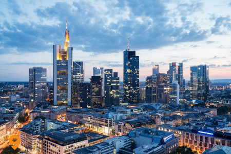
For more information visit : https://www.rmv.de/c/en/homepage
Reaching Frankfurt
By Air
Frankfurt Airport (FRA) is one of Europe’s major aviation hubs and serves as the main gateway to the city:
- Location: Approximately 12 kilometers southwest of the city center.
- S-Bahn: The most convenient way to reach downtown Frankfurt is via the S-Bahn (suburban train). Two lines connect the airport with the city center:
- S8: Runs from the airport through downtown Frankfurt to Offenbach and Hanau
- S9: Connects the airport with downtown Frankfurt and continues to Hanau
- Both lines depart from the regional train stations at Terminal 1 (Level 0) and stop at all major stations in Frankfurt including Hauptbahnhof (main station)
- Trains run every 15 minutes, and the journey to the city center takes approximately 15 minutes
- Regional Trains: Regional Express (RE) and Regional Bahn (RB) trains also connect the airport to Frankfurt Hauptbahnhof and other destinations in the region, often providing faster service than the S-Bahn.
- Long-Distance Trains: Frankfurt Airport has its own long-distance train station (Frankfurt Flughafen Fernbahnhof) with ICE high-speed connections to major German cities like Cologne, Berlin, Hamburg, and Munich.
Frankfurt-Hahn Airport is sometimes mistakenly associated with Frankfurt despite being located about 120 kilometers west of the city. If arriving at Hahn Airport, shuttle
buses connect to Frankfurt in approximately 1 hour and 45 minutes.
By Train
Frankfurt is one of Germany’s most important railway hubs:
- Frankfurt Hauptbahnhof (Main Station): One of Europe’s largest train stations, located on the western edge of the city center. It serves ICE high-speed trains, IC/EC trains, regional trains, and local S-Bahn lines, connecting Frankfurt with destinations throughout Germany and Europe.
- Frankfurt Süd (South): A significant secondary station serving southern districts and providing additional connections to long-distance and regional services.
- Frankfurt-Höchst: Important station in the western part of the city.
- Frankfurt Ost (East): Serves eastern districts with regional and S-Bahn connections.
High-speed ICE trains connect Frankfurt with major German cities:
- Berlin (4 hours)
- Hamburg (3.5 hours)
- Munich (3.5 hours)
- Cologne (1 hour)
International destinations with direct trains include:
- Amsterdam (4 hours)
- Brussels (3 hours)
- Paris (4 hours)
- Vienna (7 hours)
- Zurich (4 hours)
By Bus
Frankfurt’s central bus station (Fernbusbahnhof) is located south of the main train station:
- Long-distance coach services like FlixBus connect Frankfurt with other German and European cities.
- Upon arrival, you can easily transfer to the city’s public transportation system via the adjacent Hauptbahnhof.
By Car
Frankfurt sits at the intersection of several major autobahns:
- A3: Connects Cologne with Nuremberg and passes through the south of Frankfurt
- A5: Runs north-south between Kassel and Basel, passing west of Frankfurt
- A66: East-west connection linking Wiesbaden with Fulda via Frankfurt
- A661: North-south connection through the eastern part of the city
Public Transportation Network (RMV)
Frankfurt’s public transportation system is operated under the Rhein-Main-Verkehrsverbund (RMV), which covers not just Frankfurt but the entire Rhine-Main region including nearby cities like Offenbach, Darmstadt, Wiesbaden, and Mainz.
U-Bahn (Subway/Metro)
Frankfurt’s U-Bahn system consists of nine lines (U1-U9):
- The U-Bahn network covers the city center extensively and extends into suburbs.
- Unlike systems in other cities, Frankfurt’s U-Bahn operates partially underground (particularly in the city center) and partially at street level in outer districts.
- Trains run every 2.5 to 10 minutes during peak hours and every 10-15 minutes during off-peak times.
- Service hours are generally from 4:30 AM until around 1:30 AM, with extended hours on weekends.
Key U-Bahn lines include:
- U1, U2, U3, U8: Run north-south connecting the northern districts with the city center and southern areas
- U4, U5: Connect eastern districts with the city center and western parts
- U6, U7: Link northwestern suburbs with the center and southeastern districts
- U9: Connects the western district of Niederrad with the city center
S-Bahn (Suburban Train)
The S-Bahn network consists of nine lines (S1-S9) connecting Frankfurt with surrounding communities:
- S-Bahn trains run through the city in a tunnel system known as the “Citytunnel” with stations at Hauptbahnhof, Hauptwache, Konstablerwache, and Ostendstraße.
- Outside the central tunnel, lines branch out in all directions to serve the greater metropolitan area.
- Trains typically run every 15-30 minutes on each line, with more frequent service in the central tunnel where multiple lines converge.
Important S-Bahn lines include:
- S1, S2: Connect Wiesbaden and Niedernhausen with Frankfurt and Offenbach/Dietzenbach
- S3, S4: Link Bad Soden and Kronberg with Frankfurt and Langen/Darmstadt
- S5, S6: Connect Friedrichsdorf and Bad Homburg with Frankfurt and southern destinations
- S8, S9: Serve Frankfurt Airport and continue to Wiesbaden or Hanau
Trams (Straßenbahn)
Frankfurt’s extensive tram network complements the U-Bahn and S-Bahn systems:
- 10 tram lines numbered 11-21 (though lines 13 and 19 are not currently in service)
- Trams primarily serve areas not reached by the U-Bahn and provide finer-grained connectivity within neighborhoods
- Modern, accessible vehicles operate frequently, typically every 10 minutes during peak hours
Buses
An extensive bus network completes Frankfurt’s public transportation system:
- City Buses: Numerous lines covering all districts of Frankfurt, with particularly important connections in areas less served by rail transportation.
- Night Buses (N-lines): Operating when U-Bahn, S-Bahn, and trams are not running, primarily on weekend nights.
- Express Buses: Faster connections with fewer stops on certain routes, including the airport.
Regional Trains
Regional Express (RE) and Regional Bahn (RB) trains connect Frankfurt with towns and cities throughout the Rhine-Main region and beyond. These are fully integrated into the RMV fare system for journeys within the network area.
Additional Transportation Options
Bike Sharing
Frankfurt offers several bike-sharing options:
- Call a Bike: Deutsche Bahn’s bike-sharing service with stations throughout the city, particularly near major train stations and public transport hubs.
- nextbike: Another bike-sharing provider with numerous stations across Frankfurt.
Frankfurt has been developing its cycling infrastructure with dedicated bike lanes and paths throughout the city. The banks of the Main River feature particularly pleasant cycling routes.
E-Scooters
Several operators offer e-scooters throughout Frankfurt:
- Tier
- Lime
- Bird
- Voi
These are available through their respective apps and can be located, unlocked, and paid for via smartphone.
Car Sharing
Frankfurt has several car-sharing services:
- Share Now: Free-floating car sharing service allowing one-way trips within the service area.
- Book-n-Drive: Station-based and free-floating car sharing with a large fleet in Frankfurt.
- Stadtmobil: Station-based car sharing with designated pickup and return locations.
Transportation Apps and Websites
Official Apps
- RMV App: The official app of the Rhine-Main transport association offers comprehensive journey planning, real-time departure information, and service disruption alerts. Available in English.
- DB Navigator: Deutsche Bahn’s app works well for planning journeys that include regional and long-distance trains as well as local public transportation in Frankfurt.
- Frankfurt.de App: The city’s official app includes transportation information alongside other city services and tourist information.
Third-Party and Multi-Modal Apps
- Google Maps: Offers reliable public transportation directions in Frankfurt with real-time updates.
- Moovit: Provides detailed journey planning with real-time information and service alerts.
- Citymapper: Covers Frankfurt with excellent user interface and additional features like calorie counting for walking portions of journeys.
Useful Websites
- RMV Website (www.rmv.de): Available in English, provides comprehensive information about Frankfurt’s public transportation system, including network maps, timetables, journey planner, and service updates.
- VGF Website (www.vgf-ffm.de): The website of Frankfurt’s main transport operator, with detailed information about U-Bahn, tram, and bus services.
- Deutsche Bahn Website (www.bahn.de): For long-distance train connections to/from Frankfurt.
- Frankfurt Tourism Website (www.frankfurt-tourismus.de): Offers transportation information specifically tailored for tourists.
Navigation Tips
City Layout
Frankfurt’s layout can be understood by referring to a few key geographic features:
- Main River: Flows through the city from east to west, dividing Frankfurt into northern and southern sections.
- City Center: Located north of the river, containing the historic Altstadt (Old Town), banking district, and shopping areas.
- Hauptbahnhof (Main Station): Located on the western edge of the city center.
- Banking District: The cluster of skyscrapers in the center, often called “Mainhattan.”
- Sachsenhausen: Popular district south of the river known for its traditional apple wine taverns and cultural institutions.
Major Transit Hubs
- Hauptbahnhof (Main Station): The primary hub connecting all forms of transportation.
- Hauptwache: Central underground station where many U-Bahn and S-Bahn lines intersect, located under a main shopping area.
- Konstablerwache: Another important interchange station in the eastern part of the city center.
- Südbahnhof: Important hub in the southern part of the city.
- Höchst Bahnhof: Major station serving the western district of Frankfurt-Höchst.
English Support
Most ticket machines, digital displays, and important announcements on trains and at major stations are available in English. Station staff at larger stations typically speak English, and all official apps have English language options.
Tourist Area Coverage
Frankfurt’s main tourist attractions are well-connected by public transportation:
- Römerberg (Historic Center): Served by U-Bahn station Dom/Römer or S-Bahn stations Hauptwache or Konstablerwache.
- Museumsufer (Museum Embankment): Along the southern bank of the Main River, accessible via tram lines 15/16 or U-Bahn lines U1/U2/U3/U8 to Schweizer Platz.
- Palmengarten (Botanical Garden): Near U-Bahn stations Westend or Bockenheimer Warte.
- Frankfurt Zoo: Served by U-Bahn station Zoo or tram lines 14 and 18.
- Main Tower (Observation Deck): Near S-Bahn/U-Bahn station Taunusanlage or Hauptwache.
- Goethe House: A short walk from Hauptwache station.
- Zeil (Shopping District): Directly served by Hauptwache and Konstablerwache stations.
Day Trips from Frankfurt
The RMV network makes it easy to take day trips to nearby attractions:
- Wiesbaden: Accessible via S-Bahn lines S1, S8, and S9 or Regional trains, approximately 30-40 minutes away.
- Mainz: Served by S-Bahn lines S8 and Regional trains, about 30-40 minutes from Frankfurt.
- Darmstadt: Connected by S-Bahn line S3 or Regional trains in about 25-30 minutes.
- Heidelberg: Reachable by Regional or IC trains in about 1 hour.
- Rhine Valley: The UNESCO World Heritage Upper Middle Rhine Valley can be reached by Regional trains to Rüdesheim or Bingen in about 1 hour.
Frankfurt Card
For tourists, the Frankfurt Card combines public transportation with discounts on attractions and is available for 1-2 days.
Accessibility
Most U-Bahn and S-Bahn stations in Frankfurt are accessible for wheelchair users, with elevators or ramps. Modern trams and buses are also equipped with ramps and designated spaces for wheelchairs. The RMV app and website provide specific information about accessibility at each station and on each vehicle.
Night Service
Frankfurt offers extensive night service:
- Night Buses (N lines): Regular network of night buses operating between 1:30 AM and 4:30 AM.
- Weekend Night Service: On Friday and Saturday nights, U-Bahn and S-Bahn lines operate around the clock with reduced frequency (typically hourly).
Airport Connections
Both terminals at Frankfurt Airport are well-connected:
- Terminal 1: Has its own regional train station (Frankfurt Flughafen Regionalbahnhof) for S-Bahn and regional trains.
- Terminal 2: Connected to Terminal 1 by a free automated people mover called the Sky Line.
- Long-Distance Train Station: Frankfurt Flughafen Fernbahnhof primarily serves high-speed ICE trains and is connected to both terminals.
Frankfurt’s comprehensive and efficient public transportation system makes it easy to explore both the vibrant city center and the surrounding metropolitan region without a car. The excellent integration between different modes of transport, alongside clear signage and frequent service, makes navigation straightforward even for first-time visitors to Germany’s financial capital.

Reaching Stuttgart
By Air
Stuttgart Airport (Flughafen Stuttgart, STR) is located about 13 km south of the city center.
- S-Bahn: Take the S2 or S3 lines directly from the airport to Stuttgart Hauptbahnhof (main station). The journey takes approximately 27 minutes.
- Bus: Bus lines 122, 806, and X60 connect the airport to various parts of the city.
- Taxi/Rideshare: Available outside Terminal 1, with a journey time of about 20-30 minutes to the city center depending on traffic.
By Train
Stuttgart Hauptbahnhof is a major rail hub in southern Germany.
- High-speed ICE and IC trains connect Stuttgart with major German cities.
- International connections to Switzerland, Austria, France, and beyond.
- Upon arrival, you can transfer to local U-Bahn, S-Bahn, or bus services.
By Car
- Stuttgart is accessible via several autobahns, including A8 (Munich-Karlsruhe), A81 (Heilbronn-Singen), and A831.
- Be aware that Stuttgart has an environmental green zone (Umweltzone) requiring a special sticker for entry.
- Traffic in the city center can be challenging, especially during rush hours.
Public Transportation
U-Bahn (Stadtbahn)
Network Details:
- 16 lines (U1-U16) covering 230 km of tracks with 200+ stations
- Distinctive yellow trains that operate both underground in the city center and at street level in outer areas
- Color-coded lines on maps and station signage for easy navigation
Key Routes:
- U1: Connects Vaihingen, city center, and Bad Cannstatt
- U5/U6/U7/U12: Main lines crossing the city center
- U15: Serves Stuttgart University
Operating Hours:
- Monday to Friday: 4:30 AM to approximately 1:00 AM
- Extended hours on Friday and Saturday nights until around 2:30 AM
- Sunday service starts slightly later, around 5:30 AM
Accessibility:
- Most stations have elevators or ramps
- Level boarding is available at many stations
- Designated spaces for wheelchairs on trains
S-Bahn
Network Details:
- 7 lines (S1-S6 and S60) serving Stuttgart and the metropolitan region
- Connects outer suburbs and nearby towns with Stuttgart city center
- All lines converge at the central S-Bahn tunnel beneath the city center
Key Routes:
- S1: Kirchheim unter Teck – Stuttgart – Herrenberg
- S2: Schorndorf – Stuttgart – Airport – Filderstadt
- S3: Backnang – Stuttgart – Airport – Flughafen/Messe
- S4: Schwabstraße – Stuttgart – Marbach – Backnang
- S5: Schwabstraße – Stuttgart – Bietigheim-Bissingen
- S6: Schwabstraße – Stuttgart – Weil der Stadt
- S60: Schwabstraße – Stuttgart – Böblingen – Renningen
Operating Hours:
- Monday to Friday: 4:30 AM to 1:00 AM
- Half-hourly service on most lines, with 15-minute intervals during peak hours
- Special night service on weekends (hourly)
Accessibility:
- Most stations have elevators
- Level boarding at most platforms
- Dedicated areas for bicycles and wheelchairs
Buses
Network Details:
- Over 50 bus routes throughout the city and suburbs
- Red buses operated by SSB (Stuttgarter Straßenbahnen AG)
- Suburban routes operated by various regional companies
Key Bus Lines:
- 40/42: Circular routes around the city center
- 44: Connects Stuttgart Hauptbahnhof with Killesberg
- 70/72: Serves Mercedes-Benz Museum and Arena
- X1, X2 (Express buses): Faster connections with fewer stops
Night Buses (Nachtbus):
- Routes marked with an “N” prefix
- Operate after regular service ends
- Primary night bus hub at Schlossplatz
Frequency:
- City routes: Every 10-20 minutes during day
- Suburban routes: Every 20-30 minutes
- Night buses: Hourly service
Special Transportation Options
Zahnradbahn (Rack Railway)
- Historic rack railway line connecting Stuttgart-Süd to Degerloch
- Line 10, marked in red on transportation maps
- Steep ascent offering scenic views of the city
- Operates every 15 minutes throughout the day
- Access via Marienplatz in Stuttgart-Süd
Standseilbahn (Funicular)
- Historic funicular railway connecting Stuttgart-Süd to Waldfriedhof cemetery
- Operates every 15 minutes
- Beautiful wooden carriages from 1929
- Access via Südheimer Platz
City Bikes (RegioRad Stuttgart)
- 250+ rental stations throughout Stuttgart and region
- Download the Regiorad Stuttgart app to locate and rent bikes
- Return bikes to any station
- First 30 minutes often free with registration
Transportation Apps and Websites
Essential Apps
- VVS Mobil App
- Official app of Stuttgart’s transport authority
- DB Navigator
- Deutsche Bahn’s official app
- Useful for regional and long-distance trains
- SSB Move
- Stuttgart’s local transport company app
- Journey planning specifically for Stuttgart
- Bicycle and car-sharing integration
- Detailed station maps
- Trip duration estimates
- Moovit
- Third-party public transport app with excellent coverage
- Step-by-step navigation including walking directions
- Community updates about service disruptions
- Available in numerous languages
- Google Maps
- Comprehensive public transport integration
- Easy-to-follow directions
- Street view for visual orientation at unfamiliar stops
Useful Websites
- VVS Official Website (www.vvs.de)
- Complete timetables and network maps
- Service updates and planned construction work
- Fare information
- Available in English and German
- SSB Website (www.ssb-ag.de)
- Detailed information about city services
- Maps of specific routes
- Service changes and updates
- English language option available
- Stuttgart Tourism (www.stuttgart-tourist.de)
- Transportation information specifically for tourists
- Combination tickets for attractions and transport
- Visitor-friendly explanations of the system
Navigation Tips for Visitors
Understanding Zones
Stuttgart’s public transport uses a zone-based fare system:
- Zone 1 covers the city center
- Zones 2-4 extend outward in concentric rings
- The more zones you cross, the higher the fare
- Most tourist attractions are in zones 1-2
Useful Transport Hubs
- Hauptbahnhof (Main Station): Central hub for all S-Bahn lines, regional and long-distance trains
- Charlottenplatz: Major U-Bahn interchange with access to multiple lines
- Schlossplatz: Central square with connections to multiple U-Bahn lines
- Bad Cannstatt: Secondary hub serving eastern parts of the city


3 thoughts on “Transportation in Germany”
Comments are closed.