
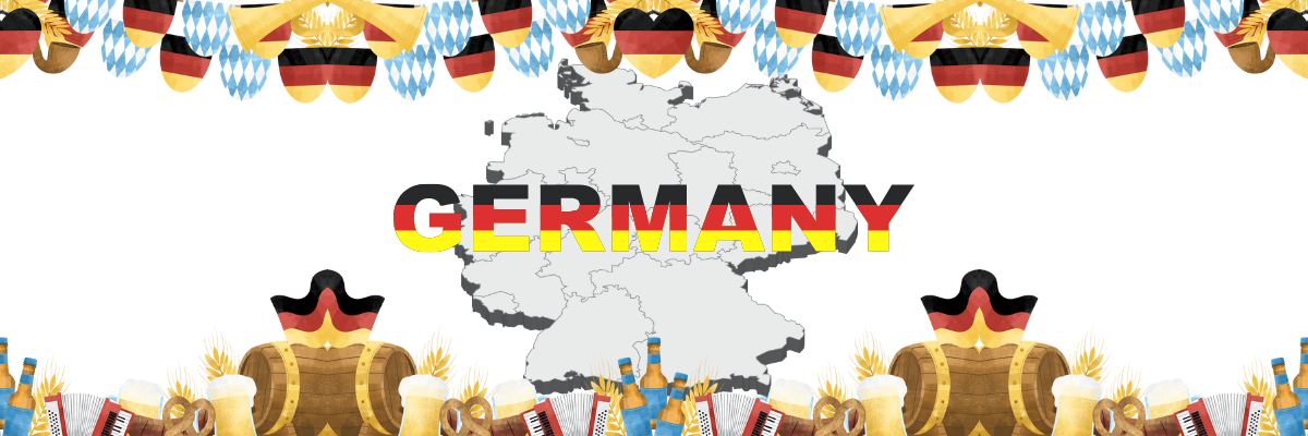
Germany offers travelers a remarkable blend of historic cities, enchanting castles, and breathtaking landscapes that attract millions of visitors each year. Any Germany travel guide will highlight the country’s exceptional mix of cultural attractions, picturesque towns, and diverse experiences that cater to every type of traveler, from history enthusiasts to outdoor adventurers.
Germany’s rich cultural heritage is reflected in its numerous museums, historic sites, and architectural marvels. The country houses over 6,000 museums, including Berlin’s Museum Island, a UNESCO World Heritage site featuring five world-class museums. Visitors can explore magnificent castles like Neuschwanstein in Bavaria, which inspired Disney’s Sleeping Beauty Castle, or wander through well-preserved medieval towns such as Rothenburg ob der Tauber with its intact city walls and half-timbered houses.
Beyond its cultural offerings, Germany boasts diverse natural environments. The Black Forest region captivates with its dense woodlands, picturesque villages, and scenic hiking trails. The Bavarian Alps provide spectacular mountain scenery with opportunities for skiing in winter and hiking in summer. Germany’s northern coastline along the Baltic and North Seas features beautiful beaches and charming seaside resorts, while the Rhine Valley enchants visitors with its vineyard-covered slopes and castle-topped hills.
Quick Facts About Germany
Geographic Information
- Full Name: Federal Republic of Germany (Bundesrepublik Deutschland)
- Capital: Berlin
- Area: 357,022 square kilometers (137,847 square miles)
- Population: Approximately 83 million people
- Bordering Countries: Germany shares borders with 9 countries:
- Denmark to the north
- Poland and Czech Republic to the east
- Austria and Switzerland to the south
- France, Luxembourg, Belgium, and the Netherlands to the west
Time Zone
- Germany operates on Central European Time (CET), which is UTC+1
- During summer, Germany observes Daylight Saving Time and switches to Central European Summer Time (CEST), which is UTC+2
Government and Politics
- Government Type: Federal parliamentary republic
- Head of State: Federal President (largely ceremonial role)
- Head of Government: Federal Chancellor
- Administrative Divisions: 16 federal states (Bundesländer)
- Currency: Euro (€)
Language and Culture
- Official Language: German
- Major Cities: Berlin, Hamburg, Munich, Cologne, Frankfurt
Geography and Environment
- Features diverse landscapes including the Alps in the south, forests, rivers, and northern coastlines along the North and Baltic Seas
- Major rivers include the Rhine, Danube, Elbe, and Main
- Highest point: Zugspitze in the Alps (2,962 meters/9,718 feet)
Best Places to Visit Germany
Berlin
Berlin captivates visitors through its remarkable fusion of history, culture, and innovation. The city offers an unparalleled museum experience with the UNESCO-listed Museum Island housing five world-class institutions. History comes alive as you trace the path of the former Berlin Wall at the East Side Gallery or stand before the Brandenburg Gate, a symbol of German reunification. Berlin’s neighborhoods each offer distinct personalities—from the hipster havens of Kreuzberg and Neukölln to the elegant boulevards of Charlottenburg. The city’s vibrant arts scene spans from classical treasures in the Gemäldegalerie to cutting-edge contemporary exhibits at the Hamburger Bahnhof. Berlin’s nightlife deserves its legendary status, with everything from underground techno clubs to sophisticated cocktail bars. Culinary adventures await at food markets like Markthalle Neun, where global flavors blend with innovative German cuisine, making Berlin an immersive destination that reveals new layers with each visit.
Brandenburg Gate

The Brandenburg Gate (Brandenburger Tor) is Berlin’s most iconic symbol, an 18th-century neoclassical monument that once marked the division between East and West Berlin. Built between 1788-1791 by Prussian King Frederick William II as a symbol of peace, this imposing structure stands 26 meters high and is topped by the Quadriga, a copper statue of a four-horse chariot driven by Victoria, the Roman goddess of victory.
The gate features 12 Doric columns, six on each side, forming five passageways. During the Cold War, it stood in the “death strip” between East and West Berlin, inaccessible to citizens from either side. After the fall of the Berlin Wall in 1989, it became a powerful symbol of German reunification. Today, it’s the site of major public celebrations, including New Year’s Eve festivities and historic political speeches. Located at Pariser Platz, it connects to the grand boulevard Unter den Linden, which leads to Museum Island.
Address and Location
The Brandenburg Gate (Brandenburger Tor) is located at: Pariser Platz, 10117 Berlin, Germany
Opening Hours
The Brandenburg Gate is a public monument accessible 24 hours a day, 7 days a week. The square surrounding it (Pariser Platz) is always open to pedestrians.
Transportation Options
S-Bahn (Suburban Train)
- S1, S2, S25, S26 – Stop at “Brandenburger Tor” station (direct access)
- From this station, it’s approximately a 2-minute walk to the Gate
U-Bahn (Underground)
- U55 – Stop at “Brandenburger Tor” station (direct access)
- U6 – Stop at “Französische Straße” station (approximately 10-minute walk)
Bus
- Bus 100 – Historical route, stops at “Brandenburger Tor”
- Bus 200 – Stops at “Brandenburger Tor”
- Bus TXL – Stops near the Brandenburg Gate
- Bus N2 (Night Bus) – Serves the area during late hours
Nearby Stops:
- Reichstag/Bundestag
- S+U Brandenburger Tor
Tram
- No direct tram connections to Brandenburg Gate, but trams connect to nearby S-Bahn and U-Bahn stations
Bicycle
- Berlin has an extensive network of bike lanes
- Several bike-sharing services available throughout the city:
- Nextbike
- Lime Bikes
- Call a Bike (operated by Deutsche Bahn)
- Numerous bicycle parking areas around Pariser Platz
By Car and Parking
Keep in mind that the immediate area around Brandenburg Gate has limited vehicular access. The closest parking options include:
- Parkhaus Brandenburger Tor (underground parking garage at Behrenstraße)
- Tiefgarage Bebelplatz (approximately 15-minute walk)
- Parkhaus Friedrichstraße (approximately 10-minute walk)
- Parkhaus Unter den Linden (approximately 7-minute walk)
Taxi/Rideshare
- Taxis are readily available throughout Berlin
- Major rideshare companies operating in Berlin:
- Uber
- FREE NOW (formerly MyTaxi)
- Bolt
Long-Distance Transportation
If arriving from outside Berlin:
- Berlin Central Station (Hauptbahnhof) – Approximately 20 minutes by public transport to Brandenburg Gate
- Berlin Brandenburg Airport (BER) – Connect via Airport Express train to central Berlin, then transfer to S-Bahn or U-Bahn
Transportation Companies
- BVG (Berliner Verkehrsbetriebe) – Operates Berlin’s buses, U-Bahn, and trams
- S-Bahn Berlin GmbH – Operates the S-Bahn network
- Deutsche Bahn – For regional and long-distance trains
- FlixBus/FlixTrain – For intercity bus and train connections
Nearby Attractions
Within walking distance of the Brandenburg Gate:
- Reichstag Building (German Parliament) – 5-minute walk
- Memorial to the Murdered Jews of Europe (Holocaust Memorial) – 3-minute walk
- Tiergarten Park – Adjacent to the Brandenburg Gate
- Unter den Linden Boulevard – Begins at the Brandenburg Gate
- Potsdamer Platz – 15-minute walk
- Madame Tussauds Berlin – 5-minute walk
- Friedrichstraße (shopping street) – 10-minute walk
- Gendarmenmarkt (historic square) – 15-minute walk
- Museum Island – 20-minute walk
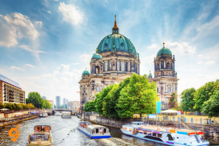
Museum Island

Museum Island (Museumsinsel) is a UNESCO World Heritage site located in the heart of Berlin on the Spree River. This cultural complex houses five world-renowned museums built between 1824 and 1930, representing a unique ensemble of museum architecture and collections:
- Pergamon Museum – Home to monumental structures like the Pergamon Altar, the Market Gate of Miletus, and the Ishtar Gate from Babylon.
- Bode Museum – Houses an extensive sculpture collection, Byzantine art, and the Coin Cabinet with over 500,000 items.
- Neues Museum – Displays the famous bust of Egyptian Queen Nefertiti, along with Egyptian, prehistoric, and early history collections.
- Alte Nationalgalerie – Features 19th-century paintings and sculptures, with a strong focus on German Romanticism and Impressionism.
- Altes Museum – Showcases the antiquities collection with Greek and Roman artifacts.
The island itself is being continuously developed under the “Masterplan Museumsinsel,” including the addition of the James Simon Gallery as a central visitor center in 2019. The museums collectively attract over 3 million visitors annually and represent one of the most significant museum complexes in the world.
Address and Location
Museum Island (Museumsinsel) is located at: Bodestraße, 10178 Berlin, Germany
The island is situated in the Spree River in central Berlin’s Mitte district. This UNESCO World Heritage site houses five world-renowned museums: the Altes Museum, Neues Museum, Alte Nationalgalerie, Bode Museum, and Pergamon Museum.
Opening Hours
Most museums on Museum Island follow these general opening hours:
- Monday: Closed (Pergamon Museum and Neues Museum are open)
- Tuesday to Sunday: 10:00 AM to 6:00 PM
- Thursday: 10:00 AM to 8:00 PM (extended hours)
However, specific opening times may vary for each museum, especially during holidays and special exhibitions. It’s advisable to check the official website of the Staatliche Museen zu Berlin for the most current information before visiting.
Transportation Options
S-Bahn (Suburban Train)
- S1, S2, S25, S5, S7, S75 – Stop at “Hackescher Markt” station (approximately 10-minute walk)
- S3, S5, S7, S9 – Stop at “Friedrichstraße” station (approximately 15-minute walk)
U-Bahn (Underground)
- U5 – Stop at “Museumsinsel” station (direct access, opened in 2021)
- U6 – Stop at “Friedrichstraße” station (approximately 15-minute walk)
Tram
- M1, M4, M5, M6 – Stop at “Hackescher Markt” (approximately 10-minute walk)
- M4, M5, M6 – Stop at “Am Kupfergraben” (very close to Museum Island)
Bus
Nearby stops:
- U Museumsinsel
- Neumannsgasse
- Staatsoper
- Berliner Schloss
Lines: 100, 30, N5, 300, 147
By Boat
A particularly scenic way to reach Museum Island is by boat:
- Several tour boat companies operate on the Spree River with stops at or near Museum Island
- Stern und Kreisschiffahrt and Reederei Riedel both offer services along the Spree with stops near Museum Island
- There’s a landing pier right at the Lustgarten next to the Altes Museum
Bicycle
- Berlin’s extensive network of bike lanes makes cycling a practical option
- Bike-sharing services available throughout Berlin:
- Nextbike
- Lime Bikes
- Call a Bike (operated by Deutsche Bahn)
- Bicycle parking areas are available around Museum Island
By Car and Parking
The area around Museum Island has restricted vehicular access, but several parking options exist nearby:
- Q-Park Alexanderplatz (approximately 15-minute walk)
- Parkhaus Radisson Blu (approximately 10-minute walk)
- Parkhaus Unter den Linden (approximately 15-minute walk)
- Parkhaus Dom Aquarée (approximately 8-minute walk)
Nearby Attractions
Within walking distance of Museum Island:
- Berlin Cathedral (Berliner Dom) – Adjacent to Museum Island
- Lustgarten – Public park in front of the Altes Museum
- Alexanderplatz – Major public square and transport hub (15-minute walk)
- Hackescher Markt – Vibrant area with shops and restaurants (10-minute walk)
- Unter den Linden Boulevard – Historic boulevard (10-minute walk)
- Nikolaiviertel – Berlin’s reconstructed historical center (8-minute walk)
- Gendarmenmarkt – Historic square with French and German Churches (15-minute walk)
- TV Tower (Fernsehturm) – Berlin’s iconic tower (15-minute walk)
- Humboldt Forum – Cultural center in the reconstructed Berlin Palace (adjacent to Museum Island)
- Brandenburg Gate – Historic landmark (25-minute walk or short public transport ride)
East Side Gallery

The East Side Gallery is the longest remaining section of the Berlin Wall, transformed into the world’s largest open-air gallery. Stretching for 1.3 kilometers along Mühlenstraße in Friedrichshain, it features over 100 colorful murals painted by artists from around the world in 1990, shortly after the fall of the Wall.
The most famous artwork is Dmitri Vrubel’s “Fraternal Kiss” depicting Soviet leader Leonid Brezhnev and East German leader Erich Honecker embracing with a kiss. Other notable works include Birgit Kinder’s “Test the Rest” showing a Trabant car breaking through the Wall, and Thierry Noir’s colorful cartoon-like faces. The gallery has been restored several times, most extensively in 2009 for the 20th anniversary of the Wall’s fall. It serves as both a memorial to the divided city and a celebration of freedom and artistic expression.
Address and Location
The East Side Gallery is located at: Mühlenstraße 3-100, 10243 Berlin, Germany
It stretches along the Spree River for approximately 1.3 kilometers between the Oberbaum Bridge (Oberbaumbrücke) and the Ostbahnhof railway station in the Friedrichshain district of Berlin.
Opening Hours
The East Side Gallery is an open-air gallery accessible 24 hours a day, 7 days a week. Since it’s essentially a preserved section of the Berlin Wall that has been transformed into an outdoor art installation, you can visit at any time. However, for the best visibility and photography conditions, daylight hours are recommended.
Transportation Options
S-Bahn (Suburban Train)
- S3, S5, S7, S9, S75- Stop at “Ostbahnhof” station (eastern end of the gallery, approximately 5-minute walk)
- S3, S5, S7, S9 – Stop at “Warschauer Straße” station (western end of the gallery, approximately 5-minute walk)
U-Bahn (Underground)
- U1, U3, U12 – Stop at “Warschauer Straße” station (western end of the gallery, approximately 5-minute walk)
- U1 – Stop at “Schlesisches Tor” station (approximately 10-minute walk to the western end)
- U5– Stop at “Ostbahnhof” station (eastern end of the gallery, approximately 5-minute walk)
Bus
Nearby Stops:
- S Ostbahnhof
- Berlin, Rummelsburger Platz
- East Side Gallery
- Tamara-Danz-Str.
Lines: 300, N40, RE1
Tram
- M10 – Stop at “Warschauer Straße” (western end of the gallery)
- M13 – Stop at “Warschauer Straße” (western end of the gallery)
By Boat
The East Side Gallery runs along the Spree River, making it accessible by boat tours:
- Several river cruise companies operate tours that pass by the East Side Gallery
- Stern und Kreisschiffahrt and Reederei Riedel both offer river cruises with views of the gallery
- Some boat tours offer hop-on-hop-off options with stops near the gallery
Bicycle
- Berlin has an excellent network of bike lanes, making cycling a convenient option
- The East Side Gallery has a dedicated bike path running parallel to it
- Bike-sharing services available throughout Berlin:
- Nextbike
- Lime Bikes
- Call a Bike (operated by Deutsche Bahn)
- Bicycle racks are available at several points along the gallery
By Car and Parking
While not the most convenient option due to limited parking, several options exist:
- Ostbahnhof Parking Garage – Located at the eastern end of the gallery
- East Side Mall Parking – Shopping center near the western end with parking facilities
- Mercedes-Benz Arena Parking – Large parking area near the western section of the gallery
- Street parking – Available on nearby streets, but often limited and with restrictions
Nearby Attractions
Within walking distance of the East Side Gallery:
- Oberbaum Bridge (Oberbaumbrücke) – Iconic double-deck bridge at the western end of the gallery
- Mercedes-Benz Arena – Major event venue adjacent to the gallery
- East Side Mall – Shopping center near the western end
- Ostbahnhof – Major railway station with shops and services
- RAW-Gelände – Alternative cultural complex with bars, clubs, and street art (10-minute walk from Warschauer Straße)
- Badeschiff – Floating swimming pool on the Spree (seasonal)
- Molecule Man – Large aluminum sculpture in the middle of the Spree River
- Treptower Park – Large park with Soviet War Memorial (20-minute walk from Ostbahnhof)
- Kreuzberg district – Vibrant neighborhood known for its alternative scene, just across the Oberbaum Bridge
- Holzmarkt – Creative village with cafés and cultural spaces along the Spree
Reichstag Building

The Reichstag Building, home to the German Parliament (Bundestag), combines historical significance with striking modern architecture. Originally constructed in 1894, it was severely damaged by a suspicious fire in 1933 that the Nazis used to consolidate power. After German reunification, the building was completely reconstructed by British architect Sir Norman Foster, featuring its distinctive glass dome that symbolizes transparency in government.
The dome offers a 360-degree view of Berlin’s cityscape and contains a mirrored cone that directs natural light into the parliamentary chamber below. Visitors can walk up spiral ramps inside the dome while learning about the parliament’s work through an audio guide. The building’s facade still bears Russian graffiti left by Soviet soldiers who captured Berlin in 1945. Visiting requires advance registration, and the rooftop restaurant offers panoramic views of the government district.
Address and Location
The Reichstag Building (Reichstagsgebäude) is located at: Platz der Republik 1, 10557 Berlin, Germany
The building houses the German Parliament (Bundestag) and is one of Berlin’s most historically significant and architecturally impressive landmarks, famous for its glass dome designed by architect Norman Foster.
Opening Hours
The Reichstag Building is open to visitors daily from 8:00 AM to 12:00 AM (midnight).
However, access to the building requires advance registration. Visitors must register online through the German Bundestag website at least 2 days before their planned visit. Spontaneous registration at the service center may be possible but is subject to availability.
For the dome and roof terrace visits:
- Last admission is at 10:00 PM
- The dome is occasionally closed for cleaning or parliamentary sessions
- Audio guides are available in multiple languages at no additional cost
Transportation Options
S-Bahn (Suburban Train)
- S1, S2, S25, S26 – Stop at “Brandenburger Tor” station (approximately 10-minute walk)
- S3, S5, S7, S9 – Stop at “Hauptbahnhof” (Berlin Central Station, approximately 15-minute walk)
U-Bahn (Underground)
- U55 – Stop at “Bundestag” station (direct access, approximately 2-minute walk)
- U5 – Connected to the U55, stops at “Bundestag” station
- U6 – Stop at “Französische Straße” station (approximately 20-minute walk)
Bus
Nearby stops:
- Reichstag/Bundestag
- Platz der Republik
Lines: 100, M41
Tram
There are no direct tram connections to the Reichstag, but trams connect to nearby S-Bahn and U-Bahn stations that serve the area.
Bicycle
- Berlin’s extensive network of bike lanes makes cycling a practical option
- The area around the Reichstag has good cycling infrastructure
- Bike-sharing services available throughout Berlin:
- Nextbike
- Lime Bikes
- Call a Bike (operated by Deutsche Bahn)
- Bicycle parking racks are available near the Reichstag Building
By Car and Parking
The immediate area around the Reichstag has restricted vehicular access. Parking options include:
- Tiefgarage Brandenburger Tor (underground parking at Brandenburg Gate, approximately 10-minute walk)
- Tiefgarage Hauptbahnhof (Berlin Central Station parking garage, approximately 15-minute walk)
- Parkhaus Dorotheenstraße (approximately 15-minute walk)
- Parkplatz Scheidemannstraße (limited space, when available)
Be aware that parking in central Berlin can be limited, and the area around government buildings often has additional security restrictions.
Nearby Attractions
Within walking distance of the Reichstag Building:
- Brandenburg Gate – Iconic landmark (approximately 10-minute walk)
- Memorial to the Murdered Jews of Europe (Holocaust Memorial) – (approximately 15-minute walk)
- Tiergarten – Berlin’s central park, directly adjacent to the Reichstag
- Chancellery Building (Bundeskanzleramt) – Office of the German Chancellor (adjacent to the Reichstag)
- Bellevue Palace – Official residence of the German President (approximately 20-minute walk through Tiergarten)
- Unter den Linden Boulevard – Historic boulevard (approximately 15-minute walk)
- Potsdamer Platz – Modern square with architecture and entertainment (approximately 25-minute walk)
- River Spree – Flows past the Reichstag, offering pleasant walking paths and boat tours
- Berlin Central Station (Hauptbahnhof) – Impressive architecture and shopping (approximately 15-minute walk)
- Futurium – Museum of the future (approximately 20-minute walk)
Tiergarten

Tiergarten is Berlin’s most popular inner-city park, covering 520 acres (210 hectares) in the heart of the city. Originally a hunting ground for Prussian kings in the 16th century, it was transformed into a public park in the 18th century and redesigned by Peter Joseph Lenné in the 19th century in the English landscape garden style.
The park features numerous monuments, including the Victory Column (Siegessäule), which was relocated here by the Nazis in 1938. In the park’s center stands the Soviet War Memorial, commemorating the 80,000 Soviet soldiers who died in the Battle of Berlin. The park contains several lakes, including the Neuer See where visitors can rent rowboats. After being nearly destroyed during World War II (trees were cut down for firewood), it was replanted in the 1950s. Today, it serves as a green oasis with numerous walking and cycling paths and is a popular spot for picnics, jogging, and relaxation.
Address and Location
Tiergarten (officially called Großer Tiergarten) is Berlin’s most popular inner-city park. It’s centrally located in the Mitte district, bordered by:
North: Spree River East: Brandenburg Gate and government district South: Potsdamer Platz and the cultural forum West: Zoological Garden and Bahnhof Zoo area
The park covers approximately 210 hectares (520 acres) and is one of the largest urban gardens in Germany. Unlike a museum or attraction with a specific address, Tiergarten has multiple entrances around its perimeter.
Opening Hours
Tiergarten is a public park that is accessible 24 hours a day, 7 days a week. There are no gates or entrance fees. However, visiting during daylight hours is recommended for safety and to fully enjoy the park’s features.
Transportation Options
S-Bahn (Suburban Train)
- S3, S5, S7, S9 – Stop at “Tiergarten” station (western side of the park)
- S1, S2, S25, S26 – Stop at “Brandenburger Tor” station (eastern edge of the park)
- S1, S2, S25, S26 – Stop at “Potsdamer Platz” station (southeastern corner)
- S3, S5, S7, S9 – Stop at “Bellevue” station (northern edge)
- S3, S5, S7, S9 – Stop at “Hauptbahnhof” (Berlin Central Station, northeast of the park)
U-Bahn (Underground)
- U5 – Stop at “Bundestag” station (eastern edge, near the Reichstag)
- U9 – Stop at “Hansaplatz” station (within the northern part of the park)
- U2 – Stop at “Potsdamer Platz” station (southeastern corner)
- U55 – Stop at “Bundestag” station (eastern edge)
Bus
Nearby Stops:
- Großer Stern
Lines: 100, 107, 106, N26,
Tram
No tram lines directly serve Tiergarten, but several connect to nearby S-Bahn and U-Bahn stations that provide access to the park.
Bicycle
Tiergarten is extremely bicycle-friendly, with numerous dedicated cycling paths throughout the park. Some options include:
- Bike-sharing services available throughout Berlin:
- Nextbike
- Lime Bikes
- Call a Bike (operated by Deutsche Bahn)
- Several bicycle rental shops are located near the western edge of the park, particularly around Zoologischer Garten
- The park has many bicycle racks and designated parking areas for bikes
- The main east-west path (Straße des 17. Juni) has a wide bicycle lane
By Car and Parking
While not the most convenient option due to limited parking and traffic in central Berlin, several parking options exist around the perimeter of Tiergarten:
- Parkhaus Brandenburger Tor (eastern edge, near Brandenburg Gate)
- Parkhaus Potsdamer Platz Arkaden (southeastern corner)
- Parkhaus Budapester Straße (western edge, near Berlin Zoo)
- Parkhaus Philharmonie (southern edge, near the Berlin Philharmonic)
- Parkplatz Scheidemannstraße (northeastern edge, near the Reichstag)
Street parking may be available on some roads bordering the park, but is typically limited, regulated, and time-restricted.
Nearby Attractions
Within or adjacent to Tiergarten:
- Berlin Zoo (Zoologischer Garten) – Located at the western edge of Tiergarten
- Siegessäule (Victory Column) – Iconic monument in the center of the park
- Reichstag Building – German Parliament building at the eastern edge
- Brandenburg Gate – Historic monument at the eastern edge
- Haus der Kulturen der Welt – Cultural center within the northern section of the park
- Schloss Bellevue – Official residence of the German Federal President (northern edge)
- Berlin Philharmonic – World-renowned concert hall at the southern edge
- Memorial to the Murdered Jews of Europe – Holocaust memorial near the southeastern corner
- Potsdamer Platz – Modern square with architecture and entertainment near the southeastern corner
- Kulturforum – Cultural complex with museums at the southern edge
- Soviet War Memorial – Located within the park
- Café am Neuen See – Popular beer garden and café within Tiergarten
- Carillon Bell Tower – 42-bell carillon within the park
- English Garden – Landscaped section within Tiergarten
- German Chancellery – Office of the German Chancellor near the eastern edge
Topography of Terror
The Topography of Terror is a documentation center located on the site of the former headquarters of the SS, Gestapo, and Reich Security Main Office during the Nazi regime (1933-1945). This open-air exhibition and indoor museum documents the systematic terror and persecution orchestrated by the Nazi regime.
The modern documentation center, opened in 2010, features a permanent exhibition detailing the rise of the Nazi party, the apparatus of terror, and the crimes committed throughout Europe. Excavated cellar rooms of the former Gestapo headquarters reveal prison cells where political opponents were tortured and interrogated. A preserved section of the Berlin Wall runs along the southern edge of the site, creating a powerful juxtaposition of two different periods of German history. With over one million visitors annually, it serves as both a memorial and an educational center focused on confronting Germany’s difficult past.
Address and Location
The Topography of Terror (Topographie des Terrors) is located at: Niederkirchnerstraße 8, 10963 Berlin, Germany
This important historical documentation center is situated on the grounds where the headquarters of the SS, the Gestapo, and the Reich Security Main Office were located during the Nazi era. It’s centrally located in Berlin, near Potsdamer Platz, in an area that was part of both East and West Berlin during the city’s division.
Opening Hours
The Topography of Terror is open daily throughout the year:
- Monday to Sunday: 10:00 AM to 8:00 PM
- The site closes earlier (6:00 PM) from October to April
- Closed on December 24, 25, and 31
- Open on all other holidays
Admission is free for all visitors, making it accessible to everyone interested in this critical period of German history.
Transportation Options
S-Bahn (Suburban Train)
- S1, S2, S25, S26 – Stop at “Potsdamer Platz” station (approximately 10-minute walk)
- S1, S2, S25, S26 – Stop at “Anhalter Bahnhof” station (approximately 10-minute walk)
U-Bahn (Underground)
- U6 – Stop at “Kochstraße” station (approximately 5-minute walk)
- U2 – Stop at “Potsdamer Platz” station (approximately 10-minute walk)
- U2 – Stop at “Mohrenstraße” station (approximately 12-minute walk)
Bus
Nearby Stop:
- Abgeordnetenhaus
- S Anhalter Bahnhof
- S+U Potsdamer Platz Bhf
Lines: M41
By Car and Parking
While not the most convenient option due to limited parking in central Berlin, several options exist:
- Parkhaus Mall of Berlin at Leipziger Platz (approximately 10-minute walk)
- Parkhaus Potsdamer Platz Arkaden (approximately 12-minute walk)
- Parkhaus Bundesrat on Leipziger Straße (approximately 8-minute walk)
- Limited street parking is available on surrounding streets, but is typically regulated and time-restricted
Nearby Attractions
Within walking distance of the Topography of Terror:
- Berlin Wall Remnant – A preserved section of the Berlin Wall runs along the eastern edge of the site
- Checkpoint Charlie – Famous Cold War border crossing (approximately 7-minute walk)
- Potsdamer Platz – Modern square with architecture and entertainment (approximately 10-minute walk)
- Martin-Gropius-Bau – Exhibition hall for art and cultural history (adjacent to the site)
- Jewish Museum Berlin – Major museum of Jewish history (approximately 15-minute walk)
- Bundesrat (Federal Council) – One of Germany’s legislative bodies (approximately 8-minute walk)
- Mall of Berlin – Large shopping mall at Leipziger Platz (approximately 10-minute walk)
- Kulturforum – Cultural complex with museums including the Gemäldegalerie (approximately 15-minute walk)
- Niederkirchnerstraße – Street named after resistance fighter Käthe Niederkirchner
- Berlin Story Bunker – Museum about Berlin history in an actual WWII bunker (approximately 15-minute walk)
The Holocaust Memorial
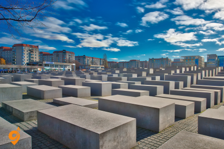
The Memorial to the Murdered Jews of Europe, commonly known as the Holocaust Memorial, is a sobering monument designed by architect Peter Eisenman and opened in 2005. Located near the Brandenburg Gate, it consists of 2,711 concrete slabs (stelae) of varying heights arranged in a grid pattern over 19,000 square meters.
The undulating ground and varying heights of the slabs create a wave-like form, producing a sense of disorientation and unease as visitors walk through the labyrinth-like structure. Beneath the memorial is an information center that documents the persecution and extermination of European Jews through personal stories, photographs, and film footage. The abstract design is open to interpretation, inviting visitors to reflect on the magnitude and horror of the Holocaust in their own way. It stands as Germany’s central memorial to the six million Jewish victims of Nazi genocide.
Address and Location
The Holocaust Memorial, officially named “Memorial to the Murdered Jews of Europe” (Denkmal für die ermordeten Juden Europas), is located at:
Cora-Berliner-Straße 1, 10117 Berlin, Germany
This significant memorial occupies an entire city block (19,000 square meters) between Potsdamer Platz and the Brandenburg Gate in central Berlin. The memorial consists of 2,711 concrete slabs or “stelae” arranged in a grid pattern on a sloping field, with an underground information center beneath.
Opening Hours
The memorial site itself (the field of stelae) is accessible 24 hours a day, seven days a week, as it’s an open-air installation with no gates or barriers.
The Information Center beneath the memorial has the following hours:
- April to September: Tuesday to Sunday, 10:00 AM to 8:00 PM
- October to March: Tuesday to Sunday, 10:00 AM to 7:00 PM
- Closed on Mondays
- Last admission is 45 minutes before closing time
- Closed on December 24-26, December 31, and January 1
Public Transportation
S-Bahn (Suburban Train)
- S1, S2, S25, S26 – Stop at “Brandenburger Tor” station (approximately 5-minute walk)
- S1, S2, S25, S26 – Stop at “Potsdamer Platz” station (approximately 10-minute walk)
U-Bahn (Underground)
- U5 – Stop at “Brandenburger Tor” station (approximately 5-minute walk)
- U2 – Stop at “Potsdamer Platz” station (approximately 10-minute walk)
- U6 – Stop at “Französische Straße” station (approximately 12-minute walk)
Bus
Nearby Stops:
- S Potsdamer Platz Bhf/Voßstr.
- /Wilhelmstr.
- S+U Potsdamer Platz Bhf
Lines: M41, M42, 300, 200, M85, N2, M48
By car and Parking
While not the most convenient option due to limited parking in central Berlin, several options exist:
- Parkhaus Brandenburger Tor (underground parking at Brandenburg Gate, approximately 7-minute walk)
- Parkhaus Potsdamer Platz Arkaden (approximately 10-minute walk)
- Parkhaus Mall of Berlin (approximately 12-minute walk)
- Parkhaus Unter den Linden (approximately 10-minute walk)
Street parking in the immediate vicinity is extremely limited and typically restricted due to the sensitive governmental and memorial nature of the area.
Nearby Attractions
Within walking distance of the Holocaust Memorial:
- Brandenburg Gate – Iconic Berlin landmark (approximately 5-minute walk)
- Reichstag Building – German Parliament building with glass dome (approximately 10-minute walk)
- Potsdamer Platz – Modern square with architecture and entertainment (approximately 10-minute walk)
- Tiergarten – Berlin’s large central park (approximately 10-minute walk)
- Unter den Linden Boulevard – Historic boulevard leading to Museum Island (begins approximately 7-minute walk)
- Pariser Platz – Square in front of the Brandenburg Gate (approximately 5-minute walk)
- Madame Tussauds Berlin – Wax museum (approximately 7-minute walk)
- Legoland Discovery Centre Berlin – Near Potsdamer Platz (approximately 12-minute walk)
- Soviet War Memorial – In Tiergarten (approximately 15-minute walk)
- Bundesrat – Federal Council building (approximately 12-minute walk)
- Memorial to Homosexuals Persecuted Under Nazism – In Tiergarten (approximately 15-minute walk)
- Memorial to the Sinti and Roma Victims of National Socialism – In Tiergarten (approximately 12-minute walk)
- Topography of Terror – Documentation center on the site of former SS headquarters (approximately 20-minute walk)
Memorial of the Berlin Wall

The Berlin Wall Memorial (Gedenkstätte Berliner Mauer) on Bernauer Straße is the central memorial site of German division. This preserved section showcases the original “death strip” complete with watchtowers, anti-vehicle trenches, and other border fortifications across 1.4 kilometers.
The memorial includes the Documentation Center, which offers insights into the history of Berlin’s division through multimedia exhibits. The Chapel of Reconciliation stands where a church once stood before being demolished to make way for the border installations. The Window of Remembrance honors those who died attempting to cross the Wall. A preserved guard tower allows visitors to understand the perspective of border guards. The site features both preserved original sections and symbolic steel rods marking where the Wall once stood, providing a comprehensive understanding of the physical and psychological impact of the divided city.
Address and Location
The Berlin Wall Memorial is located at:
- Bernauer Straße 111, 13355 Berlin, Germany
- The memorial stretches along Bernauer Straße between Nordbahnhof and Mauerpark
Opening Hours
- Documentation Center and Visitor Center: Tuesday to Sunday, 10:00 AM to 6:00 PM
- Outdoor Memorial Grounds: Open daily, 24 hours
- Chapel of Reconciliation: Tuesday to Sunday, 10:00 AM to 5:00 PM
- Closed on: January 1, December 24, December 31
Public Transportation
S-Bahn (City Rail):
- S1, S2, S25, S26 to Nordbahnhof station (main entrance)
- The memorial is directly accessible from the station
U-Bahn (Subway):
- U8 to Bernauer Straße station (5-minute walk to the memorial)
Tram:
- M10 tram to Nordbahnhof or Bernauer Straße
- M8 tram to Bernauer Straße
Bus:
Nearby Stops:
- S Nordbahnhof/Gartenstr.
Lines: S41, S42, 247
By Car
Nearby Parking:
- Q-Park Nordbahnhof (Invalidenstraße 51)
- Street parking on surrounding streets (note that parking can be limited)
- Paid parking at Mauerpark on weekends
Navigation Address:
- Set your GPS to “Bernauer Straße 111, 13355 Berlin”
Nearby Attractions
Within Walking Distance:
- Mauerpark (5-minute walk) – Famous for its Sunday flea market and karaoke
- Nordbahnhof Station (historic ghost station during Berlin Wall era)
- Gedenkstätte Günter Litfin (memorial site, 10-minute walk)
- Bornholmer Straße (where the wall first opened in 1989, 15-minute walk)
Short Transit Ride Away:
- Alexanderplatz (3 stops on S-Bahn from Nordbahnhof)
- Museum Island (4 stops on S-Bahn)
- Brandenburg Gate (5 stops on S-Bahn)
- Checkpoint Charlie (15 minutes by public transport)
- East Side Gallery (another preserved section of the Berlin Wall, 20 minutes by public transport)
Munich
Munich perfectly balances Bavarian traditions with cosmopolitan sophistication. The city’s historic center revolves around Marienplatz, where the neo-Gothic New Town Hall performs its famous Glockenspiel show daily. Munich embraces its beer heritage most visibly during Oktoberfest but year-round in historic beer halls like the Hofbräuhaus, where visitors experience authentic Bavarian hospitality. The city offers cultural riches through institutions like the Alte Pinakothek and Deutsches Museum, Europe’s largest science and technology museum. Munich’s extensive English Garden provides an urban oasis larger than New York’s Central Park, complete with beer gardens and even surfing opportunities on a standing wave in the Eisbach stream. Day trips from Munich lead to stunning Alpine landscapes and fairytale castles, making it an ideal base for exploring southern Germany’s natural and architectural wonders.
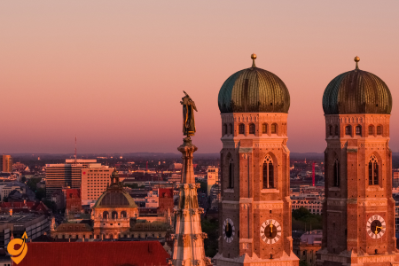
Marienplatz

Marienplatz forms the vibrant heart of Munich’s old town and has been the city’s main square since 1158. Dominated by the Neo-Gothic New Town Hall (Neues Rathaus), the square captivates visitors with its ornate architecture and the famous Glockenspiel clock tower. This mechanical marvel performs daily at 11 a.m., 12 p.m., and 5 p.m. (summer only), with 43 bells and 32 life-sized figures reenacting historical Bavarian events including a royal wedding and the coopers’ dance.
The square is named after the Mariensäule (Mary’s Column), erected in 1638 to celebrate the end of Swedish occupation during the Thirty Years’ War. The golden statue of the Virgin Mary sits atop a tall column surrounded by four putti figures fighting different creatures that symbolize hunger, war, plague, and heresy. During December, Marienplatz transforms into a magical Christmas market filled with wooden stalls selling traditional crafts, mulled wine, and seasonal treats. The square connects to major shopping streets and serves as a gathering place for locals and tourists alike.
Address and Location
- Address: Marienplatz, 80331 Munich, Germany
- Geographic position: City center of Munich (Altstadt-Lehel district)
Opening Hours
As Marienplatz is a public square, it is open 24 hours a day, 7 days a week. However, individual attractions at the square have specific opening hours:
- New Town Hall (Neues Rathaus):
- Monday to Friday: 7:30 AM – 7:00 PM
- Tourist access to the tower: 10:00 AM – 7:00 PM (April to October)
- Tourist access to the tower: 10:00 AM – 5:00 PM (November to March)
- The Glockenspiel (famous clock performance):
- Daily at 11:00 AM and 12:00 PM
- Additional show at 5:00 PM (March to October)
- Tourist Information Center:
- Monday to Saturday: 9:30 AM – 7:30 PM
- Sunday: 10:00 AM – 6:00 PM
Public Transportation
S-Bahn (Suburban Railway)
- Marienplatz Station (S1, S2, S3, S4, S5, S6, S8)
- Direct connection to Munich Airport via S1 and S8 lines
- Trains run approximately every 2-5 minutes during peak hours
- The station is directly underneath Marienplatz
U-Bahn (Subway/Metro)
- Marienplatz Station (U3, U6)
- Trains run approximately every 5 minutes
- The station connects directly to the square via underground passages
Tram
- Nearest tram stops:
- Theatinerstraße (Lines 19)
- Tal (Lines 21, 19, N19)
- Both are about 5-7 minutes walking distance from Marienplatz
Bus
Nearby Stops:
- -Jakobs-Platz
- Viktualienmarkt
- Marienplatz (Rindermarkt) – München
- Karlsplatz (Stachus)
Lines: 52, 62, N40, N45,
Transportation Companies
- MVG (Münchner Verkehrsgesellschaft) – Munich’s main public transport operator
- MVV (Münchner Verkehrs- und Tarifverbund) – The transportation association for the Munich metropolitan area
- Deutsche Bahn – Operates the S-Bahn system
Driving and Parking
Nearby Parking Garages
- Parking Garage Tal (Tal 26, 80331 Munich)
- About 5 minutes walking distance
- Approximately 800 spaces
- Parking Garage Rindermarkt (Rindermarkt 16, 80331 Munich)
- About 3 minutes walking distance
- Approximately 200 spaces
- Parking Garage Oberanger (Oberanger 27, 80331 Munich)
- About 7 minutes walking distance
- Approximately 240 spaces
- Hofbräuhaus Parking (Am Platzl 1, 80331 Munich)
- About 5 minutes walking distance
- Approximately 200 spaces
Park & Ride
- Several Park & Ride facilities at outer S-Bahn and U-Bahn stations:
- Fröttmaning (U6)
- Kieferngarten (U6)
- Messestadt Ost (U2)
- Fürstenried West (U3)
By Bicycle
- Multiple bike stands around Marienplatz
- Munich has an extensive network of bicycle paths
- MVG Rad (bike sharing) stations can be found throughout the city center
Nearby Attractions (Walking Distance)
Immediate Vicinity (1-5 minute walk)
- Old Town Hall (Altes Rathaus)
- St. Peter’s Church (Peterskirche) – oldest church in Munich
- Viktualienmarkt – famous food market
- Mariensäule – Column of St. Mary in the center of the square
- New Town Hall (Neues Rathaus) with the famous Glockenspiel
Short Walk (5-10 minutes)
- Frauenkirche (Cathedral of Our Lady) – Munich’s iconic cathedral
- Hofbräuhaus – world-famous beer hall
- Residenz – former royal palace of the Bavarian monarchs
- Odeonsplatz – another important square
- Englischer Garten (entrance) – one of the world’s largest urban parks
Englischer Garten

The Englischer Garten (English Garden) is one of the world’s largest urban public parks, stretching over 910 acres—larger than New York’s Central Park. Created in 1789 by Sir Benjamin Thompson, it combines English landscape design principles with traditional Bavarian elements. The park features winding streams, artificial lakes, meadows, and hillocks creating diverse natural environments.
One of its most unusual attractions is the Eisbach wave, where river surfers ride a standing wave year-round, even in winter. The park houses several beer gardens, including the second-largest in Munich at the Chinese Tower (Chinesischer Turm), which can seat up to 7,000 people beneath its 25-meter wooden pagoda. Other notable structures include the Monopteros, a Greek-style temple on a hill offering panoramic city views, and the Japanese Teahouse, where traditional ceremonies are performed regularly. The northern section remains more natural and less crowded, offering quiet meadows where locals sunbathe (sometimes in the nude, as is traditional in parts of German parks).
Address and Location
The Englischer Garten doesn’t have a single address since it spans a large area, but here are some key coordinates:
- Main section: Englischer Garten, 80538 Munich, Germany
- Southern entrance (closest to city center): Prinzregentenstraße near Haus der Kunst
- Northern section: Extends to Freimann district
- Geographic position: Northeast of Munich’s city center, stretching from the city center to the northeastern city limits
Understanding the Layout
The Englischer Garten is divided into two main sections:
- Southern section: The more urban part between Prinzregentenstraße and Mittlerer Ring
- Northern section: The larger, more natural area extending from Mittlerer Ring to the northern city boundary
Knowing which part you want to visit helps determine the best transportation method.
Opening Hours
As a public park, the Englischer Garten is open 24 hours a day, 7 days a week, year-round. However, individual attractions within the park have specific hours:
- Beer Gardens:
- Chinese Tower (Chinesischer Turm): 10:00 AM – 11:00 PM (weather permitting)
- Seehaus: 10:00 AM – 11:00 PM (weather permitting)
- Hirschau: 11:00 AM – 11:00 PM (weather permitting)
- Aumeister: 10:00 AM – 11:00 PM (weather permitting)
- Monopteros (Greek-style temple): Always accessible, but best visited during daylight hours
- Japanese Teahouse: Open for tea ceremonies on specific days
- Wednesday and Saturday: 2:00 PM – 5:00 PM
- Tea ceremonies require advance registration
Public Transportation
U-Bahn (Subway/Metro)
For the Southern Section:
- Universität (U3, U6): Provides access to the western edge of the southern section
- Giselastraße (U3, U6): Located near the southwestern entrance
- Lehel (U4, U5): About 10-minute walk to the southern entrance near Haus der Kunst
For the Northern Section:
- Dietlindenstraße (U6): Access to western edge of the central part
- Studentenstadt (U6): Northern area of the park
- Freimann (U6): For the northernmost sections
Tram
- Tivolistraße (Tram 16): Eastern edge of the southern section
- Paradiesstraße (Tram 16): Eastern side of the garden
- Potsdamer Straße (Tram 16): Northeast section
- Nordfriedhof (Tram 23): Northwestern edge
- Münchner Freiheit (Tram 23, 27, 28): Western access point
Bus
Neraby Stops:
- Georgenstraße
- Universität
- Von-der-Tann-Straße – München
- Königinstraße
Lines: 65, 154, N40, N41, N45, 153, 100, 58
S-Bahn (Suburban Railway)
- Isartor (S1-S8): About a 15-minute walk to the southern entrance
- Tiergarten (S1, S2, S3, S4,S5, S6, S8): Northern section
Driving and Parking
Nearby Parking Areas
For the Southern Section:
- Parkharfe (large parking area at Haus der Kunst): Prinzregentenstraße, 80538 Munich
- Approximately 150 spaces
- Direct access to southern entrance
- Von-der-Tann-Straße: Street parking (limited) near the southwestern edge
- Tivolistraße parking: Eastern edge of the garden
- Approximately 100 spaces
For the Northern Section:
- Parking at Aumeister: Hirschau 1, 80939 Munich
- Approximately 80 spaces
- Access to the northern part
- Parking at Chinese Tower: Englischer Garten 3, 80538 Munich
- Approximately 100 spaces
- Central location in the garden
Key Attractions Within the Park
- Monopteros: A Greek-style temple on a hill offering panoramic views of Munich
- Chinese Tower (Chinesischer Turm): Famous beer garden with traditional Bavarian brass band performances
- Kleinhesseloher See: Lake with boat rentals and the Seehaus beer garden
- Eisbach Wave: Famous urban surfing spot at the southern entrance
- Japanese Teahouse: Authentic teahouse on an artificial island
- Schönfeldwiese: Meadow where sunbathing (including nude sunbathing in designated areas) is permitted
- Hirschau and Aumeister: Historic buildings with beer gardens in the northern section
- Rumfordschlössl: Historic building in the northern part
Nearby Attractions
- Haus der Kunst: Modern art museum at the southern entrance
- Bavarian National Museum: Just south of the garden on Prinzregentenstraße
- Hofgarten: Formal garden adjacent to the southwestern corner
- Residenz: Former royal palace, a short walk from the southwestern entrance
- Schwabing district: Bohemian quarter along the western edge
- Maxvorstadt: Cultural district with museums near the southwestern corner
BMW Welt and Museum

BMW Welt (World) and Museum create an architectural and automotive wonderland near Munich’s Olympic Park. BMW Welt, designed by Wolf D. Prix, is a futuristic glass-and-steel structure that serves as the automaker’s delivery center and brand experience. The building’s double cone design and sweeping roof create a dramatic visual statement about technological innovation.
Adjacent to it, the BMW Museum resembles a silver bowl and offers a comprehensive journey through the company’s history since its founding in 1916. The museum displays over 125 of BMW’s most valuable and attractive automobiles, motorcycles, and engines in chronologically arranged exhibits. Visitors can explore the evolution of BMW design philosophy, engineering achievements, and racing heritage. Interactive exhibits allow guests to experience the manufacturing process and future mobility concepts. Together, these facilities attract around 3 million visitors annually, making them one of Munich’s most popular attractions beyond traditional historical sites.
Address and Location
BMW Welt (BMW World)
- Address: Am Olympiapark 1, 80809 Munich, Germany
BMW Museum
- Address: Am Olympiapark 2, 80809 Munich, Germany
BMW Group Headquarters (The iconic “Four-Cylinder” building)
- Address: Petuelring 130, 80809 Munich, Germany
All three facilities are located adjacent to each other in the northern part of Munich, near the Olympic Park (Olympiapark). The area is well-connected to the city’s transportation network, making it easily accessible regardless of your preferred mode of transportation.
Opening Hours
BMW Welt
- Monday to Saturday: 7:30 AM – 7:00 PM
- Sunday and public holidays: 9:00 AM – 7:00 PM
- Restaurant hours may vary
BMW Museum
- Tuesday to Sunday: 10:00 AM – 6:00 PM
- Closed on Mondays
- Last admission: 5:30 PM
BMW Plant Tours (advance booking required)
- Monday to Friday: Various timeslots (typically 8:30 AM, 11:30 AM, and 2:00 PM)
- Tours last approximately 2.5 hours
- No tours on weekends and public holidays
Note: Opening hours may change during holidays or special events. It’s recommended to check the official BMW Welt website before your visit.
Public Transportation
U-Bahn (Subway/Metro)
The most convenient and direct way to reach the BMW facilities is via the U-Bahn:
- Station: Olympiazentrum (U2, U3)
- This station is the primary access point for BMW Welt and Museum
- Exit the station and follow the signs to “BMW Welt” (approximately 5-minute walk)
- The U3 line connects directly to the city center (Marienplatz) and Munich Central Station (Hauptbahnhof)
- Trains run approximately every 5-10 minutes
Bus
Nearby Stops:
- Olympiapark Eissportstadion – München
- Olympiazentrum
- Helene-Mayer-Ring
Lines: 173, N76, 180
Tram
- Tram Line 20 and 21: Stop at “Olympiapark West,” approximately a 10-minute walk to BMW Welt
- Tram Line 27: Stops at “Petuelring,” close to the BMW Headquarters
S-Bahn (Suburban Railway)
While there is no S-Bahn station directly at BMW Welt, you can use:
- Olympiastadion (S1, S2, S3, S4, S6, S7, S8): During special events only
- For regular visits, take the S-Bahn to Hauptbahnhof (Central Station) and transfer to U3
Driving and Parking
Dedicated BMW Parking
BMW Welt Underground Parking
- Address: Am Olympiapark 1, 80809 Munich
- Capacity: Approximately 600 spaces
- Direct underground access to BMW Welt
- The entrance is on the north side of the building
BMW Museum Parking
- Address: Am Olympiapark 2, 80809 Munich
- Capacity: Approximately 300 spaces
- The entrance is near the BMW Museum
Nearby Alternative Parking
- Olympiapark Parkharfe (Olympic Park Parking)
- Address: Spiridon-Louis-Ring, 80809 Munich
- Capacity: Over 3,000 spaces
- Approximately 10-minute walk to BMW Welt
- Olympia-Eissportzentrum Parking (Olympic Ice Sport Center)
- Address: Willi-Daume-Platz 1, 80809 Munich
- Capacity: Approximately 400 spaces
- About 10-15 minute walk to BMW Welt
From the Autobahn
- From A9: Exit at “München-Schwabing” or “Olympiapark”
- From A8: Connect to A99 ring road, then to A9, exit at “München-Schwabing”
- From A96: Connect to Mittlerer Ring (B2R), follow signs to “Olympiapark/BMW”
On Foot
- From Olympiapark: A pleasant 10-15 minute walk through the park
- From the Olympic Village (Olympisches Dorf): Approximately 15-20 minute walk
- From Olympia Shopping Center: About 15-minute walk
Nearby Attractions
Immediate Vicinity (5-10 minute walk)
- Olympic Park (Olympiapark): Site of the 1972 Summer Olympics
- Olympic Tower (Olympiaturm): Observation deck with panoramic views of Munich
- Sea Life Munich: Aquarium in the Olympic Park
- Olympic Stadium (Olympiastadion): Historic stadium from the 1972 Olympics
- Olympic Swimming Hall (Olympia-Schwimmhalle): Olympic swimming venue
Short Distance (10-20 minute walk or one U-Bahn stop)
- Olympia Shopping Center: Large shopping mall
- Olympic Village (Olympisches Dorf): Residential area originally built for the 1972 Olympics
- Nymphenburg Canal: Linear park connecting to Nymphenburg Palace
- Luitpoldpark: Beautiful public park to the north
A Few U-Bahn Stops Away
- Schwabing: Bohemian district with cafés and shops (2-3 stops on U3)
- English Garden (Englischer Garten): Large public park (U3 + U6)
- Munich Central Station (Hauptbahnhof): Major transportation hub (direct on U3)
- Marienplatz: Munich’s central square (direct on U3)
Nymphenburg Palace

Nymphenburg Palace (Schloss Nymphenburg) is a magnificent Baroque palace that served as the summer residence of Bavarian rulers. Construction began in 1664 to celebrate the birth of Max Emanuel, heir to the throne, and expanded over generations to become one of Europe’s largest royal palaces. The central pavilion connects to expansive wings that stretch across 2,000 feet (600 meters), creating an impressive facade.
Inside, visitors can explore lavishly decorated state rooms, including the ornate Great Hall with ceiling frescoes by Johann Baptist Zimmermann, and the Gallery of Beauties commissioned by King Ludwig I to display portraits of 36 beautiful women from all social classes. The palace grounds feature a 490-acre park designed in both French formal and English landscape styles, with pavilions including the Amalienburg hunting lodge, arguably the finest example of Rococo architecture in Germany. The palace complex also houses several museums, including the Marstallmuseum displaying royal carriages and the Museum of Nymphenburg Porcelain, showcasing the famous porcelain that has been produced on-site since 1747.
Address and Location
- Full Address: Schloss Nymphenburg 1, 80638 Munich, Germany
- Geographic position: Located in the western part of Munich in the Neuhausen-Nymphenburg district
- Context: Originally a summer residence of the Bavarian rulers of the House of Wittelsbach
Opening Hours
Palace (Main Building)
- April 1 to October 15:
- 9:00 AM – 6:00 PM (daily)
- October 16 to March 31:
- 10:00 AM – 4:00 PM (daily)
- Closed on: January 1, Shrove Tuesday (Faschingsdienstag), December 24, 25, and 31
Park Palaces (Amalienburg, Badenburg, Pagodenburg, Magdalenenklause)
- April 1 to October 15:
- 9:00 AM – 6:00 PM (daily)
- October 16 to March 31:
- Closed
Palace Park/Gardens
- April to September: 6:00 AM – 9:30 PM
- October to March: 6:00 AM – 6:00 PM
- The park is open year-round and is free to access
Marstallmuseum (Carriage Museum) and Porcelain Collection
- Same hours as the main palace
Palace Complex Layout
The Nymphenburg complex is extensive and includes:
- Main Palace (Central building with state rooms)
- Palace Park (200 hectares of landscaped gardens)
- Amalienburg (Hunting lodge in the gardens)
- Badenburg (Bathing house pavilion)
- Pagodenburg (Chinese-style pavilion)
- Magdalenenklause (Artificial hermitage/ruin)
- Marstallmuseum (Carriage Museum in the former stables)
- Porcelain Museum (Museum of Nymphenburg porcelain)
Public Transportation
Tram – Most Direct Option
- Tram 17 – Stops directly at “Schloss Nymphenburg” station
- Departs from Munich city center (Karlsplatz/Stachus)
- Frequency: Every 10 minutes during the day
- Travel time from city center: Approximately 20 minutes
- The tram stop is located right in front of the palace grounds
Bus
Nearby Stops:
- Schloss Nymphenburg
Lines: 51, 151, N78
U-Bahn (Metro) + Short Walk/Bus Connection
- Rotkreuzplatz (U1, U7)
- About a 15-minute walk to the palace or connect to Tram 12 or 17
- Gern (U1, U7)
- About a 20-minute walk to the north side of the palace grounds
S-Bahn (Suburban Railway) + Connection
- Laim (S1, S2, S3, S4, S5, S6, S8)
- Connect to Bus 51 to Schloss Nymphenburg
- Travel time: Approximately 15 minutes total
- Hirschgarten (S1, S2, S3, S4, S5, S6, S8)
- About a 25-minute walk through Hirschgarten park or connect to Bus 51
Driving and Parking
Palace Parking Areas
- Main Palace Parking (Schloss Nymphenburg)
- Address: Schloss Nymphenburg 1, 80638 Munich
- Located directly in front of the palace
- Approximately 100 spaces
- Often full during peak tourist season and weekends
- Botanical Garden Parking (adjacent to the palace)
- Address: Menzinger Straße 65, 80638 Munich
- Approximately 200 spaces
- 5-minute walk to the palace entrance
Street Parking
- Limited street parking available on:
- Maria-Ward-Straße
- Menzinger Straße
- Nördliche Auffahrtsallee
Driving Directions
- From A8 (west): Exit at “München-Obermenzing,” follow signs to “Schloss Nymphenburg”
- From A9 (north): Exit at “München-Schwabing,” continue to Mittlerer Ring, then follow signs
- From A96: Exit at “München-Blumenau,” follow signs to “Schloss Nymphenburg”
- From Munich city center: Follow Arnulfstraße west, then Nymphenburger Straße all the way to the palace
Nearby Attractions
Immediate Vicinity (Within walking distance)
- Botanischer Garten (Botanical Garden) – Adjacent to the palace grounds
- Features extensive greenhouses and plant collections
- Has its own entrance fee separate from the palace
- Museum Mensch und Natur (Museum of Man and Nature)
- Located in the north wing of the palace
- Natural history museum with interactive exhibits
- Hirschgarten (Deer Park)
- Large park with restaurant and beer garden
- About a 15-minute walk from the palace
- Nymphenburg Canal
- Extends from the palace approximately 2 km eastward toward the city center
- Scenic walking path along both sides
Viktualienmarkt

Viktualienmarkt evolved from a simple farmers’ market to Munich’s premier gourmet food destination. Established in 1807 when it outgrew the Marienplatz, this daily market now covers 22,000 square meters with over 140 stalls and shops offering fresh produce, exotic fruits, cheeses, spices, and Bavarian specialties. The market’s name derives from the Latin word “victualia,” meaning “provisions.”
At its center stands a traditional maypole (Maibaum) decorated with figures representing local crafts and trades. The market’s beer garden operates under a unique Munich tradition—it rotates through the city’s major breweries, serving a different Munich beer every six weeks. Surrounding the central area are specialized shops in permanent structures, many run by the same families for generations, selling everything from game and poultry to flowers, honey, and tea. Unlike typical tourist attractions, Viktualienmarkt remains primarily a working market where locals shop daily for fresh ingredients, though visitors can enjoy Bavarian delicacies like Weisswurst (white sausage), pretzels, and fresh-pressed juices while experiencing authentic Munich daily life.
Address and Location
- Official Address: Viktualienmarkt 3, 80331 Munich, Germany
- Geographic position: City center of Munich, in the Altstadt-Lehel district
- Notable landmark: The market is situated just east of Marienplatz (Munich’s central square)
- Size: Approximately 22,000 square meters (240,000 sq ft) with over 140 stalls and shops
Opening Hours
Viktualienmarkt is open six days a week with consistent hours:
- Monday to Saturday: 8:00 AM – 8:00 PM
- Some individual stalls may open earlier (from 7:00 AM)
- Some stalls (particularly food service) may close later (until 10:00 PM)
- Flower Market: 8:00 AM – 8:00 PM (Monday to Saturday)
- Beer Garden: 9:00 AM – 10:00 PM (Weather permitting, Monday to Saturday)
- Closed on Sundays and public holidays
- Special Events: The market occasionally hosts seasonal events, festivals, and celebrations that may have extended hours
Market Layout and Sections
Viktualienmarkt is organized into distinct sections:
- Central Beer Garden: Located in the middle of the market under chestnut trees
- Flower Market: Northeastern section, colorful display of fresh flowers
- Fresh Produce: Throughout the market, with seasonal fruits and vegetables
- Delicatessen Shops: Specialty foods, spices, oils, and gourmet items
- Butchers and Fishmongers: High-quality fresh meats and seafood
- Cheese Vendors: Wide selection of local and international cheeses
- Bakeries: Fresh breads and pastries
- Food Stalls/Imbiss: Ready-to-eat food offerings and snacks
Public Transportation
U-Bahn (Subway/Metro)
The most convenient way to reach Viktualienmarkt:
- Marienplatz Station (U3, U6)
- Exit the station and walk eastward for approximately 3 minutes
- Follow signs to “Viktualienmarkt”
- Trains run approximately every 5 minutes during the day
- Isartor Station (U4, U5)
- About a 7-minute walk to the market
- Walk west along Tal street toward the city center
S-Bahn (Suburban Railway)
- Marienplatz Station (S1, S2, S3, S4, S6, S5, S8)
- Same exit as the U-Bahn station mentioned above
- Direct connection to Munich Airport via S1 and S8 lines
- Trains run approximately every 2-5 minutes during peak hours
- Isartor Station (S1, S2, S3, S4, S6, S5, S8)
- About a 7-minute walk to the market
- Exit toward Tal street and walk west
Bus
Nearby Stops:
- Viktualienmarkt
- -Jakobs-Platz
Lines: 52, 62, 132
Tram
- Isartor (Tram 16, 17, 18)
- About a 7-minute walk to Viktualienmarkt
- Walk west along Tal street
- Theatinerstraße (Tram 19)
- About a 7-minute walk
- Walk south through Platzl area
Driving and Parking
Driving to Viktualienmarkt can be challenging due to its central location in a largely pedestrianized area, but several parking options are available nearby.
Nearby Parking Garages
- Parking Garage Rindermarkt
- Address: Rindermarkt 16, 80331 Munich
- About 2-3 minutes walking distance
- Approximately 200 spaces
- Parking Garage Tal
- Address: Tal 26, 80331 Munich
- About 5 minutes walking distance
- Approximately 800 spaces
- Parking Garage Oberanger
- Address: Färbergraben 12, 80331 Munich
- About 7 minutes walking distance
- Approximately 240 spaces
- Parking Garage Hofbräuhaus
- Address: Am Platzl 1, 80331 Munich
- About 5 minutes walking distance
- Approximately 200 spaces
Street Parking
Street parking in the immediate vicinity of Viktualienmarkt is extremely limited, with most streets being pedestrianized or having parking restrictions. If you find street parking, be aware of:
- Time limitations (usually 2 hours maximum)
- Residential permit zones
- Parking fees through parking meters
Park & Ride
A more convenient option might be to use one of Munich’s Park & Ride facilities at outer S-Bahn and U-Bahn stations:
- Fröttmaning (U6)
- Kieferngarten (U6)
- Messestadt Ost (U2)
- Fürstenried West (U3)
From these stations, take the U-Bahn or S-Bahn directly to Marienplatz.
Nearby Attractions
The market’s central location places it near many of Munich’s top attractions:
Immediate Vicinity (1-5 minute walk)
- Marienplatz: Munich’s central square with the New Town Hall (Neues Rathaus)
- St. Peter’s Church (Peterskirche): Munich’s oldest parish church
- Old Town Hall (Altes Rathaus): Historic building at the eastern edge of Marienplatz
- Heiliggeistkirche (Church of the Holy Spirit): Directly adjacent to the market
Short Walking Distance (5-15 minutes)
- Hofbräuhaus: World-famous beer hall
- Munich Residenz: Former royal palace of the Bavarian monarchs
- Frauenkirche (Cathedral of Our Lady): Munich’s iconic cathedral
- Odeonsplatz: Historic square with Feldherrnhalle and Theatinerkirche
- Hofgarten: Renaissance garden of the Munich Residenz
- Isartor: One of Munich’s historic city gates
- Sendlinger Tor: Another historic city gate
- Jewish Museum and Synagogue: Important cultural landmarks
- Deutsches Museum: One of the world’s largest science and technology museums (about 15-minute walk)
Residenz München

The Munich Residenz is Germany’s largest city palace and served as the seat of government and residence of Bavarian dukes, electors, and kings from 1508 to 1918. What began as a modest castle in 1385 evolved over centuries into a vast complex with 10 courtyards and 130 rooms open to the public, displaying architectural styles from Renaissance to Neoclassicism.
The palace houses several museums, including the Treasury with its priceless collection of royal jewels, ceremonial objects, and the crown jewels of Bavarian kings. The Antiquarium, built in the 16th century as a hall for classical sculptures, is the largest Renaissance hall north of the Alps with its impressive barrel-vaulted ceiling adorned with paintings depicting Bavarian towns. The Cuvilliés Theatre, a rococo gem rebuilt inside the palace after WWII damage, still hosts performances. The Ancestral Gallery, Court Chapel, and Rich Rooms showcase opulent decoration including gilded moldings, elaborate tapestries, and ceiling frescoes. Although 90% of the Residenz was destroyed during WWII, painstaking reconstruction has restored much of its former glory using original plans and salvaged elements.
Address and Location
Residenzstraße 1 80333 München, Germany
The Residenz is centrally located in Munich’s old town (Altstadt).
Opening Hours
- April to 15 October: Daily from 9:00 AM to 6:00 PM
- 16 October to March: Daily from 10:00 AM to 5:00 PM
- Closed on certain holidays (January 1, Shrove Tuesday, December 24, 25, and 31)
Public Transportation Options
U-Bahn (Subway)
- Odeonsplatz Station: Served by lines U3, U4, U5, and U6
- Marienplatz Station: Served by lines U3 and U6 Both stations are within short walking distance (approximately 5-7 minutes) to the Residenz.
S-Bahn (Suburban Railway)
- Marienplatz Station: Served by all S-Bahn lines (S1, S2, S3, S4, S6, S5, S8)
- From here, it’s about a 7-minute walk to the Residenz
Tram
- Line 19: Stop at “Nationaltheater” directly in front of the Residenz
- Lines 18, 21: Stop at “Theatinerstraße” (5-minute walk)
Bus
Nearby Stops:
- Odeonsplatz
Lines: N40, N41, N45, 100, 153
Arriving by Car
Parking Facilities
- Parkhaus Oper (Opera Garage): Maximilianstraße 2, 300 meters from the Residenz
- Parkhaus Salvatorplatz: Salvatorplatz 1, about 400 meters away
- Tiefgarage Theatinerstraße: Theatinerstraße, approximately 300 meters away
- Parkhaus am Oberanger: Oberanger 27, about 800 meters away
Note that parking in central Munich is limited and can be expensive. Consider using public transportation.
Nearby Attractions
- Hofgarten: The former court garden is directly adjacent to the north
- Odeonsplatz: Historic square just steps away
- Theatinerkirche: Beautiful church about 100 meters away
- Nationaltheater (Bavarian State Opera): Located just opposite
- Marienplatz: Munich’s central square with the famous Glockenspiel, 500 meters south
- Englischer Garten: One of the world’s largest urban parks, begins just northeast
- Alte Pinakothek, Neue Pinakothek, and Pinakothek der Moderne: Famous art museums within walking distance
- Viktualienmarkt: Munich’s famous food market, about 10 minutes walking
Asamkirche

The Asamkirche (officially St. Johann Nepomuk Church) represents one of the most outstanding examples of late Baroque and Rococo architecture in southern Germany. Built between 1733 and 1746 by brothers Cosmas Damian Asam (painter) and Egid Quirin Asam (sculptor), the church was initially their private chapel, constructed without commission on a narrow plot between existing buildings.
Despite its modest exterior width of just 8 meters, the church’s interior creates an overwhelming impression through artistic illusion. Every surface is elaborately decorated with gold leaf, colorful marble, frescoes, and stucco work, creating a theatrical sacred space. The ceiling fresco depicts the life of St. John Nepomuk, while the high altar features a glass shrine containing a wax figure of the saint. A striking feature is the entrance area’s dramatic skeleton figure reaching for an hourglass, representing mortality and the passage of time. The brothers intended the church as their masterpiece and spiritual legacy—Egid Quirin could view the altar from his adjacent home through a window that still exists today.
Address and Location
Sendlinger Straße 32 80331 München, Germany
The Asamkirche is located on Sendlinger Straße in Munich’s historic center, positioned between Sendlinger Tor and Marienplatz.
Opening Hours
- Monday to Sunday: 9:00 AM to 7:00 PM
- During services, tourist visits are not permitted
- Services are typically held on Sundays and religious holidays
Public Transportation Options
U-Bahn (Subway)
- Sendlinger Tor Station: Served by lines U1, U2, U3, U6, U7, and U8 This station is approximately 300 meters (4-minute walk) from the church.
- Marienplatz Station: Served by lines U3 and U6 This station is about 600 meters (8-minute walk) from the church.
S-Bahn (Suburban Railway)
- Marienplatz Station: Served by all S-Bahn lines (S1, S2, S3, S4, S6, S5, S8) From here, you can walk about 600 meters (8 minutes) south along Rindermarkt and then onto Sendlinger Straße to reach the church.
Tram
- Line 16, 17, 18, 27, 28: Stop at “Sendlinger Tor” From here, it’s a short 4-minute walk east along Sendlinger Straße.
Bus
Nearby Stops:
- Sendlinger Tor
- -Jakobs-Platz
Lines: 62, 52, N40, N41, N45
Arriving by Car
Parking Facilities
- Parkhaus Rindermarkt: Rindermarkt 22, approximately 250 meters from Asamkirche
- Parkhaus Oberanger: Oberanger 27, about 350 meters away
- Parkhaus Tal: Tal 26, roughly 650 meters from the church
- Parkgarage Stachus (Karlsplatz): Slightly further but with many spaces, about 800 meters away
Keep in mind that the church is located in a pedestrian-friendly zone with limited vehicle access. The city center generally has traffic restrictions, so parking nearby and walking is recommended.
Nearby Attractions
- Sendlinger Tor: Historic city gate of Munich’s medieval fortifications, just 300 meters west
- Marienplatz: Munich’s central square with the famous Glockenspiel, 600 meters north
- Viktualienmarkt: Munich’s famous daily food market, approximately 400 meters northeast
- St. Peter’s Church (Peterskirche): Munich’s oldest parish church, about 500 meters north
- Frauenkirche: Munich’s cathedral with its distinctive twin towers, approximately 750 meters northwest
- Deutsches Museum: One of the world’s largest museums of science and technology, about 1 km east
- Karlsplatz (Stachus): Large square with shopping opportunities, approximately 800 meters northwest
- Ohel Jakob Synagogue: Modern synagogue, about 700 meters northwest
- Munich City Museum (Münchner Stadtmuseum): About 400 meters northeast
Olympiapark

Olympiapark was constructed for the 1972 Summer Olympics and represents a triumph of innovative architecture and urban planning. The site is distinguished by its revolutionary tensile roof structure designed by architect Günther Behnisch and engineer Frei Otto, covering the main sports facilities with sweeping acrylic glass panels suspended from steel cables, symbolizing the new, democratic Germany.
The 850-acre complex includes the Olympic Stadium, Olympic Hall, Olympic Swimming Hall, and the 290-meter Olympic Tower, which offers panoramic views of the city and, on clear days, the Alps. The Olympic Lake complements the undulating landscape designed by landscape architect Günther Grzimek. Following the tragic terrorist attack on Israeli athletes during those games, a memorial called “Einschnitt” (Incision) honors the victims. Today, the park serves as a recreational area and event venue, hosting concerts, festivals, and sporting events. Visitors can tour the stadium, take boat rides on the lake, or even zipline across the stadium from the tower. The park exemplifies successful Olympic legacy planning, remaining a vibrant part of Munich’s cultural and recreational life over 50 years after the games.
Address and Location
Olympiapark München is located at: Spiridon-Louis-Ring 21, 80809 Munich, Germany
The Olympiapark was built for the 1972 Summer Olympics and covers approximately 85 hectares (210 acres) in the Milbertshofen-Am Hart district in northern Munich. This iconic complex features distinctive tent-like architecture designed by Günter Behnisch and Frei Otto.
Opening Hours
The Olympiapark itself as a public park is open 24 hours daily. However, individual attractions within the park have specific opening hours:
Olympic Tower (Olympiaturm):
- Daily: 9:00 AM to 10:30 PM (last admission at 10:00 PM)
Olympic Stadium (Olympiastadion):
- Varies depending on events; guided tours are available
Sea Life Munich:
- Monday to Friday: 10:00 AM to 5:00 PM
- Weekends and holidays: 10:00 AM to 6:00 PM
Olympic Swimming Hall:
- Hours vary seasonally
Olympic Ice Sport Center:
- Hours vary seasonally
The Olympiapark Information Center located near the Olympic Tower is generally open:
- Monday to Saturday: 10:00 AM to 6:00 PM
- Sunday: 10:00 AM to 5:00 PM (Hours may vary seasonally)
Public Transportation
U-Bahn (Subway)
- U3 – Stop at “Olympiazentrum” (main entrance to the Olympic Park)
- U1 – Stop at “Gern” (southwest entrance, approximately 15-minute walk)
- U8 – Stop at “Olympiazentrum” (seasonal line during events)
Bus
Nearby Stops: Olympiazentrum
Lines: 173, 180
Tram
- Tram 20 – Stop at “Olympiapark West” (serves western entrance)
- Tram 21 – Stop at “Olympiapark West” (serves western entrance)
- Tram 27 – Stop at “Petuelring” (approximately 10-minute walk to the eastern entrance)
S-Bahn (Suburban Train)
No direct S-Bahn stations serve the Olympiapark. The closest options are:
- S1 – Stop at “München-Moosach” (then transfer to U3)
- S1, S8 – Stop at “Hauptbahnhof” (Main Station), then transfer to U2/U8 to “Scheidplatz” and switch to U3 to “Olympiazentrum”
By Car and Parking
Several parking options are available around the Olympic Park:
- Parkharfe – Large parking area north of the Olympic Stadium with over 4,000 spaces
- Olympia-Parkharfe – North entrance parking
- Olympiahalle Parking Garage – Underground parking near Olympic Hall (Olympiahalle)
- BMW Welt Parking Garage – Adjacent to the BMW Museum, short walk to Olympic Park
- Helene-Mayer-Ring Parking – Located on the western side of the Olympic Village
- Parking Spiridon-Louis-Ring – Located near the Olympic Tower
During major events, additional parking spaces are opened, and special event parking systems are implemented.
Nearby Attractions
Within or near the Olympic Park:
- Olympic Tower (Olympiaturm) – 291-meter observation tower with panoramic views of Munich and the Alps on clear days
- BMW Welt and BMW Museum – Adjacent to the Olympic Park, showcasing BMW’s automotive history and innovations
- Sea Life Munich – Aquarium located in the Olympic Park
- Olympic Stadium (Olympiastadion) – Historic venue with distinctive tent-like roof architecture
- Olympic Swimming Hall – Indoor swimming complex from the 1972 Olympics
- Olympic Village (Olympisches Dorf) – Former athlete housing converted into residential area
- Nymphenburg Palace – Baroque palace approximately 3 km southwest of the Olympic Park
- Luitpoldpark – Large urban park to the south of the Olympic Park
- Westpark – Large park approximately 5 km south, accessible via public transport
- Englischer Garten – One of the world’s largest urban parks, approximately 4 km east
Rhine Valley
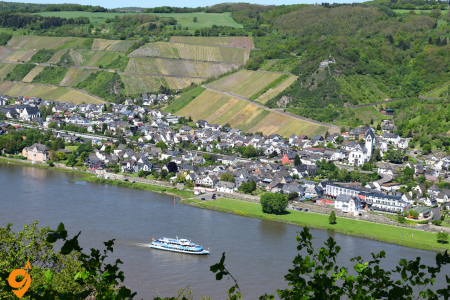
The UNESCO-listed Middle Rhine Valley presents one of Europe’s most enchanting riverscapes, where medieval castles crown dramatic hillsides above picturesque wine villages. The most scenic stretch between Bingen and Koblenz features approximately 40 castles within just 65 kilometers, creating an almost surreal landscape that has inspired artists and poets for centuries. Traditional wine towns like Bacharach and Rüdesheim preserve their half-timbered buildings and narrow cobblestone streets, inviting visitors to sample the region’s excellent Riesling wines in atmospheric taverns. River cruises offer the classic way to experience the Rhine’s majesty, though hiking trails along the valley provide equally spectacular perspectives. The famous Lorelei rock embodies the region’s romantic spirit, with legends of a siren whose singing lured sailors to their doom, representing the perfect blend of natural beauty and cultural mythology that defines the Rhine experience.
Marksburg Castle

Marksburg Castle stands as the only hilltop castle along the Rhine that has never been destroyed throughout its 700-year history. Perched 160 meters above the town of Braubach, this authentic medieval fortress provides the most complete picture of what castle life was truly like during the Middle Ages.
Built in the early 13th century, Marksburg served primarily as a defensive structure rather than a luxurious residence. Its strategic position allowed it to control river traffic and collect tolls from passing ships. The castle’s impressive defensive features include multiple gatehouses, a series of baileys (courtyards), and walls positioned to create an upward spiral path that would force attackers to expose their unshielded right sides as they climbed.
Inside, visitors can explore remarkably preserved spaces including the great hall, bedchambers, armory, kitchen, and torture chamber, all furnished with period-appropriate items. The castle’s battery still contains original bronze cannons, and the medieval herb garden showcases plants used for cooking, medicine, and dyeing during medieval times.
Since 1900, Marksburg has been owned by the German Castles Association (Deutsche Burgenvereinigung), which uses it as its headquarters. The association has meticulously maintained the castle’s authentic medieval character while conducting important research and preservation efforts for castles throughout Germany. Guided tours offer visitors fascinating insights into medieval military architecture, daily castle life, and the changing fortunes of Rhine Valley castles over the centuries.
Address and Location
Marksburg Castle
56338 Braubach, Germany
Located above the town of Braubach on the east bank of the Rhine River
Opening Hours
- March to November: Daily from 10:00 AM to 5:00 PM (last admission at 4:00 PM)
- November to March: Daily from 11:00 AM to 4:00 PM (last admission at 3:00 PM)
- Closed on December 24, 25, and January 1
Note that guided tours are mandatory and take approximately 50 minutes. Tours in English are typically available throughout the day.
Transportation Options
By Train
The nearest train station is Braubach Station, which is served by regional trains. From major cities, you’ll typically need to:
- Take a train to Koblenz Hauptbahnhof (main station)
- Transfer to a regional train toward Braubach
- From Braubach station, it’s approximately a 20-minute uphill walk to the castle
Train connections:
- From Frankfurt: IC/ICE to Koblenz, then regional train to Braubach
- From Cologne: IC/ICE to Koblenz, then regional train to Braubach
Train operators:
- Deutsche Bahn (DB) – Main national railway company
- VIAS – Regional train operator in the area
By Car
- From the A61 motorway: Exit at Koblenz/Boppard and follow signs to Braubach
- From the B42 highway: Follow signs to Braubach
- GPS coordinates: 50.267° N, 7.646° E
Parking Options
- Castle Parking Lot: Limited spaces available at the top near the castle entrance
- Braubach Town Parking: Several public parking areas in the town center, about 15-20 minutes’ walk from the castle
- Philippsburg Parking: Located near the foot of the castle hill with more available spaces
By Bus
- Regional bus services connect Braubach with nearby towns
- Bus stops are located in the town center, requiring an uphill walk to the castle
By Boat
The Rhine River is a major transportation route with several cruise and ferry options:
- KD Rhine Cruises (Köln-Düsseldorfer): Operates regular day cruises along the Rhine with stops at Braubach
- Bingen-Rüdesheimer: Offers Rhine cruises with possible stops at Braubach
- Loreley Linie: Seasonal cruises along the Middle Rhine
- From the boat dock in Braubach, it’s approximately a 25-30 minute uphill walk to the castle
Shuttle Service
During peak tourist season (usually May to September), a shuttle bus service often operates between Braubach town center and the castle. The schedule varies by season.
The Final Ascent
Regardless of how you arrive in Braubach, the final approach to the castle involves an uphill climb of approximately:
- 20-25 minutes on foot from the town center
- The path is steep and partially cobblestoned, so comfortable walking shoes are recommended
Nearby Attractions
- Rhine Gorge UNESCO World Heritage Site – The entire Middle Rhine Valley
- Stolzenfels Castle – Near Koblenz, approximately 15 km from Marksburg
- Ehrenbreitstein Fortress – In Koblenz, accessible by cable car from the city center
- Loreley Rock – Famous natural formation about 30 km south
- Rheinfels Castle – In St. Goar, one of the largest castle ruins on the Rhine
- Koblenz Old Town – Historic city where the Rhine and Moselle rivers meet
- Boppard – Picturesque Rhine town with Roman ruins
- Rüdesheim – Famous wine-growing town in the Rhine Valley
- Bacharach – Medieval town with well-preserved city walls
Transportation Companies Serving the Area
Train Operators
- Deutsche Bahn (DB) – National railway provider
- VIAS – Regional train service provider
Bus Companies
- ÖPNV Rheinland-Pfalz – Regional public transport network
- RMV – Rhein-Main-Verkehrsverbund (regional transport association)
Rhine Cruise Companies
- KD (Köln-Düsseldorfer) – The largest and most established Rhine cruise company
- Bingen-Rüdesheimer – Regular service along the Middle Rhine
- Loreley-Linie – Scenic cruises with stops at major attractions
- Weisse Flotte Rhein – Operates various boat services
Local Taxis
Taxi services are available in Braubach and can be arranged to transport visitors up to the castle, though this is less common due to the narrow road.
Lorelei Rock

The Lorelei Rock is a massive slate cliff rising 132 meters above the Rhine River at its narrowest and deepest point. This natural formation has become the most famous feature of the Rhine Gorge, not only for its impressive geological presence but for the legendary tale associated with it.
According to the popular legend immortalized by German poet Heinrich Heine in 1824, the Lorelei was a beautiful maiden who, after being betrayed by her lover, would sit atop the rock combing her golden hair and singing a haunting melody. Her enchanting voice would distract passing boatmen, causing them to crash against the treacherous rocks and currents at the base of the cliff. The myth grew from real-world observations—this section of the Rhine does indeed feature dangerous currents, hidden rocks, and an unusual echo effect created by the cliff’s acoustics.
Even before Heine’s famous poem, the area had a reputation for mysterious sounds. The name “Lorelei” likely derives from the old German words “lureln” (murmuring) and “ley” (rock), referring to the peculiar whispering sound created when certain wind and water conditions interact with the cliff’s shape.
Today, a viewing platform atop the rock offers spectacular panoramas of the Rhine Gorge, designated a UNESCO World Heritage Site in 2002. The area around the Lorelei has been developed into a visitor center with exhibitions about the geology, ecology, and cultural significance of this remarkable natural monument. A hiking trail known as the Rheinsteig passes by the Lorelei, allowing visitors to experience the dramatic landscape from various perspectives while learning about both the scientific and mythological aspects of this legendary site.
Location and Address
Lorelei Rock
56346 St. Goarshausen, Germany
GPS coordinates: 50.139722° N, 7.727222° E
The rock is situated between the towns of St. Goarshausen and St. Goar in the Upper Middle Rhine Valley, which is designated as a UNESCO World Heritage Site.
Opening Hours
The Lorelei Rock itself is a natural formation accessible year-round as it’s outdoors. However, the visitor facilities have specific hours:
Lorelei Visitor Center (Besucherzentrum Loreley):
- April to October: Daily from 10:00 AM to 6:00 PM
- November to March: Limited hours, typically 11:00 AM to 4:00 PM on weekends
- Closed on certain holidays in winter months
Lorelei Plateau (the area on top of the rock):
- Accessible 24/7 year-round
- The viewing platforms and open areas can be visited any time
- Some areas may be restricted during severe weather conditions
Transportation Options
By Train
Nearest Train Stations:
- St. Goarshausen Station (east bank of the Rhine)
- Regional trains stop here
- Approximately 2-3 km from the Lorelei, requiring additional transport
- St. Goar Station (west bank of the Rhine)
- Served by more frequent regional trains
- Located on the opposite side of the river from the Lorelei
- Requires ferry crossing to reach the eastern bank
Train Connections:
- From Frankfurt: Regional trains to St. Goar or St. Goarshausen (1.5-2 hours)
- From Koblenz: Regional trains to St. Goar or St. Goarshausen (30-45 minutes)
- From Mainz: Regional trains to St. Goar or St. Goarshausen (1-1.5 hours)
Rail Operators:
- Deutsche Bahn (DB) – Main national railway company
- VIAS – Regional train operator serving the Middle Rhine Valley
- Mittelrheinbahn – Regional service along the Rhine
By Car
Main Routes:
- From the west bank: B9 highway runs along the Rhine
- From the east bank: B42 highway follows the Rhine
- From Frankfurt: A3 motorway, then B42 toward St. Goarshausen
- From Cologne: A61 motorway, then B9 toward St. Goar
To Reach the Lorelei Plateau:
- Follow signs to “Loreley” or “Loreley-Plateau” near St. Goarshausen
- A dedicated road winds up to the top of the rock
Parking Options
- Lorelei Plateau Parking (main parking area)
- Large parking lot directly at the visitor center on top of the rock
- Easiest access to the main viewpoints
- Address: Auf der Loreley, 56346 St. Goarshausen
- St. Goarshausen Town Parking
- Several public parking areas in the town
- Requires an uphill walk or shuttle to reach the top of Lorelei
- St. Goar Town Parking (west bank)
- Multiple parking areas available
- Requires ferry crossing and additional transport to reach Lorelei
By Bus
Local Bus Services:
- Seasonal shuttle bus service between St. Goarshausen and the Lorelei Plateau
- Regular bus service (Line 535) connects nearby towns to St. Goarshausen
- Bus stop: “St. Goarshausen Loreley” at the foot of the rock
Bus Operators:
- ÖPNV Rheinland-Pfalz (regional public transport network)
- RNN (Rhein-Nahe Nahverkehrsverbund)
By Boat
The Rhine River offers excellent boat access to the Lorelei area:
Rhine Cruise Companies:
- KD (Köln-Düsseldorfer) – Largest Rhine cruise operator
- Bingen-Rüdesheimer – Regular service along the Middle Rhine
- Loreley-Linie – Specializes in cruises around the Lorelei section
Cruise Options:
- Day cruises from Koblenz, Boppard, Rüdesheim, or Bingen
- Boats typically slow down at the Lorelei for viewing and photographs
- Some cruises include narration about the Lorelei legend
- Most cruises stop at St. Goar and St. Goarshausen, from where you can reach the Lorelei
By Hiking
Hiking Routes:
- The Rheinsteig Trail – Premium hiking trail that passes directly by the Lorelei
- The RheinBurgenWeg (Rhine Castle Trail) – Connects various castles and the Lorelei
- Local circuit trails around the Lorelei area
From St. Goarshausen:
- Approximately 45-60 minutes uphill hike to reach the Lorelei plateau
- Well-marked trails with occasional information boards
- Moderate difficulty due to elevation gain
From the Bottom to the Top
If you arrive at the bottom of the Lorelei (in St. Goarshausen), you have several options to reach the plateau:
- Shuttle Bus – Seasonal service from town to the plateau (typically April-October)
- Hiking Trail – Well-marked path that takes 45-60 minutes
- Taxi – Local taxi services can drive visitors to the top
- Drive – If you have a car, you can drive up the winding road to the plateau
Nearby Attractions
- Castle Katz – Medieval fortress overlooking St. Goarshausen
- Rheinfels Castle – Impressive castle ruins across the river in St. Goar
- Marksburg Castle – The only hilltop castle on the Middle Rhine that was never destroyed
- Pfalzgrafenstein Castle – A unique castle on an island in the middle of the Rhine
- Bacharach – Picturesque medieval town with well-preserved city walls
- Boppard – Historic Rhine town with Roman ruins and boat cruises
- Rüdesheim – Famous wine town with the Niederwald Monument
- Ehrenbreitstein Fortress – Massive fortress across from Koblenz where the Rhine and Moselle meet
- Rhine Gorge – The entire UNESCO World Heritage stretch of the Middle Rhine Valley
- Assmannshausen – Charming red wine village near the Lorelei
Rüdesheim
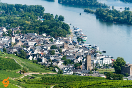
Rüdesheim Rhein embodies the quintessential Rhine Valley experience with its perfect combination of vineyard-covered hillsides, half-timbered buildings, and rich winemaking heritage. This charming town serves as the gateway to the Upper Middle Rhine Valley UNESCO World Heritage Site.
The town’s most famous attraction is the Drosselgasse, a narrow cobblestone lane barely 144 meters long but packed with wine taverns, garden restaurants, and shops housed in buildings dating from the 15th to 18th centuries. During summer evenings, the street comes alive with traditional music and dancing as visitors sample the region’s renowned Riesling wines.
Rüdesheim’s winemaking tradition stretches back to Roman times, with documents confirming viticulture here since the 1st century AD. The town’s steep, south-facing slopes create perfect conditions for growing Riesling grapes, and numerous wine estates offer tastings of their award-winning vintages. The Rheingau Wine Museum, housed in Brömserburg Castle (one of Germany’s oldest), documents the region’s 1,000-year winemaking history through historical implements and interactive exhibits.
For panoramic views of the Rhine Valley’s vineyard-covered landscapes, visitors can take the cable car to the Niederwald Monument, a massive 38-meter-high Germania statue erected in 1883 to commemorate German unification. The town also houses unique attractions like Siegfried’s Mechanical Music Cabinet museum, featuring an extraordinary collection of self-playing musical instruments from the 18th to 20th centuries.
Rüdesheim’s calendar overflows with seasonal festivals celebrating wine, particularly the Rhine in Flames event when the river is illuminated by fireworks, and the traditional wine festivals held throughout autumn during harvest season. These celebrations continue traditions that have defined this region’s cultural identity for centuries.
Location and General Information
Address: Rüdesheim am Rhein 65385 Hesse, Germany
Rüdesheim is located on the eastern bank of the Rhine River, approximately:
- 65 km west of Frankfurt
- 90 km southeast of Cologne
- 30 km south of Koblenz
- 15 km south of the famous Lorelei Rock
The town itself is open for visitors year-round, though individual attractions have specific opening hours.
Transportation Options
By Train
Main Railway Station: Rüdesheim Bahnhof Rheinstraße 10 65385 Rüdesheim am Rhein
The railway station is conveniently located close to the town center and the Rhine promenade.
Train Connections:
- From Frankfurt: Direct regional trains run approximately hourly (journey time: about 1.5 hours)
- From Wiesbaden: Regional trains every hour (journey time: about 40 minutes)
- From Koblenz: Regional trains with potential change at Bingen (journey time: about 1 hour)
- From Mainz: Direct regional trains approximately hourly (journey time: about 40 minutes)
Railway Operators:
- Deutsche Bahn (DB) – Germany’s national railway company
- VIAS Rail – Regional operator serving the Rhine Valley
- RMV (Rhein-Main-Verkehrsverbund) – Regional transport association managing services in the area
By Car
Main Routes to Rüdesheim:
- From Frankfurt: A66 to Wiesbaden, then B42 along the Rhine to Rüdesheim
- From Cologne: A3 to A61, exit at Bingen and cross the Rhine via ferry to Rüdesheim
- From Koblenz: B42 south along the Rhine’s eastern bank directly to Rüdesheim
- From Mainz: B42 northwest following the Rhine to Rüdesheim
Parking Facilities:
- Am Adlerturm Parking Garage
- Central location near the Drosselgasse
- Address: Am Adlerturm, 65385 Rüdesheim
- Multi-story covered parking
- Parkplatz Rheinufer
- Riverside parking area near the boat docks
- Address: Rheinstraße, 65385 Rüdesheim
- Open-air parking lot
- Parkplatz Brömserburg
- Near the Brömserburg Castle museum
- Address: Rheinstraße 2, 65385 Rüdesheim
- Open-air parking
- Parkplatz Seilbahn
- Located at the cable car station to the Niederwald Monument
- Address: Oberstraße, 65385 Rüdesheim
- Convenient for visiting the Niederwald Monument
Note: During peak tourist season (summer months and during wine festivals), parking can be limited. It’s advisable to arrive early or consider alternative transportation options.
By River Cruise/Boat
The Rhine River serves as a major transportation route:
Boat Dock/Landing Stage: Rüdesheim Schiffsanleger Rheinstraße 65385 Rüdesheim am Rhein
Cruise Companies:
- KD (Köln-Düsseldorfer) – Operates regular scheduled services along the Rhine
- Bingen-Rüdesheimer Fähr- und Schiffahrtsgesellschaft – Local ferry and cruise service
- Rhine River Cruises – Various operators offering day cruises and longer river cruise itineraries
- Rössler-Linie – Regional boat operator
Connections:
- Regular services from Bingen (directly across the river)
- Daily cruises from Mainz, Wiesbaden, and Koblenz (seasonal)
- Connection to major Rhine River cruise routes
The boat landing is centrally located and within easy walking distance of the town’s major attractions.
By Ferry
A car and passenger ferry operates regularly between Bingen and Rüdesheim:
Bingen-Rüdesheim Ferry
- Operating year-round
- Frequent crossings (approximately every 15-30 minutes)
- Carries both vehicles and pedestrians
- Journey time: approximately 10 minutes
- Connects the B9 road (west bank) with the B42 road (east bank)
By Bus
Local and regional bus services connect Rüdesheim with neighboring towns:
Main Bus Station: Rüdesheim Bahnhof Bus Station (Adjacent to the railway station)
Bus Services:
- Line 171: Connects Rüdesheim with Wiesbaden via towns along the Rhine
- Line 185: Service between Rüdesheim and Eltville
- Seasonal tourist shuttle buses serving major attractions in and around Rüdesheim
Bus Operators:
- RMV (Rhein-Main-Verkehrsverbund)
- ESWE Verkehr (Wiesbaden public transport)
By Air
Nearest Airports:
- Frankfurt Airport (FRA)
- Distance: approximately 65 km
- Connection to Rüdesheim:
- Direct regional train to Rüdesheim (journey time: about 1.5 hours)
- Taxi or pre-arranged transfer (journey time: about 50 minutes)
- Frankfurt-Hahn Airport (HHN)
- Distance: approximately 50 km
- Connection to Rüdesheim:
- Shuttle bus to Bingen, then ferry to Rüdesheim
- Rental car or taxi
Local Transportation in Rüdesheim
Once in Rüdesheim, several unique transportation options help visitors explore the town and surrounding attractions:
Seilbahn Rüdesheim (Cable Car)
- Connects the town center with the Niederwald Monument
- Operates daily from late March to early November
- Journey time: approximately 15 minutes
- Offers spectacular views over the Rhine Valley
Winzerexpress Tourist Train
- Small road train that circulates through Rüdesheim
- Stops at major attractions including the Mechanical Music Cabinet Museum and the cable car station
- Operates daily during the tourist season (April to October)
- Audio commentary available in multiple languages
Sesselbahn (Chairlift from Assmannshausen)
- Open-air chairlift connecting the neighboring village of Assmannshausen with the Niederwald area
- Can be combined with the cable car for a circular trip
- Seasonal operation (typically April to October)
Major Attractions in Rüdesheim
- Drosselgasse – Narrow, cobblestone alley lined with taverns, wine gardens, and shops
- Open year-round, though individual establishments have varying hours
- Most establishments open from around 10:00 AM until late evening
- Niederwald Monument – Large monument commemorating the unification of Germany
- Grounds accessible year-round
- Best accessed via the cable car from town
- Siegfried’s Mechanical Music Cabinet Museum (Siegfrieds Mechanisches Musikkabinett)
- Address: Oberstraße 29, 65385 Rüdesheim
- Open daily from 10:00 AM to 6:00 PM (reduced hours in winter)
- Houses one of the world’s largest collections of self-playing musical instruments
- Brömserburg Castle – Medieval castle housing the Wine Museum
- Address: Rheinstraße 2, 65385 Rüdesheim
- Open April to October, Tuesday to Sunday, 10:00 AM to 6:00 PM
- Asbach Distillery Visitor Center
- Address: Tempelgasse 8, 65385 Rüdesheim
- Open Monday to Friday, 10:00 AM to 6:30 PM; Saturday, 10:00 AM to 6:00 PM
- Offers tours explaining the production of Asbach brandy
Nearby Attractions
- Bingen – Historic town directly across the Rhine
- Notable for Mäuseturm (Mouse Tower) and Klopp Castle
- Connected to Rüdesheim by ferry
- Ehrenfels Castle Ruins – Medieval castle remains visible from Rüdesheim
- Located between Rüdesheim and Assmannshausen
- Viewable from the Rhine or hiking trails
- Assmannshausen – Charming village known for red wine
- Located 4 km north of Rüdesheim
- Connected by riverboat, train, or hiking path
- Eibingen Abbey – Benedictine abbey founded by St. Hildegard
- Address: Abtei St. Hildegard, 65385 Rüdesheim am Rhein
- Limited visiting hours for the church and abbey shop
- Rhine Gorge UNESCO World Heritage Site – The entire Middle Rhine Valley
- Spectacular scenery best enjoyed by boat cruise
- Numerous castles, villages, and vineyards
- Lorelei Rock – Famous slate rock formation about 30 km north of Rüdesheim
- Accessible by car, train, or boat cruises from Rüdesheim
Rheinfels Castle

Rheinfels Castle represents the most imposing castle ruin on the Rhine, once standing as the largest fortress in the Middle Rhine Valley. Built in 1245 by Count Diether V of Katzenelnbogen, the castle began as a simple customs collection point but expanded over centuries into a massive fortress complex covering more than 5 hectares.
During its heyday in the 17th century, Rheinfels demonstrated remarkable defensive innovation. Its complex system of underground mines—passages packed with gunpowder to be detonated when enemies tunneled nearby—was revolutionary at the time. The castle successfully withstood a siege by 28,000 French troops in 1692 during the Nine Years’ War, a remarkable achievement that enhanced its reputation as an impregnable fortress.
However, in 1794, the castle was surrendered to French revolutionary forces without resistance and subsequently blown up. This destruction, combined with locals using the ruins as a convenient stone quarry throughout the 19th century, reduced the once-mighty fortress to approximately one-fifth of its original size. Despite this diminishment, Rheinfels remains an awe-inspiring structure with extensive ruins to explore.
Today, visitors can wander through the remaining fortifications, including casemates (gun chambers), tunnels, and underground passageways that offer insights into medieval defensive architecture. The castle museum houses artifacts found on site and detailed models showing how the complete structure once appeared. Part of the castle complex has been converted into a luxury hotel, allowing guests to experience overnight stays within these historic walls.
The castle’s dramatic position overlooking the town of St. Goar provides spectacular views of the Rhine, making it not only a historical treasure but also one of the best vantage points for appreciating the river landscape that earned the Upper Middle Rhine Valley its UNESCO World Heritage status.
Location and Address
Rheinfels Castle (Burg Rheinfels)
56329 St. Goar, Germany
Located above the town of St. Goar on the west bank of the Rhine River
Opening Hours
The castle operates with seasonal opening hours:
- March through October:
Daily from 10:00 AM to 6:00 PM (last admission at 5:00 PM) - November through February:
Daily from 11:00 AM to 5:00 PM (last admission at 4:00 PM) - Closed on: December 24, 25, and 31
Guided tours are available at specific times throughout the day. Self-guided tours are possible with information brochures available in multiple languages.
Transportation Options
By Train
Nearest Train Station: St. Goar Bahnhof
The train station in St. Goar is conveniently located in the town center, approximately 1.5 kilometers from the castle entrance.
Train Connections:
- From Frankfurt: Regional trains run regularly, journey time approximately 1.5-2 hours
- From Koblenz: Regional trains every hour, journey time approximately 30-40 minutes
- From Mainz: Regional trains hourly, journey time approximately 1 hour
- From Cologne: IC/ICE to Koblenz, then regional train to St. Goar, total journey time approximately 2-2.5 hours
Train Operators:
- Deutsche Bahn (DB) – Germany’s national railway company
- VIAS – Regional train operator serving the Middle Rhine Valley
- Mittelrheinbahn – Regional service along the Rhine
From St. Goar station, you can either walk uphill to the castle (approximately 20-25 minutes on foot) or take a taxi or the seasonal shuttle bus service.
By Car
Main Routes:
- From the west: A61 motorway, exit at Emmelshausen, then follow B274 to St. Goar
- From the east: A3 motorway, exit at Boppard, then follow B9 along the Rhine to St. Goar
- Within the Rhine Valley: B9 runs along the western bank of the Rhine, directly through St. Goar
Navigation Address: Schlossberg 47, 56329 St. Goar
Parking Options
- Castle Parking Lot (Parkplatz Burg Rheinfels)
- Located near the castle entrance
- Limited spaces available
- Address: Schlossberg, 56329 St. Goar
- Town Center Parking (Parkplatz Zentrum)
- Multiple public parking areas in St. Goar’s town center
- Approximately 15-20 minutes’ walk uphill to the castle
- Address: Various locations along Heerstraße and near the Rhine promenade
- Rhine Promenade Parking (Rheinuferstraße)
- Larger parking area along the Rhine
- Good option during peak tourist season
- Requires uphill walk to the castle
By Bus
Local Bus Services:
- Seasonal shuttle bus service operates between St. Goar town center and Rheinfels Castle (typically April through October)
- Regional bus line 535 connects St. Goar with surrounding towns
- Bus stop: “St. Goar Zentrum” in the town center
Bus Operators:
- ÖPNV Rheinland-Pfalz (regional public transport network)
- RNN (Rhein-Nahe Nahverkehrsverbund)
By Boat
The Rhine River is a major transportation route with excellent options for reaching St. Goar:
St. Goar Boat Landing: Located in the town center along the Rhine promenade, approximately 1.5 kilometers from the castle.
Rhine Cruise Companies:
- KD (Köln-Düsseldorfer) – The largest Rhine cruise operator with regular scheduled services
- Bingen-Rüdesheimer – Operates services in the Middle Rhine section
- Loreley-Linie – Specialized cruises focusing on the Lorelei section of the Rhine
Boat Connections:
- Regular services from Koblenz, Boppard, Bacharach, and Rüdesheim
- Most services operate daily from April through October, with reduced schedules in winter months
- From the boat landing, it’s a 20-25 minute uphill walk to the castle
By Ferry
A car and passenger ferry connects St. Goar (west bank) with St. Goarshausen (east bank):
- Operates year-round with frequent crossings (approximately every 15-20 minutes)
- Carries both vehicles and pedestrians
- Useful for travelers coming from or exploring the eastern bank of the Rhine
- Ferry operator: Auto-Fähre St. Goar – St. Goarshausen
By Hiking
Several marked hiking trails lead to Rheinfels Castle:
- The Rheinsteig Trail – Premium long-distance hiking path that passes near the castle
- The RheinBurgenWeg (Rhine Castle Trail) – Connects various castles along the Rhine
- Local trails from St. Goar town center to the castle (well-marked with signposts)
From Town to Castle
Regardless of how you arrive in St. Goar, the final approach to the castle involves an uphill journey:
- On Foot: Follow the signs from the town center to “Burg Rheinfels.” The walk takes approximately 20-25 minutes and is moderately steep.
- By Shuttle Bus: Seasonal service from the town center to the castle entrance (typically operates from April to October).
- By Taxi: Local taxi services are available in St. Goar and can transport visitors directly to the castle entrance.
- By Car: Drive up Schlossberg road directly to the castle parking area.
Nearby Attractions
- Lorelei Rock – Famous slate rock formation across the river, associated with the legendary siren who lured sailors to their doom
- Located approximately 5 km upriver from St. Goar
- Visible from the castle and St. Goar riverfront
- Accessible by car, boat, or as part of a Rhine cruise
- Castle Katz (Burg Katz) – Imposing castle on the opposite bank in St. Goarshausen
- Privately owned, viewable from the outside
- Spectacular views from Rheinfels Castle across to Castle Katz
- Maus Castle (Burg Maus) – Medieval castle north of St. Goarshausen
- Home to a bird of prey sanctuary with flying demonstrations
- Accessible by car or hiking trails from St. Goarshausen
- Marksburg Castle – The only hilltop castle on the Middle Rhine that was never destroyed
- Located in Braubach, approximately 20 km north of St. Goar
- Accessible by train, car, or boat from St. Goar
- Pfalzgrafenstein Castle – Unique castle on an island in the middle of the Rhine
- Located near Kaub, about 10 km south of St. Goar
- Accessible by small ferry from Kaub
- Bacharach – Picturesque medieval town with well-preserved city walls
- Located approximately 15 km south of St. Goar
- Connected by train, car, or boat
- Boppard – Historic Rhine town with Roman ruins and a scenic Rhine bend
- Located approximately 15 km north of St. Goar
- Connected by train, car, or boat
- Oberwesel – Medieval town with impressive fortifications and the Schönburg castle ruins
- Located just 5 km south of St. Goar
- Connected by train, car, or boat
- Rhine Gorge UNESCO World Heritage Site – The entire Middle Rhine Valley is designated as a World Heritage area
- St. Goar and Rheinfels Castle are located in the heart of this protected landscape
Bacharach

Bacharach emerges as one of the Rhine Valley’s most perfectly preserved medieval towns, its skyline of towers and half-timbered buildings seemingly frozen in time since the 14th century. Named after Bacchus, the Roman god of wine, the town has been a center of viticulture for over 1,000 years, with terraced vineyards climbing the steep slopes above the settlement.
The town is encircled by a remarkably intact medieval wall featuring 16 defensive towers, the most famous being the Marktturm (Market Tower) which dates from the 11th century. This defensive system speaks to Bacharach’s historical importance as a trading center during the Middle Ages when it served as a crucial transfer point for goods traveling along the Rhine.
Bacharach’s architectural jewel is the Werner Chapel (Wernerkapelle), a roofless Gothic sanctuary built between 1289 and 1430. Construction was never completed, and the chapel was partially destroyed during the Nine Years’ War in the late 17th century. The remaining red sandstone arches create a hauntingly beautiful structure that has been preserved as a memorial, its delicate stonework demonstrating the exceptional craftsmanship of medieval stonemasons.
The town’s residential architecture features remarkably well-preserved half-timbered houses with intricate wood carvings. The most photographed is the Altes Haus (Old House), built in 1368 and now operating as a restaurant serving traditional regional cuisine. Stahleck Castle, originally constructed in the 12th century and rebuilt in the 20th century, crowns the town from its hilltop position 160 meters above the Rhine, now functioning as a youth hostel offering spectacular views.
Bacharach’s winemaking tradition continues in numerous family-owned vineyards specializing in Riesling grapes. The steep slate slopes surrounding the town create ideal growing conditions, with some vineyards positioned at angles approaching 45 degrees, requiring all harvesting to be done by hand. Local wine taverns called “Weinstuben” offer tastings of these distinctive wines, often served in the traditional green glasses typical of the region.
Throughout its narrow cobblestone streets, visitors discover small details that speak to the town’s rich history—stone markers indicating historical flood levels, medieval guild signs hanging from buildings, and ancient cellar entrances designed for rolling wine barrels. Together, these elements create an authentic medieval atmosphere that exemplifies the historical character of the entire Rhine Valley region.
Location and General Information
City Address: Bacharach 55422 Rhineland-Palatinate, Germany
Bacharach is situated on the western bank of the Rhine River, nestled between the river and steep vineyard-covered hillsides. The town itself has no formal opening hours as it’s an open settlement, though individual attractions within the town maintain their own schedules.
Transportation Options
By Train
The train provides one of the most convenient and scenic ways to reach Bacharach.
Bacharach Train Station (Bahnhof Bacharach) Located at the southern end of town, within comfortable walking distance of the historic center. Address: Oberstraße, 55422 Bacharach
Train Connections:
- From Frankfurt: Direct regional trains run approximately hourly (journey time: about 1.5 hours)
- From Mainz: Direct regional trains approximately hourly (journey time: about 50 minutes)
- From Koblenz: Direct regional trains approximately hourly (journey time: about 40 minutes)
- From Cologne: Typically requires a change at Koblenz (total journey time: about 2 hours)
Train Operators:
- Deutsche Bahn (DB) – Germany’s national railway company
- VIAS – Regional train operator serving the Middle Rhine Valley
- Mittelrheinbahn – Regional service running along the Rhine
The train station is approximately a 5-10 minute walk from the town center. The route is well-marked and leads you through part of the historic town walls.
By Car
Main Routes to Bacharach:
- From the west: A61 motorway, exit at Rheinböllen, then follow B9 along the Rhine to Bacharach
- From the east: A3 motorway, cross the Rhine at Bingen, then follow B9 north to Bacharach
- Within the Rhine Valley: B9 runs directly through Bacharach along the western bank of the Rhine
Navigation Address: Oberstraße, 55422 Bacharach
Parking Options
Bacharach is a small medieval town with limited parking within the historic walls. Several dedicated parking areas are available:
- Parkplatz Oberstraße
- Located near the train station at the southern end of town
- Address: Oberstraße, 55422 Bacharach
- Open-air parking lot
- Parkplatz am Rhein
- Riverside parking along the Rhine promenade
- Address: Rheinuferstraße, 55422 Bacharach
- Open-air parking with Rhine views
- Parkplatz Blücherstraße
- Northern end of town
- Address: Blücherstraße, 55422 Bacharach
- Small parking area
- Parkplatz Stahleck
- Near the path up to Stahleck Castle
- Address: Stahleckstraße, 55422 Bacharach
- Limited spaces
During peak tourist season (summer months and weekends), parking can fill quickly. It’s advisable to arrive early or consider alternative transportation options.
By River Cruise/Boat
The Rhine River serves as a natural transportation route:
Boat Landing/Pier: Bacharach Schiffsanleger Rheinuferstraße 55422 Bacharach
Cruise Companies:
- KD (Köln-Düsseldorfer) – Major Rhine cruise operator with scheduled services
- Bingen-Rüdesheimer – Local service operating in the Middle Rhine region
- Loreley-Linie – Specialized cruises focusing on the Lorelei section of the Rhine
Connections:
- Regular services from nearby Rhine towns including St. Goar, Boppard, and Rüdesheim
- Most services operate daily from April through October, with reduced schedules in winter
- Journey times vary depending on direction of travel (upstream/downstream)
The boat landing is centrally located along the Rhine promenade, within easy walking distance of the town center and major attractions.
By Bus
Regional bus services connect Bacharach with neighboring towns:
Bus Station: Located near the train station Oberstraße, 55422 Bacharach
Bus Services:
- Line 670: Connects Bacharach with towns along the western bank of the Rhine
- Regional school buses also serve the area but have limited schedules
Bus Operators:
- Rhein-Nahe-Nahverkehrsverbund (RNN)
- ÖPNV Rheinland-Pfalz
Bus services in the area are less frequent than trains and may not run on weekends or holidays. They’re primarily designed for local residents rather than tourists.
By Hiking
Several marked hiking trails connect Bacharach with surrounding areas:
- The Rheinsteig Trail – Premium long-distance hiking path along the eastern bank of the Rhine (requires ferry crossing)
- The RheinBurgenWeg (Rhine Castle Trail) – Connects various castles including Burg Stahleck above Bacharach
- Numerous local vineyard trails offering spectacular views of the Rhine Valley
Local Transportation in Bacharach
Due to Bacharach’s small size, most exploration can be done on foot. The town stretches approximately 1 kilometer along the Rhine, with narrow medieval streets climbing uphill from the river.
Walking Times:
- Train station to town center: 5-10 minutes
- Town center to Stahleck Castle: 15-20 minutes uphill walk
- Northern to southern town limits: approximately 15 minutes
No public transportation operates within the town itself, though taxis may be available by pre-arrangement.
Major Attractions in Bacharach
- Burg Stahleck (Stahleck Castle)
- Medieval castle perched above the town, now functioning as a youth hostel
- Address: 55422 Bacharach
- Open to non-guests for panoramic views from the courtyard
- Open daily during daylight hours
- Wernerkapelle (Werner Chapel)
- Gothic ruin of an unfinished 13th-century chapel
- Address: Blücherstraße, 55422 Bacharach
- Open-air site accessible during daylight hours
- St. Peter’s Church (Peterskirche)
- Late Romanesque church in the town center
- Address: Kirchstraße, 55422 Bacharach
- Open for visitors outside of service times, typically 10:00 AM to 5:00 PM
- Town Walls and Towers
- Medieval fortifications including the Marktturm (Market Tower)
- Accessible throughout the day
- Several towers can be climbed during summer months, generally 10:00 AM to 5:00 PM
- Altes Haus (Old House)
- Historic half-timbered building from 1368
- Address: Oberstraße 61, 55422 Bacharach
- Functions as a restaurant; viewable from outside at any time
Nearby Attractions
- Pfalzgrafenstein Castle – Unique castle on an island in the middle of the Rhine
- Located near Kaub, about 4 km north of Bacharach
- Accessible by small ferry from Kaub
- Schönburg Castle – Restored medieval castle above Oberwesel
- Located in Oberwesel, about 5 km south of Bacharach
- Functions as a hotel and restaurant
- Rheinfels Castle – Impressive castle ruins near St. Goar
- Located in St. Goar, about 15 km north of Bacharach
- One of the largest fortress ruins on the Rhine
- Lorelei Rock – Famous slate rock formation associated with the legendary siren
- Located approximately 20 km north of Bacharach
- Viewable from river cruises or dedicated viewpoints
- Bingen – Historic town at the junction of the Rhine and Nahe rivers
- Located across from Rüdesheim, about 15 km south of Bacharach
- Notable for Mouse Tower (Mäuseturm) and Klopp Castle
- Rüdesheim – Famous wine town with the Drosselgasse lane
- Located about 15 km south of Bacharach
- Connected by train, car, or boat
- Oberwesel – Medieval town with well-preserved city walls
- Located just 5 km south of Bacharach
- Connected by train, car, or boat
Special Events
- Bacharacher Weinfest (Wine Festival) – Usually held in August
- Mittelrhein Weinwanderung (Wine Hiking Day) – Typically in May
- Rhine in Flames – Fireworks spectacle with boat parade (dates vary by location)
- Christmas Market – Small but charming market held on select weekends in December
Neuschwanstein Castle
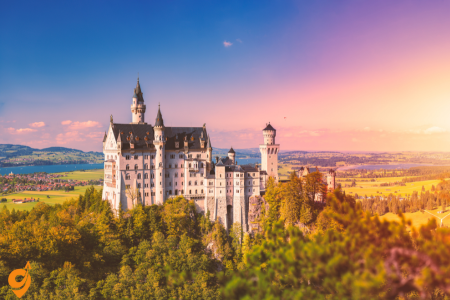
King Ludwig II’s masterpiece represents the quintessential fairytale castle, its soaring white towers and romantic turrets rising dramatically against the backdrop of the Bavarian Alps. Built in the 19th century as an idealized vision of a medieval knight’s castle, Neuschwanstein later inspired Walt Disney’s iconic castle design. The interior reveals Ludwig’s eccentric imagination with rooms decorated according to Wagner’s operatic themes, including a grotto, a throne room resembling a Byzantine church, and a singer’s hall adorned with scenes from medieval legends. The castle’s spectacular setting offers breathtaking views, particularly from Marienbrücke (Mary’s Bridge) spanning a nearby gorge. Despite being incomplete at Ludwig’s mysterious death in 1886, Neuschwanstein welcomes over 1.5 million visitors annually who make the pilgrimage to experience this architectural fantasy brought to life.
Neuschwanstein Castle Interior Tour

Neuschwanstein Castle, commissioned by King Ludwig II of Bavaria in the 19th century, offers visitors a remarkable glimpse into the king’s romantic imagination and artistic vision. The interior tour guides you through approximately 14 rooms of this unfinished castle, as only about one-third of the planned 200 rooms were completed before Ludwig’s mysterious death in 1886.
As you enter the castle, you’re first welcomed into the lower rooms, including the servants’ quarters and kitchen areas. These spaces, while functional, already hint at the opulence to come. Ascending the main staircase, adorned with rich murals depicting scenes from Germanic mythology, you’ll reach the more elaborate state rooms on the upper floors.
The Throne Room stands as one of the most impressive spaces in the castle. Designed in Byzantine style with a magnificent mosaic floor containing over 2 million stone pieces, this two-story chamber features an ornate unfinished throne dais and walls adorned with murals depicting saintly kings. The room’s centerpiece would have been the throne itself, though it was never completed following Ludwig’s death.
The king’s bedroom demonstrates Ludwig’s fascination with Germanic legends, particularly those featuring in Richard Wagner’s operas. Elaborate wood carvings depicting scenes from “Tristan and Isolde” adorn the Gothic-style bed, which took fourteen carpenters four years to complete. The adjacent artificial grotto connects to the study and provides a whimsical element, designed to evoke the Venus grotto from Wagner’s “Tannhäuser.”
Ludwig’s Singer’s Hall occupies the entire fourth floor of the castle’s eastern wing. This concert hall was never used for public performances but served as a private retreat where the king could imagine scenes from his favorite medieval legends coming to life. The hall features intricate wood paneling and paintings illustrating scenes from the legend of Parsifal.
Throughout the tour, you’ll notice the castle’s surprisingly modern amenities for its time, including central heating, running water, telephone lines, and even an electric bell system to summon servants. These technological innovations contrast with the medieval aesthetic Ludwig sought to create, revealing the fascinating dichotomy between the king’s romantic fantasies and the realities of the industrial age.
Address and Location
Neuschwanstein Castle
Neuschwansteinstraße 20
87645 Schwangau, Germany
The castle sits on a hilltop above the village of Hohenschwangau in the Bavarian Alps, near the Austrian border.
Opening Hours
- April to October 15: Daily 9:00 AM – 6:00 PM
- October 16 to March: Daily 10:00 AM – 4:00 PM
- Closed: December 24, 25, 31, January 1
- Last entry: 30 minutes before closing time
Note: These hours apply to castle tours. The grounds and exterior viewing areas have different accessibility hours.
Transportation Methods
By Train (Most Recommended for International Visitors)
The train journey offers scenic views through the Bavarian countryside and connects seamlessly with local transportation.
Main Route from Munich:
- Take Deutsche Bahn (DB) train from München Hauptbahnhof (Munich Central Station)
- Travel to Füssen station (journey time: approximately 2 hours)
- From Füssen, take bus line 73 or 78 to Hohenschwangau/Neuschwanstein
Alternative Route:
- Train to Buchloe, then transfer to regional train to Füssen
- Some routes may require connections through Augsburg
Nearest Train Stations:
- Füssen Bahnhof (primary station, 4 km from castle)
- Schwangau (smaller station, slightly closer but fewer services)
By Bus from Train Stations
Local bus services provide the final connection from train stations to the castle area.
Bus Lines:
- Line 73: Füssen Bahnhof → Steingaden → Hohenschwangau
- Line 78: Füssen Bahnhof → Schwangau → Hohenschwangau
- RVA (Regionalverkehr Allgäu) operates these routes
Bus Stops:
- Hohenschwangau Neuschwanstein (closest to castle entrance)
- Hohenschwangau Alpseestraße (alternative stop)
Bus frequency varies by season, with more frequent service during peak tourist months (May through October).
By Car
Driving offers flexibility and scenic routes through the Alpine foothills, though parking can be challenging during peak seasons.
Routes from Major Cities:
From Munich (130 km):
- Take A95 south toward Garmisch-Partenkirchen
- Merge onto A7 toward Kempten/Füssen
- Exit at Füssen and follow B17/B310 to Schwangau
- Follow brown tourist signs to “Königsschlösser” (Royal Castles)
From Stuttgart (250 km):
- Take A8 west toward Munich
- Connect to A7 south toward Füssen
- Continue as above
From Austria/Innsbruck (120 km):
- Take A12 to German border
- Continue on B179 through Reutte
- Connect to B310 toward Füssen/Schwangau
Parking Information
Parking near Neuschwanstein requires advance planning, especially during high season.
Official Parking Areas:
P4 Hohenschwangau (Recommended):
- Located at Alpseestraße 12, 87645 Schwangau
- Largest parking area with approximately 1,500 spaces
- Distance to castle: 1.5 km uphill walk or shuttle bus ride
- Open 24 hours during castle season
P1, P2, P3 (Closer but Limited):
- Smaller lots closer to castle base
- Fill up quickly, especially on weekends
- More expensive than P4
Important Parking Notes:
- Arrive early during peak season (before 9:00 AM recommended)
- All parking areas are paid parking with automated systems
- No overnight parking allowed
- Winter access may be limited due to weather conditions
By Organized Tour
Tour companies offer comprehensive packages that handle all transportation logistics.
Major Tour Operators:
- Gray Line Tours
- Munich Walk Tours
- Viator/TripAdvisor Experiences
- Local Bavarian tour companies
Tours typically include round-trip transportation from Munich, guided commentary, and sometimes skip-the-line castle tickets.
Getting Up to the Castle
Once you reach Hohenschwangau village, you still need to ascend to the castle itself, which sits 200 meters above the valley floor.
Walking Path
- Distance: 1.5 km uphill
- Time: 30-45 minutes depending on fitness level
- Difficulty: Moderate to steep incline
- Path type: Paved road and forest paths
- Note: Can be slippery in wet conditions
Horse-Drawn Carriage
- Route: From Hohenschwangau village to Marienbrücke area
- Seasonal: Typically April through October (weather dependent)
- Operator: Local carriage services
- Note: Does not go directly to castle entrance; short walk still required
Shuttle Bus
- Route: Hohenschwangau to near castle entrance
- Frequency: Every 10-15 minutes during operating hours
- Capacity: Limited, expect queues during busy periods
- Accessibility: Better option for visitors with mobility limitations
Nearby Attractions
Understanding the surrounding area helps you plan a fuller experience of this historically rich region.
Hohenschwangau Castle
- Distance: 500 meters from Neuschwanstein
- Significance: King Ludwig II’s childhood home
- Combined visits: Many visitors tour both castles
Marienbrücke (Mary’s Bridge)
- Distance: 10-minute walk from Neuschwanstein
- Purpose: Spectacular viewing point of the castle
- Note: Can be very crowded; early morning visits recommended
Alpsee Lake
- Distance: 1 km from Hohenschwangau village
- Activities: Swimming (summer), walking paths, boat rentals
- Setting: Pristine Alpine lake with mountain backdrop
Forggensee
- Distance: 3 km from castle area
- Features: Largest lake in the Allgäu region
- Activities: Water sports, cycling paths around perimeter
Tegelberg Mountain
- Distance: 5 km from castle
- Access: Cable car from valley station
- Activities: Hiking, paragliding, panoramic views
- Historical note: Nearby Roman excavation sites
Füssen Old Town
- Distance: 4 km from castle
- Features: Medieval old town, Hohes Schloss (High Castle)
- Significance: Historic trading route town with well-preserved architecture
Marienbrücke (Mary’s Bridge)

Marienbrücke spans the dramatic Pöllat Gorge, offering what is arguably the most iconic and photographed view of Neuschwanstein Castle. Named after Ludwig II’s mother, Queen Marie, this historic bridge stands approximately 90 meters above the gorge floor, providing a breathtaking vantage point.
Originally constructed in the 1850s as a wooden structure, the bridge was later replaced with a sturdier iron design under King Ludwig II’s direction. The bridge stretches about 35 meters across the gorge, connecting two steep cliffs. The experience of standing on Marienbrücke is thrilling – the bridge often sways slightly with the movement of visitors and wind, adding a sense of adventure to the experience.
From this vantage point, visitors can capture the castle’s fairytale silhouette against the backdrop of the Bavarian Alps and the lush green valley below. The perspective showcases the castle’s numerous towers, turrets, and romantic architecture exactly as Ludwig II intended it to be viewed. Particularly striking is how the castle seems to emerge organically from the rocky outcrop upon which it stands, fulfilling Ludwig’s vision of a medieval knight’s castle blending with the dramatic natural surroundings.
The bridge also offers stunning views of the surrounding Alpine landscape, including the Pöllat Waterfall cascading beneath the bridge. In different seasons, the view transforms dramatically – from the lush greens of summer to the fiery colors of autumn and the snow-covered winter landscape.
Reaching Marienbrücke requires a moderate uphill hike from the castle itself, following a well-maintained forest path for about 10-15 minutes. The climb can be somewhat strenuous but rewards visitors with progressively better views of the castle and surrounding mountains.
Hohenschwangau Castle

Often overshadowed by its more famous neighbor, Hohenschwangau Castle is actually the childhood home of King Ludwig II and holds significant historical importance in its own right. Located just a short distance from Neuschwanstein, this ochre-yellow castle sits on a hill overlooking the beautiful Alpsee lake.
Originally built in the 12th century as a fortress for the Knights of Schwangau, the castle fell into ruins during the Napoleonic Wars. In 1832, Ludwig II’s father, Crown Prince Maximilian of Bavaria (later King Maximilian II), discovered the ancient ruins while hiking and purchased the property. He then commissioned its reconstruction in the Neo-Gothic style, transforming it into a comfortable summer residence for the royal family.
The interior tour of Hohenschwangau offers a more intimate glimpse into royal Bavarian life than Neuschwanstein. Unlike the fantasy castle above, Hohenschwangau was actually inhabited for many years, and its interiors reflect the genuine day-to-day existence of 19th-century royalty. The tour includes approximately 25 rooms, featuring original furniture, decor, and personal belongings of the royal family.
The castle’s Knights’ Hall serves as the main salon, decorated with frescoes depicting the medieval legend of Schwangau. The Queen’s Bedroom contains Marie of Prussia’s (Ludwig II’s mother) original furnishings, while the Music Room showcases the royal family’s appreciation for the arts, with a piano still in place. The King’s Bedroom features a remarkable starry ceiling, illuminated by hidden lights – an innovation for its time.
Throughout the castle, walls are adorned with romantic frescoes depicting German folklore, history, and medieval legends that undoubtedly influenced young Ludwig’s imagination. Many of these themes would later be incorporated into his own castle projects.
The Orient Room is particularly distinctive, reflecting Maximilian’s travels to Turkey and Greece, with authentic Ottoman furnishings and exotic decorations. From many windows and balconies, visitors can enjoy the same breathtaking views of the Alpine landscape that the royal family once treasured, including the Alpsee lake and the site where Neuschwanstein would later be built.
Alpsee

The Alpsee is a pristine alpine lake nestled in the foothills of the Bavarian Alps, located just below Hohenschwangau Castle. This crystal-clear mountain lake covers approximately 62 hectares and reaches depths of up to 62 meters, making it one of the deepest natural lakes in the region.
The lake’s origins date back to the last Ice Age, when glacial movement carved out the basin that would eventually become the Alpsee. Its water is remarkably pure, fed by mountain springs and snowmelt from the surrounding Alps. The water clarity is such that on calm days, you can see several meters deep, revealing the sandy lake bottom near the shores.
Encircled by dense forest and set against the dramatic backdrop of the Alps, the Alpsee offers a tranquil contrast to the grandiose castles nearby. The shoreline extends for approximately 5 kilometers, with a well-maintained walking path that allows visitors to circumnavigate the entire lake in about 1.5 hours. This path provides continuously changing perspectives of both castles, the mountains, and the lake itself.
During summer months, the lake becomes a popular recreational destination. Visitors can rent rowboats or pedal boats to explore the lake’s calm waters, offering unique views of both Neuschwanstein and Hohenschwangau castles from the water. Swimming is permitted in designated areas, though the water remains quite cool even in summer due to its Alpine source.
The lake holds historical significance as well. Young Prince Ludwig (later King Ludwig II) spent many hours rowing on these waters, often lost in daydreams about medieval legends and knights – dreams that would later inspire his castle-building projects. His mother, Queen Marie, frequently enjoyed walks along the lakeshore, which is why the area features several small monuments and resting spots dedicated to the royal family.
The Alpsee’s ecosystem supports various freshwater fish species, including pike, perch, and trout, though fishing requires special permits. Birdwatchers might spot water birds like herons, ducks, and occasionally even eagles soaring above the surrounding cliffs.
Museum of the Bavarian Kings

Located in the historic Hohenschwangau village, the Museum of the Bavarian Kings (Museum der bayerischen Könige) opened in 2011 to provide visitors with deeper context about the Wittelsbach dynasty, which ruled Bavaria for over 700 years until 1918. The museum occupies the former Grand Hotel Alpenrose, a historic building that has been thoughtfully renovated to house this extensive collection.
Spanning approximately 1,000 square meters of exhibition space across multiple floors, the museum presents a chronological journey through Bavarian royal history. The exhibition begins with the rise of the Wittelsbach family in the Middle Ages and continues through the establishment of the Kingdom of Bavaria in 1806, culminating with the end of the monarchy following World War I.
The museum’s centerpiece is a 30-meter-long family tree installation that visualizes the complex genealogy of the Wittelsbach dynasty through portraits, artifacts, and interactive displays. This impressive presentation helps visitors understand the interconnections between various European royal houses and Bavaria’s place within broader European history.
Particular attention is given to King Maximilian II (Ludwig II’s father) and King Ludwig II himself, with extensive exhibits showcasing their personal belongings, letters, and clothing. The museum houses an impressive collection of royal regalia, including crowns, scepters, and ceremonial swords that symbolized Bavarian sovereignty. Original furniture from the royal residences provides insight into the daily lives of the monarchy.
The museum’s design incorporates modern exhibition techniques while respecting the historical nature of the building. Large windows throughout the museum offer spectacular views of the Alpsee lake and Hohenschwangau Castle, creating a visual connection between the artifacts inside and the historical landscape outside.
Interactive elements engage visitors of all ages, including multimedia presentations explaining key historical events, touch screens exploring castle architecture, and audio stations featuring music important to the Wittelsbach family, particularly works by Richard Wagner that so profoundly influenced Ludwig II.
The museum concludes with exhibits on the legacy of the Wittelsbach dynasty in modern Bavaria, examining how their cultural patronage and architectural projects – including the castles visitors have just explored – have shaped Bavaria’s identity and tourism industry to this day.
Dresden
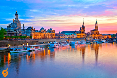
Dresden’s remarkable resurrection from World War II destruction showcases one of Europe’s most spectacular baroque cityscapes. The meticulously reconstructed Frauenkirche (Church of Our Lady) stands as both architectural masterpiece and symbol of reconciliation, its distinctive stone dome once again dominating Dresden’s skyline. The city’s cultural treasures include the Zwinger Palace complex housing exceptional art collections, and the Semperoper opera house representing the pinnacle of 19th-century theatrical architecture. Dresden’s riverside setting along the Elbe contributes to its romantic character, with panoramic views available from steamboat cruises or the promenade in the Neustadt district. Beyond the historic center, the city offers distinctive experiences from the quirky artistic neighborhood of Äußere Neustadt to the former royal summer residence at Pillnitz Castle with its beautiful gardens, providing visitors multiple perspectives on Saxon culture past and present.
Frauenkirche (Church of Our Lady)

The Frauenkirche stands as one of the most powerful symbols of Dresden’s destruction and resurrection. This magnificent Protestant church was originally built between 1726 and 1743, designed by architect George Bähr in the elaborate Baroque style that characterized Dresden’s golden age. At the time of its completion, the church’s distinctive stone dome—called the “Stone Bell”—was one of the largest in Europe and an engineering marvel of its day.
What makes the Frauenkirche particularly remarkable is its recent history. During the Allied bombing of Dresden in February 1945, the church withstood two days of intense bombing before finally collapsing from the extreme heat generated by the firestorm around it. For nearly 45 years following World War II, the ruins remained untouched as a war memorial during the GDR period, with a pile of rubble standing as a somber reminder of the destruction.
After German reunification in 1990, an ambitious reconstruction project began, meticulously rebuilding the church using original plans and incorporating about 3,800 original stones recovered from the rubble. Modern computer technology was used to determine exactly where each salvaged stone belonged in the reconstruction. These darker, fire-damaged stones are now visible throughout the reconstructed church, creating a striking patchwork effect that serves as a physical reminder of the building’s history.
The interior features five levels of galleries rising toward the dome, which soars 68 meters above the floor. The altar, pulpit, and baptismal font have been recreated based on historical documentation, while the magnificent organ with 4,873 pipes was built by Daniel Kern of Strasbourg. The church’s acoustic properties are extraordinary, making it an exceptional venue for the regular concerts held there.
The painstaking reconstruction was completed in 2005, and the church’s reconsecration service was attended by dignitaries from around the world. Today, the Frauenkirche serves not only as an active place of worship but also as a symbol of reconciliation. The golden cross atop the dome was crafted by the son of an RAF bomber pilot who participated in the 1945 air raid, symbolizing healing and forgiveness across generations.
Address and Basic Information
Frauenkirche Dresden
Neumarkt, 01067 Dresden, Germany
Opening Hours
- Monday to Friday: 10:00 AM – 12:00 PM and 1:00 PM – 6:00 PM
- Saturday: 10:00 AM – 5:00 PM
- Sunday: 12:30 PM – 6:00 PM
- Special Note: Hours may vary during religious services and special events. The church may close earlier on certain days for concerts or private events.
Public Transportation
Tram Lines
The Dresden tram system is the most convenient way to reach Frauenkirche. Several tram lines stop directly at or very near the church:
Altmarkt Stop (5-minute walk):
- Tram Lines 1, 2, 4, 44: Multiple connections across the city
- Tram Line 12: Connects various districts
Pirnaischer Platz Stop (7-minute walk):
- Tram Lines 1, 2, 4, 44: Extensive network coverage
Bus Connections
Nearby Stops:
- Altmarkt
- Postplatz 1
Lines: 333, 360, H/S,
S-Bahn (Suburban Railway)
Dresden Mitte Station (10-minute walk to Frauenkirche):
- S1 Line: Meißen Triebischtal to Schöna
- S2 Line: Pirna to Coswig
Main Railway Connections
Dresden Hauptbahnhof (Main Station) (20-minute walk or short tram ride):
- All major train services including ICE, IC, and regional trains
- From Hauptbahnhof, take Tram Line 11 to Postplatz, then transfer to Lines 1 or 2 to Neumarkt
Transportation Companies
Public Transport Operator
DVB (Dresdner Verkehrsbetriebe AG):
- Operates all trams, buses, and funicular railways in Dresden
- Integrated ticketing system covers all public transport modes
- Mobile app available for route planning and ticket purchases
Regional Transport
VVO (Verkehrsverbund Oberelbe):
- Regional transport network including S-Bahn services
- Coordinates with DVB for seamless connections
Deutsche Bahn
- National railway operator for long-distance connections to Dresden Hauptbahnhof
Nearby Parking Facilities
Quartier 206 Parking Garage:
- Address: An der Frauenkirche 5, 01067 Dresden
- Distance: 2-minute walk to Frauenkirche
- Multi-level covered parking
- Accessible 24/7
Neumarkt Parking:
- Located directly at Neumarkt square
- Underground parking facility
- Very close to the church entrance
Altmarkt Parking Garage:
- Address: Wilsdruffer Straße, 01067 Dresden
- Distance: 8-minute walk to Frauenkirche
- Large capacity parking facility
Q-Park Dresden Altstadt:
- Modern parking facility in the old town
- Short walking distance to multiple attractions
Street Parking
Limited metered street parking is available in the surrounding area, but spaces are often occupied due to high tourist traffic. Parking meters typically operate from 8:00 AM to 8:00 PM on weekdays and Saturdays.
Nearby Major Attractions
Understanding the proximity of other attractions helps you plan an efficient visit to the area:
Semperoper (Dresden Opera House):
- Distance: 400 meters (5-minute walk)
- World-renowned opera house with guided tours available
Dresden Castle (Residenzschloss):
- Distance: 300 meters (4-minute walk)
- Houses multiple museums including the Green Vault
Zwinger Palace:
- Distance: 600 meters (8-minute walk)
- Baroque palace complex with multiple museums
Brühl’s Terrace:
- Distance: 500 meters (6-minute walk)
- Elevated terrace overlooking the Elbe River, known as “Europe’s Balcony”
Dresden Cathedral (Katholische Hofkirche):
- Distance: 400 meters (5-minute walk)
- Historic cathedral with impressive baroque architecture
Neumarkt Square:
- Immediate location of Frauenkirche
- Reconstructed historic square with shops, restaurants, and cafes
Airport Connections
Dresden Airport (DRS):
- S-Bahn S2: Direct connection from airport to Dresden Mitte (near Frauenkirche)
- Airport Express Bus: Limited service to city center
- Taxi/Ride-sharing: Approximately 30-minute journey to city center
Zwinger Palace

The Zwinger Palace represents the pinnacle of Baroque extravagance in Germany. Commissioned by Augustus the Strong, Elector of Saxony and King of Poland, and built between 1710 and 1728, the Zwinger was designed by court architect Matthäus Daniel Pöppelmann with sculptures by Balthasar Permoser. The name “Zwinger” refers to its location in the former fortress area between the inner and outer defensive walls.
Unlike typical royal residences, the Zwinger was conceived primarily as a magnificent setting for court festivities, tournaments, and elaborate garden parties. Its design reflects Augustus the Strong’s ambition to transform Dresden into the “Florence on the Elbe” and cement Saxony’s place among Europe’s cultural powers. The complex is arranged as a vast rectangular pavilion with ornate buildings surrounding a central courtyard.
The architecture features sweeping curved galleries connecting grand pavilions at each corner. The most impressive of these is the Kronentor (Crown Gate), which serves as the main entrance to the palace grounds. This ornate gate is topped with a gilded Polish royal crown, symbolizing Augustus’s dual role as Saxon Elector and Polish King. The sandstone façades throughout the complex are adorned with thousands of intricate sculptures depicting mythological figures, grotesque masks, and allegorical representations of the seasons and elements.
Inside the Zwinger complex, visitors find several world-class museums. The most famous is the Gemäldegalerie Alte Meister (Old Masters Picture Gallery), housed in the building that closes the formerly open north side of the complex, added by Gottfried Semper in the 19th century. The Mathematical-Physical Salon displays historical scientific instruments and mechanical marvels collected by the Saxon rulers, while the Porcelain Collection houses one of the world’s most comprehensive collections of Meissen porcelain.
The Zwinger’s central courtyard features meticulously maintained formal gardens with ornamental hedges, fountains, and orange trees in planters that are moved indoors during winter. The Nymphenbad (Bath of the Nymphs) is a remarkable Baroque fountain featuring cascading water and numerous sculptures of nymphs and tritons.
Like many of Dresden’s treasures, the Zwinger was severely damaged during World War II, with only the outer walls remaining standing after the 1945 bombing. Its reconstruction became one of the first major architectural restoration projects in post-war Dresden, symbolizing the city’s determination to reclaim its cultural heritage.
Address and Location Details
Zwinger Palace
Theaterplatz 1, 01067 Dresden, Germany
The palace occupies a strategic position between Dresden’s old town and the Elbe River, directly adjacent to the Semperoper (Dresden State Opera) and within walking distance of Dresden Castle. Understanding this central location helps explain why the Zwinger serves as a natural starting point for exploring Dresden’s cultural quarter.
Opening Hours and Access Information
Zwinger Courtyard (Free Access): The magnificent baroque courtyard remains open to visitors daily from 6:00 AM to 10:00 PM, allowing you to appreciate the architecture and gardens even when museums are closed. This accessibility makes the Zwinger particularly valuable for early morning or evening photography and casual exploration.
Museum Collections within the Zwinger:
Old Masters Picture Gallery (Gemäldegalerie Alte Meister):
- Tuesday to Sunday: 10:00 AM to 6:00 PM
- Closed Mondays (except holidays)
- Houses Raphael’s Sistine Madonna and works by Vermeer, Rembrandt, and other masters
Porcelain Collection (Porzellansammlung):
- Tuesday to Sunday: 10:00 AM to 6:00 PM
- Closed Mondays
- Features one of the world’s largest collections of Asian and Meissen porcelain
Royal Cabinet of Mathematical and Physical Instruments:
- Tuesday to Sunday: 10:00 AM to 6:00 PM
- Closed Mondays
- Displays historical scientific instruments and clocks
Important Scheduling Considerations: Museums may extend hours during peak tourist seasons and often remain open on holiday Mondays. The courtyard’s extended access hours mean you can plan museum visits during the day while enjoying the architecture during different lighting conditions throughout your stay.
Public Transportation
Tram Transportation (Dresdner Verkehrsbetriebe – DVB)
Primary Tram Stops for Zwinger Access:
Theaterplatz Stop (directly at the Zwinger entrance): This represents your ideal arrival point, positioning you immediately at the palace entrance. Lines 3, 4, 7, and 9 serve this stop, connecting you to various parts of Dresden and surrounding areas. Line 4 particularly important because it connects the main train station (Hauptbahnhof) directly to the Zwinger, making it perfect for arriving visitors.
Postplatz Stop (150 meters walk): Served by lines 1, 2, 4, 44 this major interchange point provides excellent connectivity throughout the city. The short walk from Postplatz takes you through Kleine Brüdergasse, offering glimpses of Dresden’s rebuilding efforts and modern urban planning alongside historical preservation.
Am Zwingerteich Stop (directly at the Zwinger entrance): Stops Line 11 at this stop.
Bus Network Integration
Nearby Stops:
- Dresden Postplatz 1
Lines: 333, 360
S-Bahn Regional Rail System
Dresden Mitte Station (10-minute walk to Zwinger palace):
- S1 Line: Meißen Triebischtal to Schöna
- S2 Line: Pirna to Coswig
Major Parking Facilities:
Parkhaus Altmarkt: Located at Webergasse 1, this multi-level facility provides 600 parking spaces within 400 meters of the Zwinger. The garage operates 24 hours daily and includes electric vehicle charging stations. The walk to the Zwinger takes you through Dresden’s pedestrianized shopping area, making it convenient for combining activities.
Parkhaus Frauenkirche: Situated at An der Frauenkirche 5, this facility offers 350 spaces approximately 300 meters from the Zwinger. This parking option positions you perfectly for exploring both the Zwinger and the nearby Frauenkirche, creating an efficient cultural tour route.
Q-Park Dresden Centrum: Located on Wilsdruffer Straße, this modern facility provides 450 spaces with direct pedestrian access to the historic center. The garage features clear directional signage in multiple languages and automated payment systems that accept international credit cards.
Street Parking Considerations: Dresden’s historic center implements time-limited parking zones (typically 2 hours maximum) with digital payment systems. These spaces work well for short visits but require careful attention to time limits and payment requirements. The city actively enforces parking regulations, particularly in tourist areas.
Nearby Attractions
Adjacent Cultural Sites:
Semperoper Dresden: Sharing Theaterplatz with the Zwinger, this world-renowned opera house offers tours during non-performance periods. The architectural dialogue between the baroque Zwinger and the neo-Renaissance opera house illustrates Dresden’s layered cultural development.
Dresden Castle (Residenzschloss): Located 200 meters from the Zwinger, this former royal residence houses multiple museums including the Green Vault treasure chamber. The short walk between these sites passes through Dresden’s most historically significant area, allowing you to trace Saxon royal history across multiple locations.
Brühl’s Terrace: Known as the “Balcony of Europe,” this elevated walkway along the Elbe River sits 300 meters from the Zwinger. The terrace provides spectacular views of Dresden’s skyline and the river, offering perfect photography opportunities and peaceful breaks between intensive museum visits.
Frauenkirche Dresden: This reconstructed baroque church stands 400 meters from the Zwinger in the Neumarkt square. The walk between these sites passes through areas that showcase Dresden’s remarkable reconstruction efforts following World War II destruction.
Semperoper

The Semperoper (Semper Opera House) represents Dresden’s rich musical tradition and the city’s resilience in the face of multiple historical catastrophes. This magnificent opera house is named after its architect, Gottfried Semper, who designed the original building completed in 1841 in the early Renaissance style.
After being destroyed by fire in 1869, Semper designed its replacement from exile (having been banished from Saxony for his participation in the May Uprising of 1849). The second version, completed in 1878, featured a more opulent High Renaissance style with Baroque elements. This is essentially the building visitors see today, though it required complete reconstruction after the 1945 bombing. The painstaking rebuilding process was finally completed in 1985, with the reopening timed to coincide with the 40th anniversary of the city’s destruction.
The exterior combines elements of early Renaissance, Baroque, and Corinthian styles, creating a harmonious yet imposing presence on Theater Square. The façade is decorated with numerous sculptures representing famous figures from Greek mythology and the arts, including busts of important composers like Weber, Mozart, and Beethoven. The panthers drawing the chariot of Dionysus on the main pediment have become a distinctive symbol of the building.
Inside, the auditorium features five tiers of seating in a traditional horseshoe arrangement, accommodating approximately 1,300 spectators. The interior design includes rich red and gold decoration, extensive use of marble, and an impressive ceiling painting depicting the Greek god Apollo surrounded by nine muses. The chandelier weighs nearly 1.9 tons and contains hundreds of lights that illuminate the richly decorated space.
The Semperoper holds profound significance in music history. It was here that many of Richard Wagner’s early operas premiered, including “The Flying Dutchman” (1843) and “Tannhäuser” (1845). Richard Strauss also enjoyed a close relationship with the opera house, premiering nine of his operas here, including “Salome” (1905) and “Elektra” (1909). The house continues this tradition of musical excellence today as home to the Sächsische Staatskapelle Dresden (Saxon State Orchestra), one of the world’s oldest and most respected orchestras, founded in 1548.
The acoustics of the hall are considered nearly perfect, attracting performers and music lovers from around the world. The opera house typically presents over 300 performances annually, ranging from opera and ballet to orchestral concerts and special events.
Brühl’s Terrace

Often called “The Balcony of Europe,” Brühl’s Terrace offers a panoramic promenade along the Elbe River that has been a defining feature of Dresden’s cityscape for centuries. This elevated terrace stretches for about 500 meters along the river’s southern bank, providing spectacular views of the Elbe, the bridges spanning it, and the Neustadt district on the opposite shore.
The terrace is named after Count Heinrich von Brühl, who served as Prime Minister under Augustus III. Originally part of Dresden’s fortifications, this area was transformed into Count Brühl’s private gardens in the mid-18th century. After his death, the space was opened to the public in 1814, becoming one of the earliest examples of public urban space created from former defensive structures.
Access to the terrace from Theater Square is via a grand staircase known as the Stallhof, flanked by four allegorical sandstone sculptures representing the four times of day: Morning, Noon, Evening, and Night, created by Johannes Schilling in 1868. These sculptures exemplify the Romantic period’s fascination with the passage of time and natural cycles.
As you stroll along the terrace, you encounter several significant buildings and monuments. The Secundogenitur (originally built for the second sons of the royal family) now houses the Academy of Fine Arts. The distinctive dome of the Kunstakademie (Art Academy) rises above the terrace, while the Albertinum, home to the New Masters Gallery and the Sculpture Collection, anchors the eastern end.
Near the center of the terrace stands the Dolphin Fountain, a popular meeting point for locals and visitors alike. Nearby, a monument honors Gottfried Semper, the architect who shaped much of Dresden’s iconic skyline. Several cafés and restaurants along the terrace provide perfect spots to relax and take in the views.
The terrace’s stone balustrade features ornate decorations and offers numerous vantage points for photographers seeking to capture Dresden’s famous silhouette. The perspective from Brühl’s Terrace has inspired painters and writers for generations, appearing in countless artworks and literary descriptions of the city.
During warmer months, street musicians and artists add to the lively atmosphere, while the annual Film Nights festival transforms part of the terrace into an open-air cinema with the Elbe and the city skyline as a dramatic backdrop.
Neumarkt Square

Neumarkt Square represents one of the most ambitious urban reconstruction projects in modern European history. This central square, dominated by the Frauenkirche, has been meticulously restored to recreate the elegant Baroque ensemble that existed before the 1945 bombing, which completely destroyed this historic center of Dresden.
The square’s history dates back to the 11th century when it served as a marketplace outside the original city walls. As Dresden expanded, Neumarkt became the heart of the bourgeois district, surrounded by the homes of wealthy merchants and craftsmen. During the 18th century, under Augustus the Strong and his successors, the area was transformed with uniform Baroque façades that created a harmonious architectural ensemble, making it one of Europe’s most beautiful urban spaces.
After lying in ruins for decades following World War II, with only a few buildings partially reconstructed during the GDR period, the comprehensive restoration of Neumarkt began in earnest after German reunification. The reconstruction follows the historical principle of “critical reconstruction,” which aims to recreate the square’s original spatial composition and atmosphere while adapting interiors to modern requirements.
The buildings surrounding the square are organized into eight “quarters,” each containing several individual structures. What makes the reconstruction particularly remarkable is the attention to historical accuracy. Original architectural elements recovered from the rubble have been incorporated whenever possible. Where no original materials survived, traditional building techniques and materials were employed, including the distinctive “Dresden Baroque” style with its graceful curves and ornate sandstone decorations.
The most impressive of these reconstructed buildings include the Cosel Palace, the British Hotel, and the Museum of Dresden Romanticism. While the exteriors faithfully reproduce the historic appearance, the interiors typically feature modern apartments, shops, and restaurants. This approach—preserving historic urban design while creating functional modern spaces—has been both praised as a model for post-disaster reconstruction and criticized by those who see it as creating a kind of architectural fiction.
Street-level arcades house boutiques, cafés, and galleries, recreating the lively commercial atmosphere that characterized the pre-war square. Small details, such as historically accurate street lamps, cobblestone patterns, and benches, enhance the square’s historical ambiance.
Throughout the year, Neumarkt hosts various markets and festivals, including one of Germany’s oldest Christmas markets, continuing traditions that have taken place on this spot for centuries, creating a living connection between Dresden’s past and present.
Grünes Gewölbe (Green Vault)

The Grünes Gewölbe (Green Vault) houses one of the most magnificent treasure collections in Europe, showcasing the extraordinary wealth and artistic patronage of the Saxon electors and kings. The collection is divided between two museum spaces within Dresden Castle: the Historic Green Vault and the New Green Vault.
The name “Green Vault” derives from the original green-painted columns and decorative elements in the treasury rooms established by Augustus the Strong between 1723 and 1729. Augustus conceived this space not as a private treasury but as one of the world’s first public museums, allowing visitors—albeit only distinguished ones—to view his extensive collections of precious objects.
The Historic Green Vault recreates the original Baroque display rooms as Augustus the Strong designed them. This experience is unique in museum practice, as objects are presented without protective glass cases in lavishly decorated rooms. The space comprises nine chambers, each with a distinct theme and color scheme, with walls covered in mirrors, gilded consoles, and ornate cabinetry that create a dazzling, almost overwhelming sensory experience.
Among the most famous pieces in the collection is the “Dresden Green Diamond,” a 41-carat naturally green diamond—the largest of its kind in the world. Other highlights include Johann Melchior Dinglinger’s “Court of the Great Mogul,” an elaborate miniature tableau with 132 figurines depicting the birthday celebration of Aurangzeb, created between 1701 and 1708. This masterpiece alone contains nearly 5,000 diamonds, rubies, emeralds, and pearls.
The Ivory Room displays masterpieces of ivory carving, including incredibly delicate ships crafted from single tusks. The Silver and Gilded Silver Room showcases elaborate drinking vessels and tableware, while the Jewel Room contains stunning examples of Renaissance and Baroque jewelry. The Amber Cabinet features exquisite amber carvings, including a complete cabinet made entirely from this fossilized resin.
In November 2019, the Green Vault suffered a significant theft when burglars broke into the Historic Green Vault and stole several priceless pieces of 18th-century jewelry. While some items have been recovered, the incident highlighted the challenges of balancing security with public access to such extraordinary treasures.
The New Green Vault, located in different rooms of Dresden Castle, presents additional masterpieces from the collection in modern museum displays with improved security and conservation conditions. Here, visitors can examine the extraordinary craftsmanship of these objects more closely, appreciating details that might be missed in the atmospheric but dimly lit historic rooms.
Together, these twin museums preserve and present Augustus the Strong’s vision of a “complete artwork” where architecture, decoration, and displayed objects create a harmonious whole that demonstrates not just wealth but refined artistic taste and cultural sophistication.
Dresden Castle (Residenzschloss)
Dresden Castle served as the royal residence of the electors and kings of Saxony for nearly 400 years, evolving from a medieval fortress into one of Germany’s largest Renaissance palaces. Its architectural development reflects Dresden’s transformation from a regional power to a major European cultural center.
The castle’s history began in the 13th century with a defensive structure guarding a crossing of the Elbe River. Under the Wettin dynasty, particularly during the reigns of Dukes George the Bearded and Maurice in the 16th century, the medieval fortress was transformed into a Renaissance palace. Augustus the Strong further expanded and renovated the complex in the early 18th century, adding Baroque elements to showcase Saxony’s growing wealth and importance.
The massive complex features four main wings surrounding a large courtyard, with distinctive towers marking each corner. The most notable is the 100-meter Hausmannsturm (Hausmann Tower), which offers panoramic views of the city. The castle’s façades display a fascinating mixture of architectural styles, ranging from Renaissance to Neo-Renaissance, reflecting the building’s evolution across centuries.
Inside, visitors encounter a series of magnificent spaces that have been painstakingly reconstructed following the castle’s destruction in 1945. The most impressive is the Georgenbau (George’s Building), with its ornate staircase tower featuring the first full Renaissance portal in Dresden. The Giant’s Hall (Riesensaal) served as the main banqueting hall, capable of hosting lavish court festivities.
Today, the reconstructed castle houses five museums that showcase different aspects of Dresden’s cultural heritage. In addition to the Green Vault collections discussed earlier, these include:
The Dresden Armory (Rüstkammer), displaying one of Europe’s most important collections of ceremonial weapons, armor, and tournament equipment. Many pieces are outstanding examples of the metalworker’s art, decorated with precious metals, gems, and intricate engravings.
The Coin Cabinet (Münzkabinett) contains over 300,000 objects tracing the history of coinage from ancient times to the present, with particular strength in Saxon coins and medals that document important historical events and personalities.
The Kupferstich-Kabinett (Collection of Prints, Drawings and Photographs) preserves works on paper by masters including Dürer, Rembrandt, and Michelangelo, though only rotating exhibitions are displayed due to conservation concerns.
The Turkish Chamber (Türckische Cammer) showcases an extraordinary collection of Ottoman art and artifacts, reflecting Saxony’s fascination with and diplomatic relations with the Ottoman Empire during the 17th and 18th centuries. The collection includes luxurious tents, weapons, textiles, and ceremonial objects.
The castle’s reconstruction has been one of Dresden’s most ambitious post-war restoration projects. While some rooms have been recreated with historical accuracy, others feature modern architectural elements that acknowledge the building’s complex history of destruction and rebirth.
Procession of Princes (Fürstenzug)

The Fürstenzug, or Procession of Princes, is one of Dresden’s most distinctive public artworks—a monumental mural depicting the rulers of the House of Wettin, who governed Saxony for more than 800 years. What makes this artwork particularly remarkable is its medium: the 102-meter-long panorama consists of approximately 25,000 Meissen porcelain tiles, making it the world’s largest porcelain artwork.
The mural adorns the outer wall of the Stallhof (Stables Courtyard), part of the Dresden Castle complex, along Augustusstrasse. It was originally created between 1872 and 1876 as a sgraffito mural (a technique where layers of plaster are carved away to create images). However, to preserve the artwork from weathering, it was transferred to porcelain tiles between 1904 and 1907 by Meissen, the famous Saxon porcelain manufacturer.
The procession depicts 35 rulers, from Margrave Conrad the Great (who ruled from 1127 to 1156) to King Frederick Augustus III (the last Saxon king, who abdicated in 1918). Each figure is shown on horseback or walking in period-appropriate attire, creating a chronological parade of Saxon history and changing fashions across nearly eight centuries. The lifelike portrayal of each ruler is based on historical portraits and documents, with remarkable attention to detail in their clothing, weapons, and regalia.
Accompanying the rulers are 59 scientists, artisans, children, farmers, and soldiers representing the common people of Saxony and their contributions to the region’s development. This inclusion of ordinary citizens alongside royalty was somewhat progressive for its time, acknowledging that a society’s achievements extend beyond its ruling class.
What makes the Fürstenzug particularly significant historically is that it survived the 1945 bombing virtually intact, when most of Dresden’s center was reduced to rubble. The porcelain tiles proved remarkably resistant to both the extreme heat of the firestorm and subsequent weathering, requiring only minimal restoration over the decades.
Beyond its artistic and technical achievements, the Fürstenzug serves as an important historical document of Saxon genealogy and political evolution. The mural visually narrates how Saxony grew from a small margraviate to an electorate and eventually a kingdom, with subtle visual cues indicating each ruler’s significant contributions and historical context.
The Fürstenzug continues to attract visitors who can trace the evolution of Saxon history through this unique ceramic chronicle. Its resilience through Dresden’s darkest hour has made it a powerful symbol of cultural continuity, demonstrating how art can preserve historical memory across generations and withstand even the most destructive forces.
Loschwitz Bridge (Blue Wonder)

The Loschwitz Bridge, affectionately known as the “Blue Wonder” (Blaues Wunder), spans the Elbe River connecting the Dresden districts of Blasewitz and Loschwitz. Completed in 1893, this steel cantilever truss bridge represents a significant engineering achievement of its era and has become one of Dresden’s most recognizable landmarks.
The bridge’s official name honors King Albert of Saxony (Albertbrücke), but its popular nickname has more uncertain origins. Some attribute it to the bridge’s blue-painted steel, while others suggest it refers to the “wonder” that such a structure could be built without river piers or supports, spanning 280 meters without obstructing river navigation. This technical achievement was particularly impressive for its time.
Chief engineer Claus Köpcke designed the bridge using a cantilever system with a revolutionary approach that eliminated the need for temporary supports in the river during construction—a significant innovation for bridge building in the late 19th century. The bridge stands 24 meters above the normal water level of the Elbe, allowing river traffic to pass freely beneath it.
The Blue Wonder’s design combines practical engineering with aesthetic considerations. The intricate latticework of steel creates a visually striking silhouette that harmonizes with the picturesque surroundings of villa-lined riverbanks and distant vineyards. Small decorative towers at each end of the bridge add a touch of Neo-Gothic charm to the otherwise industrial structure.
The bridge narrowly escaped destruction in the final days of World War II. As Allied forces approached Dresden in May 1945, German troops prepared to demolish the bridge to slow the Soviet advance. A group of local residents, led by painter Paul Füssel, risked their lives to cut the detonation wires, saving this engineering masterpiece from destruction—one of the few instances where Dresden’s architectural heritage was successfully preserved during the war.
Today, the Blue Wonder serves approximately 35,000 vehicles daily, along with pedestrians and cyclists using dedicated pathways on either side. From these walkways, visitors enjoy spectacular views of the Elbe Valley, including vineyards, historic villas, and the paddle steamers that constitute the world’s oldest and largest fleet of steam-powered riverboats still in operation.
The areas surrounding the bridge have developed distinct cultural identities. The Schillerplatz on the Blasewitz side features cafés and restaurants in elegant Art Nouveau buildings, while the Körnerplatz in Loschwitz offers a more village-like atmosphere. Nearby, the Luisenhof restaurant provides panoramic views of Dresden’s skyline, earning it the nickname “The Balcony of Dresden.”
The bridge serves as the centerpiece of the annual Elbhangfest, a summer festival celebrating the cultural heritage of the communities along this scenic stretch of the Elbe. During this event, the bridge is closed to traffic and becomes a festive gathering place featuring music, art, and local culinary specialties.
Bridge Overview and Address
Official Name: Loschwitzer Brücke (also known as “Blaues Wunder” – Blue Wonder)
Address: Loschwitzer Brücke, 01326 Dresden, Germany
Coordinates: 51.0539°N, 13.8089°E
The bridge connects Dresden-Loschwitz on the right bank of the Elbe with Dresden-Blasewitz on the left bank.
Opening Hours
The Loschwitz Bridge is a public road bridge that operates 24 hours a day, 7 days a week. There are no restrictions for pedestrian or vehicle access, making it accessible at any time for sightseeing, photography, or simply crossing the Elbe River.
Public Transportation Options
Trams (Straßenbahn)
Nearby Tram Stops:
- Jüngststraße – 6, 12
- Schillerplatz – 6, 12
Buses
Nearby Stops:
- Schillerplatz
- Dresden Körnerplatz
Lines: 61, 63, 65, 84, 521, 63
S-Bahn (Suburban Railway)
While there’s no direct S-Bahn station at the bridge, you can use S-Bahn connections to reach nearby areas:
Dresden-Neustadt Station: Major railway hub
- Multiple S-Bahn lines converge here
- Connect to tram Line 6 for direct service to Loschwitz
- About 20 minutes total journey time to the bridge
Driving and Parking Information
Parking Areas
Street Parking near Loschwitz Bridge:
- Limited metered parking spaces along Loschwitzer Straße
- Free parking available on some residential side streets (observe local parking signs)
- Pillnitzer Landstraße offers some additional parking opportunities
Recommended Parking Locations:
- Small parking area near Loschwitz tram terminus
- Residential streets in Loschwitz village (respect local parking regulations)
- Consider parking in Blasewitz area and walking across the bridge
Important Note: Parking directly at the bridge is very limited, so arriving early in the day or using public transport is often more convenient.
Ferry Services
Historic Loschwitz Ferry
Schwebefähre Loschwitz: While not transportation to the bridge itself, this historic suspension ferry operates nearby
- Connects Loschwitz with Niederpoyritz across the Elbe
- Located about 800 meters upstream from the bridge
- Seasonal operation (typically April to October)
- Offers unique perspective of the area and bridge
Nearby Attractions and Points of Interest
Cultural Attractions
Loschwitz Village: Historic district with 19th-century villas and charming streets
- Traditional restaurants and cafes
- Art galleries and antique shops
- Historic church (Loschwitzer Kirche)
Villa Stockhausen: Historic villa now serving as cultural venue
- Regular exhibitions and cultural events
- Beautiful architecture representing Dresden’s wealthy past
Natural Attractions
Elbe River Promenade: Scenic walking path along the river
- Extends in both directions from the bridge
- Popular for jogging, walking, and cycling
- Offers excellent photography opportunities
Loschwitzer Hillside: Elevated area above the village
- Hiking trails with panoramic views
- Access to Luisenhof restaurant with terrace overlooking the Elbe
Technical and Historical Sites
Standseilbahn (Funicular Railway): Historic mountain railway in Loschwitz
- Operating since 1895
- Climbs to restaurant and viewpoint
- Station located 400 meters from bridge
Schwebebahn (Suspension Railway): Another historic transport system
- Connects Loschwitz area with elevated positions
- Engineering marvel from early 20th century
The Black Forest (Schwarzwald)
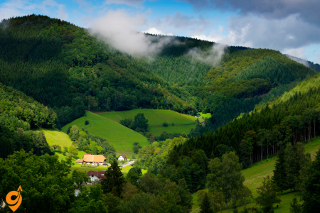
The Black Forest region evokes the mysterious atmosphere of Brothers Grimm fairy tales with its dense evergreen forests, hidden valleys, and traditional villages. This mountain range in southwest Germany offers exceptional outdoor experiences along well-maintained hiking and cycling trails, including the famous Westweg long-distance path traversing the entire region from north to south. Traditional Black Forest culture comes alive in towns like Triberg, famous for its waterfalls and cuckoo clock workshops where visitors can observe master craftsmen continuing centuries-old traditions. The region’s natural thermal springs feed sophisticated spa towns like Baden-Baden, offering wellness experiences in both historic and contemporary settings. Culinary specialties include the iconic Black Forest cake (Schwarzwälder Kirschtorte) and smoked ham, while scenic lakes such as Titisee and Mummelsee provide opportunities for swimming, boating, and winter sports, making the Black Forest a year-round destination.
Triberg Waterfalls

The Triberg Waterfalls (Triberger Wasserfälle) stand as one of Germany’s most impressive natural spectacles and are among the highest waterfalls in the country. Located near the town of Triberg im Schwarzwald in the heart of the Black Forest, these cascades drop a total of 163 meters (535 feet) through seven distinct stages as the Gutach River descends dramatically through a densely wooded valley.
The falls were formed during the last Ice Age when glaciers carved out the valley, creating the steep gradient necessary for such dramatic cascades. What makes the Triberg Waterfalls particularly enchanting is the way they interact with their surroundings—the rushing white water contrasts beautifully with the dark green of the surrounding spruce and fir trees that give the Black Forest its name.
Visitors experience the falls via a network of well-maintained hiking paths that run alongside the cascades. These paths range from easy, accessible routes near the entrance to more challenging trails that climb to the upper sections. The walkways include numerous viewing platforms positioned at strategic points, allowing visitors to witness the falls from different perspectives and heights. The sound of thundering water grows more intense as you ascend, with fine mist often creating miniature rainbows when sunlight filters through the trees.
The falls take on different characters throughout the seasons. In spring, snowmelt from higher elevations dramatically increases the water volume, creating a powerful torrent. Summer brings more moderate flow but lush greenery all around, while autumn transforms the surroundings with vibrant foliage that frames the white cascades. Winter offers perhaps the most magical experience, as sections of the falls often freeze into intricate ice sculptures, creating a crystalline landscape that appears almost otherworldly.
The waters of the Triberg Falls once powered numerous mills in the region, and this industrial heritage is still visible in some historical structures along the route. Today, the falls are illuminated at night during certain periods, creating a different kind of magic as the illuminated water dances through the darkness of the forest. The carefully designed lighting emphasizes different sections of the cascades without overwhelming the natural setting.
Local folklore connects the falls to various legends, including tales of forest spirits who were said to dwell near powerful water sources. These stories reflect the profound connection between the Black Forest’s natural features and its cultural heritage. Many visitors find that the falls embody the mystical quality often associated with the Black Forest—a place where natural beauty can still evoke a sense of wonder and primitive power.
Address: Hauptstraße 85, 78098 Triberg im Schwarzwald, Germany
GPS Coordinates: 48.1297°N, 8.2233°E
The waterfalls are situated within the town of Triberg itself, which makes them uniquely accessible compared to many mountain waterfalls that require extensive hiking. This accessibility stems from Triberg’s development as a tourist destination over more than a century.
Opening Hours and Seasonal Considerations
The waterfalls operate on a seasonal schedule that reflects both practical maintenance needs and optimal viewing conditions:
Summer Season (April 1 – October 31):
- Daily: 9:00 AM – 6:00 PM
- Extended daylight hours allow for the best photography and hiking conditions
- All trails and viewing platforms are fully accessible
- Peak tourist season with busiest crowds
Winter Season (November 1 – March 31):
- Daily: 9:00 AM – 5:00 PM
- Reduced hours due to shorter daylight
- Some upper trails may be closed due to ice and snow conditions
- Fewer crowds but potentially spectacular ice formations
Important Seasonal Notes: Winter visits offer a completely different experience, as portions of the waterfalls may freeze, creating dramatic ice sculptures. However, this also means certain viewing areas become inaccessible for safety reasons. Spring visits (April-May) provide the most dramatic water flow as snowmelt increases the volume.
Railway Transportation
Understanding the railway system is crucial because Triberg sits on one of Germany’s most scenic railway lines, making train travel not just practical but part of the experience itself.
Direct Railway Access
Triberg Railway Station (Bahnhof Triberg) serves as your primary arrival point:
- Located approximately 800 meters from the waterfalls entrance
- The station sits directly on the Schwarzwaldbahn (Black Forest Railway)
- This historic railway line, completed in 1873, represents one of Germany’s most engineering-challenging routes
- The walk from station to waterfalls takes about 10-12 minutes through the town center
Major Railway Connections
From Stuttgart (Regional Capital): The journey from Stuttgart demonstrates how Germany’s rail network efficiently connects major cities to smaller destinations. You’ll travel via Regionalexpress (RE) trains that make this journey in approximately 1 hour and 45 minutes. These trains run every two hours throughout the day, providing reliable scheduling for day trips or longer visits.
From Karlsruhe (Alternative Major Hub): Karlsruhe serves as another excellent starting point, with connections taking about 1 hour and 30 minutes. The route passes through some of the Black Forest’s most scenic territory, giving you a preview of the landscape you’ll be exploring.
From Frankfurt am Main: Frankfurt connections require approximately 2.5 to 3 hours with one change, typically in Karlsruhe or Stuttgart. This represents a longer but entirely feasible journey for those flying into Frankfurt Airport.
Understanding the Schwarzwaldbahn Experience
The Black Forest Railway itself deserves explanation because it’s considered one of Europe’s most scenic train routes. The line includes 39 tunnels and numerous viaducts as it climbs through the mountainous terrain. When you ride this railway, you’re experiencing 19th-century engineering that carved a path through some of Germany’s most challenging topography.
Bus Transportation Network
Regional Bus Services
Linie 7270 (RVS – Regionalverkehr Südwest): This bus line provides crucial connections between Triberg and surrounding Black Forest communities. The service operates with varying frequencies depending on the season and day of the week, with more frequent service during tourist season.
Linie 7265: Connects Triberg with other Black Forest destinations, allowing you to combine your waterfall visit with exploration of traditional villages and other natural attractions.
Understanding Bus Schedules in Rural Germany
Bus service in the Black Forest region reflects the rural character of the area. Schedules are designed primarily around local residents’ needs, with enhanced service during school terms and reduced service on weekends and holidays. This means planning your bus connections requires more attention to timing than in urban areas.
Triberg Bus Station (ZOB – Zentraler Omnibusbahnhof): Located in the town center, approximately 600 meters from the waterfalls entrance. The station coordinates with train arrivals to provide integrated transportation options.
Driving and Comprehensive Parking Information
Major Driving Routes
From Stuttgart (A81/B33 Route): Take Autobahn A81 south toward Singen, exit at Rottweil, then follow B33 through the heart of the Black Forest directly to Triberg. This route covers approximately 110 kilometers and typically takes 1 hour and 30 minutes under normal conditions. The B33 section winds through classic Black Forest landscape with traditional farmhouses, dense forests, and rolling hills.
From Frankfurt (A5/B33 Route): Follow A5 south toward Basel, exit at Offenburg, then take B33 east directly to Triberg. This represents a longer journey of about 200 kilometers requiring roughly 2 hours and 30 minutes. The route passes through the Rhine Valley before climbing into the Black Forest mountains.
From Munich (A8/A81/B33 Route): Take A8 west toward Stuttgart, connect to A81 north briefly, then follow the same B33 route to Triberg. This journey covers approximately 280 kilometers and requires about 3 hours.
Detailed Parking Analysis
Waterfall Parking Areas:
P1 – Main Waterfall Parking: Located directly adjacent to the waterfall entrance, this represents the most convenient but also most competitive parking option. The lot accommodates approximately 80 vehicles and fills completely during peak tourist times, typically by 10:00 AM on weekends and holidays during summer season.
P2 – Overflow Parking: Situated about 200 meters from the waterfall entrance, this larger facility handles approximately 150 vehicles. During peak periods, this lot serves as your backup option when the main parking fills.
Town Center Parking: Several smaller parking areas exist throughout Triberg’s center, typically 400-600 meters from the waterfalls. These include both metered street parking and small lots behind businesses.
Parking Strategy Recommendations: Arriving before 9:00 AM during peak season virtually guarantees parking availability. Alternatively, visiting after 4:00 PM often provides better parking availability as day visitors depart, though this reduces your exploration time before closing.
Walking and Hiking Access
The walking component of visiting Triberg Waterfalls deserves detailed explanation because it represents a significant part of the experience.
Trail System Overview
The waterfall area features three distinct trail options, each designed for different fitness levels and time commitments:
Main Trail (Hauptweg): This well-maintained path takes approximately 30-45 minutes to complete and provides access to all major viewing platforms. The trail features engineered walkways, handrails, and regular rest areas. Total elevation gain reaches about 100 meters, making it manageable for most visitors.
Nature Trail (Naturweg): A more challenging option requiring 60-90 minutes, this trail extends higher into the forest and provides additional viewpoints. The path includes steeper sections and natural terrain, requiring appropriate footwear and moderate fitness levels.
Cultural Trail (Kulturweg): This educational path combines waterfall viewing with information about local history, flora, and fauna. Interactive stations explain the geological processes that created the waterfalls and the cultural significance of the area.
Nearby Attractions and Integrated Tourism
Understanding the broader attraction landscape helps you plan a comprehensive visit that maximizes your travel effort.
Within Triberg Town
German Clock Museum (Deutsches Uhrenmuseum): Located 400 meters from the waterfalls, this museum showcases the Black Forest’s famous clockmaking tradition. The facility demonstrates how the region became synonymous with cuckoo clocks and precision timepieces.
World’s Largest Cuckoo Clock: Multiple locations in Triberg claim this distinction, creating an entertaining debate among visitors. These oversized timepieces represent the playful side of German engineering and craftsmanship.
Traditional Restaurants and Cafes: The town center features numerous establishments serving traditional Black Forest cuisine, including the famous Black Forest cake (Schwarzwälder Kirschtorte) which originated in this region.
Regional Black Forest Attractions
Schwarzwald-Baar Nature Park: The waterfalls sit within this protected area, which encompasses some of the Black Forest’s most pristine landscapes. Understanding this context helps visitors appreciate the conservation efforts that maintain the area’s natural character.
Traditional Black Forest Villages: Communities like Schönbuch, Sankt Georgen, and Furtwangen lie within easy driving distance, each offering authentic examples of Black Forest architecture and culture.
Additional Natural Attractions: The region features numerous hiking trails, scenic overlooks, and traditional farms that demonstrate the area’s agricultural heritage alongside its natural beauty.
Lake Titisee

Lake Titisee sits like a sparkling jewel nestled among the forested hills of the southern Black Forest, forming one of the region’s most picturesque and popular natural attractions. This glacial lake was formed roughly 10,000 years ago when the Feldberg glacier retreated at the end of the last Ice Age, leaving behind this pristine body of water with its distinctive oval shape.
Stretching approximately 2 kilometers in length and about 700 meters in width, Titisee covers an area of roughly 1.3 square kilometers. Its depth reaches up to 40 meters in places, and the lake is fed by the Feldberg mountain’s underground springs, resulting in exceptionally clear, clean water. The lake’s outflow forms the beginning of the Gutach River, which eventually creates the famous Triberg Waterfalls further north.
The small resort town of Titisee-Neustadt has developed along the northern shore, offering a charming blend of traditional Black Forest architecture and modern tourist amenities. The town’s waterfront promenade provides an excellent vantage point for appreciating the lake’s beauty, with the dark forested hills reflected perfectly in the calm waters. This combination of water, forest, and mountain scenery creates a landscape that has inspired artists and photographers for generations.
The lake offers numerous recreational opportunities throughout the year. During the warmer months, visitors can enjoy swimming at designated beaches, rent pedal boats, canoes, or stand-up paddleboards to explore the lake’s surface, or board one of the solar-powered passenger boats that offer guided tours. The entire lake can be circled on foot via a scenic 8-kilometer hiking path that alternates between shoreline sections and slightly elevated routes through the surrounding woods, providing constantly changing perspectives of the water and landscape.
In winter, when temperatures drop sufficiently, the lake sometimes freezes solid, transforming into a natural ice rink where locals and visitors alike enjoy skating, ice hockey, and curling. This frozen landscape creates an entirely different but equally magical experience of the lake, particularly when fresh snow covers the surrounding forests.
The area surrounding Lake Titisee boasts some of the highest air quality in Germany, which has contributed to its development as a climatic health resort. Since the 19th century, doctors have recommended the region for patients suffering from respiratory ailments, believing the combination of clear lake air and forest atmosphere provided therapeutic benefits. This medical heritage still influences the tourism industry, with many wellness hotels and spas emphasizing natural healing traditions alongside modern treatments.
Lake Titisee has also left its mark on local culinary traditions. The abundant freshwater fish, particularly pike and perch, feature prominently in regional cuisine. The lake’s waters are carefully managed to maintain both their recreational value and ecological health, with strict regulations governing fishing and boating activities to preserve this natural treasure for future generations.
Feldberg Mountain

Feldberg Mountain rises majestically as the highest peak in the Black Forest and indeed in all of Germany outside the Alps, reaching an elevation of 1,493 meters (4,898 feet) above sea level. This prominent landmark has shaped the geography, climate, and human activities in the southern Black Forest for millennia, creating a distinct highland ecosystem that contrasts with the lower forested regions.
Geologically, Feldberg is part of the ancient gneiss and granite massif that forms the backbone of the Black Forest. Its current form was significantly shaped during the last Ice Age, when glaciers carved out distinctive cirques (bowl-shaped depressions) on its eastern face, the most prominent being the Feldsee cirque. These glacial features have left the mountain with a relatively gentle western slope but a more dramatic eastern face that drops steeply toward the Rhine Valley.
The mountain’s considerable elevation creates what ecologists call an “island of Arctic climate” in the middle of Central Europe. This allows rare alpine and sub-arctic plant species to thrive here, hundreds of kilometers from their main distribution areas in the Alps or Northern Europe. The biodiversity is particularly evident in the Feldberg Nature Reserve, established in 1937 as Baden-Württemberg’s oldest nature protection area. Covering approximately 42 square kilometers, this reserve protects rare species including alpine roses, gentians, and various orchids that bloom spectacularly in early summer, transforming the upper slopes into carpets of color.
The tree line on Feldberg occurs at approximately 1,350-1,400 meters, beyond which natural alpine meadows dominate the landscape. These meadows, locally known as “Weiden,” have been maintained for centuries through traditional grazing practices that prevent forest regrowth. This practice has created the mountain’s characteristic open summit area, which offers spectacular 360-degree panoramic views. On clear days, visitors can see not only across the entire Black Forest but also to the Swiss Alps in the south, the Vosges Mountains in France to the west, and the Swabian Alb to the east.
Historically, Feldberg’s climate made permanent settlement at higher elevations impractical, but seasonal farming operations called “Allmendweiden” allowed communities to utilize the rich summer pastures through a commons system. Herders would bring cattle up to these high meadows after the spring thaw and remain until the first autumn snows, producing distinctive mountain cheeses in small huts called “Hütten.” Some of these traditional alpine farming practices continue today, maintaining both the cultural heritage and the unique open landscape.
The mountain experiences dramatic seasonal transformations. Spring arrives late at this elevation, sometimes not until June, when snowmelt feeds countless small streams and the meadows explode with wildflowers. Summer brings moderate temperatures ideal for hiking, while autumn paints the lower slopes in vibrant colors as beech and maple trees change before the first snows arrive. Winter transforms Feldberg into southern Germany’s most significant ski destination, with reliable snow cover typically lasting from December through April.
Modern Feldberg offers extensive recreational infrastructure while balancing environmental protection. A network of well-marked hiking trails ranges from gentle paths suitable for families to challenging routes for experienced mountaineers. The Feldbergsteig, a circular trail around the summit region, provides an excellent introduction to the mountain’s diverse landscapes and spectacular viewpoints. Cable cars provide easier access to the higher elevations, including the Feldbergbahn, which carries visitors from the village of Feldberg up to near the summit area.
At the summit itself stands the Feldberg Tower, a 12-meter observation tower that houses a small natural history exhibition explaining the mountain’s unique ecosystem and cultural significance. This tower has become emblematic of the mountain, featuring on countless postcards and photos of the region.
Baden-Baden

Baden-Baden, nestled at the western edge of the Black Forest, embodies the refined elegance of a classic European spa town with a rich cultural heritage spanning more than two millennia. Its name—literally meaning “Bath-Bath”—emphasizes its identity as a place of healing waters, with the double name distinguishing it from other towns called Baden in Switzerland and Austria.
The town’s story begins with the Romans, who discovered the healing properties of the thermal springs emerging from deep beneath the Black Forest. They established a settlement called Aquae Aureliae around 70 CE, building elaborate bath complexes whose ruins can still be visited today beneath the modern Friedrichsbad. These springs produce water naturally heated to between 56°C and 68°C (133°F to 154°F), enriched with minerals believed to treat various ailments from rheumatic conditions to circulatory problems.
The town’s modern identity as an international resort destination developed primarily during the 19th century when it became known as the “Summer Capital of Europe.” During this Belle Époque period, European aristocracy, wealthy industrialists, and cultural luminaries flocked to Baden-Baden for its combination of health treatments, cultural offerings, and social opportunities. Visitors included Queen Victoria, Kaiser Wilhelm I, Brahms, Dostoyevsky, and Turgenev, all contributing to the town’s cosmopolitan atmosphere.
This golden age left an architectural legacy of grand hotels, elegant villas, and ornate public buildings that still define Baden-Baden’s cityscape. The neoclassical Kurhaus (Spa House), designed by Friedrich Weinbrenner and completed in 1824, remains the social heart of the town. Its magnificent central hall, the Bénazetsaal, features ornate frescoes and chandeliers that evoke the splendor of a bygone era. Adjacent to the Kurhaus stands the Casino Baden-Baden, often described as “the most beautiful casino in the world,” whose richly decorated gaming rooms inspired Dostoyevsky to write “The Gambler” after his own experiences there.
The town’s spa tradition continues in two complementary facilities: the historic Friedrichsbad, a 19th-century Roman-Irish bath complex featuring a traditional 17-step bathing ritual through rooms of increasing temperatures, and the modern Caracalla Spa, with its contemporary wellness approach combining thermal baths with saunas, steam rooms, and treatment areas. These facilities continue to attract visitors seeking relief from the stresses of modern life, just as their predecessors did centuries ago.
Baden-Baden’s cultural life rivals its wellness offerings, particularly through the Festival Hall (Festspielhaus), which opened in 1998 as Germany’s largest classical music venue. Built within the converted former railway station, this acoustically superb concert hall hosts world-class orchestras and opera performances, continuing the town’s long tradition as a center for music appreciation that once attracted composers like Brahms, Berlioz, and Clara Schumann.
The Museum Frieder Burda, designed by renowned architect Richard Meier, adds a striking contemporary element to the town’s cultural landscape. This luminous modern building houses an exceptional collection of 20th and 21st-century art, including works by Picasso, Gerhard Richter, and Jackson Pollock, creating a dialogue between modernism and the town’s historical character.
The surrounding landscape provides a natural complement to the town’s cultural and wellness attractions. Baden-Baden nestles in the foothills where the Black Forest meets the Rhine Valley, with forested hills rising directly behind the town. A network of well-maintained walking paths, including the famous Panoramaweg, offers everything from gentle strolls to challenging hikes with spectacular views across the town and toward the Rhine and France beyond.
This geographical position also influences Baden-Baden’s microclimate, which is notably milder than deeper in the Black Forest mountains. This allows for the cultivation of wine and exotic plants, visible in the town’s parks and gardens. The town’s atmospheric old quarter, with its cobblestone streets and historic buildings, completes the picture of a place where human creativity has worked in harmony with natural advantages to create an enduring retreat for health, culture, and pleasure.
Lichtentaler Allee
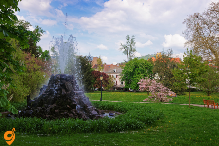
Lichtentaler Allee represents one of Europe’s most sublime examples of landscape design—a historic park avenue that connects Baden-Baden’s elegant urban center with the natural beauty of the Black Forest foothills. This tree-lined promenade extends for approximately 2.3 kilometers along the western bank of the Oos River, creating a green corridor of extraordinary botanical diversity and cultural significance.
The avenue’s development began in 1655 as a simple path connecting Baden-Baden to the Lichtental monastery, but its transformation into a formal landscaped promenade occurred primarily during the 19th century when Baden-Baden emerged as Europe’s premier spa destination. The allee was deliberately designed as a transitional space between the cultivated elegance of the town and the wilder forest landscape beyond, allowing visitors to experience a graduated immersion in nature as part of their therapeutic regime.
What makes Lichtentaler Allee exceptional is its composition of more than 300 species of native and exotic trees and shrubs, carefully selected and arranged to create a constantly changing tapestry of colors, textures, and fragrances throughout the seasons. Magnificent specimens include ancient plane trees, sequoias, ginkgos, and weeping beeches, some over 150 years old. These botanical treasures are complemented by carefully maintained flower beds that showcase around 400,000 bulbs and flowering plants annually, with displays changing seasonally.
The avenue follows the meandering course of the Oos River, whose gentle sound provides a soothing acoustic backdrop. Numerous ornamental bridges cross the stream at intervals, offering charming vantage points. The path itself alternates between sunny expanses and shaded sections, creating a pleasant microclimate that was considered beneficial for the “taking of air” prescribed as part of historical spa treatments.
Along its length, the allee incorporates several significant cultural institutions, making it not just a natural but also a cultural promenade. The Museum Frieder Burda, designed by Richard Meier, presents contemporary art in a striking modern building. Nearby, the Staatliche Kunsthalle displays changing exhibitions of international art. The historic Trinkhalle (Pump Room), with its 90-meter colonnade decorated with romantic frescoes depicting Black Forest legends, offers another architectural highlight where visitors historically would drink the mineral waters.
Several historic monuments punctuate the route, including the Stourdza Chapel, a small Russian Orthodox church built in 1866 that adds an exotic architectural element to the landscape. The Music Pavilion (Musikmuschel) hosts open-air concerts during summer months, continuing a tradition of musical performances in the park that dates back to the 19th century when composers like Brahms would premiere works here.
The avenue culminates at the Cistercian Convent of Lichtental, founded in 1245, which continues to function as a religious community. The convent’s baroque church, with its distinctive onion dome, provides both a visual landmark and a spiritual dimension to the end of the promenade. Its peaceful gardens offer a contemplative space that complements the more social character of the main allee.
Throughout its history, Lichtentaler Allee has attracted notable personalities ranging from European royalty to artists and writers. Turgenev, Gogol, and Dostoyevsky all found inspiration walking these paths, as did composers like Berlioz and Clara Schumann. Today, the allee continues to serve its historic function as a place for gentle exercise, social encounters, and cultural appreciation, embodying the sophisticated approach to health and wellbeing that characterizes Baden-Baden’s identity.
The avenue is meticulously maintained by a specialized team of gardeners who preserve both its historic character and botanical diversity while adapting to contemporary environmental challenges. In 2022, it was recognized as part of the UNESCO World Heritage designation “Great Spa Towns of Europe,” acknowledging its integral role in the European spa town tradition.
Freiburg Cathedral

Freiburg Cathedral, officially the Cathedral of Our Lady (Freiburger Münster), stands as one of Germany’s most magnificent Gothic monuments and the defining architectural landmark of Freiburg im Breisgau, the unofficial capital of the Black Forest region. This remarkable structure represents over three centuries of medieval craftsmanship, with construction spanning from approximately 1200 to 1513.
The cathedral’s most distinctive feature is its soaring west tower, rising 116 meters (380 feet) above the city center. This open-worked spire is considered one of the masterpieces of Gothic architectural engineering, remarkable not only for its height but also for its intricate stone tracery that creates a delicate, almost lace-like appearance despite its massive scale. The tower remains the only Gothic church tower in Germany that was completed during the medieval period according to its original plans, giving it particular architectural significance.
The tower can be divided into three sections: a substantial square base, an octagonal section with its corners disguised by four decorative turrets, and finally the famous pyramidal spire with its open stonework. This design allows the massive structure to appear increasingly lightweight as it rises, creating a visual impression of ascension that perfectly expresses Gothic architecture’s spiritual aspiration toward heaven.
Inside, the cathedral features a cruciform floor plan with a three-aisled nave, transept, and choir. Its proportions follow the harmonious mathematical ratios typical of High Gothic design, creating a sense of perfect balance. The interior is illuminated by 114 stained glass windows, including many that date from the 13th and 14th centuries—among the oldest intact stained glass in Germany. These windows depict biblical scenes, saints, and scenes of medieval crafts and guilds, the latter reflecting the cathedral’s funding by Freiburg’s prosperous burgher families rather than royal or episcopal patrons.
The nave is supported by massive pillars alternating in design between cruciform and round profiles, creating a rhythmic progression toward the altar. These columns are topped with carved capitals depicting local flora, mythical creatures, and biblical scenes that reward close inspection with their intricate detail and narrative content.
Among the cathedral’s artistic treasures, the high altar deserves special attention. Created by Hans Baldung Grien between 1513 and 1516, this triptych portrays the Coronation of the Virgin surrounded by the Twelve Apostles. When closed, its exterior panels show scenes from the life of Mary. This masterpiece represents the culmination of late Gothic painting in the Upper Rhine region.
Equally remarkable is the pulpit, created by Johannes Dotzinger in 1483. This stone masterpiece features detailed relief sculptures depicting Christ, the four Evangelists, Church Fathers, and prophets, all executed with astonishing technical virtuosity. The pulpit’s canopy rises in delicate Gothic tracery that echoes the cathedral’s western tower in miniature.
The cathedral houses numerous medieval tombs and monuments, including the tomb of Berthold V, Duke of Zähringen, who founded Freiburg in 1120. Other notable features include the baptismal font dating from 1360, a monumental Romanesque crucifix from around 1200, and the “Hosanna” bell from 1258, which is among the oldest functioning church bells in Germany.
The cathedral survived World War II largely intact despite heavy bombing that destroyed much of Freiburg. This preservation makes it not only an architectural treasure but also a powerful symbol of continuity for the city. Today, the cathedral continues to serve as Freiburg’s primary parish church while attracting art historians, architects, and tourists from around the world.
The cathedral’s massive western square (Münsterplatz) hosts a daily market where regional Black Forest specialties are sold alongside fresh produce, creating a lively hub of activity at the building’s feet. This combination of sacred architecture and civic life perfectly embodies the cathedral’s dual role as both spiritual center and community landmark—a role it has fulfilled for over 800 years.
Naturerlebnispark Mundenhof

The Naturerlebnispark Mundenhof offers visitors a distinctive approach to experiencing and understanding animal life within a bucolic landscape at the western edge of the Black Forest. Unlike conventional zoos, this 38-hectare nature park emphasizes the relationship between humans, animals, and sustainable agriculture in a setting that prioritizes natural habitats and spacious enclosures.
Established in 1968 on the grounds of a former estate farm, the Mundenhof has evolved into Freiburg’s largest public green space and an innovative environmental education center. What sets this park apart is its focus on domestic and farm animals from around the world, showcasing the diversity of breeds that humans have developed through centuries of selective breeding, as well as some of their wild ancestors and relatives.
The park is organized geographically, with different sections representing continents and their characteristic domestic animals. In the European area, visitors encounter ancient livestock breeds that have nearly disappeared from modern agriculture, including the massive Hungarian Grey cattle with their impressive horns, the shaggy highland cattle of Scotland, and the Mangalitza “wool pig” with its distinctive curly coat. These heritage breeds serve as living genetic repositories and reminders of agricultural biodiversity that has diminished in the age of industrial farming.
The Asian section features animals that have been integral to nomadic cultures, including Bactrian camels, yaks, and several breeds of Asian horses and donkeys. Water buffalo demonstrate their important role in wetland agriculture, while various chicken breeds from across Asia show the remarkable diversity that has developed from their jungle fowl ancestors.
In the African area, visitors find dromedary camels, Damara sheep, and Watusi cattle with their spectacular oversized horns. The South American section showcases llamas, alpacas, and guanacos alongside native rodent species like capybaras and maras. Each animal is presented not as a curiosity but in the context of its relationship with human cultures, often with demonstrations of traditional uses such as wool processing from sheep and alpacas.
Complementing these domestic animals are selected wildlife species that share habitats with traditional farming communities, including European red deer, wild boar, lynx, and various bird species. The park maintains large aviaries for birds of prey, including eagles and vultures, many of which have been rescued and rehabilitated from injuries.
What particularly distinguishes the Mundenhof is its integration of active agricultural practices into the visitor experience. The park maintains traditional orchards of heritage fruit varieties, herb gardens showcasing medicinal and culinary plants, and demonstration fields where historic farming methods are practiced. These working agricultural elements help visitors understand the interconnection between animal husbandry, plant cultivation, and sustainable land management.
Educational programs form a core part of the Mundenhof’s mission, with special focus on children’s engagement. The “Green Classroom” offers hands-on learning experiences where school groups can participate in activities like milking goats, processing wool, or making cheese. Summer camps allow children more extended immersion in caring for animals and learning about ecological relationships.
Throughout the year, the park hosts seasonal festivals that celebrate agricultural traditions, such as sheep shearing events, harvest festivals, and demonstrations of traditional crafts like blacksmithing, basket weaving, and pottery that historically complemented farming communities. These events often feature regional food specialties and music, connecting agricultural heritage with broader Black Forest cultural traditions.
The layout of the park encourages leisurely exploration, with animals housed in spacious, naturalistic enclosures connected by scenic walking paths. Ancient oak trees provide shade along these routes, while meadows of wildflowers support pollinator populations. Picnic areas and natural playgrounds made from local materials are integrated throughout the landscape, encouraging families to spend entire days immersed in the pastoral environment.
The Mundenhof operates on principles of environmental sustainability, with facilities powered by renewable energy, including solar panels and a biomass heating system that utilizes material from the park’s landscape maintenance. Rainwater collection systems supply many of the park’s water needs, while organic waste from animals is composted and returned to the demonstration gardens—completing ecological cycles in a visible way that reinforces the park’s educational mission.
Hamburg
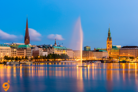
Germany’s second-largest city embraces its identity as a historic port and modern cultural center where maritime heritage infuses every aspect of city life. The UNESCO-listed Speicherstadt district features striking Gothic revival warehouse buildings now repurposed for museums and cultural venues, while the adjacent HafenCity represents one of Europe’s largest urban redevelopment projects. Hamburg’s harbor area offers fascinating contrasts between massive container terminals and historic sailing ships, best experienced through harbor boat tours. The spectacular Elbphilharmonie concert hall has become the city’s contemporary landmark, its wave-like glass structure rising above a historic warehouse base. Hamburg balances sophisticated cultural offerings with earthy entertainment in the St. Pauli district, home to the famous Reeperbahn nightlife area. The city’s numerous canals, lakes and parks—including the expansive Planten un Blomen—provide green refuges amid the urban landscape, making Hamburg a surprisingly nature-connected metropolis.
Elbphilharmonie

The Elbphilharmonie (affectionately called “Elphi” by locals) is Hamburg’s striking concert hall that opened in January 2017 after years of anticipation and construction challenges. This architectural masterpiece sits atop an old brick warehouse building (Kaispeicher A) along the Elbe River in the HafenCity quarter. The structure features a dramatic wave-like glass facade designed by Swiss architects Herzog & de Meuron that contains 1,100 individually curved glass panels, creating a shimmering effect that changes with the light and weather.
The building rises to a height of 110 meters and houses three concert venues: the Grand Hall with 2,100 seats, the Recital Hall with 550 seats, and the Kaistudio with 170 seats. The Grand Hall is particularly remarkable for its “white skin” – an interior surface made of 10,000 unique gypsum fiber panels that help create the room’s spectacular acoustics, designed by renowned acoustician Yasuhisa Toyota. The concert hall features a central stage with seating surrounding it on all sides, creating an immersive experience.
The Plaza, a public viewing platform situated 37 meters above ground between the old warehouse and new glass structure, offers spectacular 360-degree panoramic views of Hamburg’s harbor and cityscape. It has become one of Germany’s most visited attractions, welcoming over 4 million visitors in its first year alone. The building also contains a hotel, residential apartments, restaurants, and parking facilities. The total cost of construction was approximately €866 million, significantly over the initial budget of €77 million.
Address and Basic Information
Elbphilharmonie Hamburg
Platz der Deutschen Einheit 4
20457 Hamburg, Germany
The Elbphilharmonie is located in the HafenCity district, situated on the Elbe River waterfront. This iconic concert hall sits atop a historic brick warehouse, creating Hamburg’s most recognizable landmark.
Opening Hours and Access
Plaza (Public Viewing Platform):
- Daily: 9:00 AM – 12:00 AM (midnight)
- Last admission: 11:30 PM
Concert Hall Access:
- Varies by performance schedule
- Box office and lobby areas typically open 2 hours before performances
Restaurant and Café:
- Times vary by establishment within the building
- Generally open during plaza hours with extended hours for dining
Public Transportation Options
U-Bahn (Subway)
The most convenient subway connection is Baumwall Station (U3 line). From Baumwall, you’ll have a pleasant 8-minute walk through HafenCity directly to the Elbphilharmonie. This walk takes you along modern waterfront promenades with excellent views of the harbor.
The U3 line connects you to Hamburg’s city center, including stops at St. Pauli, Landungsbrücken, and Hauptbahnhof (Central Station). The route from Baumwall follows clearly marked pedestrian signs leading directly to the concert hall.
S-Bahn (Regional Rail)
Stadthausbrücke Station serves as another excellent option, located about 10 minutes walking distance from the Elbphilharmonie. This station is served by S1 and S3 lines, which connect to Hamburg’s broader metropolitan area and provide links to Hamburg Airport and surrounding suburbs.
From Stadthausbrücke, you’ll walk through the historic Speicherstadt (UNESCO World Heritage warehouse district) before reaching the modern HafenCity area where the Elbphilharmonie stands.
Bus Services
Nearby Stops:
- Am Kaiserkai (Elbphilharmonie)
Lines: 2, 111
Ferry Services
Hamburg’s harbor ferries provide a scenic approach to the Elbphilharmonie. The HADAG ferry line 62 stops at “Landungsbrücken,” from where you can take a 15-minute walk along the waterfront to reach the concert hall. This route offers spectacular views of Hamburg’s port and the Elbe River.
Ferry connections operate regularly throughout the day and provide a unique perspective of Hamburg’s maritime character. The walk from the ferry terminal follows well-maintained waterfront paths with clear signage directing visitors to HafenCity and the Elbphilharmonie.
Transportation Companies
HVV (Hamburger Verkehrsverbund) operates all public transportation in Hamburg, including U-Bahn, S-Bahn, buses, and harbor ferries. This integrated system allows you to use a single ticket across all transportation modes within Hamburg’s metropolitan area.
HADAG specifically operates the harbor ferry services, though tickets are integrated within the HVV system for seamless connections between different transportation types.
Driving and Parking Information
Nearby Parking Facilities
Elbphilharmonie Parking Garage
Located directly beneath the concert hall at Platz der Deutschen Einheit. This underground facility offers the most convenient parking option, with direct access to the building via elevators. The garage operates 24 hours daily and features spaces for standard vehicles as well as designated areas for electric vehicle charging.
HafenCity Quartier Parking
Am Sandtorkai 50, approximately 300 meters from the Elbphilharmonie. This multi-level parking structure serves the broader HafenCity district and provides covered parking with reasonable walking distance to multiple attractions.
Speicherstadt Parking
Kehrwieder 2, located about 600 meters from the concert hall in the historic warehouse district. While slightly farther, this parking option often has more availability and connects you to both the Elbphilharmonie and Speicherstadt attractions.
Driving Directions
From Hamburg’s city center, follow signs toward “HafenCity” and “Elbphilharmonie.” The concert hall is well-signposted throughout the city center. Major approach routes include Willy-Brandt-Straße from the north and Versmannstraße from the east.
Traffic can be heavy during concert times, so arriving 30-45 minutes before your intended visit allows time for parking and orientation. The area around the Elbphilharmonie features clearly marked pedestrian zones and limited vehicle access directly adjacent to the building.
Nearby Attractions and Points of Interest
Speicherstadt (Warehouse District)
This UNESCO World Heritage site sits adjacent to HafenCity and features the world’s largest warehouse district built on timber-pile foundations. The red-brick Gothic Revival buildings house museums, restaurants, and the famous Miniatur Wunderland model railway exhibition.
HafenCity
Hamburg’s newest district surrounding the Elbphilharmonie showcases contemporary architecture and urban planning. The Maritime Museum, various galleries, and waterfront promenades create a comprehensive cultural experience beyond the concert hall itself.
Landungsbrücken
Hamburg’s historic harbor area features traditional fish markets, boat tours of the harbor, and panoramic views of the Elbe River. The Sunday fish market (Fischmarkt) operates early morning hours and represents one of Hamburg’s most authentic local experiences.
St. Michaelis Church (Michel)
Hamburg’s baroque church tower provides panoramic city views and stands as another architectural landmark visible from the Elbphilharmonie area. The church is accessible via public transportation and offers guided tours of its historic interior.
Speicherstadt
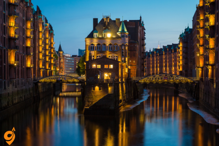
Speicherstadt (meaning “Warehouse City”) is the world’s largest complex of warehouses, constructed between 1883 and 1927 as part of the free port established by Hamburg for international trade. This UNESCO World Heritage Site (designated in 2015) covers an area of 260,000 square meters on oak log foundations in Hamburg’s port area, requiring more than 3.5 million oak piles driven into the marshy ground to support the structures.
The district consists of 17 impressive neo-Gothic red-brick buildings with distinctive architectural features including ornate facades, pointed arches, and small towers. These buildings are intersected by a network of narrow canals (known as “Fleete”) that allowed ships direct access to the warehouses. The area is particularly atmospheric at night when illuminated by 800 spotlights.
Historically, these warehouses stored valuable goods like coffee, tea, cocoa, spices, tobacco, and carpets from around the world. The buildings were designed with sophisticated technical features including hydraulic winch systems to move goods between floors and to boats. Today, while some still function as storage facilities for oriental carpets (Hamburg remains Europe’s largest trading center for carpets), many have been transformed into museums, offices, and cultural venues. Notable attractions within Speicherstadt include the International Maritime Museum, the Spice Museum, and the world-famous Miniatur Wunderland.
Basic Location Information
- Address: Am Sandtorkai, 20457 Hamburg, Germany
- District: Historic warehouse district on Elbe River islands
- Zone: Hamburg public transport Zone A (central zone)
- UNESCO status: World Heritage site since 2015
Opening Hours and Access
- Public access: 24/7 for streets and exterior viewing
- Museums: Generally 10:00 AM – 6:00 PM (varies by attraction)
- Restaurants/cafes: Typically 11:00 AM – 11:00 PM
- Best visiting hours: 9:00 AM – 7:00 PM for full experience
Public Transportation
- System name: HVV (Hamburger Verkehrsverbund)
- Coverage: Unified network including trains, buses, ferries
- Ticket validity: Works across all transport modes
- Operating hours: Generally 4:30 AM – 1:30 AM (extended weekends)
U-Bahn (Underground/Metro) Access
- Main station: Baumwall (U3 line)
- Walking distance: 5 minutes to main attractions
- Alternative station: Messberg (U1 line) – 8-10 minute walk
- Service frequency: Every 5-10 minutes
- Operating hours: 4:20 AM – 1:00 AM, 24-hour weekends
- U3 connections: Landungsbrücken, Rathaus, Barmbek
- U1 connections: Hauptbahnhof, Wandsbek, Norderstedt
Bus Transportation
Nearby Stops:
- Bei St. Annen
Lines: 4, 6, 602
Ferry Transportation
- Harbor ferry: Line 62 (HADAG ferries)
- Stops: Landungsbrücken to HafenCity/Speicherstadt
- Journey time: 15-20 minutes
- Frequency: Every 15-30 minutes depending on season
- Operating season: April – October (weather dependent)
- Scenic value: Best water views of Hamburg
Car Access and Parking
Parking Facilities
- Speicherstadt Parkhaus: Am Sandtorkai 50, 350 spaces
- HafenCity Quartier Parkhaus: Am Dalmannkai, 400 spaces
- Überseequartier Parkhaus: Überseeallee 10, 1200 spaces
- On-street parking: Limited, mostly paid zones
- Parking restrictions: Monday-Saturday 9:00 AM – 8:00 PM
Driving Directions
- From A1 (North/South): Exit Hamburg-Zentrum, follow HafenCity signs
- From A7 (West): Exit Hamburg-Bahrenfeld, via Holstenstraße to center
- From A24/A25 (East): Via city center, follow harbor signs
- Traffic restrictions: Low emission zone, environmental badge required
Alternative Transport
- Taxi companies: Hansa-Taxi (040-211211), Taxi Hamburg (040-666666)
- Ride-sharing: Uber, FREE NOW apps available
- Car sharing: DriveNow, Car2Go stations nearby
- E-scooter rental: Tier, Lime, Bird available in area
Nearby Major Stations and Hubs
- Hamburg Hauptbahnhof: 2.5 km northeast (major rail hub)
- Landungsbrücken: 1 km west (ferry terminal, S-Bahn)
- Altona station: 4 km west (long-distance trains)
- Hamburg Airport: 11 km north (direct S1 connection)
- Jungfernstieg: 1.5 km north (U-Bahn interchange)
Nearby Attractions and Districts
Within Walking Distance (Under 10 minutes)
- HafenCity: Modern urban development, Elbphilharmonie
- Miniatur Wunderland: World’s largest model railway
- Hamburg Dungeon: Interactive historical experience
- Landungsbrücken: Historic harbor promenade
- St. Nikolai Memorial: Historic church ruins and viewing platform
Short Transport Distance (10-20 minutes)
- Rathaus (City Hall): Historic building and market square
- Planten un Blomen: Large city park and botanical garden
- St. Pauli/Reeperbahn: Entertainment district
- Fish Market: Sunday morning traditional market
- Kontorhaus District: UNESCO World Heritage office buildings
Miniatur Wunderland
Miniatur Wunderland is the world’s largest model railway attraction and one of Germany’s most popular tourist destinations, welcoming over 1.4 million visitors annually. Located in the historic Speicherstadt warehouse district, this incredibly detailed miniature world spans over 1,545 square meters and continues to expand.
Founded by twin brothers Frederik and Gerrit Braun in 2000, the exhibition features nine meticulously crafted thematic sections including Hamburg, Scandinavia, America, Switzerland, Austria, Italy, fictional Knuffingen, an airport, and Venice. The attention to detail is astounding – the exhibit contains over 1,040 trains with more than 10,000 wagons, 130,000 trees, 289,000 figures, 4,340 buildings, and 389,000 lights, all managed by complex computer systems.
The Hamburg section recreates the city’s harbor (with real water), historic districts, and famous landmarks. The fully functional airport section features planes that actually take off and land. The day-night cycle system alternates lighting every 15 minutes, transforming the scenes dramatically. Perhaps most impressive are the countless embedded “scenes” depicting humorous, dramatic, or everyday situations that visitors can discover throughout the exhibits – from firefighters responding to a blaze to tiny figures engaged in illicit activities.
Behind the scenes, Miniatur Wunderland utilizes cutting-edge technology with more than 50 computers controlling the trains, vehicles, ships, and lighting systems. Around 300 employees work to maintain, expand, and operate this extraordinary attraction.
Location and Basic Information
- Exact address: Kehrwieder 2-4, Block D, 20457 Hamburg, Germany
- District: Speicherstadt (Historic Warehouse District)
- Building: Historic red-brick warehouse in UNESCO World Heritage site
- Postal code area: 20457 (HafenCity/Speicherstadt district)
- GPS coordinates: 53.5434° N, 9.9887° E
Opening Hours and Access Information
- Daily hours: 8:00 AM – 9:00 PM (varies seasonally)
- Extended summer hours: Until 10:00 PM (July-August)
- Holiday schedule: Modified hours during Christmas and New Year
- Last admission: 1 hour before closing
- Advance booking: Highly recommended, especially weekends
- Audio guide availability: Multiple languages included with admission
Public Transportation – Understanding the HVV System
- Transport authority: HVV (Hamburger Verkehrsverbund)
- Zone classification: Central Zone A (most affordable zone)
- Integrated system: Single ticket valid for all transport modes
- Digital options: HVV app for real-time schedules and mobile tickets
- Accessibility: All recommended stations have elevator access
U-Bahn (Underground Metro) Access
- Primary station: Baumwall (U3 line)
- Walking distance: 2-3 minutes direct walk
- Service frequency: Every 5-10 minutes during operating hours
- Operating schedule: 4:20 AM – 1:00 AM weekdays, 24-hour weekends
- U3 line destinations: Connects Landungsbrücken, city center, Barmbek
Bus Transportation Options
Nearby Stops:
- Auf dem Sande (Speicherstadt)
- Am Sandtorkai
Lines: 6, 602, 2, 111
Ferry Transportation (Seasonal Harbor Service)
- Ferry operator: HADAG (Hamburg harbor ferry service)
- Route number: Line 62 (Landungsbrücken to HafenCity)
- Nearest stop: Speicherstadt/HafenCity pier
- Walking distance: 4-5 minutes from pier to museum
- Operating season: April through October (weather dependent)
- Journey time: 15-20 minutes from Landungsbrücken
- Service frequency: Every 15-30 minutes
- Scenic advantage: Unique water-level view of Hamburg’s harbor
Parking Facilities Near Miniatur Wunderland
- Speicherstadt Parkhaus: Am Sandtorkai 50 (closest option, 150m walk)
- Capacity: 350 spaces across multiple levels
- HafenCity Quartier Parkhaus: Am Dalmannkai (300m walk)
- Capacity: 400 spaces with direct pedestrian access
- Überseequartier Parkhaus: Überseeallee 10 (500m walk)
- Capacity: 1,200 spaces, largest facility in area
- On-street parking: Limited metered spaces on Kehrwieder
- Parking duration limits: Maximum 2-4 hours for street parking
- Payment methods: Coins, cards, mobile apps accepted
Major Transportation Hubs and Connections
Transportation Interchange Points
- Landungsbrücken: 1.2 km west (S-Bahn, U-Bahn, ferries, buses)
- Jungfernstieg: 2 km north (major U-Bahn interchange)
- Rathaus: 1.8 km north (U3, multiple bus lines)
- St. Pauli: 2.5 km west (U3, entertainment district access)
Nearby Attractions Within Walking Distance
Immediate Vicinity (Under 300m)
- Speicherstadt Museum: Historic warehouse operations exhibition
- Hamburg Dungeon: Interactive historical horror experience
- Dialogue in the Dark: Sensory experience in complete darkness
- Traditional sailing ships: Historic vessels moored in nearby canals
- Warehouse architecture tours: Self-guided exploration of UNESCO buildings
Short Walking Distance (300m – 1km)
- Elbphilharmonie: Iconic concert hall and viewing platform
- HafenCity district: Modern urban development with shopping and dining
- International Maritime Museum: Extensive shipping and naval history
- Prototype Museum: Unique collection of failed product inventions
- St. Nikolai Memorial: Church ruins with panoramic city viewing deck
Moderate Walking Distance (1-2km)
- Landungsbrücken promenade: Historic harbor terminal with restaurants
- Fish Market (Fischmarkt): Traditional Sunday morning market experience
- Planten un Blomen park: Large botanical garden and recreation area
- Rathaus (City Hall): Neo-Renaissance architecture and guided tours
- Kontorhaus District: Additional UNESCO World Heritage office buildings
Alster Lakes

The Alster Lakes are two artificial lakes formed by damming the Alster River in the heart of Hamburg, creating one of the city’s most distinctive and beloved features. The larger Outer Alster (Außenalster) covers 164 hectares and is surrounded by parks, elegant villas, and upscale residential areas. The smaller Inner Alster (Binnenalster) covers 18 hectares and is framed by Hamburg’s city center.
The lakes originated in the 13th century when the Alster River was dammed to power a water mill, gradually expanding to their current size. The shoreline of the Outer Alster extends for approximately 7.4 kilometers and is lined with a popular walking and jogging path. In summer, the lakes become a recreational paradise with sailing boats, paddleboards, kayaks, and the iconic white Alster steamers that offer tours. The Alster Lakes also host several traditional events including the annual “Alstervergnügen” winter festival when the lake freezes and the Japanese Cherry Blossom Festival in spring.
The area around the Inner Alster features some of Hamburg’s most luxurious hotels, the famous Jungfernstieg promenade with high-end shopping, and the impressive Alster Fountain that shoots water 40 meters into the air. The Kennedybrücke and Lombardsbrücke bridges connect the Inner and Outer Alster, offering picturesque views of the city skyline. The lakes significantly enhance Hamburg’s quality of life and are often called the “green heart” of the city.
Basic Location Information
- Lake system: Binnenalster (Inner Alster) and Außenalster (Outer Alster)
- • Primary address for navigation: Jungfernstieg, 20354 Hamburg, Germany
- • District: Hamburg-Mitte (city center) and surrounding neighborhoods
- • Total area: Inner Alster 0.2 km², Outer Alster 1.6 km²
- • Geographic position: Central Hamburg, created by damming Alster River
Opening Hours and Access
- Public access: 24/7 for lakefront paths and viewing areas
- Boat services: March-October, daily 10:00 AM – 6:00 PM
- Extended summer boat hours: July-August until 8:00 PM
- Winter boat service: Limited weekend operations November-March
- Park areas: Generally accessible dawn to dusk
- Restaurants/cafes: Typically 10:00 AM – 11:00 PM (varies by location)
Transportation System Overview
U-Bahn (Underground) Access Points
Primary Stations for Inner Alster
- Jungfernstieg: Lines U1, U2, U4 intersection (busiest interchange)
- Walking distance: Direct lakefront access (0 minutes)
- Facilities: Elevators, shopping center connection, tourist information
- Service frequency: Every 3-5 minutes during peak hours
- Operating hours: 4:20 AM – 1:00 AM weekdays, 24-hour weekends
Key Stations for Outer Alster Access
- Mundsburg (U3): Northern lakefront access via Winterhude
- Walking distance: 8-10 minutes to lake through residential area
- Kellinghusenstraße (U1, U3): Northwestern lake access
- Walking distance: 5-7 minutes to waterfront paths
- Uhlandstraße (U1): Eastern lakefront access through Uhlenhorst
- Walking distance: 3-5 minutes to lake via residential streets
- Stephansplatz (U1): Western access via Planten un Blomen park
- Walking distance: 10-12 minutes through park to lakefront
- Hallerstraße (U1): Northwestern access via Rotherbaum district
- Walking distance: 8-10 minutes through university area
S-Bahn (Suburban Railway) Access
- Alternate station: Jungfernstieg (all S-Bahn lines S1, S2, S3)
- Walking distance: Direct Inner Alster access
- Primary station: Dammtor (S1, S2, S3) for western Outer Alster
- Walking distance from Dammtor: 10-12 minutes via university area
- Service frequency: Every 10-20 minutes depending on line and time
- Regional connectivity: Links to Hamburg Airport, Altona, suburban areas
- Operating hours: 4:30 AM – 1:30 AM weekdays, extended weekends
Bus Network
Nearby Stops:
- Fontenay
- Dammtor
Lines: 19, 114, 605, 4, 5, 603, 604
Boat Transportation (Alster Fleet)
- Operator: ATG (Alster-Touristik GmbH)
- Departure point: Jungfernstieg pier (Inner Alster)
- Inner Alster tours: 30-minute circuits every hour
- Outer Alster crossings: Ferry services between opposite shores
- Combined tours: 2-hour comprehensive lake journeys
- Seasonal operation: Full service April-October
- Weather dependency: Services cancelled during storms or ice
Parking Facilities Around Lakes
Inner Alster Area (Jungfernstieg vicinity)
- Alsterhaus Garage: Jungfernstieg 16-20, 400 spaces
- Quarterly Parking: Poststraße 2-4, 250 spaces
- Europa Passage: Ballindamm 40, 180 spaces
- On-street parking: Limited 2-hour metered spaces
- Operating hours: Most garages 24/7, street parking 9 AM – 8 PM
Outer Alster Perimeter Parking
- Mundsburg Center: Mundsburger Damm 1, 800 spaces
- University area lots: Various smaller facilities near western shore
- Residential parking: Street parking with time limits
- Park-and-ride: Available at suburban S-Bahn stations
- Weekend availability: Generally better parking availability
Nearby Attractions
Cultural Attractions Within Walking Distance
- Kunsthalle Hamburg: Major art museum, 300m from Jungfernstieg
- Hamburg Rathaus: City Hall with guided tours, 500m from Inner Alster
- St. Michaelis Church: Historic landmark, 1.2km from lake center
- Hamburg Museum: City history exhibits, 800m from lakes
- Miniatur Wunderland: World’s largest model railway, 2km southeast
Parks and Recreation Areas
- Planten un Blomen: Large botanical garden connecting both lakes
- Alsterpark: Continuous green space around Outer Alster perimeter
- Stadtpark: Hamburg’s largest park, northern connection to lake system
- Isebek Canal: Scenic waterway connecting to lake network
- Kennedy Bridge area: Popular recreation spot on northern Outer Alster
Shopping and Dining Districts
- Jungfernstieg shopping: Luxury retail including historic Alsterhaus
- Eppendorfer Baum: Trendy restaurants serving northern lake area
- Rotherbaum cafes: University district dining near western shore
- Winterhuder Marktplatz: Local shopping and dining, northern access
- Uhlenhorst restaurants: Upscale dining with lake views
Entertainment and Nightlife
- Reeperbahn district: Famous entertainment area, 2.5km west
- University nightlife: Student bars and clubs in Rotherbaum
- Lakefront restaurants: Seasonal outdoor dining with water views
- Concert venues: Various locations around lake perimeter
- Seasonal events: Open-air concerts and festivals in park areas
St. Pauli and Reeperbahn

St. Pauli is Hamburg’s most famous entertainment district, centered around the Reeperbahn, a street often called Germany’s most sinful mile. The area has a colorful history dating back to the 17th century when it developed as an entertainment district for sailors. Today it combines elements of red-light entertainment, mainstream nightlife, theaters, and cultural venues.
The Reeperbahn is approximately 930 meters long and features numerous bars, clubs, restaurants, theaters, and adult entertainment establishments. Historically, the street was named after rope makers (“Reep” means rope, “Bahn” means track) who needed long straight stretches to produce their wares. The district gained international fame in the early 1960s when The Beatles performed at various clubs here before becoming famous – their history is celebrated at Beatles-Platz with steel sculptures representing the band members.
Herbertstraße, a side street off the Reeperbahn, remains a regulated prostitution area closed off to minors and women, with barriers at both ends. The nearby Große Freiheit street houses several important music venues including the legendary Indra Club where The Beatles first performed and the Dollhouse, one of the oldest strip clubs in Germany.
Despite its reputation, St. Pauli has undergone significant gentrification and now offers a diverse range of entertainment including musical theaters like the Operettenhaus, which has staged major productions such as “The Lion King.” The district is also home to FC St. Pauli, a football club with a strong countercultural identity and cult following. On Sunday mornings, the Fischmarkt (Fish Market) dating back to 1703 draws thousands of visitors with its vibrant atmosphere, street food, and live music.
Primary Addresses and Navigation Points
When planning your journey to St. Pauli and Reeperbahn, you’ll want to understand the key address references that will help you navigate both digital maps and public transportation systems effectively.
Reeperbahn Main Strip: The primary entertainment boulevard runs along Reeperbahn street itself, with the most concentrated activity between house numbers 1-200. For navigation purposes, Reeperbahn 1, 20359 Hamburg serves as an excellent reference point, placing you at the eastern entrance near the St. Pauli U-Bahn station.
St. Pauli District Center: The broader district extends beyond just the Reeperbahn strip.
Millerntor-Platz 1, 20359 Hamburg represents another crucial reference point, as this location sits near the famous St. Pauli football stadium and provides access to multiple transportation options.
Landungsbrücken Connection: St. Pauli Landungsbrücken, 20359 Hamburg serves as the waterfront gateway to the district, where harbor ferries, S-Bahn, and U-Bahn services converge to create one of Hamburg’s most important transportation hubs.
Operating Hours and District Activity Patterns
Understanding when St. Pauli and Reeperbahn come alive helps you plan both your transportation timing and your overall experience. Unlike many entertainment districts that follow predictable patterns, St. Pauli operates on multiple rhythms simultaneously.
Daytime Operations (10:00 AM – 6:00 PM): During daylight hours, the area functions primarily as a cultural and tourist destination. Museums, theaters, and restaurants operate on standard business schedules, while the famous red-light establishments remain largely closed or operate with restricted hours. This period offers the most comfortable exploration for families and those interested in the district’s cultural offerings rather than its nightlife reputation.
Evening Transition (6:00 PM – 10:00 PM): The district begins its transformation as restaurants open their dinner service and early entertainment venues begin welcoming guests. This represents an ideal time for dining and cultural events, before the late-night party atmosphere fully develops.
Peak Nightlife Hours (10:00 PM – 4:00 AM): The Reeperbahn reaches its legendary intensity during these hours, when clubs, bars, and adult entertainment venues operate at full capacity. Transportation services adapt to these patterns, with increased frequency on key routes and extended operating hours for certain services.
Late Night and Early Morning (4:00 AM – 10:00 AM): Many venues continue operating into the early morning hours, particularly on weekends. However, transportation services begin returning to reduced schedules, making advance planning essential for safe departure from the district.
Hamburg’s Public Transportation Integration
Zone Classification: St. Pauli falls entirely within Hamburg’s central Zone A.
Night Service Extensions: Unlike many German cities where public transportation significantly reduces service after midnight, Hamburg maintains enhanced service to St. Pauli throughout the night, particularly on weekends.
Public Transportation
U-Bahn Underground Network Access
St. Pauli Station (U3 Line) – The Primary Gateway: This station serves as the most direct access point to the heart of Reeperbahn. Located at the intersection of Reeperbahn and Millerntor-Platz, the station places you within immediate walking distance of the district’s most famous attractions. The U3 line connects St. Pauli directly to Hamburg’s city center, the harbor area (including Landungsbrücken), and extends westward to suburban areas.
The station design itself reflects the district’s character, featuring artistic installations and cultural references that prepare visitors for the unique atmosphere above ground. Platform access requires just a short escalator ride, and the station maintains full accessibility features including elevators for wheelchair users and those with mobility challenges.
Feldstraße Station (U3 Line) – The Cultural Approach: Positioned slightly inland from the harbor, Feldstraße station provides access to St. Pauli’s more residential and culturally-oriented areas. This approach works particularly well for visitors interested in the district’s art galleries, independent theaters, and local dining scene rather than the tourist-focused entertainment strip.
The walk from Feldstraße to the main Reeperbahn areas takes approximately 8-10 minutes through neighborhoods that showcase St. Pauli’s evolution from a working-class maritime district to a diverse cultural center. This route provides context that enhances understanding of the area’s social and cultural development.
Landungsbrücken Station (U3, S1, S3) – The Harbor Gateway: While technically serving the waterfront area below St. Pauli, Landungsbrücken station deserves recognition as a crucial access point to the district. The station sits at the intersection of multiple transportation modes, including harbor ferries, S-Bahn regional services, and the U3 line.
From Landungsbrücken, visitors can ascend to St. Pauli either via the historic vehicular tunnel (Alter Elbtunnel) for a unique underground experience, or through surface streets that provide dramatic views of Hamburg’s harbor and the climbing approach to the entertainment district above.
S-Bahn Regional Railway Connections
The S-Bahn system excels at bringing visitors to St. Pauli from Hamburg’s outer districts, suburban communities, and regional destinations. The service patterns reflect the district’s role as a destination that draws visitors from across the metropolitan area and beyond.
Landungsbrücken Hub (S1 and S3 Lines): The Landungsbrücken S-Bahn station functions as the primary regional gateway to St. Pauli, offering direct connections to Hamburg Airport via the S1 line and to suburban communities throughout the metropolitan area via both S1 and S3 services.
The S1 line proves particularly valuable for visitors arriving at Hamburg Airport, providing a direct connection without transfers that takes approximately 35-40 minutes from the airport to the St. Pauli area. This service operates reliably throughout the day with trains every 10-20 minutes, depending on the time of day.
The S3 line extends the regional reach significantly, connecting St. Pauli to communities as distant as Pinneberg to the northwest and Harburg to the south. This broad regional connectivity reflects St. Pauli’s role as an entertainment destination that serves not just Hamburg proper, but the entire metropolitan region.
Reeperbahn Station (S1, S3) – Direct Access: The Reeperbahn S-Bahn station provides the most direct rail access to the entertainment strip itself. Located at the western end of the Reeperbahn boulevard, this station serves visitors who want to begin their exploration at the more concentrated entertainment areas rather than approaching from the harbor side.
This station proves particularly convenient for visitors staying in Hamburg’s western districts or arriving from destinations served by the S1 and S3 lines. The immediate area around the station features some of St. Pauli’s most iconic venues and provides easy walking access to the full length of the entertainment strip.
Bus Transportation Network
Nearby Stops:
- Pauli
- Kleine Seilerstraße
- U St. Pauli
- Davidstraße
Lines: 17, 601, 607, 608, 609, 610, 641, 16, 112, 111
Ferry and Harbor Transportation
The harbor ferries operated by HADAG provide a unique and scenic approach to St. Pauli that combines practical transportation with sightseeing opportunities. These services connect St. Pauli to various points along the Elbe River and provide perspective on Hamburg’s maritime character that enhances understanding of St. Pauli’s historical development.
Landungsbrücken Ferry Terminal: This historic terminal serves as the primary departure point for harbor ferries and tourist boats. From here, visitors can access various harbor destinations while enjoying water-level views of Hamburg’s skyline and port facilities.
The ferry services operate seasonally, with full schedules during warmer months (April through October) and reduced winter operations. However, year-round service maintains connections to key destinations, ensuring that ferry transportation remains a viable option regardless of season.
Parking Infrastructure
Finding parking in St. Pauli requires strategic planning and realistic expectations about both availability and walking distances. The district’s popularity and dense development create parking demand that consistently exceeds supply, particularly during peak entertainment hours.
Millerntor Parkhaus: Located at Millerntor-Platz 1, this multi-level parking facility provides the most convenient access to both the Reeperbahn entertainment strip and St. Pauli’s cultural attractions. With approximately 400 spaces across multiple levels, it represents the largest parking resource directly serving the district.
Landungsbrücken Parking: Several smaller parking facilities serve the waterfront area below St. Pauli, offering alternatives for visitors willing to walk uphill to reach the main entertainment areas. These facilities typically offer better availability than those directly in the entertainment district, though they require 8-12 minutes of walking to reach Reeperbahn venues.
Street Parking Realities: On-street parking throughout St. Pauli operates under strict time limitations and enforcement. Most spaces allow maximum parking durations of 1-2 hours during daytime hours, with restrictions typically enforced Monday through Saturday from 9:00 AM to 8:00 PM.
Evening and late-night street parking becomes more available but remains limited. Visitors should budget extra time for parking searches and consider longer walking distances as acceptable trade-offs for parking availability.
Nearby Attractions
Miniatur Wunderland: Located in nearby Speicherstadt, this world-famous model railway attraction sits just 15-20 minutes from St. Pauli via public transportation, making it easy to combine family-friendly cultural activities with St. Pauli exploration.
Hamburg Harbor and Maritime Museums: The extensive harbor facilities and maritime heritage sites provide context for understanding St. Pauli’s historical development as a sailor’s district. These attractions are easily accessible via the harbor ferry system or short public transportation connections.
Planten un Blomen Park: This large urban park system extends from Hamburg’s city center toward St. Pauli, providing green space and recreational opportunities that contrast with the district’s urban intensity.
Altona District: The neighboring Altona area offers additional dining, shopping, and cultural opportunities within easy public transportation access of St. Pauli, allowing visitors to experience different aspects of Hamburg’s diverse neighborhoods.
Planten un Blomen

Planten un Blomen (Low German for “Plants and Flowers”) is an urban park covering 47 hectares in the heart of Hamburg, offering a green oasis between the busy St. Pauli district and the exhibition halls. Established in 1821 as a botanical garden, it has evolved into one of Germany’s most beautiful urban parks combining horticultural excellence with recreational amenities.
The park features several specialized gardens including the largest Japanese Garden in Europe (created in 1990 by landscape architect Yoshikuni Araki), a magnificent rose garden with over 300 varieties, an apothecary garden with medicinal plants, tropical greenhouses, and formal flower beds that display over 500,000 flowers and plants through changing seasonal arrangements.
Water features prominently throughout the park with numerous ponds, streams, and the famous water-light concerts held nightly from May to early October at the lake near the Japanese Garden. These concerts synchronize colored illuminated fountains with classical music and attract thousands of spectators.
Recreational facilities include Hamburg’s largest playground, miniature golf, ice skating rink (in winter), outdoor chess boards, lawn areas for picnics, and several restaurants and cafes. The park hosts over 250 free events annually including theater performances, children’s programs, and music concerts at the open-air stage.
Planten un Blomen is also home to Hamburg’s Old Botanical Garden and borders the University of Hamburg and the Congress Center Hamburg, making it an integral part of the city’s cultural and educational landscape. The park’s name reflects Hamburg’s historical connection to both High German and Low German (Plattdeutsch) languages.
Basic Information
- Address: Marseiller Straße, 20355 Hamburg, Germany
- Opening Hours: Open 24/7 year-round (individual attractions within have varying hours)
- Park Size: 47 hectares spanning Hamburg’s city center
Public Transportation Options
S-Bahn (Suburban Railway)
- Dammtor Station (closest to main entrance)
- Lines: S2, S3, S5
- Walking distance: 2-3 minutes to park entrance
- Connects to: Hamburg Airport, surrounding suburbs
U-Bahn (Underground)
- Stephansplatz Station (U1 line)
- Eastern park entrance access
- Walking distance: 1-2 minutes
- Messehallen Station (U2 line)
- Near exhibition areas
- Walking distance: 3-4 minutes
- Gänsemarkt Station (U2 line)
- Alternative eastern access
- Walking distance: 6-7 minutes
Bus Routes
Nearby Stops:
- Hamburg Messe (Eingang Ost)
- Hamburg Messe (Eingang Mitte)
- U Stephansplatz
Lines: X35, 4, 5, 19, 603, 604, 605
Parking Information
On-Street Parking
- Marseiller Straße: Limited metered parking
- Theodor-Heuss-Platz: Short-term parking available
- Jungiusstraße: Residential parking with time restrictions
- Parking meters: Operating hours typically 9 AM – 8 PM weekdays
Parking Garages
- Dammtor Parking Garage
- Address: Dag-Hammarskjöld-Platz 1
- Capacity: 400+ spaces
- Walking distance: 3 minutes to park
- Congress Center Hamburg Parking
- Multi-level facility near exhibition areas
- 24-hour access available
- Planten un Blomen Parkhaus
- Direct park access
- Located beneath television tower area
- City Center Parking Facilities
- Multiple options within 500m radius
- Include Gänsemarkt and Stephansplatz areas
Nearby Attractions
Within Walking Distance (Under 10 minutes)
- Hamburg Television Tower: 276m observation deck with panoramic views
- Congress Center Hamburg: Major exhibition and conference venue
- Alster Lakes: Beautiful lake system perfect for boat trips
- Hamburg Dammtor: Historic railway station architecture
- University of Hamburg: Main campus and botanical areas
Cultural Attractions (10-15 minutes)
- Hamburg State Opera: World-renowned opera house
- Gänsemarkt: Historic square with shopping opportunities
- Jungfernstieg: Famous shopping boulevard along Alster lake
- Hamburg Museum: City history and cultural exhibitions
- St. Michaelis Church: Hamburg’s famous “Michel” landmark
Entertainment Districts (15-20 minutes)
- St. Pauli District: Famous nightlife and Reeperbahn
- HafenCity: Modern waterfront development
- Speicherstadt: UNESCO World Heritage warehouse district
- Fish Market: Traditional Sunday morning market experience
Park Features and Facilities
Main Attractions Within Park
- Japanese Garden: Authentic landscape design with tea house
- Rose Garden: Over 300 varieties of roses
- Botanical Gardens: Extensive plant collections from worldwide
- Water Light Concerts: Summer evening fountain shows with music
- Tropical Greenhouses: Year-round exotic plant displays
- Children’s Playground: Multiple play areas throughout park
Seasonal Events
- Summer Concerts: Outdoor performances in amphitheater areas
- Christmas Market: Traditional German holiday market
- Garden Shows: Special exhibitions throughout growing season
- Cultural Festivals: Various events hosted in park spaces
Hamburg Town Hall (Rathaus)

Hamburg’s Town Hall (Rathaus) is an imposing neo-Renaissance building completed in 1897 that serves as the seat of Hamburg’s government, housing both the city’s parliament (Bürgerschaft) and senate. The building stands as a proud symbol of Hamburg’s wealth and historical status as a free imperial city and later as a sovereign state before joining the German Empire.
This architectural masterpiece features 647 rooms (more than Buckingham Palace) spread across 17,000 square meters, with a 112-meter-high tower dominating Hamburg’s skyline. The elaborately decorated facade displays statues of 20 German emperors and is topped by a copper roof that has developed its characteristic green patina over time. The building rests on 4,000 oak piles driven into the marshy ground, similar to the foundation technique used in Venice.
The interior is equally magnificent, featuring grand staircases, ornate halls, and intricate wood carvings. The Great Hall (Großer Festsaal) spans 46 meters by 18 meters with a 15-meter-high ceiling painted with allegorical scenes representing Hamburg’s commercial relationships with the world. The Emperor’s Hall (Kaisersaal) contains life-sized portraits of emperors painted by prominent artists of the period.
The Town Hall overlooks the Rathausmarkt, a large square that hosts markets, public viewings of sporting events, and political demonstrations. A beautiful courtyard inside features a fountain depicting Hygieia, goddess of health, commemorating the cholera epidemic of 1892 that claimed thousands of lives in Hamburg.
Guided tours allow visitors to explore many of the magnificent rooms and learn about Hamburg’s political system, which is unique in Germany as it combines state and municipal government functions due to Hamburg’s status as both a city and one of Germany’s 16 federal states.
Basic Information
- Official Address: Rathausmarkt 1, 20095 Hamburg, Germany
- District: Hamburg-Mitte (City Center)
- Opening Hours for Tours:
- Monday-Thursday: 10:00 AM – 3:00 PM
- Friday-Sunday: 10:00 AM – 1:00 PM
- Tours available in German and English (advance booking recommended)
- Building Access: Public areas accessible during business hours
- Architecture: Neo-Renaissance style, completed in 1897
Public Transportation
Primary U-Bahn (Underground) Connections
- Rathaus Station (U3 line)
- Direct access beneath the Town Hall building
- Underground connection to Rathaus via pedestrian tunnels
- Walking time: 30 seconds from platform to building entrance
- Connects to: St. Pauli, Landungsbrücken, Barmbek, Wandsbek
- Jungfernstieg Station (U1, U2, U4 lines)
- Major transportation hub 200 meters from Rathaus
- Underground shopping center connects to Town Hall area
- Walking time: 2-3 minutes via covered walkways
- Central connection point for all U-Bahn lines
- Mönckebergstraße Station (U3 line)
- Alternative access from shopping district side
- Walking distance: 4-5 minutes through pedestrian zones
- Direct connection to main shopping areas
S-Bahn (Suburban Railway) Access Points
- Jungfernstieg Station (S1, S3 lines)
- Same location as U-Bahn Jungfernstieg but different level
- Connects to Hamburg Airport and suburban regions
- Walking time: 2-3 minutes to Rathaus
- Elevator access available for mobility assistance
- Hamburg Hauptbahnhof (Central Station)
- All S-Bahn lines converge here (S1, S11, S2, S21, S3, S31)
- Walking distance: 8-10 minutes through city center
- Alternative: Take U1 from Hauptbahnhof to Jungfernstieg (2 stops)
Regional and Long-Distance Rail
- Hamburg Hauptbahnhof (Central Station)
- Deutsche Bahn intercity and high-speed rail services
- International connections to Denmark, Netherlands, Switzerland
- Regional trains from throughout northern Germany
- Direct pedestrian route to Rathaus through Mönckebergstraße shopping area
Bus Transportation Network
Nearby Stops:
- Rathausmarkt
Lines: 606, 640, 4, 5, 19, 602, 603, ,604, 605, 3, 607, 608, 609, 610, 641, X35, X80
Ferry and Water Transport
- Jungfernstieg Ferry Terminal
- HADAG Alster ferry services during tourist season
- Small passenger boats for scenic lake tours
- Walking distance: 3-4 minutes from ferry landing to Rathaus
- Connects to parks and recreational areas around Alster lakes
Parking Information
Underground Parking Facilities
- Jungfernstieg Parking Garage
- Address: Jungfernstieg 16-20, directly beneath shopping area
- Capacity: 800+ spaces across multiple levels
- Walking time: 2 minutes via underground pedestrian connections
- 24-hour access with automated payment systems
- Electric vehicle charging stations available
- Gänsemarkt Parking Garage
- Multi-level facility serving business district
- Direct elevator access to street level
- Walking distance: 4-5 minutes to Rathaus
- Compact car spaces and standard vehicle accommodations
Street Parking Options
- Rathausmarkt Area
- Very limited short-term parking (15-30 minutes maximum)
- Primarily reserved for official government vehicles
- Metered parking with digital payment options
- Restricted access during official events and ceremonies
- Surrounding Streets
- Große Bleichen: Parallel parking with 2-hour time limits
- Neuer Wall: Premium shopping area with metered spaces
- Bergstraße: Residential parking with visitor permits required
- Most meters operate Monday-Saturday, 9 AM-8 PM
Specialized Parking Services
- Disabled Parking Spaces
- Reserved spaces in all major parking facilities
- Street-level spaces on Rathausmarkt for mobility-impaired visitors
- Elevator access available in parking garages
- Extended time limits for disability permit holders
- Motorcycle and Scooter Parking
- Designated areas throughout city center
- Free parking in most locations
- Covered parking available in select garages
Nearby Attractions and Points of Interest
Immediate Vicinity (Within 200 meters)
- Rathausmarkt Square
- Historic town square hosting markets and events
- Surrounded by significant commercial and government buildings
- Regular cultural performances and seasonal celebrations
- Central meeting point for guided city tours
- Hamburg Chamber of Commerce Building
- Historic architecture complementing the Town Hall
- Important business district landmark
- Houses various commercial and trade organizations
Cultural and Historical Sites (200-500 meters)
- St. Petri Church
- Hamburg’s oldest church, dating to 11th century
- Historic tower offering city views
- Regular concerts and cultural events
- Walking distance: 3-4 minutes from Rathaus
- Deichstraße Historic Street
- Preserved medieval street with traditional Hamburg architecture
- Historic buildings housing restaurants and small museums
- Represents Hamburg’s pre-fire architectural heritage
- Photography opportunities showing contrast with modern city center
Shopping and Commercial Areas (Immediate Access)
- Jungfernstieg Shopping Boulevard
- Premium shopping street along Alster lake
- Historic shopping arcade (Alsterarkaden) with luxury retailers
- Seasonal markets and outdoor events
- Direct covered walkway connection to Rathaus area
- Mönckebergstraße Shopping District
- Major pedestrian shopping zone
- Department stores, international brands, local retailers
- Connects Rathaus area to Hauptbahnhof
- Regular street performances and cultural activities
Waterfront and Recreation (300-600 meters)
- Binnenalster Lake
- Inner Alster lake offering boat tours and recreational activities
- Scenic walking paths around entire perimeter
- Seasonal fountain displays and water features
- Photography opportunities with city skyline reflections
- Alsterarkaden
- Venetian-style shopping arcade along lake waterfront
- Historic architecture housing cafés and specialty shops
- Covered walkways providing weather protection
- Popular meeting place for locals and tourists
Major Cultural Institutions (500-800 meters)
- Kunsthalle Hamburg
- Major art museum with European masterworks
- Special exhibitions and permanent collections
- Educational programs and guided tours
- Walking distance: 6-7 minutes from Rathaus
- Museum for Hamburg History
- Comprehensive city history from medieval times to present
- Interactive exhibits and historical artifacts
- Special focus on maritime heritage and trade history
- Regular temporary exhibitions on local topics
St. Michael’s Church (Hauptkirche St. Michaelis)

St. Michael’s Church, commonly called “Michel” by locals, is Hamburg’s most famous church and one of the city’s most recognizable landmarks. This grand Baroque Protestant church was built between 1750 and 1762 (replacing two previous churches that had been destroyed by lightning and fire) and stands as the most important Baroque church in northern Germany.
The church’s most distinctive feature is its 132-meter copper-covered spire topped with a golden cross, which has served as an orientation point for ships navigating the Elbe River for centuries. The tower contains Germany’s largest clock bell, weighing 9 tons. Visitors can ascend the tower via stairs or elevator to an observation platform at 106 meters offering spectacular panoramic views of Hamburg and its harbor.
The bright white interior accommodates 2,500 people and features an ornate pulpit, a marble baptismal font from 1763, and a magnificent altar with marble columns. The church’s most treasured possession is its Steinmeyer organ with 6,674 pipes, considered one of the finest in Germany. The church is adorned with five separate organ instruments in total.
Beneath the church lies a fascinating crypt containing over 2,000 burials from the 17th to 19th centuries, including the tomb of composer Carl Philipp Emanuel Bach (son of Johann Sebastian Bach) who served as the church’s music director.
St. Michael’s holds deep symbolic significance for Hamburg’s citizens. The church’s motto “Turmhoch und meilenweit” (as high as a tower and miles wide) reflects Hamburg’s mercantile spirit and outlook. The image of St. Michael’s appears on numerous official Hamburg emblems, souvenirs, and the city’s official seals, cementing its status as the true symbol of Hamburg.
Essential Information and Location Details
Complete Address: Englische Planke 1, 20459 Hamburg, Germany
District: Hamburg-Neustadt (New Town)
Postal Code Area: 20459 (St. Pauli/Neustadt boundary)
Opening Hours and Access Schedule:
- Church Interior: Daily 9:00 AM – 8:00 PM (May-October), 10:00 AM – 6:00 PM (November-April)
- Tower Viewing Platform: Daily 9:00 AM – 7:30 PM (May-October), 10:00 AM – 5:30 PM (November-April)
- Crypt Museum: Monday-Saturday 11:00 AM – 4:30 PM, Sunday 11:30 AM – 4:30 PM
- Special Services: Sunday worship at 10:00 AM and 6:00 PM, Wednesday evening services at 6:00 PM
- Guided Tours: Multiple daily tours in German and English, advance booking recommended during peak season
Mastering the U-Bahn Network for Michel Access
Primary U-Bahn Station: Rödingsmarkt (U3 Line) The Rödingsmarkt station on the U3 line provides your most direct underground access to St. Michael’s Church. When you exit this station, you’ll find yourself approximately 300 meters from the church, with clear sightlines to the distinctive tower that serves as your navigation beacon. The U3 line connects you seamlessly to Hamburg’s major districts, including St. Pauli to the west, the city center (Rathaus) to the east, and extends all the way to Barmbek and Wandsbek in the northern and eastern suburbs.
Understanding the U3 line’s route helps you appreciate its strategic importance for reaching the Michel. This line essentially follows Hamburg’s historical development pattern, connecting the medieval city center with the expanded districts that grew during Hamburg’s maritime prosperity. When you ride the U3 toward Rödingsmarkt, you’re literally following the same path that Hamburg’s growth took centuries ago.
Alternative U-Bahn Access: St. Pauli Station (U3 Line) St. Pauli station, just one stop west of Rödingsmarkt on the same U3 line, offers an alternative approach that takes you through Hamburg’s famous entertainment district. From St. Pauli station, it’s a pleasant 400-meter walk that allows you to experience the transition from Hamburg’s nightlife quarter to its spiritual center – a journey that perfectly encapsulates the city’s diverse character.
Strategic Connection Point: Landungsbrücken (U3 Line) Landungsbrücken station deserves special attention because it connects the U3 line with Hamburg’s harbor transportation network. From here, you can walk approximately 600 meters to St. Michael’s Church while experiencing Hamburg’s maritime atmosphere. This route is particularly meaningful because it connects the church with Hamburg’s historical source of prosperity – its harbor and shipping industry.
S-Bahn Network
Primary S-Bahn Strategy: Stadthausbrücke Station (S1, S3 Lines) Stadthausbrücke station on both the S1 and S3 lines provides excellent access to St. Michael’s Church, placing you approximately 400 meters from your destination. These S-Bahn lines are particularly valuable because they connect the Michel area with Hamburg’s broader metropolitan region, including direct service to Hamburg Airport via the S1 line.
Bus Transportation Network
Nearby Stops:
- Michaeliskirche
Lines: 16, 17, 601, 609, 610, 641
Major Parking Facilities
Michel Parking Garage
- Location: Directly adjacent to church grounds at Ludwig-Erhard-Straße 14
- Capacity: 300+ spaces across three underground levels
- Special Features: Direct pedestrian access to church entrance, electric vehicle charging stations, automated payment systems
- Walking Time: 30 seconds to church main entrance
- Design Philosophy: Built underground to preserve historic streetscape while providing modern parking needs
Landungsbrücken Parking Complex
- Strategic Location: Serves both Michel visitors and harbor tourists
- Capacity: 500+ spaces in multi-level facility
- Walking Distance: 8-10 minutes through scenic harbor district route
- Additional Benefits: Access to harbor attractions, ferry terminals, and restaurant district
- Special Considerations: Higher occupancy during cruise ship seasons and major harbor events
Nearby Attractions and Cultural Context
Immediate Vicinity Attractions (Within 300 meters)
Krameramtswohnungen (Guild Houses) These 17th-century almshouses, located directly adjacent to St. Michael’s Church, represent Hamburg’s social history and provide context for understanding the church’s role in community life. Walking from any transportation stop to the Michel takes you past these historic buildings, creating an educational journey that explains Hamburg’s historical development patterns.
Michel Viewing Platform and Hamburg Panorama The church tower’s viewing platform, accessible via elevator, provides unparalleled views of Hamburg’s geography that help you understand the city’s transportation networks and urban development. From this vantage point, you can see how Hamburg’s various districts connect, observe the relationship between the harbor and city center, and appreciate why St. Michael’s Church became such a prominent landmark for navigation.
Cultural and Historical Context (300-600 meters)
Hamburg Dungeon Located in the historic Speicherstadt warehouse district, approximately 500 meters from St. Michael’s Church, this attraction provides entertaining historical context about Hamburg’s maritime past. The walking route between the Michel and Hamburg Dungeon takes you through areas that demonstrate Hamburg’s evolution from medieval trading post to modern international city.
Deichstraße Historic Quarter This preserved medieval street, about 400 meters from St. Michael’s Church, contains Hamburg’s oldest remaining buildings and provides crucial context for understanding the city’s development. The route between these two historic areas follows paths that medieval Hamburg residents would have used, connecting religious and commercial activities that formed the foundation of Hamburg’s prosperity.
Harbor District Integration (600-1000 meters)
Landungsbrücken Harbor Promenade The famous harbor waterfront, easily walkable from St. Michael’s Church, represents the economic foundation that made the church’s construction possible. This connection between Hamburg’s spiritual and commercial centers reflects the historical integration of religious life with maritime trade that characterizes Hamburg’s unique culture.
HafenCity Modern Development Hamburg’s newest district, representing 21st-century urban planning, contrasts dramatically with the historic Michel area while demonstrating Hamburg’s commitment to growth that respects historical landmarks. The transportation connections between HafenCity and St. Michael’s Church area show how Hamburg integrates new development with historic preservation.
Cologne (Köln)
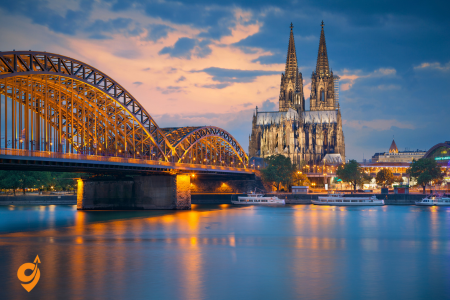
Cologne centers around its awe-inspiring Gothic cathedral, a UNESCO World Heritage site whose twin spires have defined the city’s skyline for centuries. This masterpiece took over 600 years to complete and houses treasures including the golden Shrine of the Three Kings. Beyond the cathedral, Cologne preserves two millennia of history from Roman foundations to medieval churches while embracing modern life with characteristic Rhineland conviviality. The city’s museum landscape offers exceptional diversity from the Romano-Germanic Museum’s ancient artifacts to the Ludwig Museum’s world-class modern art collection. Cologne’s distinctive beer culture revolves around Kölsch, a light ale served in traditional brew houses in small 0.2-liter glasses that continue arriving until you signal otherwise. The city transforms during Carnival season when locals abandon everyday concerns for days of colorful parades and festivities, demonstrating the joyful spirit that makes Cologne particularly welcoming to visitors.
Cologne Cathedral (Kölner Dom)

Cologne Cathedral stands as Germany’s most visited landmark, drawing nearly 20,000 visitors daily. This UNESCO World Heritage Site represents one of the world’s finest examples of Gothic architecture, with construction beginning in 1248 but remarkably not completed until 1880—a process spanning over 600 years.
The cathedral’s twin spires soar to an impressive height of 157 meters (515 feet), making it the tallest twin-spired church in the world. These magnificent towers survived World War II bombing that devastated much of Cologne, standing as virtually the only structure left intact amid the ruins—a fact many locals considered miraculous.
Inside, visitors encounter architectural brilliance with soaring vaulted ceilings reaching 43 meters high. The cathedral houses numerous treasures, most notably the Shrine of the Three Kings—a gilded sarcophagus believed to contain the remains of the three Biblical Magi. This 13th-century reliquary made of gold and silver is considered the largest and most artistically significant reliquary in the Western world.
The cathedral’s stained glass windows span eight centuries of craftsmanship, including both medieval masterpieces and modern works created after WWII. Most breathtaking is the south transept window designed by Gerhard Richter in 2007, featuring 11,500 identically sized squares of colored glass arranged randomly to create a kaleidoscopic effect.
Visitors can climb 533 spiral steps to reach the viewing platform in the south tower, offering panoramic views across the Rhine and the city. The cathedral also houses the world’s largest swinging church bell, the “Petersglocke” (St. Peter’s Bell), weighing an astounding 24 tons.
Old Town (Altstadt)

Cologne’s Old Town represents the historical heart of the city, although much of what visitors see today has been meticulously reconstructed after World War II destroyed approximately 95% of the city center. This reconstruction preserved the medieval street layout while restoring many historic buildings to their former glory.
The area encompasses about 5 square kilometers along the Rhine’s western bank, characterized by narrow cobblestone streets, colorful traditional houses, and a lively atmosphere. Alter Markt (Old Market) and Heumarkt (Hay Market) form the twin centers of the district, hosting seasonal markets including the famous Christmas Markets that transform the area into a magical winter wonderland annually.
Among the architectural highlights are the twelve Romanesque churches scattered throughout the Old Town, built between the 10th and 13th centuries. The most significant include Great St. Martin Church with its distinctive crossing tower, St. Maria im Kapitol with its trefoil choir, and St. Gereon’s Basilica with its unusual decagonal dome.
The historic Town Hall (Rathaus) stands as Germany’s oldest city hall, with portions dating back to the 14th century. Its Renaissance loggia and Gothic tower showcase the building’s evolution over centuries. The adjacent Praetorium underground museum reveals remains of the Roman governor’s palace, offering a glimpse into Cologne’s origins as the Roman city of Colonia Claudia Ara Agrippinensium founded in 50 CE.
Traditional brauhaus (brewery houses) dot the Old Town, serving the local Kölsch beer—a special protected designation that can only be brewed within the city limits. These establishments maintain centuries-old brewing traditions and offer hearty regional cuisine in an authentic atmosphere.
Location Information and Boundaries
Central Reference Address: Rathausplatz 1, 50667 Köln (Cologne City Hall)
District: Altstadt-Nord and Altstadt-Süd (Old Town North and South)
Historical Boundaries: Defined by former medieval walls, now represented by the Ring Road system
Rhine River Access: Eastern boundary with multiple bridge connections
Postal Code Areas: 50667 (primary), 50674, 50676 (surrounding areas)
Public Transportation
U-Bahn and S-Bahn Network Analysis
Primary Underground Access: Dom/Hauptbahnhof Station The Dom/Hauptbahnhof station represents the crown jewel of Cologne’s public transportation system, serving as the primary gateway to the Old Town. This massive underground complex connects U-Bahn lines U16 and U18 with all S-Bahn services (S6, S11, S12, S13, S19, S23), creating a transportation hub that rivals major international airports in complexity and passenger volume.
When you emerge from Dom/Hauptbahnhof station, you’ll find yourself directly facing Cologne Cathedral, with the Old Town spreading out before you like pages of a history book. This positioning isn’t accidental – the station was designed to provide immediate orientation and create a dramatic arrival experience that prepares visitors for the historic journey ahead.
Strategic Secondary Access: Appellhofplatz Station (U7, U15, U16, U17, U18, U19) Appellhofplatz station deserves special attention because it provides access to the Old Town’s quieter northern sections while connecting multiple U-Bahn lines that serve different parts of Cologne’s metropolitan area. This station’s design incorporates Roman archaeological finds directly into the platform areas, creating an underground museum experience that begins your historical education before you even reach street level.
Tram Network and Surface Transportation
Primary Tram Lines Serving the Altstadt:
- Lines 1, 7, 9: Connect the Cathedral area with southern and eastern districts
- Lines 3, 4: Provide north-south connectivity through the Old Town’s heart
- Lines 16, 18: Link the Altstadt with Cologne’s suburban ring and regional destinations
- Line 5: Creates east-west connections across the Rhine River system
Each tram line follows routes that incorporate elements of Cologne’s historical street patterns, often running along roads that originated as Roman streets or medieval trade routes. This historical continuity means that riding Cologne’s trams provides a unique perspective on urban development spanning two millennia.
Bus Network Integration and Specialized Services
Nearby Stops:
- Heumarkt
Lines: 106, 132, 133, 978
Rhine River Transportation and Waterway Access
KD Rhine Cruise Line and Historic Water Transportation The Rhine River has served as Cologne’s primary transportation artery for over two millennia, and modern river transportation maintains this tradition while serving contemporary tourism needs. KD (Köln-Düsseldorfer) operates regular passenger services that connect Cologne’s Old Town with other Rhine Valley historic cities, creating opportunities for multi-city cultural exploration.
Understanding Rhine Navigation and Old Town Access River transportation to the Old Town operates from several docking points along Cologne’s Rhine waterfront. The primary passenger terminal at Frankenwerft provides direct access to the southern Altstadt, while the Deutzer Brücke area serves northern sections. These multiple access points reflect the Old Town’s historical relationship with river commerce, where different types of goods arrived at specialized docking areas.
Seasonal River Services and Cultural Integration During summer months, enhanced river transportation includes evening cruises that provide illuminated views of the Old Town’s historic skyline. These services often coordinate with cultural events like the Cologne Lights festival, demonstrating how transportation integrates with cultural programming to create comprehensive visitor experiences.
Nearby Parking
Understanding Old Town Parking Philosophy Cologne approaches parking in the Old Town through a strategy that balances accessibility with historic preservation and environmental goals. Most streets within the historic core operate as pedestrian zones during daytime hours, with carefully controlled access for residents, deliveries, and visitors with mobility needs.
Major Parking Facilities Serving the Altstadt
Dom Parking Garage
- Location: Directly beneath Cathedral Square at Kardinal-Höffner-Platz
- Capacity: 850+ spaces across four underground levels
- Special Features: Direct underground access to Cathedral and surrounding attractions
- Walking Access: Immediate access to Old Town’s northern sections
- Architectural Integration: Design incorporates Roman archaeological finds visible through glass panels
Rheingarten Parking Complex
- Strategic Position: Along Rhine waterfront serving southern Altstadt
- Capacity: 600+ spaces with automated guidance systems
- Cultural Integration: Walking route to Old Town passes through historic Rheingarten park
- River Access: Direct connections to Rhine cruise terminals and waterfront attractions
Heumarkt Underground Parking
- Historic Location: Beneath one of Cologne’s oldest market squares
- Capacity: 400+ spaces designed around archaeological preservation requirements
- Cultural Significance: Elevator access emerges directly onto medieval market square
- Transportation Connections: Direct access to multiple tram and bus lines
Nearby Attractions
Immediate Old Town Core Attractions (Within 200 meters)
Cologne Cathedral (Kölner Dom) This Gothic masterpiece serves as both the Old Town’s primary landmark and a UNESCO World Heritage site that attracts millions of visitors annually. The Cathedral’s positioning at the transportation network’s center reflects its historical role as a pilgrimage destination that shaped Cologne’s entire urban development. Understanding the Cathedral’s influence helps explain why all transportation routes seem to converge at this location.
Roman-Germanic Museum (Römisch-Germanisches Museum) Located directly adjacent to the Cathedral, this museum preserves and displays Roman artifacts discovered throughout Cologne, including the famous Dionysus mosaic visible through the museum’s street-level windows. The museum’s integration with transportation infrastructure demonstrates how Cologne incorporates archaeological discoveries into contemporary urban life.
Historic City Hall (Historisches Rathaus) Cologne’s City Hall complex represents over 900 years of continuous municipal governance, with architectural elements spanning from medieval foundations to modern additions. The building’s location at Rathausplatz serves as the Old Town’s administrative center and provides context for understanding how civic life evolved within the historic urban framework.
Secondary Historic Attractions (200-500 meters)
Great St. Martin Church (Groß St. Martin) This Romanesque church, with its distinctive four-tower design, represents one of Cologne’s twelve major Romanesque churches and provides architectural context that spans from Roman foundations through medieval development. The walk from major transportation hubs to Great St. Martin takes you through narrow medieval streets that demonstrate how the Old Town’s urban fabric has been preserved and adapted over centuries.
Imhoff Chocolate Museum Located on a Rhine island connected to the Old Town by pedestrian bridges, this museum demonstrates how traditional Cologne industries evolved into contemporary cultural attractions. The museum’s location illustrates how the Old Town’s influence extends beyond its formal boundaries to encompass related historic areas.
Old Market Square (Alter Markt) This medieval market square continues to function as a commercial and social center, hosting regular markets and festivals that maintain traditions dating back centuries. The square’s accessibility via multiple transportation routes reflects its continued importance as a community gathering place that connects Cologne’s past with its present.
Extended Cultural District (500-1000 meters)
Museum Ludwig This internationally significant modern art museum occupies a purpose-built facility that demonstrates how Cologne integrates contemporary cultural institutions with historic preservation. The museum’s location near the Cathedral creates a cultural complex that attracts visitors interested in both historical and contemporary arts.
Rhine Waterfront Promenade The developed Rhine waterfront extends the Old Town’s cultural influence along the river, creating recreational and cultural spaces that complement the historic urban core. Walking or cycling along this promenade provides perspectives on the Old Town’s skyline that help visitors understand its relationship with the Rhine’s commercial and cultural significance.
Heinzelmännchen Fountain and Folk Culture Sites These attractions throughout the Old Town celebrate Cologne’s local folklore and cultural traditions, demonstrating how the historic district maintains its identity as a living community rather than a preserved museum. Understanding these cultural elements helps visitors appreciate how transportation, architecture, and community life integrate to maintain the Altstadt’s authentic character.
Chocolate Museum (Schokoladenmuseum)

Located in a striking modern building resembling a ship on the Rhine peninsula of Rheinauhafen, the Chocolate Museum creates a sensory journey through 5,000 years of chocolate history. Founded in 1993 by Hans Imhoff, a local chocolate manufacturer, it welcomes approximately 650,000 visitors annually.
The museum extends across three levels and 4,000 square meters of exhibition space. Visitors begin their exploration with the cultivation of cacao, examining the biological origins of chocolate in tropical rainforests. Full-sized replica cacao trees create an immersive greenhouse environment demonstrating how the fruit grows directly from the tree trunk—a botanical peculiarity called cauliflory.
The historical section traces chocolate’s journey from sacred Mayan and Aztec beverage to European luxury item, showcasing rare pre-Columbian vessels used in ceremonial consumption. Particularly fascinating is the collection of over 500 antique chocolate molds, revealing how chocolate evolved into an art form for special occasions and holidays.
The museum’s centerpiece—a 3-meter-high golden chocolate fountain—offers visitors wafers dipped in melted chocolate served by staff. The adjacent glass-enclosed production facility demonstrates the complete bean-to-bar chocolate-making process, with working machines showing roasting, grinding, conching, and molding.
The museum also addresses ethical concerns in the chocolate industry, with exhibits on fair trade practices, sustainable agriculture, and the historical problems of labor exploitation in cacao production. Before exiting through the museum’s expansive chocolate shop, visitors can create custom chocolate bars by selecting ingredients and watching their creation being made.
Address and Basic Information
Schokoladenmuseum Köln Am Schokoladenmuseum 1a 50678 Cologne (Köln), Germany
Opening Hours:
- Tuesday to Friday: 10:00 AM – 6:00 PM
- Saturday and Sunday: 11:00 AM – 7:00 PM
- Monday: Closed (except public holidays)
- Last admission: 1 hour before closing
Public Transportation Options
By Train (S-Bahn and Regional)
The museum is easily accessible from Cologne’s main train stations:
From Cologne Central Station (Köln Hauptbahnhof):
- Take tram line 1 or 9 from Central Station toward “Bensberg” or “Königsforst” and get off at “Heumarkt,” then walk 8 minutes
By Tram and Bus (KVB – Kölner Verkehrs-Betriebe)
Tram Lines:
- Line 1: Get off at “Heumarkt” station, then 8-minute walk
- Line 7: Get off at “Heumarkt” station, then 8-minute walk
- Line 9: Get off at “Heumarkt” station, then 8-minute walk
By Bus:
Nearby Stops:
- Schokoladenmuseum
Lines: 106, 132, 133
Transportation Companies
KVB (Kölner Verkehrs-Betriebe): Operates all local public transport including trams, buses, and metro lines within Cologne
Deutsche Bahn: Operates S-Bahn and regional train services connecting to major stations
VRS (Verkehrsverbund Rhein-Sieg): Regional transport network covering broader Rhine-Sieg area
Driving and Parking Information
By Car
The museum is located in Cologne’s Altstadt-Süd district, directly on the Rhine River.
Address for GPS Navigation: Am Schokoladenmuseum 1a, 50678 Köln
Nearby Parking Facilities:
- Rheinauhafen Parking Garage: Multi-level parking directly adjacent to the museum (most convenient option)
- Heumarkt Parking: Underground parking, 5-minute walk
- Deutzer Brücke Parking: Street parking and small lots
- Severinstraße Area: Limited street parking with time restrictions
Parking Considerations:
- The Old Town has limited parking and environmental zone restrictions
- Ensure your vehicle has a valid environmental badge (Umweltplakette)
- Weekend parking is generally easier to find than weekdays
By River
- Rhine River cruise boats make stops near the museum
- KD Rhine Line and other operators offer sightseeing cruises
- Seasonal river taxi services available
Nearby Attractions (Walking Distance)
Historical Sites
Cologne Cathedral (Kölner Dom): 15-minute walk across the Rhine
- UNESCO World Heritage site
- Iconic Gothic architecture
Great St. Martin Church: 10-minute walk
- Romanesque church with distinctive architecture
Old Town (Altstadt): Immediate vicinity
- Historic cobblestone streets
- Traditional brewhouses and restaurants
Museums and Cultural Sites
German Sport & Olympic Museum: 3-minute walk
- Located in the same Rheinauhafen district
Wallraf-Richartz Museum: 12-minute walk
- Fine arts collection from medieval to 19th century
Museum Ludwig: 15-minute walk
- Modern and contemporary art
Shopping and Entertainment
Rheinauhafen District: Immediate area
- Modern architecture and upscale shopping
- Restaurants and cafes with Rhine views
Heumarkt: 8-minute walk
- Historic market square
- Traditional German restaurants and beer halls
Severinstraße: 10-minute walk
- Shopping street with boutiques and cafes
Ludwig Museum (Museum Ludwig)
Museum Ludwig houses one of Europe’s most significant collections of modern and contemporary art, established in 1976 when Peter and Irene Ludwig donated 350 works to the city of Cologne. The distinctive building with its iconic stepped roof design sits adjacent to Cologne Cathedral in the heart of the city.
The museum holds the largest collection of Pop Art outside the United States, featuring numerous seminal works by Andy Warhol including his famous “Brillo Boxes” and multiple Marilyn Monroe portraits. Roy Lichtenstein’s comic-inspired paintings and Claes Oldenburg’s oversized soft sculptures further enhance this comprehensive Pop Art collection.
Equally impressive is the museum’s assembly of Russian Avant-garde pieces created between 1905 and 1930, including works by Kazimir Malevich, El Lissitzky, and Alexander Rodchenko. This collection provides insight into the revolutionary artistic movements that emerged during the early Soviet period before Stalin’s oppressive cultural policies took hold.
The museum boasts the third-largest Picasso collection worldwide, with over 900 works spanning the artist’s entire career from early academic studies to his final creations. Visitors can trace Picasso’s artistic evolution through major stylistic shifts including his Blue Period, Rose Period, Cubism, Neoclassicism, and Surrealism.
Beyond these core collections, Museum Ludwig maintains extensive holdings of German Expressionism, Surrealism, Abstract Expressionism, and cutting-edge contemporary works. The museum actively collects photography, with over 70,000 photographs dating from the medium’s invention to present day, including significant works by August Sander, Bernd and Hilla Becher, and Cindy Sherman.
Rhine Promenade (Rheinuferpromenade)
Cologne’s Rhine Promenade stretches approximately 1.5 kilometers along the river’s western bank, offering picturesque views of the Rhine and the city’s eastern districts. This landscaped pedestrian pathway was redesigned in the late 1990s to create a harmonious connection between the city and its river.
The promenade serves as Cologne’s recreational lifeline, attracting joggers, cyclists, families, and romantics throughout the year. Rows of linden trees provide shade during summer months, while strategically placed benches offer contemplative spots to watch the constant parade of river traffic—from massive cargo vessels to elegant passenger cruisers navigating Europe’s busiest waterway.
Historic building facades along Frankenwerft and Holzwerft reveal Cologne’s commercial past as a major medieval trading hub. Particularly charming are the pastel-colored buildings of the Fischmarkt (Fish Market), reminiscent of those found in Copenhagen or Amsterdam, highlighting the city’s Hanseatic trading connections.
The promenade hosts several significant landmarks including the Chocolate Museum at its southern end and the Hohenzollern Bridge with its thousands of “love locks” at its northern extent. Mariensäule (St. Mary’s Column), a medieval defensive tower incorporated into the waterfront promenade, now serves as a memorial for sailors lost at sea.
Numerous restaurants, beer gardens, and cafés line the route, offering regional specialties and front-row views of river activities. During summer evenings, the illuminated Cathedral creates a magical backdrop as the promenade transforms into an open-air concert venue hosting live music performances.
The Rhine Promenade reaches its crescendo during “Kölner Lichter,” an annual fireworks spectacular synchronized to music that attracts hundreds of thousands of spectators. Similarly, during Carnival season, the promenade fills with revelers participating in Cologne’s famous celebration.
KölnTriangle

KölnTriangle (also known as LVR-Turm) stands as a 103-meter-high modern landmark on the eastern bank of the Rhine River in Cologne’s Deutz district. Completed in 2006 and designed by architect Dörte Gatermann, this striking glass tower serves as the headquarters of the Rhineland Regional Council (Landschaftsverband Rheinland).
The building’s most remarkable feature is its public observation deck on the 29th floor, reached via a panoramic elevator. This platform offers what many consider the most spectacular view of Cologne, with the cathedral appearing perfectly framed against the city skyline. Unlike the cathedral’s tower view, this perspective provides visitors with a complete panorama of the entire city from across the river.
The viewing platform is encircled by a unique glass parapet that slants outward at a 50-degree angle, creating the illusion of floating above the city. This architectural feature allows visitors to look directly down without obstruction while maintaining complete safety. Special information panels identify key landmarks visible from each direction.
The building itself represents innovative sustainable architecture, featuring a double-skin facade that regulates temperature and reduces energy consumption. The tower’s triangular shape—which inspired its name—creates a distinctive silhouette on Cologne’s eastern skyline and maximizes the building’s energy efficiency by reducing surface area exposed to direct sunlight.
At night, the building’s illumination system creates an ever-changing light display, with subtle color transitions that complement rather than compete with the cathedral’s illumination across the river. This thoughtful lighting design has made KölnTriangle an important element in Cologne’s nighttime skyline.
Basic Information
- Address: Ottoplatz 1, 50679 Cologne (Köln), Germany
- Opening Hours: Monday-Sunday 10:00 AM – 8:00 PM (last admission 7:30 PM)
- Location: Right bank of Rhine River, Deutz district, opposite Old Town
Public Transportation
Railway Transportation
Primary Station: Cologne Messe/Deutz
- Distance to KölnTriangle: 400 meters (5-minute walk)
- S-Bahn Lines: S6, S11, S12, S13
- Regional Trains: RE1, RE5, RE7, RE9
- Frequency: Every 10-20 minutes during peak hours
- Connections: Direct links to airport, suburbs, neighboring cities
From Cologne Central Station
- S-Bahn connection: 3-4 minutes to Messe/Deutz
- Walking via Deutz Bridge: 15 minutes (scenic route)
- Multiple S-Bahn options: S6, S11, S12, S13 all connect
Driving and Parking
Access Routes
- From West: Cross Deutz Bridge, follow Deutz-Mülheimer-Straße
- From East: A4 Autobahn, exit Köln-Deutz
- Environmental Zone: Required emission badge for city center access
Parking Options
- Köln Messe Parking: 300m from KölnTriangle, 1,500+ spaces, 24/7 operation
- Ottoplatz Street Parking: Limited metered spaces, time restrictions •
Alternative Garages: Multiple options within 5-10 minute walk
- Trade Fair Impact: Higher demand during Koelnmesse events
River Transportation
- Rhine Cruises: Seasonal services with nearby stops
- Multiple Operators: Various cruise companies serve route
- Combined Experience: Transportation plus sightseeing value
Nearby Stations and Stops
Railway Stations
- Messe/Deutz: 400m (primary station)
- Central Station: 1.5km across river
- Deutz/LANXESS Arena: 1km south
Tram/Bus Stops
- Köln Messe/Deutz: Primary stop for Lines 1 and buses
- Deutzer Brücke: Bridge crossing point
- Ottoplatz: Local area stops
Nearby Attractions (Walking Distances)
Immediate Area
- Koelnmesse Convention Center: Adjacent to KölnTriangle
- Claudius Therme: 800m south, Roman-style thermal baths
- Rheinpark: Extensive parkland along Rhine’s eastern bank
Cross-River Attractions (via Deutz Bridge)
- Cologne Cathedral: 15-minute walk, UNESCO World Heritage
- Old Town: Historic district with traditional brewhouses
- Museum Ludwig: Modern art collection
- Wallraf-Richartz Museum: Fine arts from medieval to 19th century
Seasonal and Event Considerations
Trade Fair Periods
- Enhanced Services: Additional buses during major events
- Parking Premium: Higher demand, book in advance
- Crowd Management: Extended operating hours for transport
Weather Factors
- Indoor Connections: Covered walkways from station
- Rhine Weather: Bridge crossings affected by wind
- Visibility: Best viewing conditions typically morning hours
Rhine River Levels
- Seasonal Cruises: Operating schedules vary with water levels
- Flood Periods: Rare impact on walking routes along riverbank
Botanical Gardens Flora (Flora und Botanischer Garten)

Cologne’s Botanical Gardens Flora cover an impressive 11.5 hectares in the city’s Riehl district, providing a verdant escape approximately 3 kilometers north of the cathedral. Established in 1864 during the Victorian era’s passion for botanical collection and display, the gardens combine formal European design with global plant diversity.
The gardens’ centerpiece is the recently restored Flora—a magnificent glass palace completed in 1864 and inspired by London’s Crystal Palace and the Jardin d’Hiver in Paris. This historical conservatory features ornate cast-iron elements and glass panels that create a luminous environment for tropical plants, including rare palms, orchids, and camellias. The Flora building now serves as both a botanical showcase and an elegant event venue.
The gardens are organized into distinct zones representing different geographic regions and plant communities. The Mediterranean section features drought-resistant species from Southern Europe and North Africa, while the North American prairie garden showcases tall grasses and wildflowers that once covered vast expanses of the American Midwest.
Particularly noteworthy is the extensive collection of over 10,000 plant species, including one of Europe’s most comprehensive assortments of medicinal plants with detailed explanations of their traditional and modern uses. The garden’s systematic beds arrange plants according to their evolutionary relationships, creating a living textbook of plant classification.
Several themed gardens enhance the visitor experience, including a meticulously maintained Japanese garden with authentic elements such as stone lanterns, a tea house, and carefully pruned trees, as well as a sensory garden designed specifically for visually impaired visitors with fragrant plants labeled in Braille.
The garden’s succession of seasonal displays ensures year-round interest—from early spring bulbs and cherry blossoms to summer perennial borders, autumn foliage, and winter structure. The central fountain provides a refreshing focal point during warmer months, while sculptures throughout the grounds merge artistic appreciation with botanical education.
The gardens serve as an important conservation center, participating in international seed exchange programs and maintaining collections of threatened plant species. Educational programs for schools and the public emphasize sustainability, biodiversity, and climate change adaptation.
Basic Information
- Full Name: Flora und Botanischer Garten Köln
- Address: Amsterdamer Straße 34, 50735 Cologne (Köln), Germany
- District: Riehl (northern Cologne)
- Opening Hours: Daily 8:00 AM – 6:00 PM (winter), 8:00 AM – 8:00 PM (summer)
- Flora Building Hours: Tuesday-Sunday 10:00 AM – 6:00 PM, closed Mondays
- Special Note: Gardens remain open later during summer months, exact times vary seasonally
Understanding Flora’s Location Strategy
Geographic Context
- Distance from City Center: 4 kilometers north of Cologne Cathedral
- District Character: Riehl is primarily residential with green spaces
- Rhine Proximity: Gardens located 800 meters from Rhine River
- Urban Planning: Part of Cologne’s “green belt” connecting multiple parks
Public Transportation Access
Tram Network (KVB Operations)
- Line 16: Direct connection from city center to Flora entrance
- Key Stops: Central Station → Ebertplatz → Reichenspergerplatz → Flora
- Frequency: Every 10 minutes during peak hours, 15 minutes off-peak
- Journey Time: 15 minutes from Central Station
- Final Stop: “Flora” – directly at garden entrance
- Line 18: Alternative route serving northern districts
- Route Character: Connects eastern suburbs through Flora to western areas
- Stop Location: “Flora” terminus with direct garden access
- Frequency: Every 12 minutes peak, 20 minutes off-peak
- Strategic Value: Provides backup service when Line 16 experiences delays
Bus Connections
Nearby Stops: Zoo/ Flora
Lines: 116
Driving Access and Parking Solutions
Primary Driving Routes
- From City Center: Follow Amsterdamer Straße north from Ebertplatz
- Distance: 4 kilometers direct route
- Traffic Considerations: Residential streets with speed limitations
- Navigation Landmarks: Follow signs for “Riehl” and “Flora”
- From Autobahn A57: Exit “Köln-Niehl” and follow local signs
- Strategic Advantage: Avoids city center traffic congestion
- Route Character: Industrial to residential transition area
- From Eastern Cologne: Via Riehler Gürtel and Amsterdamer Straße
- Traffic Pattern: Major arterial with coordinated traffic signals
Parking Facilities and Strategies
Flora Parking Area: Small dedicated lot adjacent to main entrance
- Capacity: Approximately 50 spaces
- Availability: Often full during weekends and events
- Access: Direct from Amsterdamer Straße
Street Parking Options:
- Amsterdamer Straße: Limited metered spaces with time restrictions
- Residential Streets: Riehler Straße area offers longer-term options
- Walking Distance: 200-400 meters from various street parking locations
Alternative Parking Strategy:
- Köln-Nippes Area: Larger parking areas near S-Bahn station
- Combined Approach: Park at Nippes, take tram to Flora
- Cost Advantage: Often more economical for extended visits
Nearby Attractions
Within Walking Distance (Under 1 kilometer)
- Riehler Heimstätten: Historic residential development showcasing early 20th-century urban planning
- Architectural Significance: Garden city movement examples
- Walking Route: 600 meters southeast through residential streets
- Rhine Riverfront Access: Multiple connection points to river promenade
- Closest Access: 800 meters via Riehler Straße
- Activities: Walking, cycling, river viewing areas
- Seasonal Interest: Rhine shipping observation opportunities
Nearby Districts (1-2 kilometers)
- Nippes District Center: Traditional Cologne neighborhood with local character
- Transportation Hub: S-Bahn and multiple bus lines
- Cultural Features: Local markets, traditional breweries, neighborhood shops
- Distance: 2 kilometers southeast via tram or walking
- Mülheim Industrial Heritage Area: Former industrial district with cultural redevelopment
- Historical Interest: Industrial architecture and urban transformation examples
- Access: Via tram connections through Nippes
- Distance: 3 kilometers east
Extended Area Attractions (2-5 kilometers)
- Cologne Zoo: Major attraction accessible via tram network
- Transportation: Direct tram connection via Lines 16 or 18 to city center, then transfer
- Journey Time: 25-30 minutes total travel time
- Strategic Value: Easy combination with Flora visit
- Cologne Cathedral District: Historic city center
- Access Method: Direct tram Line 16 journey
- Travel Time: 20 minutes door-to-door
- Combination Strategy: Flora morning visit, cathedral afternoon exploration
Nuremberg (Nürnberg)
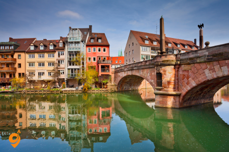
Nuremberg presents a fascinating journey through German history from medieval imperial power to 20th-century tragedy and recovery. The imposing imperial castle complex overlooks a beautifully preserved old town encircled by extensive medieval walls and towers that visitors can walk along for panoramic views. The city takes particular pride in its craftsman traditions, from metalwork to the famous Nuremberg gingerbread (Lebkuchen). During Advent, Germany’s most renowned Christmas market (Christkindlesmarkt) transforms the main square into a magical wonderland of traditional crafts and foods. Nuremberg also provides thoughtful education about its Nazi-era history at the Documentation Center Nazi Party Rally Grounds and the courtroom where the famous war crimes trials were held. This combination of celebrating cultural heritage while honestly confronting difficult history makes Nuremberg a particularly profound destination for understanding Germany’s complex journey.
Imperial Castle (Kaiserburg)

The Nuremberg Imperial Castle stands as one of Germany’s most important medieval fortresses, perched majestically on a sandstone ridge overlooking the city’s old town. Dating back to approximately 1040, this castle served as a key strategic stronghold and preferred residence for Holy Roman Emperors for over 500 years, hosting every emperor between 1050 and 1571—a record unmatched by any other imperial palace in the Holy Roman Empire.
The castle complex consists of three distinct sections: the Imperial Castle proper (Kaiserburg), the Burgraves’ Castle (Burggrafenburg), and the Imperial City’s buildings. Together, these elements create an imposing defensive structure that dominates Nuremberg’s skyline and embodies the city’s imperial past.
The castle’s most notable features include the Palas (Great Hall), containing the imperial apartments where rulers held court and conducted affairs of state. The Double Chapel represents a masterpiece of Romanesque architecture with its innovative two-story design. The lower chapel served ordinary castle residents while the upper chapel was reserved exclusively for the emperor and nobility, connected by a central opening that allowed lower-ranking individuals to participate in imperial services without direct contact with royalty.
The Sinwell Tower (whose name derives from “sinwell,” meaning “perfectly round”) rises 35 meters high, offering panoramic views across the city. During medieval times, this cylindrical tower functioned as both an observation post and last-resort defensive position. Today, visitors who climb its 113 steps are rewarded with spectacular vistas of Nuremberg’s red-tiled roofscape.
Perhaps most intriguing is the Deep Well (Tiefer Brunnen), a remarkable engineering achievement excavated through solid rock to a depth of 47 meters to guarantee water supply during sieges. Tour guides demonstrate the well’s extraordinary depth by pouring water down its shaft and illuminating its interior with candles, creating a memorable exhibition of medieval ingenuity.
The castle’s gardens and ramparts offer peaceful strolling grounds with significant historical context—these defensive walls withstood numerous sieges throughout history but suffered devastating damage during World War II bombing raids. What visitors see today represents careful reconstruction efforts completed in the 1950s, maintaining historical accuracy while acknowledging the castle’s tumultuous past.
Basic Information
- Official Name: Kaiserburg Nürnberg (Imperial Castle of Nuremberg)
- Address: Auf der Burg 13, 90403 Nuremberg, Germany
- District: Altstadt (Old Town), perched on Castle Hill (Burgberg)
- Opening Hours: April-September 9:00 AM – 6:00 PM, October-March 10:00 AM – 4:00 PM
- Closed: January 1, Shrove Tuesday, December 24, 25, 31
- UNESCO Status: Part of Nuremberg’s Old Town World Heritage consideration
Public transportation
Metro/U-Bahn System
- U1 Line: Connects Central Station to northern suburbs via city center
- Key Castle Stop: “Lorenzkirche” – 400 meters from castle base
- Walking Route: Through historic Hauptmarkt square to castle approach
- Frequency: Every 5 minutes peak hours, 10 minutes off-peak
- Journey Time: 8 minutes from Central Station to Lorenzkirche
- U2 Line: East-west corridor serving residential areas
- Castle Access Point: “Hauptbahnhof” for connections to castle-bound transport
- Strategic Function: Brings eastern suburb residents to castle access routes
- U3 Line: Serves southeastern districts and exhibition center
- Connection Strategy: Transfer at Central Station for castle access
- Event Coordination: Enhanced service during trade fair periods
Tram Network
- Line 4: Historic tram route serving traditional city districts
- Castle Proximity: “Tiergärtnertor” stop at base of castle hill
- Distance to Castle: 200 meters with uphill walk to entrance
- Historical Significance: Tram route follows medieval street patterns
- Frequency: Every 10 minutes throughout operating day
- Line 6: Connects residential areas to historic center
- Castle Stop: “Hauptmarkt” in heart of Old Town
- Walking Distance: 300 meters through market square to castle approach
- Cultural Route: Path passes through UNESCO-worthy medieval streetscape
Bus Network Integration
Nearby Stops:
- Nürnberg Burgstr.
- Tiergärtnertor – Nürnberg
Lines: N11, N10
Driving Access and Parking Challenges
Primary Driving Routes to Castle Area
- From A3 Autobahn: Exit “Nürnberg-Süd,” follow signs for “Altstadt” and “Kaiserburg”
- Route Character: Urban arterials leading to Old Town perimeter
- Traffic Management: Coordinated signals guide visitors to parking areas
- Restriction Points: Vehicle barriers prevent unauthorized Old Town access
- From A9 Autobahn: Exit “Nürnberg-Nord,” navigate via Fürther Straße to city center
- Alternative Route: Avoids southern approaches during peak traffic periods
- Commercial Traffic: Route often used by delivery vehicles serving Old Town
Parking Locations
Hauptmarkt Underground Parking: Closest to castle with direct access
- Distance to Castle: 400 meters through historic market square
- Capacity: 350 spaces across multiple levels
- Access Hours: 24/7 operation with overnight security
- Walking Route: Scenic approach through medieval streetscape
Burg Parking Garage: Dedicated facility serving castle visitors
- Location: At base of castle hill, purpose-built for tourist access
- Distance to Castle: 150 meters uphill walk via designated path
- Capacity: 120 spaces with tour bus accommodation
- Seasonal Demand: Often full during peak tourist seasons
Maxplatz Parking Area: Surface parking with Old Town access
- Distance to Castle: 600 meters through city center streets
- Advantage: Lower cost option for extended visits
- Time Limits: Various restrictions depending on specific zone
Park-and-Ride Options: Suburban parking with public transport connections
- VAG P+R Facilities: Multiple locations with metro/tram connections
- Cost Strategy: Combined parking and transport tickets available
- Suburban Locations: Langwasser, Mögeldorf, other peripheral areas
Nearby Attractions and Integrated Visit Planning
Within Walking Distance (Under 500 meters)
- Albrecht Dürer House: 200 meters from castle, integrated historic circuit
- Transportation Coordination: Single walking route connects both attractions
- Cultural Significance: Renaissance artist’s preserved home and workshop
- Combined Tickets: Often available for multiple historic sites
- Tiergärtnertor and City Walls: Immediate castle area with medieval fortifications
- Access Integration: Same transport stops serve multiple historic sites
- Walking Circuit: Self-guided route connecting various defensive structures
- St. Sebald Church: 400 meters through historic streets
- Route Character: Medieval street patterns create atmospheric approach
- Cultural Value: Gothic architecture complements castle’s Romanesque elements
Historic District Integration (500 meters – 1 kilometer)
- Hauptmarkt (Main Market Square): Central Old Town focus with year-round activities
- Transportation Hub: Multiple public transport lines converge here
- Seasonal Events: Christmas Market, spring festivals affect transport demand
- Walking Route: Direct path to castle through historic commercial district
- St. Lorenz Church: Gothic masterpiece with artistic treasures
- Metro Connection: Lorenzkirche station serves both church and castle access
- Cultural Circuit: Combined visit strategy using public transport connections
- Handwerkerhof: Craft courtyard showcasing traditional Nuremberg trades
- Location: Near Central Station, convenient for arrival/departure planning
- Transportation Strategy: Easy combination with castle visit using metro system
Extended Area Attractions (1-3 kilometers)
- Germanisches Nationalmuseum: Germany’s largest cultural history museum
- Transport Access: Direct tram and bus connections from castle area
- Visit Strategy: Half-day allocation allows combination with castle
- Distance Management: 1.2 kilometers via public transport or walking
- Documentation Center Nazi Party Rally Grounds: Historical education site
- Distance: 3 kilometers southeast of castle area
- Transport Method: Tram Line 8 provides direct connection
- Cultural Significance: Contrasts medieval castle with 20th-century history
- Nuremberg Zoo: Modern zoological facility with conservation focus
- Access Strategy: Metro Line U2 provides direct connection from castle area
- Family Coordination: Popular combination for visitors with children
- Transport Integration: Single day ticket covers castle and zoo access
Documentation Center Nazi Party Rally Grounds (Dokumentationszentrum Reichsparteitagsgelände)
The Documentation Center Nazi Party Rally Grounds represents one of Germany’s most significant historical museums addressing the darkest chapter of the nation’s past. Located in the northern wing of the unfinished Congress Hall (Kongresshalle), the center occupies part of the massive Nazi Party Rally Grounds where Hitler staged enormous propaganda events to demonstrate his power and rally support.
This sprawling complex originally covered approximately 11 square kilometers and included numerous monumental structures designed by Hitler’s architect Albert Speer to showcase Nazi ideology through imposing architecture. The Congress Hall itself was intended to seat 50,000 spectators in a structure inspired by the Roman Colosseum but on an even larger scale—a physical manifestation of the regime’s delusions of creating a “thousand-year Reich.”
The Documentation Center opened in 2001 after Nuremberg made the conscious decision to preserve these troubling sites not as monuments but as places of learning and warning. The permanent exhibition “Fascination and Terror” examines the causes, contexts, and consequences of the Nazi regime through over 1,300 artifacts, photographs, documents, and multimedia presentations.
What makes this museum particularly powerful is its location within the very architecture it critiques—visitors experience the oppressive scale of Nazi design while simultaneously learning about its sinister purposes. A modern architectural intervention—a diagonal glass and steel corridor—literally cuts through the original structure, symbolically disrupting the propaganda architecture and creating a path toward historical understanding.
The exhibition follows a chronological path examining Nuremberg’s role as the “City of Nazi Party Rallies,” exploring how these massive spectacles functioned as propaganda tools that combined political messaging with quasi-religious experiences designed to forge emotional bonds between participants and the regime. Particularly chilling are the film materials showing how these rallies were captured and distributed through Leni Riefenstahl’s propaganda films.
Beyond the indoor exhibition, visitors can explore the grounds themselves, including the Zeppelin Field with its famous tribune platform where Hitler addressed crowds of up to 200,000 people. The Great Road (Große Straße), a 2-kilometer parade boulevard, remains intact, as does the unfinished foundations of the German Stadium that was designed to hold 400,000 spectators.
The Documentation Center plays a crucial educational role in contemporary Germany, hosting over 300,000 visitors annually and offering specialized programs for schools, universities, and professional groups. Its unflinching examination of history serves as both memorial and warning about the dangers of totalitarianism, making it an essential, if sobering, destination for understanding Nuremberg’s complex history.
Basic Information
- Official Name: Dokumentationszentrum Reichsparteitagsgelände
- Address: Bayernstraße 110, 90478 Nuremberg, Germany
- District: Dutzendteich area, southeastern Nuremberg
- Opening Hours: Monday-Friday 9:00 AM – 6:00 PM, Saturday-Sunday 10:00 AM – 6:00 PM
- Closed: December 24, 25, 31, January 1
- Documentation Center Building: Located in unfinished Congress Hall (Kongresshalle)
- Historical Significance: Preserved Nazi Party Rally Grounds from 1933-1938 period
Public Transportation
Tram Network Serving Documentation Center
- Line 8: Primary tram service connecting city center directly to Documentation Center
- Key Stops: Central Station → Plärrer → Messe → Luitpoldhain → Doku-Zentrum
- Frequency: Every 10 minutes during peak hours, 15 minutes off-peak
- Journey Time: 25 minutes from Central Station to Documentation Center
- Final Stop: “Doku-Zentrum” directly at memorial entrance
Bus Network
Nearby Stops:
- Doku-Zentrum
Lines: 45, 55, 65, 96
Driving Access and Parking Infrastructure
Primary Automotive Routes
- From A9 Autobahn: Exit “Nürnberg-Fischbach” provides most direct access
- Route Character: Modern highway infrastructure transitioning to memorial area
- Signage System: Clear directional signs for “Dokumentationszentrum”
- Traffic Management: Coordinated signals manage flow during peak visitor periods
- From City Center: Via Bayernstraße through southeastern districts
- Distance: 6 kilometers following main arterial road
- Urban Character: Route passes through various neighborhood types
- Memorial Approach: Final kilometers provide visual introduction to rally grounds scale
- From A6 Autobahn: Alternative access via “Nürnberg-Süd” exit
- Strategic Value: Avoids city center traffic during congested periods
- Route Coordination: Connects to Bayernstraße via secondary arterials
Nearby Parking
- Documentation Center Main Parking: Large facility directly adjacent to memorial entrance
- Capacity: 400+ spaces designed to accommodate peak visitor demand
- Accessibility Features: Reserved spaces and barrier-free access throughout facility
- Coach Parking: Dedicated areas for tour buses and educational group transport
- Security: 24-hour monitoring appropriate for memorial site requirements
- Luitpoldhain Parking Areas: Additional parking serving broader rally grounds area
- Distance to Documentation Center: 500 meters via pedestrian paths
- Capacity Advantage: Larger area available during peak demand periods
- Integration: Walking routes connect to various memorial sites across rally grounds
- Dutzendteich Lake Parking: Recreational area parking with memorial site access
- Multi-Purpose Function: Serves both memorial visitors and recreational lake users
- Walking Distance: 800 meters to Documentation Center via lakeside paths
- Seasonal Considerations: Higher demand during summer recreational periods
Nearby Attractions
Immediate Rally Grounds Area (Walking Distance)
- Zeppelin Field (Zeppelinfeld): Preserved rally ground with grandstand remains
- Distance from Documentation Center: 400 meters via designated pedestrian paths
- Transportation Integration: Single tram stop serves both major memorial components
- Historical Significance: Main assembly area during Nazi Party rallies
- Congress Hall (Kongresshalle): Unfinished Nazi building housing Documentation Center
- Integration: Documentation Center located within this historic structure
- Architectural Significance: Massive unfinished building demonstrates Nazi architectural ambitions
- Educational Value: Building itself serves as historical artifact and museum space
- Luitpold Arena: Reconstructed area with memorial interpretation
- Distance: 600 meters from Documentation Center
- Access Route: Walking paths connect various rally grounds components
- Historical Context: Originally used for SA and Hitler Youth rallies
Extended Memorial Area (1-2 kilometers)
- Dutzendteich Lake: Recreational area within former rally grounds
- Current Function: Public park and lake serving local recreation needs
- Historical Integration: Lake area was incorporated into original rally grounds design
- Transportation Access: Same tram and bus routes serve both memorial and recreational functions
- Walking Connection: Pedestrian paths connect lake area to Documentation Center
- Märzfeld: Partially preserved area of former rally grounds
- Distance: 1.5 kilometers from Documentation Center
- Access Method: Bicycle or extended walking required from main memorial area
- Historical Significance: Planned as massive military demonstration area
- Current Status: Agricultural use with memorial markers indicating historical significance
Regional Historical Sites (Requiring Separate Transportation)
- Nuremberg Palace of Justice: Site of post-war Nuremberg Trials
- Distance: 4 kilometers northwest of Documentation Center
- Transportation Method: Tram Line 8 to city center, then local transport to courthouse
- Historical Connection: Directly related to Documentation Center’s educational mission
- Combined Visit Strategy: Full day allocation recommended for both sites
- Nuremberg Old Town and Imperial Castle: Medieval city center contrasting with 20th-century history
- Transportation Connection: Direct tram Line 8 provides efficient connection
- Cultural Contrast: Journey from medieval castle to Nazi memorial demonstrates historical continuity
- Educational Value: Combined visit shows different periods of German history
Hauptmarkt and Frauenkirche

The Hauptmarkt (Main Market Square) forms the bustling heart of Nuremberg’s old town, a magnificent public space measuring approximately 5,000 square meters that has served as the city’s commercial and cultural center since the 14th century. This historic square hosts the city’s famous Christmas Market (Christkindlesmarkt), one of the oldest and most renowned in the world, drawing over two million visitors annually during the Advent season.
Dominating the eastern edge of the square stands the Frauenkirche (Church of Our Lady), a stunning example of brick Gothic architecture built between 1352 and 1362 under the patronage of Emperor Charles IV. The church’s most distinctive feature is its Männleinlaufen (Little Men Running), an elaborate mechanical clock created in 1509 that commemorates the Golden Bull of 1356—a constitutional document of the Holy Roman Empire issued by Charles IV. Every day at noon, seven prince-electors circle around the seated emperor while trumpeters herald the spectacle, drawing crowds of onlookers.
The church’s façade features an elaborate portico with intricate stone carvings depicting scenes from the life of Mary. Inside, visitors find a surprisingly bright interior for a Gothic church, with slender columns supporting a vaulted ceiling. The Tucher Altar (1440-1450), a masterpiece of late Gothic painting, and the suspended stone tabernacle by Adam Kraft represent the church’s most treasured artistic elements.
On the square’s opposite side stands the Renaissance Schöner Brunnen (Beautiful Fountain), a 19-meter-high stone pyramid decorated with 40 colorful figures representing the worldview of the Holy Roman Empire—philosophers, evangelists, church fathers, electors, and heroes. Two brass rings embedded in the fountain’s decorative grille are said to bring good luck when turned—one has been worn smooth by countless hands seeking fortune over the centuries.
The square is ringed by colorfully painted merchant houses and the elegant Renaissance-style Rathaus (City Hall). Daily markets still operate here, continuing a tradition that has persisted since medieval times. Fresh produce, flowers, and specialty foods draw locals year-round, while seasonal markets celebrate Easter, autumn harvest, and of course, the renowned Christmas Market with its distinctive red-and-white striped stalls.
The Hauptmarkt contains another significant historical element: a simple stone marker embedded in the pavement represents the former site of the Schöner Brunnen Synagogue, destroyed during the 1349 pogrom that eliminated Nuremberg’s medieval Jewish community. This unobtrusive memorial reminds visitors of the square’s complex history, which includes both cultural achievements and historical injustices.
Location & Address
- Hauptmarkt: Hauptmarkt, 90403 Nürnberg
- Frauenkirche: Hauptmarkt 14, 90403 Nürnberg
- Both located in Nuremberg’s Altstadt (Old Town)
- Frauenkirche sits directly on Hauptmarkt square
Opening Hours
Hauptmarkt Square
- Access: 24 hours daily (public square)
- Christmas Market: Late November – December 24 (seasonal)
- Regular markets: Various days throughout week
Frauenkirche
- Monday-Saturday: 9:00 AM – 6:00 PM • Sunday: 12:30 PM – 6:00 PM
- Seasonal variations: Hours may change for special services
- Famous clock show: Daily at 12:00 PM (Männleinlaufen)
Public Transportation
U-Bahn (Subway)
- Closest station: Lorenzkirche (U1, U2, U3 lines)
- 3-5 minute walk to Hauptmarkt
- Alternative: Hauptbahnhof station (all U-Bahn lines)
- 10-minute walk through old town
By Bus
Nearby Stops:
- Nürnberg Heilig-Geist-Spital
- Nürnberg Hauptmarkt
Lines: 37, 46, 47, N11
Driving & Parking
Parking Facilities
- Hauptmarkt underground garage: Entrance via Theresienstraße
- Parkhaus Altstadt: Near Albrecht-Dürer-Platz
- Parkhaus Maxtor: Central location
- Street parking: Available in surrounding areas with time restrictions
Driving Restrictions
- Hauptmarkt area is restricted traffic zone
- Pedestrian-only access to square itself
- Resident parking zones in surrounding streets
Nearby Attractions (Walking Distance)
Immediate Area
- Schöner Brunnen (Beautiful Fountain): On Hauptmarkt square
- St. Sebaldus Church: 5-minute walk
- Albrecht Dürer House: 7-minute walk
- Imperial Castle (Kaiserburg): 10-minute walk uphill
Cultural Sites
- Germanic National Museum: 8-minute walk
- St. Lawrence Church (Lorenzkirche): 5-minute walk
- Toy Museum (Spielzeugmuseum): 6-minute walk
- Old Town Hall: Adjacent to Hauptmarkt
Historic Areas
- Handwerkerhof: Traditional craftsmen’s courtyard
- Weißgerbergasse: Historic tanner’s lane
- Tiergärtnertorplatz: Picturesque medieval square
- City walls and towers: Multiple access points nearby
Albrecht Dürer’s House
Albrecht Dürer’s House stands as one of the few completely preserved artist residences from the 16th century in all of Europe. This distinctive half-timbered structure, built around 1420 in the shadow of the Imperial Castle, served as both home and workshop for Germany’s most famous Renaissance artist from 1509 until his death in 1528.
Dürer himself was a multifaceted genius—painter, printmaker, mathematician, theoretician, and humanist—who revolutionized numerous artistic techniques, particularly woodcut and copper engraving. His innovative approaches to perspective, proportion, and anatomical accuracy brought Northern European art into conversation with Italian Renaissance developments. Works like “Adam and Eve,” “Melencolia I,” and his self-portraits remain among Western art’s most analyzed and influential images.
The five-story house has been operating as a museum since 1871 and underwent extensive renovation in the early 2000s to create an immersive historical experience. Rather than functioning as a traditional art gallery (most of Dürer’s original works are housed in major museums worldwide), the house recreates the living and working environment of a successful Renaissance artist.
Visitors encounter rooms furnished as they would have appeared during Dürer’s lifetime, including the impressive workshop where apprentices prepared pigments and panels. The printing room demonstrates the revolutionary printing techniques Dürer mastered and advanced, allowing visitors to understand how his famous woodcuts and engravings were produced and disseminated throughout Europe.
Particularly fascinating is the kitchen with its original hearth and the living quarters where Dürer entertained humanist scholars and influential patrons. The recreation of his studio features period-appropriate tools, pigments, and materials that illustrate the technical challenges Renaissance artists confronted daily.
Museum guides dressed in period costume demonstrate Renaissance printmaking techniques, pigment preparation, and other artistic practices, bringing the creative process to life. Interactive elements throughout the museum allow visitors to experiment with perspective devices similar to those Dürer pioneered in his theoretical works.
The building itself miraculously survived World War II bombing that destroyed approximately 90% of Nuremberg’s old town. This preservation allows visitors to experience authentic architectural elements including original wooden beams, period windows, and the distinctive steep roof that characterizes medieval German urban architecture.
Location & Address
- Full Address: Albrecht-Dürer-Straße 39, 90403 Nürnberg
- District: Located in Nuremberg’s historic Altstadt (Old Town)
- Neighborhood: Tiergärtnertorplatz area, below Imperial Castle
- Landmark reference: Near the medieval city fortifications and castle approach
Opening Hours & Visitor Information
Museum Operating Hours
- Tuesday-Friday: 10:00 AM – 5:00 PM
- Saturday-Sunday: 10:00 AM – 6:00 PM
- Monday: Closed (except public holidays)
- Public holidays: Special hours may apply
- Last admission: 30 minutes before closing time
Public Transportation Access
U-Bahn (Subway) Connections
- Primary station: Tiergärtnertorplatz (U1 line only)
- Walking distance: 2-3 minutes from station exit
- Alternative station: Lorenzkirche (U1, U2, U3 lines)
- Walking distance from Lorenzkirche: 8-10 minutes through old town
- Hauptbahnhof station: All U-Bahn lines (U1, U2, U3)
- Walking distance from Hauptbahnhof: 12-15 minutes uphill walk
Bus Transportation
Nearby Stops: Tiergärtnertor – Nürnberg
Lines: N10
Driving & Parking Options
Nearby Parking Facilities
- Parkhaus Altstadt: Albrecht-Dürer-Platz (2-minute walk)
- Burg parking area: Near Imperial Castle (3-minute walk)
- Maxtor parking garage: Central old town location (5-minute walk)
- Hauptmarkt underground: Theresienstraße entrance (8-minute walk)
Street Parking Considerations
- Limited availability: Residential area with restrictions
- Time limitations: Most streets have maximum parking durations
- Resident zones: Many surrounding streets require permits
- Weekend variations: Different restrictions on weekends
Driving Access Routes
- From A3 Autobahn: Exit Nürnberg-Nord, follow castle signs
- From city center: Navigate via Burgstraße toward castle
- Traffic restrictions: Limited vehicle access in immediate area
- GPS considerations: Historic street layout may confuse navigation
Nearby Attractions Within Walking Distance
Immediate Vicinity (1-3 minutes)
- Tiergärtnertorplatz: Picturesque medieval square
- Imperial Castle (Kaiserburg): 4-minute uphill walk
- Castle gardens: Panoramic city views
- Historic city walls: Medieval fortification system
Short Walking Distance (3-8 minutes)
- Hauptmarkt: Historic market square with Frauenkirche
- Schöner Brunnen: Beautiful Gothic fountain
- St. Sebaldus Church: Significant medieval church
- Old Town Hall: Historic civic building
Cultural District (5-10 minutes)
- Germanic National Museum: Germany’s largest cultural history museum
- Toy Museum: Traditional Nuremberg toy-making heritage
- Handwerkerhof: Traditional craftsmen’s courtyard
- Documentation Center: Nazi Party Rally Grounds history
Extended Walking Area (8-15 minutes)
- St. Lawrence Church: Gothic architectural masterpiece
- Weißgerbergasse: Historic tanner’s lane
- Hauptbahnhof area: Transport hub and shopping
- Modern city center: Contemporary shopping and dining
Handwerkerhof (Craftsmen’s Courtyard)

The Handwerkerhof (Craftsmen’s Courtyard) offers visitors a charming recreation of medieval craftsmen’s workshops nestled within a section of Nuremberg’s ancient city walls near the Königstor (King’s Gate). Created in 1971 to preserve traditional crafts during a period of rapid modernization, this enclosed complex transports visitors to an earlier era with its half-timbered buildings, narrow alleys, and traditional workshops.
Unlike a museum where historical crafts are merely displayed, the Handwerkerhof functions as a living commercial space where master artisans continue centuries-old traditions while selling their handcrafted goods directly to visitors. Approximately 20 different workshops and boutiques operate within the courtyard, representing trades that once formed the backbone of Nuremberg’s medieval economy.
Visitors can watch dollmakers meticulously crafting traditional German dolls, pewterers casting and engraving decorative items, gingerbread bakers preparing Nuremberg’s famous Lebkuchen following recipes dating back to the 1300s, and glassblowers creating delicate ornaments and tableware. Leather workers, goldsmiths, tin toy makers, and wood carvers demonstrate their skills throughout the day, often answering questions about techniques that have remained largely unchanged for centuries.
The courtyard’s architecture intentionally recreates the intimate scale of medieval urban spaces, with buildings clustering around small plazas and connecting through narrow passageways. Flowers cascade from window boxes, hand-painted signs identify each shop, and traditional German architectural details create an immersive historical atmosphere.
At the center of the complex sits a traditional Franconian restaurant and beer garden serving regional specialties including Nuremberg’s distinctive finger-sized bratwurst (traditionally served three to a bun), local wines from Franconia’s vineyards, and hearty dishes that would have sustained craftsmen centuries ago.
While created primarily for tourists, the Handwerkerhof plays a legitimate role in preserving cultural heritage by supporting skilled artisans practicing traditional crafts that might otherwise disappear in an era of mass production. The quality standards maintained by these workshops reflect Nuremberg’s historical reputation for exceptional craftsmanship—a tradition that once made the city’s products sought after throughout medieval Europe.
Altstadt (Old Town)

Nuremberg’s Altstadt (Old Town) represents one of Germany’s most impressively reconstructed medieval urban landscapes. Despite suffering catastrophic damage during World War II when Allied bombing destroyed approximately 90% of the historic center, meticulous post-war reconstruction efforts have recaptured the city’s medieval character while acknowledging its more recent traumatic history.
The old town is encircled by 4 kilometers of imposing sandstone walls—the most extensive surviving medieval city fortification system in Europe—incorporating 80 towers, multiple gates, and a moat that has been converted into green spaces. These massive defenses, constructed primarily in the 14th and 15th centuries, reflect Nuremberg’s historical importance and wealth during the late Middle Ages.
Dividing the old town is the Pegnitz River, creating distinctive northern and southern halves connected by several historic bridges. The Maxbrücke (Max Bridge), constructed in 1457, offers particularly picturesque views of the half-timbered Weinstadel building—once a wine warehouse and now one of the city’s most photographed structures—while the Fleisch Bridge was modeled after Venice’s Rialto Bridge.
The old town contains a remarkable concentration of historically significant churches beyond the Frauenkirche. St. Sebaldus Church (Sebalduskirche), named for Nuremberg’s patron saint, combines Romanesque and Gothic elements with an extraordinary bronze shrine created by Peter Vischer and his sons—a masterpiece requiring thirteen years to complete. St. Lawrence Church (Lorenzkirche) features the magnificent Annunciation by sculptor Veit Stoss suspended above the choir—a seven-meter-high wooden carving that can be rotated to display different scenes.
Weaving through the old town, visitors discover charming streets like Weißgerbergasse (Tanner’s Lane) with its perfectly preserved row of colorful half-timbered houses—a rare intact medieval streetscape that survived the war. The Hospital Quarter surrounding the Holy Spirit Hospital (Heilig-Geist-Spital), which spans the river with its distinctive half-timbered gallery, preserves the atmosphere of medieval charitable institutions.
Traditional restaurants housed in centuries-old buildings serve Franconian specialties, while historic wine cellars carved deep into the sandstone beneath the city offer unique dining experiences. Most famous is the Historische Felsengänge (Historic Rock-Cut Cellars), a labyrinth of underground passageways originally used for beer storage and as air raid shelters during World War II.
Throughout the old town, small brass plaques embedded in the pavement mark sites of former synagogues and Jewish community buildings, creating an unobtrusive but powerful memorial network that acknowledges the city’s Jewish heritage and its destruction during the Nazi era—a thoughtful approach to preserving difficult history alongside architectural reconstruction.
Geographic Definition & Boundaries
- Area coverage: Entire historic center enclosed by medieval city walls
- Central coordinates: Approximately 49.4521°N, 11.0767°E
- Size: Roughly 2.5 square kilometers of historic district
- Key boundary markers: Medieval city walls and gates still visible
- Districts included: Hauptmarkt, Tiergärtnertorplatz, Burgviertel, and surrounding medieval streets
- Postal codes: Primarily 90403 and 90402 Nürnberg
Main Access Points & Gates
- Hauptbahnhof side: Königstor (King’s Gate) – main southern entrance
- Maxtor: Western entrance near shopping areas
- Tiergärtnertor: Northern entrance below castle
- Laufertor: Eastern entrance toward residential areas
- Spittlertor: Northwestern entrance
- Frauentor: Southwestern entrance
Public Transportation Access
U-Bahn (Underground) Network
- Line U1: Serves Tiergärtnertorplatz (northern Altstadt), Lorenzkirche (southern edge)
- Line U2: Hauptbahnhof to Lorenzkirche corridor, skirting Altstadt southern boundary
- Line U3: Hauptbahnhof to Lorenzkirche, parallel to U2 with different stops
- Most strategic stations: Lorenzkirche (all three lines), Hauptbahnhof (all three lines)
- Tiergärtnertorplatz station: Direct access to castle area and northern Altstadt
- Weißer Turm station: Eastern approach to old town area
Bus Network
Neraby Stops:
- Nürnberg Rathaus
- Nürnberg Burgstr.
Lines: 37, 46, 47, N11, N12
Driving & Parking Solutions
Major Parking Facilities Within/Near Altstadt
- Hauptmarkt underground parking: Entrance via Theresienstraße, 400 spaces
- Parkhaus Altstadt: Albrecht-Dürer-Platz, 350 spaces, closest to northern attractions
- Maxtor parking garage: Maxfeldstraße entrance, 500 spaces
- Parkhaus Katharinengasse: Central location, 280 spaces
- Am Tiergärtnertor: Surface parking near castle, limited spaces
- Insel Schütt: Island parking area, short walk to old town
Street Parking Zones & Regulations
- Blue zones: Short-term parking with disc system
- Resident parking areas: Permit required, clearly marked
- Loading zones: Restricted hours for deliveries only
- Tourist areas: Higher turnover zones near major attractions
- Weekend variations: Some restrictions relaxed on Sundays
Driving Access Routes & Restrictions
- Environmental zone: Altstadt requires environmental sticker (Umweltplakette)
- Delivery restrictions: Most streets closed to general traffic 6 AM – 11 AM
- Pedestrian zones: Extensive car-free areas within old town core
- Emergency access: Always maintained for emergency vehicles
- GPS navigation: Can be confused by pedestrian-only streets
Major Attractions Within Altstadt
Primary Historical Sites
- Imperial Castle (Kaiserburg): Dominant hilltop fortress complex
- Hauptmarkt: Central market square with Frauenkirche
- Schöner Brunnen: Gothic fountain masterpiece
- St. Sebaldus Church: Medieval religious architecture
- St. Lawrence Church: Gothic cathedral with famous art works
Cultural Institutions
- Albrecht Dürer House: Renaissance artist’s preserved home
- Germanic National Museum: Largest cultural history museum in Germany
- Toy Museum: Traditional Nuremberg toy-making heritage
- City Museum: Local history and cultural development
- Documentation Center: Historical education about Nazi period
Architectural & Urban Features
- Medieval city walls: Extensive preserved fortification system
- Historic gates: Multiple preserved entrance points
- Craftsmen’s courtyards: Traditional workshop areas
- Timber-framed buildings: Classic German architectural styles
- Cobblestone streets: Authentic medieval street surfaces
Shopping & Commercial Areas
- Handwerkerhof: Traditional craft workshops and souvenirs
- Königstraße: Main pedestrian shopping street
- Hauptmarkt area: Local markets and specialty shops
- Antique districts: Various areas specializing in historical items
- Art galleries: Contemporary and traditional art spaces
Nuremberg Palace of Justice (Justizpalast)

The Nuremberg Palace of Justice holds profound historical significance as the venue for the Nuremberg Trials (1945-1949), where Nazi war criminals faced international prosecution for crimes against peace, war crimes, and crimes against humanity. This massive Neo-Baroque building, constructed between 1909 and 1916, became the epicenter of the world’s first comprehensive attempt to apply international law to hold government officials accountable for atrocities committed during wartime.
The building was specifically chosen for the International Military Tribunal because it remained largely intact after World War II and contained an adequately sized courtroom (Room 600) directly connected to a prison facility. This allowed secure transport of high-profile defendants including Hermann Göring, Rudolf Hess, and other Nazi leaders to face justice before judges from the United States, Great Britain, France, and the Soviet Union.
Today, Room 600 has been preserved as a memorial and museum known as the “Memorium Nuremberg Trials.” When not in use for its continuing function as an active courtroom, visitors can see the actual space where historical proceedings unfolded. The room retains many original features including the judges’ bench, defendants’ dock, and spectator gallery, although some elements have been modified over decades of continued judicial use.
The comprehensive exhibition adjacent to the courtroom uses multimedia presentations, historical photographs, and original documents to explain the legal significance of the trials and their lasting impact on international law. Particularly noteworthy is the collection of audio recordings from the proceedings and film footage showing key moments including the testimony of concentration camp survivors and the dramatic cross-examination of defendants.
The museum explores how the trials established crucial legal precedents including the rejection of “following orders” as a defense for atrocities, the concept of crimes against humanity as prosecutable offenses, and the principle of individual accountability for state actions. These proceedings directly influenced the development of the Geneva Conventions, the Universal Declaration of Human Rights, and the later establishment of international criminal tribunals and the International Criminal Court.
The Palace of Justice continues to function as a working courthouse, with German legal proceedings taking place daily throughout the building—a living testament to the restoration of rule of law after dictatorship. This dual function as both active legal institution and historical memorial creates a uniquely powerful educational experience for visitors interested in history, law, ethics, and international relations.
Location & Historical Context
Complete Address Information
- Official Address: Bärenschanzstraße 72, 90429 Nürnberg
- District: Located in Nürnberg-Bärenschanze
- Administrative area: Western section of Nuremberg
- Postal code: 90429 (different from historic center’s 90403)
- GPS coordinates: Approximately 49.4456°N, 11.0458°E
- Distance from city center: About 3.5 kilometers west of Altstadt
Visiting Hours & Access Information
Memorium Nuremberg Trials Museum
- Tuesday-Sunday: 10:00 AM – 6:00 PM
- Monday: Closed (except public holidays)
- Last admission: 5:00 PM (one hour before closing)
- Special closures: Christmas Day, New Year’s Day, and occasional court session days
- Advance booking: Recommended, especially for groups and during peak seasons
Public Transportation Access
U-Bahn (Underground) Connections
- Primary station: Maximilianstr. (U1 line only)
- Walking distance: 400 meters (5-minute walk) from station to courthouse
- Direction from station: Head east on Bärenschanzstraße toward courthouse
- Alternative U-Bahn option: Maxfeld station (U2, U3 lines)
- Walking distance from Maxfeld: 800 meters (10-minute walk)
- Transfer connections: All lines connect at Hauptbahnhof for cross-city travel
Bus Transportation Network
Nearby Stops:
- Bärenschanze
Lines: 35, 38, 39, N9, N14
Driving & Comprehensive Parking Information
Direct Driving Access
- From Autobahn A3: Exit Nürnberg-Nord, follow signs toward Bärenschanze
- From city center: Take Fürther Straße westbound toward Maxfeld/Bärenschanze
- From southern areas: Via ring roads to avoid city center congestion
- GPS navigation: Use full address Bärenschanzstraße 72 for accurate routing
Parking Facilities & Options
- Courthouse parking: Limited visitor parking directly at building (restricted access)
- Street parking: Available on Bärenschanzstraße and surrounding residential streets
- Maxfeld area parking: Additional street parking 10-minute walk away
- Parking regulations: Standard German parking disc zones and time limits
- Security considerations: Courthouse area may have enhanced security monitoring
Nearby Attractions & Points of Interest
Historical Sites Within Walking Distance
- Maxfeld residential area: Traditional German neighborhood architecture
- Local parks: Green spaces for relaxation before or after courthouse visit
- War memorial sites: Various commemorative locations in surrounding area
- Traditional German architecture: Residential buildings from early 20th century
Cultural & Educational Attractions
- Distance to city center: 15-minute U-Bahn ride to historic Altstadt
- Nuremberg Rally Grounds: Documentation Center about 2 kilometers south
- Connection to other historical sites: Part of comprehensive WWII history tour route
- Educational trail: Historical markers connecting various significant locations
St. Lawrence Church (St. Lorenz-Kirche)

St. Lawrence Church stands as Nuremberg’s largest church and one of Germany’s most significant Gothic sacred spaces. Construction began around 1250 and continued for more than 200 years, resulting in an architectural masterpiece that reflects the city’s medieval prosperity and cultural ambitions. Dedicated to Saint Lawrence, a Roman deacon martyred in 258 CE, the church served as the religious center for Nuremberg’s craftsmen and merchants.
The western façade features an impressive rose window measuring nine meters in diameter, flanked by two towers reaching 80 meters high—though interestingly, the towers have different designs and heights, creating a subtle asymmetry typical of medieval construction practices. The elaborately decorated main portal includes over 80 stone figures depicting biblical scenes and saints, creating a “Bible in stone” for medieval worshippers, many of whom were illiterate.
The church’s interior stretches an impressive 90 meters in length, creating a sense of soaring verticality enhanced by slender columns supporting a vaulted ceiling 20 meters high. Natural light streams through enormous stained glass windows, including the magnificent “Kaiser window” donated by Emperor Frederick III in 1477, which depicts imperial insignia alongside religious imagery—reflecting the close relationship between political and religious power in medieval Nuremberg.
St. Lawrence Church contains an extraordinary collection of medieval and Renaissance art treasures that miraculously survived both the Protestant Reformation (when many churches lost their religious artwork) and World War II bombing. Most spectacular is the Angelic Salutation (Englischer Gruß) by sculptor Veit Stoss—a wooden carving completed in 1518 that hangs suspended from the ceiling in the choir. This seven-meter-high masterpiece depicts the Annunciation surrounded by a rosary wreath with scenes from the life of the Virgin Mary, and can be rotated to display different aspects of the carving.
Other artistic highlights include the exquisite stone tabernacle by Adam Kraft, rising 18 meters in a spiraling Gothic spire supported by sculptures of Kraft himself and his assistants kneeling at its base, and the bronze “Goose Man” fountain in the church courtyard—a charming Renaissance sculpture by Matthias Labenwolf showing a peasant carrying two geese.
Despite becoming a Lutheran church during the Reformation in 1525, the congregation chose to preserve the building’s Catholic artistic heritage rather than destroying it—an unusual decision that saved priceless cultural treasures. The church suffered extensive damage during World War II but was meticulously reconstructed by 1952, with the original stained glass windows having been safely stored away before bombing began.
Today, St. Lawrence Church serves both as an active Lutheran parish church and cultural monument, hosting regular religious services alongside concerts that take advantage of the building’s exceptional acoustics and two historic organs—including one with over 12,000 pipes that ranks among Germany’s finest church instruments.
Complete Address & Geographic Position
- Official Address: Lorenzer Platz 10, 90402 Nürnberg
- Historic district: Southern section of Nuremberg’s Altstadt (Old Town)
- Postal code: 90402 (southern old town area)
- Geographic coordinates: 49.4486°N, 11.0781°E
- Landmark position: Faces Lorenzer Platz, major square in southern old town
- Architectural orientation: Traditional east-west church alignment with altar facing east
Church Opening Hours & Visitor Information
Regular Worship & Visiting Schedule
- Monday-Saturday: 9:00 AM – 5:00 PM (standard visiting hours)
- Sunday: 1:00 PM – 4:00 PM (after morning worship services)
- Worship services: Sunday mornings (check current schedule for exact times)
- Special services: Additional services during Christian holidays and special occasions
- Seasonal variations: Extended hours during summer tourist season possible
Public Transportation Access
U-Bahn (Underground) Network – Primary Access
- Lorenzkirche station: Direct access station named after the church
- Served by lines: U1, U2, and U3 (all three main U-Bahn lines)
- Exit strategy: Take “Lorenzer Platz” exit for shortest walking distance
- Walking time from station: 1-2 minutes to church entrance
- Platform accessibility: Modern elevators and escalators available
- Station facilities: Ticket machines, information displays, accessibility features
Primary Parking Facilities Near Church
- Hauptmarkt underground garage: 300 meters north, entrance via Theresienstraße
- Maxtor parking structure: 500 meters west, multi-level facility
- Katharinengasse parking: 400 meters northeast, central old town location
- Insel Schütt parking: 600 meters southeast, surface and garage options
- Street parking: Limited short-term options on surrounding residential streets
Driving Access Routes & Restrictions
- Environmental zone: Altstadt requires environmental sticker (Umweltplakette)
- Pedestrian zones: Lorenzer Platz itself is pedestrian-only during most hours
- Delivery access: Limited vehicle access 6:00 AM – 11:00 AM weekdays
- GPS navigation: Use “Lorenzer Platz” as destination but expect pedestrian final approach
- Traffic management: One-way streets and medieval layout require careful navigation
Major Nearby Attractions Within Walking Distance
Immediate Vicinity (1-3 minutes walking)
- Lorenzer Platz: Historic square surrounding the church with cafes and shops
- Nassauer Haus: Medieval residential tower, significant architectural landmark
- Historic city center: Traditional German architecture and cobblestone streets
- Shopping areas: Modern retail integrated tastefully with historic surroundings
Short Walking Distance (3-8 minutes)
- Hauptmarkt: Central market square with Frauenkirche and Schöner Brunnen
- St. Sebaldus Church: Northern counterpart church, creating architectural dialogue across city
- Königstraße: Main pedestrian shopping street connecting to Hauptbahnhof
- Historic bridges: River crossings with medieval architecture and scenic views
Extended Cultural District (5-15 minutes walking)
- Germanic National Museum: Germany’s largest cultural history museum
- Albrecht Dürer House: Renaissance artist’s preserved residence
- Imperial Castle: Dominant hilltop fortress complex overlooking entire city
- Handwerkerhof: Traditional craftsmen’s courtyard showcasing regional skills
- Toy Museum: Celebrating Nuremberg’s famous toy-making tradition
Franconia

Franconia (Franken) represents the northern region of Bavaria where Nuremberg serves as the unofficial capital—though Franconians maintain a distinct cultural identity separate from Bavaria proper. This historical region encompasses approximately 7,000 square miles characterized by rolling hills, river valleys, dense forests, and distinctive geological formations that have shaped local culture, cuisine, and traditional industries.
Historically, Franconia existed as an independent duchy within the Holy Roman Empire before being incorporated into Bavaria in 1803 during Napoleon’s reorganization of German territories. This relatively late integration explains why many Franconians still maintain a separate identity from their Bavarian neighbors to the south, sometimes flying the red and white Franconian rake flag rather than Bavaria’s blue and white diamond pattern.
The region’s distinctive cuisine reflects its agricultural heritage, with specialties including Schäufele (pork shoulder with crispy crust), Fränkische Sauerbraten (marinated beef roast), and the famous Nuremberg Bratwurst—uniquely small sausages seasoned with marjoram that must be produced within the city limits to bear the protected geographical indication. Equally important in Franconian culinary tradition are its bakeries producing Lebkuchen (gingerbread) following recipes dating back to medieval monastery kitchens.
Wine production represents another fundamental aspect of Franconian culture, with vineyards concentrated along the Main River valley producing distinctive dry white wines primarily from Silvaner, Müller-Thurgau, and Bacchus grapes. These wines are traditionally bottled in the unique Bocksbeutel—a flattened, round bottle shape protected by European Union regulations as exclusive to the region. The wine-growing tradition dates back to Charlemagne’s era, with over 6,000 hectares currently under cultivation.
Beyond Nuremberg, Franconia contains several historically significant cities including Würzburg with its UNESCO-listed Residence Palace, Bamberg with its completely preserved medieval town center, and Bayreuth famous for its Richard Wagner Festival. Natural attractions include the Franconian Switzerland (Fränkische Schweiz) region with its dramatic limestone formations and more than 1,000 caves, the Franconian Lake District created from former quarries, and extensive hiking networks through ancient forests.
Traditional craftsmanship remains an important cultural element throughout Franconia, with distinctive pottery traditions in villages like Creußen, glassmaking in the eastern forests, and musical instrument production centered in cities like Bubenreuth, which produces approximately 80% of Germany’s violins and string instruments. These craft traditions connect directly to Nuremberg’s role as a historical trading center distributing Franconian products throughout medieval Europe.
Visitors staying in Nuremberg can easily explore the broader Franconian region through day trips, experiencing historic towns, castle ruins, traditional breweries, and wineries that provide context for understanding Nuremberg’s role as the urban heart of this culturally distinctive region within Germany.
Three Administrative Subdivisions of Franconia
- Upper Franconia (Oberfranken): Northern region including Bamberg, Bayreuth, Coburg
- Middle Franconia (Mittelfranken): Central region with Nuremberg as the administrative capital
- Lower Franconia (Unterfranken): Western region centered around Würzburg
- Nuremberg’s position: Serves as capital city of Middle Franconia administrative district
- Regional relationships: Each subdivision has distinct transportation networks and cultural centers
Transportation Access Throughout Franconia
Railway Network Connecting Franconian Cities
- Deutsche Bahn regional services: Extensive network connecting all major Franconian cities
- Nuremberg-Bamberg line: Regular regional trains, 45-minute journey time
- Nuremberg-Würzburg route: Direct connections through scenic Franconian countryside
- Nuremberg-Bayreuth connection: Historic route serving cultural destinations
- S-Bahn extensions: Suburban rail reaching surrounding Middle Franconian towns
- Integration with national network: Seamless connections to rest of Germany and Europe
Highway System (Autobahn Network)
- A3 Frankfurt-Nuremberg-Passau: Major east-west corridor crossing all of Franconia
- A6 Heilbronn-Nuremberg: North-south connection through Middle Franconia
- A7 Hamburg-Würzburg: Passes through western Franconia (Lower Franconia)
- A9 Berlin-Munich: Eastern boundary route touching Upper Franconia
- Regional highways: Extensive network of Bundesstraßen connecting smaller communities
- Scenic routes: Romantic Road and other tourist routes crossing Franconian territory
Major Franconian Cities and Their Transportation Access
Upper Franconia (Oberfranken) Destinations
- Bamberg: UNESCO World Heritage city, 45 minutes by train from Nuremberg
- Bayreuth: Wagner Festival city, 1 hour by regional train from Nuremberg
- Coburg: Historic residence city, accessible via regional rail connections
- Kulmbach: Brewery center, connected through regional bus and rail networks
- Transportation hubs: Each city serves as local transportation center for surrounding areas
Lower Franconia (Unterfranken) Access Points
- Würzburg: Major city and transportation hub, 1.5 hours from Nuremberg by train
- Schweinfurt: Industrial center with good rail connections
- Aschaffenburg: Gateway to Rhine-Main region, connected via rail network
- Bad Kissingen: Spa town accessible through regional transportation
- Regional integration: Connected to Nuremberg through Deutsche Bahn regional services
Middle Franconia Towns Surrounding Nuremberg
- Erlangen: University city, 15 minutes by S-Bahn from Nuremberg
- Fürth: Neighboring city, integrated into Nuremberg transport network
- Ansbach: Historic residence city, 45 minutes by regional train
- Schwabach: Gold-working town, accessible via regional bus services
- Rothenburg ob der Tauber: Medieval tourism center, connected via regional rail and bus
Understanding Franconian Attractions and Cultural Sites
UNESCO World Heritage Sites in Franconia
- Bamberg Old Town: Complete medieval city center preserved as World Heritage site
- Würzburg Residence: Baroque palace complex representing pinnacle of German architecture
- Margravial Opera House Bayreuth: Historic opera venue with exceptional acoustics
- Transportation to heritage sites: All accessible via public transportation from Nuremberg
Cultural and Historical Circuits
- Romantic Road: Tourist route passing through Franconian territory
- Castle Road: Connecting numerous medieval castles throughout region
- Wagner heritage trail: Following composer’s life through Franconian locations
- Brewery routes: Celebrating Franconia’s exceptional beer culture and brewing heritage
- Religious heritage: Medieval churches, monasteries, and pilgrimage routes
Natural Attractions and Recreation Areas
- Franconian Switzerland: Unique landscape region in Upper Franconia
- Main River Valley: Scenic wine-growing region in Lower Franconia
- Steigerwald Nature Park: Forest recreation area in Middle Franconia
- Altmühl Valley: Fossil-rich geological region extending into Franconia
- Transportation access: Regional bus services and hiking trail connections
Schöner Brunnen (Beautiful Fountain)

The Schöner Brunnen (Beautiful Fountain) stands as one of Nuremberg’s most beloved landmarks—a masterpiece of Gothic sculpture located in the city’s main market square. Created between 1385 and 1396 by stonemason Heinrich Beheim, this striking structure rises approximately 19 meters high in the form of an elongated, ornately decorated stone spire resembling a Gothic church tower in miniature.
The fountain’s elaborate design encapsulates the medieval worldview through 40 colorful stone figures arranged in tiers that represent different philosophical and political orders. The lowest level depicts the seven liberal arts (grammar, rhetoric, dialectic, music, arithmetic, geometry, and astronomy) and four evangelists. Above them stand the four church fathers, four evangelists, and seven electors of the Holy Roman Empire. The highest registers contain Moses and seven prophets, culminating in a pinnacle adorned with Christian symbols.
What visitors see today is actually a precise copy created in the 1890s—the fragile original sculptures were moved to the Germanic National Museum for preservation and replaced with meticulous duplicates that maintain the fountain’s artistic integrity. During World War II, the fountain was completely encased in concrete to protect it from bombing damage—an extraordinary preservation effort that saved this irreplaceable cultural treasure.
The fountain is surrounded by an intricate wrought-iron grille created by metalsmith Paul Kühn in 1587. Within this decorative barrier are two brass rings that have become the focus of a popular local tradition—legend claims that turning the rings brings good fortune. The “native’s ring” on the north side has been worn smooth by countless hands over centuries, while the “tourist’s ring” on the west side was added later to accommodate the superstition’s growing popularity.
Water originally flowed from spouts at the fountain’s base, fulfilling its practical function of providing drinking water to market vendors and shoppers. Today, the fountain operates during summer months, with water gently cascading down its tiers, enhancing its decorative appeal.
The Schöner Brunnen has witnessed centuries of Nuremberg’s history, appearing in countless historical paintings, engravings, and early photographs of the city. During the Christmas Market, it forms a picturesque backdrop for seasonal celebrations, illuminated dramatically against the winter darkness. Throughout the year, it serves as a popular meeting point for locals and a must-see landmark for visitors seeking to understand Nuremberg’s artistic heritage and medieval cultural values.
The fountain underwent comprehensive restoration between 2014 and 2016, during which specialists carefully cleaned each figure, repaired structural elements, and refurbished the water system and night illumination, ensuring this medieval masterpiece will continue to enchant visitors for generations to come.
Frankfurt
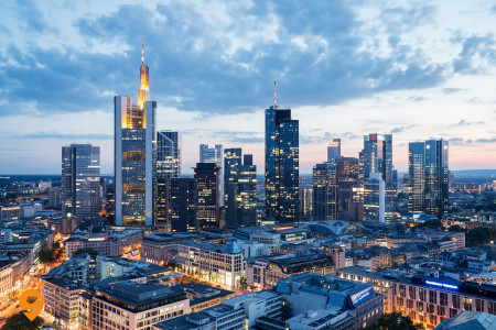
Frankfurt successfully balances its identity as a global financial hub with pockets of traditional charm, particularly in the reconstructed Römerberg square with its iconic stepped-gable facades. This city of contrasts juxtaposes ultramodern skyscrapers (earning it the nickname “Mainhattan”) with historic sites like the Gothic St. Bartholomew’s Cathedral and Goethe House, birthplace of Germany’s most famous writer. Frankfurt’s exceptional museums line both banks of the Main River in the aptly named Museumsufer (Museum Embankment), highlighted by the Städel Museum’s comprehensive art collection spanning 700 years. The city’s international character manifests in diverse culinary offerings, though visitors shouldn’t miss sampling local specialties like green sauce (Grüne Soße) and apple wine in traditional taverns in the Sachsenhausen district. As a major transportation hub, Frankfurt offers excellent connections to destinations throughout Germany and Europe, making it both a worthwhile destination and convenient starting point for broader explorations.
Römerberg

Römerberg represents the historic heart of Frankfurt, a medieval square that has served as the city’s central gathering place for over 800 years. This picturesque plaza features a collection of meticulously reconstructed buildings that tell the story of Frankfurt’s complex history and remarkable resilience.
The square takes its name from the Römer building complex, which has functioned as Frankfurt’s city hall since 1405 when the city council purchased it from a wealthy merchant family. The Römer’s most distinctive feature is its iconic three-stepped gables façade, which has become a symbol of Frankfurt itself. Behind this façade lies the Kaisersaal (Emperor’s Hall), a magnificent ceremonial room where newly crowned Holy Roman Emperors would hold their coronation banquets after being crowned in the cathedral nearby. The walls of this hall display 52 portraits of emperors who ruled between Charlemagne and Franz II, creating a visual timeline of German imperial history.
Surrounding the square are traditional timber-framed houses that create a quintessentially German medieval townscape. What visitors see today, however, represents one of Germany’s most ambitious reconstruction projects. The entire Römerberg area was devastated during World War II bombing raids in 1944 that destroyed approximately 95% of Frankfurt’s old town. Between 1981 and 1983, the eastern side of the square was meticulously rebuilt according to historical plans and photographs, recreating the “Ostzeile” (eastern row) of six buildings including the famous Schwarzer Stern (Black Star) and Grosser Engel (Great Angel) houses.
In 2018, Frankfurt completed an even more ambitious reconstruction project called the “DomRömer Quarter” that rebuilt 35 buildings between Römerberg and the Cathedral, including 15 exact recreations of historical buildings and 20 contemporary structures designed in harmony with the historical aesthetic. This project represents an important architectural debate about historical reconstruction versus contemporary interpretation of lost heritage.
The Römerberg hosts several important events throughout the year. The traditional Christmas Market transforms the square into a magical winter wonderland with hundreds of wooden stalls, a massive Christmas tree, and the scent of mulled wine and gingerbread filling the air. During international football tournaments, thousands gather to watch matches on large screens, while the square serves as the focal point for cultural festivals throughout the year.
At the center of the square stands the Gerechtigkeitsbrunnen (Fountain of Justice), created in 1543. The fountain features a statue of Justitia, the Roman goddess of justice, holding scales but unusually without the traditional blindfold—suggesting that justice in Frankfurt would be administered with open eyes. During coronation celebrations, the fountain would flow with wine instead of water, allowing citizens to partake in the imperial festivities.
I’ll help you understand how to reach Römerberg, Frankfurt’s historic heart, by breaking down all the transportation options and essential information you’ll need for your visit.
Address and Location • Römerberg, 60311 Frankfurt am Main, Germany
- Located in Frankfurt’s Altstadt (Old Town) district
- Central square surrounded by reconstructed medieval buildings
Operating Hours and Access • Römerberg square accessible 24/7 as public space
- Individual attractions have varying hours • Best visited during daylight hours for full architectural appreciation
- Evening visits offer beautiful illuminated building facades
Public Transportation Options
U-Bahn (Subway) Access
- Primary station: Dom/Römer (U4, U5 lines)
- Walk time: 2-3 minutes directly to the square
- Alternative: Hauptwache station (U1, U2, U3, U6, U7, S1-S6)
- Walk time from Hauptwache: 8-10 minutes through pedestrian zone
S-Bahn (Regional Rail) Connections
- Hauptwache station serves all S-Bahn lines (S1, S2, S3, S4, S5, S6, S8, S9)
- Frankfurt Hauptbahnhof (Central Station) – 15-minute walk or short U-Bahn ride
- Konstablerwache station (S1-S6) – 10-minute walk
Tram Services
- Tram lines 11, 12, 14, 18 stop at Frankfurt (Main) Römer/Paulskirche
- Direct access to the square
- Connects to various Frankfurt districts
Bus Transportation
Nearby Stops:
- Frankfurt (Main) Römer/Paulskirche
Lines: N4, N5, N12
Driving and Parking Information
Nearby Parking Facilities
- Parkhaus Dom/Römer – closest underground garage
- Parkhaus Hauptwache – 8-minute walk
- Parkhaus Konstablerwache – 10-minute walk
- Street parking very limited in the pedestrian zone
- Consider park-and-ride facilities on city outskirts
Transportation Companies Operating in Frankfurt
- RMV (Rhein-Main-Verkehrsverbund) – regional transport authority
- VGF (Verkehrsgesellschaft Frankfurt) – local Frankfurt transport
- Deutsche Bahn – national and regional rail services
- Various taxi companies and ride-sharing services available
Major Nearby Attractions Within Walking Distance
Historical Sites
- Frankfurt Cathedral (Frankfurter Dom) – 3-minute walk
- Alte Nikolaikirche (Old St. Nicholas Church) – on the square itself
- Saalhof archaeological site – 5-minute walk
- Jewish Museum Frankfurt – 8-minute walk
Cultural Attractions
- Städel Museum – 15-minute walk across the river
- German Film Museum – 12-minute walk
- Historical Museum Frankfurt – adjacent to Römerberg
- Schirn Kunsthalle – 5-minute walk
Shopping and Dining Areas
- Zeil shopping street – 8-minute walk via Hauptwache
- Kleinmarkthalle (covered market) – 6-minute walk
- Neue Kräme pedestrian zone – immediate vicinity
- Traditional apple wine taverns in surrounding streets
River and Bridge Access
- Main River waterfront – 8-minute walk south
- Eiserner Steg (Iron Bridge) pedestrian bridge – 10-minute walk
- Riverfront promenade with scenic views
- Access to Sachsenhausen district across the river
Main Tower

Main Tower stands as Frankfurt’s most accessible skyscraper, inviting visitors to experience the breathtaking panorama of Germany’s financial capital from 200 meters above street level. Completed in 1999 and named after the Main River that flows through the city, this 56-story building combines practical office space with public accessibility in a way that transformed Frankfurt’s relationship with its skyline.
The tower’s architecture, designed by German architects Schweger und Partner, features a distinctive blue glass façade and a unique square footprint with rounded corners that optimizes the building’s resistance to wind loads while creating a recognizable silhouette on the Frankfurt skyline. At its base, a 22-meter-high public atrium creates a welcoming entrance experience featuring rotating art exhibitions that connect the corporate environment with cultural engagement.
What truly distinguishes Main Tower from other Frankfurt skyscrapers is its public observation deck on the 56th floor, reached via high-speed elevators that transport visitors upward at 7 meters per second. This platform offers unobstructed 360-degree views of Frankfurt’s remarkable urban landscape—a unique juxtaposition of medieval elements, post-war reconstruction, and ultramodern architecture. On clear days, visibility extends to the Taunus mountains in the north, the Odenwald forest to the south, and across the Rhine-Main region that forms Germany’s economic heartland.
One floor above the observation deck, the Main Tower Restaurant & Bar offers fine dining at 187 meters above ground level. The restaurant rotates slowly, completing a full revolution every hour, providing diners with constantly changing perspectives of the cityscape while enjoying sophisticated contemporary cuisine that combines regional influences with international techniques.
Main Tower houses the headquarters of Landesbank Hessen-Thüringen and several broadcasting studios for the Hessischer Rundfunk public broadcasting network, making it not just a tourist attraction but a functioning center of Frankfurt’s financial and media operations. This dual-purpose approach embodies Frankfurt’s balanced approach to urban development—creating functional commercial spaces that remain accessible to the public.
Address and Essential Information
- Neue Mainzer Straße 52-58, 60311 Frankfurt am Main, Germany
- Located in Frankfurt’s Banking District (Bankenviertel)
- 200-meter tall skyscraper with public observation deck on 56th floor
- One of the few skyscrapers in Frankfurt open to public viewing
Operating Hours and Access Information
Main Tower Observation Deck Schedule
- Sunday through Thursday operations typically run from 10:00 AM to 9:00 PM, allowing visitors to experience both daylight and evening city views from the 56th floor. The transition from day to night provides dramatically different perspectives of Frankfurt’s skyline and the surrounding Rhine-Main region.
- Friday and Saturday extend operating hours until 11:00 PM, accommodating weekend visitors and providing opportunities to see Frankfurt’s nightlife from above. These extended hours prove particularly popular during summer months when daylight lasts longer.
Public Transportation Access Points
Primary U-Bahn and S-Bahn Connections
- Taunusanlage station serves as the closest major hub, offering access to multiple S-Bahn lines (S1, S2, S3, S4, S5, S6), requiring approximately a 5-7 minute walk through the financial district to reach Main Tower. This station connects you directly to Frankfurt’s extensive regional network, making it particularly convenient if you’re arriving from the airport, other German cities, or Frankfurt’s outer districts.
- Willy-Brandt-Platz station provides another excellent option, served by U-Bahn lines (U1, U2, U3, U4, U5, U8), with roughly a 6-8 minute walk to the tower. This route takes you through some of Frankfurt’s most impressive modern architecture, giving you a preview of the financial district’s impressive skyline as you approach your destination.
- Hauptbahnhof (Frankfurt Central Station) remains accessible for those arriving by long-distance trains, though it requires a 12-15 minute walk or a short public transport connection. The walk from Hauptbahnhof actually provides an excellent introduction to Frankfurt’s unique blend of historical and ultra-modern architecture.
Tram and Bus Network Access
Tram lines 11, 12, 14, 18 serves the Willy-Brandt-Platz area, providing direct connections from various Frankfurt neighborhoods and offering a scenic route through different parts of the city. The tram system in Frankfurt operates with remarkable efficiency and connects seamlessly with other public transport modes.
Bus Network
Nearby Stops:
- Willy-Brandt-Platz
- Taunusanlage
Lines: N8, 64
Parking and Vehicle Access
Underground Parking Facilities
- Main Tower features its own underground parking garage with direct building access, providing the most convenient option for those driving to the observation deck or business meetings within the tower. The garage offers multiple levels and connects directly to the building’s elevator system.
- Parkhaus Opernplatz provides additional parking capacity within a 10-minute walk, located near Frankfurt’s opera house and offering easy access to both Main Tower and other cultural attractions in the area.
- Parkhaus MyZeil near the Hauptwache offers another substantial parking option, though it requires a longer walk through Frankfurt’s pedestrian zones and shopping areas to reach Main Tower.
Major Nearby Attractions and Points of Interest
Financial and Architectural Landmarks
- Commerzbank Tower stands as another architectural marvel within a 5-minute walk, representing one of Europe’s tallest buildings and showcasing cutting-edge sustainable building design. The area surrounding these towers forms one of the most impressive concentrations of modern high-rise architecture in continental Europe.
- Messeturm (Trade Fair Tower) rises nearby, easily recognizable by its distinctive pyramid-shaped crown and representing another significant addition to Frankfurt’s unique skyline. The tower serves as headquarters for various international companies and adds to the area’s impressive architectural diversity.
- Alte Oper (Old Opera House) provides a stunning contrast to the modern towers, located within a 10-minute walk and offering world-class performances in a beautifully restored 19th-century building. The juxtaposition between historical and ultra-modern architecture makes this area particularly fascinating for visitors.
Cultural and Shopping Destinations
- Goethe-Straße presents one of Germany’s most luxurious shopping streets, featuring international designer boutiques and high-end retail establishments within easy walking distance of Main Tower. This area demonstrates Frankfurt’s role as a major European commercial center beyond just banking and finance.
- Hauptwache area combines shopping, dining, and transportation in a bustling central location approximately 10 minutes from Main Tower. The mix of underground shopping, street-level cafes, and historical buildings creates a vibrant atmosphere that contrasts beautifully with the quiet professionalism of the banking district.
Parks and Green Spaces
- Taunusanlage park provides a green corridor through the city center, offering peaceful walking paths between the banking district and other parts of Frankfurt. The park serves as an excellent example of how Frankfurt integrates natural spaces within its dense urban core.
- Rothschild Park offers another nearby green space where visitors can relax after experiencing the tower’s observation deck, providing benches and walking paths that offer ground-level perspectives of the same buildings you’ve just viewed from above.
Städel Museum
The Städel Museum represents one of Europe’s oldest and most prestigious art museums, housing a collection that spans 700 years of artistic development from the early 14th century to the present day. Founded in 1815 through the private collection and endowment of banker and businessman Johann Friedrich Städel, the museum embodies Frankfurt’s long tradition of citizen-supported cultural institutions.
The museum’s historical building, constructed in 1878 in a neoclassical style, underwent a revolutionary expansion in 2012 that added 3,000 square meters of exhibition space beneath the museum’s garden. This underground extension, covered by a gently sloping lawn punctuated with 195 circular skylights, creates a dramatic space flooded with natural light for displaying contemporary art. The unique architecture won numerous awards for its innovative approach to expanding a historical institution without compromising the original building’s integrity.
The collection comprises approximately 3,100 paintings, 660 sculptures, 4,600 photographs, and 100,000 drawings and prints, organized chronologically to guide visitors through the evolution of Western art. The museum’s Old Masters section includes works by Jan van Eyck, Botticelli, Dürer, Rembrandt, and Vermeer. Particularly notable is Rembrandt’s “The Blinding of Samson” (1636), which demonstrates the artist’s dramatic use of light and shadow to enhance emotional intensity.
The 19th-century collection features German Romantic painters including Caspar David Friedrich, French Impressionists like Monet and Renoir, and pivotal works by Cézanne that bridge Impressionism and Modernism. Edgar Degas’ “Orchestra Musicians” (1872) exemplifies the museum’s strength in Impressionist works that capture the emerging modern urban experience.
The museum’s Modern Art collection starts with German Expressionists from Die Brücke and Der Blaue Reiter movements, includes significant Cubist and Surrealist works, and extends to contemporary art of the 21st century. The collection includes influential works by Picasso, Matisse, Kirchner, Beckmann, Bacon, and Richter, providing a comprehensive overview of modernism’s development.
What distinguishes the Städel from many comparable institutions is its innovative digital strategy, including the award-winning “Städel Digital Collection” that allows virtual visitors to explore connections between artworks across time periods and styles. The museum’s research projects and educational programs make art accessible to diverse audiences through technology, specialized tours, and interactive stations throughout the galleries.
The Städel consistently ranks among Germany’s most visited art museums, attracting approximately 500,000 visitors annually. Its temporary exhibitions often focus on new perspectives regarding familiar artists or movements, reexamining art historical narratives and fostering fresh dialogue between historical works and contemporary viewers. This combination of historical depth and contemporary relevance makes the Städel a cornerstone of Frankfurt’s cultural landscape and a must-visit destination for art enthusiasts.
Museum Address and Basic Information
The Städel Museum is located at Schaumainkai 63, 60596 Frankfurt am Main, Germany. This prestigious art museum sits in Frankfurt’s museum district along the south bank of the River Main, making it easily accessible from various parts of the city.
Opening Hours
The museum operates Tuesday through Sunday from 10:00 AM to 6:00 PM, with extended hours on Thursdays until 9:00 PM. The museum remains closed on Mondays, except for public holidays when it follows Sunday hours.
Public Transportation Options
By U-Bahn (Underground/Subway)
- Take U1, U2, U3, or U8 lines to Schweizer Platz station
- From Schweizer Platz, it’s approximately a 5-minute walk to the museum
- Alternative: Take U4 or U5 to Willy-Brandt-Platz, then walk about 10 minutes
By S-Bahn (Suburban Railway)
- Use S1, S3, S4, S5, S6, S8 and S9 lines to Frankfurt South station
- From Frankfurt South, take U1, U2, U3 or U8 to Schweizer Platz station
- From Schweizer Platz, it’s approximately a 5-minute walk to the museum
- This option connects well with regional transportation from surrounding areas
By Tram
- Take tram lines 15, 16, 18, or 19 to Otto-Hahn-Platz
- The museum is within a 3-minute walk from this stop
Driving and Parking Information
Nearby Parking Facilities
- Parkhaus Städel: Located directly adjacent to the museum building
- Parkhaus Schweizer Platz: About 200 meters from the museum entrance
- Street parking available along Schaumainkai, though spaces are limited
- Dürerstraße offers additional street parking options within walking distance
Driving Directions
From Frankfurt city center, cross the River Main via Untermainbrücke or Friedensbrücke, then follow Schaumainkai eastward. The museum district is well-signposted with brown tourist signs throughout the city.
Nearby Attractions and Cultural District
The Städel Museum sits within Frankfurt’s renowned Museumsufer (Museum Embankment), creating an exceptional cultural cluster. The German Film Museum lies directly next door, while the Museum of Applied Arts occupies a striking building just steps away. The German Architecture Museum showcases innovative design concepts nearby, and the Liebieghaus Sculpture Collection houses an impressive array of sculptural works from various periods.
Across the river, you can easily reach the historic Römerberg square and Frankfurt Cathedral by walking across one of the pedestrian bridges. The Palm Garden, one of Germany’s largest botanical gardens, is accessible via public transportation for those interested in combining cultural and natural attractions.
Palmengarten

The Palmengarten stands as Frankfurt’s botanical paradise—a 22-hectare horticultural masterpiece that offers visitors an extraordinary journey through global plant ecosystems in the heart of Germany’s financial capital. Founded in 1868 when citizens purchased the private plant collection of Duke Adolph of Nassau to prevent its sale to England, the garden represents one of Europe’s most significant botanical institutions and Frankfurt’s enduring tradition of citizen-supported cultural initiatives.
The garden’s centerpiece is the magnificent Palmhaus (Palm House), an impressive iron and glass structure built in 1869 that remains one of the largest in Europe. This architectural marvel houses towering palms, bamboos, and other tropical specimens in a climate-controlled environment that recreates equatorial conditions. Walking through its soaring interior, visitors experience the humidity and lush vegetation of tropical rainforests while surrounded by 19th-century architectural elegance that recalls the Victorian era’s fascination with exotic flora.
The garden is organized as a series of specialized plant houses and outdoor gardens representing different global ecosystems. The Tropicarium complex contains several connected climate zones including a sub-tropical house, desert house, and tropical aquatic plants section with massive water lilies whose leaves can support the weight of a small child. The Subantarctic House displays plants from cooler southern hemisphere regions including rare specimens from New Zealand and Patagonia that are seldom cultivated elsewhere in Europe.
Outdoor areas include an extensive rose garden with over 12,000 roses representing historical and modern varieties, a formal Italian-style “Stone Garden” with Mediterranean plants, a sensory garden designed for visually impaired visitors with fragrant and tactile plants, and extensive rock gardens showcasing alpine species. The rhododendron grove becomes particularly spectacular in spring when hundreds of bushes burst into bloom with every shade of pink, purple, and white.
The garden’s scientific importance extends beyond display to conservation efforts for endangered plant species, participation in international seed exchange programs, and botanical research. The garden maintains a collection of approximately 13,000 plant species, many of which are extensively documented for scientific purposes while remaining accessible to the public.
Throughout the year, the Palmengarten hosts cultural events that combine horticultural displays with music, art, and culinary experiences. The “Rose and Light Festival” illuminates the gardens on summer evenings, the “Autumn Festival” celebrates the harvest season with ornamental gourds and chrysanthemums, and winter brings the magical “Winter Lights” exhibition when the garden is transformed by artistic light installations.
Educational programs include guided thematic tours, botanical workshops, and children’s activities designed to foster appreciation for biodiversity and environmental protection. The garden’s “Green School” offers systematic education about plant biology, ecology, and sustainable gardening practices for students of all ages.
The Palmengarten’s combination of scientific significance, historical architecture, and accessible beauty makes it a beloved institution for Frankfurt residents and a refreshing natural counterpoint to the city’s urban intensity. Visitors find themselves transported across continents through immersive plant environments that stimulate the senses while educating about Earth’s remarkable botanical diversity.
Address and Basic Information
- Palmengarten Frankfurt is located at Siesmayerstraße 61, 60323 Frankfurt am Main, Germany
- The botanical garden sits in Frankfurt’s Westend district, adjacent to the Grüneburgpark
- Main entrance faces Siesmayerstraße with additional access points from Palmengartenstraße
Opening Hours
- Daily opening hours: 9:00 AM to 6:00 PM (March through October)
- Winter hours: 9:00 AM to 4:00 PM (November through February)
- Greenhouses remain open until 30 minutes before garden closure
- Extended summer hours until 8:00 PM during special events and exhibitions
- Open 365 days per year including holidays
Public Transportation Access
U-Bahn (Underground) Connections
- U4, U5, U6 and U7 line directly to Bockenheimer Warte station – 2-minute walk to main entrance
- U6 and U7 lines to Westend station – 8-minute walk through residential area
- U1, U2, U3, U8 lines to Eschenheimer Tor – 15-minute walk via Grüneburgweg
S-Bahn (Suburban Railway) Options
- S3, S4, S5, S6 lines to Frankfurt West station – 12-minute walk
- S1, S2, S3, S4, S5, S6, S8, S9 to Hauptwache – transfer to U6/U7 for Westend
- Regional connections via Frankfurt Hauptbahnhof with U-Bahn transfer
Tram Services
- Tram line 16 stops at Bockenheimer Warte – direct access to garden entrance
- Line 16 connects central Frankfurt with university district and Palmengarten area
- Frequent service every 10-15 minutes during daytime hours
Bus Connections
Nearby Stops:
- Palmengartenstraße
- Bockenheimer Warte
Lines: 50, 75, M36, N7, 75, M32, N4, N16
Parking Facilities
- Palmengarten official parking garage – underground facility with direct garden access
- Grüneburgpark parking area – surface parking 5-minute walk from entrance
- Street parking available along Siesmayerstraße and surrounding residential streets
- Westend Campus parking facilities – shared use during non-university hours
- Park-and-ride facilities at suburban S-Bahn stations with public transport connections
Driving Routes
- From Frankfurt city center: Follow Bockenheimer Landstraße west toward university district
- From Autobahn A5: Exit at Frankfurt-Westkreuz, follow signs toward Palmengarten/Westend
- From Autobahn A66: Exit at Miquelallee, proceed north to Siesmayerstraße
- From Frankfurt Airport: Take A5 toward Frankfurt, exit at Westkreuz interchange
Nearby Attractions and Points of Interest
Grüneburgpark
- Adjacent to Palmengarten with connecting pathways and shared entrance areas
- Large public park featuring walking trails, playgrounds, and open spaces
- Historical significance as former private estate with preserved landscape architecture
- Popular for jogging, cycling, and outdoor recreational activities
Goethe University Campus Westend
- Walking distance through Grüneburgpark or via Grüneburgweg
- Notable for striking modern architecture including distinctive IG Farben building
- University botanical collections complement Palmengarten scientific mission
- Student life and academic atmosphere enhance neighborhood cultural character
Senckenberg Natural History Museum
- Located 1.5 kilometers southeast via public transportation or walking
- World-renowned dinosaur exhibits and natural science collections
- Easy combination visit using same public transport connections
- Educational synergy with Palmengarten botanical focus
Frankfurt City Forest (Stadtwald)
- Accessible via tram connections from Palmengarten area
- Extensive hiking and cycling trail network
- Outdoor recreational facilities including swimming areas and sports complexes
- Natural complement to Palmengarten cultivated botanical experience
Alte Oper (Old Opera House)
- Distance: 2 kilometers via U-Bahn direct connection
- Major cultural venue for concerts and performances
- Architectural landmark representing Frankfurt cultural heritage
- Evening entertainment option after daytime garden visits
Goethe House and Museum

The Goethe House and Museum preserves the birthplace and childhood home of Johann Wolfgang von Goethe, Germany’s most celebrated literary figure and a towering intellectual of the European Enlightenment and Romantic periods. This meticulously restored 18th-century building offers an intimate glimpse into the formative environment that shaped one of history’s most influential writers, scientists, and thinkers.
Born in this house in 1749, Goethe spent his first 16 years here before departing for Leipzig to study law. The four-story bourgeois residence reflects the considerable wealth of the Goethe family—Johann’s father was an Imperial Councilor—and demonstrates the living conditions of Frankfurt’s upper middle class during the late Baroque period. What visitors experience today is a reconstruction, as the original building was completely destroyed during World War II bombing in 1944. However, the family’s furnishings had been removed for safekeeping, allowing the interior to be restored with authentic period pieces and original Goethe family belongings when the house was rebuilt between 1947 and 1951.
The house tour follows a biographical progression through Goethe’s early life. The ground floor features the spacious kitchen with its impressive open hearth and collection of copper cookware. The first floor contains formal entertaining spaces including the dining room and music room where young Goethe was exposed to the artistic discussions that influenced his intellectual development. Particularly fascinating is the “Puppentheater” (puppet theater) that Goethe received as a gift from his grandmother, sparking his lifelong passion for drama and theatrical production.
The second floor houses family living quarters including Goethe’s father’s study with its extensive library that provided the young genius with access to literature, science, and philosophy far beyond standard education of the period. Goethe’s own writing room on the top floor under the eaves offers perhaps the most powerful connection to the writer’s creative process, with the simple desk where he wrote his earliest works including some verses that would later appear in “Faust”—the masterpiece that occupied him throughout his life.
Adjacent to the house, the Goethe Museum presents a comprehensive collection of paintings, graphics, and sculptures from Goethe’s lifetime, particularly focusing on the “Goethezeit” (Goethe era) between 1770 and 1830 when German culture flourished in dialogue with Goethe’s ideas. The museum houses significant artworks by contemporaries whom Goethe admired or influenced, manuscripts displaying his distinctive handwriting, and first editions of his publications.
Especially compelling are items connecting to Goethe’s scientific pursuits, which were as important to him as his literary work. His color theory experiments, mineralogical collections, and botanical studies reveal a mind that sought to understand natural phenomena through both artistic sensitivity and empirical observation—a unification of approaches that characterized the holistic thinking of the Romantic period.
German Film Museum (Deutsches Filmmuseum)
The German Film Museum stands as one of Europe’s most comprehensive institutions dedicated to the seventh art, exploring cinema as both technological achievement and cultural force. Located in a beautiful Wilhelminian villa along Frankfurt’s Museum Embankment, this institution combines historical preservation, educational programming, and immersive exhibitions to illuminate the evolution and impact of moving images.
The museum’s permanent exhibition “Filmisches Sehen” (Cinematic Vision) guides visitors through the pre-history of cinema, beginning with shadow plays, magic lanterns, and optical toys that created the illusion of movement before actual film technology existed. Rare artifacts include original phenakistiscopes, praxinoscopes, and zoetropes that visitors can operate themselves, experiencing firsthand how these mechanical devices tricked the human eye into perceiving continuous motion from static images.
The technological evolution of cinema receives thorough exploration through a remarkable collection of historical cameras, projectors, and sound equipment. Particularly noteworthy is the museum’s collection of early cameras including original models from the Lumière brothers and Georges Méliès, allowing visitors to understand how rapidly film technology advanced during its first decades. Interactive stations demonstrate fundamental principles of cinematography including framing, lighting, and camera movement.
Beyond technology, the museum examines cinema’s artistic development and cultural significance. The “Filmic Perception” section analyzes how editing techniques create meaning through juxtaposition, pacing, and rhythm. Visitors can experiment with editing footage themselves at digital workstations, experiencing firsthand how different cutting techniques dramatically alter a scene’s emotional impact.
The museum houses an extraordinary collection of production materials including original set designs, storyboards, costumes, and special effects models from significant German cinema—particularly expressionist masterpieces from the Weimar era such as “The Cabinet of Dr. Caligari” and Fritz Lang’s “Metropolis.” These artifacts reveal the artistic collaboration and technical innovation behind landmark films.
A particularly striking feature is the museum’s recreation of iconic film sets that visitors can physically enter, experiencing the disconnect between the artificial construction of film environments and their convincing appearance on screen. This behind-the-scenes perspective demystifies the filmmaking process while deepening appreciation for its artistry.
The institution maintains a significant film archive preserving over 25,000 titles, with particular strength in German expressionism, New German Cinema of the 1970s, and international experimental film. This collection supports the museum’s second major function as a cinematheque, screening approximately 500 films annually in its two theaters, often presenting restored classics with live musical accompaniment or introducing rare works with scholarly commentary.
Educational programs engage audiences from preschoolers to professionals, with specially designed workshops where participants create their own short films using techniques ranging from hand-drawn animation to digital production. The museum’s approach emphasizes hands-on learning, allowing visitors to experience the creative decisions and technical processes behind moving images.
The German Film Museum’s combination of historical artifacts, interactive experiences, and scholarly programming creates a multifaceted institution that serves both casual visitors and serious researchers. By contextualizing cinema within broader cultural currents while celebrating its unique artistic possibilities, the museum honors film’s profound influence on modern visual culture and collective imagination.
Senckenberg Natural History Museum
The Senckenberg Natural History Museum ranks among Europe’s largest natural history museums, housing extraordinary collections that span the breadth of Earth’s biodiversity and geological history. Founded in 1821 by the Senckenberg Society for Nature Research, this institution seamlessly combines cutting-edge scientific research with educational exhibitions designed to inspire wonder at the natural world.
The museum’s most famous exhibits include one of Europe’s most comprehensive dinosaur collections, featuring dozens of complete skeletons dramatically posed to demonstrate their movement and behavior. The centerpiece is an Apatosaurus skeleton measuring 27 meters long, but equally impressive are the museum’s rare specimens including a fossilized Tyrannosaurus rex with preserved soft tissue impressions and an exceptionally complete Psittacosaurus showing skin patterns and bristle structures that revolutionized understanding of dinosaur appearance.
Beyond dinosaurs, the paleontological section presents an unparalleled collection of Messel Pit fossils from a 47-million-year-old lake deposit near Frankfurt. This UNESCO World Heritage fossil site preserves extraordinary details including stomach contents, fur, feathers, and even skin pigmentation. The museum’s specimens include “Ida” (Darwinius masillae), an early primate fossil so perfectly preserved that individual hair patterns and even her last meal remain visible—a preservation level that provides unprecedented insight into Eocene ecosystems.
The zoological collections showcase approximately 6,000 specimens representing current biodiversity through expertly prepared taxidermy, skeletons, and models. Unlike traditional static displays, many exhibits place animals in dynamic poses illustrating natural behaviors within detailed habitat reconstructions. The mammal hall features specimens organized to demonstrate evolutionary relationships, including comparative anatomy exhibits showing how similar structures evolved for different functions across species.
The museum excels at contextualizing exhibits within broader scientific narratives. The human evolution section presents actual fossils alongside reconstructions of early hominids, mapping the complex evolutionary path from early primates to Homo sapiens. Interactive elements allow visitors to compare their own physical characteristics with those of various human ancestors and relatives.
The geology and mineralogy sections contain approximately 5,000 minerals and gems from worldwide sources, organized to demonstrate how Earth’s physical processes create mineral structures. Particularly impressive is the collection of meteorites, including specimens from Mars and the Moon, accompanied by explanations of how these extraterrestrial samples advance our understanding of solar system formation.
What distinguishes the Senckenberg from many natural history museums is its direct connection to active scientific research. The museum belongs to the Leibniz Association of German research institutions, with more than 300 scientists working in associated facilities. This research focus influences exhibition design, with displays frequently updated to reflect current scientific understanding. Visitors often encounter scientists working with collections, providing authentic glimpses into research methodology.
Educational programs emphasize experiential learning through “discovery rooms” where visitors can handle specimens, microscope stations revealing miniature worlds, and laboratories where school groups conduct actual experiments. The museum particularly excels at communicating complex ecological relationships through dioramas showing species interactions within specific habitats and exhibits explaining concepts like keystone species and biodiversity hotspots.
The Senckenberg’s approach combines scientific accuracy with accessible presentation, creating exhibitions that engage visitors at multiple levels—from children fascinated by dramatic dinosaur skeletons to specialists examining rare specimens. This sophisticated educational approach has established the museum as a cornerstone of scientific literacy in central Germany and a destination for approximately 500,000 visitors annually.
Alte Oper (Old Opera)

The Alte Oper stands as a magnificent testament to Frankfurt’s cultural resilience—a neo-Renaissance architectural masterpiece that embodies the city’s commitment to preserving artistic heritage while adapting historical spaces for contemporary use. Originally opened in 1880 as Frankfurt’s opera house, the building today functions as one of Europe’s premier concert halls with a remarkable history of destruction and rebirth.
When first constructed under the name “Opernhaus Frankfurt,” the building represented the culmination of Frankfurt’s 19th-century cultural ambitions. Designed by architect Richard Lucae in an opulent neo-Renaissance style with elements of classical antiquity, the structure cost the then-astronomical sum of 6.8 million gold marks—financed entirely through civic donations rather than state funding. This citizen-led initiative reflected Frankfurt’s tradition of burgher patronage and independence.
The building’s grand façade features an elaborate sculptural program celebrating great composers, with a massive portico supported by six Corinthian columns and topped by a pediment depicting Apollo and the muses. The inscription above the main entrance—”Dem Wahren, Schönen, Guten” (To the True, the Beautiful, the Good)—articulates the idealistic cultural mission that guided its creation.
For decades, the opera house served as the primary venue for Frankfurt’s operatic and orchestral performances, hosting world premieres of important works including Carl Orff’s “Carmina Burana” in 1937. However, World War II bombing raids in 1944 devastated the building, leaving only the exterior walls standing amid a gutted interior. The structure remained a prominent ruin in Frankfurt’s center for over three decades—locally nicknamed “Germany’s most beautiful ruin”—a constant reminder of cultural loss.
By the late 1960s, practical discussions favored demolition until citizen activism again intervened. A grassroots campaign led by Frankfurt residents raised 15 million Deutschmarks with the slogan “Bürger retten ihre Alte Oper” (Citizens save their Old Opera). This remarkable fundraising effort, combined with municipal support, enabled reconstruction beginning in 1976. The rebuilt Alte Oper opened in 1981, exactly 101 years after its original inauguration.
The restored building maintains the historical façade while the interior was redesigned as a modern concert venue rather than an opera house (Frankfurt’s actual opera performances had relocated to a modern facility elsewhere). The Great Hall (Großer Saal) seats 2,450 people and features acoustics carefully engineered for orchestral performances. Smaller venues within the complex include the Mozart-Saal with 700 seats and several chamber music spaces, creating a versatile cultural center hosting approximately 450 events annually.
Today, the Alte Oper serves as home to prestigious concert series featuring international orchestras, recitalists, and jazz performers while maintaining a strong commitment to educational programming. The building’s grand foyers and staircases maintain the ornate character of the original design, creating elegant spaces for intermissions and social gathering. The central location on Opernplatz makes the building a natural focal point for cultural life, with the plaza often hosting public events and festivals.
The Alte Oper’s remarkable journey from prestigious cultural temple to war ruin to restored concert hall encapsulates Frankfurt’s broader historical narrative of destruction and renewal. Its continued vitality as a performance venue rather than mere monument demonstrates how historical preservation can accommodate evolving cultural functions, maintaining connections to the past while serving contemporary artistic needs.
Address & Location
- Opernplatz 1, 60313 Frankfurt am Main, Germany
- Located in Frankfurt city center (Innenstadt)
- GPS Coordinates: 50.1167° N, 8.6725° E
- Situated between Bockenheimer Landstraße and Taunusanlage
Opening Hours
- Concert Hall: Event-dependent, typically 7:00 PM – 11:00 PM
- Foyer and Restaurant: Monday-Friday 10:00 AM – 11:00 PM
- Box Office: Monday-Friday 10:00 AM – 6:30 PM, Saturday 10:00 AM – 2:00 PM
- Guided Tours: Available by appointment
- Special Events: Extended hours during festivals
Public Transportation
U-Bahn (Subway) Transportation
- Alte Oper U-Bahn Station (U6, U7) – Direct access (0 km)
- Eschenheimer Tor (U1, U2, U3, U8) – 600m walking distance
- Hauptwache (U1, U2, U3, U6, U7, U8) – 800m walking distance
- Westend (U6, U7) – 700m walking distance
- Operating hours: 4:00 AM – 1:30 AM (extended weekends)
S-Bahn (Regional Rail) Transportation
- Taunusanlage S-Bahn Station (S1, S2, S3, S4, S5, S6, S8, S9) – 400m walking distance
- Frankfurt Hauptbahnhof (All S-Bahn lines) – 1.5 km away
- Frankfurt West (S3, S4, S5, S6) – 2 km away
- Direct connections to Frankfurt Airport and surrounding cities
Tram Transportation
- Tram Line 16 – Stops at Alte Oper (Opernplatz stop)
- Tram Line 11 – Bockenheimer Warte connection, 500m walk
- Tram Line 12 – Grüneburgweg connection, 600m walk
- Operates: 5:00 AM – 1:00 AM daily
Bus Transportation
Nearby Stops:
- Alte Oper
- Freßgass
- Taunusanlage
Lines: 64, N7, N8
Parking Facilities
- Opernturm Garage – 200 spaces, directly beneath Alte Oper
- MyZeil Parking – 600 spaces, 800m walking distance
- Hauptwache Garage – 400 spaces, 800m walking distance
- ParkOne Taunusanlage – 150 spaces, 300m walking distance
- Street parking – Limited 2-hour zones on surrounding streets
- Disabled parking – Reserved spaces on Opernplatz
Nearby Transportation Hubs
- Hauptwache – Major U-Bahn and S-Bahn interchange (800m)
- Eschenheimer Tor – Multi-line U-Bahn station (600m)
- Frankfurt Hauptbahnhof – Main railway station (1.5 km)
- Konstablerwache – Major tram and U-Bahn hub (1 km)
Nearby Attractions (Walking Distance)
- Palmengarten – 800m (botanical garden)
- Senckenberg Natural History Museum – 1 km
- Goethe House and Museum – 1.2 km
- Zeil Shopping Street – 800m
- Frankfurt Stock Exchange – 900m
- St. Paul’s Church (Paulskirche) – 1.5 km
- Main Tower observation deck – 700m
- Städel Museum – 2 km (art museum)
Romantic Road (Romantische Straße)
The Romantic Road represents Germany’s most famous scenic route—a 350-kilometer journey through medieval towns, fairy-tale castles, and picturesque landscapes that embodies the quintessential German cultural experience. While the road itself extends from Würzburg to Füssen in Bavaria, Frankfurt serves as the most common gateway city for international travelers beginning this iconic journey, making it an essential inclusion in any comprehensive Frankfurt tourism guide.
This touristic route was ingeniously created in the 1950s to revitalize tourism in post-war Germany, drawing on Americans’ romantic notions of old-world Europe. Marketing specialists identified a series of well-preserved medieval towns and historical sites that had largely escaped wartime destruction, connecting them into a coherent itinerary that would appeal to visitors seeking an idealized vision of historic Germany. The route’s creators deliberately evoked 19th-century Romanticism—the artistic and literary movement that celebrated emotional connection to landscape, medieval heritage, and folk traditions.
From Frankfurt, travelers typically begin their Romantic Road journey at Würzburg, approximately 120 kilometers east. This elegant baroque city, centered around the UNESCO-listed Residence Palace with ceiling frescoes by Venetian master Tiepolo, represents the northern gateway to the route. The journey then winds southward through the medieval walled town of Rothenburg ob der Tauber—perhaps the most perfectly preserved medieval settlement in Germany with its intact city walls, cobblestone streets, and half-timbered buildings that appear virtually unchanged since the 16th century.
The route continues through the Tauber Valley with its rolling vineyards to Dinkelsbühl and Nördlingen, both surrounded by complete medieval walls. Particularly impressive is Nördlingen’s unusual circular layout within walls built inside an ancient meteorite crater. Further south, travelers encounter Harburg Castle—one of Germany’s oldest and largest castle complexes—before reaching Augsburg, a Roman settlement founded in 15 BCE that later flourished as a Renaissance banking center.
The southern portion of the route enters the Alpine foothills, passing through the rococo pilgrimage church of Wieskirche (another UNESCO site) before culminating at the fairy-tale castles of Hohenschwangau and Neuschwanstein near Füssen. Neuschwanstein Castle, with its soaring towers and dramatic mountain setting, represents the ultimate expression of Romantic ideals in architecture—ironically built in the 1870s as a historicist fantasy rather than an authentic medieval structure.
Most travelers approach the Romantic Road as a multi-day journey, staying in historic hotels within the medieval towns or in countryside accommodations between destinations. The route is thoroughly documented with distinctive brown road signs featuring a white typeface, making navigation straightforward without guides. While driving offers maximum flexibility, a dedicated bus service operates along the route from April to October, and sections can be explored by bicycle using well-marked cycling paths.
What makes the Romantic Road particularly valuable as a cultural experience is its immersion in Germany’s distinctive regional character. Each town along the route maintains unique culinary traditions, architectural styles, and cultural festivals reflecting the historical development of Franconia and Bavaria. The route passes through diverse landscapes including river valleys, agricultural plateaus, and Alpine foothills, demonstrating how natural geography influenced settlement patterns and architectural styles.
For Frankfurt visitors with limited time, even experiencing just the northern portion of the Romantic Road provides authentic insight into Germany’s medieval heritage and picturesque countryside—a perfect complement to Frankfurt’s contemporary cosmopolitan character.
Stuttgart
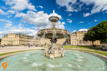
Stuttgart’s identity intertwines with automotive innovation as the birthplace of both Mercedes-Benz and Porsche, whose spectacular museums offer immersive journeys through transportation history with iconic vehicles displayed as works of art. Beyond its industrial heritage, Stuttgart surprises visitors with extensive green spaces including the magnificent Wilhelma zoological-botanical garden and the central Schlossplatz square leading to the New and Old Castles. The city’s setting in a wine-growing valley provides unusual urban landscapes with vineyards extending into residential areas, producing excellent local wines that can be sampled in traditional wine taverns (Besenwirtschaften). Stuttgart’s cultural offerings include world-class ballet and opera companies performing in the striking modernist State Theater complex, while the Kunstmuseum’s glass cube architecture houses an outstanding modern art collection. This combination of technological achievement, natural beauty, and cultural sophistication makes Stuttgart much more than just Germany’s automotive capital.
Mercedes-Benz Museum

The Mercedes-Benz Museum stands as an architectural marvel and testament to automotive innovation in Stuttgart. Designed by UNStudio and opened in 2006, this nine-story, double-helix structure showcases over 130 years of automotive history through more than 160 vehicles and 1,500 exhibits.
The museum follows a unique spiral concept where visitors start at the top floor and wind their way down through chronologically arranged exhibitions. Each level tells a different chapter in the evolution of the automobile, beginning with Karl Benz’s patent motorwagen from 1886—widely considered the world’s first automobile. The exhibitions interweave automotive developments with contemporary historical events, providing context for how Mercedes-Benz both influenced and responded to societal changes.
Beyond the impressive vehicle collection, the museum features interactive displays explaining engineering principles, design processes, and technological innovations. The building itself is an engineering achievement, with its distinctive double-helix interior allowing visitors to follow two parallel timelines: one focusing on brand history and the other on special collections organized by themes like long-distance travel, motorsport achievements, and celebrity vehicles.
The expansive atrium offers breathtaking views of Stuttgart, while the museum’s dedication to accessibility includes audio guides in multiple languages and accommodations for visitors with mobility challenges.
Address & Location
- Mercedesstraße 100, 70372 Stuttgart, Germany
- Located in Stuttgart-Bad Cannstatt district
- GPS Coordinates: 48.7886° N, 9.2320° E
- Situated near Mercedes-Benz production facilities and NeckarPark
Opening Hours
- Tuesday to Sunday: 9:00 AM – 6:00 PM
- Monday: Closed (except public holidays)
- Last admission: 5:00 PM
- Christmas period: Special holiday hours apply
- Audio guide tours: Available during opening hours
- Group tours: By advance reservation
Public Transportation
S-Bahn (Regional Rail) Transportation
- Neckarpark (Mercedes-Benz) S-Bahn Station (S1) – Direct access (200m walk)
- Bad Cannstatt S-Bahn Station (S1, S2, S3) – 1.5 km walking distance
- Stuttgart Hauptbahnhof (All S-Bahn lines) – Transfer to S1 line
- Nordbahnhof (S4, S5, S6) – Transfer connection required
- Operating hours: 4:30 AM – 1:00 AM daily
- Weekend service: Reduced frequency but maintains regular schedule
U-Bahn (Subway) Transportation
- Neckarpark (Mercedes-Benz) U-Bahn Station (U11 and U19) – Direct access (200m walk)
- Cannstatter Wilhelmsplatz (U1, U2, U11, U12) – 2 km distance
- Mercedesstraße (U1, U2, U11, U13, U16) – 2.4 km walking distance
- Direct connection from Stuttgart city center via U11 line
Bus Transportation
Nearby Stops:
- Mercedes-Benz Welt
- Fritz-Walter-Weg
Lines: 45
Parking Facilities
- Mercedes-Benz Museum Parking Garage – 800 spaces, underground facility
- NeckarPark Stadium Parking – 1,500 spaces (400m walk on non-event days)
- Mercedes-Benz Arena Parking – 600 spaces, shared facility
- Street parking – Limited spaces on Mercedesstraße
- Disabled parking – Reserved spaces at museum entrance level
- Motorcycle parking – Designated areas available
- Bus parking – Special areas for tour buses and coaches
Stuttgart Airport Connections
- S-Bahn S2 or S3 – Direct to Stuttgart Hauptbahnhof, transfer to S1
- Airport Bus X3 – Direct connection to Bad Cannstatt area
- Taxi/Uber – Direct service (45-60 minutes depending on traffic)
- Rental car pickup – All major companies available at airport
- Airport shuttle services – Hotel and tourist group transfers available
Taxi and Ride Services
- Stuttgart Taxi – Official city taxi service with stands at major stations
- Uber – Available throughout Stuttgart metropolitan area
- Bolt – Popular European ride-sharing alternative
- Free Now (MyTaxi) – German taxi booking application
- Hotel shuttle services – Many hotels provide museum transportation
- Private chauffeur services – Available through luxury hotels
Car Rental Companies
- Sixt – Multiple locations including Hauptbahnhof and airport
- Hertz – City center, airport, and hotel locations
- Avis – Available at major transportation hubs
- Europcar – Downtown Stuttgart and airport branches
- Enterprise – Business district and hotel partnerships
- Local rental companies – Smaller providers in Bad Cannstatt area
Highway and Driving Directions
- From A8 Autobahn – Exit Stuttgart-Bad Cannstatt, follow Mercedes-Benz signs
- From A81 Autobahn – Via Stuttgart-Zuffenhausen exit, then local roads
- From city center – Follow B14 toward Bad Cannstatt district
- Navigation systems – “Mercedes-Benz Museum” as destination point
- Traffic considerations – Rush hour congestion 7:00-9:00 AM and 5:00-7:00 PM
Nearby Transportation Hubs
- Neckarpark S-Bahn/U-Bahn Station – Major interchange point (200m)
- Bad Cannstatt Station – Regional rail and local transport hub (1.5 km)
- Cannstatter Wilhelmsplatz – Multi-line U-Bahn station (2 km)
- Stuttgart Hauptbahnhof – Main railway station (6 km)
- NeckarPark Stadium – Event transportation hub (400m)
Nearby Attractions (Walking Distance)
- Mercedes-Benz Arena – 400m (VfB Stuttgart football stadium)
- Porsche Arena – 600m (indoor sports and entertainment venue)
- Bad Cannstatt Mineral Baths – 2 km (historic thermal spa facilities)
- Rosenstein Park and Castle – 1.5 km (baroque palace and gardens)
- Cannstatter Wasen – 1 km (Oktoberfest fairgrounds)
- State Opera Stuttgart – 4 km (world-renowned opera house)
- Wilhelma Zoo and Botanical Garden – 3 km
- Stuttgart TV Tower – 8 km (first concrete TV tower in world)
Transportation Companies & Services
- VVS (Verkehrs- und Tarifverbund Stuttgart) – Regional transport authority
- SSB (Stuttgarter Straßenbahnen) – Local public transport operator
- Deutsche Bahn – National railway company operating S-Bahn services
- FlixBus – Long-distance bus connections to European cities
- Regional bus companies – Serving surrounding communities and attractions
Special Event Transportation
- Stadium events – Additional S-Bahn and bus services during VfB Stuttgart matches
- Concert transportation – Extended public transport hours for Mercedes-Benz Arena events
- Festival periods – Special services during Cannstatter Wasen (Stuttgart Oktoberfest)
- Museum special exhibitions – Coordinated transport promotions with major exhibitions
- Group tour coordination – Bus parking and scheduling for organized visits
Transportation Apps and Digital Services
- VVS app – Journey planning and digital ticketing for Stuttgart region
- DB Navigator – Deutsche Bahn schedules and ICE train booking
- Stuttgart Card app – Tourist transport passes and attraction discounts
- Google Maps integration – Real-time public transport information
- Mercedes-Benz Museum app – Includes transportation planning features
Business and Corporate Transportation
- Corporate shuttle services – Available for business groups and conferences
- Mercedes-Benz factory tours – Combined transportation packages available
- Convention center connections – Links to Stuttgart trade fair facilities
- Hotel partnerships – Many Stuttgart hotels offer museum transportation packages
- Executive car services – Premium transportation options for business visitors
Porsche Museum

Located in Stuttgart-Zuffenhausen, the Porsche Museum is an architectural gem designed by Viennese firm Delugan Meissl. The striking white structure appears to float above the ground, creating a dramatic visual impression before visitors even enter. Opened in 2009, this museum houses over 80 vehicles and numerous smaller exhibits that chronicle Porsche’s legacy of precision engineering and sports car excellence.
The exhibition space of approximately 5,600 square meters displays legendary models like the 356, the iconic 911, and revolutionary racing cars including the 917 and 956. What makes this museum special is that about 80 percent of the vehicles remain in working condition—Porsche calls it a “living museum” where cars are regularly removed for events, driving demonstrations, and prestigious races worldwide.
The museum takes visitors on a journey through Porsche’s evolution from its founding by Ferdinand Porsche to its current status as a luxury sports car manufacturer. Interactive displays explain the technical innovations that defined each era, from air-cooled engines to turbocharging technology and recent hybrid developments.
The museum features specialized sections dedicated to Porsche’s racing heritage, showcasing numerous trophies from Le Mans, Formula One, and other prestigious competitions. The building also houses restoration workshops where visitors can occasionally witness master technicians maintaining these historic vehicles.
Address & Location
- Porscheplatz 1, 70435 Stuttgart-Zuffenhausen, Germany
- Located in Stuttgart-Zuffenhausen district (northern Stuttgart)
- GPS Coordinates: 48.8347° N, 9.1522° E
- Adjacent to Porsche headquarters and main production facility
- Situated near Neuwirtshaus area in industrial zone
Opening Hours
- Tuesday to Sunday: 9:00 AM – 6:00 PM
- Monday: Closed (except Baden-Württemberg school holidays)
- Last admission: 5:00 PM
- Christmas closure: December 24-26 and January 1
- Special exhibitions: May have extended hours
- Factory tours: Separate scheduling required, Tuesday-Friday only
- Restaurant: Open during museum hours plus Monday lunch service
Public Transportation
S-Bahn (Regional Rail) Transportation
- Neuwirtshaus (Porscheplatz) S-Bahn Station (S6) – 300m walking distance
- Zuffenhausen S-Bahn Station (S4, S5, S6) – 1.2 km walking distance
- Stuttgart Nord S-Bahn Station (S4, S5) – 2 km distance
- Feuerbach S-Bahn Station (S4, S5, S6) – 2.5 km distance
- Stuttgart Hauptbahnhof – Transfer required to S6 line (20 minutes total)
- Operating schedule: 4:30 AM – 1:00 AM daily with weekend frequency adjustments
U-Bahn (Subway) Transportation
- Zuffenhausen U-Bahn Station (U7, U15) – 1.5 km walking distance
- Stammheim U-Bahn Station (U15) – 2.2 km distance
- Löwentor U-Bahn Station (U6, U7, U12) – 3 km distance
- Pragsattel U-Bahn Station (U6, U7, U12, U15) – 3.5 km distance
- Direct city center connections via U7 line to Zuffenhausen
- Transfer options available at Hauptbahnhof for multiple U-Bahn lines
Bus Transportation
Nearby Stops:
- Zuffenhausen Porsche
Lines: 52, 99, 501, 502, 503, 504, N4
Parking Facilities
- Porsche Museum Parking Garage – 200 visitor spaces, underground facility
- Porscheplatz Surface Parking – 150 spaces adjacent to museum
- Zuffenhausen Park+Ride – 300 spaces near S-Bahn station (1.2 km walk)
- Street parking – Limited 2-hour zones on surrounding industrial streets
- Disabled parking – Reserved spaces at museum main entrance
- Motorcycle parking – Designated areas in museum parking facility
- Electric vehicle charging – Tesla and universal charging stations available
- Tour bus parking – Separate area for coaches and larger vehicles
Nearby Attractions
- Porsche Factory Tour – Adjacent facility requiring separate advance booking
- Weissenhof Estate – UNESCO World Heritage modernist architecture (3 km)
- Killesberg Park and Tower – Recreational area with observation tower (4 km)
- Löwentor Museum – Natural history collections (3.5 km)
- Bad Cannstatt historic center – Traditional German town area (5 km)
- Ludwigsburg Baroque Palace – Major palace complex (8 km)
- Marbach Literature Museum – Dedicated to German literary heritage (15 km)
- Stuttgart TV Tower – World’s first concrete television tower (6 km)
Wilhelma

Wilhelma stands as one of Europe’s most unique zoological and botanical gardens, remarkably situated within a 19th-century Moorish-style palace complex commissioned by King Wilhelm I of Württemberg. This extraordinary combination creates a distinctive atmosphere where visitors can experience over 11,000 animal species and approximately 6,000 plant species amid historical architecture.
The zoo section houses animals from nearly every continent, with particular emphasis on its great ape house, which is renowned for its successful breeding programs for bonobos and gorillas. The elephant house, designed with Asian architectural influences, provides a spacious environment for its residents while educating visitors about conservation efforts. Wilhelma’s aquarium offers impressive displays of marine biodiversity, including a coral reef ecosystem and various freshwater habitats.
The botanical gardens feature spectacular collections, including one of Europe’s largest orchid displays with over 8,000 plants representing about 1,000 species. The historical greenhouses, built in ornate Moorish revival style during the 19th century, house tropical and subtropical plant collections. Seasonal displays transform throughout the year, from spring bulb exhibitions to summer dahlias and autumn chrysanthemums.
What makes Wilhelma truly special is how seamlessly the natural exhibits integrate with the historical palace structures. Visitors can wander through Moorish arcades and elaborately decorated pavilions while experiencing biodiversity from around the world. The gardens also feature Europe’s largest magnolia grove, particularly spectacular during spring blooming season.
Address & Location
- Wilhelma 13, 70376 Stuttgart-Bad Cannstatt, Germany
- Located in Stuttgart-Bad Cannstatt district along the Neckar River
- GPS Coordinates: 48.8042° N, 9.2051° E
- Situated in historic Rosenstein Park area between Bad Cannstatt and Stuttgart Nord
- Adjacent to Rosenstein Castle and extensive parkland areas
Opening Hours
- March to October: 8:15 AM – 6:00 PM daily
- November to February: 8:15 AM – 4:00 PM daily
- Last admission: 1 hour before closing time
- Special holiday hours: Extended summer hours during school holidays
- Feeding times: Various throughout the day, check daily schedules
- Botanical greenhouses: Same hours as zoo, climate-controlled year-round
- Restaurant and gift shop: Open during zoo operating hours
Public Transportation
U-Bahn (Subway) Transportation
- Wilhelma U-Bahn Station (U14) – Direct access, 200m walking distance to main entrance
- Mineralbäder U-Bahn Station (U1, U2, U11, U14) – 800m walking distance through Rosenstein Park
- Bad Cannstatt Wilhelmsplatz (U1, U2, U13, U12, U16, U19) – 1.5 km walking distance
- Neckarpark Mercedes-Benz (U1, U2, U11, U13, U16) – 2 km distance, connects to S-Bahn network
- Rosenstein Park paths – Scenic walking routes connecting multiple stations
- Direct city center access via U14 line from Stuttgart Hauptbahnhof area
S-Bahn (Regional Rail) Transportation
- Bad Cannstatt S-Bahn Station (S1, S2, S3) – 1.8 km walking distance
- Neckarpark Mercedes-Benz (S1) – 2.2 km distance with park walking route
- Stuttgart Nord (S4, S5) – 2.5 km distance through residential areas
- Nordbahnhof (S4, S5, S6) – 3 km distance with direct U-Bahn connections
- Stuttgart Hauptbahnhof – Transfer point for all S-Bahn lines to region
- Regional connections to surrounding Baden-Württemberg cities and airports
Bus Transportation
Nearby Stops:
- Rosensteinbrücke
Lines: 52, 56, N4
Parking Facilities and Vehicle Access
- Wilhelma Main Parking – 800 visitor spaces, located at zoo entrance area
- Rosenstein Park Parking – 200 additional spaces, 400m walk through parkland
- Bad Cannstatt Center Parking – Multiple garages, 1.5 km distance with public transport
- Street parking zones – Limited 3-hour maximum stays on surrounding residential streets
- Disabled visitor parking – Reserved spaces directly adjacent to main entrance
- Motorcycle and bicycle parking – Secure designated areas near ticket office
- Electric vehicle charging – Several charging stations in main parking facility
- Recreational vehicle parking – Special areas for motorhomes and larger vehicles
Nearby Transportation Hubs and Interchange Points
- Wilhelma U-Bahn Station – Primary public transport access point with direct zoo connection
- Bad Cannstatt Wilhelmsplatz – Major multi-line interchange serving broader region (1.5 km)
- Mineralbäder Station – Scenic park route connection point (800m through Rosenstein Park)
- Neckarpark interchange – S-Bahn and U-Bahn connections with Mercedes-Benz area (2 km)
- Stuttgart Hauptbahnhof – Central hub for all regional and long-distance connections (5 km)
Nearby Attractions and Combined Visit Opportunities
- Rosenstein Castle – Historic palace with museum, 300m walking distance
- Rosenstein Park – Extensive recreational area surrounding Wilhelma with walking trails
- Bad Cannstatt Mineral Springs – Historic thermal spa facilities, 1.5 km distance
- Mercedes-Benz Museum – Automotive history museum, 3 km with public transport connection
- Cannstatter Wasen fairgrounds – Traditional German festival site, 2 km distance
- State Opera Stuttgart – World-renowned opera house, 4 km via public transport
- Stuttgart TV Tower – Observation deck and restaurant, 5 km with scenic approach
- Ludwigsburg Palace – Baroque palace complex, 12 km with direct regional train connection
Stuttgart State Gallery (Staatsgalerie Stuttgart)
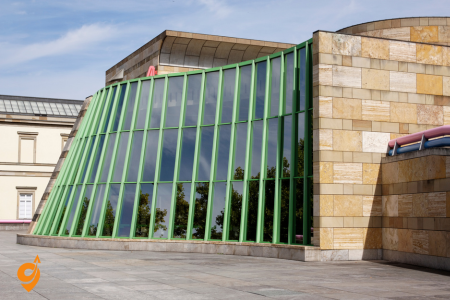
The Stuttgart State Gallery represents a fascinating architectural dialogue between classical and postmodern design. The original neoclassical building from 1843 now stands connected to British architect James Stirling’s colorful postmodern extension completed in 1984. This visual contrast creates a unique setting for one of Germany’s most important art collections.
The gallery houses masterpieces spanning seven centuries, with particular strengths in German Renaissance art, Dutch masters, and an exceptional collection of early 20th-century modern art. Visitors can experience works by artistic giants including Rembrandt, Monet, Cézanne, Picasso, and Matisse. The museum is especially renowned for its collection of works by German Expressionists, including Ernst Ludwig Kirchner and Otto Dix, offering profound insights into this influential movement.
The modern wing features a distinctive rotunda with a sloping ramp reminiscent of Frank Lloyd Wright’s Guggenheim Museum, though rendered in Stirling’s signature colorful postmodern style. This architectural element serves as both circulation space and a sculpture gallery. The museum’s thoughtful layout creates intimate exhibition spaces while maintaining an overall sense of openness and flow.
Beyond the permanent collection, the State Gallery hosts significant temporary exhibitions that often combine historical and contemporary perspectives. The museum’s dedication to education includes detailed multilingual information panels, guided tours, and interactive digital resources that help visitors engage more deeply with the artworks.
Killesberg Park

Killesberg Park represents an extraordinary transformation of a former quarry into one of Stuttgart’s most beloved green spaces. Created initially for the 1939 Reich Garden Show, this 123-acre horticultural masterpiece combines formal garden design with naturalistic landscapes and recreational facilities.
The park’s most distinctive feature is the 40-meter-tall Killesberg Tower, a delicate spiraling structure that offers panoramic views of Stuttgart and the surrounding hills. This unique observation tower, designed by Jörg Schlaich, creates an almost floating sensation for visitors who climb its transparent stairs.
Horticultural enthusiasts appreciate the park’s meticulously maintained themed gardens, including an extensive rose garden with over 8,000 roses representing hundreds of varieties. The cactus garden presents drought-resistant plants from around the world, while seasonal displays ensure something is always blooming throughout the warmer months.
The park integrates recreational elements like a miniature railway that winds through the landscape, a small lake with paddleboats, and several distinctive playgrounds designed to blend with the natural environment. Throughout the park, notable sculptures and art installations create points of interest and reflection.
During summer evenings, the park frequently hosts cultural events at its open-air theater, offering performances against the backdrop of illuminated gardens. The annual Lichterfest (Festival of Lights) transforms Killesberg into a magical landscape with thousands of lanterns and culminates in a spectacular fireworks display.
Killesberg Park, Stuttgart – Transportation & Visitor Guide
Address
Killesbergpark, 70192 Stuttgart, Germany
Opening Hours
- Park: Open 24/7, year-round
- Killesberg Tower: Daily 9:00 AM – 6:00 PM (seasonal variations)
- Killesberg Railway: April-October, weekends and holidays 10:00 AM – 6:00 PM
Public Transportation
U-Bahn (Subway)
- U5, U6, U7, U12 – Killesberg station (direct access to park)
- U15, U6, U7 – Löwentor station (10-minute walk)
S-Bahn (Regional Train)
- S4, S5, S6 – Stuttgart-Bad Cannstatt station (15-minute walk)
- S1-S6 – Stuttgart Hauptbahnhof (transfer to U-Bahn)
Bus Lines
Nearby Stops:
- Killesberg
- Oskar-Schlemmer-Straße
- Löwentorbrücke
- Kunstakademie
Lines: 43, 44, 50, N2, N3, N4
Parking Areas
On-site Parking
- Killesbergpark P1 – Main entrance parking (Am Kochenhof)
- Killesbergpark P2 – North entrance parking
- Messe Stuttgart parking – Adjacent to park (Messepiazza)
Street Parking
- Stresemannstraße – Limited street parking
- Am Kochenhof – Residential area parking
- Ehmannstraße – Side street parking
Nearby Attractions
Within Walking Distance
- Löwentor (Lion Gate) – Historic city gate
- Rosenstein Park – Large English-style park
- State Museum of Natural History – Natural history exhibits
- Wilhelma Zoo and Botanical Garden – Major zoo complex
- Cannstatter Wasen – Festival grounds (Oktoberfest location)
Close Proximity
- Mercedes-Benz Museum – 3 km
- Porsche Museum – 4 km
- Stuttgart TV Tower – 2 km
- Weissenhof Estate – UNESCO World Heritage site
- Bad Cannstatt Mineral Baths – Historic spa area
Park Features & Facilities
- Killesberg Tower – 42-meter viewing tower
- Killesberg Railway – Historic narrow-gauge railway
- Rose Garden – Extensive rose collection
- Adventure playground – Large children’s area
- Restaurant facilities – Multiple dining options
- Event venues – Concert and exhibition spaces
- Walking/jogging paths – Extensive trail network
Stadion NeckarPark (Mercedes-Benz Arena)

The Mercedes-Benz Arena dominates Stuttgart’s NeckarPark as a monument to German engineering and sporting culture. Originally built in 1933 and comprehensively renovated for the 2006 FIFA World Cup, this 60,000-capacity stadium serves as home to VfB Stuttgart football club while hosting major concerts and sporting events.
The stadium’s most distinctive feature is its unique roof structure—a lightweight membrane suspended from massive steel cables that creates a striking architectural silhouette. This engineering solution provides optimal viewing conditions while allowing sufficient sunlight to reach the natural grass playing surface. The steep seating configuration brings spectators close to the action, creating one of Germany’s most intense sporting atmospheres.
The surrounding NeckarPark complex includes additional sporting facilities like the Porsche Arena for indoor events, the Robert Schlienz Stadium for smaller matches, and training grounds. The integration of these facilities with public spaces, restaurants, and transportation hubs makes the area a comprehensive entertainment district.
The stadium holds significant historical importance, having hosted matches during the 1974 and 2006 FIFA World Cups, including the legendary 1974 match between East and West Germany. It regularly hosts German national team matches and serves as a venue for major European club competitions.
Stuttgarter Weihnachtsmarkt (Stuttgart Christmas Market)

Dating back to 1692, the Stuttgart Christmas Market transforms the city center into a winter wonderland annually from late November until Christmas Eve. Centered around the magnificent Schlossplatz and extending through adjacent streets, this traditional market features over 290 elaborately decorated wooden stalls.
What distinguishes Stuttgart’s market is its emphasis on craftsmanship and tradition. The market regulations require that stallholders personally create many of their offerings, ensuring visitors experience authentic regional crafts rather than mass-produced items. The market showcases handcrafted wooden ornaments from the Black Forest region, hand-blown glass decorations, and traditional textiles.
The visual centerpiece is the towering Christmas tree in front of the Old Palace, decorated with thousands of lights. Each evening, the Rathaus (City Hall) becomes a giant Advent calendar, with a new illuminated window revealed daily. The market’s distinctive wooden rooftops, adorned with festive figures and decorations, create a fairytale atmosphere that attracts over 4 million visitors annually.
Culinary traditions form an essential part of the experience, with regional specialties like Schupfnudeln (hand-rolled potato noodles), Glühwein (mulled wine) served in collectible mugs unique to each year’s market, and Hutzelbrot (fruit bread). A dedicated children’s area features a miniature railway, storytelling sessions, and craft workshops where younger visitors can create their own decorations.
Address and Location
Stuttgarter Weihnachtsmarkt is located in Stuttgart’s city center, primarily at Marktplatz and surrounding squares including Schillerplatz and Karlsplatz, 70173 Stuttgart, Germany
Opening Hours and Season
- Season: Late November through December 23rd (typically opens around November 27th)
- Daily Hours: Monday-Thursday 10:00 AM – 9:00 PM, Friday-Saturday 10:00 AM – 10:00 PM, Sunday 11:00 AM – 9:00 PM
- Christmas Eve: Usually closes early at 2:00 PM
- Special Events: Extended hours during weekends and special celebration days
Public Transportation Access
U-Bahn (Subway) Connections
The Christmas market is exceptionally well-connected through Stuttgart’s U-Bahn network, with multiple stations providing direct access to the market area
- Charlottenplatz Station – Lines U1, U2, U4, U9, U14 (2-minute walk to Marktplatz)
- Stadtmitte Station – Lines U5, U6, U7, U12, U15 (3-minute walk to market center)
- Schlossplatz Station – Lines U5, U6, U7, U12, U15 (direct access to adjacent Königstraße)
- Rotebühlplatz Station – Lines U1, U2, U4, U9, U14 (5-minute walk through pedestrian zone)
S-Bahn (Regional Train) Access
- Stuttgart Hauptbahnhof – All S-Bahn lines S1-S6 (8-minute walk via Königstraße pedestrian zone)
- Stuttgart Stadtmitte – Lines S1, S2, S3 (direct city center access)
- Connecting from regional areas: S-Bahn provides access from Böblingen, Esslingen, Ludwigsburg, and surrounding communities
Bus Transportation
City bus network complements rail connections with stops near the market area
- Charlottenplatz – Multiple bus lines including 40, 42, 43, 44
- Schlossplatz – Bus lines 42, 43
- Rathaus – Central bus stop near city hall (Bus lines 61, 62, 63)
Tram Connections
Historic tram lines provide additional access routes
- Charlottenplatz Tram Stop – Multiple tram connections
- Schlossplatz Tram Stop – Direct access to shopping and market area
Parking Solutions and Vehicle Access
Public Parking Garages Near Christmas Market
The city center offers multiple parking facilities within walking distance of the market
- Parkhaus Charlottenplatz – Underground parking directly beneath Charlottenplatz (2-minute walk)
- Parkhaus Galeria Kaufhof – Multi-level parking in department store building
- Parkhaus Breuninger – Premium department store parking facility
- Parkhaus Königsbau-Passagen – Shopping center parking with direct pedestrian access
- Parkhaus Züblin – Large capacity parking near Hauptbahnhof
Street Parking Considerations
Limited metered parking available on surrounding streets, though most city center areas restrict long-term parking during market season
- Büchsenstraße – Limited short-term parking spaces
- Eberhardstraße – Metered parking with time restrictions
- Calwer Straße – Some street parking available
Nearby Attractions and Points of Interest
Historic and Cultural Sites
The Christmas market location places visitors at the heart of Stuttgart’s historic center
- Stiftskirche – Historic collegiate church overlooking Marktplatz
- Altes Schloss (Old Castle) – Medieval castle housing Württemberg State Museum
- Neues Schloss (New Palace) – Baroque palace with formal gardens
- Schillerplatz – Historic square with additional market stalls and traditional architecture
- Stuttgart Opera House – World-renowned opera and ballet venue (5-minute walk)
Shopping and Entertainment Districts
The Christmas market integrates with Stuttgart’s primary shopping areas
- Königstraße – Germany’s longest pedestrian shopping street
- Calwer Straße – Boutique shopping area with restaurants and cafes
- Breuninger Department Store – Luxury shopping destination
- Königsbau-Passagen – Underground shopping center with direct weather protection
Museums and Cultural Venues
Multiple cultural attractions within easy walking distance enhance the Christmas market experience
- Stuttgart State Theater – Complex including opera, ballet, and drama venues
- Kunstmuseum Stuttgart – Modern art museum in distinctive glass cube building
- Württemberg State Museum – Regional history and cultural artifacts in Old Castle
- Linden Museum – Ethnological museum with global cultural collections
Palace Square (Schlossplatz)

Palace Square represents Stuttgart’s cultural and geographical heart, an expansive urban space surrounded by architectural treasures from different historical periods. The square is framed by the Neues Schloss (New Palace), a magnificent 18th-century baroque structure that served as residence for the kings of Württemberg and now houses government ministries.
The square’s elegant proportions showcase classic urban planning principles, with symmetrical arrangements of gardens, fountains, and pathways. The Jubilee Column (Jubiläumssäule) rises 30 meters at the center, commemorating King Wilhelm I’s 25th year of reign, while symbolic statues representing commerce, industry, agriculture, and the arts surround its base.
During summer months, the palace square transforms into an outdoor living room for Stuttgart residents, with expansive lawns inviting picnics, games, and relaxation. The carefully maintained gardens feature seasonal plantings that change throughout the year, from spring tulips to summer rose displays and autumn chrysanthemums.
The square serves as Stuttgart’s primary venue for public celebrations and events, hosting summer festivals, open-air concerts, and public viewings during major sporting events. During the Stuttgart Wine Village festival, the square accommodates hundreds of stalls representing regional wineries.
Beyond its aesthetic and recreational value, Palace Square functions as an important transportation hub, with underground stations providing connectivity throughout the region. This combination of historical significance, aesthetic beauty, and practical function makes Palace Square the true center of Stuttgart civic life.
Must-Do Activities in Germany: Year-Round and Seasonal Experiences
Germany offers diverse landscapes and experiences for activity-oriented travelers. Here’s a comprehensive guide to the hands-on, outdoor, and interactive activities you can enjoy throughout the year in Germany.
Hiking and Nature Activities
The Black Forest Region
The Black Forest offers some of Germany’s most spectacular hiking opportunities:
- Westweg Trail: Germany’s classic long-distance path stretching 285 km from Pforzheim to Basel, offering diverse terrain from gentle valleys to challenging mountain sections
- Feldberg Mountain Trails: The highest peak in the Black Forest (1,493m) features well-marked trails suitable for different fitness levels with panoramic Alpine views
- Wutach Gorge: Often called “Germany’s Grand Canyon,” this dramatic gorge features a 12 km trail alongside rushing waters through limestone formations
Bavarian Alps
Bavaria’s alpine region provides world-class mountain experiences:
- Zugspitze: Hike sections of Germany’s highest mountain (2,962m) or take the cable car and enjoy shorter trails at the summit
- Partnach Gorge: Near Garmisch-Partenkirchen, this dramatic 700m-long gorge trail takes you along walkways carved into the rock alongside thundering waters
- Eagle’s Nest Historical Trail: Combines history and hiking as you climb to Hitler’s former mountain retreat, now a restaurant with spectacular views
Saxon Switzerland National Park
Located near Dresden, this unique sandstone landscape offers:
- Bastei Bridge: Short but dramatic hike to this iconic stone bridge set among towering rock formations
- Schrammsteine: More challenging trails leading to unusual rock formations with panoramic views of the Elbe River
- Malerweg Trail: The “Painter’s Way” is an 112 km trail divided into 8 stages, following the paths that inspired Romantic painters
Island and Coastal Hiking
- Rügen Island Chalk Cliffs: The Jasmund National Park features hiking trails along dramatic white chalk cliffs overlooking the Baltic Sea
- East Frisian Islands: Car-free environments with extensive networks of coastal hiking paths through dunes and salt marshes
- Wadden Sea National Park: Experience guided mudflat hiking (Wattwandern) where you can walk on the seabed during low tide
Cycling Adventures
Long-Distance Cycling Routes
- Rhine Cycle Route: Follow one of Europe’s great rivers past castles, vineyards, and medieval towns
- Elbe Cycle Route: A mostly flat, family-friendly 860 km route from near the Czech border to Hamburg
- German Wine Route: Cycle through vineyards and wine villages in the Palatinate region with plenty of tasting opportunities
Mountain Biking
- Harz Mountains: Extensive trail network for all skill levels in central Germany with abandoned mining trails and forest paths
- Bavarian Forest: Purpose-built mountain bike parks and natural trails through ancient woodlands
- Black Forest: Challenging single-track routes with significant elevation changes and technical sections
Urban Cycling
- Berlin Wall Trail: 160 km circular route following the former border between East and West Berlin
- Hamburg’s Harbor Tour: Cycle around one of Europe’s largest ports with dramatic views of container ships and historic warehouses
- Munich’s English Garden: Extensive paths through one of the world’s largest urban parks
Water Activities
Lake Experiences
- Lake Constance (Bodensee): Swim, sail, windsurf, or paddleboard on this massive lake bordering Germany, Switzerland, and Austria
- Bavarian Lakes: Königssee, Chiemsee, and Starnberger See offer crystal-clear alpine swimming and boating opportunities
- Mecklenburg Lake District: Often called “The Land of a Thousand Lakes,” this region is perfect for multi-day canoe and kayak trips
River Activities
- Rafting the Isar River: White water experiences near Bad Tölz when water levels permit
- Danube Canoe Trips: Gentle paddling through scenic valleys and past medieval towns
- Stand-up Paddleboarding in Urban Centers: Try SUP in Berlin’s vast network of waterways or on the Isar River through Munich
Winter Water Activities
- Ice Swimming: Join locals in the tradition of winter lake dipping, particularly popular in Berlin’s lakes
- Ice Skating on Frozen Lakes: When conditions permit, lakes like Königssee offer natural skating rinks
Winter Sports
Alpine Skiing and Snowboarding
- Garmisch-Partenkirchen: Germany’s premier ski destination with varied terrain and guaranteed snow on the Zugspitze glacier
- Oberstdorf: Host of international ski jumping competitions with excellent slopes for all levels
- Berchtesgaden: Family-friendly ski areas with breathtaking Alpine scenery
Nordic Activities
- Harz Mountains Cross-Country Skiing: Over 500 km of groomed trails in central Germany
- Black Forest Ski Touring: Backcountry routes through snow-covered forests
- Bavarian Forest Snowshoeing: Guided tours through pristine winter landscapes
Unique Winter Experiences
- Toboggan Runs: Try Germany’s longest natural toboggan run at Wallberg Mountain near Tegernsee (6.5 km)
- Winter Hiking: Well-maintained winter hiking paths in all major mountain regions
- Ice Climbing: Guided experiences on frozen waterfalls in the Bavarian Alps
Climbing and Adventure Activities
Rock Climbing
- Saxon Switzerland: Over 1,100 free-standing sandstone towers with 21,000+ climbing routes
- Frankenjura: World-famous limestone climbing area with over 10,000 routes
- Harz Mountains: Granite climbing with routes for all abilities
Via Ferrata
- Mittenwald Via Ferrata: Protected climbing route in the Bavarian Alps with stunning views
- Alpspitze: Classic via ferrata route for experienced climbers
- Zugspitze: Several routes of varying difficulty on Germany’s highest mountain
Adventure Parks
- Forest Rope Courses: Germany has hundreds of tree-top adventure parks (Kletterwald) with rope courses and zip lines
- Harz Witches’ Trail: Adventure park themed around local folklore with unique challenges
- Erlebnisberg Kappe: Summer toboggan runs, zip lines, and climbing walls in one location
Seasonal Must-Do Activities
Spring (March to May)
Asparagus Season: Spring brings Spargelzeit (asparagus season), when white asparagus appears on menus nationwide. Restaurants offer special asparagus menus, and roadside stands sell fresh spears. The Baden region is particularly famous for its asparagus cultivation.
Cherry Blossom Viewing: The cherry blossoms along Bonn’s Heerstrasse create a pink tunnel called “Cherry Blossom Avenue” in April. The Japanese cherry trees were planted in the 1980s and attract photographers and nature lovers each spring.
May Day Celebrations: May 1st traditions include raising maypoles in village squares and folk dancing in traditional costumes. In Bavaria, young men secretly erect a maypole (Maibaum) in front of their sweetheart’s house as a declaration of love.
Spring Festivals: Munich’s Frühlingsfest (Spring Festival) offers a smaller, more authentic alternative to Oktoberfest, with beer tents, rides, and traditional Bavarian music between late April and early May.
Summer (June to August)
Open-Air Festivals: Summer brings hundreds of music festivals across Germany. The Tollwood Summer Festival in Munich combines music, theater, and environmental awareness in a multicultural celebration. Classical music lovers should experience the Wagner Festival in Bayreuth or the Schleswig-Holstein Music Festival.
Lake Swimming: Germany’s lakes provide perfect summer refreshment. Lake Constance (Bodensee) borders Germany, Switzerland, and Austria, offering swimming, sailing, and windsurfing against Alpine backdrops. Berlin’s lakes like Wannsee and Müggelsee become social hubs where locals escape urban heat.
Vineyard Tours: Summer is ideal for exploring Germany’s 13 wine regions. The Moselle Valley’s steep vineyards produce world-class Rieslings, while the Rheingau region offers wine tastings in medieval monasteries and castles. Many wineries open wine taverns called Straußwirtschaften during summer, serving their newest vintages with regional specialties.
Beach Culture on the North Sea and Baltic Coast: Germany’s northern coastlines feature wide sandy beaches and distinctive wicker beach chairs (Strandkörbe). The East Frisian Islands in the North Sea and Rügen Island in the Baltic Sea offer relaxed seaside experiences with cycling, water sports, and fresh seafood.
Autumn (September to November)
Oktoberfest: Munich’s world-famous beer festival runs from mid-September to early October. Beyond the beer tents, enjoy traditional Bavarian music, carnival rides, and parades in historical costumes. For authentic experiences with fewer tourists, seek out smaller regional beer festivals like the Cannstatter Wasen in Stuttgart.
Wine Harvesting and Festivals: Autumn wine festivals celebrate the grape harvest throughout Germany’s wine regions. The German Wine Route in the Palatinate region hosts the world’s largest wine festival in Bad Dürkheim each September. Many vineyards allow visitors to participate in the grape harvest, followed by traditional meals with new wine.
Hiking During Foliage Season: The Black Forest’s dense woodlands transform with spectacular autumn colors. The Harz Mountains in central Germany offer hiking trails through colorful forests to granite peaks with panoramic views. Bavaria’s Alpine foothills provide moderate hiking routes with mountain vistas, particularly beautiful when fall colors frame snow-capped peaks.
Castle Illuminations: Several Rhine castles host spectacular illumination events in autumn. The “Rhine in Flames” festival features castle illuminations, fireworks, and boat parades on selected weekends between May and September, with the September dates offering magical scenes as lights reflect on the river between vineyard-covered hillsides.
Winter (December to February)
Christmas Markets: Germany’s Christkindlmärkte tradition dates back to the Middle Ages. Each market has its own character: Nuremberg’s Christkindlesmarkt is known for its handcrafted ornaments and gingerbread, Dresden’s Striezelmarkt (Germany’s oldest) specializes in traditional woodcrafts, and Cologne operates multiple markets in different themes around its cathedral. Beyond the famous markets, discover smaller, more intimate markets in neighborhood squares and courtyards for a local experience.
Winter Sports in the Alps: Bavaria’s Alpine region offers world-class skiing and snowboarding. Garmisch-Partenkirchen, host of the 1936 Winter Olympics, features Germany’s highest peak (Zugspitze) and varied terrain for all skill levels. For a luxurious winter experience, visit Oberstdorf with its combination of challenging slopes and upscale amenities.
Carnival Celebrations: Germany’s Karneval (also called Fasching or Fastnacht depending on the region) brings vibrant street parades and costume balls. Cologne’s celebration is the largest and most famous, culminating on Rose Monday with elaborate parades featuring satirical floats. The Swabian-Alemannic Fastnacht in southwestern Germany involves distinctive wooden masks and centuries-old traditions, with Rottweil’s Narrensprung (Fools’ Jump) being particularly spectacular.
Thermal Spa Culture: Winter is perfect for experiencing Germany’s spa traditions. Baden-Baden’s elegant thermal baths have attracted European aristocracy for centuries. The Bareiss Resort in the Black Forest combines traditional thermal treatments with modern wellness concepts. For a unique experience, visit the Liquidrom in Berlin, which combines thermal bathing with underwater music.
Visa
For more details visit: https://home-affairs.ec.europa.eu/index_en
Overview of the German Visa System
Germany, as a member of the Schengen Area, operates under the shared visa policy that governs travel throughout 29 European countries. The German visa system is designed to facilitate different types of travel while maintaining secure borders. Understanding the requirements and processes is essential for potential visitors.
Types of German Visas
Schengen Visa (Short-stay visa)
This visa allows stays of up to 90 days within a 180-day period for tourism, business, visiting family, or short-term study purposes. It’s the most common visa type for temporary visitors.
National Visa (Long-stay visa)
For stays exceeding 90 days, such as for study programs, work assignments, or family reunification. These visas are specific to Germany rather than the entire Schengen Area.
Airport Transit Visa
Required for nationals of certain countries who need to transit through German airports without entering the Schengen Area.
Visa Requirements for Visiting Germany
Entry requirements for Germany vary based on nationality. The world’s countries are divided into several categories:
Visa-Free Entry to Germany
Citizens of around 95 countries and territories can enter Germany without obtaining a visa beforehand for short stays (up to 90 days in a 180-day period). These include:
- All EU/EEA countries and Switzerland
- United States, Canada, Australia, New Zealand, Japan
- South Korea, Singapore, Israel, United Arab Emirates
- United Kingdom, Brazil, Argentina, Chile, Mexico
- Malaysia, Hong Kong, Taiwan, and others
These travelers need only a valid passport (generally valid for at least three months beyond the intended departure date), proof of sufficient funds, and proof of onward/return travel.
Visa Required Countries
Citizens of approximately 135 countries require a visa before traveling to Germany. These include most African countries, many Asian countries (including China, India, Pakistan, Philippines), and several Middle Eastern and Central Asian nations.
Visa Application Process
The German visa application process typically involves:
- Determining the appropriate visa type
- Gathering necessary documentation (passport, photos, travel insurance, itinerary, etc.)
- Completing the application form
- Paying the visa fee (€90 for adults, €45 for children aged 6-12)
- Scheduling and attending an interview at a German consulate or visa application center
- Waiting for processing (usually 15 days but can take up to 45 days)
Electronic Visa System
Currently, Germany does not offer a dedicated e-visa system for most visitors. Applications must typically be submitted in person at consulates or visa application centers. However, there are plans to implement the European Travel Information and Authorization System (ETIAS) in 2026, which will function as a pre-travel authorization system for visa-exempt travelers.
Visa on Arrival
Germany/Schengen does not offer a standard visa-on-arrival program. Travelers from countries requiring visas must obtain them before arrival.
Countries with Various Entry Requirements for Germany
To provide a comprehensive picture of global mobility to Germany, here’s how different countries’ citizens can access Germany:
Visa-Free Access (Around 95 countries)
These citizens can enter and stay in the Schengen Area for up to 90 days within a 180-day period without obtaining a visa beforehand.
Visa Required (135+ countries)
Citizens from these countries must apply for and receive a Schengen visa before traveling to Germany.
Special Cases
- British citizens: Can visit without a visa for up to 90 days
- EU citizens and EEA nationals: Enjoy freedom of movement and can live and work in Germany
- Swiss nationals: Enjoy similar privileges to EU citizens through bilateral agreements
Processing Times and Success Rates
Processing time for German visas typically ranges from:
- Standard processing: 15 calendar days
- Extended processing: Up to 45 days for complex cases
The visa approval rate varies by country of origin, purpose of visit, and completeness of application, but generally ranges from 60% to 98% depending on these factors.
Tips for a Successful Visa Application
- Apply well in advance (ideally 3-4 weeks before travel)
- Ensure all documentation is complete and accurately translated
- Provide proof of sufficient funds (approximately €45 per day of stay)
- Present a coherent travel itinerary
- Demonstrate ties to your home country (job, property, family) that suggest you will return
- Obtain comprehensive travel insurance with medical coverage of at least €30,000
Safety Precautions for Visiting Germany
Germany is generally a safe country to visit, but as with any travel destination, it’s important to take certain precautions to ensure your trip is enjoyable and trouble-free. This comprehensive guide covers essential safety measures, health precautions, and emergency contacts to help you prepare for your visit to Germany.
General Safety Precautions
Crime Prevention
Germany has relatively low crime rates, but petty theft and pickpocketing can occur, especially in crowded tourist areas. To protect yourself:
- Stay vigilant in busy areas such as train stations, Christmas markets, and popular tourist attractions where pickpockets may operate.
- Keep your valuables secure and out of sight. Consider using a money belt worn under your clothing for passports, excess cash, and important documents.
- Don’t leave bags or belongings unattended, even for a brief moment.
- Be cautious with ATM usage – shield your PIN when entering it and be aware of your surroundings.
- Use hotel safes for storing passports, extra credit cards, and valuable items when not needed.
- Make digital copies of important documents like your passport, visa, insurance information, and store them securely online where you can access them if needed.
Transportation Safety
- German public transportation is efficient and generally very safe, but remain alert, particularly at night.
- If driving, familiarize yourself with German traffic rules, which may differ from your home country. For example, right of way often belongs to vehicles coming from the right, and there are strict rules about when you can and cannot turn right on red lights.
- On the Autobahn, be aware that while some sections have no speed limits, many areas do have posted limits that are strictly enforced.
- Never drink and drive. Germany has strict laws with a blood alcohol limit of 0.05%, lower than many other countries.
- Always wear seatbelts, which are mandatory for all passengers.
Environmental Safety
- Be prepared for the weather conditions during your visit. Germany can experience extremely hot summers, particularly in recent years due to climate change, as well as cold, snowy winters.
- If hiking in rural or mountainous areas, stick to marked trails, bring appropriate gear, and inform someone of your plans.
- During winter, be cautious of icy conditions on sidewalks and roads.
Health Precautions
Medical Preparation
- Ensure you have adequate travel health insurance that covers medical emergencies and repatriation if necessary.
- Bring any prescription medications you need in their original packaging, along with a copy of the prescription.
- Consider bringing a basic first aid kit with pain relievers, bandages, and any personal medications.
Healthcare Access
- Germany has excellent healthcare facilities with high standards, but services can be expensive without proper insurance.
- Pharmacies (Apotheken) are widely available and can be identified by a red “A” or green cross sign. They can provide over-the-counter medications and advice for minor ailments.
- If you have specific health conditions, learn how to explain them in German or carry a medical alert card in German.
Food and Water Safety
- Tap water in Germany is safe to drink and meets high quality standards.
- Food safety standards are strictly enforced, making foodborne illness relatively uncommon.
- If you have food allergies, learn the German terms for common allergens or carry an allergy translation card.
Emergency Preparedness
Understanding the Alert Systems
- Germany has a nationwide emergency alert system that includes sirens and cell broadcast messages.
- The NINA warning app (Notfall-Informations- und Nachrichten-App) provides official warnings and emergency information in German and English.
Natural Disaster Awareness
- Parts of Germany occasionally experience flooding, particularly near major rivers.
- In mountainous regions, be aware of potential avalanche risks during winter.
- Severe storms can occur throughout the year, so check weather forecasts regularly.
Emergency Contacts in Germany
Essential Emergency Numbers
- Universal European Emergency Number: 112 (for medical emergencies, fire, or immediate danger)
- Police: 110
- Medical Emergency Service: 116 117 (for non-life-threatening medical situations outside normal doctor office hours)
These emergency numbers are free of charge and accessible from any phone, even without a SIM card or credit.
Medical Services
- Pharmacies (Apotheken): Look for the “Notdienst” sign in pharmacy windows or online at www.aponet.de to find pharmacies open during nights and weekends
- Hospitals (Krankenhaus): Major hospitals have emergency rooms (Notaufnahme) open 24/7
- Dental Emergencies: Call 112 or visit a hospital emergency room
Helplines with English Support
- Crisis and Suicide Prevention Hotline: 0800 111 0 111
- Domestic Violence Hotline: 08000 116 016
- ADAC (German Automobile Club) Road Assistance: 0180 2 22 22 22
Communication During Emergencies
- Many Germans speak English, especially younger people and those in the service industry, but learning basic German phrases for emergencies is helpful.
- Key emergency phrases in German:
- “Hilfe!” (Help!)
- “Notruf!” (Emergency!)
- “Ich brauche einen Arzt.” (I need a doctor.)
- “Ich brauche die Polizei.” (I need the police.)
- “Es gibt einen Unfall.” (There’s been an accident.)
- Keep a card with your accommodation address, emergency contact information, and any medical conditions or allergies written in both English and German.
Transportation in Germany
Germany boasts one of Europe’s most comprehensive and efficient transportation networks, integrating various systems to provide mobility across the country. The German transportation infrastructure connects urban centers, rural areas, and international destinations through an organized network of different travel modes.
Rail Transportation
Deutsche Bahn (DB) operates Germany’s national railway system, carrying over 2 billion passengers annually. The network includes high-speed InterCity Express (ICE) trains reaching speeds of up to 300 km/h, connecting major cities quickly and efficiently. Regional trains provide comprehensive coverage to smaller towns and rural areas.
Official website: Deutsche Bahn
Public Urban Transit
German cities have well-developed public transportation systems typically consisting of:
- U-Bahn (subway/metro systems)
- S-Bahn (suburban railway networks)
- Trams/streetcars
- Buses
These systems are organized into regional transport associations (Verkehrsverbünde) that coordinate schedules and offer integrated ticketing. For example, Berlin’s transportation is managed by BVG, while Munich’s is operated by MVG.
Official websites:
- Berliner Verkehrsbetriebe (BVG)
- Münchner Verkehrsgesellschaft (MVG)
- Verkehrsverbund Rhein-Ruhr (VRR)
Road Transportation
Germany’s extensive Autobahn network spans approximately 13,000 kilometers, famous for sections without speed limits. The Federal Highway Authority (Bundesanstalt für Straßenwesen) oversees road infrastructure and safety standards.
Official website: Bundesanstalt für Straßenwesen
Air Transportation
Germany has major international airports in Frankfurt, Munich, Berlin, Düsseldorf, and Hamburg. Lufthansa, the national carrier, operates an extensive global network from these hubs.
Official websites:
Waterways
Germany maintains approximately 7,500 kilometers of navigable inland waterways, primarily along rivers like the Rhine, Main, and Danube. The Federal Waterways and Shipping Administration (Wasserstraßen- und Schifffahrtsverwaltung des Bundes) manages these waterways.
Official website: Wasserstraßen- und Schifffahrtsverwaltung des Bundes
Transport Information
For comprehensive travel planning across all modes of transportation:
Official website: Federal Ministry of Transport and Digital Infrastructure
Major Transportation Hubs in Germany
Germany’s transportation infrastructure features numerous significant hubs that connect various modes of transit across the country and internationally. Let’s explore the major airports, train stations, bus stations, and multimodal transportation centers throughout Germany.
Major Airports
Frankfurt Airport (FRA)
Frankfurt Airport stands as Germany’s largest aviation hub and one of Europe’s busiest airports. It serves as the main base for Lufthansa and handles approximately 70 million passengers annually under normal operations.
- Features connections to over 300 destinations worldwide
- Has two major terminals with excellent rail connections to the national network
- Official website: www.frankfurt-airport.com
Munich Airport (MUC)
Munich Airport functions as Germany’s second-largest airport and Lufthansa’s secondary hub.
- Features the award-winning Terminal 2 operated in partnership with Lufthansa
- Connects to approximately 250 destinations globally
- Official website: www.munich-airport.com
Berlin Brandenburg Airport (BER)
Opened in 2020 to replace the former Tegel and Schönefeld airports, Berlin Brandenburg serves as the capital’s primary international gateway.
- Connected to Berlin city center via express trains and regional services
- Serves as a hub for various airlines including easyJet and Eurowings
- Official website: www.berlin-airport.de
Düsseldorf Airport (DUS)
A major international airport serving western Germany and the densely populated Rhine-Ruhr metropolitan region.
- Important for business travelers due to its proximity to Germany’s industrial heartland
- Offers connections to approximately 200 destinations
- Official website: www.dus.com
Hamburg Airport (HAM)
Serving northern Germany, Hamburg Airport is the oldest airport in Germany still in operation.
- Connects to about 130 destinations
- Important gateway for Scandinavian connections
- Official website: www.hamburg-airport.de
Other Significant Airports
- Stuttgart Airport (STR) – www.flughafen-stuttgart.de
- Cologne Bonn Airport (CGN) – www.cologne-bonn-airport.com
- Hannover Airport (HAJ) – www.hannover-airport.de
- Nuremberg Airport (NUE) – www.airport-nuernberg.de
- Leipzig/Halle Airport (LEJ) – www.leipzig-halle-airport.de
Major Train Stations
Berlin Hauptbahnhof
Berlin’s central station is Europe’s largest two-level station, serving approximately 300,000 passengers daily.
- Connects long-distance, regional, S-Bahn, U-Bahn, tram, and bus services
- Features a five-story shopping mall with numerous retail and dining options
- Official website via Deutsche Bahn: www.bahnhof.de/berlin-hbf
Frankfurt Hauptbahnhof
One of Europe’s busiest railway stations, Frankfurt’s main station serves as a critical junction in Germany’s rail network.
- Handles approximately 450,000 passengers daily
- Connects to Frankfurt Airport via regular service
- Features 25 platforms serving long-distance and regional trains
Munich Hauptbahnhof
Munich’s central station serves as a major transportation hub for southern Germany.
- Features 32 platforms serving domestic and international destinations
- Direct connection to Munich Airport via S-Bahn
- Undergoes significant modernization program planned through 2028
Hamburg Hauptbahnhof
Hamburg’s main station is among Europe’s busiest, connecting northern Germany and Scandinavian destinations.
- Serves approximately 500,000 passengers daily
- Houses 8 long-distance and 12 S-Bahn platforms
- Central hub for regional connections throughout northern Germany
Cologne Hauptbahnhof
Located directly next to Cologne Cathedral, this major hub connects western Germany and international destinations.
- Features 11 platforms serving ICE, IC, and regional trains
- Important junction for trains to Belgium, the Netherlands, and France
- Connects to Cologne/Bonn Airport via S-Bahn
Other Important Train Stations
- Stuttgart Hauptbahnhof (undergoing major reconstruction as part of Stuttgart 21 project)
- Hannover Hauptbahnhof (important north-south and east-west junction)
- Leipzig Hauptbahnhof (Europe’s largest terminal station by floor area)
- Dresden Hauptbahnhof (key station for connections to Eastern Europe)
- Nuremberg Hauptbahnhof (important hub for Bavaria and connections to Czech Republic)
Major Bus Stations
Berlin Central Bus Station (ZOB)
Germany’s largest long-distance bus terminal located in western Berlin.
- Serves approximately 5 million passengers annually
- Connects to destinations throughout Europe
Munich Central Bus Station (ZOB)
Located near Hackerbrücke, this station serves as the main bus hub for southern Germany.
- Connected to Munich Hauptbahnhof via a short walk or S-Bahn connection
- Serves both domestic and international routes
- Handles approximately 40 bus companies
Hamburg Central Bus Station (ZOB)
Located adjacent to Hamburg Hauptbahnhof, serving northern Germany and Scandinavian connections.
- Renovated and expanded in recent years to handle increased demand
- Serves approximately 8 million passengers annually
- Offers connections to over 30 countries
Frankfurt Bus Station (Hauptbahnhof)
Located near Frankfurt’s main train station, serving as a central hub for FlixBus and other carriers.
- Direct connections to Frankfurt Airport
- Serves domestic and international routes
- Integrated with the city’s public transportation system
Integrated Transportation Hubs
Berlin Südkreuz
An important intermodal transportation hub in southern Berlin.
- Connects regional, S-Bahn, and long-distance trains
- Features integrated bus connections and car/bike sharing services
- Test site for intelligent mobility concepts
Leipzig City Tunnel
An underground railway tunnel system connecting Leipzig Hauptbahnhof with other stations.
- Created a unified S-Bahn network for the Leipzig-Halle metropolitan region
- Significantly improved transit times across the region
- Integrated with tram and bus connections
Frankfurt Airport Long-Distance Station
A dedicated long-distance train station at Frankfurt Airport.
- Serves ICE high-speed trains connecting the airport directly to major cities
- Separate from the regional train station at the airport
- Functions as an air-rail hub allowing seamless transitions between modes
Munich Airport Center (MAC)
Located between the two terminals at Munich Airport.
- Features shopping, dining, and services connecting both terminals
- Houses the airport’s train station with S-Bahn connections to Munich
- Functions as a central gathering and distribution point for passengers
Germany’s transportation hubs exemplify integrated planning and interconnectivity, allowing travelers to switch between modes of transportation efficiently. The country continues to invest in modernizing and expanding these facilities to meet growing demand and enhance the traveling experience while improving sustainability and reducing environmental impact.
Berlin
Berlin offers one of Europe’s most efficient and comprehensive public transportation systems, making it easy to navigate this sprawling capital city without a car. The integrated network consists of several modes of transport that work together seamlessly to help you reach virtually any part of the city and its surroundings.
For more details visit: https://www.bvg.de/en
Berlin’s Public Transportation Network
Berlin’s public transportation system is operated primarily by BVG (Berliner Verkehrsbetriebe) and S-Bahn Berlin, and includes:
U-Bahn (Underground)
The U-Bahn is Berlin’s metro system, consisting of 9 lines (U1-U9) marked by blue signs. Trains run frequently—every 3-5 minutes during peak hours and every 5-10 minutes during off-peak times. The U-Bahn operates from approximately 4:30 AM until 1:00 AM on weekdays, with 24-hour service on weekends (Friday and Saturday nights). The network covers most of central Berlin with approximately 173 stations across approximately 152 kilometers of track.
Subway Line U1: S+U Warschauer Str.◄►U Uhlandstr.
Subway Line U12: S+U Warschauer Str.◄►U Ruhleben
Subway Line U2: S+U Pankow◄►U Ruhleben
Subway Line U3: S+U Warschauer Str.◄►U Krumme Lanke
Subway Line U4: U Nollendorfplatz◄►S+U Innsbrucker Platz
Subway Line U5: U Hönow◄►S+U Hauptbahnhof
Subway Line U6: U Kurt-Schumacher-Platz◄►U Alt-Mariendorf
Subway Line U7: S+U Rathaus Spandau◄►U Rudow
Subway Line U8: S+U Wittenau◄►S+U Hermannstr.
Subway Line U9: U Osloer Str.◄►S+U Rathaus Steglitz
S-Bahn (Suburban Railway)
For more details visit: https://sbahn.berlin/en/
The S-Bahn, identified by green signs with a white “S”, connects the city center with outer districts and suburbs. It includes 15 lines and is particularly useful for longer journeys across the city. Many S-Bahn lines converge at the Stadtbahn, which runs east-west through central Berlin. The “Ring” (S41 clockwise and S42 counterclockwise) circles the inner city and is an excellent way to travel between neighborhoods without going through the center.
Buses
Berlin’s extensive bus network fills gaps between rail services and reaches areas not covered by trains. Key bus routes include:
- MetroBuses (M11-M85): High-frequency routes operating every 10 minutes
- Express buses (X11-X83): Faster services with fewer stops
- Regular buses (100-399): Standard services throughout the city
- Night buses (N1-N9): Replace U-Bahn services when they’re not running
The 100 and 200 bus routes are particularly popular with tourists as they pass many major landmarks, effectively serving as informal city tours.
Trams (Straßenbahn)
Trams operate primarily in the eastern parts of Berlin, with some lines running 24 hours. The “MetroTram” lines (M1-M17, 12,16, 18, 21, 27, 37, 50, 60, 61, 62, 63, 67, 68) offer frequent service day and night. Trams are an excellent way to get around neighborhoods like Prenzlauer Berg, Friedrichshain, and Pankow.
Regional Trains (RE/RB)
Regional Express (RE) and Regional Bahn (RB) trains connect Berlin with Brandenburg and other surrounding regions. These trains can also be useful for traveling quickly across different parts of Berlin, as they make fewer stops than the S-Bahn.
Ferries
Berlin also operates several ferry routes across lakes and rivers as part of the public transportation network. These are particularly useful in the southeastern parts of the city, around Müggelsee and Wannsee.
Lines: F10, F11, F12, F21, F23, F24
Ticketing System
Berlin uses an integrated ticketing system across all modes of public transport, organized into three fare zones:
- Zone A: Central Berlin (within the S-Bahn ring)
- Zone B: Urban areas outside the ring to the city limits
- Zone C: Surrounding suburbs, including Potsdam and Schönefeld Airport
Most visitors will only need tickets for zones A and B, which cover all major attractions and Berlin Brandenburg Airport.
Validating Tickets
After purchasing a ticket, you must validate it before your first journey by stamping it in the yellow or red validation machines found on platforms or inside buses and trams. Failure to validate tickets can result in a fine. Digital tickets purchased through apps are usually validated automatically.
Transportation Apps and Websites
Essential Apps
- BVG Fahrinfo: The official BVG app provides real-time information, journey planning, ticket purchasing, and service disruption updates.
- DB Navigator: The Deutsche Bahn app covers all public transportation in Berlin plus long-distance trains throughout Germany. It offers real-time information and mobile ticket purchasing.
- Jelbi: Berlin’s mobility app that integrates public transport with sharing services (bikes, scooters, cars) for multimodal journey planning.
- Moovit: An international app with excellent coverage of Berlin’s public transport, featuring offline capabilities and community-based service updates.
- Google Maps: While not specifically designed for Berlin, Google Maps provides reliable public transport directions and timing information.
- CityMapper: Offers comprehensive journey planning with real-time data and interesting features like “rain-safe” routes.
Useful Websites
- BVG.de: The official website of Berlin’s main transport authority with timetables, network maps, and ticket information.
- S-Bahn Berlin: Information specific to the S-Bahn network, including service updates.
- VBB.de: The Berlin-Brandenburg transport association website covering the entire region’s public transport network.
- Berlin.de/en/public-transportation: The city’s official guide to public transport with useful information for visitors.
Additional Transportation Options
Bike Sharing
Berlin is a very bike-friendly city with excellent cycling infrastructure. Several bike-sharing services operate throughout the city:
- Nextbike: The largest system with stations throughout Berlin
- LIDL-Bike: Formerly Call a Bike, operated by Deutsche Bahn
- Donkey Republic: Distinctive orange bikes available via app
E-Scooter Sharing
Several e-scooter services operate in Berlin, including Tier, Lime, Voi, and Bird. These can be rented through their respective apps and are particularly useful for short journeys.
Car Sharing
Services like SHARE NOW, Miles, and WeShare offer flexible car rentals by the minute or hour, with vehicles found throughout the city.
Munich
For more details visit: https://www.mvv-muenchen.de/en/index.html
Reaching Munich
By Air
Munich International Airport (MUC) is located about 28 kilometers northeast of the city center. From the airport, you can reach the city by:
- S-Bahn: Lines S1 and S8 connect the airport directly to the city center in about 40 minutes. The S-Bahn station is located directly beneath the central terminal area.
- Lufthansa Airport Bus: Operates between the airport and Munich’s main train station (Hauptbahnhof) with departures every 15 minutes during peak hours.
- Taxi: Available outside both terminals, though more expensive than public transportation.
By Train
Munich has excellent rail connections to other German cities and European destinations:
- Munich Hauptbahnhof (Main Station): The central hub for local, regional, and international trains, located in the city center.
- Munich Ostbahnhof (East Station): Secondary hub serving eastern destinations.
- Munich-Pasing: Important station in western Munich.
Deutsche Bahn operates high-speed ICE trains connecting Munich with other major German cities like Berlin (4 hours), Hamburg (6 hours), and Frankfurt (3.5 hours).
By Car
Munich is well-connected by several autobahns (highways):
- A8 from Stuttgart and Salzburg
- A9 from Nuremberg and Berlin
- A95 from Garmisch-Partenkirchen
- A96 from Lindau and Lake Constance
Public Transportation Network (MVV)
U-Bahn (Subway)
- 8 lines (U1-U8) with trains running every 5 minutes during peak hours and 10 minutes during off-peak times
- Service hours: 4:45 AM until 1:30 AM (Friday and Saturday until 2:30 AM)
- Recognizable by blue signs with a white “U”
S-Bahn (Suburban Trains)
- 8 lines (S1-S8) that run through the city center in a tunnel (the “Stammstrecke”)
- Connect the city with suburbs and nearby towns like Dachau, Freising, and Starnberg
- Recognizable by green signs with a white “S”
- Trains run approximately every 20 minutes per line, with more frequent service in the central corridor
Trams
- 13 lines covering many inner-city areas where U-Bahn and S-Bahn don’t reach
- Night trams (N17, N19, N20, N27) operate when regular service ends
- Modern, accessible vehicles with frequent stops
Buses
- Extensive network of regular and express (MetroBus and ExpressBus) lines
- Fill gaps between rail services and reach areas not covered by rail transport
- Night buses (N40-N81) operate when regular service ends
Transportation Apps and Websites
Official MVV Apps
- MVV Companion: The official app for planning journeys, buying tickets, and real-time updates on service disruptions.
- MVV Fahrinfo: Journey planner with real-time departure information and disruption alerts.
Third-Party Apps
- München Navigator: Comprehensive city guide with integrated public transport information.
- DB Navigator: Deutsche Bahn’s app works well for all public transportation in Munich, not just trains.
- Google Maps: Offers reliable public transportation directions in Munich.
- Moovit: Provides detailed journey planning with real-time information.
Useful Websites
- MVV website (www.mvv-muenchen.de): Official site with journey planner, network maps, and service updates.
- Deutsche Bahn website (www.bahn.de): For long-distance train connections to/from Munich.
- MVG website (www.mvg.de): Information about Munich’s subway, tram, and bus services.
Additional Transportation Options
Bike Sharing
- MVG Rad: The city’s official bike-sharing service with over 1,200 bicycles available.
- Call a Bike: Deutsche Bahn’s bike-sharing service.
- Extensive network of cycling paths throughout the city.
E-Scooters
Several operators like Tier, Lime, and Voi offer e-scooters throughout the city center.
Car Sharing
- SHARE NOW: Free-floating car sharing service.
- Sixt Share: Car sharing service with flexible pickup and return locations.
- StadtAuto München: Traditional station-based car sharing.
Navigation Tips
Zones and Rings
The MVV network is divided into rings (zones) radiating outward from the city center. When purchasing tickets, you’ll need to know which zones your journey covers.
Airport Connections
The S1 and S8 lines connect the airport to the city center, taking approximately 40 minutes. These trains depart every 10 minutes during the day.
IsarCard
For longer stays, consider purchasing an IsarCard weekly or monthly pass, which offers unlimited travel within your selected zones.
English Support
All ticket machines have English language options, and most transportation staff speak basic English. Station announcements on S-Bahn and U-Bahn trains are often made in both German and English.
Navigation Within Stations
Major stations like Hauptbahnhof, Marienplatz, and Odeonsplatz are large with multiple levels and connections. Look for the color-coded directional signs to navigate between different lines.
Tourist Areas Coverage
The main tourist attractions are well-served by public transportation:
- Marienplatz: U3, U6, S1-S8
- English Garden: U3, U6, Tram 16
- Olympic Park: U3
- Museums Quarter: Tram 27, Bus 100
- Nymphenburg Palace: Tram 17
Munich’s efficient and comprehensive transportation system makes it one of Europe’s most accessible cities for visitors and residents alike.
Rhine Valley
Reaching the Rhine Valley
By Air
The Rhine Valley is accessible through several international airports:
Frankfurt Airport (FRA): As Germany’s largest airport, Frankfurt serves as the main gateway to the Rhine Valley. From the airport:
- Take a direct train (ICE, IC, or Regional) from the airport’s long-distance train station to major Rhine Valley cities like Koblenz, Bingen, or Mainz
- The journey to Mainz takes approximately 30 minutes by regional train
- The journey to Koblenz takes about 1.5 hours by direct train
Cologne-Bonn Airport (CGN): Serves the northern section of the Rhine Valley:
- The S-Bahn line S13 connects the airport to Cologne’s main station (Köln Hauptbahnhof)
- From Cologne, regional trains travel south along the Rhine Valley
- Airport shuttle buses also operate to various Rhine Valley destinations
Düsseldorf Airport (DUS): Convenient for the northern Rhine region:
- The airport has its own train station with connections to Düsseldorf Hauptbahnhof
- From there, trains travel along the Rhine Valley cities
- Regional Express trains offer direct connections to cities like Koblenz
Hahn Airport (HHN): Though technically farther from the Rhine, this airport is used by some budget airlines:
- Bus services connect the airport to Rhine cities like Mainz, Koblenz, and Frankfurt
- Requires longer transfer times than major airports
By Train
The Rhine Valley has excellent rail coverage, with tracks running along both banks of the river:
Western Bank Railway (Linke Rheinstrecke):
- Runs between Cologne and Mainz via Bonn, Remagen, Andernach, and Koblenz
- Offers spectacular views of the Rhine and its castles
- Generally more scenic than the eastern route
Eastern Bank Railway (Rechte Rheinstrecke):
- Connects Cologne with Wiesbaden via Königswinter, Bad Hönningen, and Rüdesheim
- Serves many small wine villages and heritage sites
- Slightly less frequent service than the western bank
High-Speed Routes:
- ICE trains connect major cities near the Rhine Valley like Frankfurt, Cologne, and Mannheim
- These fast trains don’t follow the scenic river route but provide quick access to the region
By Car
Major highways connecting to the Rhine Valley:
- A3: Connects Frankfurt to Cologne, passing near the Rhine
- A61: Runs parallel to the Rhine on the western side
- A5: Runs along the eastern side of the Rhine
- B9: Scenic route closely following the western bank of the Rhine
- B42: Follows the eastern bank of the Rhine
By River Cruise
Many visitors experience the Rhine Valley via river cruises:
- Major cruise operators have services between Amsterdam and Basel
- Day cruises operate between popular sections like Bingen to St. Goar or Koblenz to Cologne
- Cruise ships dock at numerous towns, allowing for embarkation and disembarkation at multiple points
Public Transportation Within the Rhine Valley
Regional Train Network
The backbone of Rhine Valley transportation consists of:
Regional Express (RE): Fast regional trains connecting major cities along the Rhine with limited stops.
RegionalBahn (RB): Local trains stopping at smaller stations along the river.
S-Bahn: Suburban train networks around the larger cities like Cologne, Frankfurt, and Mainz that extend into parts of the Rhine Valley.
MittelrheinBahn: Operates every hour between Cologne and Mainz, stopping at all stations along the UNESCO World Heritage section of the Rhine Valley.
Bus Services
Complementing the rail network:
Public Buses: Most Rhine Valley towns have local bus services connecting town centers with railway stations and nearby villages.
Tourist Shuttle Buses: Seasonal services in popular areas like the Upper Middle Rhine Valley, connecting major attractions and hiking trailheads.
WeinBus: Specialized services in wine regions connecting various vineyards and wine villages, particularly useful during wine festival seasons.
Ferries and River Transportation
The Rhine River itself serves as a transportation route:
Car Ferries: Regular services cross the Rhine at multiple points, connecting towns across the river where bridges are distant.
- Notable crossings include St. Goar to St. Goarshausen, Bingen to Rüdesheim, and Linz to Remagen
Passenger Ferries: Smaller boats offering pedestrian crossings between towns.
Rhine Water Taxis: Seasonal services in tourist areas allowing hop-on, hop-off travel between riverside towns.
KD Rhine Cruises: While primarily offering tourist cruises, these ships can also be used for point-to-point transportation between Rhine towns.
Cycling Infrastructure
The Rhine Valley features excellent cycling options:
Rhine Cycle Route: One of Europe’s most popular long-distance cycling paths running the entire length of the Rhine, with well-maintained dedicated paths.
Bike Rental Services: Available in most towns along the Rhine, often at or near train stations.
Bike-Friendly Transportation: Regional trains and many ferries accommodate bicycles, making it easy to combine cycling with other transportation modes.
Transportation Apps and Websites
Official Transportation Apps
Deutsche Bahn (DB) Navigator: The essential app for all train travel in Germany, including the Rhine Valley region. Features:
- Real-time train information and delays
- Complete journey planning
- Mobile ticket purchases
- Platform information
- Available in English
VRM App: For the Middle Rhine Valley region, offering local bus and train connections.
VRS App: Covers the northern Rhine Valley including Cologne and Bonn.
RMV App: For the southern Rhine region including Frankfurt and Mainz.
Third-Party and Multi-Modal Apps
Moovit: Comprehensive public transport app covering the entire Rhine Valley with real-time updates.
Google Maps: Reliable for basic navigation but may miss some local transportation options.
Rome2Rio: Excellent for planning multi-modal journeys throughout the Rhine region.
Komoot: Particularly useful for hiking and cycling routes along the Rhine.
FlixBus: For budget long-distance bus travel to and between major Rhine Valley cities.
Useful Websites
German Railways (www.bahn.com/en): The official Deutsche Bahn website with English language option, essential for train planning.
Romantic Rhine Tourism (www.romantischer-rhein.de/en): Tourism website with transportation information for the UNESCO Middle Rhine section.
KD Rhine (www.k-d.com/en): Information on passenger ships and cruises operating as public transportation on the Rhine.
Rheinland-Pfalz Mobility Portal (www.rolph.de): Comprehensive public transportation information for the Rhineland-Palatinate state.
ADAC Route Planner (www.adac.de/reise-freizeit/routenplaner): Detailed driving directions if traveling by car.
Additional Transportation Details
Regional Transport Associations
The Rhine Valley is covered by several regional transport associations, each with its own ticketing system:
VRM (Verkehrsverbund Rhein-Mosel): Covers the Middle Rhine Valley including Koblenz.
VRS (Verkehrsverbund Rhein-Sieg): Covers the northern Rhine including Cologne and Bonn.
RMV (Rhein-Main-Verkehrsverbund): Covers Frankfurt, Mainz, and surrounding areas.
VRN (Verkehrsverbund Rhein-Neckar): Covers the southern Rhine region including Mannheim.
Special Tourist Transportation
Sesselbahn Rüdesheim: Cable car from Rüdesheim up to the Niederwald Monument with Rhine views.
Drachenfels Railway: Historic cog railway in Königswinter ascending to Drachenfels castle ruins.
RheinBurgenWeg Shuttle: Seasonal hiking shuttle connecting various sections of the Rhine Castle Trail.
Wine Village Shuttles: Seasonal services during wine festivals connecting multiple wine villages.
Navigation Tips
Station Naming: Some Rhine Valley stations are named differently from their towns (e.g., Bacharach station is called “Bacharach Bf”).
River Bank Identification: Always note which side of the Rhine your destination is on, as crossing points are limited.
UNESCO Middle Rhine Section: The most scenic portion lies between Bingen and Koblenz, with the highest concentration of castles and historic towns.
Train Platform Information: Smaller stations may have limited announcements, so confirm platform numbers via the DB app.
Seasonal Considerations: Some ferry services and tourist transportation options operate with reduced schedules or close entirely during winter months.
Integrated Day Tickets: Various regional day tickets allow unlimited travel on all public transportation within certain zones, ideal for exploring multiple Rhine towns in one day.
The Rhine Valley’s comprehensive transportation network makes it possible to explore this historic and scenic region efficiently without a car, connecting medieval castles, vineyards, historic towns, and natural landscapes through an integrated system of trains, buses, and boats.
Neuschwanstein Castle
Neuschwanstein Castle is one of Germany’s most iconic landmarks, located near the town of Füssen in southwest Bavaria. Here’s a comprehensive guide on how to reach the castle and navigate the area effectively.
Getting to Füssen (The Gateway to Neuschwanstein)
By Train
Germany has an excellent rail network that makes reaching Füssen straightforward:
- From Munich: Direct regional trains (operated by Deutsche Bahn) run approximately every two hours from Munich Hauptbahnhof (main station) to Füssen. The journey takes about 2 hours.
- From other German cities: Connect via Munich or Augsburg to reach Füssen.
- The Bayern Ticket is valid on these regional trains and also covers local buses to the castle (though not the shuttle bus directly at the castle).
By Bus
- Long-distance bus companies like FlixBus offer services to Füssen from various German cities and neighboring countries.
From Füssen to Neuschwanstein Castle
Once you arrive in Füssen, you have several options to reach the castle:
Local Bus (Recommended Option)
- Bus 73 or 78 runs from Füssen train station to Hohenschwangau village (the base of the castle). The journey takes about 10 minutes.
- Buses are timed to meet arriving trains from Munich.
- During peak season, buses run approximately every 30 minutes.
Taxi
- Taxis are readily available at Füssen train station.
- The journey to Hohenschwangau takes about 5-10 minutes.
Walking
- It’s possible to walk from Füssen to Hohenschwangau in about 40-50 minutes.
- The route is scenic and well-marked.
From Hohenschwangau Village to the Castle
Once you reach Hohenschwangau village at the base of the mountain, you still need to ascend to the castle:
Shuttle Bus
- A shuttle bus runs from the ticket center in Hohenschwangau up to Marienbrücke (Mary’s Bridge), which offers the classic postcard view of the castle.
- From Marienbrücke, it’s a 10-minute downhill walk to the castle entrance.
- Note: The shuttle only operates when weather conditions permit.
Horse-Drawn Carriage
- Carriages depart near the Hotel Müller in Hohenschwangau.
- They go uphill but stop below the castle, requiring a 10-15 minute uphill walk to reach the entrance.
Walking
- The walk from the village to the castle takes about 30-40 minutes uphill.
- The path is paved and offers beautiful views of the surrounding landscape.
- This option requires moderate fitness but is manageable for most visitors.
Useful Transportation Apps and Websites
Deutsche Bahn (DB Navigator)
- Official app of the German railway system
- Features: Real-time schedules, platform information, delay notifications, mobile tickets
- Website: bahn.com
- Available for iOS and Android
Bayern Fahrplan
- Comprehensive public transportation planner for all of Bavaria
- Includes trains, buses, and local transportation options
- Website: bayern-fahrplan.de
- Available for iOS and Android
Google Maps
- Offers reliable public transportation directions in this area
- Shows walking routes around the castle and surrounding areas
- Available for iOS and Android
ÖPNV Bayern
- Official public transportation app for Bavaria
- Provides real-time information for all forms of public transportation
- Website: bayern-fahrplan.de/en/apps
- Available for iOS and Android
FlixBus
- For long-distance bus travel to Füssen
- Website: flixbus.com
- Available for iOS and Android
Additional Tips for Getting Around
Best Times to Visit
- Early morning (before 10:00) or late afternoon (after 15:00) to avoid the largest crowds
- Weekdays are generally less crowded than weekends
Planning Your Visit
- Reserve your castle tickets online in advance through the official website (neuschwanstein.de)
Accessibility
- The castle itself has many stairs and is not wheelchair accessible
- The shuttle bus can accommodate visitors with limited mobility
- Horse carriages are an alternative for those who cannot walk uphill
Exploring Beyond Neuschwanstein
- Consider also visiting nearby Hohenschwangau Castle (in the same village)
- Local buses connect to other attractions in the area, including the Tegelberg cable car and the town of Schwangau.
Regional Transportation Passes
- The Füssen Card is available if you stay overnight in Füssen and provides free local bus travel
- The aforementioned Bayern Ticket covers all regional trains and most buses in Bavaria for a full day
By planning your transportation carefully, you can make your visit to Neuschwanstein Castle both enjoyable and efficient. The German public transportation system is reliable, punctual, and comprehensive, making it relatively straightforward to reach this spectacular landmark even without a car.
Dresden
Dresden, the capital of Saxony, is a beautifully restored historic city located in eastern Germany. The city offers a well-developed public transportation system that makes exploring both the city center and surrounding areas convenient and efficient. This guide will help you navigate Dresden’s transportation options with confidence.
For more information visit: https://www.dvb.de/en-gb/
Getting to Dresden
By Train
Dresden is well-connected to Germany’s rail network, making train travel one of the most convenient ways to reach the city:
- Long-distance trains (ICE, IC) connect Dresden to major German cities like Berlin (approximately 2 hours), Leipzig (1 hour), Munich (about 6 hours), and Frankfurt (about 6 hours).
- Dresden has two main railway stations:
- Dresden Hauptbahnhof (main station) in the southern part of the city center
- Dresden-Neustadt station in the northern part of the inner city
- International connections are available to Prague (2.5 hours), Vienna, Budapest, and other European cities.
By Air
- Dresden Airport (DRS) is located about 9 km north of the city center.
- The S-Bahn line S2 connects the airport directly to Dresden Hauptbahnhof and Dresden-Neustadt station, with trains departing every 30 minutes. The journey takes approximately 20-25 minutes to the main station.
By Bus
- Long-distance bus companies like FlixBus and Eurolines offer connections to Dresden from various European cities.
- These buses typically arrive at Dresden’s central bus station (ZOB), located near the main train station.
Dresden’s Public Transportation System
Dresden has an integrated public transportation network operated by Dresdner Verkehrsbetriebe (DVB), which includes:
Trams (Straßenbahn)
- The backbone of Dresden’s public transportation with 12 lines crisscrossing the city
- Trams run frequently (every 10 minutes during the day on main lines)
- Most tram lines operate daily from approximately 4:30 AM until midnight (with reduced night services)
- Lines 3, 7, 8, and 9 are particularly useful for tourists as they connect many major attractions
Buses
- Complement the tram network, reaching areas not served by trams
- Over 33 bus routes throughout the city and surroundings
- Regular city buses, regional buses, and night buses (identified with an “N” prefix)
S-Bahn (Suburban Railway)
- Operated by DB Regio (part of Deutsche Bahn)
- Connects Dresden with surrounding towns and regions
- S1 runs from Meißen to Schöna (along the Elbe Valley)
- S2 connects Dresden Airport to the city center and continues to Pirna
Elbe Ferries
- Several ferry connections across the Elbe River
- Part of the public transportation network (included in DVB tickets)
- Particularly useful for accessing hiking areas in Saxon Switzerland
Funicular Railways and Suspension Railway
- Standseilbahn Dresden (funicular railway) connects Dresden-Loschwitz with Weißer Hirsch district
- Schwebebahn Dresden (suspension railway) connects Loschwitz with Oberloschwitz
- Both are not only transportation options but also historic attractions in themselves
Navigating Dresden by Zone
Dresden’s public transportation system is divided into fare zones:
- Zone Dresden covers the entire city area
- Zone Freital and other surrounding zones for trips to neighboring areas
- Most tourist activities will only require Zone Dresden
Digital Tools for Navigation
DVB App
- Official app of Dresden’s transport company
- Features: Real-time departures, route planning, mobile tickets
- Available for iOS and Android
VVO Mobil
- App for the broader Verkehrsverbund Oberelbe network (which includes Dresden)
- Offers comprehensive coverage of the entire region, including regional trains
- Available for iOS and Android
Deutsche Bahn (DB Navigator)
- Essential for long-distance train travel to Dresden
- Also useful for S-Bahn connections within the city
- Features: Real-time information, platform changes, delay notifications
- Available for iOS and Android
Google Maps
- Works well for public transportation in Dresden
- Shows walking directions to and from stops
- Available for iOS and Android
ÖPNV Navigator
- National public transportation navigator with good coverage in Dresden
- Available for iOS and Android
Easy.GO
- Mobile ticketing app for Dresden and the Oberelbe region
- Purchase tickets directly through the app
- Available for iOS and Android
Useful Transportation Websites
- DVB (Dresdner Verkehrsbetriebe): www.dvb.de/en-gb/ – Official site with timetables, route planning, and service updates
- VVO (Verkehrsverbund Oberelbe): www.vvo-online.de/en – Regional transport association site
- Deutsche Bahn: www.bahn.com – For national and international train connections
- Dresden Airport: www.dresden-airport.de/en/ – Flight information and airport services
Key Transportation Hubs
Postplatz
- Central transfer point where many tram lines intersect
- Located in the heart of the historic center
Hauptbahnhof (Main Station)
- Major hub for trams, buses, and trains
- Connected to the Prager Straße shopping district
Albertplatz
- Important transfer point in Dresden-Neustadt
- Gateway to the alternative and vibrant Outer Neustadt district
Pirnaischer Platz
- Key transfer point on the eastern edge of the Old Town
- Access point for city buses and trams
Tips for Navigating Dresden
Understanding Tram and Bus Indicators
- Electronic displays show destination, line number, and minutes until arrival
- Yellow signs at stops provide timetables and network maps
Using Day Tickets Effectively
- Day tickets are valid from validation until 4 AM the following day
- Validate your ticket in the yellow machines on trams and buses when first boarding
Night Transportation
- Night lines (GuteNachtLinie) operate after regular service ends
- Main night bus and tram lines meet at Postplatz for transfers
Bicycle Integration
- Most trams and S-Bahn trains have designated spaces for bicycles
- Bicycles are permitted outside of peak hours
Accessibility
- Most modern trams are low-floor vehicles for easy boarding
- Major stops have been upgraded with tactile guidance systems for visually impaired travelers
- Electronic announcements and displays on vehicles provide information about upcoming stops
Exploring Beyond Dresden
To Saxon Switzerland National Park
- Take S-Bahn S1 from Dresden Hauptbahnhof to Bad Schandau or Schöna
- Journey time: approximately 45 minutes to 1 hour
- The route along the Elbe Valley is particularly scenic
To Meissen
- Take S-Bahn S1 from Dresden Hauptbahnhof in the direction of Meißen
- Journey time: approximately 40 minutes
- Famous for its porcelain and historic old town
To Moritzburg Castle
- Take tram 3 to Wilden Mann, then bus 326 to Moritzburg
- Total journey time: approximately 45 minutes
To Radebeul (Saxon Wine Route)
- Take S-Bahn S1 from Dresden Hauptbahnhof
- Journey time: approximately 15-20 minutes
The Black Forest
The Black Forest (Schwarzwald) is a magnificent mountain range and forest in southwestern Germany, spanning approximately 160 km from north to south. While renowned for its dense evergreen forests, picturesque villages, and cuckoo clocks, navigating this vast region requires some planning. Here’s a comprehensive guide to reaching and exploring the Black Forest using public transportation.
Major Gateway Cities
The Black Forest is accessible via several gateway cities that serve as transportation hubs:
Freiburg im Breisgau
- Located at the southwestern edge of the Black Forest
- Major railway hub with excellent connections
- Ideal starting point for exploring the southern Black Forest
Baden-Baden
- Northern gateway to the Black Forest
- Well-connected spa town with rail and bus links
- Good base for exploring the northern Black Forest
Karlsruhe
- Northern access point with excellent rail connections
- Connection to high-speed trains (ICE)
Stuttgart
- Major city northeast of the Black Forest
- International airport with good rail connections to the region
Basel (Switzerland)
- International access point at the southern edge
- EuroAirport Basel-Mulhouse-Freiburg nearby
Getting to the Black Forest
By Train
Germany’s efficient rail network makes reaching the Black Forest straightforward:
Long-Distance Trains
- ICE/IC/EC trains connect major German cities to Black Forest gateway cities
- Main railway stations serving the Black Forest:
- Freiburg Hauptbahnhof
- Baden-Baden Bahnhof
- Offenburg Hauptbahnhof
- Karlsruhe Hauptbahnhof
Regional Trains
- RegionalExpress (RE) and RegionalBahn (RB) trains connect smaller towns throughout the region
- The Black Forest Railway (Schwarzwaldbahn) runs from Offenburg to Konstanz through spectacular scenery
By Air
Several airports provide access to the Black Forest:
- Stuttgart Airport (STR): Connected to Stuttgart Hauptbahnhof by S-Bahn (S2, S3)
- EuroAirport Basel-Mulhouse-Freiburg (BSL): Bus connection to Freiburg (approximately 1 hour)
- Frankfurt Airport (FRA): High-speed ICE trains to Karlsruhe, Baden-Baden, and Freiburg
- Karlsruhe/Baden-Baden Airport (FKB): Shuttle bus to Baden-Baden and Karlsruhe
Navigating Within the Black Forest
Regional Train Lines
Several scenic railway lines traverse the Black Forest:
Schwarzwaldbahn (Black Forest Railway)
- Runs from Offenburg to Konstanz
- One of Germany’s most scenic rail routes
- Passes through Triberg, Hornberg, St. Georgen, and Villingen
- Stunning viaducts and tunnels with breathtaking views
Höllentalbahn (Hell Valley Railway)
- Connects Freiburg to Donaueschingen
- Steepest standard-gauge railway in Germany
- Passes through dramatic Höllental (Hell Valley) gorge
- Stops include Kirchzarten, Hinterzarten, and Titisee
Murgtalbahn (Murg Valley Railway)
- Runs from Rastatt to Freudenstadt
- Picturesque route through the northern Black Forest
- Follows the Murg river valley
Bus Networks
The Black Forest has an extensive bus network that reaches areas not served by trains:
SüdbadenBus (SBG)
- Comprehensive network in the southern Black Forest
- Connects train stations to smaller villages and attractions
- Line 7300 (Freiburg to Feldberg) is particularly useful for hikers
Regionalbusverkehr Südwest (RVS)
- Serves the central and northern Black Forest
- Connects with train stations in Baden-Baden, Freudenstadt, and Offenburg
National Park Shuttle
- Seasonal shuttle service in the Black Forest National Park
- Connects parking areas with hiking trails and attractions
Specialized Tourist Transportation
Konus Guest Card
- Available to tourists staying overnight in participating accommodations
- Enables free use of public transportation throughout the Black Forest region
- Valid on buses, trams, and regional trains (excluding IC/ICE)
Black Forest Panorama Route
- Circular bus route (Bus 73) from Freiburg through the southern Black Forest
- Operates during summer months
- Stops at major attractions including Titisee and Feldberg
Key Transportation Routes for Tourists
Southern Black Forest
- Freiburg to Titisee/Feldberg: Train on Höllentalbahn to Titisee, then bus 7300 to Feldberg
- Freiburg to Schauinsland: Tram 2 to Denzlingen, then Schauinslandbahn cable car
- Basel to Todtnau: Train to Zell im Wiesental, then bus 7300
Central Black Forest
- Offenburg to Triberg: Direct train on Schwarzwaldbahn
- Freudenstadt to Baiersbronn: Train on Murgtalbahn
- Baden-Baden to Mummelsee: Bus 245 (Black Forest Line)
Northern Black Forest
- Karlsruhe to Baden-Baden: Direct train, then local buses to forest attractions
- Stuttgart to Calw: Train to Pforzheim, then connecting train to Calw
- Karlsruhe to Freudenstadt: Train via Rastatt and Murgtalbahn
Transportation Apps
Deutsche Bahn (DB Navigator)
- Essential app for all train travel in Germany
- Features: Real-time schedules, platform information, delay notifications, mobile tickets
- Available for iOS and Android
- Website: bahn.com
NVBW – “Fahrplan & Tickets”
- Comprehensive app for Baden-Württemberg public transportation
- Includes rural bus routes often missing from other apps
- Available for iOS and Android
- Website: nvbw.de
Ortenau S’Cool Card
- Regional transportation app for the Ortenau district in the central Black Forest
- Website: ortenaulinie.de
VVS (Verkehrs- und Tarifverbund Stuttgart)
- Transportation app for the Stuttgart region and eastern Black Forest
- Available for iOS and Android
- Website: vvs.de
RVF (Regio-Verkehrsverbund Freiburg)
- Transportation app for Freiburg and the southern Black Forest
- Available for iOS and Android
- Website: rvf.de
Useful Websites
- schwarzwald-tourismus.info: Official Black Forest tourism website with transportation information
- schwarzwaldbahn.de: Information on the Black Forest Railway
- bahn.com: German railway website for schedules and tickets
- europapark.de/en/service/arrival: Information on reaching Europa-Park (popular destination near the Black Forest)
- hochschwarzwald.de: Tourism website for the High Black Forest with transportation tips
Hamburg
For more information visit: https://www.hvv.de/en
Reaching Hamburg
By Air
Hamburg Airport (Flughafen Hamburg, HAM) is located about 8.5 kilometers north of the city center. To reach the city from the airport:
- S-Bahn: The S1 line connects the airport directly with Hamburg Central Station (Hauptbahnhof) and continues through the city center. Trains run every 10 minutes during peak hours, and the journey to the central station takes approximately 25 minutes. The S-Bahn station is located directly in front of the terminals, clearly marked with signs.
- Taxi: Taxis are available at designated stands outside both terminals. The journey to the city center takes about 20-30 minutes depending on traffic.
- Bus: Several bus lines (e.g., 274, 292) connect the airport to various parts of the city, though the S-Bahn is typically faster for reaching the city center.
By Train
Hamburg is a major railway hub with excellent connections throughout Germany and to neighboring countries:
- Hamburg Hauptbahnhof (Central Station): The main railway station serves long-distance ICE, IC, and EC trains connecting Hamburg to cities like Berlin (1.5-2 hours), Munich (5.5-6 hours), and Frankfurt (3.5-4 hours). The station is located right in the city center.
- Hamburg-Altona: A secondary long-distance station in the western part of the city, serving some north-south routes.
- Hamburg-Harburg: Located south of the Elbe river, this station serves some long-distance trains, particularly those coming from the south.
By Coach
Hamburg’s central coach station (ZOB Hamburg) is located near the Central Station (Hauptbahnhof):
- Long-distance coach services like FlixBus connect Hamburg with other major European cities.
- Upon arrival, you can easily transfer to the city’s public transportation system.
By Car
Hamburg is connected to Germany’s extensive autobahn network:
- A1: Connects to Lübeck/Baltic Sea and Bremen/Ruhr Valley
- A7: North-south route connecting to Denmark and southern Germany
- A24: Connects to Berlin
- A23: Connects to the North Sea coast
Public Transportation Network (HVV)
Hamburg’s integrated public transport network (Hamburger Verkehrsverbund, HVV) consists of the following services:
U-Bahn (Subway)
Hamburg’s U-Bahn system consists of four lines (U1-U4):
- U1 (Blue Line): Connects the northeast suburbs through the city center to the northwest suburbs, running from Norderstedt Mitte to Ohlstedt/Großhansdorf.
- U2 (Red Line): Runs from Niendorf Nord to Mümmelmannsberg, connecting northern and eastern districts.
- U3 (Yellow Line): A circular line that follows a ring around the city center and passes many tourist attractions including the harbor area.
- U4 (Teal Line): Connects the city center with the HafenCity and the Elbbrücken (Elbe bridges) area.
Trains run frequently (every 5 minutes during peak hours, 10 minutes during off-peak) and operate from approximately 4:30 AM until 1:00 AM on weekdays and all night on weekends.
S-Bahn (Suburban Train)
The S-Bahn system comprises six lines (S1-S6) connecting the city center with outer districts and surrounding communities:
- S1: Airport – City Center – Wedel
- S2: Altona – City Center – Bergedorf – Aumühle
- S3: Pinneberg – City Center – Harburg – Stade
- S21/S31: Circular routes connecting various parts of the city
- S5: Connects Stade to Central Station via a different route
S-Bahn trains generally run every 10-20 minutes, with more frequent service where lines overlap.
A-Bahn (Regional Train)
These are regional trains that are integrated into the HVV network, connecting Hamburg with surrounding towns and regions.
Buses
Hamburg has an extensive bus network with several types of services:
- MetroBus: Main routes with frequent service (lines 1-29)
- Express Buses: Faster connections with fewer stops (lines X1-X99)
- Regular Buses: Standard service covering most areas (lines 100-999)
- Night Buses: Operating when U-Bahn and S-Bahn are not running (lines 600-688)
Ferries
Hamburg’s ferry services are fully integrated into the public transportation system and are particularly useful for harbor areas:
- Line 62: Landungsbrücken – Finkenwerder
- Line 62: Landungsbrücken – Neumühlen/Övelgönne
- Line 72: Landungsbrücken – Elbphilharmonie
- Line 72 > 72: Landungsbrücken – Arningstraße
- Line 73: Landungsbrücken – Ernst-August-Schleuse
Ferries are a great way to see Hamburg from the water and are particularly popular with tourists, especially routes 61 and 62 which offer excellent views of the harbor and the Elbe River.
AKN
The AKN is a regional railway company operating lines connecting Hamburg with Schleswig-Holstein. The AKN lines are integrated into the HVV tariff system.
Transportation Apps and Websites
Official HVV Apps
- HVV App: The official app by Hamburg’s public transport authority offers comprehensive journey planning, real-time departure information, and service disruption alerts. It provides detailed maps and has an English interface option.
- HVV switch: A mobility platform app that integrates not only public transportation but also sharing services like car-sharing, bike-sharing, and e-scooters in Hamburg.
Third-Party and Multi-Modal Apps
- DB Navigator: Deutsche Bahn’s app works well for planning journeys that include regional and long-distance trains as well as local public transportation in Hamburg.
- Google Maps: Offers reliable public transportation directions in Hamburg with real-time updates.
- Moovit: Provides detailed journey planning with real-time information and service alerts.
- MOIA: App for Hamburg’s ride-pooling service, which offers shared rides in electric vehicles.
Useful Websites
- HVV Website (www.hvv.de): Available in English, provides comprehensive information about Hamburg’s public transportation system, including network maps, timetables, journey planner, and service updates.
- Deutsche Bahn Website (www.bahn.de): For long-distance train connections to/from Hamburg.
- Hamburg Tourism Website (www.hamburg-travel.com): Offers transportation information specifically tailored for tourists.
Additional Transportation Options
Bike Sharing
Hamburg offers several bike-sharing options:
- StadtRAD Hamburg: The city’s official bike-sharing service with over 3,000 bicycles at approximately 250 stations throughout Hamburg. Registration is required but can be done via the StadtRAD app.
- Donkey Republic: Another bike-sharing service with distinctive orange bicycles.
Hamburg is increasingly bicycle-friendly, with dedicated bike lanes and paths throughout the city, though some areas have more comprehensive cycling infrastructure than others.
E-Scooters
Several operators offer e-scooters throughout Hamburg:
- Tier
- Lime
- VOI
- Bird
These are available through their respective apps and can be located, unlocked, and paid for via smartphone.
Car Sharing
Hamburg has several car-sharing services:
- SHARE NOW: Free-floating car sharing service allowing one-way trips within the service area.
- Cambio: Station-based car sharing with designated pickup and return locations.
- SIXT share: Flexible car sharing service with a variety of vehicle types.
MOIA
MOIA is a ride-pooling service operating in Hamburg with electric vehicles. It works similar to a shared taxi service where you book via an app, and the vehicle might pick up other passengers headed in a similar direction.
Navigation Tips
HVV Ring System
Hamburg’s public transportation network uses a ring system for ticketing:
- Ring A: Covers the city center
- Ring B: Includes inner suburban areas
- Ring C: Covers outlying suburban areas
- Rings D-E: Cover more distant areas in the metropolitan region
Understanding this ring system is important when purchasing tickets, although the journey planner apps will automatically calculate the correct ticket type needed.
Hamburg Card
For tourists, the Hamburg Card combines public transportation with discounts on attractions and is available for 1-5 days.
Major Transit Hubs
- Hauptbahnhof (Central Station): Main hub connecting all U-Bahn and S-Bahn lines with regional and long-distance trains.
- Jungfernstieg: Important interchange between U1, U2, U4, and S-Bahn lines in the city center.
- Altona: Major station in western Hamburg connecting U-Bahn, S-Bahn, and regional/long-distance trains.
- Landungsbrücken: Hub for U3, S-Bahn, and all harbor ferries.
English Support
Most ticket machines, digital displays, and important announcements on trains and at major stations are available in English. Station staff at larger stations typically speak English, and all official apps have English language options.
Tourist Area Coverage
Hamburg’s main tourist attractions are well-connected by public transportation:
- HafenCity and Elbphilharmonie: U4 to Überseequartier or HafenCity Universität, or Ferry 72 from Landungsbrücken
- Reeperbahn and St. Pauli: S1/S2/S3 to Reeperbahn or U3 to St. Pauli
- Harbor and Fish Market: U3 or S1/S2/S3 to Landungsbrücken
- Alster Lakes: U1/U2/U3 to Jungfernstieg
- Planten un Blomen Park: U1 to Stephansplatz or U2 to Messehallen
- Miniatur Wunderland and Speicherstadt: U3 to Baumwall or U4 to Überseequartier
Cologne (Köln)
For more information visit : https://www.kvb.koeln/
Reaching Cologne
By Air
Cologne Bonn Airport (CGN) is the main gateway to the city, located approximately 15 kilometers southeast of the city center:
- S-Bahn: The S13 and S19 lines connect the airport directly with Cologne’s main train station (Köln Hauptbahnhof). The journey takes about 15 minutes, with trains departing every 20 minutes. The S-Bahn station is located in Terminal 2, directly beneath the arrivals area.
- Bus: Bus line 161 connects the airport to Porz and Cologne-Deutz, operating every 30 minutes. Though less direct than the S-Bahn for reaching the city center, it’s useful for specific destinations in the eastern parts of the city.
- Regional Trains: The RE6 and RE8 regional express trains stop at the airport and connect to both Cologne Hauptbahnhof and Cologne Messe/Deutz stations.
- Taxi: Taxis are available outside both terminals. The journey to the city center takes approximately 20 minutes, depending on traffic.
Düsseldorf Airport (DUS) is another option, located about 60 kilometers north of Cologne:
- Regional Express (RE): Direct trains connect Düsseldorf Airport with Cologne Hauptbahnhof in approximately 45 minutes.
By Train
Cologne is a major rail hub with excellent connections throughout Germany and to neighboring countries:
- Köln Hauptbahnhof (Central Station): Located directly next to the famous Cologne Cathedral in the heart of the city, this is the main arrival point for long-distance ICE, IC, and EC trains. The station connects Cologne with cities like Berlin (4.5 hours), Munich (4.5 hours), Hamburg (4 hours), and Frankfurt (1 hour).
- Köln Messe/Deutz: A secondary major station on the eastern bank of the Rhine, serving some high-speed and regional trains. It’s particularly convenient for the Koelnmesse exhibition center.
- Köln-Ehrenfeld, Köln-West, and Köln Süd: Smaller stations serving specific areas of the city with regional trains and S-Bahn connections.
International train connections include:
- Paris (3.5 hours via Thalys)
- Brussels (2 hours via ICE/Thalys)
- Amsterdam (2.5 hours via ICE)
- London (4.5 hours via Eurostar with one change in Brussels)
By Bus
Cologne’s central bus station (ZOB) is located near Breslauer Platz, adjacent to the main train station:
- Long-distance coach services like FlixBus connect Cologne with other major European cities.
- Upon arrival, you can easily transfer to the city’s public transportation system.
By Car
Cologne is well-connected to Germany’s autobahn network:
- A1: Connects to the Ruhr Valley in the north and Saarbrücken in the south
- A3: Runs northeast to Frankfurt and southwest to the Netherlands
- A4: Connects to Aachen and Belgium in the west and to eastern Germany
- A57: Links to the Netherlands in the northwest
- A59: Provides access to Cologne Bonn Airport
- A555: Connects Cologne with Bonn to the south
Public Transportation Network (KVB/VRS)
Cologne’s public transport system is operated primarily by the Kölner Verkehrs-Betriebe (KVB) under the regional transport association Verkehrsverbund Rhein-Sieg (VRS).
U-Bahn/Stadtbahn (Light Rail)
Cologne’s Stadtbahn is a hybrid system combining elements of subway and tram systems:
- Underground sections: Primarily in the city center
- Street-level sections: In outer districts
- 12 lines (numbered 1, 3, 4, 5, 7, 9, 12, 13, 15, 16, 17, 18)
Key Stadtbahn lines include:
- Line 1: Connects Weiden West to Bensberg via the city center
- Line 5: Links Sparkasse Am Butzweilerhof to Heumarkt
- Line 16: Connects Niehl to Bonn, running through both city centers
- Line 18: Connects Thielenbruch to Bonn, providing another cross-city route
Trains run every 5-10 minutes during peak hours (Monday to Friday, 6:30-19:00) and every 10-15 minutes during off-peak times. Night service operates on weekends.
S-Bahn (Suburban Train)
The S-Bahn network consists of 5 lines connecting Cologne with surrounding cities and suburbs:
- S6: Köln-Nippes – Essen
- S11: Bergisch Gladbach – Düsseldorf Airport
- S12: Köln-Ehrenfeld – Au (Sieg)
- S13: Troisdorf – Horrem via Cologne Bonn Airport
- S19: Düren – Troisdorf via Cologne Bonn Airport
S-Bahn trains generally run every 20-30 minutes, with more frequent service where lines overlap.
Buses
Cologne has an extensive bus network complementing the rail system:
- 142 lines covering the entire city and surrounding areas
- MetroBus lines (designated with an M prefix) offer high-frequency service on main routes
- Regular bus lines cover less frequented routes
- Night buses (designated with an N prefix) operate when rail services are reduced or not running
Regional Trains
Regional Express (RE) and Regional Bahn (RB) trains connect Cologne with towns and cities throughout North Rhine-Westphalia and are fully integrated into the local transportation fare system.
Transportation Apps and Websites
Official Apps
- KVB App: The official app of Cologne’s public transport operator offers journey planning, real-time departure information, and service disruption alerts.
- VRS App: The regional transport association’s app covers not just Cologne but the entire Rhine-Sieg region, including surrounding cities like Bonn.
- DB Navigator: Deutsche Bahn’s app works well for planning journeys that include regional and long-distance trains as well as local public transportation in Cologne.
Third-Party and Multi-Modal Apps
- Google Maps: Offers reliable public transportation directions in Cologne with real-time updates.
- Moovit: Provides detailed journey planning with real-time information and service alerts.
- Citymapper: Covers Cologne with excellent user interface and additional features like calorie counting for walking portions of journeys.
- KVB Widget: Not a standalone app but a homescreen widget showing upcoming departures from selected stops.
Useful Websites
- KVB Website (www.kvb.koeln): Available in English, provides information about Cologne’s public transportation system, including network maps, timetables, and service updates.
- VRS Website (www.vrs.de): Covers the entire Rhine-Sieg transport region with comprehensive journey planning tools.
- Deutsche Bahn Website (www.bahn.de): For long-distance train connections to/from Cologne.
- Cologne Tourism Website (www.cologne-tourism.com): Offers transportation information specifically tailored for tourists.
Additional Transportation Options
Bike Sharing
Cologne is a bicycle-friendly city with several bike-sharing options:
- KVB Rad: The city’s official bike-sharing service operated in partnership with nextbike. Stations are located throughout the city, with higher concentration in the center.
- Donkey Republic: Another bike-sharing service with distinctive orange bicycles.
Cologne has an expanding network of cycling paths, particularly along the Rhine river, making cycling a pleasant option for exploring the city.
E-Scooters
Several operators offer e-scooters throughout Cologne:
- Tier
- Lime
- Bird
- Voi
These are available through their respective apps and can be located, unlocked, and paid for via smartphone.
Car Sharing
Cologne has several car-sharing services:
- Cambio: Station-based car sharing with designated pickup and return locations.
- SHARE NOW: Free-floating car sharing service allowing one-way trips within the service area.
- Miles: Another flexible car sharing option in Cologne.
Navigation Tips
Rhine River Orientation
The Rhine River divides Cologne into western and eastern sections:
- Western bank (left bank): Contains the historic city center (Altstadt), the main train station (Hauptbahnhof), the cathedral, and most tourist attractions.
- Eastern bank (right bank): Features the Deutz district, the Koelnmesse exhibition center, and the Lanxess Arena.
Understanding which side of the river your destination is on will help with navigation. The river can be crossed by several bridges, with the Hohenzollern Bridge being the most central and iconic.
Major Transit Hubs
- Köln Hauptbahnhof: Main hub connecting all forms of transportation, located directly next to the cathedral.
- Neumarkt: Central interchange for multiple Stadtbahn lines in the heart of the shopping district.
- Ebertplatz: Important Stadtbahn junction in the northern part of the city center.
- Deutz/Messe: Major hub on the eastern bank, convenient for the exhibition center and arena.
- Appellhofplatz/Zeughaus: Central interchange serving the old town area.
Tourist Area Coverage
Cologne’s main tourist attractions are well-connected by public transportation:
- Cathedral (Dom): Directly at Hauptbahnhof station, served by almost all Stadtbahn and S-Bahn lines
- Old Town (Altstadt): Served by stops Dom/Hauptbahnhof, Heumarkt, and Rathaus
- Rhine River Promenade: Accessible from Dom/Hauptbahnhof or Rhine Garden (Rheinpark) via the cable car
- Belgian Quarter: Served by Stadtbahn stations Friesenplatz and Rudolfplatz
- Cologne Zoo: Served by Stadtbahn station Zoo/Flora
- Chocolate Museum: Near Heumarkt or Severinstrasse stations
- Museum Ludwig and Philharmonic: At Dom/Hauptbahnhof station
KölnTag (Cologne Day)
For tourists staying in hotels in Cologne, ask if your accommodation offers the “KölnTag” card, which provides free public transportation on a specific day.
Accessibility
Most Stadtbahn stations in Cologne are accessible for wheelchair users, with elevators or ramps. Buses are equipped with ramps and designated spaces for wheelchairs. The KVB app and website provide specific information about accessibility at each station and on each vehicle.
River Transportation
While not part of the regular public transportation system, tourist boats operate on the Rhine River, offering sightseeing cruises as well as scheduled services to nearby towns and attractions. These depart from landings near the Altstadt and Deutz.
Guided Tours on Public Transportation
The KölnTour, operated by KVB, is a guided tour on a special Stadtbahn vehicle that covers major attractions in the city. This combines sightseeing with an introduction to the public transportation system.
Night Service
On weekends (Friday and Saturday nights), Cologne offers extensive night service:
- All Stadtbahn lines operate through the night at 30-minute intervals
- Night bus routes (N lines) fill gaps in the network
- During weeknights, night buses replace Stadtbahn services after midnight
Cologne’s comprehensive and efficient public transportation system makes it easy to explore the city without a car, connecting all major attractions, business districts, and residential areas through a well-integrated network of trains, buses, and trams.
Nuremberg (Nürnberg)
For more details visit: https://www.vgn.de/en/
Reaching Nuremberg
By Air
Nuremberg Airport (NUE) is located approximately 5 kilometers north of the city center, making it one of Germany’s most conveniently situated airports in relation to its city:
- U-Bahn: The U2 subway line connects the airport directly with the city center. Trains run every 10 minutes during peak hours and the journey to the main train station (Hauptbahnhof) takes just 12 minutes. The U-Bahn station is located directly in front of the terminal building, clearly marked with signs.
- Bus: Bus lines 30, 43, 44, 45, 65, also serve the airport, connecting it to other parts of the city network not directly reached by the U-Bahn.
- Taxi: Taxis are available at designated stands outside the terminal. The journey to the city center takes approximately 15 minutes depending on traffic.
By Train
Nuremberg is a significant railway hub in southern Germany with excellent connections:
- Nuremberg Hauptbahnhof (Central Station): Located at the edge of the Old Town (Altstadt), this major station is served by numerous high-speed ICE, IC, and EC trains connecting Nuremberg to cities like Munich (1 hour), Berlin (3-4 hours), Frankfurt (2 hours), and Vienna (4-5 hours). The station features multiple platforms, shopping facilities, and direct access to the city’s U-Bahn system.
- Nuremberg-Nordostbahnhof: Secondary station serving northeastern districts.
- Nuremberg-Stein: Station serving the western suburbs.
International train connections include direct services to:
- Prague (4-5 hours)
- Vienna (4-5 hours)
- Zurich (5-6 hours)
- Budapest (7-8 hours via Vienna)
By Bus
Nuremberg’s central bus station (ZOB) is located next to the main train station:
- Long-distance coach services like FlixBus connect Nuremberg with other German and European cities.
- The location provides easy transfer to all forms of local public transportation.
By Car
Nuremberg sits at the intersection of several major autobahns:
- A3: Connects Frankfurt to Passau (Austrian border)
- A6: Runs from the French border near Saarbrücken to the Czech border
- A9: Links Berlin with Munich via Nuremberg
- A73: Connects Nuremberg with Bamberg and Suhl
Public Transportation Network (VGN)
Nuremberg’s public transport system is operated under the Verkehrsverbund Großraum Nürnberg (VGN), which covers not just Nuremberg but the entire metropolitan region including nearby cities like Fürth, Erlangen, and Schwabach.
U-Bahn (Subway)
Nuremberg’s U-Bahn system consists of three lines:
- U1 (Red Line): Runs from Langwasser Süd to Hardhöhe (Fürth), connecting the southeastern districts through the city center to the neighboring city of Fürth.
- U2 (Blue Line): Connects the Airport with Röthenbach via the central station and city center.
- U3 (Green Line): Runs from Nordwestring to Grobreuth, partially sharing tracks with U2. This is one of Germany’s first automated subway lines operating without drivers.
Trains run frequently (every 5 minutes during peak hours, 10 minutes during off-peak) and operate from approximately 5:00 AM until 1:00 AM (with extended hours on weekends).
Trams (Straßenbahn)
Nuremberg’s tram network consists of 7 lines complementing the U-Bahn system:
- Line 4: Gibitzenhof – Am Wegfeld
- Line 5: Tiergarten – Worzeldorfer Straße
- Line 6: Documentation Center – Westfriedhof
- Line 7: Main Station – Tristanstraße
- Line 8: Documentation Center – Erlenstegen
- Line 10: Dutzendteich – Am Wegfeld
- Line 11: Zoo – Gibitzenhof
Trams generally run every 10 minutes during peak hours and every 15 minutes during off-peak times.
Buses
An extensive bus network complements the rail-based transportation:
- Regular City Buses: Numbered lines covering the entire city, with higher frequency on main routes.
- Night Buses (N-lines): Operating when U-Bahn and trams are not running, primarily on weekend nights.
- Express Buses: Faster connections with fewer stops on certain routes.
S-Bahn (Suburban Train)
The S-Bahn network connects Nuremberg with surrounding towns and cities in the metropolitan area:
- S1: Bamberg – Forchheim – Erlangen – Fürth (Bay) Hbf – Nürnberg Hbf* – Lauf (links Pegnitz)* – Hersbruck (links Pegnitz)* – Hartmannshof*
- S2: Roth – Schwabach – Nürnberg Hbf – Feucht – Altdorf
- S3: Nürnberg Hbf – Feucht – Neumarkt (Oberpf)
- S4: Nürnberg Hbf – Ansbach – Crailsheim
- S5: Nürnberg Hbf – Allersberg (Rothsee)
- S6: Nürnberg Hbf – Neustadt an der Aisch
Regional Trains
Regional Express (RE) and Regional Bahn (RB) trains connect Nuremberg with towns and cities throughout Bavaria and neighboring states, providing service to destinations not covered by the S-Bahn network.
Transportation Apps and Websites
Official Apps
- VGN Fahrplan & Tickets: The official app of the Nuremberg metropolitan transport association offers journey planning, real-time departure information, and service disruption alerts. Available in English.
- DB Navigator: Deutsche Bahn’s app works well for planning journeys that include regional and long-distance trains as well as local public transportation in Nuremberg.
- VAG Fahrinfo: Focused specifically on Nuremberg’s city transportation (U-Bahn, trams, and buses) with real-time information.
Third-Party and Multi-Modal Apps
- Google Maps: Offers reliable public transportation directions in Nuremberg with real-time updates.
- Moovit: Provides detailed journey planning with real-time information and service alerts.
- Öffi: Popular open-source app that works well for Nuremberg’s public transportation system.
Useful Websites
- VGN Website (www.vgn.de): Available in English, provides comprehensive information about Nuremberg’s public transportation system, including network maps, timetables, journey planner, and service updates.
- VAG Website (www.vag.de): The website of Nuremberg’s main transport operator, with detailed information about U-Bahn, tram, and bus services.
- Deutsche Bahn Website (www.bahn.de): For long-distance train connections to/from Nuremberg.
- Nuremberg Tourism Website (www.nuernberg.de/internet/tourismus_en): Offers transportation information specifically tailored for tourists.
Additional Transportation Options
Bike Sharing
Nuremberg offers several bike-sharing options:
- VAG_Rad: The city’s official bike-sharing service operated in partnership with nextbike. Stations are located throughout the city, with higher concentration in the center.
- Tier: Also offers bicycles in addition to e-scooters in Nuremberg.
Nuremberg has made significant investments in cycling infrastructure with dedicated bike lanes and paths throughout the city. The area around the Old Town walls features a particularly scenic cycling route.
E-Scooters
Several operators offer e-scooters throughout Nuremberg:
- Tier
- Lime
- Bird
- Voi
These are available through their respective apps and can be located, unlocked, and paid for via smartphone.
Car Sharing
Nuremberg has several car-sharing services:
- Stadtmobil: Station-based car sharing with designated pickup and return locations.
- SCOUTER: Free-floating car sharing service focusing on electric vehicles.
- Miles: Another flexible car sharing option available in Nuremberg.
Navigation Tips
Old Town Orientation
Nuremberg’s historic Old Town (Altstadt) is relatively compact and encircled by medieval walls:
- The Old Town is largely pedestrianized, making walking the best option for exploring this area.
- It is divided by the Pegnitz River into the northern half (Sebalder Altstadt) and southern half (Lorenzer Altstadt).
- The main train station is located at the southeastern edge of the Old Town, providing an easy starting point for exploration.
Major Transit Hubs
- Hauptbahnhof (Main Station): The primary hub connecting all forms of transportation, located at the edge of the Old Town.
- Plärrer: Important interchange for U-Bahn, tram, and bus lines just outside the western edge of the Old Town.
- Opernhaus: Key transit hub in the eastern part of the city center.
- Hauptmarkt: Central square in the Old Town, served by multiple bus lines.
- Rathenauplatz: Major transfer point north of the Old Town.
Tourist Area Coverage
Nuremberg’s main tourist attractions are well-connected by public transportation:
- Nuremberg Castle (Kaiserburg): Take the U1 to Lorenzkirche and walk uphill, or use bus lines 36 (stop Burg) or 46 (stop Burgstraße).
- Nazi Party Rally Grounds and Documentation Center: Directly served by tram lines 6 and 8 (stop Doku-Zentrum).
- Germanisches Nationalmuseum: Near U1/U2/U3 station Opernhaus.
- Hauptmarkt (Main Market Square): Served by multiple bus lines and a short walk from Lorenzkirche U-Bahn station.
- Nuremberg Zoo (Tiergarten): Terminus of tram line 5.
- Memorium Nuremberg Trials: Take U1 to Bärenschanze station.
- DB Museum (German Railway Museum): Near the main station, easily walkable.
Day Trips from Nuremberg
The VGN network makes it easy to take day trips to nearby attractions:
- Fürth: Direct connection via U1, just 8 minutes from central Nuremberg.
- Erlangen: Accessible via S1, Regional Express, or bus 30, approximately 20 minutes away.
- Bamberg (UNESCO World Heritage Site): Reachable by S1 or Regional Express trains in about 40-60 minutes.
- Rothenburg ob der Tauber: Connected by Regional trains with one change, journey time about 1.5 hours.
- Franconian Switzerland region: Accessible via regional trains and buses for hiking and outdoor activities.
Night Service
On weekends (Friday and Saturday nights), Nuremberg offers extensive night service:
- Night bus routes (N-lines) operate approximately every 30 minutes
- The main night bus hub is at Hauptbahnhof, with coordinated departures facilitating transfers between lines
- During weeknights, a more limited night bus network operates
Nuremberg’s comprehensive and efficient public transportation system makes it easy to explore both the historic city center and the surrounding metropolitan region without a car. The excellent integration between different modes of transport, alongside clear signage and frequent service, makes navigation straightforward even for first-time visitors.
Frankfurt
For more information visit : https://www.rmv.de/c/en/homepage
Reaching Frankfurt
By Air
Frankfurt Airport (FRA) is one of Europe’s major aviation hubs and serves as the main gateway to the city:
- Location: Approximately 12 kilometers southwest of the city center.
- S-Bahn: The most convenient way to reach downtown Frankfurt is via the S-Bahn (suburban train). Two lines connect the airport with the city center:
- S8: Runs from the airport through downtown Frankfurt to Offenbach and Hanau
- S9: Connects the airport with downtown Frankfurt and continues to Hanau
- Both lines depart from the regional train stations at Terminal 1 (Level 0) and stop at all major stations in Frankfurt including Hauptbahnhof (main station)
- Trains run every 15 minutes, and the journey to the city center takes approximately 15 minutes
- Regional Trains: Regional Express (RE) and Regional Bahn (RB) trains also connect the airport to Frankfurt Hauptbahnhof and other destinations in the region, often providing faster service than the S-Bahn.
- Long-Distance Trains: Frankfurt Airport has its own long-distance train station (Frankfurt Flughafen Fernbahnhof) with ICE high-speed connections to major German cities like Cologne, Berlin, Hamburg, and Munich.
Frankfurt-Hahn Airport is sometimes mistakenly associated with Frankfurt despite being located about 120 kilometers west of the city. If arriving at Hahn Airport, shuttle buses connect to Frankfurt in approximately 1 hour and 45 minutes.
By Train
Frankfurt is one of Germany’s most important railway hubs:
- Frankfurt Hauptbahnhof (Main Station): One of Europe’s largest train stations, located on the western edge of the city center. It serves ICE high-speed trains, IC/EC trains, regional trains, and local S-Bahn lines, connecting Frankfurt with destinations throughout Germany and Europe.
- Frankfurt Süd (South): A significant secondary station serving southern districts and providing additional connections to long-distance and regional services.
- Frankfurt-Höchst: Important station in the western part of the city.
- Frankfurt Ost (East): Serves eastern districts with regional and S-Bahn connections.
High-speed ICE trains connect Frankfurt with major German cities:
- Berlin (4 hours)
- Hamburg (3.5 hours)
- Munich (3.5 hours)
- Cologne (1 hour)
International destinations with direct trains include:
- Amsterdam (4 hours)
- Brussels (3 hours)
- Paris (4 hours)
- Vienna (7 hours)
- Zurich (4 hours)
By Bus
Frankfurt’s central bus station (Fernbusbahnhof) is located south of the main train station:
- Long-distance coach services like FlixBus connect Frankfurt with other German and European cities.
- Upon arrival, you can easily transfer to the city’s public transportation system via the adjacent Hauptbahnhof.
By Car
Frankfurt sits at the intersection of several major autobahns:
- A3: Connects Cologne with Nuremberg and passes through the south of Frankfurt
- A5: Runs north-south between Kassel and Basel, passing west of Frankfurt
- A66: East-west connection linking Wiesbaden with Fulda via Frankfurt
- A661: North-south connection through the eastern part of the city
Public Transportation Network (RMV)
Frankfurt’s public transportation system is operated under the Rhein-Main-Verkehrsverbund (RMV), which covers not just Frankfurt but the entire Rhine-Main region including nearby cities like Offenbach, Darmstadt, Wiesbaden, and Mainz.
U-Bahn (Subway/Metro)
Frankfurt’s U-Bahn system consists of nine lines (U1-U9):
- The U-Bahn network covers the city center extensively and extends into suburbs.
- Unlike systems in other cities, Frankfurt’s U-Bahn operates partially underground (particularly in the city center) and partially at street level in outer districts.
- Trains run every 2.5 to 10 minutes during peak hours and every 10-15 minutes during off-peak times.
- Service hours are generally from 4:30 AM until around 1:30 AM, with extended hours on weekends.
Key U-Bahn lines include:
- U1, U2, U3, U8: Run north-south connecting the northern districts with the city center and southern areas
- U4, U5: Connect eastern districts with the city center and western parts
- U6, U7: Link northwestern suburbs with the center and southeastern districts
- U9: Connects the western district of Niederrad with the city center
S-Bahn (Suburban Train)
The S-Bahn network consists of nine lines (S1-S9) connecting Frankfurt with surrounding communities:
- S-Bahn trains run through the city in a tunnel system known as the “Citytunnel” with stations at Hauptbahnhof, Hauptwache, Konstablerwache, and Ostendstraße.
- Outside the central tunnel, lines branch out in all directions to serve the greater metropolitan area.
- Trains typically run every 15-30 minutes on each line, with more frequent service in the central tunnel where multiple lines converge.
Important S-Bahn lines include:
- S1, S2: Connect Wiesbaden and Niedernhausen with Frankfurt and Offenbach/Dietzenbach
- S3, S4: Link Bad Soden and Kronberg with Frankfurt and Langen/Darmstadt
- S5, S6: Connect Friedrichsdorf and Bad Homburg with Frankfurt and southern destinations
- S8, S9: Serve Frankfurt Airport and continue to Wiesbaden or Hanau
Trams (Straßenbahn)
Frankfurt’s extensive tram network complements the U-Bahn and S-Bahn systems:
- 10 tram lines numbered 11-21 (though lines 13 and 19 are not currently in service)
- Trams primarily serve areas not reached by the U-Bahn and provide finer-grained connectivity within neighborhoods
- Modern, accessible vehicles operate frequently, typically every 10 minutes during peak hours
Buses
An extensive bus network completes Frankfurt’s public transportation system:
- City Buses: Numerous lines covering all districts of Frankfurt, with particularly important connections in areas less served by rail transportation.
- Night Buses (N-lines): Operating when U-Bahn, S-Bahn, and trams are not running, primarily on weekend nights.
- Express Buses: Faster connections with fewer stops on certain routes, including the airport.
Regional Trains
Regional Express (RE) and Regional Bahn (RB) trains connect Frankfurt with towns and cities throughout the Rhine-Main region and beyond. These are fully integrated into the RMV fare system for journeys within the network area.
Transportation Apps and Websites
Official Apps
- RMV App: The official app of the Rhine-Main transport association offers comprehensive journey planning, real-time departure information, and service disruption alerts. Available in English.
- DB Navigator: Deutsche Bahn’s app works well for planning journeys that include regional and long-distance trains as well as local public transportation in Frankfurt.
- Frankfurt.de App: The city’s official app includes transportation information alongside other city services and tourist information.
Third-Party and Multi-Modal Apps
- Google Maps: Offers reliable public transportation directions in Frankfurt with real-time updates.
- Moovit: Provides detailed journey planning with real-time information and service alerts.
- Citymapper: Covers Frankfurt with excellent user interface and additional features like calorie counting for walking portions of journeys.
Useful Websites
- RMV Website (www.rmv.de): Available in English, provides comprehensive information about Frankfurt’s public transportation system, including network maps, timetables, journey planner, and service updates.
- VGF Website (www.vgf-ffm.de): The website of Frankfurt’s main transport operator, with detailed information about U-Bahn, tram, and bus services.
- Deutsche Bahn Website (www.bahn.de): For long-distance train connections to/from Frankfurt.
- Frankfurt Tourism Website (www.frankfurt-tourismus.de): Offers transportation information specifically tailored for tourists.
Additional Transportation Options
Bike Sharing
Frankfurt offers several bike-sharing options:
- Call a Bike: Deutsche Bahn’s bike-sharing service with stations throughout the city, particularly near major train stations and public transport hubs.
- nextbike: Another bike-sharing provider with numerous stations across Frankfurt.
Frankfurt has been developing its cycling infrastructure with dedicated bike lanes and paths throughout the city. The banks of the Main River feature particularly pleasant cycling routes.
E-Scooters
Several operators offer e-scooters throughout Frankfurt:
- Tier
- Lime
- Bird
- Voi
These are available through their respective apps and can be located, unlocked, and paid for via smartphone.
Car Sharing
Frankfurt has several car-sharing services:
- Share Now: Free-floating car sharing service allowing one-way trips within the service area.
- Book-n-Drive: Station-based and free-floating car sharing with a large fleet in Frankfurt.
- Stadtmobil: Station-based car sharing with designated pickup and return locations.
Navigation Tips
City Layout
Frankfurt’s layout can be understood by referring to a few key geographic features:
- Main River: Flows through the city from east to west, dividing Frankfurt into northern and southern sections.
- City Center: Located north of the river, containing the historic Altstadt (Old Town), banking district, and shopping areas.
- Hauptbahnhof (Main Station): Located on the western edge of the city center.
- Banking District: The cluster of skyscrapers in the center, often called “Mainhattan.”
- Sachsenhausen: Popular district south of the river known for its traditional apple wine taverns and cultural institutions.
Major Transit Hubs
- Hauptbahnhof (Main Station): The primary hub connecting all forms of transportation.
- Hauptwache: Central underground station where many U-Bahn and S-Bahn lines intersect, located under a main shopping area.
- Konstablerwache: Another important interchange station in the eastern part of the city center.
- Südbahnhof: Important hub in the southern part of the city.
- Höchst Bahnhof: Major station serving the western district of Frankfurt-Höchst.
English Support
Most ticket machines, digital displays, and important announcements on trains and at major stations are available in English. Station staff at larger stations typically speak English, and all official apps have English language options.
Tourist Area Coverage
Frankfurt’s main tourist attractions are well-connected by public transportation:
- Römerberg (Historic Center): Served by U-Bahn station Dom/Römer or S-Bahn stations Hauptwache or Konstablerwache.
- Museumsufer (Museum Embankment): Along the southern bank of the Main River, accessible via tram lines 15/16 or U-Bahn lines U1/U2/U3/U8 to Schweizer Platz.
- Palmengarten (Botanical Garden): Near U-Bahn stations Westend or Bockenheimer Warte.
- Frankfurt Zoo: Served by U-Bahn station Zoo or tram lines 14 and 18.
- Main Tower (Observation Deck): Near S-Bahn/U-Bahn station Taunusanlage or Hauptwache.
- Goethe House: A short walk from Hauptwache station.
- Zeil (Shopping District): Directly served by Hauptwache and Konstablerwache stations.
Day Trips from Frankfurt
The RMV network makes it easy to take day trips to nearby attractions:
- Wiesbaden: Accessible via S-Bahn lines S1, S8, and S9 or Regional trains, approximately 30-40 minutes away.
- Mainz: Served by S-Bahn lines S8 and Regional trains, about 30-40 minutes from Frankfurt.
- Darmstadt: Connected by S-Bahn line S3 or Regional trains in about 25-30 minutes.
- Heidelberg: Reachable by Regional or IC trains in about 1 hour.
- Rhine Valley: The UNESCO World Heritage Upper Middle Rhine Valley can be reached by Regional trains to Rüdesheim or Bingen in about 1 hour.
Frankfurt Card
For tourists, the Frankfurt Card combines public transportation with discounts on attractions and is available for 1-2 days.
Accessibility
Most U-Bahn and S-Bahn stations in Frankfurt are accessible for wheelchair users, with elevators or ramps. Modern trams and buses are also equipped with ramps and designated spaces for wheelchairs. The RMV app and website provide specific information about accessibility at each station and on each vehicle.
Night Service
Frankfurt offers extensive night service:
- Night Buses (N lines): Regular network of night buses operating between 1:30 AM and 4:30 AM.
- Weekend Night Service: On Friday and Saturday nights, U-Bahn and S-Bahn lines operate around the clock with reduced frequency (typically hourly).
Airport Connections
Both terminals at Frankfurt Airport are well-connected:
- Terminal 1: Has its own regional train station (Frankfurt Flughafen Regionalbahnhof) for S-Bahn and regional trains.
- Terminal 2: Connected to Terminal 1 by a free automated people mover called the Sky Line.
- Long-Distance Train Station: Frankfurt Flughafen Fernbahnhof primarily serves high-speed ICE trains and is connected to both terminals.
Frankfurt’s comprehensive and efficient public transportation system makes it easy to explore both the vibrant city center and the surrounding metropolitan region without a car. The excellent integration between different modes of transport, alongside clear signage and frequent service, makes navigation straightforward even for first-time visitors to Germany’s financial capital.
Stuttgart
Reaching Stuttgart
By Air
Stuttgart Airport (Flughafen Stuttgart, STR) is located about 13 km south of the city center.
- S-Bahn: Take the S2 or S3 lines directly from the airport to Stuttgart Hauptbahnhof (main station). The journey takes approximately 27 minutes.
- Bus: Bus lines 122, 806, and X60 connect the airport to various parts of the city.
- Taxi/Rideshare: Available outside Terminal 1, with a journey time of about 20-30 minutes to the city center depending on traffic.
By Train
Stuttgart Hauptbahnhof is a major rail hub in southern Germany.
- High-speed ICE and IC trains connect Stuttgart with major German cities.
- International connections to Switzerland, Austria, France, and beyond.
- Upon arrival, you can transfer to local U-Bahn, S-Bahn, or bus services.
By Car
- Stuttgart is accessible via several autobahns, including A8 (Munich-Karlsruhe), A81 (Heilbronn-Singen), and A831.
- Be aware that Stuttgart has an environmental green zone (Umweltzone) requiring a special sticker for entry.
- Traffic in the city center can be challenging, especially during rush hours.
Public Transportation in Stuttgart
U-Bahn (Stadtbahn)
Network Details:
- 16 lines (U1-U16) covering 230 km of tracks with 200+ stations
- Distinctive yellow trains that operate both underground in the city center and at street level in outer areas
- Color-coded lines on maps and station signage for easy navigation
Key Routes:
- U1: Connects Vaihingen, city center, and Bad Cannstatt
- U5/U6/U7/U12: Main lines crossing the city center
- U15: Serves Stuttgart University
Operating Hours:
- Monday to Friday: 4:30 AM to approximately 1:00 AM
- Extended hours on Friday and Saturday nights until around 2:30 AM
- Sunday service starts slightly later, around 5:30 AM
Accessibility:
- Most stations have elevators or ramps
- Level boarding is available at many stations
- Designated spaces for wheelchairs on trains
S-Bahn
Network Details:
- 7 lines (S1-S6 and S60) serving Stuttgart and the metropolitan region
- Connects outer suburbs and nearby towns with Stuttgart city center
- All lines converge at the central S-Bahn tunnel beneath the city center
Key Routes:
- S1: Kirchheim unter Teck – Stuttgart – Herrenberg
- S2: Schorndorf – Stuttgart – Airport – Filderstadt
- S3: Backnang – Stuttgart – Airport – Flughafen/Messe
- S4: Schwabstraße – Stuttgart – Marbach – Backnang
- S5: Schwabstraße – Stuttgart – Bietigheim-Bissingen
- S6: Schwabstraße – Stuttgart – Weil der Stadt
- S60: Schwabstraße – Stuttgart – Böblingen – Renningen
Operating Hours:
- Monday to Friday: 4:30 AM to 1:00 AM
- Half-hourly service on most lines, with 15-minute intervals during peak hours
- Special night service on weekends (hourly)
Accessibility:
- Most stations have elevators
- Level boarding at most platforms
- Dedicated areas for bicycles and wheelchairs
Buses
Network Details:
- Over 50 bus routes throughout the city and suburbs
- Red buses operated by SSB (Stuttgarter Straßenbahnen AG)
- Suburban routes operated by various regional companies
Key Bus Lines:
- 40/42: Circular routes around the city center
- 44: Connects Stuttgart Hauptbahnhof with Killesberg
- 70/72: Serves Mercedes-Benz Museum and Arena
- X1, X2 (Express buses): Faster connections with fewer stops
Night Buses (Nachtbus):
- Routes marked with an “N” prefix
- Operate after regular service ends
- Primary night bus hub at Schlossplatz
Frequency:
- City routes: Every 10-20 minutes during day
- Suburban routes: Every 20-30 minutes
- Night buses: Hourly service
Special Transportation Options
Zahnradbahn (Rack Railway)
- Historic rack railway line connecting Stuttgart-Süd to Degerloch
- Line 10, marked in red on transportation maps
- Steep ascent offering scenic views of the city
- Operates every 15 minutes throughout the day
- Access via Marienplatz in Stuttgart-Süd
Standseilbahn (Funicular)
- Historic funicular railway connecting Stuttgart-Süd to Waldfriedhof cemetery
- Operates every 15 minutes
- Beautiful wooden carriages from 1929
- Access via Südheimer Platz
City Bikes (RegioRad Stuttgart)
- 250+ rental stations throughout Stuttgart and region
- Download the Regiorad Stuttgart app to locate and rent bikes
- Return bikes to any station
- First 30 minutes often free with registration
Transportation Apps and Websites
Essential Apps
- VVS Mobil App
- Official app of Stuttgart’s transport authority
- DB Navigator
- Deutsche Bahn’s official app
- Useful for regional and long-distance trains
- SSB Move
- Stuttgart’s local transport company app
- Journey planning specifically for Stuttgart
- Bicycle and car-sharing integration
- Detailed station maps
- Trip duration estimates
- Moovit
- Third-party public transport app with excellent coverage
- Step-by-step navigation including walking directions
- Community updates about service disruptions
- Available in numerous languages
- Google Maps
- Comprehensive public transport integration
- Easy-to-follow directions
- Street view for visual orientation at unfamiliar stops
Useful Websites
- VVS Official Website (www.vvs.de)
- Complete timetables and network maps
- Service updates and planned construction work
- Fare information
- Available in English and German
- SSB Website (www.ssb-ag.de)
- Detailed information about city services
- Maps of specific routes
- Service changes and updates
- English language option available
- Stuttgart Tourism (www.stuttgart-tourist.de)
- Transportation information specifically for tourists
- Combination tickets for attractions and transport
- Visitor-friendly explanations of the system
Navigation Tips for Visitors
Understanding Zones
Stuttgart’s public transport uses a zone-based fare system:
- Zone 1 covers the city center
- Zones 2-4 extend outward in concentric rings
- The more zones you cross, the higher the fare
- Most tourist attractions are in zones 1-2
Useful Transport Hubs
- Hauptbahnhof (Main Station): Central hub for all S-Bahn lines, regional and long-distance trains
- Charlottenplatz: Major U-Bahn interchange with access to multiple lines
- Schlossplatz: Central square with connections to multiple U-Bahn lines
- Bad Cannstatt: Secondary hub serving eastern parts of the city
Most Useful Apps
Travel Booking & Planning
Trip.com

Trip.com (formerly Ctrip) is a Chinese online travel agency that has expanded globally. The platform offers comprehensive travel services including flight bookings, hotel reservations, train tickets, car rentals, and attraction tickets. It’s particularly strong for travel within Asia, offering competitive prices and local payment options. The service features 24/7 customer support in multiple languages and a loyalty program that rewards frequent travelers. Trip.com has become increasingly popular for international travelers due to its competitive pricing, particularly for Asian destinations, and its user-friendly mobile app with integrated trip management features.
Download From: Play Store or App Store or visit: Trip.com
Skyscanner

Skyscanner is a global travel search engine that compares flights, hotels, and car rentals from hundreds of providers. The platform is known for its powerful flight search features, including the ability to search for the cheapest month to fly, search multiple destinations simultaneously, or search “everywhere” to find the cheapest destinations from a specific departure point. Skyscanner doesn’t sell tickets directly but redirects users to airlines or travel agencies for booking. The service is available in over 30 languages and used by millions of travelers worldwide to find the best deals across multiple providers.
Download From: Play Store or App Store or visit: SkyScanner
DB Navigator

DB Navigator is the official mobile app of Deutsche Bahn, Germany’s national railway company. It allows users to plan train journeys, purchase tickets, access real-time information about departures and arrivals, and receive delay notifications. The app provides door-to-door journey planning throughout Germany and to many European destinations, integrating regional public transportation options. Users can store digital tickets directly in the app, check platform information, and manage their BahnCard subscription. It’s an essential tool for anyone traveling by train in Germany.
Download From: Play Store or App Store or visit: DB Navigator
Flixbus

Flixbus is a German brand offering intercity bus service across Europe and the United States. It operates using a platform business model, where Flixbus handles marketing, ticketing, and customer service, while local bus partners operate the actual routes. The company is known for its bright green buses, affordable fares, and extensive network covering thousands of destinations. The service includes amenities such as Wi-Fi, electrical outlets, and an entertainment portal. Flixbus has revolutionized bus travel in Europe by creating a unified booking system and brand identity across previously fragmented regional bus markets.
Download From: Play Store or App Store or visit: FlixBus
BVG Fahrinfo
BVG Fahrinfo is the official app of Berlin’s public transport company (Berliner Verkehrsbetriebe). It provides comprehensive journey planning across Berlin’s extensive public transportation network, including U-Bahn (subway), S-Bahn (urban rail), trams, buses, and ferries. Users can access real-time departure information, service disruptions, and purchase digital tickets directly through the app. The app features location-based searches, saved favorite routes, and accessibility information for stations. It’s an essential tool for navigating Berlin’s public transportation system efficiently.
Download From: Play Store or App Store or visit: BVG
TUI

TUI (Touristik Union International) is one of the world’s largest tourism companies, headquartered in Germany. The company operates as both a tour operator and travel agency, offering package holidays, flights, cruises, accommodations, and activities. TUI owns a fleet of aircraft, cruise ships, and hundreds of hotels and resorts worldwide, allowing it to provide end-to-end vacation experiences. The company specializes in package holidays to popular destinations, particularly beach resorts in the Mediterranean, Caribbean, and Southeast Asia. Their digital platforms allow customers to customize packages, add experiences, and manage bookings.
Download From: Play Store or App Store or visit: BVG
Lufthansa
Lufthansa, Germany’s largest airline and one of the world’s leading carriers. The site allows users to book flights, check in online, manage bookings, and access information about Lufthansa’s services and policies. It features the airline’s frequent flyer program, Miles & More, and provides details about onboard services, baggage policies, and special assistance. The website also offers mobile check-in, seat selection, and additional service bookings such as extra baggage or special meals. As a premium carrier, Lufthansa operates an extensive route network focusing on Europe, Asia, the Americas, and Africa.
Download From: Play Store or App Store or visit: Lufthansa
Searaider

Searaider is a booking platform for sea transportation and water-based activities. The service allows users to book ferry tickets, private boat tours, yacht charters, and water sport activities. It’s particularly useful in coastal and island destinations where water transportation is essential. Searaider provides detailed information about vessels, routes, schedules, and onboard amenities. The platform simplifies the often complex process of booking maritime transportation, especially in regions where multiple operators serve similar routes with varying schedules and service levels. It’s a specialized service focusing exclusively on maritime travel and water-based tourism.
visit: SeaRader
Moovit

Moovit is a public transit planning and navigation app available in thousands of cities worldwide. It combines official transit data with crowdsourced information from its user community to provide accurate route planning and real-time arrival information. The app offers step-by-step navigation including walking directions to stops, live arrival countdowns, service alerts, and station accessibility information. Moovit stands out for its global coverage and local accuracy, serving over 3,400 cities across 112 countries. It’s particularly useful for travelers as it works across different cities and countries with the same familiar interface.
Download From: Play Store or App Store or visit: Moovit
Jelbi

Jelbi is Berlin’s integrated mobility app developed by the city’s public transportation company BVG. It serves as a mobility hub that combines various transportation services into one platform. Users can find, book, and pay for public transportation, bike-sharing, car-sharing, e-scooters, and ride-hailing services all within a single app. Jelbi aims to provide seamless mobility by creating physical mobility stations throughout Berlin where different transportation options are available. The app represents an innovative approach to urban mobility by integrating public and private transportation services into a unified system.
Download From: Play Store or App Store or visit: Jelbi
Accommodation
Booking.com

Booking.com is one of the world’s largest online travel agencies specializing in accommodation bookings. The platform lists millions of properties including hotels, apartments, vacation homes, hostels, and unique stays like treehouses or boats. Users can search for accommodations based on location, dates, price, amenities, and review scores. The service features a comprehensive review system where verified guests provide ratings and feedback. Booking.com offers various booking options including free cancellation policies, pay-later options, and instant confirmations. The platform operates in over 40 languages and features accommodations in virtually every country worldwide.
Download From: Play Store or App Store or Visit: Booking.com
Trip.com
Trip.com (formerly Ctrip) is a Chinese online travel agency that has expanded globally. The platform offers comprehensive travel services including flight bookings, hotel reservations, train tickets, car rentals, and attraction tickets. It’s particularly strong for travel within Asia, offering competitive prices and local payment options. The service features 24/7 customer support in multiple languages and a loyalty program that rewards frequent travelers. Trip.com has become increasingly popular for international travelers due to its competitive pricing, particularly for Asian destinations, and its user-friendly mobile app with integrated trip management features.
Download From: Play Store or App Store or visit: Trip.com
Airbnb

Airbnb is an online marketplace for short and long-term homestays and experiences. The platform allows hosts to rent out their properties or rooms to guests, offering alternatives to traditional hotels. Listings range from spare bedrooms to luxury villas, treehouses, and unique architectural spaces. Besides accommodations, Airbnb offers “Experiences” – activities designed and led by local hosts. The service transformed the hospitality industry by enabling peer-to-peer property rentals at scale, complete with a review system for both hosts and guests. Airbnb operates globally with millions of listings in over 220 countries and regions.
Download From: Play Store or App Store or visit: Airbnb
Activities
Tripadvisor

Tripadvisor is a travel guidance platform featuring user-generated reviews and photos of accommodations, restaurants, attractions, and experiences worldwide. The site helps travelers plan trips by providing authentic reviews, price comparisons, and booking options. Tripadvisor’s massive collection of user reviews (over 900 million) makes it a go-to resource for researching destinations and businesses. Beyond reviews, the platform offers forums where travelers can ask questions and get advice from other community members. While originally focused on reviews, Tripadvisor has expanded to include price comparison and direct booking capabilities for hotels, experiences, and restaurants.
Download From: Play Store or App Store or visit: Tripadvisor
GetYourGuide

GetYourGuide is an online marketplace for travel experiences and activities. The platform offers tours, excursions, workshops, and attraction tickets in destinations worldwide. Users can book skip-the-line tickets to popular attractions, guided tours, day trips, cooking classes, and unique local experiences. The service features verified customer reviews, instant confirmations, and flexible cancellation policies. GetYourGuide focuses on curating high-quality experiences and provides a seamless booking process with mobile tickets. The Berlin-based company has become one of the leading platforms for in-destination activities, helping travelers discover and book experiences easily.
Download From: Play Store or App Store or visit: GetYourGuide
Tiqets

Tiqets specializes in digital tickets for museums, attractions, and experiences worldwide. The platform focuses on providing instant ticket delivery and mobile entry for popular attractions, eliminating the need to print physical tickets or wait in ticket lines. Tiqets partners directly with venues to secure official tickets, often with exclusive deals or special access. The service is particularly strong in major European cities and cultural destinations, offering tickets to museums, theme parks, landmarks, and guided tours. Their mobile app serves as both a booking platform and a digital wallet for storing tickets.
Download From: Play Store or App Store or visit: Tiqets
WeGoTrip

WeGoTrip offers self-guided audio tours and walking routes for destinations around the world. Users download tour routes and audio commentary to their smartphones, allowing them to explore cities at their own pace without joining a guided group. The tours combine storytelling, historical context, and practical guidance, created by local experts and professional guides. WeGoTrip’s app works offline once tours are downloaded, eliminating roaming charges. This budget-friendly alternative to traditional guided tours appeals to independent travelers who prefer flexibility in their sightseeing schedule while still benefiting from professional guidance.
Download From: Play Store or App Store or visit: WeGoTrip
Klook

Klook is an activities and services booking platform particularly strong in Asia-Pacific markets. The service offers attraction tickets, tours, local transportation, WiFi rental, and unique experiences ranging from traditional cooking classes to adventure activities. Klook often provides discounted rates compared to walk-up prices and features instant confirmation with QR-code tickets. The platform has expanded globally but maintains its strongest presence in Asian destinations where it offers unique local experiences that might be difficult for international travelers to discover or book independently due to language barriers or local payment requirements.
Download From: Play Store or App Store or visit: Klook
Intui.travel

Intui.travel is a platform specializing in guided tours and unique travel experiences. The service focuses on connecting travelers with knowledgeable local guides who provide authentic insights into destinations. Tours range from traditional sightseeing to specialized themes like food, history, or photography. The platform emphasizes small group sizes and personalized experiences rather than mass tourism. Intuit.travel verifies guides and provides detailed information about tour content, physical requirements, and what’s included. It serves as an alternative to larger tour booking platforms by focusing on quality local experiences with expert guides.
visit: Intui.travel
Cab’s
BlaBlaCar

BlaBlaCar is a French online marketplace for carpooling. The platform connects drivers with empty seats to passengers looking for a ride. Drivers post their journey details including departure time, price per seat, and available space, while passengers can search for rides matching their travel needs. The service is popular for intercity travel as it often provides more affordable transportation than trains or buses. The name comes from how much the driver likes to talk during journeys (from “Bla” to “BlaBlaBla”). It operates in over 20 countries and has expanded to include bus services in some regions.
Download From: Play Store or App Store or visit: BLaBlaCar
FREENOW

FREENOW (formerly known as mytaxi) is a mobility service provider operating in Europe. The app allows users to book taxis, private hire vehicles, e-scooters, and e-bikes. FREENOW connects passengers directly with licensed taxi drivers, providing estimated arrival times, fare estimates, and cashless payment options. Users can rate drivers, save favorite addresses, and receive digital receipts. The service operates in over 100 European cities and has expanded beyond traditional taxi services to become a multi-modal mobility platform integrating various transportation options in urban environments.
Download From: Play Store or App Store or visit: FreeNow
Kiwitaxi

Kiwitaxi is an international transfer booking service that arranges private transportation from airports, train stations, or hotels to destinations in over 100 countries. Users can pre-book rides with fixed prices shown upfront in their preferred currency. The service offers various vehicle classes from economy to luxury vans based on passenger count and luggage requirements. Kiwitaxi handles the booking and payment process, while local transportation companies provide the actual service. Drivers typically meet customers with name signs, assist with luggage, and provide door-to-door service, making it particularly useful for travelers seeking hassle-free airport transfers in unfamiliar destinations.
Download From: App Store or visit: Kiwitaxi
Welcome Pickups

Welcome Pickups specializes in personalized airport transfers and travel experiences. The service goes beyond standard transportation by pairing travelers with local, English-speaking drivers who provide insights about the destination. Bookings include meet-and-greet service with drivers tracking flight information for timely pickups, even if flights are delayed. Welcome Pickups differentiates itself by offering fixed prices, personalized welcome kits with useful local information, and the option to add experiences like guided tours to transfers. The service operates in major tourist destinations across Europe, Asia, North America, and Australia.
Download From: Play Store or App Store or visit: Welcome Pickups
Food & Dining
Lieferando.de

Lieferando is Germany’s largest online food delivery service, owned by Just Eat Takeaway.com. The platform connects users with thousands of restaurants across Germany, allowing them to browse menus, place orders, and pay online. Restaurants range from fast food chains to local eateries offering various cuisines. The service provides real-time order tracking, estimated delivery times, and customer reviews. Lieferando handles the order processing and digital payment, while partner restaurants manage food preparation and either use Lieferando’s delivery network or their own delivery personnel. The app is essential for food delivery in German-speaking countries.
Download From: Play Store or App Store or visit: Lieferando
Network Providers
Deutsche Telekom

Deutsche Telekom represents Germany’s telecom heritage and largest player. Originally the state-owned postal and telecommunications monopoly, Deutsche Telekom was privatized in the 1990s but retains the German government as its largest shareholder. Think of it as the “incumbent” operator that built much of Germany’s original telephone infrastructure. Today, it operates under the T-Mobile brand for mobile services and maintains the largest network coverage across Germany. The company has evolved from a traditional landline provider into a comprehensive digital services company, offering everything from mobile and broadband to cloud computing and IoT solutions. Its pink magenta branding is instantly recognizable throughout Germany, and it continues to be the market leader in terms of revenue and customer base.
Download From: Play Store or App Store or visit: Deutsche Telekom
Vodafone Germany

Vodafone Germany operates as the German subsidiary of the British multinational Vodafone Group, one of the world’s largest mobile telecommunications companies. What makes Vodafone particularly interesting is how it entered the German market through acquisitions, gradually building a strong challenger position to Deutsche Telekom. Vodafone focuses heavily on premium services and business customers, positioning itself as the innovation leader in areas like 5G technology and digital transformation services for enterprises. The company has built a reputation for robust network quality and tends to target customers who are willing to pay for superior service and cutting-edge technology.
Visit: Vodafone
Telefonica Germany

Telefonica Germany, operating under the O2 brand, represents the third major force in German telecommunications and follows a distinctly different strategy from its two larger competitors. Originally entering through the acquisition of various German operators, O2 has positioned itself as the value-oriented alternative, often offering more competitive pricing while still maintaining decent network quality. This approach has made O2 particularly popular among younger consumers and price-conscious customers. The company has worked steadily to improve its network infrastructure while maintaining its reputation as the more affordable option among the three major carriers.
Visit: Telefonica
Yesim

Digital eSIM provider specializing in travel connectivity solutions. Offers the convenience of instant activation without physical SIM cards. Popular with tech-savvy tourists who have eSIM-compatible devices. Provides flexible short-term plans specifically designed for visitors.
Download From: Play Store or App Store or visit: yeSim
Miscellaneous
Radical Storage

On-demand luggage storage network with verified locations in cities worldwide. Book secure storage by the day for hassle-free sightseeing without heavy bags.
Download From: Play Store or App Store or visit: Radical Storage
Compensair

Flight compensation service that helps travelers claim money for delayed or canceled flights under EU regulations. Simple process with no upfront fees.
visit: Compensair
AccuWeather

AccuWeather is a weather forecasting service providing detailed weather information for locations worldwide. The platform offers current conditions, hourly forecasts, and extended predictions up to 45 days. AccuWeather’s MinuteCast feature provides minute-by-minute precipitation forecasts for the next two hours. The service includes air quality information, allergy reports, radar and satellite imagery, and severe weather alerts. AccuWeather distinguishes itself through its AccuWeather Superior Accuracy™ forecasting methodology, which combines meteorological data, proprietary algorithms, and human forecaster expertise to provide highly accurate weather predictions.
Download from: Play store or App Store or visit: AccuWeather
Wetter.com

Wetter.com is a German weather service providing forecasts, weather news, and climate information primarily for German-speaking countries. The platform offers detailed local forecasts including temperature, precipitation, wind, humidity, and UV index. Features include radar imagery, pollen forecasts for allergy sufferers, and weather warnings. Wetter.com provides specialized forecasts for outdoor activities like hiking or water sports. The service is popular in Germany, Austria, and Switzerland for its localized approach to weather forecasting and its detailed coverage of Central European weather patterns and regional climate characteristics.
Download From: Play Store or App Store or visit: Wetter.com
Kachelmannwetter

Kachelmannwetter is a Swiss-German weather service founded by meteorologist Jörg Kachelmann. The platform is known for its highly detailed meteorological data, professional-grade weather models, and comprehensive radar imagery. It provides standard forecasts plus advanced features like multi-model comparisons, weather model animations, and detailed lightning tracking. Kachelmannwetter appeals to weather enthusiasts and professionals looking for more technical meteorological information than typical consumer weather apps provide. The service is particularly strong in the Alpine region, offering specialized forecasts for mountain weather conditions crucial for hiking, skiing, and other alpine activities.
Visit: kachelmannwetter
EasyPark

EasyPark is a mobile parking payment application operating in hundreds of cities across Europe and Australia. The app allows drivers to pay for parking digitally without needing physical tickets or coins for parking meters. Users can start, extend, or stop parking sessions remotely through the app, paying only for the exact time used. EasyPark provides features like parking spot finding, reminder notifications before parking expires, and digital receipts for expense reporting. The service has expanded to include electric vehicle charging payments in some markets. EasyPark simplifies urban parking through digital payment and management of parking sessions.
Download From: Play Store or App Store or visit: EasyPark
Duolingo

Duolingo is a language learning platform offering courses in over 40 languages through gamified lessons. The app breaks language learning into short, interactive exercises focusing on reading, writing, listening, and speaking skills. Duolingo uses spaced repetition techniques to optimize vocabulary retention and implements game elements like points, levels, and streaks to maintain user motivation. The platform employs a freemium model with optional subscription removing advertisements and adding features like offline learning. Duolingo’s approach makes language learning accessible to beginners and provides a structured path from basic phrases to more complex language constructions through regular, bite-sized practice sessions.
Download From: Play Store or App Store or visit: Duolingo
Check24.de

Check24.de is a German comparison portal that allows users to compare prices and services across multiple sectors including travel, insurance, finance, energy, telecommunications, and shopping. In the travel sector, it compares flights, hotels, package holidays, car rentals, and travel insurance from numerous providers. The platform aims to provide transparency and help consumers find the best deals. Check24 offers customer reviews, detailed product information, and often exclusive discounts. It’s one of Germany’s most popular comparison websites, combining multiple service sectors that are typically separate comparison sites in other markets.
Download From: Play Store or App Store or visit: Check24.de
Komoot

Komoot is an outdoor navigation app specializing in hiking, cycling, and mountain biking routes. The app allows users to plan detailed routes based on their fitness level, preferred terrain, and activity type. It provides turn-by-turn voice navigation, detailed topographic maps, and elevation profiles. Users can discover new routes through recommendations from the community and expert guides. Komoot’s standout feature is its sophisticated route planning algorithm that considers surface types, way types, and elevation to suggest optimal paths for different activities. It’s popular among outdoor enthusiasts throughout Europe, particularly in German-speaking countries.
Download From: Play Store or App Store or visit: Komoot
Google Maps

Google Maps is the world’s most widely used mapping and navigation service. It provides detailed maps, satellite imagery, street view perspectives, real-time traffic information, and navigation for driving, walking, cycling, and public transportation. The app integrates business listings, reviews, and photos, making it useful for discovering local establishments. Google Maps offers features like offline maps, location sharing, and saved places. Its strength lies in comprehensive global coverage, frequent updates, accurate traffic predictions based on historical data and real-time information, and integration with other Google services.
Download From: Play Store or App Store or visit: Maps
Google Translate

Google Translate is a multilingual machine translation service that can translate text, documents, websites, and even images containing text between over 100 languages. The app offers features like conversation mode for real-time speech translation, camera translation for instantly translating text in images, and offline translation capabilities for selected languages. While not always perfect, particularly for complex or idiomatic language, Google Translate serves as an invaluable tool for travelers, language learners, and international communication. It uses neural machine translation technology to provide increasingly natural-sounding translations.
Download From: Play Store or App Store or visit: Translate
Citymapper

Citymapper is a public transit and mapping service that combines all urban mobility options into one app. Unlike traditional mapping services, Citymapper specializes in complex urban environments and offers detailed transit directions including subways, buses, trains, ferries, ride-sharing, bike-sharing, and walking. The app provides real-time departures, service disruption alerts, and even calorie counts for walking routes. It excels in showing multiple route options with accurate time estimates and step-by-step navigation. Originally launched in London, it now covers major cities worldwide and is particularly valued by travelers and new residents unfamiliar with local transit systems.
Download From: Play Store or App Store or visit: Citymapper