Waterbom Bali
Waterbom Bali stands as Southeast Asia’s premier water park, strategically located in Kuta’s bustling tourist corridor. This isn’t just any water park – it’s an award-winning attraction that has redefined how theme parks can integrate with tropical environments. The park spans 3.8 hectares and features over 17 water slides, each designed around the existing mature trees rather than clearing them away. This approach creates a unique experience where you’re sliding down world-class rides while surrounded by towering tropical foliage.
The engineering marvel here lies in how the designers worked with nature rather than against it. The Climax slide, for instance, drops riders through a trapdoor at speeds reaching 70 kilometers per hour, while the Python winds through natural vegetation. The park maintains international safety standards while preserving its tropical character, making it suitable for families with children as young as two years old through to thrill-seeking adults.
What sets Waterbom apart is its commitment to environmental sustainability. The park uses eco-friendly water treatment systems and has eliminated single-use plastics. This demonstrates how modern tourism attractions can operate responsibly while delivering exceptional experiences. The facility attracts over 500,000 visitors annually, proving that sustainable practices and commercial success can coexist.
Address & Location Details
- Jalan Kartika Plaza, Tuban, Kec. Kuta, Kabupaten Badung, Bali 80361, Indonesia
- Located in the heart of Kuta’s tourist district
- Positioned between Kuta and Tuban areas
- Approximately 5 minutes from Ngurah Rai International Airport
- Walking distance from major Kuta hotels and attractions
Opening Hours
- Daily operations: 9:00 AM – 6:00 PM
- Open 7 days a week, Monday through Sunday
- Last entry typically 1 hour before closing
- Holiday hours may vary – check official website before visiting
Transportation
By Air (International Arrival)
- Ngurah Rai International Airport (DPS) – closest airport
- Distance: 2-3 kilometers from airport
- Travel time: 10-15 minutes by taxi or ride-hailing
- Airport taxi counters available upon arrival
- Pre-paid taxi services available at airport
Taxi Services
- Blue Bird Taxi – most reliable traditional taxi company
- Airport taxi services with fixed rates
- Hotel taxi services (bookable through accommodations)
- Street hail taxis available throughout Kuta area
- Metered and negotiated fare options available
Ride-Hailing Apps
- Gojek – Indonesia’s most popular ride-hailing platform
- Grab – international ride-hailing service available
- GoCar and GoRide options for different vehicle types
- Both apps accept international credit cards
- Real-time tracking and upfront pricing
Private Transportation
- Hotel shuttle services (many Kuta hotels offer this)
- Private driver hire for full-day or half-day
- Tour operator transfers with package deals
- Car rental with self-driving option
- Motorcycle rental (for experienced riders only)
Public Transportation
- Bemo (local minivan) services serving Kuta-Tuban route
- Local bus connections from Denpasar
- Trans Sarbagita bus system (limited routes near area)
- Ojek (motorcycle taxi) for short distances
- Walking from nearby Kuta accommodation
Nearby Transportation Hubs & Stations
- Ngurah Rai International Airport – primary hub
- Kuta Central Parking Area – public parking facility
- Tuban area transportation nodes
- Legian transportation junction points
- Discovery Shopping Mall transport area
- Major hotel pickup points along Jalan Kartika Plaza
Parking Facilities
- On-site parking available at Waterbom Bali entrance
- Secure motorcycle parking areas
- Car parking spaces with attendant service
- Discovery Shopping Mall parking (short walk away)
- Street parking along Jalan Kartika Plaza
- Hotel parking for guests staying nearby
Transportation Companies & Service Providers
- Taxi Companies: Blue Bird, Express Taxi, Ngurah Rai Taxi
- Ride-Hailing: Gojek, Grab Indonesia
- Car Rental: Hertz, Avis, local Bali rental companies
- Tour Operators: Bali Golden Tour, Wandernesia, GetYourGuide
- Airport Transfers: Bali Safest Driver, various hotel partnerships
- Private Drivers: Bookable through hotels or online platforms
Nearby Attractions Within Walking Distance
- Discovery Shopping Mall – 2 minutes walk
- Kuta Theatre – adjacent to Discovery Mall
- Tuban Beach – 5 minutes walk
- Various restaurants and cafes along Jalan Kartika Plaza
- Spa and massage centers in immediate vicinity
- Convenience stores and money changers nearby
Transportation from Major Bali Areas
From Seminyak/Legian
- Distance: 3-5 kilometers
- Travel time: 15-20 minutes by taxi/ride-hailing
- Multiple route options available
- Regular bemo services available
From Sanur
- Distance: 8-10 kilometers
- Travel time: 25-30 minutes depending on traffic
- Taxi or ride-hailing recommended
- Some hotel shuttle services available
From Ubud
- Distance: 35-40 kilometers
- Travel time: 45-60 minutes
- Private driver or tour package recommended
- Multiple scenic route options
From Canggu
- Distance: 12-15 kilometers
- Travel time: 30-40 minutes
- Taxi, ride-hailing, or scooter rental options
- Traffic conditions affect timing significantly
From Uluwatu/Pecatu
- Distance: 15-20 kilometers
- Travel time: 25-35 minutes
- Private transportation recommended
- Limited public transport options
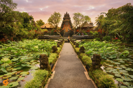
Sacred Monkey Forest Sanctuary
The Sacred Monkey Forest Sanctuary in Ubud serves as a living classroom where visitors can observe the intricate relationship between Balinese spirituality, wildlife conservation, and community management. This 12.5-hectare sanctuary houses approximately 700 Balinese long-tailed macaques across three separate troops, each with distinct territories and social hierarchies.
Understanding this location requires grasping the concept of “Tri Hita Karana,” the fundamental Balinese philosophy that emphasizes harmony between humans, nature, and the spiritual realm. The sanctuary contains three ancient Hindu temples dating back to the 14th century: Pura Dalem Agung, Pura Beji, and Pura Prajapati. These temples remain active places of worship, where local communities conduct ceremonies while the monkeys roam freely.
The forest itself represents a rare example of primary rainforest within an urban area. It contains over 186 tree species, many of which are used in traditional Balinese medicine and religious ceremonies. The giant banyan trees, some over 400 years old, create a cathedral-like canopy that provides both spiritual atmosphere and scientific value. Researchers study the macaque populations here to understand primate behavior and social structures.
Visitors learn about wildlife conservation through direct observation. The sanctuary operates without cages or barriers, relying instead on natural boundaries and careful management. Local staff, trained in both monkey behavior and Hindu traditions, guide visitors while ensuring both human safety and animal welfare. This model demonstrates how community-based conservation can generate income while protecting biodiversity.
Address & Location Details
- Jl. Monkey Forest, Ubud, Kecamatan Ubud, Kabupaten Gianyar, Bali 80571, Indonesia
- Also known as Jalan Wenara Wana in some references
- Located on the southern border of Ubud town around 3 kms south of central town
- About 2 kilometres away from Ubud town center
- It’s so close to town that some people opt to walk there
Opening Hours
- Daily operations (specific hours vary by season – check official website)
- Open 7 days a week throughout the year
- Typically operates during daylight hours
- Best visited during morning or late afternoon for optimal lighting and monkey activity
Transportation Options by Type
Walking from Ubud Center
- The entrance of the sanctuary at the end of Monkey Forest Road is a 10 to 15 minutes walk from Ubud town centre
- Easy walking route along Monkey Forest Road (Jalan Monkey Forest)
- Well-paved pathway suitable for most fitness levels
- Scenic walk through local shops and cafes
Free Shuttle Bus Service
- Free shuttles to get here and back drive a loop around central Ubud every 15 minutes
- Frequent shuttle buses are ferrying back and forth from the centre of Ubud every 15-30 minutes
- Stopping on JI Raya Ubud, JI Hanoman and on Money Forest Rd – look for the lime-green buses
- Convenient pickup points throughout central Ubud
Scooter/Motorcycle Rental
- Renting two-wheelers is a popular practice in Bali
- Multiple rental shops throughout Ubud center
- Easy parking available near the sanctuary entrance
- Popular choice for exploring multiple Ubud attractions
Transportation from Major Bali Areas
From Ngurah Rai International Airport
- If you depart from Ngurah Rai international airport heading to the Ubud monkey forest location, then it will take around 1 hour, and 15 minutes, with a distance of about 36 kilometers
- Private taxi or pre-arranged transfer recommended
- Airport shuttle services available through hotels
From Kuta/Seminyak Area
- Distance: approximately 35-40 kilometers
- Travel time: 60-75 minutes depending on traffic
- Private driver or taxi service recommended
- Multiple scenic route options through rice terraces
From Sanur
- Distance: approximately 25-30 kilometers
- Travel time: 45-60 minutes
- Regular taxi and ride-hailing services available
- Shorter route through Denpasar or scenic back roads
From Canggu
- Distance: approximately 30-35 kilometers
- Travel time: 50-70 minutes
- Private transportation recommended due to limited public options
- Beautiful countryside views along the route
Nearby Transportation Hubs & Stations
- Ubud Central Market area – main transportation hub
- Jalan Raya Ubud – primary road with regular transport services
- Ubud Traditional Market parking area
- Major hotel pickup points along main roads
- Peliatan area – neighboring village with transport connections
Parking Facilities
- On-site parking available at the sanctuary entrance
- Motorcycle parking areas with attendants
- Car parking spaces (limited capacity during peak times)
- Street parking available along Monkey Forest Road
- Nearby restaurant and shop parking (with purchases)
- Secure parking with nominal fees through local attendants
Transportation Companies & Service Providers
- Ride-Hailing: Gojek, Grab Indonesia
- Local Taxi Services: Ubud taxi cooperatives, hotel partnerships
- Tour Operators: Bali Golden Tour, local Ubud tour guides
- Bike/Scooter Rental: Multiple shops along Jalan Raya Ubud
- Private Drivers: Bookable through hotels and guesthouses
- Shuttle Services: Hotel partnerships and local operators
Nearby Attractions Within Walking Distance
- Ubud Traditional Market – 10-15 minutes walk
- Saraswati Temple – 15 minutes walk
- Various art galleries and studios along Monkey Forest Road
- Local restaurants and cafes lining the route
- Handicraft shops and souvenir stores
- Yoga studios and wellness centers
- Goa Gajah (Elephant Cave) – short drive/ride away
Tegalalang Rice Terrace

Tegalalang Rice Terrace represents a masterpiece of agricultural engineering that has sustained Balinese civilization for over a thousand years. These cascading emerald terraces stretch across steep hillsides north of Ubud, creating a landscape so stunning it appears almost artificial. However, every curve and level serves specific agricultural and hydraulic purposes developed through centuries of trial and refinement.
The terraces operate through the “subak” system, a cooperative irrigation method recognized by UNESCO as a World Heritage practice. This system demonstrates sophisticated water management, where mountain springs feed the highest terraces, and water flows systematically through each level, ensuring every rice field receives adequate irrigation. Farmers coordinate planting and harvesting schedules to optimize water usage and prevent pest outbreaks.
Understanding Tegalalang requires appreciating both its practical and spiritual dimensions. Rice cultivation in Bali isn’t merely agriculture – it’s a sacred practice honoring Dewi Sri, the rice goddess. The agricultural calendar aligns with religious ceremonies, creating a rhythm of life that has sustained communities for generations. Farmers perform blessing ceremonies at each stage of cultivation, from planting to harvest.
The tourism dimension of Tegalalang has evolved carefully. Visitors can walk along designated paths through the terraces, observing farming techniques while learning about sustainable agriculture. Local cafes offer panoramic views while serving traditional Balinese cuisine, creating economic opportunities for farming families. Some farmers offer hands-on experiences, teaching visitors to plant rice or explaining the intricate water management systems. This approach allows tourism revenue to support traditional agriculture rather than replace it.
Ubud
Ubud functions as Bali’s cultural and spiritual epicenter, a town that has evolved from a traditional royal seat into an international destination for arts, wellness, and authentic cultural experiences. The name “Ubud” derives from the Balinese word “ubad,” meaning medicine, reflecting the town’s historical role as a center for traditional healing and spiritual practices.
The town’s transformation began in the 1930s when European artists like Walter Spies and Rudolf Bonnet settled here, establishing art movements that blended Western techniques with traditional Balinese themes. This cultural fusion created Ubud’s distinctive character – a place where ancient traditions coexist with contemporary artistic expression. Today, the town hosts numerous art galleries, museums, and cultural performances, making it a living showcase of Balinese creativity.
Ubud’s appeal extends beyond visual arts to encompass wellness and spiritual tourism. The town has become a global center for yoga, meditation, and holistic healing practices. Numerous retreat centers offer programs combining traditional Balinese healing methods with contemporary wellness approaches. The surrounding landscape of rice fields, river valleys, and tropical forests provides an ideal setting for reflection and renewal.
The town’s economic model demonstrates sustainable cultural tourism. Local families operate homestays, traditional restaurants, and craft workshops, ensuring tourism benefits reach community members rather than external corporations. The surrounding villages specialize in specific crafts – Mas village for wood carving, Celuk for silver jewelry, and Batuan for traditional painting. This specialization preserves traditional skills while creating diverse income streams.
Ubud’s food scene reflects this cultural synthesis. Traditional warungs serve authentic Balinese cuisine alongside restaurants offering international fusion dishes using local ingredients. The famous Ubud Market provides fresh produce, spices, and handcrafted items, creating a sensory experience that connects visitors with local daily life.
Location & Administrative Details
- Ubud is located in Gianyar Regency, central Bali, Indonesia
- Administrative address: Ubud, Kecamatan Ubud, Kabupaten Gianyar, Bali, Indonesia
- Positioned approximately 36 kilometers northeast of Ngurah Rai International Airport
- Situated in the uplands of Bali at elevation of about 600 meters above sea level
- Ubud Bali is often described as the cultural heart of Bali
- Central area encompasses Jalan Raya Ubud (main road) and surrounding villages
Operating Hours (Town Access)
- Ubud town is accessible 24/7 as a residential and tourist area
- Most attractions and businesses operate during daylight hours (typically 8:00 AM – 6:00 PM)
- Restaurants and cafes often stay open until 10:00 PM or later
- Some temples have specific visiting hours (usually dawn to dusk)
- Markets typically open early morning (6:00 AM) and close by late afternoon
Public Bus System
- You’ll need to take the K2B bus from the airport and change at Gor Ngurah Rai station onto the K4B which continues to central Ubud
- Stops include the Monkey Forest or Ubud Palace
- The first bus leaves the airport at 6am with regular buses until 7:50pm
- There’s an app with live tracking
- Transfer required at Gor Ngurah Rai station
Kura-Kura Bus Service
- Although there’s no direct bus from Bali Airport to Ubud, a popular choice for travelers on a budget is to transfer to Kuta and catch the direct Kura-Kura shuttle bus to Ubud
- The Kura-Kura Bus is a shuttle service that connects major tourist areas like Seminyak, Kuta, Legian, Nusa Dua, and Ubud
- You can reach Lippo Mall in Kuta on foot, which takes around 15 minutes, or by taxi
- Multiple daily departures from various pickup points
Transportation from Major Bali Areas
From Kuta/Seminyak/Legian
- Distance: 25-30 kilometers from Kuta area
- Travel time: 45-75 minutes depending on traffic and route
- Kura-Kura Bus direct service available
- Multiple taxi and ride-hailing options
- Private driver services recommended for comfort
From Sanur
- Distance: approximately 20-25 kilometers
- Travel time: 35-50 minutes via inland routes
- Taxi services readily available
- Scenic route through traditional villages
- Less traffic congestion compared to southern routes
From Canggu
- Distance: 30-35 kilometers
- Travel time: 50-70 minutes
- Route passes through rice terraces and rural areas
- Private transportation recommended
- Limited public transport options
From Nusa Dua
- Distance: 35-40 kilometers
- Travel time: 60-80 minutes
- Bypass road options available to avoid central Denpasar
- Hotel shuttle services often available
- Kura-Kura Bus connections possible
Local Transportation Within Ubud
Scooter/Motorcycle Rental
- There are basically only two ways to get around Ubud, renting a scooter and taxis
- Multiple rental shops throughout central Ubud
- Popular choice for exploring surrounding attractions
- Parking available at most destinations
- International driving license required
Taxi Services
- There are both car taxis and motorbike taxis in Ubud and they can both be booked via Grab
- Traditional taxi services available through hotels
- Local taxi cooperatives operate throughout the area
- Negotiated fare system common for longer distances
Ride-Hailing Apps
- they can both be booked via Grab, which is an app similar to Uber
- Gojek services available (motorcycle and car options)
- Both apps offer real-time tracking and upfront pricing
- Popular for short to medium distance travel within and around Ubud
Transportation Hubs & Key Stations
Central Ubud Transportation Points
- Ubud Central Market area (Pasar Ubud) – main gathering point for local transport
- Jalan Raya Ubud – primary road with regular bus stops
- Ubud Palace area – central landmark and pickup point
- Monkey Forest Road junction – popular tourist area transport hub
Bus Stations & Stops
- Gor Ngurah Rai station – major transfer point for public buses
- Various Kura-Kura Bus stops throughout central Ubud
- Local bemo (minivan) stops along main roads
- Hotel pickup points coordinated through accommodations
Parking Facilities Throughout Ubud
Central Ubud Parking
- Public parking areas near Ubud Traditional Market
- Street parking available along Jalan Raya Ubud (with fees)
- Private parking lots operated by local businesses
- Motorcycle parking areas with attendant services
Attraction-Specific Parking
- Parking available at major temples (Saraswati Temple, etc.)
- Rice terrace viewing areas provide parking facilities
- Art galleries and studios offer customer parking
- Restaurant and cafe parking (often free with purchases)
Hotel & Accommodation Parking
- Most hotels and guesthouses provide free parking for guests
- Secure parking areas with 24-hour supervision
- Valet parking services at upscale resorts
- Street parking guidance provided by accommodation staff
Major Nearby Attractions Accessible from Ubud
Within Walking Distance of Central Ubud
- Ubud Traditional Market (Pasar Ubud)
- Ubud Royal Palace (Puri Saren Agung)
- Saraswati Temple
- Sacred Monkey Forest Sanctuary
- Various art galleries along Monkey Forest Road
- Campuhan Ridge Walk starting point
Short Drive/Ride from Ubud Center (5-15 minutes)
- Tegallalang Rice Terraces
- Goa Gajah (Elephant Cave)
- Petulu White Heron Sanctuary
- Various traditional villages (Mas, Peliatan)
- Art workshops and traditional craft centers
Day Trip Distances (30-60 minutes)
- Mount Batur sunrise trekking departure points
- Tirta Empul Temple (Holy Spring Water Temple)
- Gunung Kawi Temple complex
- Sekumpul Waterfall
- Traditional pottery villages (Pejeng)
Bali Zoo

Bali Zoo represents a modern approach to wildlife conservation and education, spanning 22 hectares in the Gianyar regency. Unlike traditional zoos that primarily display animals, Bali Zoo focuses on interactive experiences that educate visitors about wildlife conservation while providing close encounters with over 500 animals representing 60 species.
The zoo’s design philosophy emphasizes natural habitats and species-appropriate environments. Animals live in spacious enclosures that replicate their natural surroundings, allowing them to exhibit normal behaviors. The Sumatran tigers, for instance, have a large territory with pools, caves, and dense vegetation, while the orangutans inhabit elevated platforms that mimic their arboreal lifestyle.
Educational programs form the zoo’s core mission. The facility offers night safaris where visitors can observe nocturnal animal behaviors, breakfast programs with orangutans that teach about primate intelligence and conservation challenges, and elephant rides that educate about Asian elephant ecology and threats. These programs generate emotional connections between visitors and wildlife, fostering conservation awareness.
The zoo contributes to regional conservation through breeding programs for endangered Indonesian species. Their successful breeding of Balinese starlings, nearly extinct in the wild, demonstrates how zoos can support species recovery. The facility also rehabilitates injured wildlife and educates local communities about human-wildlife conflict resolution.
Location and Address
Bali Zoo is located at Jl. Raya Singapadu, Sukawati 80582, Gianyar Regency, Bali, Indonesia. The zoo sits in the village of Singapadu within the Sukawati district, making it easily accessible from several major tourist areas in Bali.
Opening Hours
The zoo operates daily from 9:00 AM to 5:00 PM, seven days a week. However, the last check-in is at 4:00 PM, so visitors should plan to arrive well before closing time. The zoo is closed on Nyepi Day, the Hindu day of silence, and hours may vary on public holidays.
For those interested in special experiences, the zoo also offers “Night at the Zoo” activities from 6:00 PM to 9:00 PM, which provides a different perspective on the animals’ behavior during evening hours.
Parking Facilities
The zoo provides on-site parking facilities for visitors arriving by private vehicle, scooter, or motorcycle. The parking area is conveniently located near the main entrance, making it easy to access the zoo after arriving.
Nearby Attractions
Being located in the cultural heart of Bali, the zoo is surrounded by numerous attractions that make for excellent day-trip combinations:
Cultural Sites
The area around Sukawati is rich in traditional Balinese culture, with several temples, art villages, and cultural centers within a short distance. The proximity to Ubud means visitors can easily combine their zoo visit with exploration of Bali’s artistic and spiritual center.
Natural Attractions
The Gianyar Regency offers various natural attractions including rice terraces, waterfalls, and traditional villages that showcase authentic Balinese rural life.
Artisan Villages
Sukawati and surrounding areas are known for traditional crafts, including wood carving, silver jewelry making, and traditional painting. Many artisan workshops welcome visitors to observe the creative process.
What to Expect at the Zoo
Bali Zoo spans 22 acres of lush landscaped gardens and houses over 400 animals. The facility focuses on conservation and education while providing interactive experiences for visitors of all ages.
Special Programs
The zoo offers various special programs including breakfast with orangutans, elephant encounters, and educational shows. Activities included in the admission ticket are playing in the Jungle Splash Waterplay, Animal Encounters & Shows, and Insurance.
Nusa Penida Island
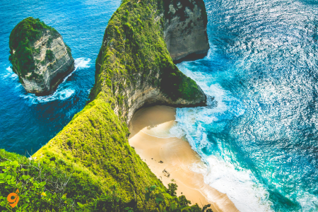
Nusa Penida represents Bali’s final frontier for adventure tourism, an island that remained relatively isolated until recent years due to rough seas and limited infrastructure. This 200-square-kilometer island southeast of Bali offers some of Indonesia’s most dramatic coastal scenery and pristine marine environments.
The island’s tourism boom began around 2015 when social media images of locations like Kelingking Beach went viral. Kelingking’s T-Rex-shaped cliff formation and pristine white sand beach create one of the world’s most photographed coastal scenes. However, accessing these locations requires physical fitness and courage – the trail to Kelingking Beach involves a steep, sometimes dangerous descent down unstable cliff faces.
Nusa Penida’s marine environment rivals any in Southeast Asia. The waters surrounding the island serve as a cleaning station for oceanic manta rays, creating reliable opportunities for divers and snorkelers to encounter these gentle giants. The island sits in the heart of the Coral Triangle, supporting exceptional marine biodiversity including the rare mola mola (ocean sunfish) during certain seasons.
The island’s rapid tourism development presents both opportunities and challenges. Local communities have gained new income sources through homestays, boat services, and guiding, but infrastructure hasn’t kept pace with visitor numbers. Roads remain rough, waste management systems are overwhelmed, and some pristine locations show signs of environmental stress. This situation offers lessons about managing tourism growth in fragile environments.
Understanding Nusa Penida requires recognizing it as a place in transition. Traditional seaweed farming communities are adapting to tourism economies, while trying to preserve their cultural identity and natural environment. Visitors who approach the island with respect for local customs and environmental sensitivity contribute to sustainable development models.
Primary Transportation Methods
Fast Boat Services – The most popular and convenient option for reaching Nusa Penida. These speedboats operate throughout the day with multiple departure times and provide the quickest journey across the Badung Strait.
Traditional Ferry (RORO Ferry) – The ferry boat called Roro crosses from Padang Bai to Nusa Penida twice daily, at 10 am and 2 pm, except on Sundays when only the 10 am ferry operates, taking around 90 minutes but often running late.
Charter Boats – Private boat services available for groups or custom schedules, though more expensive than regular services.
Departure Points from Bali
Sanur Harbor (Most Popular)
- Location: Sanur Beach area, southeastern Bali
- Operating Hours: Ferry services run every half hour throughout the day and sometimes even more frequently
- Journey Time: Average sailing time by ferry from Bali to Nusa Penida is 42 minutes
- Schedule Range: Earliest ferries typically depart from Kusamba at 06:30 in the morning, with last scheduled trips usually departing at 17:00
Serangan Harbor
- Location: Serangan Island (connected to mainland Bali by bridge)
- Special Services: Fast boat operations on Mondays and Fridays at 10:30AM via Lembongan to Nusa Penida Island, taking only one hour to arrive at Buyuk harbor Penida
- Check-in Requirement: Check-in is 30 minutes before departure
Padang Bai Harbor
- Location: Eastern Bali coast
- Ferry Service: Traditional RORO ferry service
- Operating Schedule: Two services each day from Padang Bai that run in the late afternoon via Eka Jaya Fast Boat service
Kusamba Harbor
- Location: Eastern Bali coast
- Service Type: Local ferry services
- Early Departures: Primary departure point for early morning services
Arrival Points on Nusa Penida
Sampalan Harbor (Main Port)
- Location: Northern coast of Nusa Penida
- Facilities: Complete range of facilities, including parking lot, information center, restrooms, and food, beverage, and souvenir vending kiosks
- Primary arrival point for most ferry services
Buyuk Harbor
- Location: Northern Nusa Penida
- Facilities: Complete range of facilities, including parking lot, information center, restrooms, and food, beverage, and souvenir vending kiosks
- Specialization: Fast boat services, particularly from Serangan
Banjar Nyuh Harbor
- Location: Northwestern Nusa Penida
- Services: Alternative arrival point for some ferry routes
- Facilities: Full harbor amenities similar to other ports
Parking Facilities at Departure Points
Sanur Area
- Beach parking areas – Multiple parking zones along Sanur Beach near boat departure points
- Hotel parking – Many nearby hotels offer parking for boat passengers
- Street parking – Available but limited during peak hours
Serangan Harbor
- Dedicated harbor parking – On-site parking facilities at the harbor complex
- Motorcycle parking – Separate areas for scooter parking
Padang Bai
- Ferry terminal parking – Official parking area at the ferry terminal
- Nearby commercial parking – Additional parking options in the town
Transportation Companies and Operators
Major Fast Boat Operators
- Eka Jaya Fast Boat – Regular services from multiple departure points
- Crown Fast Cruises – Premium fast boat services
- Wahana Gili Ocean – Multi-route operator
- Starfish Fast Boat – Popular with tourists
- D’Camel Fast Ferry – Reliable daily services
- Marina Srikandi – Established operator
- Semaya One Fast Cruise – Modern fleet services
Traditional Ferry Services
- RORO Ferry Service – Government-operated traditional ferry from Padang Bai
Getting to Departure Points from Major Tourist Areas
From Denpasar Airport (Ngurah Rai)
- Taxi services – Direct taxi to any harbor (45-90 minutes depending on destination)
- Ride-sharing apps – Grab and Gojek available
- Private transfers – Pre-arranged airport transfers
From Ubud
- Private driver – Most convenient option (45-60 minutes to Sanur)
- Tourist shuttle – Shared transportation services
- Motorbike rental – For experienced riders
From Kuta/Seminyak
- Taxi/ride-sharing – 30-45 minutes to Sanur Harbor
- Hotel transfers – Many hotels arrange transportation
- Public transport – Trans Metro Dewata bus connections available
From Canggu
- Private transport – Direct drive to harbors (45-75 minutes)
- Organized tours – Many include transportation and boat tickets
Public Transportation to Harbors
Trans Metro Dewata Bus
- Route to Serangan: Take Trans Metro Dewata bus Corridor 5, stop at Serangan 1 Shelter/Halte, then walk to reach the port
- Operating hours – Regular schedule throughout the day
- Connection points – Multiple stops connecting major tourist areas
Local Bemo (Minibus)
- Traditional local transport – Connects various points to harbor areas
- More time-consuming but authentic local experience
- Irregular schedules – Best for flexible travelers
Nearby Attractions to Departure Points
Around Sanur Harbor
- Sanur Beach – Calm waters perfect for swimming and sunrise viewing
- Sanur Night Market – Local food and shopping experience
- Traditional fishing villages – Cultural experiences nearby
- Batu Jimbar Cafe – Popular pre-departure dining spot
Near Serangan Harbor
- Serangan Turtle Conservation – Sea turtle breeding and conservation center
- Traditional salt farming – Local salt production areas
- Serangan Beach – Quieter beach experience
- Local seafood restaurants – Fresh catch dining options
Around Padang Bai
- Padang Bai Beach – Beautiful white sand beach
- Blue Lagoon Beach – Excellent snorkeling spot
- Virgin Beach (Bias Tugel) – Hidden gem beach nearby
- Traditional markets – Local shopping and food experiences
Amed
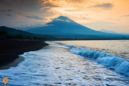
Amed represents Bali’s traditional fishing village culture preserved within a growing eco-tourism destination. Located on Bali’s northeastern coast beneath the imposing Mount Agung volcano, Amed actually encompasses several small fishing villages stretched along eight kilometers of dramatic black sand coastline.
The area’s primary appeal lies in its authentic local atmosphere and exceptional diving opportunities. Unlike Bali’s developed southern beaches, Amed maintains its traditional character with colorful outrigger fishing boats, salt farming operations, and village life centered around fishing cycles. Visitors can observe traditional salt harvesting, where seawater evaporates in geometric patterns of shallow pools, creating crystalline deposits harvested by local families.
Amed’s underwater environment rivals world-famous diving destinations while remaining relatively uncrowded. The USAT Liberty shipwreck at nearby Tulamben attracts divers globally – this World War II cargo ship, sunk by a Japanese torpedo and later pushed onto the beach by Mount Agung’s 1963 eruption, now serves as an artificial reef supporting incredible marine biodiversity. The wreck sits in shallow water just meters from shore, making it accessible to both beginning and advanced divers.
The volcanic coastline creates diverse diving environments within short distances. House reefs directly in front of beachside accommodations offer excellent snorkeling and diving, while nearby sites feature dramatic drop-offs, coral gardens, and pelagic species encounters. The area’s volcanic activity creates unique underwater topography with black sand slopes, coral outcrops, and occasional underwater volcanic vents.
Amed’s tourism development follows sustainable models emphasizing community involvement and environmental protection. Local fishing families operate homestays and restaurants, ensuring tourism revenue supports traditional livelihoods rather than replacing them. Many accommodations source ingredients from local farmers and fishermen, creating economic linkages that strengthen community resilience.
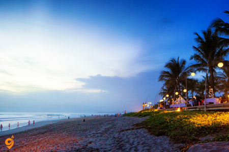
Canggu
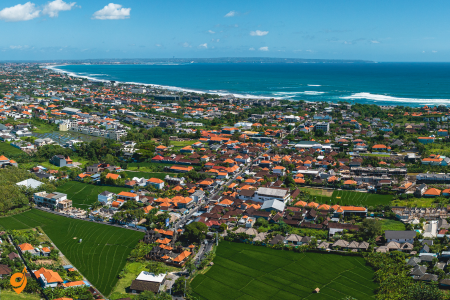
Canggu has transformed from a quiet rice farming area into Bali’s trendy surf and digital nomad capital, representing how modern tourism can completely reshape local landscapes and communities. This rapid transformation offers insights into both the opportunities and challenges of tourism-driven development.
The area’s appeal centers on its world-class surf breaks, which attract surfers from beginner to professional levels. Echo Beach, Batu Bolong, and Pererenan offer different wave characteristics suitable for various skill levels, while the consistent swell and warm water create ideal surfing conditions year-round. Surf schools and board rental shops provide easy access for beginners, while experienced surfers can test their skills on more challenging breaks.
Beyond surfing, Canggu has become a hub for digital nomads and remote workers attracted by reliable internet, affordable living costs, and a vibrant international community. Co-working spaces, cafes with strong wifi, and accommodation options from budget hostels to luxury villas create an ecosystem supporting location-independent professionals. This demographic has influenced local business development, with establishments catering to health-conscious, internationally-minded visitors.
The area’s dramatic transformation illustrates both positive and negative aspects of rapid tourism growth. Former rice fields have been converted to villas, cafes, and surf shops, creating employment opportunities but also displacing traditional agriculture. Traffic congestion, waste management challenges, and rising land prices affect local communities who may benefit from tourism jobs while losing access to affordable housing and traditional livelihoods.
Canggu’s beach clubs and restaurant scene reflect this international influence. Establishments offer everything from traditional Indonesian cuisine to international fusion dishes, smoothie bowls, and specialty coffee. The nightlife ranges from relaxed beach bars to energetic clubs, creating entertainment options for diverse preferences.
Seminyak
Seminyak represents Bali’s most sophisticated beach destination, where international luxury meets tropical paradise in a carefully curated experience. This upscale area has evolved into Southeast Asia’s premier beach resort destination, setting standards for tropical luxury that influence tourism development across the region.
The area’s foundation rests on its spectacular beaches with golden sand stretching for kilometers, consistent surf suitable for all levels, and stunning sunsets that create daily spectacles. Unlike Bali’s busier beach areas, Seminyak maintains a more refined atmosphere with upscale beach clubs, luxury resorts, and high-end shopping that attracts affluent travelers seeking premium experiences.
Seminyak’s culinary scene rivals major international destinations, featuring award-winning restaurants helmed by celebrity chefs alongside innovative local establishments. The area offers everything from traditional Indonesian fine dining to contemporary fusion cuisine, rooftop bars with panoramic views, and beachfront restaurants where diners can enjoy gourmet meals with sand between their toes. This culinary sophistication has elevated Bali’s gastronomic reputation globally.
The shopping experience in Seminyak combines international luxury brands with local designer boutiques and artisan workshops. Visitors can find everything from haute couture to handcrafted jewelry, contemporary art, and unique home decor items. The area’s design aesthetic blends modern minimalism with traditional Balinese elements, creating a distinctive style that influences resort and residential design throughout Southeast Asia.
Seminyak’s accommodation options range from intimate boutique hotels to expansive luxury resorts, each designed to provide privacy and personalized service. Many properties feature private villas with pools, spa services, and butler service, creating resort experiences that compete with any luxury destination globally. The area’s spa culture incorporates traditional Balinese healing practices with contemporary wellness trends, offering treatments that restore both body and spirit.
Borobudur Temple
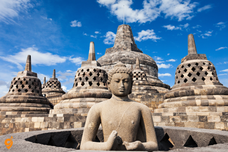
Borobudur stands as one of the world’s most magnificent Buddhist monuments, built in the 8th and 9th centuries during the Sailendra Dynasty. This massive stone structure functions as both a temple and a three-dimensional mandala, representing the Buddhist cosmology. The temple consists of nine stacked platforms topped by a central dome, surrounded by 2,672 relief panels and 504 Buddha statues.
When you visit, you’ll climb through three levels representing the Buddhist path to enlightenment: Kamadhatu (the world of desire), Rupadhatu (the world of forms), and Arupadhatu (the formless world). The best time to visit is during sunrise, when golden light illuminates the temple and surrounding countryside. Plan to spend 2-3 hours exploring the intricate stone carvings that tell stories from Buddhist texts. The temple is located about 40 kilometers northwest of Yogyakarta, and you’ll need to purchase tickets in advance, especially for sunrise viewing.
Understanding Borobudur’s Location Borobudur Temple sits in Magelang Regency, Central Java, approximately 40 kilometers northwest of Yogyakarta city center. The temple complex is located in Borobudur village, making it accessible through various transportation methods that I’ll explain step by step.
Temple Address and Operating Information
Borobudur Temple is located at Jl. Badrawati, Kw. Candi Borobudur, Borobudur, Magelang, Central Java 56553, Indonesia. The temple complex opens daily from 6:00 AM to 5:00 PM, with the last entry typically allowed one hour before closing time. During special occasions or cultural events, operating hours may be extended.
Transportation Options from Yogyakarta
By Bus (Most Budget-Friendly Option) You can take the Trans Jogja bus system, specifically the 2A route that connects to regional buses heading toward Borobudur. The main departure point is Jombor Bus Terminal in northern Yogyakarta. From Jombor, you’ll board buses operated by companies like Armada Jaya or other local operators that run regular services to Borobudur. The journey typically involves transferring at Muntilan before reaching the temple complex.
By Tourist Bus and Shuttle Services Several companies operate direct tourist buses from Yogyakarta to Borobudur, including DAM Transport, Taman Sari Royal Heritage Spa, and various hotel shuttle services. These buses typically depart from Malioboro Street area, major hotels, or designated pickup points throughout the city. The advantage here is door-to-door convenience without transfers.
By Private Car or Rental Vehicle This offers maximum flexibility for your visit. You’ll drive northwest from Yogyakarta via Jalan Magelang (Route 15), passing through Muntilan before reaching Borobudur. The route is well-signposted and relatively straightforward, following the main arterial road that connects the two locations.
By Motorcycle or Scooter Many travelers rent motorcycles in Yogyakarta for the journey to Borobudur. The route follows the same path as cars, offering scenic views of Central Java’s countryside, rice paddies, and small villages along the way.
By Organized Tour Numerous tour operators in Yogyakarta offer day trips to Borobudur, often combined with visits to nearby attractions. These tours typically include transportation, guide services, and sometimes meals, departing from hotels or central meeting points.
Key Transportation Hubs and Stations
Jombor Bus Terminal serves as the primary departure point for public buses heading toward Borobudur. Located in northern Yogyakarta, this terminal connects regional bus services throughout Central Java.
Yogyakarta Railway Station (Tugu Station) doesn’t directly serve Borobudur, but you can arrange onward transportation from here if arriving by train from other cities.
Adisutcipto International Airport offers car rental services and taxi connections for those flying into Yogyakarta specifically to visit Borobudur.
Parking Facilities at Borobudur
The temple complex provides several parking areas to accommodate different vehicle types.
Car parking areas are located near the main entrance, with multiple lots available during peak seasons.
Motorcycle parking is designated in separate areas closer to the entrance gates.
Bus parking serves tour groups and public transportation, situated in a dedicated zone that doesn’t interfere with private vehicle access.
Nearby Attractions Worth Exploring
- Mendut Temple sits approximately 3 kilometers from Borobudur, featuring a single large chamber with impressive Buddha statues.
- Pawon Temple lies between Borobudur and Mendut, completing what archaeologists call the “three temple complex” representing the Buddhist path to enlightenment.
- Borobudur Museum provides essential historical context about the temple’s construction, restoration, and cultural significance.
- Svargabumi Borobudur offers cultural performances and traditional Javanese experiences.
- Chicken Church (Gereja Ayam) has become a popular photography destination despite being an abandoned building with unique architecture.
Transportation Companies and Services
- Public bus services include Armada Jaya, Sumber Alam, and other regional operators connecting Yogyakarta to Magelang regency.
- Tourist shuttle services are provided by companies like Borobudur Shuttle, various hotel partnerships, and independent tour operators.
- Car rental companies such as Trac Astra, Bluebrid, and local Yogyakarta rental services offer vehicles for self-drive options.
- Ride-hailing services like Gojek and Grab operate in Yogyakarta and can arrange trips to Borobudur, though availability may vary depending on driver willingness for longer distances.
Kraton (Sultan’s Palace)
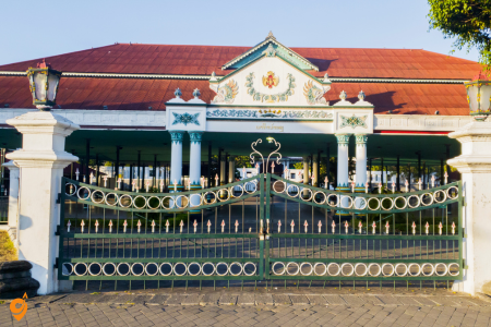
The Kraton serves as the living heart of Javanese culture and the official residence of the Sultan of Yogyakarta. Built in 1756, this vast palace complex represents traditional Javanese architecture and philosophy. Unlike typical tourist attractions, the Kraton remains a functioning palace where the current Sultan, Hamengkubuwono X, still resides.
As you explore the complex, you’ll discover pavilions, courtyards, and museums that showcase royal artifacts, traditional batik, and ceremonial objects. The architecture follows Javanese cosmological principles, with each building positioned according to spiritual significance. You can witness traditional court performances, including gamelan music and classical Javanese dance. The palace operates on specific visiting hours, typically morning and afternoon sessions, and you should dress modestly out of respect for this sacred space.
Understanding Kraton’s Strategic Location
Kraton Yogyakarta sits at the heart of Yogyakarta’s cultural district, making it one of the most accessible heritage sites in the city. Located on Jalan Rotowijayan, the palace complex occupies a central position that connects seamlessly with Malioboro Street, the city’s main thoroughfare, and the traditional Taman Sari water castle complex.
Official Address and Contact Information
Complete Address: Kraton Yogyakarta, Jalan Rotowijayan No. 1, Panembahan, Kraton, Yogyakarta Special Region 55131, Indonesia
Postal Code: 55131
Administrative District: Kraton Subdistrict, Yogyakarta City
Operating Hours and Visiting Information
Regular Operating Schedule
Kraton Yogyakarta opens daily from 8:30 AM to 2:00 PM, with the last entry typically allowed 30 minutes before closing time. The palace maintains consistent hours throughout the week, though special events or ceremonies may occasionally affect regular visiting schedules.
Special Event Considerations
During important Javanese cultural ceremonies, royal celebrations, or national holidays, operating hours may be modified or certain areas may be restricted to accommodate ceremonial activities. These events often provide unique cultural experiences but may require advance planning.
Transportation Methods to Reach Kraton
Public Bus Transportation
Trans Jogja, Yogyakarta’s bus rapid transit system, provides excellent access to Kraton through multiple routes. Route 1A and 1B serve the Malioboro corridor, with stops at Malioboro Mall and Titik Nol Kilometer, both within easy walking distance of the palace. Route 2A connects from Jombor Terminal and passes through central areas before reaching stops near the palace complex.
Traditional Becak (Cycle Rickshaw) Experience
Becak represents the quintessential Yogyakarta transportation experience, offering a leisurely and culturally authentic journey to Kraton. These three-wheeled cycle rickshaws operate throughout the city center, particularly concentrated around Malioboro Street, Tugu Railway Station, and major hotels. The becak ride to Kraton provides opportunities to observe street life while supporting traditional livelihoods.
Andong (Horse-Drawn Cart) Heritage Transport
Andong offers another traditional transportation option that reflects Yogyakarta’s commitment to preserving cultural heritage. These horse-drawn carts operate primarily in the central cultural district, providing scenic routes that pass through areas of historical significance before reaching the palace complex.
Modern Ride-Sharing Services
Gojek and Grab motorcycle taxis provide quick and convenient access to Kraton from any location in Yogyakarta. These services operate extensively throughout the city, offering both motorcycle and car options. The motorcycle service proves particularly efficient for navigating the sometimes narrow streets around the palace complex.
Private Vehicle Access
Driving to Kraton requires understanding the one-way traffic system that governs Yogyakarta’s city center. The approach typically involves entering the central area via Jalan Malioboro or alternative routes, then navigating to Jalan Rotowijayan where the palace entrance is located.
Transportation Hubs and Stations
Tugu Railway Station Connections
Yogyakarta’s main railway station sits approximately 2 kilometers north of Kraton, connected by Jalan Malioboro. From Tugu Station, visitors can walk, take becak, use Trans Jogja buses, or arrange ride-sharing services to reach the palace. The station serves as a major arrival point for visitors traveling from Jakarta, Surabaya, and other Indonesian cities.
Giwangan Bus Terminal Access
Located in southern Yogyakarta, Giwangan serves as the primary intercity bus terminal. From here, Trans Jogja Route 1A provides direct access to the city center and Kraton area. Alternative connections include taking local buses or arranging private transportation for the journey to the palace complex.
Parking Facilities Near Kraton
Designated Palace Parking Areas
The Kraton complex provides limited parking spaces for visitors arriving by private vehicle. These areas accommodate both motorcycles and cars, though space becomes constrained during peak visiting hours and cultural events. The parking areas are located near the main entrance gates, providing convenient access to the palace complex.
Alternative Parking Options
Several private parking facilities operate in the surrounding area, particularly along Jalan Malioboro and nearby streets. These include parking areas at shopping centers, hotels, and dedicated parking lots that serve the broader cultural district.
Street Parking Considerations
Limited street parking exists in the immediate vicinity of Kraton, though visitors should be aware of local parking regulations and time restrictions that may apply in different areas around the palace complex.
Nearby Attractions Within Walking Distance
Taman Sari Water Castle Complex
Located approximately 500 meters south of Kraton, Taman Sari represents the former royal bathing complex and recreational gardens. The underground passages and pools showcase sophisticated Javanese hydraulic engineering and provide insight into royal court life.
Malioboro Street Cultural Corridor
Extending northward from Kraton, Malioboro Street serves as Yogyakarta’s main cultural and commercial thoroughfare. The street features traditional shops, street food vendors, cultural performances, and colonial-era architecture that reflects the city’s diverse historical influences.
Alun-Alun Kidul (South Square)
The southern palace square provides a traditional Javanese urban space where visitors can experience local recreational activities, particularly the famous tradition of walking blindfolded between two banyan trees.
Sonobudoyo Museum
Located near the northern palace entrance, this ethnographic museum houses extensive collections of Javanese cultural artifacts, traditional weapons, textiles, and historical documents that complement the palace visit.
Vredeburg Fortress Museum
Situated along Malioboro Street, this Dutch colonial fortress has been converted into a museum focusing on Indonesian independence history and the role of Yogyakarta in the national struggle.
Malioboro Street
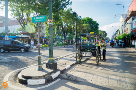
Malioboro represents Yogyakarta’s main thoroughfare and cultural spine, stretching from the railway station toward the Kraton. This pedestrian-friendly avenue embodies the city’s blend of tradition and modernity. During the day, the street bustles with becak (pedicabs), street vendors, and shoppers browsing batik stores, silver workshops, and traditional handicraft shops.
The evening transforms Malioboro into a vibrant cultural showcase. Street performers demonstrate traditional arts, food vendors serve local specialties like gudeg and bakpia, and the atmosphere becomes electric with activity. You’ll find everything from traditional Javanese snacks to contemporary Indonesian cuisine. The street serves as an excellent introduction to Yogyakarta’s culture, and walking its length gives you a comprehensive feel for the city’s rhythm and character.
Taman Sari Water Castle
Taman Sari was once an elaborate royal garden and bathing complex for the Kraton, built in the mid-18th century. This “water castle” combined recreation, meditation, and defense functions in a unique architectural complex. The site originally featured artificial lakes, bathing pools, meditation towers, and underground tunnels connecting to the main palace.
Today, you can explore the partially restored ruins that hint at the complex’s former grandeur. The main attractions include Sumur Gumuling (a circular structure used for meditation), the bathing pools where royal family members once relaxed, and Pulau Kenongo (an artificial island). The underground tunnels, though partially accessible, demonstrate the sophisticated engineering of Javanese architects. Visiting Taman Sari helps you understand the lifestyle and aesthetic preferences of Javanese royalty, and it’s best combined with a Kraton visit since they’re historically connected.
Location and Address Taman Sari Water Castle is located at Jl. Taman, Kraton, Kecamatan Kraton, Kota Yogyakarta, Daerah Istimewa Yogyakarta 55133, Indonesia.
This historic royal water palace sits right in the heart of Yogyakarta’s cultural district, making it easily accessible from various parts of the city.
Operating Hours The water castle welcomes visitors daily from 9:00 AM to 2:00 PM, giving you a five-hour window to explore this fascinating UNESCO World Heritage site. Keep in mind that these hours can occasionally change during special events or maintenance periods.
Local Transportation Methods
Trans Jogja Bus System
This is Yogyakarta’s efficient public bus network with dedicated lanes. Route 1A passes near the Kraton area, and you can get off at Kraton bus stop, which puts you within walking distance of Taman Sari. The buses run frequently throughout the day and connect major points across the city.
Becak (Traditional Rickshaw)
These colorful three-wheeled vehicles offer a uniquely Indonesian way to reach Taman Sari. You’ll find becak operators throughout Yogyakarta, particularly around tourist areas, hotels, and transportation hubs. This option gives you a cultural experience while getting to your destination.
Andong (Horse Cart)
For an even more traditional experience, horse-drawn carts operate in the Kraton area and can take you directly to Taman Sari. These are particularly popular with tourists and offer a leisurely pace perfect for sightseeing along the way.
Ojek (Motorcycle Taxi)
Both traditional ojek drivers and app-based services like Go-Jek and Grab operate throughout Yogyakarta. This is often the fastest way to navigate through the city’s sometimes congested streets, especially during peak hours.
Parking Facilities
Several parking areas serve visitors to Taman Sari. The main parking area is located along Jalan Taman, directly adjacent to the entrance. Additional parking spaces can be found along nearby streets within the Kraton complex.
Motorcycle parking is available closer to the entrance, while car parking might require a short walk to the site.
Nearby Attractions Walking Distance
Understanding the proximity of other attractions helps you plan an efficient sightseeing route.
- The Sultan’s Palace (Kraton Yogyakarta) sits literally next door to Taman Sari, sharing the same complex.
- Alun-Alun Kidul, the southern square with its famous twin banyan trees, is about 500 meters away.
- The Silver Workshop area, where you can watch traditional jewelry making, is within 300 meters.
- Tamansari Traditional Market offers local shopping experiences just 200 meters from the water castle.
Prambanan Temple
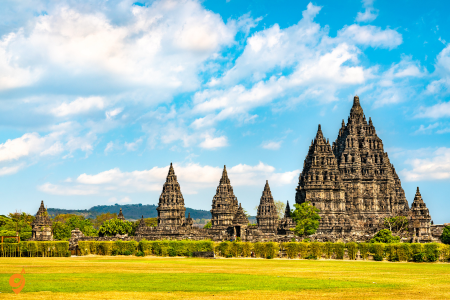
Prambanan stands as Indonesia’s largest Hindu temple complex, built in the 9th century during the Mataram Kingdom. This UNESCO World Heritage site consists of over 240 temple structures, though the main complex features eight primary temples dedicated to Hindu deities. The three largest temples honor Brahma, Vishnu, and Shiva, with Shiva’s temple reaching 47 meters in height.
The temple’s architecture represents classical Hindu temple design, with each structure pointing skyward to symbolize the connection between earth and heaven. The relief carvings around the temples tell the epic stories of Ramayana and Krishnayana. Unlike Borobudur’s meditative circular design, Prambanan’s angular towers create a more dramatic skyline. Visit in late afternoon to appreciate the golden hour lighting on the stone structures. The evening Ramayana ballet performances, held during dry season months, provide spectacular cultural entertainment with the illuminated temples as backdrop.
I’ll provide you with comprehensive guidance on reaching Prambanan Temple, one of Indonesia’s most magnificent Hindu temple complexes, by breaking down every transportation option and essential detail you’ll need for a successful visit.
Location and Address Details
Prambanan Temple stands majestically at Jalan Raya Solo-Yogyakarta KM 16, Kranggan, Bokoharjo, Prambanan District, Sleman Regency, Special Region of Yogyakarta 55571, Indonesia.
This UNESCO World Heritage site sits strategically along the main road connecting Yogyakarta and Solo, making it accessible from both major cities. The temple complex occupies a significant area, so you’ll easily spot the towering spires from the main road.
Operating Hours and Visit Planning
Prambanan Temple welcomes visitors daily from 6:00 AM to 5:00 PM, giving you an eleven-hour window to explore this architectural marvel. The extended hours allow for both sunrise and sunset visits, each offering dramatically different photographic opportunities and spiritual experiences. Early morning visits provide cooler temperatures and softer lighting, while late afternoon visits offer the famous golden hour illumination of the ancient stones.
Public Transportation
Trans Jogja Public Bus System
Route 1A operates along Jalan Solo, the main road leading directly to Prambanan Temple. You can board this route from various points in Yogyakarta city center, including stops near major hotels and tourist areas. The bus system uses dedicated lanes in many areas, making it reliable even during peak traffic hours. The Prambanan bus stop sits directly in front of the temple entrance, eliminating any walking distance from public transport.
Traditional Transportation Experiences
Yogyakarta offers unique traditional transportation methods that add cultural richness to your temple visit. Becak, the colorful three-wheeled rickshaws, operate throughout the region, though the distance to Prambanan makes this option more suitable for short connections rather than the full journey from city center. Andong horse carts provide another traditional experience, particularly popular for tours that combine multiple temple sites in the Prambanan area.
Modern Ride-Hailing Services
Contemporary transportation apps have revolutionized travel in Yogyakarta. Go-Jek and Grab operate comprehensive services including Go-Car and Grab Car for private vehicle transport, Go-Ride and Grab Bike for motorcycle transport, and even specialized tour packages. These services offer real-time tracking, upfront pricing, and the convenience of cashless payments. The apps work particularly well for temple visits because they can wait for you or arrange return pickups.
Motorcycle Transportation Options
Ojek, both traditional and app-based, provide fast and economical transport to Prambanan. Traditional ojek drivers often wait at transportation hubs, hotels, and popular tourist spots. They’re particularly useful during Yogyakarta’s traffic peak hours when motorcycles can navigate congested streets more efficiently than cars. Many ojek drivers familiar with tourist routes can provide informal commentary about sites you pass during the journey.
Private Vehicle and Rental Options
Car rental services operate from the airport, major hotels, and dedicated rental offices throughout Yogyakarta. Driving to Prambanan follows a straightforward route along Jalan Solo, making it suitable even for visitors unfamiliar with local roads. Traditional taxi services and private driver arrangements offer alternatives for those preferring not to drive themselves. Many hotels can arrange private drivers who combine transportation with guided commentary.
Parking Facilities and Management
Prambanan Temple provides extensive parking facilities to accommodate the high volume of visitors. The main parking area sits directly adjacent to the temple entrance, offering both car and motorcycle sections.
Additional overflow parking areas activate during peak tourist seasons or special events. Parking attendants help direct traffic and provide basic security for vehicles. The short walking distance from parking to the temple entrance makes this convenient for visitors carrying camera equipment or traveling with elderly family members.
Nearby Transportation Hubs
Several smaller transportation points near Prambanan can serve as intermediate stops or alternative access routes.
Prambanan village center, about 2 kilometers from the temple, offers local angkot (public minivans) connections to various directions. The nearby Prambanan railway halt, though primarily for local trains, can serve passengers coming from Solo or other points along the railway line.
These local hubs also provide access to traditional food options and basic services.
Surrounding Attractions Within Walking Distance
- Sewu Temple, another significant Buddhist temple complex, sits approximately 800 meters north of Prambanan Temple. Bubrah Temple ruins lie about 1.2 kilometers to the south, offering a quieter exploration experience.
- Lumbung Temple and Asu Temple, though smaller, provide additional historical context within easy walking or short transport distance.
- The Prambanan Open Air Theatre, famous for traditional Ramayana performances, occupies grounds immediately west of the main temple complex.
Major Nearby Attractions Requiring Transport
- Several significant attractions near Prambanan warrant inclusion in extended itineraries.
- Ratu Boko Palace ruins, sitting on a hilltop about 3 kilometers south of Prambanan, offer spectacular sunset views and different architectural styles.
- Sambisari Temple, an underground Hindu temple discovered in 1966, lies about 8 kilometers northwest of Prambanan.
- Kalasan Temple, another ancient Buddhist temple, sits 4 kilometers west along the main road toward Yogyakarta. These sites work well as combination visits, particularly when using private transportation.
Alun-Alun Kidul (Southern Square)
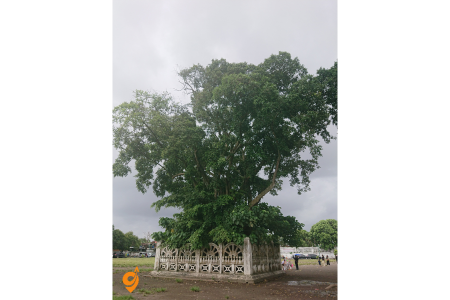
Alun-Alun Kidul serves as Yogyakarta’s southern town square, positioned directly south of the Kraton according to traditional Javanese city planning principles. This large grass field, flanked by two ancient banyan trees, holds deep spiritual significance in Javanese cosmology. The square traditionally served as a gathering place for royal ceremonies and public events.
Today, the square offers a peaceful respite from city bustle, especially beautiful in the evening when locals gather for recreation. The challenging “masangin” tradition involves walking blindfolded between the two banyan trees, which locals believe brings good luck if accomplished successfully. The square provides insight into how traditional Javanese urban planning created harmony between spiritual, royal, and community spaces. It’s particularly lovely at sunset when families gather and the atmosphere becomes relaxed and social.
Parangtritis Beach
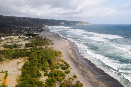
Parangtritis Beach stretches along the Indian Ocean coast about 25 kilometers south of Yogyakarta. This dramatic black sand beach is steeped in Javanese mythology, believed to be the earthly kingdom of Nyai Loro Kidul, the legendary Queen of the Southern Sea. The beach offers spectacular sunset views and powerful waves that create a mystical atmosphere.
The beach experience extends beyond swimming and sunbathing. You can take horse or dune buggy rides along the expansive shoreline, explore the sand dunes that rise behind the beach, or visit nearby caves and temples built into coastal cliffs. Local vendors sell grilled seafood and traditional snacks. However, respect the strong currents and local advisories about swimming safety. The spiritual significance of this beach means many visitors come for meditation and reflection, particularly during full moon periods when traditional ceremonies sometimes occur.
Indrayanti Beach
Indrayanti Beach represents a more pristine and less crowded alternative to Parangtritis, located along the Gunung Kidul coastline about 60 kilometers southeast of Yogyakarta. This white sand beach offers clearer, calmer waters suitable for swimming, snorkeling, and relaxation. The beach sits nestled between limestone cliffs that create a protected cove environment.
The journey to Indrayanti takes you through rural Javanese countryside, passing traditional villages and agricultural landscapes that provide insight into local life. The beach facilities include local restaurants serving fresh seafood, simple accommodations, and equipment rental for water activities. Unlike the mystical atmosphere of Parangtritis, Indrayanti offers a more conventional tropical beach experience with opportunities for water sports and leisurely swimming. The best time to visit is during dry season months when access roads are in good condition and weather is most predictable.
Each of these destinations contributes to a comprehensive understanding of Javanese culture, from ancient spiritual traditions to contemporary local life, creating a rich tapestry of experiences that will deepen your appreciation for this remarkable region of Indonesia.
National Monument (Monas)
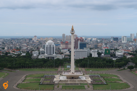
The National Monument stands as Jakarta’s most recognizable landmark and Indonesia’s most important symbol of independence. Rising 132 meters into the Jakarta skyline, this towering obelisk was conceived by Indonesia’s first president, Sukarno, as a permanent reminder of the nation’s struggle for freedom from Dutch colonial rule. The monument’s design carries deep symbolic meaning that reflects Indonesian philosophy and national aspirations.
When you approach Monas, you’ll notice its unique architectural form combines traditional Indonesian elements with modern design principles. The monument’s base represents earth and stability, while its soaring height symbolizes the nation’s upward aspirations. At the very top sits a flame sculpture covered in 35 kilograms of gold, representing the eternal spirit of Indonesian independence. This golden flame becomes particularly striking during sunset and evening hours when illumination transforms it into a beacon visible across the city.
The monument’s interior houses a comprehensive museum that chronicles Indonesia’s journey from ancient kingdoms through colonial periods to independence and modern nationhood. As you explore the exhibits, you’ll discover artifacts, dioramas, and historical displays that provide essential context for understanding Indonesia’s complex history. The museum uses a chronological approach that helps visitors grasp how various cultural influences, colonial experiences, and independence movements shaped contemporary Indonesia.
The viewing platform at the monument’s peak offers Jakarta’s best panoramic views, allowing you to appreciate the city’s vast scale and urban complexity. From this vantage point, you can observe how Jakarta spreads in all directions, understand the relationship between old and new districts, and appreciate the geographical factors that made this location Indonesia’s natural capital. The surrounding Merdeka Square, one of the world’s largest public squares, provides green space and recreational areas that serve as Jakarta’s central gathering place for national celebrations and public events.
National Monument (Monas) Jakarta – Complete Travel Guide
Address: Jl. Silang Monas, Jakarta 10110 Indonesia
Opening Hours
Monas is open to visitors Tuesday through Sunday from 08:00 AM to 04:00 PM. The monument is closed every Monday for maintenance. During weekdays, hours are 08:00 – 16:00 and 19:00 – 22:00, while weekends extend to 08:00 – 16:00 and 19:00 – 00:00. The observation deck usually opens at 8 AM, and arriving before 8 AM gives you the best chance of going up without waiting in line.
Transportation Options
MRT (Mass Rapid Transit)
The MRT has become the most practical option for getting to the Monas, particularly for visitors staying in central Jakarta or South Jakarta, as it completely bypasses notorious traffic jams. Take the MRT and get off at the HI Roundabout Station, then continue with Transjakarta.
TransJakarta Bus
You can use Transjakarta with the Kota-Blok M or Ragunan-Monas route and get off at the Monas Stop. TransJakarta operates buses from Monumen Nasional to Dukuh Atas every 5 minutes, and from MH Thamrin to Monumen Nasional every 5 minutes with a 6-minute journey time.
Special Tourist Bus
The TransJakarta Monas Explorer bus with the code BW10 started operating on October 17 2023, complementing existing TransJakarta tourist bus collections.
Private Transportation
Driving is possible but requires careful timing due to Jakarta’s traffic conditions. Taxi services, ride-hailing apps (Gojek, Grab), and private vehicles are available options.
Nearby Stations and Stops
Closest Transportation Stops
The stops closest to Monas include: Gambir 3, Gambir, Istiqlal, Monas 1, Balai Kota, IRTI, Stasiun Gambir, Monas 2, Monumen Nasional, Museum Nasional, Gondangdia. Additionally, Bundaran HI is also among the closest stops.
Major Railway Station
Gambir Station is the nearest major railway station, providing connections to various parts of Jakarta and beyond.
Nearby Attractions
Cultural and Historical Sites
- National Museum (Museum Nasional) – located very close to Monas
- Istiqlal Mosque – Indonesia’s largest mosque, within walking distance
- Jakarta Cathedral – historic Catholic cathedral near the monument
- Merdeka Palace – presidential palace in the area
- Gambir Station area with various colonial-era buildings
Entertainment Features
A dancing fountain attraction in one of Monas’ pools is available every weekend from 7:30 PM to 8:30 PM, with dancing waters accompanied by songs arranged by renowned composer Addie MS.
Transportation Companies
Public Transportation Providers
- TransJakarta (BRT system)
- MRT Jakarta (Mass Rapid Transit)
- PT KAI (Indonesian Railways)
- Jakarta city buses
Private Transportation
- Gojek (ride-hailing and delivery)
- Grab (ride-hailing service)
- Blue Bird taxi
- Express taxi
- Various local taxi companies
Istiqlal Mosque and Jakarta Cathedral
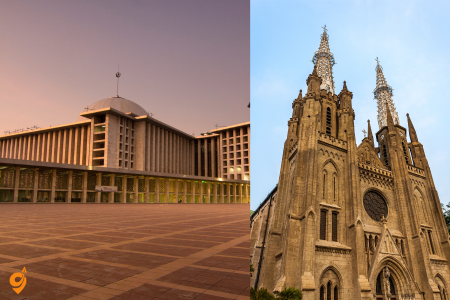
These two magnificent religious buildings sit directly across from each other, creating one of the world’s most powerful symbols of religious tolerance and pluralism. Understanding their relationship requires appreciating Indonesia’s national philosophy of Pancasila, which emphasizes unity in diversity and mutual respect among different faiths.
Istiqlal Mosque ranks as Southeast Asia’s largest mosque and one of the world’s grandest Islamic architectural achievements. Completed in 1978, the mosque can accommodate over 120,000 worshippers, making it not just a place of worship but a statement about Islam’s significant role in Indonesian society. The mosque’s modernist design, created by Christian architect Friedrich Silaban, demonstrates Indonesia’s approach to religious architecture that honors tradition while embracing contemporary aesthetics.
As you explore Istiqlal’s interior, you’ll be struck by its minimalist grandeur. The main prayer hall features clean lines, geometric patterns, and a soaring dome that creates an atmosphere of contemplative spirituality. The absence of figurative decoration follows Islamic artistic principles while allowing the architecture itself to inspire devotion. The mosque’s facilities include libraries, meeting halls, and educational spaces that serve Jakarta’s Muslim community beyond religious services.
Jakarta Cathedral, officially known as the Cathedral of the Assumption of the Blessed Virgin Mary, represents Indonesian Catholicism’s architectural and spiritual center. Built in neo-Gothic style during the late 19th century, the cathedral showcases European architectural traditions adapted to tropical Indonesian conditions. The building’s soaring spires, pointed arches, and intricate stonework create a dramatic contrast with Istiqlal’s modernist simplicity.
The cathedral’s interior features beautiful stained glass windows, carved wooden details, and religious artwork that reflects both European Catholic traditions and Indonesian cultural influences. The building serves not only Jakarta’s Catholic community but also stands as a monument to Indonesia’s commitment to religious freedom and diversity.
The significance of these buildings extends beyond their individual architectural merits. Their proximity symbolizes Indonesia’s foundational principle that different faiths can coexist peacefully and contribute to national unity. During religious holidays and national celebrations, both buildings often coordinate activities that demonstrate interfaith cooperation and mutual respect.
Thousand Islands (Pulau Seribu)
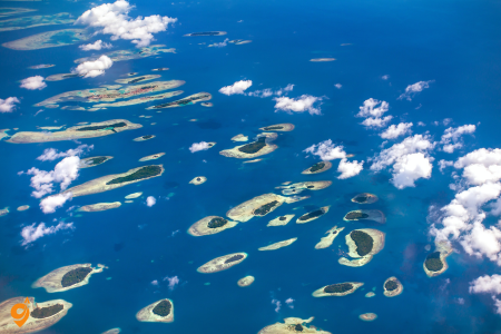
The Thousand Islands archipelago offers Jakarta residents and visitors an accessible escape to tropical paradise just two hours from the urban center. This chain of 110 small islands in Jakarta Bay demonstrates how Indonesia’s capital maintains connections to the maritime environment that historically sustained the region’s communities and economies.
The islands showcase Indonesia’s incredible marine biodiversity, with coral reefs, tropical fish populations, and pristine beaches that provide stark contrast to Jakarta’s urban intensity. Popular islands like Tidung, Pramuka, and Harapan offer different experiences ranging from day trips to extended stays, allowing visitors to choose experiences that match their time constraints and interests.
Water activities form the primary attraction, with snorkeling and diving revealing underwater ecosystems that thrive despite their proximity to one of Asia’s largest cities. The coral reefs demonstrate successful marine conservation efforts and provide important habitats for fish species that support local fishing communities. Swimming in crystal-clear waters surrounded by tropical scenery creates an almost surreal contrast to Jakarta’s urban environment.
Island accommodations range from basic homestays with local families to resort-style facilities, providing options for different budgets and comfort preferences. Staying overnight allows you to experience island rhythms, enjoy spectacular sunsets and sunrises, and understand how small Indonesian communities maintain traditional lifestyles while adapting to tourism opportunities.
The journey to the islands, typically by speedboat from Ancol Marina, offers perspectives on Jakarta Bay’s geography and marine environment. You’ll observe how the city’s coastline appears from the water, appreciate the scale of Jakarta’s port facilities, and understand the maritime connections that historically made this region a crucial Southeast Asian trading center.
Old Town Jakarta (Kota Tua)
Kota Tua preserves the historical core of Batavia, the Dutch colonial city that became modern Jakarta. This cobblestone square surrounded by 17th and 18th-century buildings provides tangible connections to Indonesia’s colonial period and helps visitors understand how European trading companies shaped Southeast Asian urban development.
The area centers around Fatahillah Square, where the old Dutch city hall now houses the Jakarta History Museum. This building’s architecture exemplifies Dutch colonial style adapted to tropical conditions, with thick walls, high ceilings, and wide verandas designed to manage heat and humidity. The museum’s exhibits chronicle Jakarta’s transformation from a small Javanese trading port to a major colonial administrative center to Indonesia’s modern capital.
Surrounding the square, historic buildings now house specialized museums that explore different aspects of Indonesian culture and history. The Puppet Museum showcases Indonesia’s rich tradition of wayang (shadow puppet) theater, explaining how these performances serve as entertainment, education, and spiritual practice. The Fine Arts and Ceramics Museum displays both traditional Indonesian artworks and pieces that demonstrate cultural exchanges between Indonesia and other Asian civilizations.
The old port area of Sunda Kelapa, walking distance from the main square, maintains its function as a working harbor where traditional wooden schooners called pinisi still dock. These magnificent sailing vessels, some over 100 feet long, continue maritime trading traditions that connect Jakarta to ports throughout the Indonesian archipelago. Watching these boats load and unload cargo provides insights into how traditional Indonesian commerce operates alongside modern container shipping.
Street vendors, cafes, and small shops throughout Kota Tua offer opportunities to experience contemporary Indonesian life within historical settings. The area becomes particularly lively during weekends when Jakarta families visit for recreation and cultural education, creating a dynamic blend of historical preservation and living community use.
Address and Location
Fatahillah Square, also known as Taman Fatahillah, is a historic town square located in the Kota Tua (Old Town) area of Jakarta, Indonesia. The main address centers around Fatahillah Square in North Jakarta, which serves as the heart of this historic district.
Opening Hours
The museums in Kota Tua generally open from 9 AM to 3 PM, although it’s advised to check in advance for specific timings as they can vary, and some museums may be closed on public holidays.
General Schedule:
- Museums: 9:00 AM – 3:00 PM (Tuesday to Sunday)
- Fatahillah Square: Open 24 hours (public space)
- Individual attractions may have varying schedules
Important Notes: Many museums close on Mondays for maintenance, and holiday schedules may differ from regular operating hours.
Transportation Options
TransJakarta Bus Rapid Transit (Primary Recommendation)
TransJakarta corridor 1 (red line connecting Kota – Blok M) will be the best option, cheap and fast. This dedicated bus lane system bypasses Jakarta’s notorious traffic congestion, making it the most reliable public transportation method.
Key TransJakarta Stops:
- Kota Station (main stop for Kota Tua)
- Kali Besar (alternative nearby stop)
Railway Services
It has a strategic location near major public transportation hubs such as TransJakarta stops, Jakarta Kota Station, and Sunda Kelapa Harbor. Jakarta Kota Station represents the primary railway terminus serving the Old Town area.
Available Train Lines: BOGOR LINE, TANJUNG PRIUK LINE, LINGKAR CIKARANG LINE all provide connections to Kota Tua, offering extensive coverage from various parts of Greater Jakarta.
Nearby Stations and Transportation Hubs
Jakarta Kota Station serves as the main railway terminus, providing connections to suburban areas and other major Indonesian cities. This historic station also represents an architectural attraction in itself.
Sunda Kelapa Harbor offers unique transportation experiences, including traditional pinisi boats and harbor tours, though primarily serving maritime rather than urban transportation needs.
Multiple TransJakarta corridors converge in this area, creating excellent connectivity to other parts of Jakarta’s public transportation network.
Parking Facilities
There’s available parking, but it can get crowded, especially on weekends. The parking situation requires careful planning, particularly during peak visiting times.
Parking Options:
- Street parking around Fatahillah Square (limited availability)
- Private parking lots in surrounding areas
- Commercial building parking facilities
- Jakarta Kota Station parking areas
Parking Considerations: Weekend visits require earlier arrival to secure parking spaces, as the area becomes significantly more crowded during leisure periods.
Major Nearby Attractions
Historical Museums
The Jakarta History Museum occupies the former Dutch colonial city hall building, showcasing the evolution of Jakarta from its origins as Jayakarta through the colonial period to modern times.
The Wayang Museum displays Indonesia’s traditional puppet art forms, offering insight into cultural storytelling traditions that remain vital to Indonesian heritage.
The Fine Arts and Ceramics Museum houses collections spanning traditional Indonesian art through contemporary works, providing comprehensive artistic context.
Architectural Highlights
At the heart of Kota Tua is Batavia’s old city hall, which epitomises colonial architecture at the time, in front of ‘Fatahillah Square’. The surrounding buildings create an authentic Dutch colonial streetscape that transports visitors to Indonesia’s colonial era.
Cultural Experiences
The square often hosts various cultural events and performances, adding to its vibrant atmosphere. These events range from traditional Indonesian performances to contemporary cultural celebrations.
Historical Significance
The square is named after the Muslim scholar turned warrior Fatahillah, He masterminded the attack on the Portuguese settlers who were trading from Sunda Kelapa harbour. On June 22nd, 1527 he conquered the harbour and renamed it Jayakarta or ‘glorious victory’. June 22nd is still celebrated every year as Jakarta’s birthday.
National Museum of Indonesia
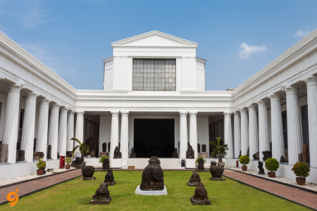
The National Museum serves as Indonesia’s premier institution for understanding the archipelago’s incredible cultural diversity, historical depth, and archaeological significance. Often called the Elephant Museum due to the bronze elephant statue in its courtyard (a gift from the King of Thailand), this institution houses the world’s most comprehensive collection of Indonesian cultural artifacts.
The museum’s approach to displaying Indonesian heritage helps visitors grasp the complexity of a nation composed of over 17,000 islands, hundreds of ethnic groups, and centuries of cultural interaction. The prehistoric collection includes fossils of Java Man (Homo erectus), providing evidence of early human presence in Southeast Asia. These archaeological finds help explain Indonesia’s role in human evolutionary history and prehistoric migration patterns.
Traditional art collections showcase the incredible diversity of Indonesian creative expression, from Balinese wood carvings and Javanese batik to Dayak tribal artifacts and Maluku ceremonial objects. Each display provides context about how different Indonesian communities developed distinct artistic traditions while maintaining connections through trade, migration, and cultural exchange.
The ethnographic exhibits demonstrate how Indonesian communities adapted to diverse geographical environments, from mountain highlands to coastal areas to tropical rainforests. Traditional tools, weapons, clothing, and household objects illustrate how different groups developed technologies and social practices suited to their specific environments while maintaining broader Indonesian cultural characteristics.
Historical artifacts trace Indonesia’s interactions with Indian, Chinese, Arab, and European civilizations, showing how the archipelago served as a crucial crossroads for Asian trade and cultural exchange. Ancient inscriptions, coins, and religious objects demonstrate how Indonesian kingdoms maintained independence while selectively adopting influences from other civilizations.
Ancol Dreamland
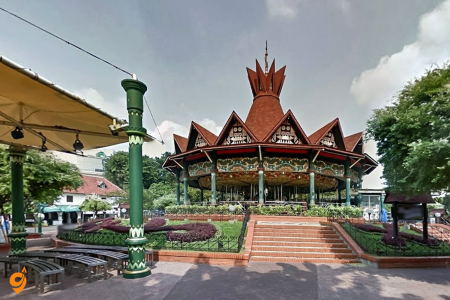
Ancol Dreamland represents Jakarta’s largest recreational complex, offering diverse entertainment options that serve the city’s enormous population while showcasing how Indonesian urban planning addresses recreational needs in high-density environments. This waterfront complex demonstrates creative solutions for providing green space, entertainment, and coastal access within a major metropolitan area.
The complex’s SeaWorld aquarium provides insights into Indonesian marine biodiversity, featuring species from both Indonesian waters and other tropical regions. Interactive exhibits help visitors understand marine conservation challenges while providing educational entertainment for families. The aquarium’s design considers Indonesian climate conditions, creating comfortable indoor environments that allow extended visits despite outdoor heat and humidity.
Dunia Fantasi (Fantasy World) amusement park offers rides and attractions designed for tropical conditions while incorporating Indonesian cultural themes. The park’s approach to entertainment combines international amusement park concepts with local cultural elements, creating experiences that appeal to Indonesian families while introducing visitors to Indonesian storytelling traditions and cultural references.
Beach areas within Ancol provide Jakarta residents with accessible coastal recreation, though the water quality reflects urban environmental challenges. The beaches serve important social functions, allowing families to experience seaside environments without extensive travel. Beach activities include swimming, beach sports, and coastal walks that provide relief from urban density.
Art Market and cultural facilities within Ancol showcase contemporary Indonesian creativity while providing platforms for local artists and craftspeople. These spaces demonstrate how recreational complexes can support cultural development while providing entertainment, creating multifunctional environments that serve diverse community needs.
Address and Location Details
Ancol is the largest, integrated recreation park located in northern Jakarta. Also known as Ancol Dreamland, Jakarta’s amazing destination, situated in the Pademangan area of North Jakarta along the Java Sea coastline. The complex spans an enormous area and serves as Indonesia’s premier integrated tourism destination.
Opening Hours
Opening Hours: 06:00 – 22:00 for the main Ancol complex, though individual attractions within the park may have different operating schedules. Monday – Friday: 10:00 AM – 6:00 PM Saturday, Sunday: 10:00 AM – 8:00 PM for specific attractions like theme parks within the complex.
Primary Transportation Methods
TransJakarta Bus Rapid Transit (Most Recommended)
The TransJakarta system provides the most reliable public transportation option for reaching Ancol. The TransJakarta bus service provides an affordable and convenient way to reach Ancol. Simply take a route that connects to the TransJakarta corridor heading to Ancol. There is a dedicated bus stop near the entrance of Ancol Dreamland.
The Ancol Busway Station is conveniently located near the entrance, making it extremely convenient for visitors. It’s on Corridor 5 of the TransJakarta rapid transit bus system, providing direct connections from various parts of Jakarta.
For those coming from central Jakarta, using the Transjakarta bus. From Sarinah, go to the Bank Indonesia bus shelter and find Corridor 1 trans-Jakarta Blok M-Kota. Then stop at the last destination, the Stasiun Kota shelter, then transfer to Corridor 5 heading to Ancol.
The frequency and reliability make this the preferred choice: TransJakarta operates a bus from Matraman Baru to Ancol every 5 minutes. Tickets cost $1 and the journey takes 49 min.
Parking Facilities
The resort has a parking area available for guests, accommodating private vehicles throughout the complex. The extensive nature of Ancol Dreamland means multiple parking areas serve different attraction zones within the resort.
Given Jakarta’s traffic patterns, arriving early helps secure convenient parking spots, particularly during weekends and holidays when visitor numbers peak significantly.
Internal Transportation Within Ancol
Once you arrive at Ancol, the complex provides comprehensive internal transportation. Ancol Dreamland provides a free shuttle bus service named Wara-Wiri. It operates from 06:00 – 24:00 and consist of three routes, connecting different attraction areas within the massive complex.
The internal shuttle system includes connections to Gondola station (nearby Atlantis Water Adventure, Sea World, Ocean Dream Samudera and Jakarta Bird Land), ensuring easy movement between different entertainment zones.
Major Nearby Attractions
The strategic location in North Jakarta places Ancol near several other significant destinations.
- The historic Kota Tua (Old Town Jakarta) lies relatively close, allowing visitors to combine historical exploration with modern entertainment.
- Sunda Kelapa Harbor provides insight into Jakarta’s maritime heritage and traditional Indonesian sailing vessels, creating cultural context for your visit to this coastal entertainment destination.
- The proximity to Jakarta’s central business district means numerous dining, shopping, and accommodation options remain easily accessible even while staying in the Ancol area.
Chinatown (Glodok)
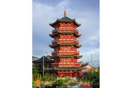
Glodok represents one of Southeast Asia’s oldest and most culturally significant Chinese communities, providing insights into how Chinese Indonesian culture developed distinct characteristics while maintaining connections to broader Chinese traditions. This bustling district demonstrates the crucial role Chinese Indonesians played in Indonesia’s economic development and cultural evolution.
The area’s narrow streets, traditional shophouses, and busy markets create an atmosphere that reflects centuries of Chinese commercial and cultural presence in Jakarta. Traditional architecture shows how Chinese building techniques adapted to Indonesian climate conditions, with shop houses featuring covered walkways, courtyards for ventilation, and mixed residential-commercial uses that characterize Southeast Asian Chinese communities.
Temples throughout Glodok showcase Chinese Indonesian religious practices that blend Confucian, Taoist, and Buddhist traditions with local Indonesian elements. Jin De Yuan temple, one of Jakarta’s oldest Chinese temples, demonstrates how Chinese religious architecture adapted to Indonesian conditions while maintaining essential spiritual functions. Temple festivals and ceremonies provide opportunities to observe how Chinese Indonesian communities maintain cultural traditions while participating in broader Indonesian society.
Traditional markets in Glodok offer authentic experiences of Chinese Indonesian commercial culture, with vendors selling everything from traditional medicines and herbal teas to electronic goods and textiles. The area’s wholesale markets serve retailers throughout Jakarta and demonstrate the continued importance of Chinese Indonesian business networks in Indonesia’s economy.
Food culture in Glodok represents some of Indonesia’s most distinctive culinary fusion, where Chinese cooking techniques combine with local Indonesian ingredients and flavors. Street food vendors and traditional restaurants serve dishes that exist nowhere else in the world, created by generations of Chinese Indonesian families who adapted ancestral recipes to local tastes and available ingredients.
Lake Toba
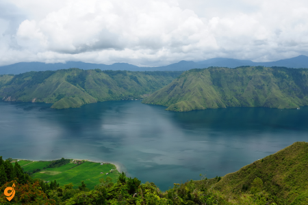
Lake Toba represents one of Earth’s most extraordinary geological phenomena and serves as the cultural heartland of North Sumatra. To truly appreciate this destination, you need to understand the cataclysmic event that created it. Approximately 75,000 years ago, the Toba supervolcano erupted in what scientists consider one of the most powerful volcanic explosions in human history. This eruption was so massive that it created a volcanic winter that may have affected global climate patterns and potentially influenced early human evolution.
The lake that formed in this massive caldera stretches 100 kilometers long and 30 kilometers wide, making it larger than Singapore and deeper than the North Sea. This scale becomes truly apparent when you first arrive at the lake’s rim viewpoints, where the water extends beyond the horizon like an inland sea surrounded by dramatic volcanic mountains. The lake’s immense size creates its own microclimate, with cooler temperatures and higher humidity that provide relief from Sumatra’s typically intense tropical heat.
At the lake’s center sits Samosir Island, which functions as a cultural time capsule where traditional Batak civilization remains vibrantly alive. The Batak people developed a sophisticated society around Lake Toba over many centuries, creating unique architectural styles, social systems, and spiritual practices that adapted to the lake’s geographic isolation. When you visit traditional Batak villages on Samosir Island, you encounter not tourist reconstructions but living communities where ancient customs continue to guide daily life.
Traditional Batak houses, called Jabu, demonstrate remarkable architectural innovation adapted to the lake’s climate and cultural needs. These structures feature distinctive boat-shaped roofs that efficiently shed tropical rainfall while creating spacious interiors for extended family groups. The houses are elevated on sturdy wooden posts that protect against flooding while providing storage space and areas for domestic animals. Understanding this architecture helps you appreciate how indigenous communities developed sophisticated solutions to environmental challenges long before modern technology.
Batak cultural practices center around complex kinship systems and spiritual beliefs that emphasize harmony between humans, ancestors, and natural forces. Traditional ceremonies, music, and dances that you can observe during visits reflect these deep philosophical systems. The Batak writing system, one of the few indigenous scripts that survived colonial periods, continues to be used for traditional manuscripts and ceremonial purposes, demonstrating cultural continuity that spans centuries.
The lake experience combines cultural immersion with spectacular natural beauty. Swimming in Toba’s crystal-clear waters provides a surreal experience, as you float in what is essentially a massive volcanic crater while surrounded by mountains that rise directly from the water’s edge. Boat trips reveal hidden coves, traditional fishing villages, and perspectives on the volcanic landscape that help you grasp the geological forces that shaped this region.
Location & Address
Lake Toba is located in North Sumatra, Indonesia. The main gateway town is Parapat, which serves as the ferry terminal to reach Samosir Island, the most popular destination within Lake Toba. The lake itself is situated approximately 176 kilometers south of Medan.
Getting There from Medan
By Air (to Medan first)
Kualanamu International Airport (KNO) in Medan serves as the primary entry point for international and domestic travelers. Most visitors fly into Medan first, then continue to Lake Toba by land transportation.
By Train
The train option is considered the best way to get to Lake Toba from Medan, though it requires a combination of train and bus:
- Depart from Medan Railway Station (Stasiun Medan)
- Take the train to Pematangsiantar (final railway destination)
- There is only one train per day in each direction, so planning is essential
- From Pematangsiantar, continue by bus to Parapat
- Total journey time is minimum 6.5 hours from Medan Airport to Parapat
By Bus
Several bus stations serve the Medan to Lake Toba route:
- Amplas Bus Terminal (Medan) – Main departure point for buses to Parapat
- Pinang Baris Bus Station (Medan) – Alternative bus departure point
- Direct buses from Kualanamu Airport (KNO) to Parapat are now available via DAMRI mini buses as of March 2025
- Journey time: approximately 5-6 hours from Medan city
- Journey time: approximately 6-7 hours from Medan Airport
By Private Car/Taxi
Using a car is the easiest and safest way to get around, but you need to rent from either Medan or Pematangsiantar. It’s recommended to use a car with high ground clearance and good power due to unpaved roads and poor road conditions around Lake Toba.
Ferry Transportation
Main Ferry Terminal
Port Tiga Raja (also called Simalungun Port) in Parapat serves as the main ferry terminal for accessing Samosir Island in the middle of Lake Toba.
Ferry Destinations
- Tuk-Tuk – The main tourist town on Samosir Island, reached by a 40-minute ferry crossing from Parapat
- Tomok Village – Another destination point on Samosir Island accessible by ferry
Ferry Types
Local transportation around the lake includes both cheaper school boats with limited schedules and more expensive public boats that operate throughout the day.
Local Transportation Around Lake Toba
Boats
Boats serve as the primary local transportation method around the lake, connecting various points on the mainland with different locations on Samosir Island.
Mini Buses
Mini buses operate to various destinations around the lake, including routes to Pangururan and connections to Tomok.
Parking Facilities
Parking is available at:
- Ferry terminals in Parapat
- Hotels and guesthouses around the lake
- Tourist attraction sites
- Most roads around Lake Toba are unpaved except for major roads, which may still be in poor condition with potholes
Operating Hours
- Ferries: Generally operate from early morning until late afternoon, with more frequent services during peak tourist seasons
- Buses: Regular daily services, with early morning departures being most common
- Train: Only one train per day in each direction between Medan and Pematangsiantar
Nearby Attractions
- Samosir Island – The main attraction featuring traditional Batak culture
- Tuk-Tuk Peninsula – The main destination for Lake Toba travel, offering refreshing climate and open vistas
- Tomok Village – Traditional Batak village with cultural sites
- Holbung Hills – Scenic viewpoint
- Efrata Waterfall – Natural attraction
- Bukit Sibeabea – Scenic hills area
- Berastagi – Mountain town with passion fruit farms
- Traditional Batak villages with cultural performances
Transportation Companies
- DAMRI – Provides mini bus services from Kualanamu Airport to Parapat
- Local bus operators – Various companies serve the Medan-Parapat route
- Ferry operators – Multiple companies provide boat services between Parapat and Samosir Island
- PT Kereta Api Indonesia – Operates the train service between Medan and Pematangsiantar
Mount Sibayak
Mount Sibayak offers an accessible introduction to Sumatra’s volcanic landscape while providing insights into the geological processes that continue to shape the island. This active volcano, standing 2,094 meters above sea level, demonstrates how volcanic activity creates both dramatic landscapes and practical benefits for local communities through geothermal energy and fertile soils.
Understanding Mount Sibayak requires appreciating its role in the larger Sumatran volcanic system. The mountain sits along the same fault line that created Lake Toba, representing ongoing geological processes that make Indonesia one of the world’s most volcanically active regions. This volcanic activity, while potentially destructive, also creates the incredibly fertile soils that support Sumatra’s agricultural productivity and biodiversity.
The trek to Sibayak’s summit typically begins before dawn, allowing you to reach the crater rim in time for sunrise. This timing serves practical purposes beyond scenic value. Early morning temperatures are cooler and more comfortable for climbing, while afternoon weather patterns often bring clouds and rainfall that can obscure views and make descent more challenging. The pre-dawn start also means you experience the mountain’s transformation from nighttime jungle sounds to dawn bird choruses to full daylight tropical forest activity.
The trail to the summit passes through distinct ecological zones that demonstrate how elevation affects tropical ecosystems. You begin in lower montane forest characterized by dense vegetation, high humidity, and incredible biodiversity. As you climb higher, the forest gradually transitions to cloud forest environments where mist and cooler temperatures support different plant communities, including moss-covered trees and unique highland species found nowhere else.
At the crater rim, you encounter dramatic evidence of ongoing volcanic activity. Steam vents release sulfurous gases that remind you this mountain remains geologically active, while the crater interior reveals volcanic formations and mineral deposits created by underground thermal processes. The summit views encompass the broader North Sumatran landscape, helping you understand how volcanic peaks like Sibayak create the dramatic topography that characterizes this region.
The descent often includes visits to natural hot springs created by geothermal activity associated with the volcano. These thermal pools provide practical benefits for tired muscles while demonstrating how volcanic processes create resources that local communities have utilized for generations. Understanding these connections between geological activity and human settlement patterns helps explain why people continue to live near active volcanoes despite potential risks.
Location and Address
Mount Sibayak is located near Berastagi town in the Karo Regency of North Sumatra, Indonesia. The town is situated at approximately 1,300 meters above sea level, serving as the primary base for accessing Mount Sibayak volcano. The mountain is part of the Barisan mountain range and stands as one of the most accessible active volcanoes in Indonesia for hiking enthusiasts.
Getting to Berastagi (Gateway to Mount Sibayak)
Transportation to Mount Sibayak Trailhead
From Berastagi Town
The Sibayak volcano climb can be started by walking from the town itself, or you can take a bus to the trailhead proper. This gives hikers flexibility in choosing their starting point based on their fitness level and time preferences.
Local Transport Options
Once in Berastagi, various local transportation options are available to reach the Mount Sibayak trailhead. Local buses, shared taxis, and motorcycle taxis (ojek) provide connections between the town center and the mountain’s base. Many guesthouses and hotels can arrange transportation or provide detailed directions to the trailhead.
Bus Stations and Terminals
Berastagi Bus Station
The main bus station in Berastagi serves as the central hub for all public transportation in the area. This station connects to various destinations throughout North Sumatra and provides regular services to Medan, Kabanjahe, and other regional centers.
Kabanjahe Transport Hub
Kabanjahe serves as a major transportation junction for the region, connecting Berastagi with other destinations in North Sumatra. This town acts as an important waypoint for travelers heading to various attractions in the Karo highlands.
Parking Facilities
Trailhead Parking
Parking areas are available near the Mount Sibayak trailhead for visitors arriving by private vehicle. These parking spots accommodate both cars and motorcycles, though space can be limited during peak hiking seasons and weekends.
Berastagi Town Parking
Hotels, guesthouses, and restaurants in Berastagi typically provide parking facilities for their guests. Street parking is also available throughout the town, though it’s advisable to park in secure, well-lit areas.
Operating Hours and Schedules
Bus Services
Bus services between Medan and Berastagi typically operate from early morning until late evening, with more frequent departures during weekends and holidays when local tourists visit the area.
Mount Sibayak Access
The mountain is accessible 24 hours a day, though most hikers begin their ascent in the early morning hours (around 4:00-5:00 AM) to reach the summit for sunrise viewing. The trail remains open throughout the day for those preferring later starts.
Transportation Companies
Bus Companies
- Sumatera Transport – Primary bus company serving the Medan to Berastagi route
- MURNI Express – One of three bus options available at Simpang Pos station
- Sinabung Jaya – Another bus service connecting Medan with Berastagi
- Sutra – Third bus option for travelers to the region
Tour and Guide Services
Local tour companies and guides operate in Berastagi, offering comprehensive packages that include transportation, guided hiking, and accommodation arrangements. These services are particularly valuable for international visitors unfamiliar with local transportation systems.
Nearby Attractions
Gundaling Hill
Gundaling Hill offers an easy 40-minute hike with beautiful views, making it an excellent warm-up activity before attempting Mount Sibayak or a relaxing alternative for those preferring less strenuous activities.
Hot Springs
Natural hot springs are located near Mount Sibayak, providing a perfect relaxation opportunity after completing the volcano hike. These thermal waters offer therapeutic benefits and spectacular natural settings.
Sinabung Volcano
Berastagi is home to two famous volcanoes, Sibayak and Sinabung, the latter of which has been erupting quite frequently since 2013. While Sinabung is not currently accessible for hiking due to its active status, it provides dramatic scenery and geological interest.
Mikie Funland
This family-friendly amusement park offers entertainment options for visitors traveling with children, providing a nice contrast to the more adventurous hiking activities.
Traditional Markets
Berastagi’s traditional markets showcase local Karo culture, featuring fresh produce from the highland region, traditional textiles, and local handicrafts that reflect the area’s rich cultural heritage.
Gunung Leuser National Park
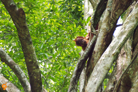
Gunung Leuser National Park represents one of the world’s most critical conservation areas and provides visitors with opportunities to experience pristine tropical rainforest ecosystems that have remained largely unchanged for millions of years. This UNESCO World Heritage site protects the last significant habitat for several endangered species while offering insights into tropical ecology that help you understand why rainforest conservation matters globally.
To appreciate Gunung Leuser’s significance, you need to understand its role in the broader Leuser Ecosystem, which encompasses over 2.6 million hectares of protected forest across northern Sumatra. This ecosystem represents one of the most biodiverse places on Earth, supporting over 4,000 plant species and providing habitat for mammals, birds, reptiles, and insects found nowhere else. The park’s location at the convergence of Asian and Indonesian biogeographical zones creates unique conditions that support this extraordinary diversity.
The park’s most famous residents are Sumatran orangutans, critically endangered great apes that survive only in the forests of Sumatra and Borneo. Observing orangutans in their natural habitat provides profound insights into primate behavior, intelligence, and the complex relationships between species and their environments. These encounters help you understand why habitat protection is essential for species survival and how human activities affect wildlife populations.
Jungle trekking in Gunung Leuser reveals the incredible complexity of tropical rainforest ecosystems. The forest operates as an interconnected system where every species plays specific roles in maintaining ecological balance. Towering dipterocarp trees create the forest canopy that moderates temperature and humidity while providing habitat for countless epiphytes, insects, birds, and mammals. Understanding these relationships helps you appreciate why rainforest destruction has such devastating ecological consequences.
Multi-day treks deep into the park’s interior provide authentic wilderness experiences that few places on Earth can match. These expeditions require camping in the forest, crossing rivers, and navigating challenging terrain while accompanied by experienced local guides who understand forest navigation, wildlife behavior, and safety protocols. The physical challenges of jungle trekking help you appreciate the skills required to survive in tropical forest environments and understand why indigenous communities developed such sophisticated knowledge of forest resources.
Night sounds in the Leuser jungle create an entirely different sensory experience that reveals nocturnal animal activity rarely observed during daylight hours. The forest comes alive with calls from countless species of frogs, insects, birds, and mammals, creating a symphony that demonstrates the incredible biodiversity that thrives in darkness. These experiences help you understand how tropical ecosystems operate on cycles that extend far beyond human daily rhythms.
I’ll help you understand the comprehensive transportation options to reach Gunung Leuser National Park, one of Indonesia’s most important biodiversity hotspots and UNESCO World Heritage sites. Let me search for the most current and detailed information about accessing this incredible destination.
Gunung Leuser National Park Transportation Guide
There are two main access points for this national park, Ketambe and Bukit Lawang. Ketambe is located around 226 km (140 miles) from the capital city of Medan (by road), and Bukit Lawang is around 85 km (53 miles) away. This distance difference significantly affects your transportation planning and journey time.
Location and Address Details
Gunung Leuser National Park is a large national park covering 950,000 hectares in northern Sumatra, Indonesia, straddling the border of the provinces of North Sumatra and Aceh. The park’s massive size means that your chosen entry point determines not only your travel route but also the type of wildlife experiences you’ll encounter. The village of Bukit Lawang is in the park 90 km northwest of Medan. It is most famous for being one of the last places in the world where one can see orangutans in the wild.
The two main gateway addresses are:
• Bukit Lawang: Located in Bohorok Sub-district, Langkat Regency, North Sumatra Province
• Ketambe: Located in Kutacane, Southeast Aceh Regency, Aceh Province.
Operating Hours and Schedule Information
Park Access Hours
Visitors will need to arrange a permit at a Gunung Leuser National Park prior to entering. The park offices typically operate during standard business hours (8:00 AM to 5:00 PM), though specific times may vary. Obtaining permits in advance ensures smooth entry and avoids delays that could affect your wildlife viewing opportunities.
Transportation from Medan Airport (Primary Entry Point)
Most international and domestic visitors begin their journey from Kualanamu International Airport (KNO) near Medan, which serves as the primary aviation gateway to the region. In both cases the closest major airport and city is Medan. If you’re flying from Jakarta there will be plenty of direct flights from which to choose that can get you to Medan.
Private Transportation (Most Efficient Option)
Since the completion of the Kuala Namu – Medan – Binjai toll road in 2022, by far and away the best way to reach Bukit Lawang is by private transport, as there is a toll between the airport and Binjai, meaning traffic delays essentially eliminated between Medan and Bukit Lawang if you use private transport. This infrastructure improvement has revolutionized travel to the park. The journey time will therefore be 3 hours from the airport to Bukit Lawang. This compares to around five hours or more by public transport.
Private car services offer several advantages beyond speed. They provide door-to-door service, air conditioning for comfort in Sumatra’s tropical climate, and flexibility in departure times. Many guesthouses and tour operators can arrange private transfers, ensuring coordination with your accommodation and park activities.
Shared Taxi Services (Balance of Cost and Comfort)
The two main ones are called CV. Happy Track Tour Transportation and PT. Bagus Wisata Holidays. This is essentially a minivan that carries up to 7 passengers, charging them per person for the journey. These services represent a middle ground between expensive private transport and slower public buses.
For journeys to Ketambe, The company CV. Adi Guna Travel offers a more comfortable, aircon public shared taxi service with modern cars (Toyota Innova) between Medan and Kutacane. Understanding these company names helps you identify legitimate services and avoid potential scams.
Public Transportation Options
Bus Services to Bukit Lawang
Public buses provide the most economical option for budget-conscious travelers, though they require more time and planning. DAMRI has two bus shelters in Medan City, one at Jalan Gatot Subroto next to Carrefour and the other at Amplas bus terminal. Buses go more frequent than trains. The DAMRI bus system represents Indonesia’s national public transportation network and maintains regular schedules.
Transportation to Ketambe (Northern Access Point)
Reaching Ketambe requires a more complex journey involving multiple transportation modes. You have to take the mini bus from bus company BTN or Karsima. This mini bus will drop you in Kutacane. From Kutacane you have to take a labi-labi to Ketambe. Understanding this multi-stage process helps you plan adequate travel time and prepare for transfers.
Parking Facilities and Vehicle Access
Both Bukit Lawang and Ketambe provide parking facilities for visitors arriving by private vehicle, though the infrastructure quality varies between locations. Bukit Lawang, being more developed for tourism, offers better parking facilities near guesthouses and the park entrance. These parking areas accommodate both motorcycles and cars, with some guesthouses providing secure parking for their guests.
Ketambe’s parking facilities are more basic, reflecting its status as a less developed entry point. However, adequate parking exists near guesthouses and the park entrance, though security arrangements may be less formal than in Bukit Lawang.
Operating Hours and Schedule Information
Park Access Hours
Visitors will need to arrange a permit at a Gunung Leuser National Park prior to entering. The park offices typically operate during standard business hours (8:00 AM to 5:00 PM), though specific times may vary. Obtaining permits in advance ensures smooth entry and avoids delays that could affect your wildlife viewing opportunities.
Transportation Schedules
Public transportation schedules vary by route and season. DAMRI buses operate regular daily schedules from their Medan terminals, with more frequent services during peak travel periods. Shared taxi services often operate on-demand, departing when vehicles reach capacity rather than following fixed schedules.
The timing considerations become particularly important for multi-stage journeys to Ketambe, where missing connections can result in overnight delays in intermediate towns.
Padang
Padang serves as the cultural and economic center of West Sumatra while functioning as the homeland of Minangkabau culture, one of Indonesia’s most distinctive and influential cultural traditions. Understanding Padang requires appreciating Minangkabau society’s unique characteristics, including matrilineal social organization, distinctive architecture, and philosophical systems that have influenced Indonesian national culture.
Minangkabau culture centers around matrilineal kinship systems where property and family names pass through female lineages, creating social structures that differ significantly from most world cultures. This system influences everything from family relationships to economic organization to political leadership, creating communities where women hold significant authority and influence. Understanding these social patterns helps explain many aspects of contemporary Indonesian culture and politics.
Traditional Minangkabau architecture, exemplified by Rumah Gadang houses with their distinctive curved roofs resembling buffalo horns, demonstrates how cultural values are expressed through built environments. These structures accommodate extended family groups while reflecting philosophical beliefs about harmony between humans and nature. The architecture’s adaptation to tropical conditions shows how indigenous communities developed sophisticated building techniques suited to local climate and cultural needs.
Padang cuisine has gained international recognition as one of Indonesia’s most flavorful and complex regional food traditions. The famous Padang restaurant style, where multiple dishes are served simultaneously and customers pay only for what they consume, reflects Minangkabau hospitality traditions and social values. Understanding this food culture provides insights into how cultural practices adapt to commercial contexts while maintaining traditional values.
The city’s location on Sumatra’s west coast creates connections to the Indian Ocean that have influenced local culture, trade patterns, and historical development. Padang’s beaches, fishing communities, and maritime traditions demonstrate how coastal geography shapes cultural development and economic activities.
West Sumatran highlands surrounding Padang showcase dramatic volcanic landscapes, traditional villages, and agricultural systems that support local communities while maintaining environmental sustainability. Day trips from Padang to highland areas reveal how Minangkabau communities adapted to diverse geographical environments while maintaining cultural coherence.
Air Transportation
Minangkabau International Airport serves as Padang’s main aviation gateway, located in Ketaping area, Batang Anai sub-district, Padang Pariaman Regency.
From Airport to City:
- Minangkabau Express Airport Train operates five times daily with single-track railway operation
- Damri buses operate regularly connecting airport with city
- TransPadang buses operate regularly from Padang City
- Taxis available with airport terminal pickup
- Private vehicle access available
Airport Train Station:
- Located past airport building on the left, accessed via walkway
- Operates from Padang Simpang Haru to Bandara Minangkabau
- Journey time: 40 minutes
Airport Bus Services:
- Damri buses pick up and drop off at bus terminal on Jalan Imam Bonjol
- Damri operates hourly bus service from Plaza Andalas to Padang Airport
- Journey time: 42 minutes
Rail Transportation
Padang Railway Network:
- Train station in Padang services airport express and commuter rail to nearby towns like Pariaman, Pasar Alai, and Lubuk Buaya
- Main station: Padang Simpang Haru
- Connects to Minangkabau Express for airport access
- Regional connections to surrounding West Sumatra areas
Booking Options:
- Hotel reservations, online booking at Tiket.com, or Kereta Api Indonesia (Indonesian Railways) for schedules
Public Bus Transportation
Trans Padang BRT System:
- Bus rapid transit (BRT)-based public transportation service connecting various areas in Padang, West Sumatra
- Features air conditioning, CCTV, and free WiFi
- Operating hours: 6:00 AM to 10:00 PM
- Multiple routes covering city areas
Inter-city Bus Services:
- Long-distance bus connections to other Sumatra cities
- Terminal locations throughout the city
- Regular services to Jakarta, Medan, and other major destinations
Taxi and Private Transportation
Taxi Services:
- Available from airport terminal
- City-wide taxi coverage
- Metered services with airport surcharge
- Online ride-hailing apps operational
Private Vehicle Access:
- Well-connected road network
- Parking facilities available at major destinations
- Car rental services available
- Motorcycle taxi (ojek) services
Transportation Hubs:
- Minangkabau International Airport: Ketaping, Batang Anai, Padang Pariaman Regency
- Padang Simpang Haru Railway Station: Central Padang
- Plaza Andalas Bus Terminal: Jalan Imam Bonjol area
- Main city bus terminals distributed throughout urban areas
Nearby Attractions
Within Padang City:
- Grand Mosque of West Sumatra
- Adityawarman Museum featuring traditional Minangkabau architecture and local culture exhibits
- Dutch colonial houses in the old town
- Traditional markets and culinary centers
- Padang Beach waterfront area
Banda Aceh
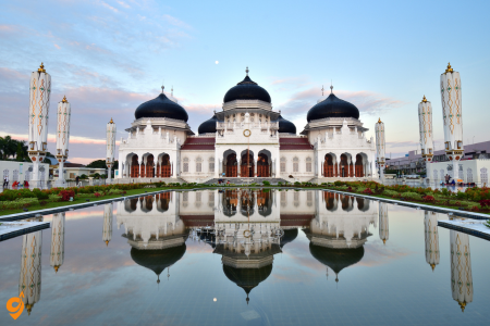
Banda Aceh represents one of Indonesia’s most historically significant and culturally distinctive regions, serving as the center of Acehnese culture and the closest point of the Indonesian archipelago to the Middle East and India. Understanding Banda Aceh requires appreciating its role as a major Islamic center, its distinctive cultural traditions, and its recent history including both conflict and natural disaster recovery.
Aceh’s location at the northern tip of Sumatra made it a crucial stop for merchants and pilgrims traveling between the Middle East, India, and Southeast Asia. This strategic position led to early Islamic conversion and the development of powerful sultanates that controlled regional trade routes. The province’s strong Islamic identity continues to influence contemporary culture, law, and social organization in ways that distinguish Aceh from other Indonesian regions.
Traditional Acehnese culture combines Islamic traditions with distinctive local customs, creating unique expressions in architecture, arts, crafts, and social practices. Traditional houses, mosques, and cultural centers demonstrate architectural styles that blend Middle Eastern Islamic influences with adaptations to tropical Indonesian conditions. Understanding these cultural syntheses helps explain how Islam adapted to local contexts throughout Southeast Asia.
The 2004 Indian Ocean tsunami devastated Banda Aceh and surrounding coastal areas, creating one of the most significant natural disasters in recorded history. The city’s recovery demonstrates remarkable resilience and international cooperation in disaster response and reconstruction. Visiting tsunami memorials and rebuilt areas provides sobering reminders of natural disaster impacts while showcasing human capacity for recovery and community rebuilding.
Acehnese cuisine reflects the region’s history of trade and cultural exchange, with dishes that incorporate spices and cooking techniques from across the Indian Ocean region. Local specialties demonstrate how geography, trade relationships, and cultural preferences create distinctive regional food traditions within Indonesia’s broader culinary diversity.
The province’s special autonomous status within Indonesia reflects recognition of Acehnese cultural distinctiveness and political aspirations. This autonomy allows implementation of Islamic law and preservation of local customs that might otherwise be threatened by national standardization policies.
Air Transportation
Sultan Iskandar Muda International Airport (BTJ) serves as the primary gateway to Banda Aceh, positioned 13.5 kilometres southeast of Banda Aceh, capital city of Aceh province. This airport operates as the 23rd busiest airport in Indonesia and was formerly known as Blangbintang Airport.
Flight Connections: Regular domestic flights to major cities such as Jakarta and Medan, and maintains international routes to Kuala Lumpur and Penang in Malaysia. The airport handles approximately 9 flights per day, serving both domestic and international routes.
Airport to City Transportation: There is a bus serving the airport. Once you leave the airport, turn left, then right at the bus stop sign. You’ll pass a motorbike parking lot (it’s on your left) and arrive directly at the bus stop. Taxi services are also available for the approximate 30-minute journey to the city center.
Road Transportation – Long Distance Buses
Inter-city Bus Services: Non-stop night buses, with travel times ranging from 9-13 hours from Medan to Banda Aceh. Major bus companies such as PMTOH, Pelangi, Kurnia and Pusaka have offices on Jl. Gajah Mada, Medan.
Bus Terminal Location: The bus station is around a fifteen-minute drive, several miles from the city. Travelers need to arrange local transportation to reach the city center from the terminal.
Local Transportation Within Banda Aceh
Public Bus System: Banda Aceh also has a public bus system that connects many parts of the city. The buses are cheap, but often crowded. The types of public transportation recommended for budget travelers in Banda Aceh are local buses and mini buses, also known as angkot.
Becak (Tuk-tuk) Services: The city is also known for its vibrant becak (tuktuk) culture, providing a unique and eco-friendly way to navigate the streets. Tuk-tuks, labi-labi (small buses) provide local transportation. You’ll need to take a tuk-tuk and it’s worth negotiating the journey into pricing for a day trip to some of the attractions.
Alternative Transportation: There are bicycle rental services available in Banda Aceh, providing an eco-friendly option for exploring the city at a leisurely pace.
Parking Facilities
Major parking areas are available at key locations throughout Banda Aceh, including the airport for both short-term and long-term parking needs. A motorbike parking lot is located near the airport bus stop. Hotels, shopping centers, and major attractions typically provide dedicated parking spaces for visitors.
Transportation Companies
Airlines: Multiple carriers including AirAsia and Super Air Jet for international routes, various domestic Indonesian airlines
Bus Companies: PMTOH, Pelangi, Kurnia, and Pusaka for long-distance services
Local Transport: Various independent operators for tuk-tuks, angkot, and local bus services
Airport Operator: PT Angkasa Pura II manages Sultan Iskandar Muda International Airport
Major Nearby Attractions
Historical and Cultural Sites: The city contains many notable sites including a sports stadium, the Baiturrahman Mosque, the Aceh Museum, the Gunongan (a series of baths and pleasure gardens on the banks of the Aceh River).
Tsunami-Related Memorials: The Tsunami Museum commemorates the tsunami that struck Southeast Asia in 2004. Banda Aceh was the most affected location, with over 160,000 deaths. Located at Jalan Iskandar Muda, Banda Aceh, the museum is open every day (except Friday) at 10:00 to 12:00 and 15:00 to 17:00.
Natural Attractions: Lampuuk Beach is another must-see destination, offering stunning natural beauty with its white sand and blue sea. A fine beach, though most sustained heavy damage from the 2004 tsunami.
Museums and Cultural Centers: The Aceh Museum is home to various historical and cultural treasures from the region. This provides visitors with comprehensive insights into local Acehnese culture and history.
Berastagi
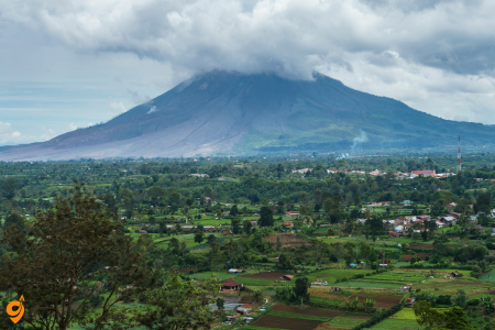
Berastagi functions as North Sumatra’s premier highland destination, offering cool mountain climate, volcanic landscapes, and agricultural productivity that creates a distinctive regional culture adapted to highland conditions. This small town demonstrates how Indonesian communities adapt to different ecological zones while maintaining connections to broader regional and national cultures.
The town’s elevation of 1,300 meters above sea level creates a temperate climate that provides relief from Sumatra’s typical tropical heat and humidity. This climate difference allowed Dutch colonial administrators to establish Berastagi as a hill station where Europeans could escape coastal heat while maintaining colonial administrative functions. Understanding this colonial history helps explain the town’s architecture, urban planning, and contemporary tourism infrastructure.
Berastagi’s agricultural surroundings showcase highland farming systems that produce vegetables, fruits, and flowers for markets throughout North Sumatra. The region’s volcanic soils, created by nearby Mount Sinabung and Mount Sibayak, provide exceptional fertility that supports intensive agriculture. Observing these farming systems helps you understand how volcanic activity creates both risks and benefits for human communities.
Traditional markets in Berastagi offer authentic experiences of highland agricultural culture, with vendors selling produce grown in surrounding valleys and mountain slopes. These markets demonstrate how local communities maintain traditional trading practices while adapting to modern transportation and communication technologies.
The town serves as a base for exploring nearby volcanoes, traditional villages, and natural attractions while providing comfortable accommodations and reliable infrastructure. This combination makes Berastagi an excellent introduction to highland Sumatra for visitors who want to experience mountain environments without extreme physical challenges.
Air Transportation Access
Primary Airport Gateway: The nearest airport is Medan’s Kuala Namu International Airport. This modern international airport serves as the main entry point for travelers heading to Berastagi.
Airport to Berastagi Transportation Options: A taxi direct from the airport takes around 3 hours to reach Berastagi. Buses also go right from the airport to Kabanjahe via Berastagi. If you just arrive in Kualanamu Airport, there are many options to reach Berastagi. First you can find bus named ALMASAR in train station, which provides regular connections from the airport area.
Distance and Travel Time: The journey from Medan’s Kuala Namu International Airport covers approximately 70 kilometers, with travel times varying based on transportation method and traffic conditions.
Road Transportation – Long Distance Options
Tourist Shuttle Services: From Bukit Lawang, the only way to reach Berastagi is to take a tourist shuttle that will take you directly to your hotel. Any local guesthouse will be able to organise your trip for you in comfort. Transport to Medan, Berastagi, Lake Toba or Banda Aceh is available through a daily tourist bus service running from Bukit Lawang every morning at around 08:30 am.
Private Vehicle Access: The road network connecting Medan to Berastagi is well-established, making private car rentals and taxi services viable options for travelers preferring door-to-door convenience.
Inter-city Bus Services: Regular bus connections operate between major North Sumatra cities, with Berastagi serving as an important stop on routes connecting Medan to Lake Toba and other highland destinations.
Local Transportation Within Berastagi
Public Minivan Buses: You’ll be travelling around the area in public minivan buses, also known as Opelets. These run from the main terminal and will take you to a variety of destinations including Lake Toba and Sipiso Piso Waterfall. These shared transportation vehicles form the backbone of local public transport in the Berastagi area.
Becak (Tuk-tuk) Services: Get a taste of the locals’ transportation by riding a Becak (Tuk Tuk). These three-wheeled vehicles provide an authentic local transportation experience and are particularly useful for short distances within town.
Motorcycle Rental: You’ve also got the option of hiring your own motorbike if you’d prefer more independence in exploring the surrounding areas at your own pace.
Major Nearby Attractions Accessible by Local Transport
Mount Sibayak: Hiking Sibayak Volcano at sunrise is hands down the main highlight of visiting Berastagi. Sibayak Volcano is probably one of the most accessible volcanic peaks in Indonesia. Famous for its steamy sulphurous fumaroles, Gunung Sibayak (2094m) is one of Indonesia’s most accessible volcanoes.
Berastagi Fruit Market: Thanks to its location in the Karo highlands, Berastagi is a fantastic place for buying local produce. In fact, this town is famous for its fruit and vegetables; namely passion fruit. Pasar Buah Berastagi is the town’s main market and it’s the best place in town to grab fresh produce. Berastagi Fruit Market is a regionally famous traditional market selling local fruit souvenirs.
Traditional Karo Villages: It’s time to visit Lingga Village, one of the oldest traditional villages in Karo. At this tourist attraction in Berastagi, you can see the 250 year old Karo Traditional House. Siwaluh Jabu House is a wooden house with a thatched roof. Each house is unique, because it is inhabited by eight families who live side by side.
Bukit Kubu: Bukit Kubu (Kubu Hill), is a greeny hill area with a hotel inside suitable for picnics. While you are at it, don’t miss out the chance to fly kite in Bukit Kubu.
Natural Attractions: The next tourist attraction in Berastagi is the Two Color Waterfall. As the name suggests, this waterfall has two colors, namely blue and grayish white with hot water. Additional attractions include Lau Debuk-Debuk Hot Springs and various hiking trails throughout the Karo highlands.
Pulau Weh
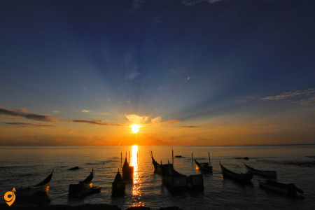
Pulau Weh represents Indonesia’s northernmost territory and offers some of Southeast Asia’s finest diving and snorkeling experiences in pristine marine environments. This small island demonstrates how isolated maritime communities develop distinctive cultures while maintaining connections to broader Indonesian society through trade, transportation, and cultural exchange.
The island’s location in the Andaman Sea places it at the convergence of Indian Ocean and Southeast Asian marine ecosystems, creating underwater biodiversity that attracts marine life from both biogeographical regions. Coral reefs around Pulau Weh support fish populations, coral species, and marine mammals that represent some of the richest marine ecosystems in tropical Asia.
Diving and snorkeling sites around the island reveal underwater landscapes that include coral walls, underwater caves, volcanic formations, and open ocean environments that support different types of marine life. Understanding these diverse marine habitats helps you appreciate the complexity of tropical marine ecosystems and the importance of marine conservation.
The island’s small size and relatively undeveloped tourism infrastructure create opportunities for authentic cultural interactions with local fishing communities that maintain traditional maritime lifestyles. These communities demonstrate how small island populations adapt to marine environments while participating in broader Indonesian economic and cultural systems.
Pulau Weh’s beaches combine volcanic black sand with coral white sand, creating diverse coastal environments that support different types of marine and terrestrial ecosystems. These varied beach environments provide opportunities for different types of recreation while demonstrating how geological processes create diverse coastal landscapes.
The island’s role as a transportation hub for ferry connections between Sumatra and other Indonesian islands helps you understand how maritime transportation continues to connect Indonesian communities across vast ocean distances, maintaining cultural and economic relationships that span the archipelago.
Air Transportation
Nearest Airport:
- Sultan Iskandar Muda Airport (BTJ) – Banda Aceh
- Location: Blang Bintang, Aceh Besar Regency, approximately 15 km from Banda Aceh city center
- Operating hours: 24 hours
- Airlines serving the route: Garuda Indonesia and Lion Air with direct flights from Jakarta (CGK) and Medan (KNO)
- International connections: Via Medan to Bangkok (Air Asia), Kuala Lumpur (Air Asia, Malaysia Airlines)
- Direct flights to Pulau Weh: Available from Medan Kuala Namu Airport
Airport Transportation:
- Free shuttle bus from airport to Banda Aceh town center (available at arrivals pickup area)
- Taxi, bus, rental car, or shuttle services to Ulee Lheu Seaport (30 minutes)
- Taxi fare from airport to ferry port: approximately 100,000 IDR (30 minutes)
Sea Transportation
Main Ferry Route:
- From Ulee Lheu Seaport (Banda Aceh) to Balohan Seaport (Pulau Weh)
- Address: Ulee Lheu Port, Banda Aceh, Aceh Province
Ferry Services:
Express Bahari (Fast Ferry):
- Daily departures from Banda Aceh at 16:00 and from Pulau Weh at 08:30
- Additional departure at 10:00 from Banda Aceh
- Journey time: Maximum 1 hour
- Booking contact: +62813 7325 6365, +62852
Regular Fast Ferry:
- Departures at 09:30 AM and 4:00 PM daily
- Return ferries: 08:00 and 14:30 daily
- Journey time: 45 minutes by fast regular ship
Transportation on Pulau Weh
Local Transportation:
- No public transport on the island
- Main options: motorcycles or tuk-tuks
- Motorbike rental available for independent travel around the island
Inter-island Transportation:
- Boat service from Teupin Layeu (Iboih) jetty to Pulau Rubiah for 50,000 IDR one way
Main Destinations on Pulau Weh
Primary Locations:
- Sabang: Main city of Pulau Weh
- Popular tourist destinations: Iboih, Gapang, and Sumur Tiga
Transportation Companies
Airlines:
- Garuda Indonesia
- Lion Air
- Air Asia (for international connections)
- Malaysia Airlines (for international connections)
Ferry Operators:
- Express Bahari
- Aceh Hebat 2 Ferry
- KMP BRR Ferry
Nearby Attractions
Natural Attractions:
- Known for ecosystem, diving, jungle, and beaches
- Pulau Rubiah: Clear water diving and snorkeling destination
- Various beaches around Iboih, Gapang, and Sumur Tiga areas
Island Location:
- Most northwestern island in the Indonesian Archipelago
- Situated in the Andaman Sea
Mount Rinjani
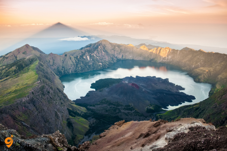
Mount Rinjani stands majestically as Lombok’s most iconic landmark and Indonesia’s second-highest volcano at 3,726 meters. This sacred mountain offers one of Southeast Asia’s most rewarding trekking experiences, with multi-day hikes leading through diverse ecosystems from tropical forests to alpine meadows.
The summit rewards climbers with breathtaking panoramic views and the stunning Segara Anak crater lake, a turquoise jewel nestled within the caldera. Natural hot springs dot the crater rim, providing a therapeutic soak after challenging climbs. The mountain holds deep spiritual significance for the local Sasak people, who conduct annual ceremonies at its peak. Adventure seekers can choose from various trekking routes, with the most popular being 2-3 day expeditions that include camping under star-filled skies and witnessing spectacular sunrises above the clouds.
Gili Islands
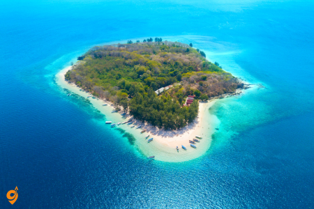
The three tiny Gili Islands – Gili Trawangan, Gili Meno, and Gili Air – float like emeralds in the azure waters off Lombok’s northwest coast. These car-free paradises offer the perfect tropical escape where bicycles and horse-drawn carts called cidomos provide all transportation. Gili Trawangan pulses with backpacker energy, featuring beach bars, diving schools, and vibrant nightlife. Gili Meno remains the quietest and most romantic, ideal for honeymooners seeking pristine beaches and tranquil sunsets.
Gili Air strikes a perfect balance, offering both relaxation and gentle activity. All three islands boast world-class diving and snorkeling with sea turtles, colorful coral gardens, and diverse marine life. The powdery white sand beaches and swaying palm trees create postcard-perfect scenes, while beachfront warungs serve fresh seafood as waves lap nearby.
Tiu Kelep Waterfalls
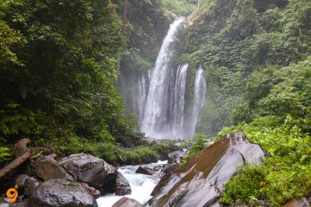
Hidden deep within Lombok’s lush northern forests, Tiu Kelep Waterfalls cascade dramatically down volcanic rock faces, creating one of the island’s most spectacular natural attractions. The journey to reach these falls becomes part of the adventure, involving a scenic trek through dense tropical rainforest filled with exotic birds and towering trees. The main waterfall plunges 45 meters into a natural swimming pool of crystal-clear mountain water, perfect for refreshing dips after the hike.
Local legend claims these sacred waters possess healing properties, and the Sasak people have long considered the falls spiritually significant. The trek typically takes 1-2 hours each way, passing through traditional villages and rice paddies before entering the jungle. Multiple tiers of cascading water create natural jacuzzis and swimming holes, while the surrounding forest provides a cool, misty atmosphere that feels worlds away from the tropical heat below.
Senggigi Beach
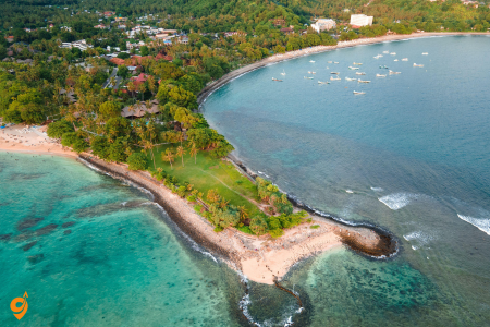
Senggigi Beach stretches along Lombok’s western coastline as the island’s original beach resort destination, offering a more refined alternative to the backpacker havens elsewhere. This crescent-shaped bay features golden sand beaches backed by rolling hills and traditional fishing villages. The beach faces west, making it perfect for spectacular sunset viewing, with the silhouette of Bali’s Mount Agung visible across the strait on clear days. Senggigi maintains a relaxed, upscale atmosphere with beachfront hotels, seaside restaurants, and local art markets selling traditional Sasak handicrafts.
The calm waters make it ideal for swimming and beginner surfing, while nearby coral reefs offer decent snorkeling opportunities. Traditional outrigger boats bob in the bay, and local fishermen still launch their colorful vessels at dawn. The area serves as an excellent base for exploring Lombok’s attractions while enjoying comfortable accommodations and reliable tourist infrastructure.
Tanjung Puting National Park
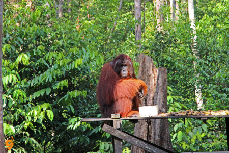
Tanjung Puting National Park in Central Kalimantan stands as one of the world’s most important orangutan conservation areas and offers perhaps the planet’s best opportunity to observe these remarkable great apes in their natural habitat. This UNESCO Biosphere Reserve protects over 400,000 hectares of peat swamp forests, freshwater swamp forests, and tropical heath forests that form critical habitat for endangered Bornean orangutans.
The park experience centers around multi-day boat journeys aboard traditional klotok houseboats that navigate the Sekonyer River system. These floating expeditions allow visitors to penetrate deep into the forest while maintaining comfortable accommodations and meals on board. The highlight involves visiting rehabilitation centers like Camp Leakey, where rescued orangutans learn survival skills before returning to the wild. During feeding times, visitors witness these intelligent primates displaying complex behaviors and social interactions. The park also protects sun bears, clouded leopards, and over 200 bird species. Night sounds of gibbons calling and the forest coming alive create an immersive jungle experience that connects visitors directly with one of Earth’s most threatened ecosystems.
Address & Location
- Located in Central Kalimantan, straddling Kotawaringin Barat and Seruyan regencies
- Main gateway town: Pangkalan Bun
- Entry point: Kumai Port
- Airport code: PKN (Iskandar Airport/Pangkalan Bun Airport)
Opening Hours
- Park is accessible 24/7 once you’re on your klotok boat
- Flight schedules and tour operators determine actual visiting times
- Most tours start early morning from Kumai Port
Transportation Methods
By Air (Primary Method)
Major Airlines:
- NAM Air: Jakarta-Pangkalan Bun daily (ETD 06:40, ETA 08:00)
- Trigana Air: Surabaya-Pangkalan Bun daily (ETD 06:10, ETA 07:10)
- NAM Air: Surabaya-Pangkalan Bun daily service
- Trigana Air: Jakarta-Pangkalan Bun (09:15-10:20)
Airport Details:
- Iskandar Airport at Pangkalan Bun
- Direct flights available from Jakarta and Surabaya
- Current destinations include Jakarta, Semarang, and Surabaya
By Sea (Alternative Method)
- Pelni boats from Semarang (Java) to Kumai
- Couple of boats per week, journey takes around 72 hours
Ground Transportation
Airport to Kumai:
- Short taxi ride from Pangkalan Bun airport to Kumai
- Tour operators typically provide airport pickup to Kumai port
- Distance: Approximately 30 minutes drive
Within the Park:
- Klotok (traditional wooden houseboat) is the only convenient river transportation
- Klotok boat is the primary mode of transportation in Tanjung Puting
- Take klotok from Kumai Port up the Sekonyer River to Camp Leakey
Nearby Stations & Terminals
- Iskandar Airport (Pangkalan Bun Airport) – PKN
- Kumai Port (main departure point for klotok boats)
- Kumai is the nearest port to Tanjung Puting
Transportation Companies & Tour Operators
Mentioned Tour Companies:
- Orangutan Applause
- Orangutan & Dayak Tour PT Beeholiday Mitra Wisata
- Tanjung Puting Tourism
- Monica Guide Orangutan Tour
- Ema Tour Indonesia
- Guia En Borneo
Ferry Services:
- Pelni (state ferry company)
Journey Timeline & Distances
Travel Stages:
- Kumai to Tanjung Harapan: 2 hours by klotok
- Camp Leakey: further 2 to 2½ hours upriver
Accommodation & Transportation Combined
- Main accommodation option is the klotok wooden houseboat, which also serves as transportation
- Klotok plays dual role as transportation and base accommodation
- Multi-day packages typically include overnight stays on the klotok
Important Notes
Tour Arrangements:
- Tour operators typically wait at airport for pickup to Kumai
- Return airport transfers usually available for additional cost
- Most visitors book all-inclusive packages including transportation
Access Restrictions:
- Klotok designed for slowly cruising down the Sekonyer river
- Park access is primarily water-based via river system
- Land access extremely limited within the park
Nearby Attractions
- Camp Leakey (famous orangutan rehabilitation center)
- Tanjung Harapan Orangutan Rehabilitation Center
- Sekonyer River ecosystem
- BSM Waterpark (in Pangkalan Bun)
- Istana Kuning (Yellow Palace)
Wildlife Viewing Opportunities
- World’s largest population of wild orangutans
- Proboscis monkeys, civets, gibbons, and sun bears
- Near guarantee of seeing free-roaming orangutans
Derawan Archipelago
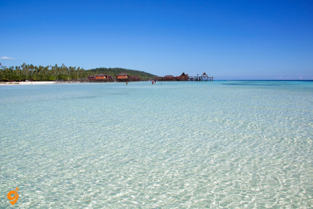
The Derawan Archipelago off East Kalimantan’s coast represents one of Indonesia’s premier marine destinations, where pristine coral reefs meet crystal-clear tropical waters. This collection of 31 islands creates a marine paradise that supports incredible biodiversity both above and below the waterline. The archipelago’s isolated location has preserved its ecosystems from major human impacts, resulting in some of the world’s healthiest coral reefs.
Derawan Island serves as the main base, offering comfortable accommodations and easy access to world-class diving and snorkeling sites. The surrounding waters teem with marine life, including manta rays, whale sharks, and schools of barracuda that create underwater spectacles. Sangalaki Island functions as a major green turtle nesting site, where visitors can witness these ancient mariners coming ashore to lay eggs during nesting season. Kakaban Island contains a unique phenomenon – a marine lake filled with harmless jellyfish that have evolved without stingers, allowing visitors to swim among thousands of these ethereal creatures. The archipelago’s combination of pristine reefs, rare marine encounters, and traditional fishing village culture creates a complete tropical paradise experience.
Kinabatangan River
The Kinabatangan River flows as Sabah’s longest river and creates one of Indonesia’s most important wildlife corridors, supporting the highest concentration of wildlife in the country. This 560-kilometer waterway winds through lowland rainforests, oxbow lakes, and limestone caves, creating diverse habitats that support an remarkable array of species. The river’s meandering course through relatively undisturbed forests makes it accessible for wildlife viewing while maintaining ecological integrity.
Wildlife encounters along the Kinabatangan river those found anywhere in Southeast Asia. Bornean orangutans nest in riverside trees, proboscis monkeys leap between branches, and pygmy elephants emerge from the forest to drink at the water’s edge. The river supports eight primate species, over 200 bird species, and serves as a crucial habitat for endangered species like the Sumatran rhinoceros.
Evening river cruises reveal nocturnal wildlife, including crocodiles with glowing eyes, sleeping birds, and various mammals coming to drink. The surrounding landscape includes the Gomantong Caves, where millions of swiftlets nest and produce valuable bird’s nest soup ingredients. Local communities have developed sustainable ecotourism that provides economic benefits while protecting critical habitats.
Lokbaintan Floating Market
Lokbaintan Floating Market near Banjarmasin represents one of Indonesia’s most authentic traditional markets, where commerce has been conducted on the water for over 400 years. This remarkable market demonstrates how communities adapt to their environment, as the flat, flood-prone landscape of South Kalimantan makes water-based trade more practical than land-based alternatives. The market operates as a living museum of traditional Banjar culture and commerce.
The market comes alive before dawn as hundreds of small boats called jukung converge on the Barito River. Local farmers and traders paddle their wooden vessels loaded with fresh produce, flowers, and traditional foods to create a floating bazaar. The scene creates a photographer’s paradise as colorful boats packed with tropical fruits, vegetables, and flowers create patterns across the dark water. Traditional Banjar women wear distinctive pointed hats called tanggui while conducting business entirely from their boats.
The market reflects the region’s agricultural abundance, featuring exotic fruits like rambutan and durian alongside everyday vegetables and spices. This authentic cultural experience allows visitors to witness centuries-old trading traditions that continue to serve local communities while providing insight into how traditional societies organize commerce around their natural environment.
Address & Location
- Sungai Pinang village (Lok Baintan), Sungai Tabuk sub-district, Banjar district, South Kalimantan
- Located along the Martapura River in Banjarmasin, Indonesia
- Located in Pinang River and only 10 kms from Swiss-Belhotel Banjarmasin
Operating Hours
- Trading activity starts at 06:00 AM until 09:30 WITA (Western Indonesian Time)
- The market starts every morning at sunrise, aim to be there between 6:00 AM and 6:30 AM
- For the most authentic experience, arrive early – make a 4:30 AM start to witness the first sales between canoe vendors and city traders
Transportation Methods
By Boat (Primary Method)
- Boat rental from Banjarmasin with negotiable rates
- Ideal departure time is 05:00-05:30 AM, journey takes 30-45 minutes by boat
- Boat ride from central Banjarmasin takes about 45 minutes
- 45-minute boat ride from downtown Banjarmasin
- Walk along the Martapura river using a klotok (traditional boat)
By Land Transportation (Alternative)
- Land transportation is available but takes twice as long as boat transportation
- The market is accessible by land transportation, followed by a small boat ride to the floating market
- Can be reached in an hour from Banjarbaru City, then proceed by using an engine boat or klotok
Ride-Hailing and Local Transport
- Ride-hailing apps like Gojek or Grab operate in Banjarmasin, offering convenient transportation options
- Alternative modes of transportation such as ojek (motorcycle taxis) or becak (tricycle taxis) for short distances
Nearby Stations & Terminals
- Syamsudin Noor Airport (Banjarmasin) – main airport serving the region
- Banjarmasin city center – main departure point for boats
- Banjarbaru City – alternative starting point
- Various boat jetties along the Martapura River
Parking
- Limited parking available at various boat departure points along the Martapura River in Banjarmasin
- Hotel parking available for tourists staying in central Banjarmasin
- Parking at traditional boat rental locations near the river
Nearby Attractions
- The closest floating market to central Banjarmasin
- Banjarmasin is known for several floating markets, but Lokbaintan Floating Market is the most famous and historically significant
- There are other smaller floating markets scattered throughout the city, each offering its own unique charm
- Martapura River scenic boat tours
- Traditional Banjar cultural sites in the surrounding area
- Banjarmasin city center attractions
Bunaken Marine National Park
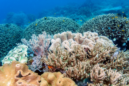
Bunaken Marine National Park represents one of Indonesia’s most significant marine conservation achievements and serves as a living laboratory for understanding tropical reef ecosystems. Established in 1991, this 89,065-hectare marine sanctuary encompasses five islands off North Sulawesi’s coast, protecting some of the world’s most biodiverse coral reef systems. The park’s unique position at the confluence of the Pacific and Indian Ocean currents creates exceptional conditions that support an extraordinary variety of marine life.
The park’s underwater landscape features dramatic vertical walls that plunge from shallow coral gardens to depths exceeding 1,500 meters, creating distinct ecological zones that support different species communities. These reef walls function as underwater highways for pelagic species while providing shelter for countless smaller reef inhabitants. Divers encounter over 390 coral species and more than 2,000 fish species, including massive schools of barracuda, reef sharks, and the occasional whale shark. The coral formations themselves tell a story of millions of years of growth and adaptation, with hard corals creating the reef structure while soft corals add brilliant colors and movement to the underwater scenes.
What makes Bunaken particularly special is its role in marine conservation education and community involvement. Local fishing communities have transformed from potential threats to the reef into its primary protectors, demonstrating how sustainable tourism can create economic incentives for conservation. The park’s success in balancing human needs with environmental protection serves as a model for marine conservation worldwide.
Address & Location
Bunaken National Marine Park is located at Kotak Pos 1196, Bunaken, Bunaken Kepulauan, Kota Manado, Sulawesi Utara 95011, Indonesia
Located near Manado City in North Sulawesi
The park covers a total area of 890.65 km², 97% of which is marine habitat
Opening Hours
Open 24 hours daily
However, boat services operate on specific schedules, and most activities are conducted during daylight hours for safety and optimal marine life viewing.
Transportation Methods
Getting to Manado (Gateway City)
By Air:
The main gateway is Sam Ratulangi International Airport (MDC) in Manado. Most flights have a stopover in Makassar airport
Major Airlines Serving Manado:
Indonesian domestic carriers operate regular flights from Jakarta, Surabaya, and other major Indonesian cities
From Manado to Bunaken Island
Public Ferry Service:
- The ferry runs daily (except Sundays), departing Manado at 2:00 PM and returning from Bunaken at 8:00 AM
- Public boats to Bunaken Island leave from the boat pier near Soekarno Bridge. They leave every day except Sundays, between 2pm and 3pm
- Bunaken to Manado between 8am and 9am every morning
Private Boat/Charter:
- The islands can be reached in just 30 minutes by speedboat from Manado
- Most resorts will arrange a private boat or charter boat for your transfer
- A chartered speedboat will depart from Manado on demand
Day Tour Options:
Tour operators offer glass bottom boat trips: You will be picked up from a Manado hotel at 8 AM, and then transported to the Manado Port. Here, you will board the glass bottom boat for the 1 hour trip to Bunaken Island
Nearby Stations & Terminals
- Sam Ratulangi International Airport (MDC) – Main airport serving North Sulawesi
- Boat pier near Soekarno Bridge, Manado – Main departure point for public ferries
- Dermaga Bunaken – Main arrival pier on Bunaken Island (closest to Manado)
Transportation Companies & Services
Taxi Services in Manado:
- Several taxi operators here: Bluebird, Taxi Kokapura, Trust, Celebrity
- The most reliable one in Manado, the blue taxi; Bluebird is the most trusted taxi operator
Local Transportation:
Motor bike + driver (called an ojek) that can take you around the island
Tour Companies:
- Sulawesi Daily Tour Company
- Welcome Manado Tours & Travel
- Various resort-arranged transportation services
Journey Duration & Distances
- 45-minute boat ride from Manado to Bunaken
- Arrange a pick up with your resort prior to arrival, as you may struggle to find transport otherwise
Islands Included in the Marine Park
In addition to banana-shaped Bunaken Island itself, the 890 km² of marine national park includes the neighboring islands of Manado Tua (a distinctive cone-shaped extinct volcano), Siladen, Mantehage, Nain, and Nain Kecil
Nearby Attractions
- Manado Tua Island (extinct volcano within the marine park)
- Siladen Island (part of the marine park complex)
- Manado city attractions and cultural sites
- Tomohon (highland town near Manado)
- Tangkoko Nature Reserve (wildlife sanctuary)
- Minahasa Highlands cultural sites
Tangkoko National Reserve
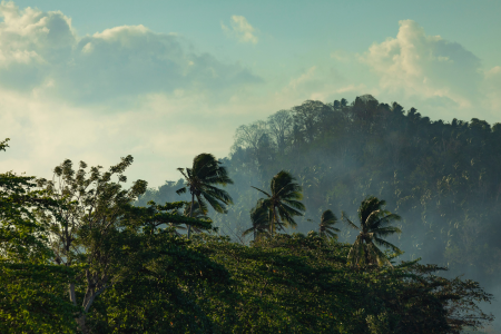
Tangkoko National Reserve functions as one of Sulawesi’s most accessible windows into the island’s remarkable endemic wildlife, protecting 8,700 hectares of lowland rainforest that harbor species found nowhere else on Earth. This reserve demonstrates the concept of island biogeography in action, showing how isolation leads to the evolution of unique species that fill specific ecological niches unavailable elsewhere.
The reserve’s most famous residents are the spectral tarsiers, tiny primates with enormous eyes that represent one of the world’s smallest primates and showcase remarkable adaptations to nocturnal life. These creatures, weighing less than 150 grams, possess eyes larger than their brains and can rotate their heads 180 degrees, adaptations that make them supremely efficient night hunters. The reserve also protects the endangered crested black macaques, whose expressive faces and complex social behaviors provide insights into primate evolution and intelligence.
Tangkoko’s accessibility makes it an ideal location for understanding how tropical ecosystems function and how different species interact within complex food webs. The forest’s layered structure, from ground level to canopy, supports different communities of animals and plants, demonstrating how ecosystems maximize biodiversity through vertical habitat specialization. Night walks reveal an entirely different cast of characters, including various species of bats, nocturnal birds, and insects that play crucial roles in pollination and seed dispersal.
Address & Location
- The Tangkoko Nature Reserve is located on Mount Tangkoko in the district of Bitung in the province of North Sulawesi, about one hour’s drive from Manado
- Tangkoko Lodge is located in Batuputih village
- The main entry point is through Taman Wisata Alam Batuputih (Batuputih Nature Tourism Park)
- Tangkoko National Park is about 60 kilometers (40 miles) east of Manado
Opening Hours
- Morning walk: 5:30 AM to 10:00 or 11:00 AM
- Afternoon walk: 4:00 PM to 6:30 PM
- Special interest is given to the Tarsius Monkeys, which sneak out at dawn and dusk
- The reserve operates year-round, but wildlife viewing is most active during early morning and late afternoon hours when nocturnal species like tarsiers are most active.
Transportation Methods
Getting to North Sulawesi
By Air:
Best way to get to Tangkoko National Park is to fly to Sam Ratulangi International Airport (MDC) in Manado with transit in Ujung Pandang, Makassar, South Sulawesi
Sam Ratulangi International Airport (MDC) serves as the main gateway to North Sulawesi and is located approximately 60 kilometers from the reserve.
From Manado to Tangkoko
Organized Tours:
Viator offers a high-rated Tangkoko private tour starting from Manado. This tour includes transportation to and from the Manado city area, park admission ticket for Tangkoko, and the ranger/guide fee, plus 10 hours of sightseeing in total
Safari Tours offers transfer by bus or AC 4-passenger vehicle to Nature Reserve. The 2-hour drive to the 9,000 hectares national park is quite scenic as visitors pass through small villages.
Private Transportation:
- Tours depart from Manado, Tomohon, Bitung hotel, or airport directly to Tangkoko nature reserve
- Taxi services from Manado airport or city center are available for direct transfer to the reserve.
Public Transportation Challenges:
- There is no regular public transportation going from Bitung to Batuputih
- This means most visitors rely on organized tours or private transportation to reach the reserve.
Nearby Stations & Terminals
- Sam Ratulangi International Airport (MDC) – Primary arrival point for international and domestic visitors
- Manado city center – Various hotels and tour operators offer pickup services
- Bitung city – Closest major town to the reserve
- Batuputih village – Final destination and entry point to the reserve
Transportation Companies & Services
Tour Operators:
- Manado Safaris offers tours to Tangkoko Nature Reserve
- Safari Tours provides transportation via bus or AC vehicle
- Tangkoko Wildlife Tour offers full-day trip services
- Viator (international tour platform) – offers private tours with transportation included
Local Services:
- Tangkoko Lodge & Tours operates from Batuputih village
- Various local guides and transportation providers based in Batuputih village
Journey Duration & Practical Details
- The drive from Manado to Tangkoko takes approximately 2 hours
- Return journey from Tangkoko to Manado takes place between 9:00 AM and 11:00 AM
- The journey involves traveling through scenic countryside and small villages, providing visitors with views of rural North Sulawesi life.
Nearby Attractions
Within North Sulawesi:
- The highlands around Tomohon are a popular destination
- Lembeh is another notable destination in the region
- Tumbak offers additional attractions for visitors
Wildlife Viewing:
- In the Tangkoko Nature Reserve one can often view Tarsius tarsier (one of the smallest known primates), black tailless monkeys, maleo birds, wild pigs and kuskus (marsupials)
- Birds include the Green-backed Kingfisher, Sulawesi Lilac Kingfisher, Sulawesi Dwarf Kingfisher, knobbed hornbill, Sulawesi hornbill and maleo
Lokon Volcano
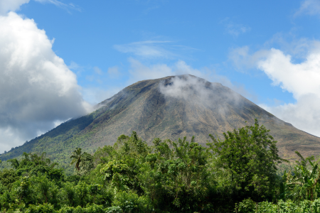
Lokon Volcano stands as one of North Sulawesi’s most active volcanic peaks and provides an excellent example of how volcanic activity shapes both landscapes and human communities. This twin-peaked stratovolcano, reaching 1,580 meters in height, demonstrates the dynamic geological processes that continue to build and reshape the Indonesian archipelago. Understanding Lokon helps explain how the Ring of Fire’s volcanic activity creates the fertile soils and dramatic landscapes that characterize much of Indonesia.
The volcano’s recent activity, including significant eruptions in the early 2010s, illustrates how volcanic systems cycle between periods of dormancy and activity. The volcanic soils around Lokon support incredibly fertile agricultural areas where local communities grow everything from rice to exotic fruits, demonstrating how human societies adapt to and benefit from living near active volcanoes despite the inherent risks. The traditional Minahasan people have developed sophisticated systems for monitoring volcanic activity and have learned to time their agricultural cycles to take advantage of volcanic soil enrichment.
Climbing Lokon when conditions permit offers insights into volcanic geology and the process of ecological succession as life recolonizes areas affected by recent eruptions. The journey up the volcano passes through different vegetation zones, each adapted to specific altitude and soil conditions, providing a natural lesson in how plants and animals adapt to challenging environments. The views from the summit encompass the broader geological context of North Sulawesi, showing how volcanic activity has shaped the entire regional landscape.
Makassar
Makassar serves as South Sulawesi’s dynamic gateway and represents how Indonesian cities balance rapid modernization with deep historical roots. As the region’s largest city and primary port, Makassar demonstrates how strategic geographic positioning creates opportunities for trade, cultural exchange, and economic development. The city’s location at the intersection of major sea routes has made it a crucial hub for centuries, connecting the spice islands with international markets.
The city’s most iconic landmark, Fort Rotterdam, provides a tangible connection to the complex history of European colonialism in Southeast Asia. Built by the Gowa Sultanate and later expanded by the Dutch, this fortress illustrates how local kingdoms adapted to colonial pressures while maintaining their cultural identity. The fort now houses museums that explain how the spice trade transformed global economics and how local Bugis and Makassarese cultures influenced maritime trade throughout the archipelago.
Modern Makassar showcases Indonesia’s rapid urban transformation while maintaining strong connections to traditional maritime culture. The Paotere Harbor continues to function as one of Indonesia’s last major ports for traditional pinisi schooners, wooden sailing vessels that represent centuries of Bugis maritime expertise. These boats, still constructed using traditional techniques without blueprints, demonstrate how indigenous knowledge adapts to modern commerce while preserving cultural heritage.
Getting to Makassar by Air
- Sultan Hasanuddin Airport serves as Makassar’s main gateway, located about 20 kilometers northeast of the city center. This airport connects Makassar to major Indonesian cities like Jakarta, Surabaya, Denpasar, and Yogyakarta, as well as international destinations. The airport operates 24 hours daily, though specific airline counters have varying schedules.
- From the airport to the city, you can take the official airport bus (Damri), taxis, ride-hailing services like Grab and Gojek, or rental cars. The airport provides both short-term and long-term parking facilities for those driving their own vehicles.
- Major airlines serving this route include Garuda Indonesia, Lion Air, Citilink, AirAsia, and Sriwijaya Air for domestic flights, with some international carriers offering regional connections.
Reaching Makassar by Sea
Makassar’s strategic coastal location makes it accessible by ferry and passenger ships. The main port is Pelabuhan Soekarno-Hatta, which handles both cargo and passenger vessels. PELNI (Indonesia’s national shipping company) operates regular passenger ferry services connecting Makassar to other Indonesian islands including Java, Kalimantan, and eastern Indonesian destinations.
The port operates daily with varying schedules depending on the destination. Terminal buildings provide waiting areas, though amenities are basic compared to airports.
Land Transportation Options
While Makassar is on Sulawesi island, you can reach it overland if you’re already on the island. Long-distance buses operate from various cities within Sulawesi, with the main bus terminal being Terminal Daya, located about 10 kilometers from the city center.
For intercity travel within Sulawesi, companies like PO Litha and other regional bus operators provide services. The terminal operates from early morning until late evening.
Local Transportation Within Makassar
Once you arrive, several local transportation options help you navigate the city. Pete-pete (colorful local minibuses) follow specific routes throughout the city and operate from dawn until evening. Ojek (motorcycle taxis) and becak (cycle rickshaws) provide point-to-point transportation, especially useful for short distances or areas not served by larger vehicles.
Modern ride-hailing apps like Grab and Gojek operate extensively in Makassar, offering both motorcycle and car services through smartphone apps available 24 hours.
Nearby Attractions and Their Access
- Fort Rotterdam, a historical Dutch fort, sits in the city center and is easily accessible by all forms of local transportation.
- Losari Beach Boulevard runs along the waterfront and connects to various parts of the city through main roads.
- Trans Studio Makassar, one of the world’s largest indoor theme parks, is located in the city center with ample parking and public transportation access.
- Somba Opu Street offers traditional shopping and cultural experiences, accessible via multiple pete-pete routes.
- The floating mosque (Masjid Terapung) and various traditional markets are scattered throughout the city, each accessible through the comprehensive local transportation network.
Tana Toraja
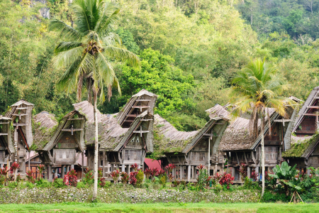
Tana Toraja represents one of Indonesia’s most culturally intact highland regions, where ancient animistic traditions have evolved alongside Christian influences to create a unique synthesis of beliefs and practices. This mountainous region, situated in South Sulawesi’s central highlands, provides exceptional insights into how traditional societies maintain cultural continuity while adapting to modern pressures and opportunities.
The region’s most distinctive cultural feature involves elaborate funeral ceremonies that can last for days and involve entire communities in complex rituals that honor the deceased while reinforcing social bonds among the living. These ceremonies demonstrate how traditional societies use ritual and ceremony to process grief, redistribute wealth, and maintain social cohesion across extended family networks. The famous buffalo sacrifices, while striking to outsiders, represent sophisticated systems of social reciprocity and spiritual belief that have sustained Torajan communities for centuries.
Tana Toraja’s landscape itself reflects this cultural complexity, with ancient burial sites carved into cliff faces and traditional rice terraces that transform steep mountainsides into productive agricultural areas. The region’s megalithic monuments, some dating back over a thousand years, provide evidence of sophisticated prehistoric societies that developed complex religious and social systems. These archaeological remains help explain how contemporary Torajan culture represents thousands of years of cultural evolution and adaptation to highland environments.
Ground Transportation: Makassar to Tana Toraja
Public Bus Services
- Main departure terminal: Terminal Daya, Makassar
- Address: Jl. Perintis Kemerdekaan, Tamalanrea, Makassar
- Operating hours: 5:00 AM – 10:00 PM
- Distance from Makassar city center: 10 km
- Journey time to Tana Toraja: 8-10 hours
- Bus companies serving this route
- PO Litha & Co
- PO Bintang Prima
- PO Kramat Djati
- Local regional operators
- Bus departure schedules
- Morning departures: 6:00 AM – 9:00 AM
- Evening departures: 7:00 PM – 9:00 PM
- Daily service availability
- Reduced frequency during rainy season
Private Vehicle Options
- Car rental companies in Makassar
- Avis Indonesia
- Hertz Indonesia
- Local rental agencies (Makassar Car Rental, etc.)
- Hotel-affiliated rental services
- Rental pickup locations
- Sultan Hasanuddin Airport
- Major hotels in Makassar
- City center rental offices
- Terminal Daya area
- Route information
- Primary route: Highway 1 (Trans-Sulawesi Highway)
- Total distance: approximately 300 km
- Driving time: 6-8 hours
- Mountain road conditions: winding, elevation changes
- Fuel stations available at regular intervals
Organized Tour Transportation
- Tour operators providing transportation
- Toraja Highland Tours
- Sulawesi Adventure Tours
- Local Makassar tour agencies
- Hotel tour desks
- Service inclusions
- Air-conditioned vehicles
- English-speaking guides
- Stops at scenic viewpoints
- Cultural site explanations
Transportation Within Tana Toraja
Main Transportation Hub: Rantepao
- Rantepao Bus Terminal
- Address: Jl. Pongtiku, Rantepao, North Toraja Regency
- Operating hours: 5:00 AM – 6:00 PM
- Services: Arrival point for buses from Makassar
- Facilities: Basic waiting area, food stalls, local transport connections
- Rantepao town center
- Main market area (Pasar Bolu)
- Hotel and guesthouse concentration
- Restaurant and shop locations
- Tourist information services
Local Transportation Options
- Ojek (motorcycle taxis)
- Operating hours: 6:00 AM – 6:00 PM
- Coverage: All villages and remote locations
- Availability: Throughout Rantepao and major villages
- Bemo (shared minivans)
- Routes: Rantepao to major villages
- Operating hours: 6:00 AM – 5:00 PM
- Departure frequency: When full (Indonesian style)
- Pete-pete (local minibuses)
- Limited routes within town areas
- Operating hours: Early morning to late afternoon
- Fixed routes with multiple stops
- Motorcycle rental shops
- Locations: Rantepao town center
- Operating hours: 8:00 AM – 6:00 PM
- Requirements: Valid driving license, deposit
Alternative Access Routes
Via Pare-Pare
- Pare-Pare to Tana Toraja
- Bus services available but limited
- Journey time: 10-12 hours
- Less frequent departures
- More scenic mountain route
Via Palu (Central Sulawesi)
- Long-distance overland route
- Multiple transportation changes required
- Journey time: 15-20 hours total
- Suitable for extended Sulawesi exploration
- Limited direct services
Sea Route Connections
- PELNI ferry services to Makassar
- From Java, Kalimantan, other Indonesian islands
- Soekarno-Hatta Port, Makassar
- Connect to overland transportation to Tana Toraja
Parking Facilities in Tana Toraja
Rantepao Town
- Hotel and guesthouse parking
- Most accommodations provide parking
- Usually included in room rate
- Security varies by establishment
- Public parking areas
- Rantepao market area
- Town center street parking
- Some paid parking zones
Tourist Sites
- Ke’te Kesu Traditional Village
- Designated parking area
- Walking distance to village entrance
- Basic facilities
- Lemo Burial Site
- Parking area with local attendants
- Short walk to viewing area
- Souvenir stalls nearby
- Londa Burial Caves
- Parking at site entrance
- Local guide meeting point
- Basic visitor facilities
Major Attractions and Access Information
Traditional Villages
- Ke’te Kesu Village
- Distance from Rantepao: 4 km southeast
- Access: All local transportation methods
- Visiting hours: 8:00 AM – 5:00 PM
- Features: Traditional Tongkonan houses, rice barns
- Pallawa Village
- Distance from Rantepao: 11 km
- Access: Ojek, bemo, private vehicle
- Traditional weaving demonstrations
- Ancient burial sites
- Sa’dan Village
- Distance from Rantepao: 2 km north
- Easy access from town center
- Traditional architecture
- Cultural demonstrations
Burial Sites and Ceremonies
- Lemo Rock Graves
- Distance from Rantepao: 7 km southwest
- Access: All transportation methods
- Visiting hours: 8:00 AM – 5:00 PM
- Features: Cliff-carved graves, tau-tau effigies
- Londa Burial Caves
- Distance from Rantepao: 6 km southwest
- Access: Guided tours recommended
- Operating hours: 8:00 AM – 4:00 PM
- Features: Natural caves, hanging coffins
- Suaya Burial Site
- Distance from Rantepao: 5 km east
- Traditional hanging coffin site
- Cultural significance tours available
Natural Attractions
- Batutumonga Viewpoint
- Distance from Rantepao: 20 km north
- Access: Private vehicle or organized tour
- Best visited: Early morning or late afternoon
- Features: Panoramic highland views
- Tilanga Natural Pool
- Distance from Rantepao: 12 km
- Access: Motorcycle or private vehicle
- Natural swimming area
- Local recreation spot

Bromo-Tengger-Semeru National Park stands as one of Java’s most spectacular natural wonders and provides an extraordinary window into understanding how volcanic activity shapes both landscapes and human cultures over thousands of years. This remarkable park, covering 58,332 hectares in East Java, encompasses an active volcanic complex that demonstrates the dynamic geological processes still building the Indonesian archipelago today.
To truly appreciate this park, imagine standing at the edge of an ancient supervolcano’s caldera, looking across a vast sandy plain toward smoking volcanic cones that rise like islands from a sea of volcanic ash. The Tengger Caldera, formed by a massive eruption approximately 820,000 years ago, creates this otherworldly landscape that feels more like standing on an alien planet than anywhere else on Earth. This caldera stretches ten kilometers across and contains multiple volcanic cones, including the famous Mount Bromo, which continues to emit sulfurous gases and occasional eruptions that remind visitors of the powerful forces still at work beneath their feet.
The park’s most iconic feature, Mount Bromo, rises 2,329 meters above sea level and represents what geologists call a stratovolcano—a type of volcano built up by layers of hardened lava and volcanic debris over thousands of eruptions. Understanding Bromo’s structure helps explain how volcanic activity creates the landscapes we see today. Each eruption adds new layers to the mountain while simultaneously wearing away older surfaces, creating a constantly changing geological canvas. The mountain’s perfectly formed crater, approximately 800 meters in diameter, provides a direct view into the Earth’s interior processes, where molten rock from deep within the planet rises toward the surface.
What makes this park particularly fascinating from a cultural perspective involves the Tenggerese people, who have lived in these volcanic highlands for over 600 years and developed sophisticated ways of interpreting and adapting to volcanic activity. These Hindu communities, descendants of the ancient Majapahit kingdom, maintain spiritual traditions that treat the volcanic landscape as sacred space. Their annual Kasada ceremony, where offerings are thrown into Bromo’s crater to appease the mountain spirits, demonstrates how traditional cultures develop practical and spiritual responses to living with active volcanoes.
The park’s highest peak, Mount Semeru, soars to 3,676 meters and holds the distinction of being Java’s tallest mountain and one of Indonesia’s most active volcanoes. Semeru’s regular eruptions, occurring roughly every twenty minutes, create a natural laboratory for understanding volcanic behavior and eruption patterns. Climbing Semeru requires careful timing and preparation because its eruptions, while generally predictable, can create dangerous conditions for unprepared visitors. The mountain’s name, derived from Mount Meru in Hindu cosmology, reflects how local cultures interpret volcanic landscapes through religious and mythological frameworks.
The famous sunrise viewpoint at Penanjakan offers visitors an opportunity to witness how atmospheric conditions interact with volcanic landscapes to create spectacular visual displays. The interplay between volcanic emissions, morning mist, and sunlight creates ethereal scenes that change moment by moment as the sun rises over the caldera. This experience helps visitors understand how volcanic activity influences local weather patterns and creates the unique atmospheric conditions that make the Tengger region so visually striking.
Understanding Your Journey Structure
Primary Access Gateways
The journey to Bromo-Tengger-Semeru National Park requires understanding that you’ll typically approach through one of three main gateway cities, each offering different advantages and transportation connections. These gateways serve as your launching points into the national park area.
Malang serves as the southern gateway, positioned approximately 67 kilometers from Cemoro Lawang village (the main base for Bromo exploration). This route offers the most scenic approach through traditional Javanese countryside and provides excellent opportunities to experience local culture along the way.
Surabaya functions as the eastern gateway, located about 150 kilometers from the park entrance. As East Java’s largest city and main transportation hub, Surabaya provides the most flight connections and serves as the primary entry point for most international and domestic travelers.
Probolinggo acts as the northern gateway, sitting roughly 45 kilometers from Cemoro Lawang. This smaller city offers the shortest ground distance to the park and serves travelers seeking the most direct route, though with fewer accommodation and service options compared to larger cities.
Air Transportation Access
Reaching Surabaya (Primary Air Gateway)
Abdul Rachman Saleh Airport (Malang) Malang’s domestic airport handles limited flight services, primarily connecting to Jakarta and other major Indonesian cities. The airport operates daily from 6:00 AM to 10:00 PM, with services including Wings Air and Citilink providing regular connections. Located approximately 12 kilometers from Malang city center, the airport connects to ground transportation including taxis, ride-hailing services, and airport shuttles.
Juanda International Airport (Surabaya) Surabaya’s main international airport serves as the primary aviation gateway for reaching Bromo-Tengger-Semeru National Park. Operating 24 hours daily, this major hub connects to Jakarta, Denpasar, Yogyakarta, and other Indonesian cities, plus international destinations including Singapore, Kuala Lumpur, and several Middle Eastern cities.
Airlines serving Juanda International include Garuda Indonesia, Lion Air, AirAsia, Citilink, Batik Air, and international carriers like Singapore Airlines and AirAsia. The airport sits approximately 20 kilometers south of Surabaya city center, with comprehensive ground transportation including airport trains, buses, taxis, and ride-hailing services.
Airport facilities include extensive parking areas with short-term, long-term, and premium parking zones, plus motorcycle parking sections. Car rental services operate from the airport with major international brands like Avis, Hertz, and local Indonesian rental companies providing various vehicle options.
Ground Transportation from Major Cities
From Surabaya to Bromo Area
Public Bus Services Surabaya’s main bus terminal, Terminal Bungurasih (also known as Terminal Purabaya), serves as the primary departure point for buses heading toward the Bromo region. Located at Jalan Jenggolo No. 1, Sidoarjo, approximately 15 kilometers south of Surabaya city center, this terminal operates from 4:00 AM to 11:00 PM daily.
Bus companies serving the Surabaya-Probolinggo route include PO Rosalia Indah, PO Pahala Kencana, and various regional operators. These services run regularly throughout the day, with journey times of approximately 2.5 to 3 hours to reach Probolinggo, where you’ll transfer to local transportation for the final leg to Cemoro Lawang.
Private Vehicle Options The drive from Surabaya to Bromo involves taking the Surabaya-Malang highway initially, then branching toward Pasuruan and Probolinggo. The total journey covers approximately 150 kilometers and typically takes 3 to 4 hours depending on traffic conditions and your chosen route.
Major car rental companies in Surabaya include Avis (located at Juanda Airport and city center), Hertz (multiple locations including airport and major hotels), and numerous local rental agencies. Vehicle options range from economy cars to SUVs, with four-wheel-drive vehicles recommended for the final mountain approach to Cemoro Lawang.
From Malang to Bromo Area
Direct Transportation Services Malang offers perhaps the most scenic route to Bromo-Tengger-Semeru National Park, winding through traditional villages and agricultural landscapes. The journey from Malang to Cemoro Lawang covers approximately 67 kilometers and typically takes 2 to 2.5 hours.
Terminal Arjosari in Malang, located at Jalan Raya Arjosari, serves as the main departure point for buses and minivans heading toward the Bromo region. Operating hours run from 5:00 AM to 9:00 PM, with various transportation options including shared minivans, private charter vehicles, and organized tour transportation.
Regional bus services and travel agencies in Malang provide direct transportation to Cemoro Lawang, often combined with tour packages that include accommodation and guide services. These services typically operate during daylight hours to ensure safe mountain driving conditions.
Local Transportation Within Park Area
Cemoro Lawang Village Hub
Village Layout and Transportation Center Cemoro Lawang serves as the primary accommodation and transportation hub for Bromo exploration, positioned at approximately 2,217 meters above sea level on the rim of the Tengger Caldera. This small village contains most tourist facilities including hotels, restaurants, and transportation services.
The village operates informal transportation systems where jeep drivers and motorcycle taxi operators gather near hotel areas and the main village center. Operating hours for local transportation typically begin at 3:00 AM for sunrise tours and continue until 6:00 PM for regular sightseeing activities.
Specialized Mountain Transportation Hardtop Jeep Services represent the primary method for exploring Bromo’s volcanic landscape, specially modified vehicles designed to handle the challenging terrain of volcanic sand and steep mountain tracks. These services operate from Cemoro Lawang with drivers who possess intimate knowledge of the area’s geography and optimal viewing locations.
Jeep operators typically offer several tour packages including sunrise viewing expeditions departing at 3:30 AM, full-day exploration tours, and sunset viewing trips. The vehicles accommodate 4 to 6 passengers and include experienced local drivers who serve as informal guides.
Horse Riding Services provide traditional transportation across the Sea of Sand (Laut Pasir) from the jeep drop-off point to the base of Mount Bromo. Local Tengger people operate these services, with horses and guides available from approximately 5:00 AM to 5:00 PM daily.
Accommodation Areas and Transportation Access
Cemoro Lawang Accommodation Zone
Hotels and guesthouses in Cemoro Lawang typically provide parking areas for guests arriving by private vehicle, though spaces may be limited during peak seasons. Most accommodations offer basic parking facilities with security arrangements varying by establishment.
Major Hotels and Their Transportation Services Hotel facilities in Cemoro Lawang often include transportation arrangements as part of their services. Many hotels coordinate with local jeep operators to provide seamless tour experiences for guests, with pickup and drop-off services directly from hotel locations.
Alternative Accommodation Areas
Tosari Village provides accommodation options on the northern approach to the park, offering a different perspective and slightly shorter access to certain viewpoints. Transportation from Tosari typically involves local jeep services and hiking opportunities.
Ngadisari Village serves as another accommodation option closer to the park entrance, with local transportation connections to major viewing areas and hiking trail access points.
Specific Park Entrances and Access Points
Main Park Entrance (Gubuk Klakah)
Location and Operating Hours The primary entrance to Bromo-Tengger-Semeru National Park operates from Gubuk Klakah gate, positioned along the main access road from Probolinggo. Operating hours run from 24 hours daily, though entrance procedures typically occur between 6:00 AM and 6:00 PM for visitor registration and permit processing.
Parking and Facilities The entrance area provides parking facilities for private vehicles, tour buses, and motorcycles. Basic facilities include visitor information centers, restroom facilities, and small shops selling snacks and drinks.
Secondary Access Points
Ranu Pani Entrance serves hikers and trekkers planning to explore Mount Semeru, the park’s highest peak. This entrance provides access to hiking trails and camping areas, with basic parking facilities and trail registration services.
Coban Pelangi Entrance offers access to waterfall attractions within the park boundaries, with parking areas and short hiking trail access to scenic locations.
Transportation Companies and Services
Organized Tour Operators
Surabaya-Based Tour Companies Major tour operators in Surabaya provide comprehensive transportation and tour packages to Bromo-Tengger-Semeru National Park. These companies typically offer air-conditioned vehicle transportation, English-speaking guides, and multi-day itineraries combining Bromo with other East Java attractions.
Malang-Based Tour Services Local tour operators in Malang specialize in Bromo excursions, often providing more intimate group sizes and cultural experiences. These services frequently include stops at traditional villages and local cultural sites along the route.
Local Cemoro Lawang Operators Village-based tour services provide the most authentic local experiences, with Tengger community members serving as guides and transportation coordinators. These services offer deep cultural insights and support local economic development.
Seasonal Considerations and Operating Variations
Weather Impact on Transportation
Dry Season Access (April-October) During dry season months, all transportation options operate at full capacity with optimal road conditions and reliable scheduling. Mountain roads remain accessible to all vehicle types, and hiking trails maintain good conditions.
Rainy Season Considerations (November-March) Rainy season conditions can affect transportation reliability, particularly for the final mountain approaches to Cemoro Lawang. Some secondary roads may become challenging for standard vehicles, making four-wheel-drive transportation more essential.
Peak Season Transportation Demand
High Season Periods (June-August, December-January) During peak tourist seasons, transportation demand significantly increases, requiring advance booking for both transportation services and accommodation. Popular sunrise viewing times may require earlier departure times due to increased visitor numbers.
Festival and Holiday Periods Traditional Tengger ceremonies and Indonesian national holidays create additional transportation demand and may affect normal operating schedules. The annual Kasada ceremony attracts thousands of visitors, requiring special transportation arrangements.
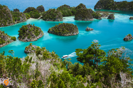
Raja Ampat, meaning “Four Kings” in Indonesian, represents the crown jewel of marine biodiversity on our planet and serves as a living laboratory that helps us understand how healthy ocean ecosystems function. Located off the northwest tip of West Papua, this remote archipelago consists of four main islands—Misool, Salawati, Batanta, and Waigeo—along with hundreds of smaller islands and rocky outcrops that create one of the most complex and productive marine environments ever documented by science.
To truly appreciate what makes Raja Ampat extraordinary, we need to understand its unique position at the heart of the Coral Triangle, often called the “Amazon of the Seas.” This region, stretching across parts of Indonesia, Malaysia, Philippines, Papua New Guinea, Timor-Leste, and the Solomon Islands, contains the highest marine biodiversity on Earth. Raja Ampat sits at the very center of this triangle, where ocean currents from the Pacific and Indian Oceans converge, creating the perfect conditions for marine life to flourish in ways found nowhere else on our planet.
The most famous residents of Raja Ampat’s waters are the manta rays, whose populations here represent one of the world’s most important aggregation sites for these gentle giants. Understanding why manta rays gather in such numbers at Raja Ampat requires thinking about ocean productivity and food chains. The nutrient-rich currents create ideal conditions for plankton blooms, which attract the manta rays that feed by filtering massive quantities of these tiny organisms from the water. Watching a manta ray feed demonstrates one of nature’s most elegant solutions to the challenge of extracting energy from the ocean—these creatures have evolved into living filter systems that can process thousands of gallons of water per hour while gracefully gliding through their underwater world.
The cultural dimension of Raja Ampat adds another layer of complexity to understanding this remarkable place. The indigenous Papuan communities have lived in harmony with these marine ecosystems for thousands of years, developing traditional management systems called “sasi” that regulate fishing activities and protect important breeding areas. These traditional practices, based on generations of careful observation and understanding of natural cycles, created some of the world’s first marine protected areas long before modern conservation science recognized their importance. Today, these traditional systems work alongside modern conservation efforts, demonstrating how indigenous knowledge and scientific research can combine to create more effective protection strategies.
The diving experience in Raja Ampat offers visitors direct encounters with ecological processes that are usually invisible to casual observation. The famous sites like Cape Kri and Chicken Reef function as underwater museums where every coral formation, fish aggregation, and cleaning station tells a story about how marine ecosystems organize themselves. Watching cleaner fish removing parasites from larger species demonstrates mutualistic relationships that keep reef communities healthy. Observing schools of fish moving in coordinated patterns reveals how prey species use collective behavior to survive in environments filled with predators.
The underwater topography of Raja Ampat creates what marine biologists call “habitat heterogeneity”—essentially, many different types of underwater environments clustered close together. Shallow coral gardens give way to steep walls that plunge into deep blue water, while underwater caves and swim-throughs create sheltered environments for species that cannot survive in open water. This variety means that a single dive can encounter species adapted to completely different ecological niches, providing insights into how biodiversity arises when environments offer multiple ways of making a living.
Primary Access Gateway: Sorong as Your Essential Hub
Sorong’s Role in Your Journey
Sorong city on the mainland of West Papua serves as the mandatory gateway to Raja Ampat, functioning as the transportation bottleneck through which virtually all visitors must pass. Think of Sorong as the last major urban center before entering one of the world’s most pristine marine environments, where modern transportation infrastructure gives way to traditional boat-based island hopping.
Domine Eduard Osok Airport (SOQ) Located at Jalan Bandara, Sorong, West Papua, this airport operates as your primary aviation gateway to the Raja Ampat region. The airport maintains daily operations from 6:00 AM to 10:00 PM, though flight schedules depend heavily on weather conditions and seasonal demand patterns that affect this remote region.
The airport sits approximately 15 kilometers southeast of Sorong city center, connected by taxi services, ride-hailing applications where available, and hotel shuttle services. Airport parking facilities include short-term and long-term options, though most visitors rely on onward boat transportation rather than maintaining vehicles in Sorong.
Alternative Connection Points
Makassar (Sultan Hasanuddin Airport) serves as an alternative connection hub, particularly useful for travelers coming from other parts of Sulawesi or those seeking to break up the journey with cultural exploration. Makassar offers good connections to Sorong with multiple daily flights.
Manado (Sam Ratulangi International Airport) provides another connection option, especially relevant for travelers exploring multiple diving destinations in eastern Indonesia. The airport offers both domestic and limited international connections.
Denpasar (Ngurah Rai International Airport) connects to Sorong through Jakarta or Makassar, providing access for travelers beginning their journey from Bali’s international gateway.
Ground Transportation in Sorong
Airport to City Center and Harbor Access
Taxi Services operate from designated airport areas with regulated fare structures, though availability can vary depending on flight arrival times. Most taxi drivers familiar with airport routes understand the connection requirements for travelers heading to Raja Ampat.
Hotel Shuttle Services provide transportation for guests staying at Sorong hotels, often coordinating with boat departure schedules to ensure seamless connections. Many dive operators and tour companies arrange airport pickup services as part of their packages.
Ride-Hailing Services including Grab operate in Sorong with limited coverage compared to major Indonesian cities, though service availability continues expanding as the tourism industry grows.
Sorong Harbor and Port Facilities
Sorong Harbor serves as the primary departure point for boats heading to Raja Ampat islands, located approximately 5 kilometers from the city center along Jalan Basuki Rahmat. The harbor operates from early morning (typically 5:00 AM) until late afternoon (around 6:00 PM), though exact schedules depend on weather conditions and tide patterns.
Harbor facilities include basic passenger waiting areas, small shops selling snacks and drinks, and limited parking for travelers leaving vehicles in Sorong. Security arrangements vary, with some operators providing supervised parking services for guests on extended trips.
Boat Transportation to Raja Ampat Islands
Regular Ferry Services
Public Ferry Operations connect Sorong to major Raja Ampat islands including Waisai (the regency capital on Waigeo Island) and other island destinations. These ferries typically operate on fixed schedules, though weather conditions can cause delays or cancellations, particularly during the monsoon season.
Ferry Schedules and Routes Morning departures from Sorong usually occur between 7:00 AM and 9:00 AM, with journey times to Waisai taking approximately 2 to 3 hours depending on sea conditions. Return ferries from Raja Ampat islands typically depart in the early afternoon to ensure arrival in Sorong before dark.
Ferry Facilities and Passenger Services Public ferries provide basic seating arrangements with limited amenities, though some newer vessels include air-conditioned passenger areas and basic refreshment services. Passengers should prepare for variable sea conditions and bring appropriate motion sickness remedies if needed.
Private Boat Charter Services
Speedboat Charters offer faster but more expensive transportation, with journey times reduced to approximately 1 to 1.5 hours to reach major Raja Ampat destinations. These services provide greater scheduling flexibility and can accommodate specific timing requirements for connecting flights or dive schedules.
Traditional Boat Services operated by local communities provide authentic transportation experiences while supporting local economic development. These services often include cultural interactions and opportunities to learn about traditional navigation techniques.
Dive Operator Transportation Services
Integrated Transportation Packages offered by dive resorts and liveaboard operators typically include boat transfers as part of comprehensive packages. These services coordinate closely with flight schedules and provide the most seamless transportation experience, though at premium pricing levels.
Liveaboard Departure Points vary depending on the operator, with some departing directly from Sorong Harbor while others use alternative ports or even pick up passengers from resort locations within Raja Ampat itself.
Transportation Within Raja Ampat Islands
Inter-Island Transportation
Local Boat Services connect the four main islands of Raja Ampat using traditional wooden boats and modern fiberglass vessels operated by local communities. These services operate on informal schedules, typically departing when passenger loads justify the journey or when weather conditions are optimal.
Island-Hopping Logistics require flexibility and advance coordination, as schedules depend on multiple factors including weather, tides, fuel availability, and passenger demand. Travelers should build buffer time into their itineraries to accommodate these variables.
Land Transportation on Major Islands
Waigeo Island Transportation includes motorcycle taxis (ojek) and occasional four-wheel vehicles for transportation between villages, harbors, and accommodation areas. The island’s limited road infrastructure means most transportation involves short distances between coastal communities.
Motorcycle Rental Services operate in some areas, though availability remains limited and requires valid Indonesian driving licenses or international permits. Road conditions vary significantly, with some areas requiring four-wheel-drive vehicles during rainy periods.
Accommodation Areas and Transportation Access
Waisai (Administrative Capital)
Town Layout and Transportation Hub – Waisai serves as the administrative center of Raja Ampat Regency, providing basic urban services including harbor facilities, government offices, and limited accommodation options. The town operates as a transportation hub for connections to outer islands and remote diving locations.
Harbor Facilities in Waisai include ferry terminals for connections to Sorong, local boat services to surrounding islands, and charter boat operations. The harbor operates during daylight hours with limited night operations depending on weather and safety conditions.
Resort and Dive Center Locations
Arborek Village Area provides community-based tourism accommodations with transportation typically arranged through village cooperatives. Boat access from Waisai or direct charter from Sorong provides the primary transportation options.
Gam Island Resort Areas operate private boat services coordinating with Sorong airport arrivals and departures. These resorts typically provide comprehensive transportation packages including airport transfers and inter-island movements.
Pianemo Island Access requires specialized boat charters due to remote location and challenging navigation through limestone karst formations. Transportation timing depends heavily on weather conditions and local guide availability.
Specialized Transportation for Diving Activities
Dive Boat Operations
Daily Dive Boat Services operate from various resort and village locations, typically departing early morning (6:00 AM to 7:00 AM) and returning late afternoon (4:00 PM to 5:00 PM). These services focus on accessing Raja Ampat’s world-renowned diving sites scattered across the archipelago.
Liveaboard Diving Vessels provide multi-day diving experiences with onboard accommodation, operating on weekly schedules that coordinate with Sorong flight connections. These vessels offer the most comprehensive access to remote diving locations throughout the Raja Ampat marine protected area.
Specialized Activity Transportation
Bird Watching Transportation for accessing Wilson’s Bird-of-Paradise viewing locations requires early morning boat charters combined with guided jungle trekking. Transportation timing must coordinate with bird activity patterns, typically requiring pre-dawn departures.
Snorkeling Site Access utilizes smaller boats capable of accessing shallow reef areas and lagoons not suitable for larger diving vessels. These services often operate on half-day schedules with flexible timing based on tide conditions.
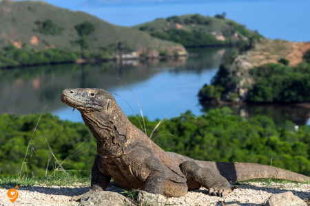
Komodo National Park represents one of our planet’s most extraordinary examples of how geographic isolation drives evolutionary processes to create species found nowhere else on Earth. To truly understand what makes this UNESCO World Heritage site so remarkable, we need to think about it as a living laboratory where we can observe the principles of island biogeography in action and witness how unique ecosystems develop when separated from mainland influences for millions of years.
Located in the center of the Indonesian archipelago between the islands of Sumbawa and Flores, Komodo National Park encompasses 1,733 square kilometers of rugged volcanic islands, pristine coral reefs, and dry savanna landscapes that support the world’s largest living lizard—the legendary Komodo dragon. But understanding this park requires looking beyond its most famous resident to appreciate how entire ecosystems evolve in isolation and how every species within these boundaries tells a story about adaptation, survival, and the delicate balance that maintains biodiversity in challenging environments.
The Komodo dragon itself serves as a perfect case study in evolutionary adaptation and island gigantism—a phenomenon where isolated island populations of animals often evolve to become much larger than their mainland relatives. These massive lizards, which can reach lengths of three meters and weights exceeding 70 kilograms, represent the apex predators in an ecosystem where the absence of large mammals created ecological opportunities that allowed monitor lizards to fill the role typically occupied by big cats or wolves in other environments. When we observe a Komodo dragon hunting, we’re witnessing millions of years of evolutionary refinement that produced a predator perfectly adapted to its specific environment.
The islands within Komodo National Park showcase different stages of volcanic evolution and how geological processes create the foundation for biological diversity. Komodo Island itself, formed by volcanic activity millions of years ago, demonstrates how volcanic soils weather over time to create the nutrient conditions that support specific types of vegetation. The dry climate, influenced by the park’s position in the rain shadow of larger mountains, creates savanna conditions that favor drought-adapted plants and the animals that depend on them. Understanding this geological and climatic foundation helps explain why the park’s terrestrial ecosystems look so different from the lush tropical forests found elsewhere in Indonesia.
The marine environments surrounding these volcanic islands provide an equally compelling example of how underwater topography influences biodiversity patterns. The deep waters between islands create corridors for large pelagic species, while shallow reefs around the islands support entirely different communities of fish and invertebrates. The mixing of different water masses creates upwelling patterns that bring nutrients from deep water to the surface, supporting productive food webs that can sustain both small reef fish and large predators like sharks and manta rays.
What makes the marine biodiversity particularly interesting involves the park’s position at the intersection of different biogeographic regions. Species from both the Indian and Pacific Ocean regions meet and overlap in these waters, creating communities that contain elements from both regions while also supporting endemic species that evolved specifically in this transition zone. When snorkeling or diving in the park, visitors encounter this biogeographic mixing in real time, observing fish species that represent different evolutionary lineages sharing the same reef systems.
The park’s tourism management demonstrates both the opportunities and challenges involved in using ecotourism to fund conservation efforts. Carefully controlled visits to observe Komodo dragons in their natural habitat generate revenue that supports both conservation programs and local communities, but managing this tourism requires constant attention to ensure that human presence doesn’t disrupt natural behaviors or degrade habitat quality. The viewing protocols developed for dragon encounters represent sophisticated attempts to allow meaningful wildlife experiences while minimizing human impact on these sensitive ecosystems.
The terrestrial plant communities within the park provide excellent examples of how species adapt to challenging environmental conditions. The dry season, which can last eight months or more, creates stress conditions that favor plants with specialized water-storage capabilities, extensive root systems, or other drought adaptations. The savanna grasses that dominate much of the landscape represent species that can survive both extended dry periods and the intense grazing pressure from the park’s large herbivore populations, including deer, wild boar, and water buffalo.
Primary Gateway Cities and Their Strategic Importance
Labuan Bajo as Your Essential Hub
Labuan Bajo functions as the primary gateway to Komodo National Park, serving as the last significant settlement with comprehensive tourism infrastructure before entering the park’s island environment. Located on the western tip of Flores Island, this fishing town has evolved into a crucial transportation hub where land-based travel transitions to the boat-based exploration that defines the Komodo experience.
Understanding Labuan Bajo’s role helps you appreciate why virtually all Komodo visitors spend at least one night in this town. The settlement provides not only transportation connections but also the essential services, supplies, and coordination opportunities that make multi-day island exploration possible. Think of Labuan Bajo as your staging area where you’ll finalize boat arrangements, purchase supplies, and coordinate with local guides who possess intimate knowledge of park conditions and regulations.
Komodo Airport (Labuan Bajo) The Komodo Airport, officially designated with the airport code LBJ, represents your most direct aviation gateway to the park region. Located at Jalan Trans Flores, approximately 2 kilometers from Labuan Bajo town center, this airport operates daily from 6:00 AM to 8:00 PM, though flight schedules remain subject to weather conditions that can affect this mountainous coastal region.
The airport’s compact size means that ground transportation to town centers involves short taxi rides, hotel shuttle services, or motorcycle taxi services that reflect the intimate scale of Labuan Bajo’s urban environment. Airport parking facilities include basic short-term and limited long-term options, though most visitors rely on onward boat transportation rather than maintaining vehicles for extended periods.
Alternative Access Through Bima and Sumbawa
Sultan Muhammad Salahuddin Airport (Bima) Bima serves as an alternative gateway particularly relevant for travelers exploring multiple destinations across the Lesser Sunda Islands or those seeking less crowded access routes during peak tourist seasons. Located on Sumbawa Island, Bima provides access to Komodo through inter-island ferry connections that offer a different perspective on Indonesian maritime travel.
The airport, positioned approximately 18 kilometers from Bima city center, operates daily flights connecting to major Indonesian hubs including Jakarta, Surabaya, and Denpasar. Ground transportation from the airport includes taxi services, local buses, and hotel shuttles that connect to Bima’s ferry terminal for onward island connections.
Ferry services from Bima to Labuan Bajo operate on regular schedules, providing an alternative approach that includes scenic inter-island travel experiences. These ferry connections offer opportunities to understand the broader geographic context of the Lesser Sunda Islands while approaching Komodo National Park from a different directional perspective.
Maritime Transportation Within the Park Region
Understanding Boat-Based Park Access
Komodo National Park’s island geography means that boat transportation becomes absolutely essential for park exploration, regardless of how you initially reach the Labuan Bajo gateway. Understanding the different categories of boat services helps you choose options that align with your comfort preferences, time constraints, and exploration goals.
The diversity of boat options reflects different approaches to experiencing the park, from quick day trips focused on dragon viewing to comprehensive multi-day adventures that explore remote islands, pristine diving sites, and traditional fishing communities. Each boat category serves different traveler profiles while providing access to the same remarkable natural attractions.
Day Boat Services and Local Operations
Traditional Wooden Boat Services Local operators in Labuan Bajo provide traditional wooden boat charters that offer authentic Indonesian maritime experiences while supporting local economic development. These boats, typically measuring 10-15 meters in length, accommodate small groups and provide flexible scheduling that can adapt to weather conditions and passenger preferences.
Operating hours for day boat services typically begin with early morning departures between 6:00 AM and 8:00 AM, allowing full-day exploration programs that return to Labuan Bajo by late afternoon or early evening. These schedules optimize daylight hours for wildlife viewing while ensuring safe harbor returns before sunset.
Modern Speedboat Services Speedboat operators provide faster access to park islands with reduced travel times that maximize time available for actual island exploration and wildlife viewing. These services typically accommodate 8-12 passengers and include more comfortable seating arrangements, shade coverage, and basic refreshment facilities.
Speedboat services operate on more fixed schedules with specific tour programs that visit multiple islands in coordinated sequences designed to optimize wildlife viewing opportunities. Popular itineraries include combinations of Komodo Island dragon viewing, Padar Island hiking for panoramic views, and snorkeling at Pink Beach or other marine sites.
Multi-Day Liveaboard Experiences
Traditional Phinisi Boat Adventures Phinisi boats represent traditional Indonesian sailing vessels adapted for modern tourism, providing multi-day exploration experiences that combine cultural authenticity with comprehensive park access. These wooden vessels, ranging from 20-35 meters in length, accommodate 8-16 passengers in cabin accommodations that vary from basic to comfortable depending on the specific operator and vessel.
Multi-day itineraries typically range from 2-day/1-night programs to 4-day/3-night comprehensive explorations that include remote islands rarely visited by day boat services. These extended programs provide opportunities for sunrise and sunset wildlife viewing, night snorkeling experiences, and visits to traditional fishing communities that offer insights into local maritime culture.
Liveaboard services typically include all meals prepared onboard, snorkeling equipment, basic diving equipment for certified divers, and guided activities led by local naturalist guides who understand park ecology and wildlife behavior patterns. Accommodation standards vary significantly between operators, from shared cabin arrangements to private cabin options with en-suite facilities.
Modern Charter Yacht Services Upscale charter services provide luxury accommodation and personalized itineraries for travelers seeking premium comfort while exploring Komodo National Park. These vessels typically feature air-conditioned cabins, private bathroom facilities, professional crew services, and high-quality dining experiences that complement the natural attractions.
Charter yacht services offer maximum flexibility in itinerary planning, allowing customized exploration schedules that can adapt to weather conditions, wildlife activity patterns, and passenger preferences. These services typically require advance booking and coordination through specialized marine tourism operators who understand luxury traveler expectations.
Ground Transportation in Labuan Bajo
Airport to Town Center Connections
Understanding ground transportation options in Labuan Bajo helps you transition efficiently from aviation connections to maritime park access. The town’s compact size means that most transportation needs involve relatively short distances, though coordinating between different service providers requires some local knowledge.
Taxi and Private Car Services Labuan Bajo taxi services operate from the airport and major hotels, providing reliable transportation for travelers with luggage or those preferring door-to-door service. Most taxi drivers understand the connection between airport arrivals and boat departure schedules, often providing information about local operators and tour options.
Private car services, often arranged through hotels or tour operators, provide personalized transportation that can include stops for supply shopping, equipment rental, or tour coordination meetings. These services prove particularly valuable for travelers with complex itineraries or those carrying specialized equipment like diving gear or photography equipment.
Motorcycle Taxi Services (Ojek) Ojek services provide economical and flexible transportation throughout Labuan Bajo, particularly useful for solo travelers or those with minimal luggage. Local ojek drivers often possess extensive knowledge about boat operators, tour options, and practical logistics that can prove valuable for independent travelers.
Motorcycle taxis operate throughout daylight hours and can access areas not easily reached by larger vehicles, including some boat departure points and local markets where travelers might purchase supplies for extended boat trips.
Local Transportation Infrastructure
Labuan Bajo Harbor Complex The main harbor area serves as the coordination center for all boat-based park access, located within walking distance of most town center accommodations and services. Harbor facilities include boat departure areas, ticket sales offices for various operators, basic passenger facilities, and small shops selling snacks, drinks, and basic marine supplies.
Harbor operations typically begin early morning (5:00 AM) as boat operators prepare for day trips, with peak activity occurring between 6:00 AM and 8:00 AM during departure times. Evening activity increases between 4:00 PM and 6:00 PM as day boats return and evening boat trips prepare for departure.
Parking facilities near the harbor include basic street parking and some designated areas for motorcycles and cars, though space limitations during peak season may require alternative parking arrangements or reliance on walking access from accommodation areas.
Seasonal Considerations and Operational Variations
Weather Pattern Impact on Transportation
Understanding seasonal weather patterns helps you plan transportation timing and set appropriate expectations for service reliability throughout the Komodo region. The tropical climate creates distinct seasons that influence both aviation and maritime transportation in different ways.
Dry Season Advantages (April through September) Dry season conditions provide optimal transportation reliability with calmer seas, more predictable flight schedules, and better weather for outdoor activities within the park. This period represents peak season for Komodo tourism, with correspondingly higher demand for all transportation services and accommodation options.
Maritime transportation during dry season benefits from calmer sea conditions that improve passenger comfort and allow access to more remote islands and dive sites that may be challenging during rough weather periods. Boat operators typically offer their full range of services and destinations during these optimal conditions.
Wet Season Considerations (October through March) Wet season conditions can create transportation challenges including flight delays, rough sea conditions, and limited access to certain park areas during severe weather periods. However, this season also offers advantages including reduced tourist crowds, more flexible booking availability, and potentially lower service costs.
Travelers during wet season should build additional flexibility into their transportation schedules and consider extended stays in Labuan Bajo to accommodate potential weather delays. Many boat operators adjust their services during wet season, focusing on more protected areas and maintaining flexible scheduling that can adapt to daily weather conditions.