Eiffel Tower
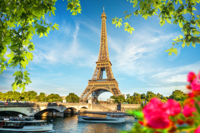
The 330-meter iron lattice tower was constructed by Gustave Eiffel for the 1889 World’s Fair and initially faced criticism from Paris’s artistic community. Today, visitors can ascend through three levels, with the top floor standing 276 meters above ground. The structure contains 18,000 metallic parts joined by 2.5 million rivets and requires 60 tons of paint every seven years for maintenance.
The tower’s lighting system includes 20,000 bulbs that create a sparkling effect for five minutes every hour from sunset until 1 AM. Different observation decks offer varying perspectives of Paris, with the second floor providing the optimal balance of height and proximity for city landmark identification.
The tower features multiple restaurants, including the Michelin-starred Le Jules Verne on the second floor.
Address for Navigation
Champ de Mars, 5 Avenue Anatole France, 75007 Paris, France.
Connectivity:
Metro
The Eiffel Tower is accessible via several metro stations:
- Bir-Hakeim (Line 6) – Approximately 500m walk
- Trocadéro (Lines 6 and 9) – Offers excellent views of the tower from across the Seine
- École Militaire (Line 8) – About 800m walk through the Champ de Mars
- Champ de Mars-Tour Eiffel (RER C) – The closest RER station, just 100m from the tower
Bus
Several bus routes serve the Eiffel Tower area:
- Bus 42, 69, 82, 87 – Stop at Champ de Mars
- Bus 30, 82, 86 – Stop at Tour Eiffel
To book Trains Visit: https://www.trip.com/t/6HHHZjoh5P2
Tram
- T2 Line – Alighting at Porte de Versailles and connecting to metro Line 8
Alternative Transportation
Taxi/Ride-sharing
Taxis and ride-sharing services (Uber, Bolt, etc.) can drop you directly at the Eiffel Tower. Request “Tour Eiffel” as your destination.
To book Taxis Visit: https://kiwitaxi.tp.st/TZb7s0MG
Louvre Museum

Originally built as a fortress in the 12th century and later transformed into a royal residence, the Louvre spans 72,735 square meters of exhibition space.
Beyond the iconic Mona Lisa, Venus de Milo, and Winged Victory of Samothrace, the museum houses extensive collections of Egyptian antiquities, including artifacts from the Pharaonic period, and the apartments of Napoleon III that showcase Second Empire opulence. The Islamic Art department features one of the world’s largest collections with pieces dating from the 7th to the 19th century.
The museum’s glass pyramid entrance, designed by architect I.M. Pei in 1989, contains 673 glass panes and has become an iconic landmark in its own right. The Louvre’s extensive holdings are so vast that seeing every artwork would require spending just 30 seconds at each piece for eight hours daily over 100 days.
Official Address
Musée du Louvre, Rue de Rivoli, 75001 Paris, France
Main Entrance Information
The primary entrance is through the glass pyramid in the central courtyard (Cour Napoléon). Additional entrances are available at the Porte des Lions and the Carrousel du Louvre shopping mall.
Connectivity:
Metro
The Louvre Museum is directly accessible via the following metro stations:
- Palais-Royal–Musée du Louvre (Lines 1 and 7) – Provides direct access to the museum through an underground passage
- Louvre-Rivoli (Line 1) – Located near the eastern end of the museum
Bus
Several bus routes provide convenient access to the museum:
- Bus 21, 27, 39, 67, 68, 69, 72, 74, 85, 95 – All stop within walking distance of the main entrances
To book Buses Visit: https://www.trip.com/t/6HHHZjoh5P2
RER
- Châtelet-Les Halles (RER A, B, D) – Approximately a 10-minute walk to the museum
River Transport
The Batobus river shuttle service includes a stop at the Louvre on its Seine route, offering a scenic approach to the museum.
Notre-Dame Cathedral
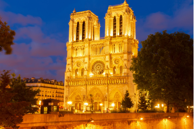
Construction of this Gothic masterpiece began in 1163 and continued for nearly 200 years. Its architectural innovations include pioneering use of flying buttresses that allowed for higher walls and larger stained glass windows. The cathedral houses exceptional artifacts including the Crown of Thorns and a fragment of the True Cross. Before the 2019 fire, the spire contained three relics sealed in a copper rooster: a fragment of the Crown of Thorns and relics of Saint Denis and Saint Genevieve.
The Great Organ, dating from the 18th century, features five keyboards and nearly 8,000 pipes. The cathedral’s gargoyles serve both decorative and functional purposes, channeling rainwater away from the building’s foundation. Restoration efforts after the devastating fire have involved advanced technology including 3D laser scans to ensure historical accuracy.
Official Address
Parvis Notre-Dame – Place Jean-Paul II, 75004 Paris, France
Connectivity:
Metro
The cathedral is accessible via several metro stations:
- Cité (Line 4) – Located on Île de la Cité, approximately 300 meters from Notre-Dame
- Saint-Michel (Line 4) – Situated on the Left Bank, a short walk across Pont Saint-Michel
- Hôtel de Ville (Lines 1 and 11) – Located on the Right Bank, approximately 500 meters from the cathedral
RER
- Saint-Michel-Notre-Dame (RER B and C) – Provides direct access to the area from both central Paris and the suburbs
Bus
Several bus routes service the Notre-Dame area:
- Bus 21, 38, 47, 85, 96 – All stop within walking distance of the cathedral
Taxi/Ride-sharing
Taxi services and ride-sharing platforms can drop passengers at designated points near the cathedral. Request “Notre-Dame Cathedral” or “Parvis Notre-Dame” as your destination.
Bicycle
The Vélib’ bicycle sharing system offers several docking stations in proximity to Notre-Dame:
- Station at Quai de Montebello
- Station near Hôtel de Ville
- Station at Place Maubert
River Transport
The Batobus river shuttle includes a stop at Notre-Dame, offering a scenic approach along the Seine.
Musée d’Orsay

Housed in the former Gare d’Orsay railway station, a Beaux-Arts masterpiece built for the 1900 World’s Fair, the museum was inaugurated in 1986 after extensive renovations. Its collection bridges the gap between the Louvre and the Centre Pompidou, focusing primarily on art created between 1848 and 1914.
The museum showcases the evolution of art movements from Academic painting and Realism through Impressionism to Post-Impressionism and Art Nouveau. Iconic works include “Whistler’s Mother” by James Abbott McNeill Whistler, Vincent van Gogh’s self-portraits, and Édouard Manet’s controversial “Olympia.”
The building’s transformation preserved many original architectural elements, including the monumental clock faces that now serve as features within the exhibition spaces. The museum’s top floor is bathed in natural light from the original glass roof, creating ideal viewing conditions for Impressionist works that emphasized light effects.
Official Address
1 Rue de la Légion d’Honneur, 75007 Paris, France
Connectivity:
Metro
The museum is accessible via the following metro stations:
- Solférino (Line 12) – The closest station, approximately 100 meters from the museum entrance
- Assemblée Nationale (Line 12) – Located at a distance of approximately 500 meters
- Musée d’Orsay (RER C) – Provides direct access to the museum from this dedicated RER station
Bus
Several bus routes service the Musée d’Orsay area:
- Bus 24, 63, 68, 69, 73, 83, 84, 94 – All routes stop within walking distance of the museum entrance
RER
- Musée d’Orsay (RER C) – Situated directly beneath the museum, this station offers the most convenient RER access
Taxi/Ride-sharing
Taxi services and ride-sharing applications can provide direct access to the museum entrance. Request “Musée d’Orsay” as your destination point.
River Transport
The Batobus river shuttle service includes a designated stop at Musée d’Orsay, allowing visitors to arrive via a scenic route along the Seine.
Montmartre and Sacré-Cœur

This historic district, standing 130 meters above Paris on a gypsum hill (the “mount of martyrs”), has maintained its village-like character despite urban development. Sacré-Cœur Basilica, completed in 1914, was built as a national act of contrition following France’s defeat in the Franco-Prussian War.
The white travertine stone used in construction releases calcite when exposed to rainwater, helping the basilica maintain its bright appearance despite pollution. During the late 19th and early 20th centuries, the area attracted prominent artists including Picasso, Modigliani, and Toulouse-Lautrec, who frequented establishments like Le Lapin Agile cabaret, which still operates today.
The Place du Tertre, just steps from Sacré-Cœur, continues the artistic tradition with approximately 140 officially licensed artists creating portraits and landscapes for visitors. Nearby attractions include the Montmartre Vineyard (Clos Montmartre), which produces about 1,500 bottles of wine annually, and the Moulin Rouge cabaret in the adjacent Pigalle district.
Key Addresses
- Sacré-Cœur Basilica: 35 Rue du Chevalier de la Barre, 75018 Paris
- Place du Tertre (Artists’ Square): Place du Tertre, 75018 Paris
Connectivity:
Metro
Montmartre and Sacré-Cœur are accessible via several metro stations:
- Anvers (Line 2) – Located at the southern base of the hill, providing access to the funicular
- Abbesses (Line 12) – Situated in the heart of Montmartre, though requiring an uphill walk to reach Sacré-Cœur
- Pigalle (Lines 2 and 12) – Positioned at the southeastern edge of Montmartre
- Lamarck-Caulaincourt (Line 12) – Located on the northern side of the hill, offering a less touristy approach
Bus
Several bus routes service the Montmartre area:
- Bus 30, 31, 54, 80, 85 – All routes stop at various points around the base of Montmartre
- Montmartrobus – A specialized small bus service that circulates through the narrow streets of Montmartre
Funicular
The Montmartre Funicular provides direct access from the base of the hill (near Anvers metro station) to the vicinity of Sacré-Cœur Basilica. This service operates using standard metro tickets.
Taxi/Ride-sharing
Taxi services and ride-sharing applications can provide access to the lower areas of Montmartre. Request “Place du Tertre” or “Sacré-Cœur” as your destination. Vehicle access is limited in the upper sections due to narrow, steep streets.
Hall of Mirrors
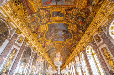
This magnificent 73-meter-long gallery served as the principal ceremonial space of the royal court and featured prominently in diplomatic functions, including the signing of the Treaty of Versailles in 1919 that ended World War I. The 357 mirrors were an exceptional technological and luxury statement when installed in the 17th century, as Venice had previously maintained a monopoly on high-quality mirror production.
The hall’s 17 arched windows facing the gardens are perfectly aligned with 17 mirror-adorned arches on the opposite wall, creating an illusion of expanded space and amplified light. The ceiling contains 30 painted compositions by Charles Le Brun glorifying the political, economic, and artistic achievements of Louis XIV’s reign.
The hall’s chandeliers originally held wax candles that required constant maintenance by dedicated staff during evening events; on special occasions, thousands of candles would illuminate the space, creating a dazzling effect as their light multiplied in the mirrors.
The hall underwent extensive restoration from 2004-2007, returning the space to its original brilliance.
Official Address
Palace of Versailles
Place d’Armes
78000 Versailles, France
Connectivity:
Train Options
RER Line C
- Board the RER C train from central Paris toward “Versailles Château–Rive Gauche”
- The journey takes approximately 40 minutes from central Paris
- Upon arrival, the Palace of Versailles is an 8-minute walk from the station
- This option provides the most direct access to the palace grounds
SNCF Train
- Trains depart from Paris Montparnasse station to “Versailles-Chantiers”
- Journey time is approximately 20 minutes
- The palace is a 20-minute walk from this station
- Alternatively, bus lines 171, 172, and 10 connect the station to the palace
Bus
- Bus 171 runs from Pont de Sèvres (Metro Line 9 terminus) directly to Versailles
- The journey takes approximately 30 minutes plus metro time from central Paris
Navigating to the Hall of Mirrors Inside the Palace
Once you have entered the Palace of Versailles:
- Proceed through the standard visitor entrance
- Follow the main visitor route through the State Apartments on the first floor
- The Hall of Mirrors (Galerie des Glaces) is located on the first floor, connecting the King’s and Queen’s State Apartments
- The visitor route is clearly marked with signs directing toward the Hall of Mirrors
Please note that entrance to the Palace requires a ticket. It is advisable to purchase tickets in advance online to avoid lengthy queues, particularly during peak tourist seasons.
The Royal Apartments
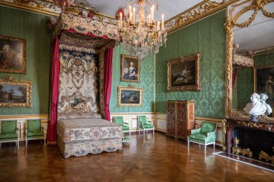
The King’s Apartment suite consists of seven rooms arranged in sequence according to the traditional Italian palace model, with each room increasing in grandeur as one approaches the King’s Bedchamber, which served as the ceremonial center of the palace.
Louis XIV established elaborate court rituals including the daily “lever” (rising) and “coucher” (retiring) ceremonies where privileged nobles would assist the king with dressing and undressing—positions highly coveted for the access and influence they provided. The Queen’s Apartment mirrors the king’s in layout but features more feminine decorative elements.
Marie Antoinette’s bedchamber was the site of royal births performed in public to verify the legitimacy of heirs. The apartments showcase the evolution of French decorative styles from the heavy Baroque of Louis XIV through the lighter Rococo of Louis XV to the more restrained Neoclassicism favored by Louis XVI and Marie Antoinette.
The furniture and decorative objects displayed represent the pinnacle of French craftsmanship from renowned artisans such as cabinetmaker André-Charles Boulle and bronze-caster Pierre Gouthière.
The Gardens
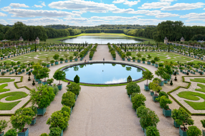
André Le Nôtre spent nearly 40 years transforming swampland into these geometrically precise gardens, creating a masterpiece of perspective, proportion, and symmetry that established the definitive model for the French formal garden style. The central axis extends over three kilometers from the palace facade to the Grand Canal, creating an impression of infinite perspective.
The gardens required extensive engineering works, including the creation of a massive hydraulic system with pumping stations, aqueducts, and reservoirs to supply water to the numerous fountains. These fountains employ both mechanical and visual trickery—many have reduced water flow when viewed from a distance and increased flow when the king approached, creating an impression of animated waters responding to the royal presence.
The garden’s plantings include carefully maintained topiary forms with approximately 200,000 trees and 210,000 flowers planted annually. The most elaborate fountain complex, the Bassin d’Apollon, depicts the sun god (representing Louis XIV) rising from the waters in his chariot. During Louis XIV’s reign, the gardens hosted spectacular entertainments including fireworks displays, theatrical performances, and concerts by composers such as Jean-Baptiste Lully.
Marie Antoinette’s Estate
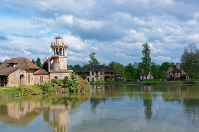
Presented to Marie Antoinette by Louis XVI in 1774, the Petit Trianon exemplifies Neoclassical architecture with its symmetrical design and restrained ornamentation. The queen made significant modifications to ensure her privacy, including innovative mechanical tables that could be raised from the kitchen below, eliminating the need for servants to be present during intimate dinners.
The surrounding English garden represented a radical departure from the geometric French style seen elsewhere at Versailles, reflecting Enlightenment ideals about returning to nature and the influence of Rousseau’s philosophy. The Queen’s Hamlet, designed by architect Richard Mique and completed in 1783, comprised twelve rustic buildings arranged around an artificial lake, including functioning dairy facilities where the queen and her ladies could play at being milkmaids.
The buildings combined authentically rustic exteriors with luxuriously appointed interiors—a contrast that reflected the period’s fascination with the “picturesque” aesthetic. Contrary to popular belief, the hamlet served practical agricultural functions and was not merely decorative; it produced food for the Trianon estate and functioned as an experimental farm implementing agricultural innovations.
This area represents a crucial historical document of pre-revolutionary aristocratic attitudes toward rural life and nature.
Nice Promenade des Anglais
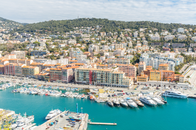
This iconic seven-kilometer seafront promenade was initially financed by English aristocrats wintering in Nice during the early 19th century, hence its name (“Walkway of the English”). The walkway follows the gentle curve of the Baie des Anges (Bay of Angels) and is lined with palm trees and distinctive blue chairs that have become symbols of the city.
The pebbly beach bordering the promenade contrasts with the intensely azure Mediterranean waters, creating the distinctive color palette that inspired artists like Matisse, who resided in Nice and developed his signature style partly in response to the region’s distinctive light.
Belle Époque architecture dominates the promenade, most notably the palatial Hôtel Negresco, built in 1913, with its distinctive pink dome and collection of over 6,000 works of art spanning five centuries. The Promenade serves as the center for Nice’s carnival celebrations each February, hosting elaborate parades and the famous “Battle of Flowers” where costumed participants throw fresh blooms to spectators. The eastern end of the Promenade connects to the Quai des États-Unis and ultimately to the picturesque Old Town (Vieux Nice) with its narrow streets, colorful Italian-influenced architecture, and bustling Cours Saleya market.
Connectivity:
From Nice Côte d’Azur Airport
The airport provides convenient access to the western end of the Promenade:
- Airport Bus 98: Runs directly from Terminals 1 and 2 to the Promenade des Anglais
- Tramway Line 2: Connects the airport to the city center with stops near the Promenade
- Taxi/Ride-sharing: Available directly outside the terminal buildings for door-to-door service
From Nice Ville Train Station
For travelers arriving by train:
- Tramway Line 1: Connect to Line 2 at Jean Médecin station for access to the Promenade
- Bus Lines 12, 23, 37: All provide connections to various points along the Promenade
- Walking: The Promenade is approximately 20-25 minutes on foot from the station
Navigating the Promenade des Anglais
The Promenade extends for approximately 7 kilometers along Nice’s coastline. Key access points include:
- Western End: Near the airport and Lenval Hospital
- Central Section: Adjacent to Place Masséna and Old Town (Vieux Nice)
- Eastern End: Near the port area and Mont Boron
Local buses run along the length of the Promenade, with the 12 and 100 routes being particularly useful for tourists. Bicycle rentals are widely available through the city’s Vélo Bleu bike-sharing program, with numerous stations along the Promenade.
Saint-Tropez

This former fishing village was transformed into an international destination after filmmaker Roger Vadim used it as the setting for his 1956 film “And God Created Woman” starring Brigitte Bardot.
The town’s historic core features narrow cobblestone streets lined with pastel-colored buildings housing high-end boutiques and art galleries that contrast with the working fishing boats still moored in the old port. The citadel, built between 1590 and 1607 to defend against Spanish invasion, now houses a maritime museum and offers panoramic views of the Gulf of Saint-Tropez and the Massif des Maures mountain range.
The Place des Lices, shaded by plane trees, hosts a traditional Provençal market twice weekly where locals still play pétanque alongside visiting celebrities. Despite its glamorous reputation, Saint-Tropez maintains authentic Provençal traditions, including the Bravade festival each May honoring the town’s patron saint with processions of residents in traditional costume.
The surrounding peninsula features exceptional beaches, particularly the five-kilometer stretch of Pampelonne, which gained fame through Bardot’s films and now hosts legendary beach clubs like Club 55, established during the filming of “And God Created Woman.”
Connectivity
By Air
The closest airports to Saint-Tropez are:
- Nice Côte d’Azur Airport (NCE)
- Distance: Approximately 95 km
- Transportation from airport:
- Airport shuttle to Saint-Raphaël, then bus to Saint-Tropez
- Taxi or private transfer (journey time: 1.5-2 hours)
- Helicopter transfer (journey time: 20 minutes)
- Toulon-Hyères Airport (TLN)
- Distance: Approximately 50 km
- Transportation from airport:
- Taxi or private transfer (journey time: 45-60 minutes)
- Bus to Toulon, then bus or boat to Saint-Tropez
By Train
There is no direct train station in Saint-Tropez. The nearest railway stations are:
- Saint-Raphaël-Valescure Station
- Distance: 38 km from Saint-Tropez
- Connections: TGV high-speed trains from Paris, Nice, and Marseille
- Onward transport: Bus line 7601 to Saint-Tropez (journey time: 1 hour)
- Les Arcs-Draguignan Station
- Distance: 44 km from Saint-Tropez
- Connections: TGV high-speed trains from Paris
- Onward transport: Bus or taxi to Saint-Tropez
- Toulon Station
- Distance: 70 km from Saint-Tropez
- Connections: TGV high-speed trains from Paris, Nice, and Marseille
- Onward transport: Bus or ferry to Saint-Tropez
By Bus
Regular bus services operate to Saint-Tropez from:
- Nice (Varlib line 3003)
- Saint-Raphaël (Varlib line 7601)
- Toulon (Varlib line 7801)
- Marseille (connections via Saint-Raphaël or Toulon)
By Boat
Maritime transportation options:
- Regular Ferry Services
- From Saint-Raphaël (seasonal, journey time: 1 hour)
- From Port Grimaud (journey time: 20 minutes)
- From Sainte-Maxime (journey time: 15 minutes)
- Les Bateaux Verts Ferry
- Operates across the Gulf of Saint-Tropez
- Regular service from Sainte-Maxime (journey time: 15 minutes)
- Private Boat Charter
- Available from various coastal towns along the French Riviera
By Car
Access routes to Saint-Tropez:
- From Nice: A8 motorway to Le Muy, then D25 to Saint-Tropez
- From Marseille: A50 and A57 to Le Muy, then D25 to Saint-Tropez
- Journey time: 1.5-2 hours from Nice; 2-2.5 hours from Marseille
Cannes

Originally a fishing village and later a modest resort favored by British aristocrats, Cannes achieved international prominence after its annual film festival was established in 1946.
La Croisette, the palm-lined seafront boulevard, stretches for 2.5 kilometers and is flanked by sandy beaches on one side and luxury hotels and designer boutiques on the other. The most famous of these establishments, the Carlton Hotel, with its distinctive domed turrets, has hosted film stars and royalty since 1911 and featured prominently in Alfred Hitchcock’s “To Catch a Thief.”
The Palais des Festivals et des Congrès, home to the Cannes Film Festival, features the celebrated red carpet staircase and handprints of film industry legends. The oldest section of the city, Le Suquet, rises on a hill above the modern town and offers a different perspective with its medieval streets, 16th-century church, and panoramic views from the 12th-century Tour du Mont Chevalier.
The nearby Îles de Lérins, a 15-minute boat ride from Cannes, provide a tranquil counterpoint to the mainland’s glamour; the larger island, Sainte-Marguerite, housed the mysterious prisoner known as the “Man in the Iron Mask” in the 17th century, while the smaller Saint-Honorat has been home to a community of Cistercian monks since the 5th century who produce award-winning wines from their eight hectares of vineyards.
Connectivity:
By Air
Nice Côte d’Azur Airport (NCE)
- Closest major international airport to Cannes (approximately 27 km)
- Regular flights from most European cities and international destinations
- Transportation from airport to Cannes:
- Express Bus 210 (journey time: 50 minutes, cost: approximately €22)
- Train from Nice-St. Augustin station (5-minute shuttle from airport terminal)
Cannes-Mandelieu Airport (CEQ)
- Small airport primarily serving private aircraft and limited commercial flights
- Located 7 km from Cannes center
- Transportation options: taxi, rental car
By Train
Cannes Railway Station (Gare de Cannes)
- Located in the city center near La Croisette
- Served by SNCF national rail network
- Connections:
- TGV high-speed train from Paris (journey time: approximately 5 hours)
- Regional TER trains from Nice (journey time: 30 minutes)
- Regional trains from Marseille (journey time: 2 hours)
- International trains from Italy and other European destinations
Cannes-La Bocca Station
- Secondary station located in western Cannes
- Served by regional TER trains
Bus Services
Regional Bus Network
- ZOU! network operates throughout the Provence-Alpes-Côte d’Azur region
- Line 200 connects Nice to Cannes (journey time: 1.5 hours)
- Line 600 connects Grasse to Cannes
Long-Distance Buses
- Flixbus and BlaBlaCar Bus operate services to Cannes from major European cities
- Bus station located near the train station
Maritime Transportation
Ferry Services
- Seasonal ferry connections from:
- Nice (journey time: approximately 1 hour)
- Ports in Corsica (seasonal)
- St. Tropez (seasonal)
Water Taxis
- Available for transportation between coastal towns during high season
Local Transportation in Cannes
Palm Bus Network
- Comprehensive local bus service throughout Cannes
- Connect city center with La Bocca, Le Cannet, and suburbs
Taxis
- Available at designated taxi stands throughout the city
- Can be booked in advance or hailed from official taxi stands
For travelers coming from outside the region, flying into Nice Côte d’Azur Airport followed by an Express Bus or train connection provides the most efficient route to Cannes. For those already in southern France, the train network offers convenient and regular services to Cannes Railway Station, situated in the heart of the city.
Monaco
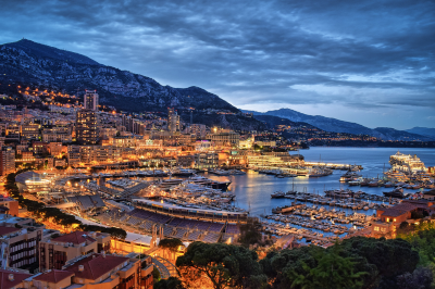
This sovereign principality occupying just 2.02 square kilometers (making it the world’s second-smallest country) has been ruled by the Grimaldi family since 1297. The Prince’s Palace, situated on the “Rock of Monaco,” combines elements from various historical periods including its medieval fortress origins and Baroque modifications; the changing of the guard ceremony occurs daily at 11:55 AM.
Monaco-Ville, the old town surrounding the palace, retains its medieval character with narrow streets and historic buildings including the Romanesque-Byzantine Cathedral where Prince Rainier III and Grace Kelly are interred. The Monte Carlo Casino, designed by Charles Garnier (architect of the Paris Opera) and opened in 1863, features opulent Belle Époque interiors with marble atria, onyx columns, and gold leaf details; its establishment saved the principality from bankruptcy and eliminated the need for taxation of residents.
The Oceanographic Museum, founded by Prince Albert I in 1910, rises dramatically from a cliff face 85 meters above the sea and housed the laboratory of Jacques Cousteau during his tenure as director from 1957-1988. The Formula 1 Grand Prix, established in 1929, transforms Monaco’s streets into one of the world’s most challenging race circuits each May, with drivers navigating hairpin turns and a tunnel at speeds exceeding 260 km/h within meters of buildings and spectators.
Connectivity:
Air Travel Options
The nearest airport to Monaco is Nice Côte d’Azur Airport (NCE), located approximately 30 kilometers west of Monaco. From the airport, several transfer options are available:
Helicopter Transfer
- Monaco Heliport (Heliport de Monaco) offers regular helicopter service from Nice Airport
- Journey time: 7 minutes
- Operators include Monacair and Heli Air Monaco
- Transfer services to your final destination in Monaco are typically included
Airport Express Bus
- Bus line 110 runs directly from Nice Airport to Monaco
- Journey time: 45-60 minutes depending on traffic
- Buses depart regularly throughout the day
- Stops at various locations within Monaco including Monte Carlo
Train Travel
Monaco-Monte Carlo Station
- Located in the heart of Monaco
- Part of the main coastal railway line connecting France and Italy
- Key train services:
- Regional TER trains from Nice (journey time: 20-25 minutes)
- Regional trains from Ventimiglia, Italy (journey time: 25-30 minutes)
- TGV high-speed trains from Paris (journey time: approximately 6 hours)
- Thello trains from Milan and Genoa
Bus Services
Regional Bus Network
- Line 100 connects Nice to Monaco and continues to Menton
- Journey time from Nice: approximately 45 minutes
Long-Distance Buses
- Companies such as Flixbus offer services to Monaco from major European cities
- Typically arrive at Monaco’s bus station near the Port Hercule
Maritime Transportation
Cruise Ships and Private Vessels
- Port Hercule accommodates cruise ships and private yachts
- Regular ferry services are limited, though seasonal tourist boats may operate
Water Taxi Services
- Available between Monaco and nearby coastal destinations during summer months
Car Travel
- Monaco is accessible via the A8/E80 autoroute followed by the Moyenne Corniche or Basse Corniche coastal roads
- Note that parking in Monaco can be limited and expensive
- Several public parking garages are available throughout the principality
Local Transportation Within Monaco
Public Buses
- Monaco’s compact bus network (CAM) efficiently serves all areas of the principality
- Buses run frequently throughout the day
- Tickets can be purchased onboard or at various points throughout Monaco
Èze

This medieval village perched on a narrow rocky peak 429 meters above sea level offers some of the Riviera’s most spectacular panoramic views, extending from Italy to Saint-Tropez on clear days. The village’s stone buildings form a circular pattern around the mountain, connected by cobblestone streets so narrow and winding that they were designed to confuse potential invaders.
The ruins of a 12th-century castle crown the village and now house the exotic Jardin d’Èze, featuring cacti, succulents, and Mediterranean species adapted to the exposed mountainside conditions. Perfume manufacturing represents an important local industry, with the historic Fragonard and Galimard factories offering tours demonstrating traditional perfume-making techniques.
Friedrich Nietzsche composed part of his philosophical work “Thus Spoke Zarathustra” while staying in Èze, regularly walking the steep path (now called “Nietzsche’s Path”) that connects the village to Èze-sur-Mer at sea level—a challenging 90-minute descent with an elevation change of nearly 400 meters.
The 12th-century church features a neo-Baroque façade from 1772 and contains remarkable trompe-l’œil paintings creating the illusion of architectural details that the modest parish could not afford to construct. The village’s strategic location made it repeatedly contested territory, changing hands among the French, Turks (under Barbarossa), and Savoyards before definitively becoming part of France in 1860.
Connectivity:
Air Travel
The nearest airport to Èze is Nice Côte d’Azur Airport (NCE), located approximately 13 kilometers west of Èze. From the airport, several onward transportation options are available:
Airport Transfer Options:
- Taxi services operate from the airport to Èze. The journey takes approximately 25-30 minutes, depending on traffic conditions.
- Private transfer services can be pre-booked for direct travel from the airport to Èze.
- Rental cars are available at the airport for those who prefer to drive independently.
Train Travel
Èze is served by a railway station, Èze-sur-Mer, located in the lower part of Èze by the sea:
Èze-sur-Mer Station:
- Regional TER trains connect Èze-sur-Mer with Nice (journey time: approximately 10 minutes) and Monaco (journey time: approximately 8 minutes).
- Trains also provide connections to destinations further along the coast such as Menton and Ventimiglia (Italy).
- Please note that Èze-sur-Mer station is located in the lower part of Èze (Èze-sur-Mer), while the medieval village (Èze-Village) is situated on the hilltop. A bus connection or taxi is required to reach Èze-Village from the train station.
Bus Services
Regular Bus Services:
- Bus Line 82 connects Nice with Èze-Village. The journey takes approximately 40 minutes.
- Bus Line 112 connects Monaco with Èze-Village. The journey takes approximately 30 minutes.
- Bus Line 83 connects Èze-sur-Mer (lower Èze) with Èze-Village (upper medieval village). This is useful for travelers arriving at the train station who need to reach the hilltop village.
Road Access
Èze is accessible by road via the following routes:
By Car:
- From Nice: Follow the Moyenne Corniche (D6007) east toward Monaco. The journey takes approximately 25 minutes.
- From Monaco: Follow the Moyenne Corniche (D6007) west toward Nice. The journey takes approximately 20 minutes.
- Parking is available at designated car parks near the entrance to the medieval village, though spaces are limited, particularly during peak tourist season.
By Taxi:
- Taxi services operate between Èze and surrounding destinations such as Nice, Monaco, and Beaulieu-sur-Mer.
- Taxis can be pre-booked or found at designated taxi stands in nearby towns.
Hiking Options
For the more adventurous traveler, hiking paths connect Èze with neighboring areas:
Nietzsche Path:
- A scenic footpath named after philosopher Friedrich Nietzsche connects Èze-Village with Èze-sur-Mer.
- The hike takes approximately 45 minutes to ascend from the coast to the village (longer in hot weather).
- The path offers spectacular views of the Mediterranean Sea.
The Abbey

The abbey church sits at the highest point, with monastic buildings ingeniously arranged on multiple levels below according to their functions, from spiritual spaces at the top to storage and practical rooms at lower levels. The structure represents a remarkable feat of medieval engineering, with massive crypts and pillars supporting the weight of the church above.
The abbey’s architectural styles span several periods, from Romanesque elements in the nave to the flamboyant Gothic choir rebuilt after a collapse in 1421. The abbey’s refectory features exceptional acoustics and illumination through a row of windows designed to create even lighting across the space.
During the French Revolution, the abbey was converted into a prison, which ironically saved it from destruction but caused significant damage to its interior. The immense wheel room contains a wooden treadwheel crane that was operated by prisoners to haul supplies up to the abbey. This human-powered device could lift up to 1.5 tons of materials and provisions.
After extensive restoration in the 19th century by architect Édouard Corroyer, the abbey was returned to its spiritual function in 1966 when a community of Benedictine monks was reestablished, later replaced by the Monastic Fraternities of Jerusalem who continue to conduct daily services.
Connectivity:
To Reach the Abbey
- The Abbey is located at the highest point of the island
- Access is via the Grand Rue (main street) that winds upward through the village
- Approximately 350 steps lead from the village entrance to the Abbey entrance
- The climb is steep and includes multiple staircases
Practical Information
- Allow sufficient time for the journey from parking to the Abbey entrance (approximately 1-1.5 hours)
- The Abbey has specific opening hours (typically 9:00 AM to 7:00 PM during peak season)
- Guided tours of the Abbey are available in multiple languages
- Public transportation frequency decreases significantly during off-peak seasons
For the most efficient visit, consider arriving early in the morning or later in the afternoon to avoid peak crowds, particularly during summer months.
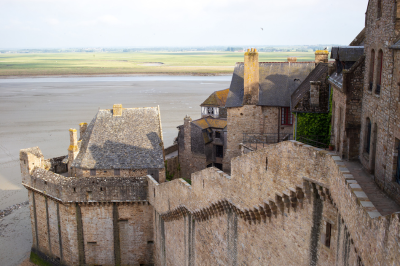
The Medieval Village
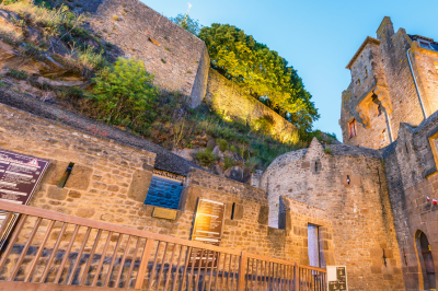
The village that developed below the abbey follows a medieval plan with a single main street spiraling upward around the rocky mount. This layout was designed both for defense and to accommodate the thousands of pilgrims who visited the site.
The stone and half-timbered buildings lining the Grande Rue date primarily from the 15th and 16th centuries and originally housed merchants, fishermen, and artisans who served the abbey and its visitors. The village was protected by defensive walls and gates constructed during the Hundred Years’ War, demonstrating its strategic importance; these fortifications successfully resisted English sieges throughout the conflict, cementing Mont Saint-Michel’s reputation as an impregnable fortress.
The parish church of Saint-Pierre, distinct from the abbey church above, served the village’s permanent population and features a statue of Joan of Arc commemorating her role in inspiring French resistance during the period when Mont Saint-Michel stood as a symbol of French resilience against English domination.
Today, many of the historic buildings house restaurants specializing in the famous fluffy omelets that became a traditional meal for pilgrims, created by Mère Poulard in the 1880s; the distinctive beating technique used to create these omelets can be heard throughout the village. Despite receiving over 3 million visitors annually, approximately 30 residents still live permanently within the medieval walls, maintaining the site as a living community rather than simply a museum.
The New Bridge-Causeway
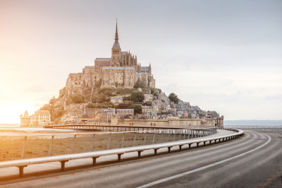
The innovative bridge-causeway completed in 2015 replaced the solid causeway built in 1879 that had disrupted the natural flow of water around the Mont, resulting in significant siltation that threatened to permanently connect the island to the mainland.
The new 756-meter structure consists of a light bridge resting on slender pillars that allows tidal waters to flow freely underneath, helping to restore the bay’s natural hydraulic patterns. The project included the construction of a dam on the Couesnon River that uses a complex system of eight sluice gates to release water at strategic times, creating a flushing effect that helps push accumulated sediment away from the Mont.
The bridge-causeway is designed to be completely covered by water during exceptional high tides approximately 20 times per year, temporarily restoring the Mont’s true island character. The project included the removal of the old car park that had been built at the foot of the Mont and its replacement with a new facility on the mainland, connected to the site by environmentally friendly shuttle services.
Visitors now approach the Mont on foot from the shuttle stop, crossing the bridge-causeway while experiencing unobstructed views of the abbey rising dramatically from the sea—a perspective that closely resembles the approach of medieval pilgrims.
The Ramparts
The defensive walls encircling Mont Saint-Michel were constructed primarily during the Hundred Years’ War (1337-1453) and incorporate seven towers designed to protect the site from English attacks. The Tour Gabriel, the largest of these towers, was added in the 16th century and features a rare example of an early circular gun platform adapted for cannon defense. The ramparts provide a complete circuit of the Mont, offering spectacular views of the bay’s changing tides and the Norman and Breton coastlines.
The main entrance to the fortified complex is through the Porte du Roy (King’s Gate), which still contains the mechanisms for its original drawbridge and portcullis. The walls incorporate sophisticated defensive features including machicolations (openings in the floor through which defenders could drop projectiles on attackers below) and arrow slits that widen toward the interior to allow archers greater range of movement.
The design of the fortifications takes advantage of the natural topography, with the steepest sections requiring minimal defensive construction. During the French Revolution, sections of the walls were modified to serve the site’s new function as a prison, including the addition of guard posts and elevated walkways.
The ramparts today serve as an excellent vantage point for observing the phenomenon of the incoming tide, which local saying describes as arriving “à la vitesse d’un cheval au galop” (at the speed of a galloping horse).
Château de Chambord

The largest château in the Loire Valley, Chambord was commissioned by François I in 1519 as a hunting lodge but evolved into a monumental 440-room palace combining French medieval architectural traditions with Italian Renaissance elements. Its distinctive French Renaissance style features an elaborate roofline with 282 chimneys, lantern towers, and dormer windows creating a skyline resembling a miniature city.
The centerpiece of the interior is the remarkable double-helix staircase, possibly designed by Leonardo da Vinci during his final years in France; the two spirals ascend three floors without ever meeting, allowing occupants to ascend and descend without encountering one another. Despite its grand scale, François I spent less than 50 days at Chambord during his entire reign, using it primarily for hunting expeditions and diplomatic displays.
The château stands in a walled park covering 5,440 hectares (the largest enclosed forest park in Europe), which contains trails originally laid out for royal hunting parties and still maintains a diverse wildlife population including red deer and wild boar. The building’s architectural complexity includes 365 fireplaces and an intricate rooftop terrace system with passageways offering views of the surrounding landscape.
During World War II, the château served as a repository for artworks evacuated from the Louvre, including the Mona Lisa and Venus de Milo, which were hidden in its chambers to protect them from Nazi looting.
Connectivity:
Air Travel
The nearest major airports to Château de Chambord are:
Paris Charles de Gaulle Airport (CDG)
- Distance: Approximately 200 km from Chambord
- Transportation options:
- High-speed train (TGV) from CDG to Blois-Chambord station, followed by bus or taxi
- Rental car (journey time: approximately 2.5 hours)
- Private transfer services
Paris Orly Airport (ORY)
- Distance: Approximately 180 km from Chambord
- Transportation options:
- Train connections to Paris city center, then train to Blois-Chambord station
- Rental car (journey time: approximately 2 hours)
- Private transfer services
Tours Val de Loire Airport (TUF)
- Distance: Approximately 80 km from Chambord
- Transportation options:
- Rental car (journey time: approximately 1 hour)
- Taxi or private transfer to Tours station, then train to Blois followed by bus or taxi
Train Travel
The nearest train station to Château de Chambord is Blois-Chambord Station.
Blois-Chambord Station
- Distance: 16 km from Château de Chambord
- Train connections:
- Direct trains from Paris Austerlitz station (journey time: approximately 1.5 hours)
- Regional trains from Tours and Orléans
- Onward transportation:
- Seasonal shuttle buses operate from Blois to Chambord (primarily during summer months)
- Taxis available at the station (journey time: approximately 20-25 minutes)
- Local bus service (Line 2) operates from Blois to Chambord with limited frequency
Bus Services
Public Bus Services
- Route 2 (Azalys network) connects Blois to Chambord
- Limited service frequency (typically 2-4 departures per day)
- Journey time: approximately 30-40 minutes
- Services may be reduced during off-peak seasons
Navette Châteaux Shuttle Service
- Seasonal shuttle service connecting multiple Loire Valley châteaux
- Operates primarily during summer months (May to September)
- Advance booking recommended
- Departs from Blois-Chambord station
Car Travel
Château de Chambord is readily accessible by car:
From Paris
- Take A10 motorway south, exit at Mer (exit 16)
- Follow D112 toward Chambord
- Journey time: approximately 2 hours
- Parking available at the château (fee applies)
From Tours
- Take A10 motorway north, exit at Blois (exit 17)
- Follow directions to Chambord via D33 and D84
- Journey time: approximately 50 minutes
From Orléans
- Take D951 and D112
- Journey time: approximately 45 minutes
Practical Information
Visitors should note that Château de Chambord is situated within a large forested estate, and the entrance to the château grounds is approximately 1.5 km from the actual castle building. A shuttle service operates within the grounds during peak seasons, or visitors can walk through the park to reach the château.
Château de Chenonceau

Known as the “Ladies’ Château” due to the succession of influential women who shaped its development, Chenonceau uniquely spans the River Cher on a series of graceful arches. The current structure dates primarily from the 16th century, when Thomas Bohier and his wife Katherine Briçonnet demolished the original medieval castle, retaining only the dungeon.
The château gained its distinctive gallery across the river under the direction of Catherine de Medici, who claimed the property after the death of her husband, Henry II; this 60-meter gallery served as a ballroom and was later used as a hospital during World War I. During World War II, the château’s position was strategically significant, with the River Cher forming the boundary between occupied and free zones of France; the gallery across the river became a conduit for resistance activities, helping refugees and resistance fighters move between zones.
The château’s formal gardens reflect the tastes of their female creators: the geometrically precise Diane de Poitiers garden contrasts with Catherine de Medici’s more naturalistic design. The interior features exceptional Flemish tapestries, including a 16th-century set depicting the life of Samson, and an unusual black marble kitchen built directly in the river piers with water flowing beneath it that provided natural refrigeration and easy disposal of waste.
The château’s art collection includes works by Tintoretto, Rubens, and Nicolas Poussin, assembled by its various owners over the centuries.
Connectivity:
Air Travel
The nearest major airports to Château de Chenonceau are:
Tours Val de Loire Airport (TUF)
- Distance: Approximately 35 kilometers from Chenonceau
- Transportation options from the airport:
-
- Rental car service (journey time: approximately 40 minutes)
-
- Taxi to Tours railway station, then train to Chenonceau station
-
- Private transfer services available with advance booking
-
Paris Charles de Gaulle Airport (CDG)
- Distance: Approximately 250 kilometers from Chenonceau
- Transportation options from the airport:
-
- Direct TGV train to Saint-Pierre-des-Corps station near Tours, followed by regional train to Chenonceau
-
- Rental car (journey time: approximately 3 hours via A10 motorway)
-
- Private transfer services
-
Train Travel
Château de Chenonceau benefits from having its own dedicated railway station:
Chenonceau Railway Station
- Distance: Approximately 400 meters from the château entrance
- Train connections:
-
- Direct regional trains from Tours (journey time: approximately 30 minutes)
-
- Connections from Paris require a transfer at Saint-Pierre-des-Corps or Tours
-
- From Paris Montparnasse to Tours/Saint-Pierre-des-Corps: approximately 1 hour 15 minutes by TGV
-
- Regional trains also connect from Blois and Amboise
-
The proximity of the railway station to the château makes train travel one of the most convenient options for visitors. A short walk through the village leads directly to the château entrance.
Bus Services
Public bus services to Chenonceau are limited:
Regional Bus Network
- Rémi regional bus service connects Tours to Chenonceau during certain periods
- Service frequency is limited, primarily operating during peak tourist seasons
- Journey time from Tours: approximately 1 hour
Car Travel
Château de Chenonceau is readily accessible by car:
From Paris
- Take A10 motorway south, exit at Blois (exit 17) or Amboise (exit 18)
- Follow D976 toward Chenonceau
- Journey time: approximately 2.5 hours
- Parking available at the château (fee applies)
From Tours
- Take D976 east toward Chenonceau
- Journey time: approximately 35 minutes
From Amboise
- Take D31 south toward Chenonceau
- Journey time: approximately 20 minutes
Château de Villandry

Distinguished by its exceptional gardens rather than its architectural grandeur, Villandry represents the last great Renaissance château built in the Loire Valley. The current building replaced a medieval fortress where King Philip II of France met with Richard the Lionheart in 1189 to arrange the terms of the Third Crusade.
The château’s Renaissance gardens, reconstructed in the early 20th century by Spanish doctor Joachim Carvallo and his American wife Ann Coleman, are arranged in formal patterns best appreciated from the château’s elevated terraces. The gardens consist of four distinct levels: the magnificent ornamental vegetable garden (potager) arranged in geometric patterns where vegetables are selected as much for their decorative qualities as their culinary value; the ornamental garden symbolizing different aspects of love (tender, passionate, fickle, and tragic); the water garden with its serene reflecting pool; and the elevated herb and flower garden.
The potager combines 40 different types of vegetables planted in precise geometric patterns, creating a living mosaic that changes with the seasons; the design uses approximately 115,000 plants and vegetables twice annually.
The château interior features a Moorish-style drawing room reflecting the Spanish origins of the Carvallo family, who purchased the deteriorating estate in 1906 and dedicated their fortune to its restoration, creating one of the most authentic Renaissance garden reconstructions in Europe.
Connectivity:
Air Travel
The nearest major airports to Château de Villandry are:
Tours Val de Loire Airport (TUF)
- Distance: Approximately 20 kilometers from Villandry
- Transportation options from the airport:
- Rental car services available at the airport (journey time: approximately 25 minutes)
- Taxi to Tours railway station, then public transportation to Villandry
- Private transfer services available with advance booking
- Transportation options from the airport:
Paris Charles de Gaulle Airport (CDG)
- Distance: Approximately 260 kilometers from Villandry
- Transportation options from the airport:
- Direct TGV train to Saint-Pierre-des-Corps station near Tours, followed by local transportation
- Rental car (journey time: approximately 3 hours via A10 motorway)
- Private transfer services
- Transportation options from the airport:
Train Travel
Villandry does not have its own train station. The nearest railway stations are:
Tours Railway Station
- Distance: Approximately 15 kilometers from Villandry
- Train connections:
- High-speed TGV trains from Paris Montparnasse (journey time: approximately 1 hour 15 minutes)
- Regional trains from other Loire Valley destinations
- Train connections:
- Onward transportation options:
- Bus service (line C1) from Tours to Villandry (journey time: approximately 40 minutes)
- Taxi services (journey time: approximately 25 minutes)
- Onward transportation options:
Saint-Pierre-des-Corps Station
- Distance: Approximately 18 kilometers from Villandry
- Train connections:
- TGV high-speed trains from Paris and other major cities
- Train connections:
- Onward transportation options:
- Local train or tram to Tours station, then bus to Villandry
- Taxi services (journey time: approximately 30 minutes)
- Onward transportation options:
Bus Services
Public Bus Services
- Fil Bleu bus network (line C1) connects Tours to Villandry
- Bus departures approximately every 1-2 hours during weekdays
- Service is less frequent on weekends and holidays
- Journey time: approximately 40 minutes from Tours city center
Car Travel
Château de Villandry is readily accessible by car:
From Paris
- Take A10 motorway south to Tours
- Exit at Tours Centre (exit 21) and follow signs toward Villandry via D7
- Journey time: approximately 2.5-3 hours
- Parking available at the château (fee applies during high season)
From Tours
- Take D7 southwest toward Villandry
- Journey time: approximately 20 minutes
From Chinon
- Take D751 east toward Villandry
- Journey time: approximately 30 minutes
Water Transport
During summer months, limited boat services operate on the Loire and Cher rivers:
River Cruises
- Seasonal cruises operate from Tours with stops near Villandry
- These typically operate between April and October
- Advanced booking is generally required
Château d’Amboise

This royal residence occupies a strategic defensive position overlooking the Loire River and played a significant role in French history from the medieval period through the Renaissance. The château was transformed from a medieval fortress into a Renaissance palace by Charles VIII, who introduced Italian architectural influences to France after his military campaigns in Italy.
King François I spent much of his childhood at Amboise and later brought Leonardo da Vinci to live nearby at Clos Lucé, connected to the château by an underground passage. Leonardo spent his final three years under royal patronage and died at Amboise in 1519; he is buried in the Saint-Hubert Chapel on the château grounds. The château’s architectural features include the distinctive Tour des Minimes, a massive circular tower containing a spiral ramp broad and gentle enough to allow horses and carriages to ascend to the château’s upper levels.
The château’s strategically important location made it a center of political intrigue; in 1560, it was the site of the “Amboise Conspiracy,” a failed Protestant plot against the Catholic Guise family that resulted in hundreds of executions, with bodies hung from the château walls as a warning to other potential conspirators. Though substantially reduced from its original size after destruction during the French Revolution, the château still commands magnificent views of the Loire Valley from its terrace, which was created by Charles VIII after he fatally struck his head on a low doorway within the château in 1498.
Connectivity:
By Air
Nearest Airports:
- Tours Val de Loire Airport (TUF) – 26 km from Amboise
- Paris Charles de Gaulle Airport (CDG) – 225 km from Amboise
- Paris Orly Airport (ORY) – 205 km from Amboise
From Tours Airport, take a taxi (approximately 30 minutes) or bus to Tours city center, then connect to Amboise via train.
From Paris airports, proceed to central Paris to connect with rail options.
By Train
Nearest Stations:
- Amboise Station – 1.5 km from the château (20-minute walk)
- Tours Station – 25 km from Amboise (major connection hub)
- Blois-Chambord Station – 30 km from Amboise
TGV high-speed trains from Paris Montparnasse connect to Tours (approximately 1 hour 15 minutes), then regional TER trains continue to Amboise (25 minutes).
Direct regional trains also operate from Paris Austerlitz to Amboise (approximately 2 hours).
By Car
From Paris:
- Take A10 motorway south toward Orléans/Tours
- Exit at Amboise (approximately 2 hours 30 minutes)
- Parking is available near the château entrance (paid)
From Tours:
- Take D952 along the Loire River (approximately 30 minutes)
By Bus
Regional buses connect Tours and Amboise (Rémi network, Line I).
From Paris, FlixBus and BlaBlaCar Bus services operate to Tours, requiring a transfer to local transportation.
Château de Blois

Unique among Loire Valley châteaux for its representation of four distinct architectural periods and styles around a single courtyard, Blois served as the principal residence of seven French kings and ten queens.
The medieval fortress origins are visible in the 13th-century Tour du Foix, while the Gothic wing built by Louis XII (identifiable by its red brick and stone pattern) represents the early transition toward Renaissance influences. The François I wing showcases the mature French Renaissance style, featuring the château’s most famous architectural element: an octagonal open staircase adorned with salamander emblems (François I’s personal symbol).
The classical wing commissioned by Gaston d’Orléans in the 17th century was designed by François Mansart but remains unfinished, illustrating the shift toward more restrained classical proportions. The château was the site of significant historical events, including the assassination of the Duke of Guise in 1588 under the orders of King Henri III; the room where this pivotal event of the French Wars of Religion occurred is preserved as part of the château’s historical narrative.
The interior contains the royal apartments of Henri III, Catherine de Medici’s study with its 237 secret compartments, and a fine arts museum featuring works by Ingres, Rubens, and Boucher. The château played a role in royal ceremonial life, hosting the coronation of Louis XIII in 1610 and serving as the setting for the engagement of Henri IV to Marie de Medici in 1600.
Connectivity:
By Air
Nearest Airports:
- Tours Val de Loire Airport (TUF) – 69 km from Blois
- Paris Charles de Gaulle Airport (CDG) – 185 km from Blois
- Paris Orly Airport (ORY) – 165 km from Blois
From Tours Airport, travelers can take a taxi to Tours city center and then connect to Blois via train. From Paris airports, one should proceed to central Paris to connect with rail transportation options.
By Train
Nearest Station:
- Blois-Chambord Station – 1.2 km from the château (approximately 15-minute walk)
Direct trains operate from Paris Austerlitz station to Blois-Chambord (journey time approximately 1 hour 40 minutes). Additionally, regional TER trains connect Tours to Blois (journey time approximately 35 minutes).
By Car
From Paris:
- Take the A10 motorway south toward Orléans
- Exit at Blois (journey time approximately 2 hours)
- Parking facilities are available near the château with several public parking lots in the city center
From Tours:
- Take the A10 motorway north toward Paris
- Exit at Blois (journey time approximately 45 minutes)
By Bus
Regional buses (Rémi network) connect surrounding towns to Blois. From Paris, coach services operate to Blois, though these are less frequent than train services.
Local Transportation in Blois
- Local Azalys bus network serves the city of Blois
- Taxis are available at the train station
Avignon and the Palais des Papes
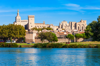
The imposing Palais des Papes (Palace of the Popes) dominates Avignon’s skyline as the largest Gothic palace in Europe, built when the papacy relocated from Rome to Avignon between 1309 and 1377 during a period known as the “Avignon Papacy.” The fortress-like structure contains 25 rooms open to the public, including the Great Chapel standing 20 meters high, the Pope’s private apartments decorated with magnificent frescoes by Italian master Matteo Giovannetti, and the Great Audience Hall where papal courts were held.
The palace complex covers 15,000 square meters and is surrounded by defensive walls featuring 39 towers and battlements. The famous Pont d’Avignon (officially Pont Saint-Bénézet) nearby is the subject of a well-known French nursery rhyme; the bridge originally spanned the entire Rhône River with 22 arches but was repeatedly damaged by flooding, leaving only four arches standing today. The city walls built by Pope Innocent VI in the 14th century remain largely intact, encircling the medieval center with 4.3 kilometers of defensive stone punctuated by seven gates and 39 towers.
The annual Avignon Festival, established in 1947, transforms the city into one of Europe’s most important cultural centers each July, with theatrical performances held in the courtyard of the Palais des Papes and dozens of other venues throughout the city.
The Musée du Petit Palais, housed in a 14th-century cardinal’s residence, contains an exceptional collection of Italian primitive paintings and works from the early Renaissance.
Connectivity:
Air Travel
Nearest Airports:
- Avignon-Provence Airport (AVN) – 8 km from city center
- Marseille Provence Airport (MRS) – 80 km from Avignon
- Nîmes-Alès-Camargue-Cévennes Airport (FNI) – 45 km from Avignon
From Marseille Airport, direct shuttle buses operate to Avignon city center (journey time approximately 1 hour). From Avignon Airport, taxis and limited shuttle services connect to the city center.
Rail Transportation
Primary Station:
- Avignon TGV Station – 6 km from city center
- Avignon Centre Station – 800 meters from Palais des Papes
High-speed TGV trains connect Paris Gare de Lyon to Avignon TGV in approximately 2 hours 40 minutes. A dedicated shuttle train connects Avignon TGV and Avignon Centre stations in 5 minutes. Direct TGV services also operate from major French cities including Lyon (1 hour), Marseille (30 minutes), and Nice (3 hours).
Road Transportation
From Paris:
- Take A6 and A7 motorways south (journey time approximately 7 hours)
- Multiple rest areas available along the route
From Lyon:
- Take A7 motorway south (journey time approximately 2 hours 30 minutes)
From Marseille:
- Take A7 motorway north (journey time approximately 1 hour)
Bus Services
Long-distance coach services connect Avignon to major French cities through providers such as FlixBus and BlaBlaCar Bus. The main bus station is located near Avignon Centre train station.
Local Transportation to Palais des Papes
The Palais des Papes is centrally located within Avignon’s historic center. From Avignon Centre station, it is approximately a 15-minute walk. Local transportation options include:
- City buses operated by TCRA network
- Baladine electric shuttle service circulating through the historic center
- Taxis readily available at both train stations
- Bicycle rentals available throughout the city
Arles and Roman Ruins

Founded as a Greek colony and later developed into a major Roman settlement, Arles contains some of the best-preserved Roman monuments in France. The amphitheater, built around 90 CE, could accommodate 20,000 spectators and remains in remarkable condition, still hosting bullfights and concerts.
The nearby Roman theater, though less well-preserved due to its stones being repurposed for other construction during the Middle Ages, dates from the 1st century BCE and once featured 33 rows of seating for 10,000 spectators.
The Alyscamps necropolis, mentioned in Dante’s Inferno, served as a burial ground from Roman times through the Middle Ages and contains sarcophagi and carved tombs spanning several centuries. Beyond its Roman heritage, Arles is renowned for its connection to Vincent van Gogh, who spent 15 productive months in the city from February 1888 to May 1889, producing over 300 paintings and drawings inspired by the distinctive light and landscapes.
The city’s Romanesque cathedral of Saint-Trophime features an elaborately carved portal depicting the Last Judgment, considered one of the finest examples of Provençal Romanesque sculpture. The Musée Réattu houses an impressive collection of Picasso drawings donated by the artist himself, along with works by local painter Jacques Réattu.
The city’s Saturday market, established in the 12th century, remains one of Provence’s most vibrant, stretching for two kilometers along the ring road that follows the line of the old Roman walls.
Connectivity:
For more details visit: https://www.arlestourisme.com/en/practical-information-groups.html
Air Travel
Nearest Airports:
- Nîmes-Alès-Camargue-Cévennes Airport (FNI) – 25 km from Arles
- Marseille Provence Airport (MRS) – 65 km from Arles
- Montpellier-Méditerranée Airport (MPL) – 80 km from Arles
From Marseille Airport, travelers can take a shuttle bus to Vitrolles train station, then connect to Arles by train (total journey approximately 1 hour 30 minutes). From Nîmes Airport, a shuttle bus connects to Nîmes train station, with onward train service to Arles (total journey approximately 1 hour).
Rail Transportation
Main Station:
- Arles Train Station – Located approximately 1 km from the Roman Amphitheater
TGV high-speed trains connect Paris Gare de Lyon to Arles in approximately 4 hours. Regional TER trains operate frequently from Marseille (40 minutes), Avignon (40 minutes), and Nîmes (20 minutes). The station is equipped with taxi stands and bus connections to the city center.
Road Transportation
From Paris:
- Take A6 and A7 motorways south, then A54 toward Arles (journey time approximately 7 hours 30 minutes)
From Marseille:
- Take A7 motorway north, then A54 toward Arles (journey time approximately 1 hour)
From Avignon:
- Take N570 road south (journey time approximately 45 minutes)
Bus Services
Regional bus services connect Arles to nearby cities including Avignon, Nîmes, and Marseille. The main bus station is adjacent to the train station. Long-distance coach operators such as FlixBus offer services to major cities throughout France.
Local Transportation to Roman Ruins
Arles contains several significant Roman ruins distributed throughout the compact historic center. The primary sites include:
Roman Amphitheater (Arènes d’Arles):
- 10-minute walk from the train station
- Accessible via city bus lines 1 and 2
Roman Theater:
- 15-minute walk from the train station
- Adjacent to the Amphitheater
Cryptoporticus and Forum Remains:
- Located in the city center, 12-minute walk from the train station
Constantine Baths:
- Located near the Rhône River, 15-minute walk from the train station
Alyscamps Roman Necropolis:
- 20-minute walk from the city center
- Accessible via city bus line 3
Local Transportation Options
Arles offers various local transportation options:
- Envia bus network operates throughout the city
- Taxis are available at the train station and central locations
- Bicycle rentals provide an excellent way to navigate between sites
- The compact nature of the historic center makes walking an efficient option for most visitors
The Roman sites are well-signposted throughout the city, and a combined ticket provides access to multiple archaeological attractions. For precise scheduling information and current operating hours, it is advisable to consult the official Arles tourism website or the SNCF (French Railways) website for train services.
Gordes and the Luberon Villages

The Luberon region surrounding Gordes contains numerous hilltop villages each with distinctive character, including Roussillon with its ochre-colored buildings derived from local clay deposits in 17 different shades ranging from bright yellow to deep red.
The village of Ménerbes, made famous by Peter Mayle’s book “A Year in Provence,” features a truffle and wine museum highlighting these regional specialties. Nearby Lacoste is dominated by the partially restored château once owned by the Marquis de Sade and now the property of fashion designer Pierre Cardin. These villages were historically populated by Protestant Waldensians who faced persecution in the 16th century, resulting in fortified architecture and hidden escape passages.
The Luberon Regional Natural Park encompassing these villages covers 120,000 hectares and features exceptional biodiversity with over 1,800 plant species and varied landscapes from cedar forests to dramatic limestone cliffs. Traditional agricultural practices continue throughout the region, including lavender cultivation, olive oil production, goat cheese making, and wine growing, with many farms offering direct sales and tastings to visitors.
Connectivity:
Air Travel Options
Recommended Airports:
- Marseille Provence Airport (MRS) – 70 km from Gordes
- Avignon-Provence Airport (AVN) – 35 km from Gordes
From Marseille Airport, travelers can access Gordes via rental car (approximately 1 hour 15 minutes) or by taking a shuttle to Aix-en-Provence TGV station, then connecting to regional transportation. From Avignon Airport, rental car offers the most direct route (approximately 45 minutes).
Rail Transportation
Nearest Train Stations:
- Avignon TGV Station – 40 km from Gordes
- Cavaillon Station – 20 km from Gordes
These stations receive high-speed TGV trains from major cities including Paris (approximately 2 hours 40 minutes to Avignon). Regional TER trains connect to Cavaillon from Marseille and Avignon. From these stations, travelers must arrange onward transportation to Gordes.
Road Transportation
Private vehicle access offers the most flexibility for exploring the Luberon villages. Recommended routes include:
From Paris:
- Take A6 and A7 motorways south, then D900 and D2 (journey time approximately 7 hours)
From Marseille:
- Take A7 motorway north, then D900 and D2 (journey time approximately 1 hour 15 minutes)
From Avignon:
- Take D900 east, then D2 (journey time approximately 45 minutes)
Bus Services
Limited regional bus services operate between larger towns in Provence and the Luberon villages:
- Line 15.1 connects Avignon to Gordes (seasonal schedule)
- Line 15.2 connects Cavaillon to Apt, with stops in several Luberon villages
These services are operated by the regional Zou! transportation network. Schedules may be limited, particularly during off-season periods.
Guided Tours
Numerous tour operators offer day trips to the Luberon villages from Avignon, Aix-en-Provence, and Marseille. These typically include transportation in air-conditioned vehicles and visits to multiple villages such as Gordes, Roussillon, Ménerbes, and Bonnieux.
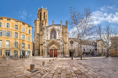
Aix-en-Provence
Founded as a Roman settlement in 123 BCE at the site of natural thermal springs, Aix-en-Provence developed into an elegant university town and cultural center known as the “city of a thousand fountains.” The most famous of these fountains, La Rotonde, built in 1860, measures 32 meters in diameter and features sculptures representing Justice, Agriculture, and Fine Arts.
The city’s main boulevard, the plane tree-lined Cours Mirabeau, divides the medieval quarter (Vieil Aix) from the Quartier Mazarin developed in the 17th century; the street features elegant hôtels particuliers (mansions) built by the city’s parliament members and aristocracy. Aix Cathedral combines architectural elements spanning the 5th through 17th centuries, including a Roman wall, a Gothic nave, and Renaissance decorations; its elaborately carved 16th-century doors depict scenes from the Old and New Testaments.
The city maintains strong associations with Post-Impressionist painter Paul Cézanne, who was born in Aix in 1839; visitors can tour his preserved studio at Les Lauves where the light and arrangement remain exactly as he left them at his death in 1906. The Musée Granet houses a significant collection including works by Cézanne and his contemporaries, along with archaeological artifacts from the region’s Celtic-Ligurian and Roman periods.
The city hosts a renowned international opera festival each July in the courtyard of the former Archbishop’s Palace, building on Aix’s long musical tradition that includes being the birthplace of composer Darius Milhaud. The renowned Calissons d’Aix, almond-shaped confections made from candied fruit and ground almonds on a wafer base, have been produced in the city since the 15th century and remain a signature local specialty.
Connectivity:
For more details visit: https://zou.maregionsud.fr/en/
Air Travel Options
Primary Airports:
- Marseille Provence Airport (MRS) – 25 km from Aix-en-Provence
- Nice Côte d’Azur Airport (NCE) – 155 km from Aix-en-Provence
- Paris Charles de Gaulle (CDG) – 750 km from Aix-en-Provence
From Marseille Provence Airport, travelers can utilize the dedicated airport shuttle bus service that operates directly to Aix-en-Provence city center. This service runs approximately every 30 minutes with a journey time of 30-40 minutes. Taxis are also readily available at the airport terminal, providing a more direct but costlier alternative with a journey time of approximately 25 minutes.
Rail Transportation
Main Stations:
- Aix-en-Provence TGV Station – 15 km northwest of the city center
- Aix-en-Provence Centre Station – Located in the city center
High-speed TGV trains connect Paris Gare de Lyon to Aix-en-Provence TGV station in approximately 3 hours. Regular shuttle buses operate between the TGV station and the city center, with a journey time of approximately 20 minutes. Regional TER trains connect Marseille Saint-Charles station to Aix-en-Provence Centre station in approximately 40 minutes, operating on frequent schedules throughout the day.
Road Transportation
From Paris:
- Take A6 and A7 motorways south (journey time approximately 7 hours)
From Lyon:
- Take A7 motorway south (journey time approximately 3 hours)
From Marseille:
- Take A51 motorway north (journey time approximately 30 minutes)
Parking facilities are available throughout Aix-en-Provence, though the historic center features limited vehicle access with several designated parking structures at the periphery.
Bus Services
Long-distance coach services connect Aix-en-Provence to major French cities through providers such as FlixBus and BlaBlaCar Bus. The regional Zou! transportation network offers comprehensive connections to surrounding Provençal towns and villages. The main bus terminal in Aix-en-Provence is situated adjacent to the city center train station.
Local Transportation
Aix-en-Provence benefits from a well-organized public transportation system:
The city bus network operated by Aix en Bus provides comprehensive coverage of the urban area with services connecting the TGV station, city center, and surrounding districts. The historic center’s compact nature makes it highly suitable for pedestrian exploration, with most notable attractions situated within walking distance of each other. Taxi services are readily available at designated stands throughout the city and can be reserved in advance.
Accessibility Considerations
The historic center of Aix-en-Provence features some cobblestone streets and pedestrian zones that may present challenges for travelers with mobility concerns. The Aix en Bus system includes vehicles equipped with accessibility features, and many major tourist attractions have implemented accommodations for visitors with special mobility requirements.
For the most current transportation schedules and planning assistance, travelers are advised to consult the SNCF (French Railways) website for train services or the Zou! regional transportation network for comprehensive journey planning within the Provence region.
The Camargue

Western Europe’s largest river delta, where the Rhône meets the Mediterranean, creates a distinctive wetland ecosystem covering over 930 square kilometers. This unique landscape features salt flats, marshes, and lagoons that support extraordinary biodiversity, including over 400 bird species, most notably the pink flamingos that gather in colonies of up to 20,000 individuals.
The region is famous for its indigenous white horses, one of the oldest horse breeds in the world, which roam semi-wild and are used by the gardians (Camargue cowboys) to herd the local black bulls bred for traditional bull games and the French form of bullfighting (course camarguaise) in which the aim is to remove ribbons tied to the bull’s horns rather than to kill the animal.
The Camargue’s principal town, Saintes-Maries-de-la-Mer, features a fortified church containing the relics of Saint Mary Jacobé and Saint Mary Salomé, who according to Provençal legend arrived by boat from Palestine after the crucifixion; the town hosts an annual Roma pilgrimage honoring their patron saint, Sara, with processions carrying her statue to the sea.
The delta environment enables salt production that has been practiced since ancient times; the vast salt pans near Aigues-Mortes produce 15,000 tons of salt annually, creating pyramids of white “salt mountains” visible across the landscape. Traditional reed-thatched cottages called cabanes serve as a reminder of the region’s distinctive architectural heritage adapted to the challenging wetland environment.
The Camargue Regional Nature Park established in 1970 works to balance human activity—including rice cultivation, salt harvesting, and tourism—with preservation of this fragile ecosystem that serves as a critical migratory bird stopover between Europe and Africa.
Connectivity:
Air Travel Access Points
Nearest Airports:
- Marseille Provence Airport (MRS) – 75 km from central Camargue
- Nîmes-Alès-Camargue-Cévennes Airport (FNI) – 25 km from northern Camargue
- Montpellier-Méditerranée Airport (MPL) – 50 km from western Camargue
From these airports, onward transportation to the Camargue region requires either rental vehicles or connections to regional transportation networks. Marseille Airport offers the most extensive international connections, while Nîmes provides the closest access point to the eastern Camargue.
Rail Transportation
Primary Railway Stations:
- Arles Station – Located at the northeastern entrance to the Camargue
- Nîmes Station – Providing access to the eastern Camargue
- Montpellier Station – Serving the western access points
High-speed TGV services connect Paris Gare de Lyon to Arles (approximately 4 hours), Nîmes (approximately 3 hours), and Montpellier (approximately 3 hours 30 minutes). Regional TER trains provide frequent connections between these cities. From these stations, travelers must arrange further transportation into the Camargue itself.
Road Transportation
The Camargue region is best accessed by private vehicle, providing flexibility to explore its diverse natural landscapes. Primary routes include:
From Marseille:
- Take A7 motorway west, then A54 toward Arles, followed by D570 south into the Camargue (journey time approximately 1 hour 30 minutes)
From Avignon:
- Take N570 south to Arles, then D570 into the Camargue (journey time approximately 1 hour)
From Montpellier:
- Take A9 motorway east, then exit toward Aigues-Mortes and Le Grau-du-Roi (journey time approximately 45 minutes)
Bus Services
Regional bus services operated by the Zou! network connect major towns surrounding the Camargue:
- Line 20 connects Arles to Saintes-Maries-de-la-Mer (central Camargue)
- Limited services connect Aigues-Mortes to surrounding communities
These bus services operate on reduced schedules outside the summer tourist season. Advance schedule verification is highly recommended.
Guided Tours
Several operators offer organized excursions to the Camargue from Arles, Nîmes, Avignon, and Marseille. These tours typically include transportation in air-conditioned vehicles and visits to key attractions such as the ornithological park, salt flats, and traditional ranches.
Practical Considerations
The Camargue presents unique transportation considerations:
- Public transportation coverage is limited, particularly to natural areas
- Weather conditions can affect accessibility to certain areas, especially during seasonal flooding
- Summer months experience significant visitor numbers, affecting traffic conditions
- The region’s protected status limits infrastructure development
For comprehensive exploration of the Camargue’s diverse ecosystems and cultural heritage, a rental vehicle is strongly recommended. This provides the necessary flexibility to access more remote areas while accommodating the region’s limited public transportation network.
D-Day Beaches
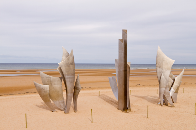
The five landing beaches—Utah, Omaha, Gold, Juno, and Sword—represent one of the most significant military operations in modern history. Walking these peaceful shorelines today, it’s hard to imagine the events of June 6, 1944, when Allied forces began the liberation of Western Europe.
The American Cemetery at Colleville-sur-Mer, with its 9,388 perfectly aligned white crosses and Stars of David overlooking Omaha Beach, offers a profound space for reflection. Museums like the Caen Memorial and numerous bunkers and batteries along the coast help visitors understand the complex planning and human cost of Operation Overlord.
Connectivity:
Air Travel Options
Recommended Airports:
- Paris Charles de Gaulle Airport (CDG) – 260 km from Normandy beaches
- Paris Orly Airport (ORY) – 250 km from Normandy beaches
- Caen-Carpiquet Airport (CFR) – 25 km from primary landing beaches
- Deauville Normandie Airport (DOL) – 40 km from eastern landing beaches
From Paris airports, travelers must connect to rail or road transportation for onward journey to the D-Day beach areas. Caen-Carpiquet offers limited regional flights but provides the closest access point to the central D-Day landing sectors.
Rail Transportation
Principal Railway Stations:
- Caen Station – Strategic central access point to D-Day sites
- Bayeux Station – Provides direct access to Omaha Beach area
- Cherbourg Station – Nearest station to Utah Beach
High-speed SNCF trains connect Paris Saint-Lazare station to Caen (2 hours) and Bayeux (2 hours 30 minutes). Regional trains provide connections between these Norman cities. Upon arrival at these stations, travelers must arrange further transportation to specific beach sites.
Road Transportation
Private vehicle transportation offers optimal flexibility for exploring the dispersed D-Day sites spanning approximately 80 kilometers of coastline. Primary routes include:
From Paris:
- Take A13 motorway west toward Caen, then connect to coastal routes (journey time approximately 3 hours)
From Caen:
- Take N13 northwest toward Bayeux for access to Omaha and Gold beaches
- Take D514 north for access to Juno and Sword beaches
- Take N13 west toward Cherbourg for access to Utah Beach
Bus Services
Regional bus services operated by Normandie connect major towns in the region:
- Line 70 connects Caen to Arromanches (Gold Beach)
- Line 74 connects Bayeux to Omaha Beach
- Additional services connect Caen and Bayeux to smaller coastal communities
These services operate on limited schedules, particularly outside peak tourist season.
Transportation Between D-Day Sites
The D-Day landing beaches and associated historical sites extend across five designated sectors (Utah, Omaha, Gold, Juno, and Sword). Transportation options between these sites include:
- Private vehicle rental (recommended for comprehensive exploration)
- Organized tours (providing historical context and eliminating navigation concerns)
- Limited public bus services (requiring careful schedule planning)
- Bicycle rentals (suitable for shorter distances between adjacent sites)
Key D-Day Locations and Access Points
- Utah Beach – Accessible via D329 from Sainte-Mère-Église
- Omaha Beach – Accessible via D517 from Bayeux
- Gold Beach – Centered around Arromanches, accessible via D514
- Juno Beach – Accessible via D79 from Douvres-la-Délivrande
- Sword Beach – Accessible from Ouistreham, connected to Caen by frequent bus services
- American Cemetery at Colleville-sur-Mer – Adjacent to Omaha Beach
- Caen Memorial Museum – Located in southern Caen with dedicated parking facilities
For comprehensive exploration of the D-Day landing beaches and associated historical sites, a rental vehicle is strongly recommended. This provides necessary flexibility to access the dispersed locations while accommodating limitations in public transportation availability.
For current transportation schedules and detailed site information, consulting the official Normandy Tourism website is advisable prior to travel planning.
Bayeux
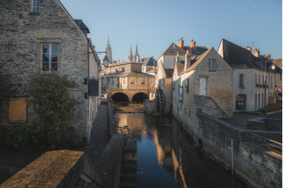
This charming medieval town miraculously survived WWII intact. It houses the famous Bayeux Tapestry, a remarkable 70-meter-long embroidered cloth depicting William the Conqueror’s invasion of England in 1066.
The tapestry represents an extraordinary historical document and artistic achievement, combining narrative storytelling with detailed embroidery work. The town itself features a magnificent cathedral and well-preserved medieval streets that transport visitors back through the centuries.
Bayeux serves as an excellent base for exploring both the D-Day sites and the picturesque Norman countryside.
Rouen

The historic capital of Normandy offers a stunning Gothic cathedral that Claude Monet painted repeatedly, capturing its façade in different lights and seasons. The city’s medieval quarter features meticulously preserved half-timbered buildings and the site where Joan of Arc was executed in 1431.
The Great Clock (Gros Horloge), an astronomical clock dating from the 14th century, spans an archway over a pedestrian street. Rouen’s museums house impressive collections of Impressionist paintings, reflecting the region’s significant influence on this artistic movement.
The blend of medieval architecture, religious history, and artistic heritage makes Rouen a multifaceted cultural destination.
Connectivity:
For more details visit: https://www.myastuce.fr/en
Air Travel Options
Nearest Airports:
- Paris Charles de Gaulle Airport (CDG) – 140 km from Rouen
- Paris Orly Airport (ORY) – 160 km from Rouen
- Deauville Normandie Airport (DOL) – 80 km from Rouen
From Paris airports, travelers must connect to rail or road transportation for the onward journey to Rouen. No direct airport shuttle services operate to Rouen, necessitating transfer via central Paris or private transportation arrangements.
Rail Transportation
Main Station:
- Rouen Rive Droite Station – Located in the city center, 800 meters from the cathedral
Direct SNCF trains connect Paris Saint-Lazare station to Rouen Rive Droite with frequent daily departures (journey time approximately 1 hour 15 minutes). Regional trains provide connections to other Norman cities including Caen (1 hour 30 minutes), Le Havre (45 minutes), and Dieppe (40 minutes).
Road Transportation
Several major routes provide access to Rouen by private vehicle:
From Paris:
- Take A13 motorway northwest toward Caen, exit at Rouen (journey time approximately 1 hour 40 minutes)
From Caen:
- Take A13 motorway east toward Paris, exit at Rouen (journey time approximately 1 hour 15 minutes)
From Le Havre:
- Take A131 and A13 motorways east (journey time approximately 45 minutes)
Bus Services
Long-distance coach services connect Rouen to major French cities through operators such as FlixBus and BlaBlaCar Bus. These services arrive at Rouen bus station adjacent to the main railway station. Regional bus services operated by Normandie connect Rouen to surrounding Norman towns and villages.
Local Transportation Within Rouen
Rouen benefits from a comprehensive public transportation network:
The ASTUCE network operates bus and tram services throughout the metropolitan area. Four tram lines (T1-T4) and numerous bus routes provide extensive coverage. The historical center is compact and pedestrian-friendly, with most notable attractions situated within walking distance of each other. Taxi services are readily available at designated stands throughout the city and can be reserved in advance.
Transportation to Key Attractions
Rouen’s principal attractions are concentrated within the historic center:
- Rouen Cathedral – Located 800 meters from the train station, accessible on foot or via bus lines F1, F2, or F3
- Joan of Arc Church and Square – Located in the city center, 700 meters from the train station
- Fine Arts Museum – Located 1 km from the train station, accessible via tram lines T1 and T2
- Church of Saint-Ouen – Located 1.2 km from the train station, accessible via bus lines F1 and F2
For current transportation schedules and detailed information, consulting the official SNCF (French Railways) website for train services or the ASTUCE network website for local transportation is advisable prior to travel planning.
Étretat

Nature has sculpted remarkable chalk cliffs and arches along this section of the Alabaster Coast. The dramatic white cliffs and naturally formed arches rising from the turquoise waters have captivated artists including Monet, Courbet, and Boudin.
The cliff-top paths offer breathtaking panoramic views that change with the light and tides throughout the day. The charming village below, with its pebble beach and Belle Époque architecture, completes this quintessentially Norman landscape where land meets sea in spectacular fashion.
The quality of light here is extraordinary, which explains why so many Impressionist painters were drawn to capture this coastline.
Connectivity:
Air Travel Options
Nearest Airports:
- Le Havre–Octeville Airport (LEH) – 30 km from Étretat
- Deauville Normandie Airport (DOL) – 65 km from Étretat
- Paris Charles de Gaulle Airport (CDG) – 215 km from Étretat
Le Havre–Octeville Airport offers limited regional flights. For international connections, Paris airports provide more extensive options, though onward transportation to Étretat requires train or car connections.
Rail Transportation
Nearest Train Stations:
- Les Ifs Station – 8 km from Étretat
- Fécamp Station – 18 km from Étretat
- Le Havre Station – 30 km from Étretat
No direct train service reaches Étretat itself. Travelers must take a train to one of these stations and then connect via bus or taxi. The most practical rail route is to Le Havre from Paris Saint-Lazare (journey time approximately 2 hours), followed by a bus connection.
Road Transportation
Access to Étretat by private vehicle provides the most direct approach:
From Paris:
- Take A13 motorway toward Caen, then A29 toward Le Havre
- Exit at Bolbec/Goderville and follow D940 to Étretat
- Journey time approximately 2 hours 30 minutes
From Rouen:
- Take A29 motorway west toward Le Havre
- Exit at Bolbec/Goderville and follow D940 to Étretat
- Journey time approximately 1 hour 15 minutes
From Le Havre:
- Take D940 coastal road north toward Étretat
- Journey time approximately 35 minutes
Bus Services
Regional bus services operated by Normandie connect Étretat to larger towns:
- Line 24 connects Le Havre to Fécamp via Étretat with multiple daily departures
- Line 60 connects Étretat to Fécamp
These services operate daily but with reduced frequency outside the summer tourist season.
Local Transportation Within Étretat
Étretat is a compact village with its famous cliffs and beach accessible on foot from the town center:
- The village center is approximately 400 meters from the beach
- The path to the top of the cliffs begins near the beach
- The entire village is navigable on foot, with most attractions within a 15-minute walk
Key Attractions and Walking Distances
- Falaise d’Aval (Downstream Cliff with famous arch) – 10-minute walk from town center
- Falaise d’Amont (Upstream Cliff with chapel) – 15-minute walk from town center
- Étretat Beach – 5-minute walk from town center
- Clos Lupin (Maurice Leblanc Museum) – Located in the town center
- Étretat Gardens – Located on the cliff tops, 15-minute walk from town center
For visitors without private transportation, the most reliable access route is to travel to Le Havre by train from Paris, then connect via the Line 24 bus to Étretat. However, a rental car provides the most flexibility for exploring Étretat and the surrounding Alabaster Coast.
For current transportation schedules and detailed information, consulting the official Normandy Tourism website or Normandie for bus services is advisable prior to travel planning.
Bordeaux City Center and Port of the Moon
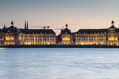
The city’s historic center curves along the Garonne River in a crescent shape known as the “Port of the Moon,” which earned UNESCO World Heritage status for its exceptional 18th-century urban ensemble.
The waterfront features the Place de la Bourse with its symmetrical buildings reflecting in the innovative Miroir d’Eau (Water Mirror)—the world’s largest reflecting pool covering 3,450 square meters with just 2 cm of water that cycles through fog effects every 15 minutes. The Grand Théâtre, built between 1773 and 1780, exemplifies neoclassical architecture with its 12 Corinthian columns and is considered one of Europe’s finest theaters; its exceptional acoustics and original machinery remain largely intact.
The Bordeaux Cathedral, mainly constructed between the 12th and 16th centuries, features two distinct Gothic towers and royal wedding sculptures commissioned by Eleanor of Aquitaine. The Rue Sainte-Catherine stretches for 1.2 kilometers as Europe’s longest pedestrian shopping street, connecting the Grand Théâtre to the former Roman forum site.
The city underwent extensive urban renewal under Mayor Alain Juppé beginning in the 1990s, including cleaning centuries of soot from the honey-colored limestone buildings, creating tramway lines, and revitalizing the formerly industrial riverfront. The city served as a temporary capital when the French government evacuated Paris during both World Wars, and its lack of bombing during WWII helped preserve its architectural integrity.
Bordeaux’s historical significance as a trading port is evident in street names reflecting colonial connections and in the remarkable mansions built by wine merchants and shipowners during the city’s 18th-century golden age.
Connectivity:
Tram Service
- Tram B: Runs directly along the Garonne riverfront with stops at:
- Quinconces
- CAPC (Musée d’Art Contemporain)
- Chartrons
- Grand Théâtre
- Tram C: Connects Saint-Jean railway station to Port of the Moon with stops at:
- Porte de Bourgogne
- Place de la Bourse
- Quinconces
- Tram A: Intersects with B and C lines at Hôtel de Ville and Mériadeck
Bus Routes
- Line 1: Connects Place des Quinconces to northern districts
- Line 4: Runs through the historic center with stops near Place de la Bourse
- Line 15: Serves the riverfront area with stops at Quinconces and Bourse
- Navette Électrique: Electric shuttle buses operate circular routes within the pedestrianized historic center
River Transportation
- BatCub River Shuttles: Regular service along the Garonne with stops at:
- Stalingrad (east bank)
- Quinconces (west bank)
- Les Hangars (west bank)
- Cité du Vin (west bank)
- River Cruises: Sightseeing boats depart from Quai Richelieu offering panoramic views of the UNESCO-listed Port of the Moon facades
Key Stations Near Port of the Moon
- Place des Quinconces: Major transport hub for trams B and C, multiple bus lines
- Gare Saint-Jean: Main railway station (2km south), connected via tram C
- Place de la Bourse: Central tram C stop directly at the iconic water mirror
- Grand Théâtre: Tram B stop serving the northern section of the historic center
- Hôtel de Ville: Interchange between tram A and B lines
- Porte de Bourgogne: Gateway to the historic center from the south, served by tram C
Saint-Émilion
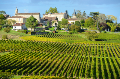
This medieval town built on a limestone promontory has been associated with wine production since Roman times and forms the center of one of Bordeaux’s most prestigious wine appellations. The town and its surrounding vineyards achieved UNESCO World Heritage status in 1999, recognizing both the cultural landscape shaped by centuries of viticulture and the exceptional preservation of its medieval architecture.
The town’s most distinctive feature is its monolithic church, carved from a single massive limestone cliff in the 12th century; this remarkable structure measures 38 meters long, 12 meters wide, and 11 meters high, making it Europe’s largest underground church. The 53-meter-tall Bell Tower adjacent to the monolithic church provides panoramic views of the surrounding vineyards but required additional reinforcement in the 19th century when engineers discovered it had been built directly over catacombs.
The village is named for an 8th-century Breton monk who lived as a hermit in a cave that can still be visited; according to legend, he performed miracles and gave his food to the poor, which led to his eventual canonization. The collegiate church features remarkable 14th-century cloister sculptures depicting scenes from daily medieval life alongside religious imagery.
The surrounding vineyards primarily grow Merlot and Cabernet Franc grapes on varied terroirs ranging from limestone plateaus to sandy soils, creating the distinctive Saint-Émilion wine profile. The ancient tradition of wine production is evident in the numerous underground galleries extending beneath the town, naturally temperature-controlled chambers that have served as wine cellars for centuries.
The classification system for Saint-Émilion wines, unlike other Bordeaux regions, undergoes reevaluation every decade, creating a more dynamic hierarchy that recognizes evolving quality.
Connectivity:
For details visit: https://www.saint-emilion-tourisme.com/en/
Rail Transportation
Nearest Station:
- Saint-Émilion Station – Located approximately 2 km from the medieval village center
Regional TER trains connect Bordeaux Saint-Jean station to Saint-Émilion in approximately 35 minutes, with 4-6 daily departures. From the station, visitors can reach the village center via a 20-minute walk or local taxi service.
Bus Services
Regional bus service Line 403 (operated by the Nouvelle-Aquitaine region) connects Bordeaux Quinconces to Saint-Émilion with limited daily departures. Journey time is approximately 1 hour 15 minutes. The bus stop is located at the entrance to the village, requiring a short uphill walk to the historic center.
Road Transportation
From Bordeaux:
- Take A10/E5/E70 eastbound, then D243 to Saint-Émilion
- Journey time approximately 45 minutes
- Parking facilities are available at the village periphery (P1-P5), with a 5-10 minute walk to the center
From Bergerac:
- Take D936 westbound to Saint-Émilion
- Journey time approximately 50 minutes
Guided Tours
Numerous tour operators offer day trips to Saint-Émilion from Bordeaux, including:
- Half-day wine tours with transportation
- Full-day excursions combining village visits with winery tours
- Small group and private options departing from Bordeaux city center
Local Transportation Within Saint-Émilion
The medieval village is compact and primarily pedestrianized:
- Tourist train (“Petit Train”) operates circular routes through the village during peak season
- The village center features steep, cobbled streets not suitable for vehicles
- Electric golf carts are available for rental at the tourist office for visitors with mobility concerns
Transportation to Surrounding Vineyards
Several options exist for visiting the renowned wineries surrounding Saint-Émilion:
- Wine tour shuttle services operate from the village center to selected châteaux
- Bicycle rentals are available for independent exploration
- Taxi services can be arranged through accommodations or the tourist office
- Some larger châteaux offer pick-up service from the village or train station
Nearest Major Transport Hubs
- Bordeaux Saint-Jean Station – 40 km west
- Bordeaux-Mérignac Airport – 50 km west
- Bergerac Dordogne Périgord Airport – 45 km east
- Libourne Train Station – 7 km northwest (offers more frequent train connections than Saint-Émilion station)
For current schedules and transportation information, consulting the official Saint-Émilion Tourism Office website is recommended prior to planning your visit.
Médoc Wine Route
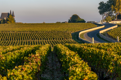
This 80-kilometer route winds north from Bordeaux through the peninsula between the Atlantic Ocean and the Gironde Estuary, passing through some of the world’s most renowned wine appellations including Margaux, Pauillac, and Saint-Estèphe.
The area’s wine production dates to Roman times but gained its current prestige after Dutch engineers drained the marshlands in the 17th century, creating the gravelly soil that proves ideal for growing Cabernet Sauvignon. The landscape is dotted with architectural showpieces like Château Margaux, rebuilt in the Palladian style after a fire in 1810, and Château Pichon Baron with its fairytale turrets inspired by French Renaissance châteaux.
The famous 1855 classification commissioned by Napoleon III for the Paris Exhibition established a hierarchy of Médoc wines that largely remains unchanged today, with only one adjustment in over 160 years when Château Mouton Rothschild was elevated to First Growth status in 1973 after decades of lobbying. The gravelly soil composition forces vine roots to grow deeply in search of water, creating stress conditions that produce smaller, more concentrated grapes—a factor contributing to the wines’ renowned aging potential and distinctive character.
Many estates maintain traditional harvest practices including hand-picking and sorting, despite the region’s adoption of modern winemaking technology. The landscape features the distinctive flat horizon of the Médoc plain punctuated by the gravelly rises (croupes) where the finest vineyards are situated, often just a few meters higher than surrounding land but with crucial drainage advantages.
The Médoc route includes not only famous classified growths but also hundreds of smaller châteaux producing excellent Cru Bourgeois and artisanal wines that often provide exceptional value.
Connectivity:
For more details visit: https://www.medocvignoble.com/en/
Rail Transportation
Nearest Stations:
- Pauillac Station – Located in the heart of the Médoc wine region
- Moulis-Listrac Station – Serves southern Médoc appellations
Regional TER trains connect Bordeaux Saint-Jean station to Pauillac in approximately 1 hour, with limited daily departures (typically 2-3 services per day). These trains continue north to Le Verdon-sur-Mer with stops at smaller Médoc stations. Service frequency is higher during weekdays than weekends.
Bus Services
Regional bus service Line 705 (operated by TransGironde) connects Bordeaux Quinconces to key points along the Médoc Wine Route including:
- Margaux
- Moulis
- Saint-Julien
- Pauillac
Journey time from Bordeaux to Pauillac is approximately 1 hour 30 minutes with multiple daily departures. The bus follows the D2 “Route des Châteaux” providing convenient access to many notable wineries.
Road Transportation
The D2 highway (Route des Châteaux) forms the backbone of the Médoc Wine Route:
From Bordeaux:
- Take D2 north from Bordeaux toward Pauillac
- Journey time to Margaux (southern Médoc) approximately 40 minutes
- Journey time to Pauillac (central Médoc) approximately 1 hour
- Journey time to Saint-Estèphe (northern Médoc) approximately 1 hour 15 minutes
Local Transportation Along the Wine Route
The Médoc Wine Route extends approximately 80 km from Bordeaux to the northern tip of the peninsula:
- No comprehensive public transportation exists between individual châteaux
- Many prestigious wineries are not within walking distance of bus/train stops
- Local taxi services are limited and should be booked in advance
Transportation to Key Wine Appellations
- Margaux: 40 km north of Bordeaux, accessible via bus 705, train to Moulis-Listrac, or D2 highway
- Saint-Julien: 50 km north of Bordeaux, accessible via bus 705 or D2 highway
- Pauillac: 60 km north of Bordeaux, accessible via bus 705, train to Pauillac station, or D2 highway
- Saint-Estèphe: 65 km north of Bordeaux, accessible via D2 highway or train to Pauillac followed by local transportation
Alternative Transportation Options
- Bicycle Tourism: Several companies offer bicycle rentals and self-guided cycling itineraries along the D2
- River Cruises: Seasonal boat excursions operate from Bordeaux along the Gironde Estuary with stops at select Médoc ports
La Cité du Vin
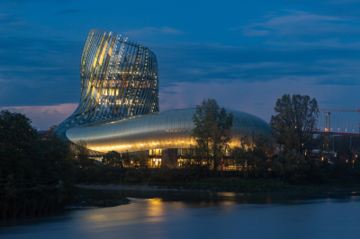
Opened in 2016 on the banks of the Garonne River, this innovative wine museum housed in a distinctive swirling glass and aluminum structure resembling wine moving in a glass has become Bordeaux’s most visited cultural attraction. The building’s architecture by XTU Architects incorporates 900 glass panels and 2,500 aluminum panels in varying shades to reflect the colors of the river and sky. The museum explores wine civilization through history, culture, and geography with 19 thematic sections utilizing cutting-edge interactive technology including olfactory stations, 3D visuals, and motion-sensitive displays.
Beyond Bordeaux, the museum addresses wine production and culture across 80 countries, emphasizing wine as a universal cultural heritage rather than focusing solely on local traditions. The Belvedere observation deck on the eighth floor offers 360-degree views of Bordeaux while visitors sample a wine of their choice included with admission; the adjacent restaurant features a 500-bottle wine list with selections available by the glass using advanced preservation systems.
The permanent exhibition includes over 10 hours of audiovisual content and more than 125 interactive stations addressing topics ranging from terroir and viticulture to wine in sacred rituals and artistic representation. The building incorporates significant environmental design elements including natural ventilation systems, rainwater recovery, and solar panels that produce 50% of the building’s electricity. The museum serves as both a tourist attraction and educational resource, offering professional training programs, academic partnerships, and temporary exhibitions addressing contemporary issues in wine culture.
Annual attendance has surpassed 400,000 visitors, significantly exceeding initial projections and contributing to the revitalization of Bordeaux’s formerly industrial north bank.
Connectivity:
Tram Service
- Tram B: Direct service to La Cité du Vin with its own dedicated stop “La Cité du Vin”
- From Bordeaux city center/Quinconces: approximately 15 minutes
- From Bordeaux Saint-Jean train station: Take Tram C to Quinconces, then transfer to Tram B
- Frequency: Every 5-7 minutes during peak hours
Bus Routes
- Line 7: Stops at “La Cité du Vin”
- Connects northern districts to the museum
- Line 32: Stops near “La Cité du Vin”
- Provides connections to western suburbs
River Transportation
- BatCub River Shuttle: Direct service to La Cité du Vin dock
- Line B: Connects Stalingrad (east bank) to La Cité du Vin
- Frequency: Approximately every 45 minutes
- Journey time from city center: 20-25 minutes
- Scenic approach with views of the Port of the Moon
Nearby Stations
- La Cité du Vin Tram Station: Directly in front of the museum entrance
- Bassins à Flot Tram Station: 400 meters from the museum (Tram B)
- Les Hangars BatCub Stop: 300 meters from the museum
- Bordeaux Maritime Bus Hub: 500 meters from the museum, connecting multiple bus lines
From Bordeaux Saint-Jean Train Station
- Option 1: Tram C to Quinconces, transfer to Tram B to La Cité du Vin (total journey approximately 30 minutes)
- Option 2: Direct bus service (Line 15) to Bassins à Flot, then 5-minute walk
From Bordeaux-Mérignac Airport
- Option 1: Airport shuttle to city center, then Tram B to La Cité du Vin
- Option 2: Direct taxi service (approximately 30 minutes)
Strasbour

The capital of Alsace features a UNESCO-listed historic center with a magnificent Gothic cathedral housing an astronomical clock that performs a mechanical show daily at 12:30 PM. La Petite France quarter showcases charming half-timbered houses along canals, originally home to tanners and millers.
The city blends French and German influences in its architecture, culture, and cuisine, best experienced in traditional winstubs serving specialties like choucroute and tarte flambée. Strasbourg also hosts European institutions like the European Parliament and Council of Europe.
During December, the city transforms with one of Europe’s oldest Christmas markets dating back to 1570, featuring hundreds of wooden chalets selling crafts and seasonal treats.
Connectivity:
For more Details visit: https://www.cts-strasbourg.eu/en/
Tram Network
Strasbourg’s modern tram system forms the backbone of the city’s public transportation:
- Network Coverage: Six lines (A through F) cover the entire city, including the European Quarter, University area, and historic center
- Frequency: Trams run every 5-7 minutes during peak hours and every 10-15 minutes during off-peak times
- Operating Hours: Service generally runs from 4:30 AM to 12:30 AM (extended to 1:30 AM on Friday and Saturday nights)
- Cross-Border Service: Line D extends across the Rhine to Kehl in Germany, making international travel seamless
Bus Network
Complementing the tram system, Strasbourg’s bus network provides comprehensive coverage:
- Regular Lines: Numbered routes connect neighborhoods not served by trams
- Express Lines: Faster service with fewer stops on major corridors
- Night Buses (Hibus): Special night routes operating on weekends when regular service ends
- Shuttle Buses: Specialized routes serving specific areas like the European Parliament during session periods
Bike-Sharing: Vélhop
Strasbourg is known as France’s premier cycling city, and its bike-sharing system reflects this:
- Station Network: Over 20 manned stations and numerous automated rental points throughout the city
- Bike Types: Standard bikes, electric bikes, and children’s bikes available
- Rental Options: Short-term (from 1 hour) to long-term (several months) rentals
- Pricing: Starts at €1 for a basic 1-hour rental, with daily rates around €6
- Process: Register with ID and credit card at any station (automated stations accept credit cards with PIN)
The extensive network of dedicated cycle paths (over 600 km throughout the metropolitan area) makes cycling one of the most pleasant ways to explore the city.
River Shuttle: Batorama
For a more scenic transportation option, Strasbourg offers river shuttles:
- Tourist Boats: 70-minute circular tours of the historic center via the canals
- Navette Fluviale: River shuttle service operating seasonally in the summer months
- Boarding Points: Main embarkation point at Place de la Cathédrale, with additional stops throughout the city
Ticketing System
Strasbourg uses an integrated ticketing system operated by CTS (Compagnie des Transports Strasbourgeois):
Single Tickets
- Single Journey: Valid for 1 hour of unlimited travel in one direction (€1.80)
- 24-Hour Pass: Unlimited travel for 24 hours (€4.60)
- Group Ticket: Day pass for up to 3 people traveling together (€7.00)
Multi-Day Options
- 3-Day Pass: Unlimited travel for 72 hours (€9.30)
- Europass: 24-hour pass valid in both Strasbourg and the German city of Kehl (€5.00)
Regular User Options
- 10-Trip Ticket: Ten single journeys at a reduced rate (€14.20)
- Monthly Pass: Unlimited travel for one calendar month (€51.80)
- Annual Pass: Significant savings for year-round users (€514)
Purchasing Options
- Ticket Machines: Located at all tram stops and major bus stops
- CTS Boutiques: Service centers at central locations (Homme de Fer, train station)
- Mobile App: “CTS Mobile” allows ticket purchase and validation via smartphone
- Onboard Purchase: Available on buses only (slightly higher price)
All tickets must be validated before boarding using the yellow machines at tram stations or on buses.
Specialized Services
Mobility Services for Persons with Reduced Mobility
- Mobi’link: Door-to-door transportation service for registered users with disabilities
- Wheelchair Access: All trams and most buses are wheelchair accessible
Digital Tools
Several apps enhance the transportation experience in Strasbourg:
- CTS Mobile: Official app for route planning, real-time arrivals, and mobile ticketing
- Vélhop: Bike-sharing app showing available bikes and stations
- Optimod’Lyon: Multi-modal journey planner including all transportation options
Practical Tips
- Navigation Hub: Place de l’Homme de Fer is the central transportation hub where five tram lines intersect
- Petit France Access: The historic district is largely pedestrianized, but tram lines A and D provide access to its periphery
- European Quarter: Directly served by tram line E
- Airport Connection: Tram line G connects the airport to the train station in approximately 20 minutes
- Sunday Service: Public transportation operates on Sundays, though with reduced frequency
- Rush Hours: Trams can become crowded between 8:00-9:00 AM and 5:00-6:30 PM on weekdays
Colmar

This beautifully preserved medieval town is known for its colorful half-timbered buildings and canals in the “Little Venice” district where flat-bottomed boats offer scenic rides. Colmar escaped major damage during WWII, preserving its architectural heritage including the Pfister House with its painted frescoes.
The Unterlinden Museum, housed in a 13th-century Dominican convent, displays the famous Isenheim Altarpiece by Matthias Grünewald. The town celebrates its connection to sculptor Frédéric Auguste Bartholdi, creator of the Statue of Liberty, with a dedicated museum.
Colmar serves as an excellent base for exploring nearby vineyards and hosts vibrant seasonal markets.
Connectivity:
For more details visit: https://www.tourisme-colmar.com/en/practical/travel-and-mobility/public-transport
By Train
From Major Cities
- From Paris: Direct TGV (high-speed train) services from Paris Gare de l’Est take approximately 2 hours 20 minutes. There are typically 5-7 daily connections.
- From Strasbourg: Regular TER (regional train) services connect Strasbourg to Colmar, with a journey time of approximately 30 minutes. Trains run frequently, with departures approximately every 30 minutes during peak hours.
- From Basel (Switzerland): Direct TER trains take about 45 minutes, with hourly service throughout most of the day.
- From Lyon: Direct TGV connections take approximately 3 hours 30 minutes, with several daily departures.
- From Frankfurt (Germany): Requires a change in Strasbourg, with a total journey time of approximately 3 hours.
Colmar Train Station
The train station is located about a 10-minute walk from the historic center. Upon arrival, you’ll find:
- Tourist information desk (seasonal)
- Taxi stand
- Bus connections to the city center (lines 1, 3, 4, and others)
- Bicycle rental facilities
By Air
Colmar doesn’t have its own commercial airport, but several nearby airports provide convenient access:
EuroAirport Basel-Mulhouse-Freiburg (BSL)
- Distance: 60 km (approximately 40 minutes by car)
- Connections: Regular Flixbus services to Colmar (1-2 hours depending on the route)
- Transportation: Taxi, rental car, or shuttle service to Saint-Louis train station, then train to Colmar
Strasbourg Airport (SXB)
- Distance: 70 km (approximately 45 minutes by car)
- Transportation: Take the tram from the airport to Strasbourg train station, then a TER train to Colmar
Zurich Airport (ZRH)
- Distance: 150 km (approximately 1 hour 30 minutes by car)
- Transportation: Train connections require a change in Basel
By Bus
Long-Distance Coaches
- FlixBus: Offers connections to Colmar from many European cities including Paris, Strasbourg, Basel, and Frankfurt
- BlaBlaCar Bus: Provides service on major routes with competitive pricing
- Colmar Bus Station: Located adjacent to the train station
Typical journey times by bus:
- From Strasbourg: 45-60 minutes
- From Basel: 1 hour
- From Paris: 5-6 hours
By Car
Major Route Access
- A35 Motorway: The main north-south route through Alsace, connecting Strasbourg to Basel
- N83 National Road: Connects Colmar to the Vosges mountains
- D415: Eastern access from Germany via Breisach
Parking Information
- Several parking garages in and around the city center
- Place de la Mairie Parking: Central location near the old town
- Parking Lacarre: Large facility near the train station
- Parking Rapp: Convenient for accessing the Little Venice area
- Street parking with paid meters available in some areas (often time-limited)
Local Transportation Upon Arrival
Once in Colmar, the city offers several public transportation options:
- TRACE Bus Network: Covers the city and surrounding villages with 9 regular routes
- Shuttle Bus: Free shuttle connecting major parking areas with the city center (seasonal)
- Taxis: Available at the train station and can be called throughout town
- Walking: Most tourist attractions are concentrated in the compact historic center, easily explored on foot
Haut-Koenigsbourg Castle
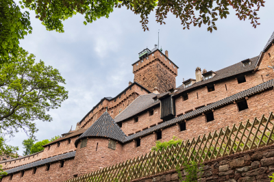
This imposing medieval fortress sits atop a mountain at 757 meters, offering panoramic views of the Alsace plain, Vosges Mountains, and sometimes even the Black Forest. Built in the 12th century and meticulously restored from 1900-1908 under Kaiser Wilhelm II, the castle provides an authentic glimpse into medieval military architecture with its drawbridge, spiral staircases, great hall, and living quarters.
Visitors can explore the castle’s weaponry collection, kitchen with its massive fireplace, and learn about its strategic importance in controlling the wine and salt routes. The castle offers special events including medieval festivals and night visits during summer months. Its distinctive red sandstone walls contrast beautifully with the surrounding green forest.
Connectivity:
Haut-Koenigsbourg Castle (Château du Haut-Kœnigsbourg) is located in the Alsace region of northeastern France, perched atop the Vosges Mountains at an elevation of 757 meters. The castle is situated near the commune of Orschwiller, approximately 26 kilometers north of Colmar and 55 kilometers southwest of Strasbourg.
Reaching the Castle from Major Cities
From Strasbourg
Strasbourg provides the most convenient access point for international travelers visiting Haut-Koenigsbourg Castle.
By Train and Bus
- Take a regional train (TER) from Strasbourg to Sélestat. This journey takes approximately 20 minutes.
- From Sélestat train station, catch the seasonal shuttle bus (Navette du Haut-Koenigsbourg) that operates directly to the castle. This service typically runs from April through November, with limited winter service.
- The shuttle bus journey takes approximately 30 minutes through scenic mountain roads.
By Car
- Follow the A35 autoroute south from Strasbourg for approximately 40 kilometers.
- Take exit 17 toward Kintzheim/Sélestat.
- Follow signs for “Château du Haut-Koenigsbourg” through Sélestat and along the D159 and D159bis mountain roads.
- The driving time is approximately 45-50 minutes from Strasbourg.
From Colmar
By Train and Bus
- Take a regional train from Colmar to Sélestat (approximately 10 minutes).
- Follow the same shuttle bus connection as mentioned above.
By Car
- Follow the A35 autoroute north from Colmar for approximately 20 kilometers.
- Take exit 17 toward Kintzheim/Sélestat.
- Follow the signs as described above.
- The driving time is approximately 30-35 minutes from Colmar.
Mulhouse
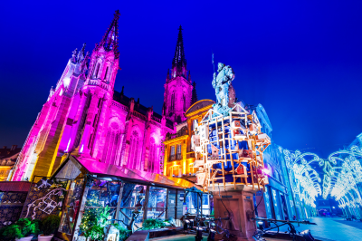
This industrial city in southern Alsace houses exceptional museums, including the National Automobile Museum with one of the world’s largest car collections featuring over 400 vehicles including rare Bugattis, and the Railway Museum with its impressive collection of historic locomotives.
Visitors can explore the historic center with its colorful town hall (Hôtel de Ville) decorated with trompe l’oeil paintings and Place de la Réunion. The city’s textile industry is celebrated at the Museum of Printed Textiles with over six million samples dating back to the 18th century.
Unlike other Alsatian cities, Mulhouse shows Swiss influence from its time as part of the Swiss Confederation until 1798. The city hosts a popular Christmas market and serves as a gateway to the nearby Ballons des Vosges Natural Park.
For more details visit: https://www.tourisme-mulhouse.com/en/
Connectivity:
By Train
Mulhouse has excellent rail connections that make it accessible from many European cities. The main railway station is Mulhouse-Ville, which serves as a hub for regional and international train services.
From Paris
High-speed TGV trains provide direct connections from Paris to Mulhouse:
- Depart from Paris Gare de l’Est station
- Journey time is approximately 2 hours and 40 minutes
- Multiple departures daily
- The line passes through Strasbourg, where some connections may require a transfer
From Strasbourg
Regional trains connect Mulhouse with the Alsatian capital:
- TER trains depart regularly from Strasbourg station
- Journey time is approximately 50 minutes
- Services run frequently throughout the day
From Switzerland
Mulhouse is well-connected to Swiss cities:
- Direct trains from Basel SBB station take about 30 minutes
- Connections from Zurich require approximately 1 hour and 30 minutes, often with a change in Basel
From Germany
Cross-border services provide access from German cities:
- Trains from Freiburg im Breisgau take approximately 45 minutes
- Connections from Frankfurt typically require 3-4 hours with transfers
By Air
Mulhouse shares an international airport with Basel, Switzerland:
EuroAirport Basel-Mulhouse-Freiburg
This unique tri-national airport serves the region:
- Located approximately 30 kilometers from downtown Mulhouse
- Offers flights from major European cities
- Connected to Mulhouse by regular shuttle bus services (route 50)
- The journey from the airport to Mulhouse takes about 30 minutes
- Taxis and rental cars are also available at the terminal
By Road
By Car
Mulhouse is easily accessible via the French motorway network:
- The A36 autoroute connects Mulhouse with Beaune and the wider French road network
- The A35 autoroute provides north-south connections to Strasbourg and Switzerland
- The A5 German autobahn connects nearby to provide access from German cities
By Bus
Long-distance bus services connect Mulhouse with other European cities:
- Flixbus operates services to numerous destinations including Paris, Lyon, and Frankfurt
- The main bus station is located adjacent to the railway station
- Journey times vary considerably depending on the origin city
Local Transportation Within Mulhouse
Once in Mulhouse, the city offers comprehensive public transportation:
Tram Network
Mulhouse has a modern tram system:
- Three lines cover the main urban area
- Services run frequently throughout the day
- Tickets can be purchased at machines located at tram stops
Bus Network
An extensive bus network complements the tram system:
- Routes connect all neighborhoods and surrounding communities
- Central bus station is located near the railway station
- The same tickets can be used for both trams and buses
Tram-Train
This hybrid system connects the city center with the northern suburbs:
- Operates as both a tram within the city and as a train on the regional rail network
- Provides convenient access to northern communities and the Parc des Expositions
Practical Information
The city center of Mulhouse is relatively compact and many attractions are within walking distance of each other. Major sites like the Cité de l’Automobile (National Automobile Museum) and the Cité du Train (Railway Museum) are accessible via the public transportation network.
For visitors planning to use public transportation extensively, day passes or multi-day tickets offer good value and convenience. These can be purchased at the main stations or from the Soléa transportation office near the railway station.