
Major Airports in USA
Top Tier Hubs:
- Hartsfield-Jackson Atlanta International (ATL)
- Los Angeles International (LAX)
- Chicago O’Hare (ORD)
- Dallas/Fort Worth International (DFW)
- Denver International (DEN)
Major Regional Hubs:
- John F. Kennedy International (JFK) – Primary international gateway for New York
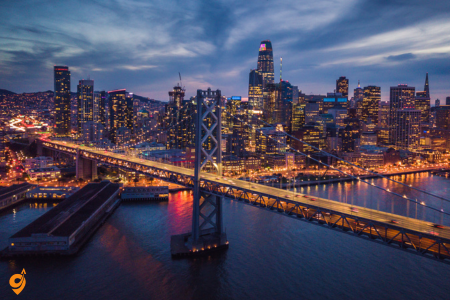
- San Francisco International (SFO) – Major Pacific gateway
- Seattle-Tacoma International (SEA) – Pacific Northwest hub
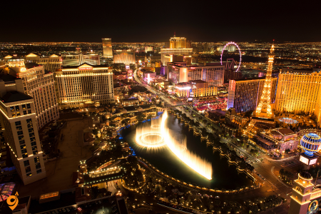
- Las Vegas McCarran/Harry Reid (LAS) – Tourism hub
- Orlando International (MCO) – Tourism destination hub
- Miami International (MIA) – Latin America gateway
- Phoenix Sky Harbor (PHX) – Southwest hub
- Boston Logan (BOS) – New England hub
- Minneapolis-St. Paul (MSP) – Upper Midwest hub
- Detroit Metropolitan Wayne County (DTW) – Great Lakes hub
Major Train Stations in USA
Northeast Corridor Stations:
- Union Station (Washington D.C.) – 32 million passengers annually, serves 15 rail lines
- Pennsylvania Station (New York) – Busiest train station in North America, 650,000 daily passengers
- South Station (Boston) – New England’s largest train station, serves 4 Amtrak routes
- 30th Street Station (Philadelphia) – Major Northeast Corridor stop, art deco architecture
Major Hub Stations:
- Union Station (Chicago) – Central hub for cross-country routes, connects 15 Amtrak lines
- Union Station (Los Angeles) – West Coast terminus, serves 5 Amtrak routes plus Metrolink
- King Street Station (Seattle) – Pacific Northwest hub, serves Empire Builder and Cascades routes
- Union Station (Denver) – Recently renovated multimodal hub
- Union Station (Kansas City) – Historic station serving Missouri River Runner
- Central Station (New Orleans) – Serves City of New Orleans, Sunset Limited, and Crescent routes
Major Bus Terminals in USA
Greyhound Network Hubs:
- Port Authority Bus Terminal (New York) – World’s busiest bus terminal, 232,000 daily passengers
- Union Station (Washington D.C.) – Integrated rail-bus terminal
- South Station (Boston) – Combined train-bus facility
- Greyhound Terminal (Chicago) – Major Midwest hub at Union Station
- Union Station (Los Angeles) – West Coast bus-rail hub
- Transbay Terminal (San Francisco) – Regional bus hub
Regional Bus Networks:
- Megabus hubs – Chicago, New York, Washington D.C., Atlanta
- BoltBus terminals – Northeast corridor cities
- FlixBus stations – Expanding network across major cities.
Port Facilities

- Los Angeles/Long Beach Port Complex – Handles 40% of US container traffic
- New York/New Jersey Port Authority – Largest East Coast port complex
- Port of Savannah – Fastest-growing container port
- Port of Seattle/Tacoma – Major Pacific Northwest gateway
- Port of Miami – “Cruise Capital of the World” plus major cargo hub
Major Transportation Hubs (Multimodal Centers):
Integrated Transit Centers:
- Union Station complexes – Washington D.C., Chicago, Los Angeles, Denver combine rail, bus, and metro
- Airport intermodal facilities – Connect air travel with rail and bus systems
- Downtown transit centers – Seattle, Portland, San Francisco integrate multiple transit modes
- Border crossing facilities – San Diego (San Ysidro), Detroit (Ambassador Bridge), Buffalo (Peace Bridge)
Major Interstate Highways:

East-West Transcontinental Routes:
- Interstate 10 (2,460 miles): Santa Monica, CA to Jacksonville, FL – passes through Los Angeles, Phoenix, San Antonio, Houston, New Orleans, Mobile, Tallahassee
- Interstate 20 (1,539 miles): Kent, WA to Florence, SC – through Dallas, Shreveport, Jackson, Birmingham, Atlanta, Columbia
- Interstate 40 (2,559 miles): Barstow, CA to Wilmington, NC – through Flagstaff, Albuquerque, Oklahoma City, Little Rock, Nashville, Knoxville
- Interstate 70 (2,151 miles): Utah to Maryland – through Denver, Kansas City, St. Louis, Indianapolis, Columbus
- Interstate 80 (2,899 miles): San Francisco to New York City – through Sacramento, Reno, Salt Lake City, Omaha, Des Moines, Chicago, Cleveland
- Interstate 90 (3,020 miles): Seattle to Boston – through Spokane, Billings, Rapid City, Minneapolis, Madison, Chicago, Cleveland, Buffalo
North-South Major Routes:
- Interstate 5 (1,381 miles): Mexican border to Canadian border – through San Diego, Los Angeles, Sacramento, Portland, Seattle
- Interstate 15 (1,433 miles): San Diego to Canadian border – through Las Vegas, Salt Lake City
- Interstate 25 (1,062 miles): New Mexico to Wyoming – through Albuquerque, Santa Fe, Denver, Cheyenne
- Interstate 35 (1,568 miles): Laredo, TX to Duluth, MN – splits into I-35E and I-35W through Dallas-Fort Worth and Minneapolis-St. Paul
- Interstate 65 (887 miles): Mobile, AL to Gary, IN – through Montgomery, Birmingham, Nashville, Louisville, Indianapolis
- Interstate 75 (1,786 miles): Miami to Sault Ste. Marie, MI – through Tampa, Gainesville, Macon, Atlanta, Knoxville, Lexington, Cincinnati, Toledo, Detroit
- Interstate 95 (1,908 miles): Miami to Canadian border – through Jacksonville, Savannah, Richmond, Washington D.C., Baltimore, Philadelphia, New York, Boston, Portland

Reaching Grand Canyon National Park
Flying to Gateway Cities
The Grand Canyon sits in a relatively remote area of northern Arizona, which means you’ll likely need to fly into a major airport first and then travel overland. Phoenix Sky Harbor International Airport serves as the primary gateway, located about 230 miles south of the South Rim. This creates roughly a 3.5 to 4-hour drive through Arizona’s diverse landscapes, transitioning from desert valleys to pine forests as you gain elevation.
Las Vegas McCarran International Airport offers another popular option, positioned about 280 miles northwest of the South Rim. While slightly farther than Phoenix, many visitors prefer this route because Las Vegas often has more flight options and competitive airfares. The drive takes you through dramatically changing scenery, from Nevada’s Mojave Desert through the fascinating geology of northwestern Arizona.
Flagstaff Pulliam Airport provides the closest commercial air service, sitting just 80 miles from the South Rim. However, this smaller regional airport has limited flight schedules and typically requires connections through Phoenix or other major hubs. The drive from Flagstaff takes you through beautiful ponderosa pine forests and offers a gentler introduction to the high country environment you’ll experience at the rim.
Ground Transportation from Gateway Cities
From Phoenix: The most straightforward route follows Interstate 17 north to Flagstaff, then transitions to Highway 180 northwest to the park’s South Entrance. This journey takes you through multiple climate zones and ecological communities, serving as an educational experience in itself. Several shuttle services operate this route regularly, and rental car agencies at Phoenix Sky Harbor offer unlimited mileage options specifically designed for visitors making this journey.
From Las Vegas: The route typically follows Highway 93 south through the dramatic landscapes of northwestern Arizona, passing near the Hoover Dam before connecting to Interstate 40 east and then Highway 64 north to the park. This drive showcases the incredible geological diversity of the American Southwest, transitioning through several distinct desert ecosystems before reaching the forested plateau surrounding the canyon.
From Flagstaff: This represents the most scenic and manageable approach for many visitors. Highway 180 winds through the Coconino National Forest, where towering ponderosa pines create a parklike atmosphere. The gradual elevation gain helps your body adjust to the 7,000-foot altitude at the South Rim, reducing the likelihood of altitude-related discomfort.
Transportation Within Grand Canyon National Park
Understanding the Park’s Transportation Philosophy
Grand Canyon National Park operates under a sustainable transportation model designed to preserve the natural environment while providing excellent visitor access. The park has intentionally limited private vehicle access to certain areas while developing an extensive free shuttle system. This approach reduces traffic congestion, minimizes environmental impact, and often provides visitors with a more relaxing and educational experience.
The Free Shuttle System
The Grand Canyon operates four distinct shuttle routes, each serving different purposes and areas of the park. Understanding how these routes interconnect will help you plan efficient visits to multiple locations.
Village Route (Blue Line): This route connects all the major facilities in Grand Canyon Village, including hotels, restaurants, the visitor center, and several iconic viewpoints. The shuttles run approximately every 15 minutes during peak seasons and every 30 minutes during slower periods. This route operates year-round and provides wheelchair accessibility at all stops. The Village Route essentially serves as the park’s main transportation artery, connecting you to most essential services and several spectacular viewpoints including Hopi Point and Powell Point.
Kaibab Rim Route (Orange Line): Operating seasonally from March through October, this route provides access to Yaki Point and the South Kaibab Trailhead. This shuttle becomes essential if you plan to hike the South Kaibab Trail, as private vehicles cannot access this trailhead. The route connects to the Village Route at several transfer points, making it easy to incorporate a canyon hike into your broader park exploration.
Hermits Rest Route (Red Line): This route takes you along the famous Hermit Road, accessing eight spectacular viewpoints along the canyon’s rim. During peak season (March through October), private vehicles cannot travel this road, making the shuttle your only option for reaching these viewpoints. The red line operates with stops at Trailview Overlook, Maricopa Point, Powell Point, Hopi Point, Mohave Point, The Abyss, Monument Creek Vista, and Hermits Rest. Each stop offers unique perspectives and photographic opportunities, and you can get off at any stop and catch a later shuttle to continue your journey.
Tusayan Route (Purple Line): This route connects the gateway town of Tusayan with Grand Canyon Village, providing an alternative for visitors staying in Tusayan hotels. The route includes a stop at the Grand Canyon Visitor Center and IMAX Theater, making it convenient for visitors who want to start their experience with the park’s orientation programs.
Essential Transportation Apps and Digital Resources
Official National Park Service Tools
The NPS Grand Canyon National Park app serves as your primary digital companion for navigating the park. This free application provides real-time shuttle tracking, allowing you to see exactly when the next shuttle will arrive at your current location. The app includes detailed maps that work offline, ensuring you can navigate even in areas with limited cellular coverage. Additionally, the app provides audio tours for popular routes, transforming your shuttle rides into educational experiences with expert commentary about the canyon’s geology, ecology, and human history.
Third-Party Navigation and Planning Tools
AllTrails provides detailed information about hiking trails within and around the park, including elevation profiles, difficulty ratings, and recent condition reports from other hikers. While not specifically a transportation app, AllTrails helps you plan hiking adventures that connect with shuttle stops, allowing you to create comprehensive itineraries combining rim viewing with backcountry exploration.
Google Maps offers excellent navigation support for reaching the park and navigating nearby communities like Tusayan and Flagstaff. However, within the park itself, the official NPS app provides more accurate and detailed information about shuttle routes and stops.
Specialized Regional Resources
Arizona Department of Transportation (ADOT) maintains a comprehensive website and mobile app providing real-time road conditions, construction updates, and weather-related closures for highways leading to the Grand Canyon. This resource becomes particularly valuable during winter months when snow and ice can affect travel conditions, especially on routes approaching from higher elevations.
The Grand Canyon Association website offers detailed trip planning resources, including transportation guides, seasonal considerations, and special event information that might affect shuttle schedules or access to certain areas of the park.
Alternative Transportation Options
Bicycle Transportation
The Grand Canyon welcomes bicycles on paved roads and designated trails, offering a unique perspective on this massive landscape. Bicycles can travel on all roads open to private vehicles, and cyclists can also use most shuttle routes by loading their bikes onto shuttle bike racks. This combination of cycling and shuttle use allows for flexible exploration strategies.
The rim trail extends for approximately 13 miles and provides mostly level, paved cycling with spectacular canyon views throughout the journey. Bicycles offer the advantage of stopping anywhere along this route for photography or contemplation, rather than being limited to designated shuttle stops.
Several local businesses in Tusayan offer bicycle rental services, including standard bikes, electric-assist models, and specialized equipment for more adventurous cyclists planning backcountry exploration.
Transportation Safety and Preparation
High Altitude Considerations
The Grand Canyon’s South Rim sits at approximately 7,000 feet elevation, which can affect visitors arriving from sea level locations. This elevation can impact your physical comfort and energy levels, making the shuttle system particularly valuable for reducing walking distances while you acclimate to the thinner air.
Stay hydrated and take your time when walking between shuttle stops or exploring viewpoints. The combination of high altitude, intense sun, and dry air can lead to dehydration more quickly than many visitors expect.
Weather Preparedness
Mountain weather can change rapidly, even during seemingly stable conditions. The shuttle system provides shelter during sudden weather changes, but you should always carry layers of clothing and weather protection when exploring viewpoints. Summer thunderstorms can develop quickly during afternoon hours, while winter conditions can include snow, ice, and bitter winds.
The enclosed shuttle vehicles provide protection from weather extremes, making them particularly valuable during harsh conditions when walking long distances along exposed rim trails would be uncomfortable or potentially dangerous.

For more details visit: MTA
Getting to New York City
Airports
John F. Kennedy International Airport (JFK)
- Located in Queens, about 15 miles from Manhattan
- Major international gateway with extensive flight connections
- Airport connections: AirTrain JFK connects to subway and Long Island Rail Road
LaGuardia Airport (LGA)
- Closest to Manhattan (8 miles), primarily domestic flights
- Recently renovated with improved ground transportation
- Connected via bus, taxi, rideshare, and ferry services
Newark Liberty International Airport (EWR)
- Located in New Jersey, about 16 miles from Manhattan
- Major hub with both domestic and international flights
- AirTrain Newark connects to NJ Transit trains and Amtrak
Ground Transportation to NYC
Amtrak serves Penn Station from cities across the Northeast Corridor and beyond, offering comfortable rail travel from Boston, Philadelphia, Washington D.C., and other major cities.
Bus services like Greyhound, Megabus, and regional carriers arrive at Port Authority Bus Terminal and other locations throughout the city.
NYC Public Transportation System
Metropolitan Transportation Authority (MTA)
The MTA operates the largest public transportation system in North America, serving over 5 million daily riders across New York City’s five boroughs.
Subway System
The subway network spans 472 stations across four boroughs (Manhattan, Brooklyn, Queens, and the Bronx), with 26 different lines covering approximately 245 miles of track. The system serves over 5 million riders daily, making it the busiest rapid transit system in the Western Hemisphere. Staten Island is served by the separate Staten Island Railway system.
Understanding the Line System
Line Categories and Naming
- Numbered Lines (Former IRT)
- 4, 5, 6 Lines: East Side of Manhattan (Lexington Avenue corridor)
- 1, 2, 3 Lines: West Side of Manhattan (Broadway-Seventh Avenue corridor)
- 7 Line: Connects Times Square to Queens (Flushing Line)
Lettered Lines (Former BMT and IND)
- A, C, E Lines: Eighth Avenue corridor
- B, D, F, M Lines: Sixth Avenue corridor
- N, Q, R, W Lines: Broadway corridor in Manhattan
- G Line: Brooklyn-Queens crosstown (doesn’t enter Manhattan)
- J, Z Lines: Jamaica Line through Brooklyn and Queens
- L Line: 14th Street crosstown (Canarsie Line)
Express vs Local Servic
Local Trains stop at every station along their route, providing comprehensive neighborhood access but taking longer for distant destinations.
Express Trains skip certain stations, stopping only at major hubs and transfer points. Express service typically runs on the middle tracks while local trains use the outer tracks. Key express lines include:
- 4, 5, 6 Express: Skip stops between major stations on the East Side
- N, Q, R, W Express: Limited express service during peak hours
- D, F Express: Express service in Brooklyn and Queens
- A Express: Express service to Far Rockaway and JFK Airport
Station Types and Design
Station Categories
- Local Stations serve only local trains and typically have two tracks with platforms on either side.
- Express Stations accommodate both local and express trains, often featuring four tracks with island platforms or multiple levels.
- Terminal Stations mark the end of subway lines and often serve as major transfer hubs.
- Transfer Stations allow passengers to switch between different lines, marked by white circles on subway maps.
Platform Configuration
- Side Platforms: Separate platforms for each direction of travel
- Island Platforms: Single platform serving trains in both directions
- Multi-level Stations: Complex stations with platforms on different levels
Comprehensive Route Information
East Side Lines (4, 5, 6)
6 Line (Local)
- Runs from Pelham Bay Park in the Bronx to Brooklyn Bridge-City Hall
- Serves Upper East Side via Lexington Avenue
- Key stops: 125th Street, 86th Street, 59th Street, Union Square, 14th Street
6 Express
- Limited express service during peak hours
- Skips stops between 125th Street and 59th Street
4 Line (Express)
- Runs from Woodlawn (Bronx) to New Lots Avenue (Brooklyn)
- Express service in Manhattan, local in outer boroughs
- Major stops: 125th Street, 86th Street, 59th Street, Union Square, Brooklyn Bridge
5 Line (Express)
- Runs from Eastchester-Dyre Avenue (Bronx) to Flatbush Avenue-Brooklyn College
- Shares tracks with 4 train in Manhattan
- Peak direction express service in Brooklyn
West Side Lines (1, 2, 3)
1 Line (Local)
- Runs from Van Cortlandt Park-242nd Street (Bronx) to South Ferry (Manhattan)
- Serves West Side of Manhattan via Broadway and Seventh Avenue
- Key stops: 168th Street, 125th Street, 96th Street, Times Square, 14th Street
2 Line (Express)
- Runs from Wakefield-241st Street (Bronx) to Flatbush Avenue-Brooklyn College
- Express service in Manhattan, continues to Brooklyn
- Major express stops: 125th Street, 96th Street, Times Square, 14th Street
3 Line (Express)
- Runs from Harlem-148th Street to New Lots Avenue (Brooklyn)
- Limited service compared to 2 train
- Express in Manhattan, local in Brooklyn
Crosstown and Outer Borough Lines
7 Line
- Runs from Times Square-42nd Street to Flushing-Main Street (Queens)
- 7 Express service during peak hours and special events
- Serves diverse Queens neighborhoods including Long Island City, Sunnyside, and Flushing
L Line (Canarsie)
- Runs from Eighth Avenue (Manhattan) to Canarsie-Rockaway Parkway (Brooklyn)
- Crosstown service along 14th Street in Manhattan
- Recently underwent major reconstruction with improved accessibility
G Line (Brooklyn-Queens Crosstown)
- Runs from Court Square (Queens) to Church Avenue (Brooklyn)
- Only line that doesn’t enter Manhattan
- Provides crucial connections between Brooklyn and Queens neighborhoods
Sixth Avenue Lines (B, D, F, M)
F Line
- Runs from Jamaica-179th Street (Queens) to Coney Island-Stillwell Avenue (Brooklyn)
- Local service in Manhattan, mixed local/express in outer boroughs
- Serves key destinations like Roosevelt Island and Coney Island
D Line
- Runs from Norwood-205th Street (Bronx) to Coney Island-Stillwell Avenue (Brooklyn)
- Express service for most of its route
- Major stops include 125th Street, Columbus Circle, Herald Square
B Line
- Runs from Bedford Park Boulevard (Bronx) to Brighton Beach (Brooklyn)
- Limited service during weekends
- Express service in Manhattan during weekdays
M Line
- Runs from Forest Hills-71st Avenue (Queens) to Bay Ridge-95th Street (Brooklyn)
- Local service throughout its route
- Weekday service only
Eighth Avenue Lines (A, C, E)
A Line
- Longest subway line, running from Inwood-207th Street (Manhattan) to Far Rockaway and Lefferts Boulevard (Queens)
- Express service with connections to JFK Airport via AirTrain
- Major stops: 125th Street, Columbus Circle, Times Square, West 4th Street
C Line
- Runs from 168th Street (Manhattan) to Euclid Avenue (Brooklyn)
- Local service sharing tracks with A train
- Serves Washington Heights, Harlem, and Bedford-Stuyvesant
E Line
- Runs from World Trade Center to Jamaica Center-Parsons/Archer (Queens)
- Express service in Manhattan and Queens
- Key stops: Times Square, Herald Square, Roosevelt Avenue
Broadway Lines (N, Q, R, W)
N Line
- Runs from Astoria-Ditmars Boulevard (Queens) to Coney Island-Stillwell Avenue (Brooklyn)
- Express service during peak hours in Manhattan
- Crosses Manhattan Bridge with Manhattan skyline views
Q Line
- Runs from 96th Street-Second Avenue (Manhattan) to Coney Island-Stillwell Avenue (Brooklyn)
- Express service in Manhattan and Brooklyn
- Newest routing configuration in the system
R Line
- Runs from Forest Hills-71st Avenue (Queens) to Bay Ridge-95th Street (Brooklyn)
- Local service throughout its route
- Serves diverse neighborhoods across three boroughs
W Line
- Runs from Astoria-Ditmars Boulevard (Queens) to Whitehall Street-South Ferry (Manhattan)
- Local service in Manhattan
- Limited weekend service
Jamaica Line (J, Z)
J Line
- Runs from Jamaica Center-Parsons/Archer (Queens) to Broad Street (Manhattan)
- Local service with elevated sections in Brooklyn and Queens
- Serves neighborhoods often underserved by other lines
Z Line
- Peak direction express service on the J line
- Rush hour service only
- Skips stops between Marcy Avenue and Gates Avenue
Transfer Stations and Hubs
Major Transfer Complexes
Times Square-42nd Street
- Serves lines: 1, 2, 3, 7, N, Q, R, W, S (shuttle)
- Largest subway complex in the system
- Multiple levels and extensive underground walkways
- Connections to Port Authority Bus Terminal
Union Square-14th Street
- Serves lines: 4, 5, 6, L, N, Q, R, W
- Major shopping and dining area
- Multiple entrances and exits throughout the square
Atlantic Terminal/Barclays Center
- Serves lines: B, D, N, Q, R, 2, 3, 4, 5
- Major Brooklyn hub with connections to LIRR
- Adjacent to major sports and entertainment venues
Jackson Heights-Roosevelt Avenue
- Serves lines: 7, E, F, M, R
- Major Queens transfer point
- Elevated station complex serving diverse communities
Fulton Street
- Serves lines: 2, 3, 4, 5, A, C, J, Z
- Lower Manhattan financial district hub
- Recently renovated with improved accessibility
Strategic Transfer Points
- 14th Street-Union Square: Critical for north-south and east-west connections
- 59th Street-Columbus Circle: Major Upper West Side hub
- Herald Square-34th Street: Penn Station area connections
- Canal Street: Multiple stations serving different line groups
- 96th Street: Upper East and West Side transfer points
Operating Hours and Service Patterns
24-Hour Operation
The NYC Subway operates continuously, but service levels vary significantly:
Peak Hours (7:30-9:30 AM, 5:00-6:30 PM weekdays)
- Highest frequency service
- All express services operating
- Most crowded conditions
Off-Peak Hours
- Reduced frequency on most lines
- Some express services may run local
- Generally more comfortable riding conditions
Late Night Service (12:00 AM – 6:00 AM)
- Significantly reduced frequency
- Many express services suspended
- Some lines may be temporarily suspended for maintenance
Weekend Service
- Modified schedules on most lines
- Extensive construction work often affects service
- Some lines may be rerouted or suspended
Bus Network
- Over 300 local and express bus routes
- Select Bus Service (SBS) offers faster travel with limited stops
- Articulated buses on high-traffic routes
- All buses are wheelchair accessible and equipped with bike racks
- Select Bus Service: This premium bus service operates more like surface subway lines, with dedicated lanes, off-board fare payment, and limited stops that increase travel speed significantly compared to traditional bus service. Select Bus Service demonstrates how cities can create high-quality public transportation using surface streets rather than expensive underground infrastructure. These routes particularly excel for crosstown travel in Manhattan and connections between boroughs that don’t align well with subway routes.
- Local Bus Networks: Traditional bus routes provide comprehensive neighborhood access with frequent stops, operating as the circulatory system that connects residential areas to subway stations and major destinations. Local buses become particularly valuable during subway service disruptions, late-night hours when subway service runs less frequently, and for passengers with mobility challenges who find subway stations with their stairs and turnstiles more difficult to navigate.
Staten Island Railway
- Connects Staten Island’s North and South shores
- Free transfer from Staten Island Ferry
Payment Methods
OMNY (One Metro New York)
- Contactless payment system using smartphones, smartwatches, or contactless cards
- Tap and go at subway turnstiles and bus farebox
MetroCard
- Traditional payment method being phased out
- Still accepted but OMNY is preferred for new users
Essential Transportation Apps and Websites
Official MTA Resources
MTA website (new.mta.info)
- Real-time service updates and alerts
- Trip planning tools
- Accessibility information
- System maps and schedules
MTA mobile app
- Service status and real-time updates
- Trip planner with multiple route options
- Nearby stations and stops locator
Third-Party Navigation Apps
Citymapper
- Excellent for NYC public transit navigation
- Real-time departure information
- Multiple transportation options including bike-share and walking
- Disruption alerts and alternative routes
Google Maps
- Comprehensive trip planning combining transit, walking, and cycling
- Real-time updates and delays
- Street view integration for navigation
Transit App
- Clean interface with real-time predictions
- Works well for both subway and bus systems
- GO features for step-by-step navigation
Rideshare and Taxi Apps
Uber and Lyft
- Widely available throughout the five boroughs
- Various service levels from economy to premium
- Pool options for shared rides
Curb and Arro
- Apps for hailing traditional yellow and green taxis
- Useful in areas where rideshare pickup is restricted
Alternative Transportation Options
Citi Bike Share System
- Over 1,000 docking stations across Manhattan, Brooklyn, Queens, and the Bronx
- Electric and classic bike options
- Perfect for short trips and areas underserved by subway
- Annual memberships, monthly passes, and single rides available
NYC Ferry
- Seasonal and year-round routes connecting waterfront neighborhoods
- Serves areas like DUMBO, Long Island City, the Rockaways, and Staten Island
- Scenic alternative to subway for certain routes
- Bike-friendly with onboard storage
Navigating the Five Boroughs
Manhattan
- Most subway lines converge here
- Excellent bus coverage on major avenues
- Walking is often fastest for short distances
- Traffic can be heavy, making public transit preferred
Brooklyn
- Well-connected by multiple subway lines
- Express buses provide connections to areas farther from subway
- Citi Bike expansion has improved local connectivity
Queens
- More car-dependent than other boroughs
- Express buses crucial for areas distant from subway
- LIRR provides additional rail connections
The Bronx
- Good subway coverage in western areas
- Express buses serve eastern neighborhoods
- Free transfers between subway and bus systems
Staten Island
- Primarily served by bus network
- Staten Island Ferry provides free connection to Manhattan
- Staten Island Railway offers north-south connectivity
Pro Tips for NYC Transportation
Rush Hour Considerations
- Peak hours: 7:30-9:30 AM and 5:00-6:30 PM on weekdays
- Trains run more frequently but are more crowded
- Consider alternative routes during major disruptions
Weekend Service
- Many lines run on modified schedules
- Construction work often affects weekend service
- Check MTA website for planned service changes

Getting There by Air
Primary Airports
Jackson Hole Airport (JAC), Wyoming
- Distance: 60 miles to South Entrance (1.5 hours drive)
- Best for: South and West entrances
- Rental cars: All major companies available
- Shuttle services: Available to Jackson town, then connect to park shuttles
- Peak season: Higher prices June-September due to tourism
Bozeman Yellowstone International Airport (BZN), Montana
- Distance: 90 miles to North Entrance (2 hours drive)
- Best for: North and West entrances
- Largest airport serving the region with most flight options
- Route: Take I-90 west to US-191 south through Bozeman
Billings Logan International Airport (BIL), Montana
- Distance: 130 miles to Northeast Entrance (2.5 hours drive)
- More affordable flight options
- Route: Take I-90 west to US-212 south through Red Lodge
- Note: Beartooth Highway (US-212) is scenic but closes in winter
Idaho Falls Regional Airport (IDA), Idaho
- Distance: 110 miles to West Entrance (2.5 hours drive)
- Often less expensive than Jackson Hole
- Route: Take US-20 east through Island Park
Secondary Airports
- Cody Regional Airport (COD): 53 miles to East Entrance, limited commercial flights
- West Yellowstone Airport (WYS): Only operates May-September, closest to West Entrance
Detailed Entrance Information
North Entrance (Gardiner, Montana)
- Open: Year-round, 24 hours
- Elevation: 5,314 feet
- Access: US Highway 89
- Gateway town: Gardiner, Montana
- Best for: Roosevelt Lodge, Mammoth Hot Springs
- Driving distances:
- From Bozeman: 85 miles (1.5 hours)
- From Billings: 175 miles (3 hours)
Northeast Entrance (Cooke City, Montana)
- Open: Typically late May to mid-October (weather dependent)
- Elevation: 7,365 feet
- Access: US Highway 212 (Beartooth Highway)
- Gateway towns: Cooke City, Silver Gate, Red Lodge
- Features: Most scenic drive (Beartooth Highway), highest elevation route
- Note: Road beyond Cooke City closes in winter
East Entrance (Cody, Wyoming)
- Open: Typically early May to early November
- Elevation: 6,955 feet
- Access: US Highway 14/16/20
- Gateway town: Cody, Wyoming
- Distance from Cody: 53 miles (1 hour)
- Features: Sylvan Pass, beautiful mountain scenery
- Attractions nearby: Buffalo Bill Center of the West in Cody
South Entrance (Jackson, Wyoming)
- Open: Typically mid-May to early November
- Elevation: 6,886 feet
- Access: US Highway 89/191/287
- Gateway town: Jackson, Wyoming
- Distance from Jackson: 57 miles (1.5 hours)
- Route highlights: Grand Teton National Park, Jackson Lake
- Can combine: Visit both Yellowstone and Grand Teton
West Entrance (West Yellowstone, Montana)
- Open: Typically late April to early November
- Elevation: 6,667 feet
- Access: US Highway 20
- Gateway town: West Yellowstone, Montana
- Most popular entrance: Closest to Old Faithful
- Summer traffic: Expect delays during peak hours
Driving Routes from Major Cities
From Denver, Colorado (540 miles, 8-9 hours)
- Route: I-76 west to I-80 west to I-25 north to I-287 north to US-287 north
- Alternative: Through Rocky Mountain National Park adds scenic value
- Overnight stops: Cheyenne, Casper, or Riverton, Wyoming
From Salt Lake City, Utah (320 miles, 5-6 hours)
- Route: I-15 north to I-84 west to I-86 west to US-20 east
- Scenic alternative: Through Jackson via I-80 east to US-189 north
- Stop recommendations: Idaho Falls, West Yellowstone
From Seattle, Washington (550 miles, 8-9 hours)
- Route: I-90 east to I-84 east to various connecting routes
- Mountain passes may require chains in winter
- Alternative coastal route: I-5 south to I-84 east (longer but fewer mountain passes)
From Minneapolis, Minnesota (750 miles, 11-12 hours)
- Route: I-94 west to I-25 south to I-90 west to various connecting routes
- Consider breaking into 2-day trip
- Stop recommendations: Rapid City (near Mount Rushmore), Billings
From Chicago, Illinois (900 miles, 13-14 hours)
- Route: I-80 west to I-76 west to I-25 north to various connecting routes
- Definitely plan as 2-3 day trip
- Alternative through Badlands: I-80 west to I-76 west to I-25 north to I-90 west
Transportation Within the Region
Rental Cars
- Recommended: Most flexible option for exploring the park
- Book early: Especially for summer months
- Winter requirements: All-wheel drive or 4WD recommended; carry chains
- Fuel up: Limited gas stations in park, expensive prices
Shuttle Services
- Salt Lake Express: Connects Salt Lake City airport to Jackson and West Yellowstone
- Karst Stage: Bozeman airport to various Montana destinations
- Alltrans: Jackson Hole airport shuttles
Tour Companies
- Gray Line: Multi-day tours from various starting points
- Yellowstone Forever: Educational tours and classes
- Local outfitters: Based in gateway towns, day tours available
Gateway Towns and Accommodations
West Yellowstone, Montana
- Peak season: June-September
- Accommodations: Hotels, motels, cabins, RV parks
- Activities: Museum, IMAX theater, snowmobile rentals (winter)
- Dining: Variety of restaurants, grocery stores
Jackson, Wyoming
- Style: Upscale resort town
- Accommodations: Luxury resorts to budget motels
- Activities: Jackson Hole ski resort, town square with elk antler arches
- Shopping: Western wear, art galleries, outdoor gear
Gardiner, Montana
- Character: Historic, less touristy
- Accommodations: Limited but authentic Western experience
- Access: Only year-round entrance to Yellowstone
- Hot springs: Natural hot springs nearby
Cody, Wyoming
- Founded by: Buffalo Bill Cody
- Attractions: Buffalo Bill Center of the West, nightly rodeo (summer)
- Accommodations: Historic hotels, modern chains
- Distance: 53 miles to East Entrance
Seasonal Considerations
Summer (June-August)
- Pros: All roads open, warmest weather, full services
- Cons: Crowds, highest prices, traffic delays
- Reservations: Book 6-12 months in advance
- Wildlife: Most active early morning and evening
Spring (April-May)
- Pros: Fewer crowds, wildlife active, lower prices
- Cons: Weather unpredictable, some roads closed, limited services
- Conditions: Mud season, potential snow at higher elevations
Fall (September-October)
- Pros: Beautiful colors, elk bugling, fewer crowds
- Cons: Weather can change quickly, some facilities close early
- Wildlife: Excellent viewing opportunities
Winter (November-March)
- Access: Only North Entrance accessible by car
- Activities: Snowmobiling, cross-country skiing, wildlife viewing
- Accommodations: Very limited, mostly in gateway towns
- Transportation: Snowcoach tours available from West Yellowstone
Road Conditions and Closures
- Check before traveling: https://www.nps.gov/yell/index.htm
- Winter closures: Typically early November through late April
- Construction: Road work common in summer, expect delays
- Weather updates: Conditions change rapidly at high elevation
For more details visit: SFMTA
Getting to San Francisco
By Air
San Francisco International Airport (SFO)
- Location: 13 miles south of downtown San Francisco
- Transportation to City:
- BART (Bay Area Rapid Transit): Direct service to downtown, fastest option
- SamTrans buses: Routes 292, 397, KX express buses
- Shared ride services: Uber, Lyft pickup areas on departure level
- Taxis: Available at designated stands
- Rental cars: All major companies on-site
- Hotel shuttles: Many hotels provide complimentary service
Oakland International Airport (OAK)
- Location: 20 miles east across the bay
- Transportation to SF:
- BART: Take AirBART shuttle to Coliseum Station, then BART to SF
- AC Transit: Transbay buses to San Francisco
- Shared rides: Often less expensive than from SFO
- Rental cars: Available, but consider bridge tolls and traffic
San Jose International Airport (SJC)
- Location: 45 miles south in Silicon Valley
- Transportation to SF:
- Caltrain: Take VTA light rail to Caltrain, then train to SF
- Express buses: Various routes to downtown SF
- Rental cars: Longest drive but sometimes cheapest flights
By Train
Amtrak Services
- Coast Starlight: From Los Angeles and Seattle
- California Zephyr: From Chicago via Denver
- Capitol Corridor: From Sacramento and Davis
- San Joaquins: From Central Valley cities
- Emeryville Station: Amtrak’s Bay Area hub with bus connections to SF
By Bus
Greyhound: National bus service to Transbay Terminal
Megabus: Budget option from various West Coast cities
FlixBus: European-style bus service expanding in California
Regional carriers: Connect smaller cities to San Francisco
By Car
From Los Angeles (380 miles, 6-7 hours)
- Route: I-5 north to I-580 west, or coastal US-101
- Traffic considerations: Avoid LA and SF rush hours
- Parking: Limited and expensive in SF, consider leaving car outside city
From Seattle (800 miles, 12-14 hours)
- Route: I-5 south through Oregon and California
- Scenic alternative: US-101 coastal route (longer but beautiful)
- Mountain passes: Check conditions in winter
From Las Vegas (570 miles, 8-9 hours)
- Route: I-15 north to I-580 west through Central Valley
- Desert driving: Carry extra water, especially in summer
San Francisco Public Transportation System
BART (Bay Area Rapid Transit)
Coverage:
- Connects San Francisco to East Bay (Oakland, Berkeley, Fremont)
- South Bay connections (Daly City, Millbrae with SFO connection)
- Recent extensions to Silicon Valley
Key SF Stations:
- Embarcadero: Financial District, Ferry Building
- Montgomery: Financial District, shopping
- Powell: Union Square, shopping, hotels
- Civic Center: Government buildings, arts venues
- 24th Street Mission: Mission District culture
- Glen Park: Residential, connecting to other neighborhoods
Operating Hours:
- Monday-Friday: Early morning to midnight
- Saturday: 6 AM to midnight
- Sunday: 8 AM to 9 PM
- Limited late-night service on weekends
Tips:
- Trains run frequently during rush hours
- Weekend service less frequent
- Some stations have long escalators
- Bikes allowed except during rush hours in certain directions
Muni (San Francisco Municipal Transportation)
System Overview:
Muni operates the seventh-largest public transit system in the United States, serving over 700,000 daily riders with 80+ routes covering 49 square miles. The system includes light rail, buses, trolleybuses, cable cars, and historic streetcars.
Muni Metro (Light Rail System)
Underground Stations (Downtown):
– Embarcadero: Connects to BART, Ferry Building, waterfront
– Montgomery: Financial District, shopping centers
– Powell: Union Square, major shopping district
– Civic Center: Government buildings, symphony, opera
– Van Ness: Medical centers, concert halls
Metro Lines – Detailed Routes:
- J-Church Line:
– Route: Embarcadero to Balboa Park via Mission District
– Key stops: Castro Station, 24th Street, Glen Park
– Neighborhoods served: SOMA, Mission, Noe Valley, Glen Park
– Frequency: Every 6-12 minutes during peak hours
– Travel time: 45 minutes end-to-end
– Special features: Passes through Castro District, steepest grades in system
- K-Ingleside Line:
– Route: Embarcadero to Balboa Park via West Portal
– Key stops: West Portal, SF State University, Balboa Park
– Neighborhoods served: SOMA, Twin Peaks, West Portal, Ingleside
– Frequency: Every 8-15 minutes
– Travel time: 40 minutes end-to-end
– Special features: Serves SF State University, major shopping areas
- L-Taraval Line:
– Route: Embarcadero to SF Zoo via Sunset District
– Key stops: West Portal, Taraval/19th Ave, SF Zoo
– Neighborhoods served: SOMA, West Portal, Sunset District
– Frequency: Every 6-12 minutes
– Travel time: 50 minutes end-to-end
– Special features: Longest Muni Metro line, serves zoo and beach
- M-Ocean View Line:
– Route: Embarcadero to Balboa Park via Stonestown
– Key stops: West Portal, Stonestown Galleria, Balboa Park
– Neighborhoods served: SOMA, West Portal, Stonestown, Ingleside
– Frequency: Every 8-15 minutes
– Travel time: 35 minutes end-to-end
– Special features: Serves major shopping center, connects to BART
- N-Judah Line:
– Route: Embarcadero to Ocean Beach via Sunset District
– Key stops: Duboce/Church, Carl/Cole, Judah/9th Ave, Ocean Beach
– Neighborhoods served: SOMA, Duboce Triangle, Cole Valley, Inner/Outer Sunset
– Frequency: Every 4-8 minutes (highest frequency)
– Travel time: 45 minutes end-to-end
– Special features: Only line reaching Ocean Beach, serves Golden Gate Park
- T-Third Line:
– Route: Embarcadero to Sunnydale via Bayview
– Key stops: AT&T Park, Bayview, Candlestick Point
– Neighborhoods served: SOMA, Mission Bay, Bayview-Hunters Point
– Frequency: Every 12-20 minutes
– Travel time: 40 minutes end-to-end
– Special features: Newest line, serves Giants ballpark, connects underserved communities
Muni Bus System
High-Frequency Routes (Every 10 minutes or less during peak):
- 1-California:
– Route: Richmond District to Financial District
– Length: 6.5 miles
– Key stops: Van Ness, Polk Street, Chinatown, Financial District
– Ridership: 15,000+ daily
– Special features: Crosses entire city east-west, serves major business districts
- 5-Fulton:
– Route: Richmond to Downtown via Golden Gate Park
– Key stops: Golden Gate Park, Fillmore, Civic Center
– Ridership: 12,000+ daily
– Special features: Serves Golden Gate Park museums, Japan Center
- 14-Mission:
– Route: Mission Street from Daly City to Downtown
– Key stops: 24th Street BART, 16th Street BART, Mission/Van Ness
– Ridership: 25,000+ daily (busiest Muni route)
– Special features: Serves Mission District cultural corridor, connects to BART
- 22-Fillmore:
– Route: Mission District to Marina via Fillmore
– Key stops: Mission/16th, Fillmore/Geary, Chestnut Street
– Ridership: 8,000+ daily
– Special features: Connects diverse neighborhoods, serves Japan Center
- 30-Stockton:
– Route: Marina to Caltrain via Chinatown
– Key stops: Chestnut Street, North Beach, Chinatown, Union Square
– Ridership: 14,000+ daily
– Special features: Serves densest tourist areas, very crowded
- 38-Geary/38R-Geary Rapid:
– Route: Richmond to Downtown via Geary Boulevard
– Key stops: 38th Avenue, Park Presidio, Fillmore, Union Square
– Ridership: 35,000+ daily (busiest bus route in SF)
– Special features: Two variants (local and rapid), serves major commercial corridor
- 49-Van Ness/Mission:
– Route: Mission District to Fisherman’s Wharf
– Key stops: Mission/16th, Civic Center, Van Ness/California, Fisherman’s Wharf
– Ridership: 12,000+ daily
– Special features: Serves major north-south corridor
- Express Routes:
– 8X-Bayshore Express: Daly City to Downtown
– 14X-Mission Express: Mission District to Downtown
– 38BX-Geary Express: Richmond to Downtown via Bay Bridge
– N-Judah Express: Limited stops during peak hours
Night Owl Service:
– 24-hour routes: 14-Mission, 22-Fillmore, 38-Geary, 5-Fulton
– Late-night service: Extended hours on weekends for major routes
– Frequency: Every 30-60 minutes during overnight hours
Trolleybus Network
Electric Trolleybus Routes:
– 1-California: Uses overhead electric wires
– 24-Divisadero: Serves Western Addition, Castro
– 33-Ashbury: Serves Haight-Ashbury, Richmond
– 41-Union: Serves Union Street shopping corridor
– 45-Union/Stockton: Serves North Beach, Financial District
Advantages:
– Zero emissions at point of use
– Quieter than diesel buses
– Better acceleration on hills
– More reliable than battery buses
Cable Car System (Historic)
- Powell-Hyde Line:
– Route: Powell/Market to Hyde/Beach (Aquatic Park)
– Distance: 2.1 miles
– Travel time: 20-25 minutes
– Key attractions: Lombard Street, Russian Hill, Ghirardelli Square
– Turnaround: Manual turntable at Powell Street
– Capacity: 60 passengers (30 seated, 30 standing)
- Powell-Mason Line:
– Route: Powell/Market to Mason/Beach (near Fisherman’s Wharf)
– Distance: 1.6 miles
– Travel time: 15-20 minutes
– Key attractions: Nob Hill, North Beach
– Turnaround: Manual turntable at Powell Street
– Capacity: 60 passengers
- California Line:
– Route: California/Market to California/Van Ness
– Distance: 1.4 miles
– Travel time: 12-15 minutes
– Key attractions: Chinatown, Nob Hill hotels, Grace Cathedral
– Operation: No turntables, cars can operate in both directions
– Capacity: 60 passengers
Historic Streetcar Lines (F and E Lines)
- F-Market & Wharves:
– Route: Castro to Fisherman’s Wharf via Market Street
– Fleet: Vintage streetcars from around the world
– Countries represented: USA, Australia, Japan, Portugal, Italy, Germany
– Key stops: Castro, Civic Center, Embarcadero, Pier 39
– Frequency: Every 10-15 minutes
– Special features: Each car has unique history and design
- E-Embarcadero:
– Route: Caltrain station to Fisherman’s Wharf
– Fleet: Historic streetcars, primarily from 1940s-1950s
– Key stops: AT&T Park, Ferry Building, Pier 39
– Frequency: Every 12-20 minutes
– Special features: Waterfront route, connects to other transit
Fare Structure and Payment
- Fare Categories:
– Adult: Standard fare for most passengers
– Senior (65+): Reduced fare with valid ID
– Youth (5-17): Reduced fare
– Disabled: Reduced fare with proper documentation
– Children (4 and under): Free with paying adult
- Payment Methods:
– Clipper Card: Reloadable card for all Bay Area transit
– MuniMobile: Smartphone app for mobile tickets
– Cash: Exact change required on buses
– Transfers: Free within 90 minutes on Clipper, 120 minutes on mobile
- Pass Options:
– 1-Day: Unlimited rides for one calendar day
– 3-Day: Unlimited rides for three consecutive days
– 7-Day: Unlimited rides for seven consecutive days
– Monthly: Unlimited rides for calendar month
– Annual: Best value for regular riders
Major Hubs and Transfer Points
- Powell Station:
– Lines served: All Metro lines, cable cars, multiple bus routes
– Facilities: Elevators, escalators, fare gates
– Connections: BART, shopping, hotels
– Passenger volume: Busiest Muni station
- Van Ness Station:
– Lines served: All Metro lines, multiple bus routes
– Facilities: Island platform, accessibility features
– Connections: Medical centers, concert venues
– Transfer point: Major bus routes intersection
- West Portal:
– Lines served: K, L, M Metro lines
– Facilities: Surface station with shops
– Neighborhood: Residential area with local businesses
– Parking: Limited street parking available
- Balboa Park:
– Lines served: K, M Metro lines, multiple bus routes
– Facilities: Major bus transfer facility
– Connections: BART (Daly City), City College
– Amenities: Shops, restaurants, large transit center
Transportation Apps and Digital Tools
Official Transit Apps
BART Official App
- Real-time arrival information
- Trip planning
- Service alerts and delays
- Mobile ticketing (Clipper on phone)
Muni Mobile
- Real-time bus and train locations
- Route planning
- Service alerts
- NextBus predictions
511 SF Bay
- Multi-modal trip planning
- Real-time traffic and transit info
- Parking availability
- Bridge toll information
- Carpool and vanpool matching
Third-Party Apps
Citymapper
- Excellent for multi-modal trip planning
- Real-time updates
- Disruption alerts
- Uber/Lyft integration
- Offline maps capability
Transit App
- Real-time departures
- Trip planning
- Service alerts
- Works with Clipper card
- GO feature for turn-by-turn directions
Moovit
- Community-driven updates
- Step-by-step navigation
- Multi-modal planning
- Works offline
- Accessibility features
Google Maps
- Integrated transit directions
- Real-time updates
- Walking directions to stops
- Bike route planning
- Traffic conditions
Payment Apps
Clipper App
- Mobile payment for all Bay Area transit
- Add value to virtual card
- Trip history and planning
- Works with Apple Pay and Google Pay
MuniMobile
- Mobile ticketing for Muni only
- Single rides and day passes
- No need for physical card
Alternative Transportation Options
Bike Sharing and Rentals
Bay Wheels (Bike Share)
- Stations throughout SF and Bay Area
- Electric and regular bikes available
- App-based rental system
- Short trips under 30 minutes included
- Integration with public transit
Bike Rental Shops
- Concentrated near Fisherman’s Wharf and Golden Gate Bridge
- Full-day and multi-day rentals
- Include helmets and maps
- Delivery to hotels available
Ride-Sharing and Taxis
Uber and Lyft
- Abundant throughout the city
- Pool/shared options available
- Surge pricing during peak times
- Airport pickup designated areas
Traditional Taxis
- Can be hailed on street
- Taxi stands at major hotels
- Call dispatch services
- Credit cards accepted
Luxury Car Services
- Hotel concierge arrangements
- Airport transfers
- Wine country tours
- Corporate accounts available
Car Sharing
Zipcar
- Cars parked throughout neighborhoods
- Hourly and daily rentals
- Insurance and gas included
- Reservation through app
Gig Car Share
- One-way car sharing
- Park anywhere in service area
- By-the-minute pricing
- Hybrid vehicles
Turo
- Peer-to-peer car rental
- Variety of vehicle types
- Longer rental periods
- Airport delivery available
Scooters and E-Mobility
Electric Scooters
- Various companies operate in SF
- App-based rentals
- Park responsibly in designated areas
- Helmet recommended but not required
Electric Skateboards/Unicycles
- Personal transportation option
- Consider hills and traffic
- Follow same rules as bicycles
Neighborhood-Specific Transportation Tips
Downtown/Financial District
- Best access: BART, Muni Metro, multiple bus lines
- Walking: Very walkable, but steep hills
- Parking: Extremely limited and expensive
- Rush hour: Avoid driving 7-9 AM and 5-7 PM
Union Square/Shopping District
- Access: Powell BART/Muni station
- Cable cars: Tourist attraction but slow
- Buses: Multiple lines converge here
- Walking: Flat area, very walkable
Chinatown/North Beach
- Access: Stockton bus (30), walking from downtown
- Parking: Very limited, narrow streets
- Hills: Steep grades, good walking shoes essential
- Cable cars: California line serves area
Mission District
- Access: BART (16th/24th Street stations), J-Church line
- Biking: Relatively flat, bike-friendly
- Buses: Mission Street bus (14) runs frequently
- Walking: Great for exploring, safe during day
Castro District
- Access: Muni Metro (Castro station)
- Buses: Multiple lines serve area
- Walking: Hilly but manageable
- Biking: Some bike lanes available
Haight-Ashbury
- Access: N-Judah line, multiple bus routes
- Parking: Street parking available but limited
- Walking: Moderate hills
- Biking: Panhandle bike path nearby
Richmond/Sunset Districts
- Access: Multiple Muni lines (N, L, 38-Geary)
- Character: Residential, less tourist-focused
- Parking: More available than downtown
- Fog: Often foggy, especially summer evenings
Marina/Cow Hollow
- Access: Multiple bus lines from downtown
- Biking: Flat area, good for cycling
- Walking: Very walkable neighborhood
- Parking: Better than downtown but still limited
Tips for Navigating San Francisco
Geographic Understanding
- Hills: SF has 43 hills, plan routes accordingly
- Microclimates: Weather varies significantly by neighborhood
- Grid system: Streets mostly follow grid pattern except in older areas
- Compass directions: Learn cardinal directions for navigation
Practical Transit Tips
- Clipper Card: Essential for seamless travel across all systems
- Rush hours: 7-9 AM and 5-7 PM are peak times
- Weekend service: Reduced frequency on most lines
- Weather: Carry layers, fog can roll in quickly
- Safety: Stay alert, especially at night in certain areas
Money-Saving Strategies
- Day passes: Available for unlimited daily travel
- Monthly passes: Best value for extended stays
- Transfer discounts: Some systems offer reduced transfer fees
- Walk/bike short distances: Often faster than waiting for transit
- Avoid surge pricing: Plan rides during off-peak hours
Special Events and Considerations
- Giants games: Caltrain crowded, extra Muni service
- Festivals: Street closures affect bus routes
- Marathons: Major route disruptions
- Protests: Can impact downtown transit
- Fleet Week: Increased tourism, crowded transit
Getting to Las Vegas
By Air
McCarran International Airport (LAS) – Now Harry Reid International Airport
- Location: 5 miles south of the Las Vegas Strip
- Terminals: Terminal 1 (domestic), Terminal 3 (international and some domestic)
Transportation from Airport to City:
RTC Transit (Public Bus):
- Route 108: Airport to Downtown Las Vegas
- Route 109: Airport to South Strip
- CX (Centennial Express): Airport to northwest Las Vegas
- WAX (Westcliff Airport Express): Airport to Summerlin area
- Travel time: 30-60 minutes depending on destination
- Luggage: Allowed but space limited during peak times
Taxi and Ride Services:
- Taxi stands: Located outside baggage claim areas
- Uber/Lyft: Designated pickup areas on Level 2 of parking garages
- Shared shuttles: Bell Trans, SuperShuttle alternatives
- Private car services: Luxury options available through hotels
Rental Cars:
- Location: Consolidated Rental Car Center (off-site)
- Shuttle service: Free shuttles from terminals every 5-10 minutes
- Companies: All major rental companies represented
- Traffic considerations: Heavy Strip traffic, especially evenings and weekends
By Car
From Los Angeles (270 miles, 4-5 hours):
- Route: I-10 east to I-15 north
- Traffic: Avoid Friday afternoons and Sunday evenings
- Rest stops: Barstow, Baker (World’s Tallest Thermometer)
- Desert driving: Carry extra water, check vehicle condition
From Phoenix (300 miles, 4.5-5.5 hours):
- Route: I-17 north to I-40 west to US-93 north
- Alternative: US-60 west to I-10 west to I-15 north (longer but may avoid traffic)
- Scenic route: Through Kingman and over Hoover Dam (slower)
From Salt Lake City (420 miles, 6-7 hours):
- Route: I-15 south (straight shot)
- Mountain passes: Check conditions in winter
- Rest stops: Fillmore, Cedar City, St. George
From Denver (750 miles, 11-12 hours):
- Route: I-70 west to I-15 south
- Alternative: I-76 west to I-80 west to I-15 south
- Mountain driving: Check weather conditions, carry chains in winter
By Bus
Greyhound:
- Station: Downtown Las Vegas Transportation Center
- Routes: From all major West Coast and Southwest cities
- Amenities: WiFi, power outlets, restrooms
- Travel times: LA (5-7 hours), Phoenix (7-9 hours), Denver (15-18 hours)
Megabus:
- Stop: Various locations including South Strip
- Routes: Limited but expanding West Coast service
- Budget option: Often less expensive than Greyhound
FlixBus:
- Routes: West Coast cities to Las Vegas
- Modern fleet: European-style amenities
- Book online: Mobile ticketing available
By Train
Note: No direct passenger train service to Las Vegas currently exists. Amtrak serves nearby cities with bus connections:
- Los Angeles: Amtrak to Barstow, then bus connection
- Salt Lake City: Amtrak California Zephyr with bus connection
- Future: Brightline West high-speed rail planned from LA to Las Vegas
Las Vegas Public Transportation System
RTC Transit (Regional Transportation Commission)
System Overview:
- Service area: Las Vegas Valley including Henderson, North Las Vegas
- Fleet size: Over 400 buses
- Routes: 38+ fixed routes plus express and rapid transit
The Deuce (Double Decker Buses):
- Route: Las Vegas Boulevard from Downtown to South Strip
- Service hours: 24/7, every 15 minutes during peak hours
- Features: Air conditioning, luggage racks, WiFi
- Stops: All major hotels and attractions on the Strip
- Accessibility: Wheelchair accessible with lifts
Strip & Downtown Express (SDX):
- Route: Premium service on Las Vegas Boulevard
- Features: Limited stops, faster service than Deuce
- Hours: Daily service with frequent departures
- Stops: Major resort destinations only
Major Bus Routes
Route 108 – Airport/Strip:
- Service area: Airport to Downtown Las Vegas
- Key stops: Airport, South Strip hotels, Fashion Show Mall, Downtown
- Frequency: Every 15-30 minutes
- Travel time: 60+ minutes end-to-end
Route 109 – Maryland Parkway:
- Service area: Airport to Henderson via major shopping areas
- Key stops: Airport, Strip, UNLV, major shopping centers
- Frequency: Every 15-20 minutes
- Community connector: Serves residential areas
Route 206 – Flamingo:
- Service area: East-west across valley
- Key stops: Strip hotels, UNLV, major shopping areas
- Frequency: Every 30 minutes
- Important: Connects Strip to eastern suburbs
Route 208 – Washington:
- Service area: Downtown to northwest valley
- Key stops: Downtown, medical facilities, residential areas
- Frequency: Every 30 minutes
- Community service: Serves local neighborhoods
Rapid Transit Routes:
- Blue Line (BHX): Boulder Highway Express
- Gold Line (GCX): Grand Central Parkway Express
- Orange Line (VCX): Vegas Valley/Charleston Express
- Features: Limited stops, faster service, enhanced stations
Monorail Systems
Las Vegas Monorail
Route and Stations:
- MGM Grand: South terminus, connects to Strip
- Bally’s/Paris: Central Strip location
- Flamingo/Caesars Palace: Mid-Strip major hotels
- Harrah’s/The LINQ: Shopping and entertainment
- Convention Center: Business and convention travelers
- Westgate: North terminus, near convention facilities
- Sahara: Newest station (opened 2020)
Service Details:
- Operating hours: Vary by day, typically 7 AM to midnight (later on weekends)
- Frequency: Every 4-8 minutes during peak hours
- Travel time: 15 minutes end-to-end
- Capacity: Up to 222 passengers per train
- Accessibility: All stations wheelchair accessible
Free Hotel Shuttles and Trams
Mandalay Bay Tram:
- Route: Mandalay Bay to Excalibur via Luxor
- Features: Free, air-conditioned, frequent service
- Operating hours: Daily until late night
- Capacity: Handles large crowds efficiently
Park MGM/Bellagio Tram:
- Route: Connects Park MGM to Bellagio (via underground)
- Features: Free, bypasses Strip traffic
- Note: Currently suspended, check status before traveling
Mirage/Treasure Island Tram:
- Route: Free connection between properties
- Schedule: Regular intervals throughout day
- Note: Service discontinued, verify current status
Transportation Apps and Digital Tools
Official Transit Apps
rideRTC Mobile App:
- Features: Real-time bus tracking, trip planning, route maps
- Mobile tickets: Purchase and store transit passes
- Service alerts: Real-time disruptions and delays
- Accessibility: ADA-compliant features
- Languages: English and Spanish options
Las Vegas Monorail App:
- Features: Station information, service alerts, mobile ticketing
- Maps: Interactive system map with attractions
- Hours: Current operating schedule
- Promotions: Special offers and discounts
Third-Party Navigation Apps
Google Maps:
- Transit directions: Integrated RTC and monorail information
- Real-time updates: Current service conditions
- Walking directions: Pedestrian routes between stops
- Traffic conditions: Road congestion information
Citymapper:
- Multi-modal planning: Combines walking, transit, ride-sharing
- Real-time tracking: Live vehicle locations
- Disruption alerts: Service changes and delays
- Offline maps: Works without internet connection
Transit App:
- Real-time arrivals: Live bus and monorail times
- Trip planning: Multiple route options
- Service alerts: Push notifications for disruptions
- Nearby stops: GPS-based stop finder
Moovit:
- Community updates: User-reported service conditions
- Step-by-step navigation: Turn-by-turn transit directions
- Live timing: Real-time arrival predictions
- Accessibility: Routes for wheelchair users
Ride-Sharing and Taxi Apps
Uber:
- Service types: UberX, Uber Black, Uber Pool
- Airport pickup: Designated areas at terminals
- Strip service: High demand during peak hours
- Surge pricing: Higher rates during busy periods
Lyft:
- Service options: Regular, Premium, Shared rides
- Events: Special service for conventions and shows
- Strip coverage: Comprehensive Las Vegas service
- Scheduled rides: Advance booking available
Taxi Apps:
- Desert Cab: Local taxi company app
- Yellow Checker Star: Traditional taxi service
- Whittlesea Blue Cab: Airport and city service
Alternative Transportation Options
Walking the Strip
Pedestrian Infrastructure:
- Sidewalks: Wide pedestrian areas along Las Vegas Boulevard
- Pedestrian bridges: Climate-controlled crossings at major intersections
- Moving walkways: Inside some hotel complexes
- Distance considerations: Strip is longer than it appears (4+ miles)
Walking Challenges:
- Heat: Extreme temperatures in summer (100°F+)
- Distance: Hotels appear closer than they actually are
- Crowds: Heavy pedestrian traffic, especially evenings
- Time: Walking can be slower than expected due to crowds
Bike Sharing and Rentals
RTC Bike Share:
- Stations: Throughout downtown and some Strip locations
- Electric bikes: E-bikes available for easier riding
- App-based: Rent and return via smartphone
- Membership options: Daily, monthly, and annual passes
Private Bike Rentals:
- Strip locations: Multiple rental shops near hotels
- Types available: Standard bikes, e-bikes, specialty bikes
- Guided tours: Bike tour options available
- Safety equipment: Helmets typically included
Scooters and E-Mobility
Electric Scooter Share:
- Companies: Various operators (Bird, Lime, others – availability changes)
- Coverage: Downtown and some Strip areas
- App rental: Smartphone-based rental system
- Parking: Designated areas, follow local regulations
Electric Skateboard/Unicycle Rentals:
- Availability: Some specialty rental companies
- Experience required: Not recommended for beginners
- Traffic concerns: Use extreme caution on busy streets
Car Sharing Services
Zipcar:
- Locations: Select hotels and neighborhoods
- Hourly rental: Short-term car access
- Insurance included: Comprehensive coverage provided
- Fuel included: Gas and maintenance covered
Turo:
- Peer-to-peer: Rent cars from local owners
- Variety: Wide selection of vehicle types
- Airport delivery: Some owners offer airport service
- Longer rentals: Good for multi-day needs
Specialized Transportation Services
Airport Shuttles
Shared Ride Shuttles:
- Bell Trans: Door-to-door service to hotels
- SuperShuttle alternatives: Various companies provide service
- Hotel shuttles: Some hotels offer complimentary airport service
- Advance booking: Recommended, especially during conventions
Private Car Services:
- Luxury transportation: High-end vehicles and service
- Corporate accounts: Business travel arrangements
- Group transportation: Larger vehicles for parties
- Meet and greet: Driver assistance with luggage
Convention and Event Transportation
Convention Center Shuttles:
- Hotel shuttles: Complimentary service during major conventions
- RTC enhanced service: Additional buses during large events
- Monorail connections: Direct service to Convention Center station
- Walking: Convention Center within walking distance of some hotels
Special Event Transportation:
- Sports events: Enhanced service to T-Mobile Arena, Allegiant Stadium
- Concerts: Additional transit service for major venues
- Festivals: Temporary service adjustments
- New Year’s Eve: Extensive service modifications for celebrations
Tours and Sightseeing Transportation
Hop-On Hop-Off Tours:
- Big Bus Tours: Double-decker sightseeing buses
- Gray Line: Traditional tour bus service
- Route coverage: Major attractions and hotels
- Commentary: Audio guides in multiple languages
Specialty Tours:
- Helicopter tours: Aerial views of Strip and surrounding areas
- Limousine tours: Luxury sightseeing experiences
- Party buses: Group entertainment transportation
- Food tours: Transportation included in culinary experiences
Regional Transportation
Henderson and Suburbs
RTC Route Coverage:
- Route 217: Green Valley area service
- Route 218: Henderson residential areas
- Route 219: Eastern Henderson service
- BHX (Boulder Highway Express): Rapid transit to Henderson
Local Circulator Services:
- Henderson shuttles: Limited local circulation
- Summerlin circulators: Service within planned community
- Residential area service: Limited but available
North Las Vegas
RTC Service:
- Route 113: North Las Vegas Boulevard
- Route 208: Washington Avenue corridor
- Route 210: Rancho Drive service
- Limited frequency: Less frequent than Strip area service
Outlying Areas
Red Rock Canyon:
- No public transit: Rental car or tour required
- Tour options: Organized tours with transportation
- Cycling: Popular but challenging due to distance
Lake Mead/Hoover Dam:
- Tour transportation: Most practical option
- Rental car: Necessary for independent visits
- No regular transit: Public transportation not available
Parking and Traffic Considerations
Strip Parking
Hotel Parking:
- Self-parking: Available at most hotels
- Valet parking: Full-service option at most properties
- Validation: Some hotels offer reduced or free parking with play/dining
- Parking structures: Multi-level garages at most major hotels
Public Parking:
- Street parking: Very limited on Las Vegas Boulevard
- Municipal lots: Limited downtown options
- Shopping centers: Free parking at malls and shopping areas
Traffic Patterns
Peak Hours:
- Weekday rush: 7-9 AM, 4-7 PM
- Weekend evenings: Heavy traffic Friday and Saturday nights
- Convention periods: Increased traffic during major shows
- Special events: Sports events and concerts cause congestion
Paratransit Services
RTC ACCESS:
- Door-to-door service: For individuals unable to use regular transit
- Service area: Entire RTC transit service area
- Advance reservations: Required 24 hours in advance
- Complementary service: Serves areas within 3/4 mile of regular routes
Eligibility Requirements:
- ADA certification: Must meet federal ADA requirements
- Application process: Formal application and assessment required
- Temporary disabilities: Service available for temporary conditions

Reaching the park
By Air + Car
Major Airports and Distances:
- Fresno Yosemite International (FAT): ~65 miles, 1.5 hours drive
- San Francisco International (SFO): ~200 miles, 4-5 hours drive
- Sacramento (SMF): ~180 miles, 3.5-4 hours drive
- San Jose (SJC): ~170 miles, 3.5-4 hours drive
- Oakland (OAK): ~180 miles, 3.5-4 hours drive
Detailed Highway Routes
Highway 140 (All-Weather Route)
- From: Merced, Mariposa
- Advantages: Open year-round, most reliable route
- Travel time: 2-3 hours from Merced
- Best for: First-time visitors, winter travel
Highway 41 (Wawona Route)
- From: Fresno, Oakhurst
- Features: Passes through Wawona, enters via South Entrance
- Travel time: 1.5 hours from Fresno
- Note: Some steep grades
Highway 120 West (Big Oak Flat)
- From: Modesto, Manteca area
- Travel time: 2.5-3 hours from Modesto
- Winter: Lower elevation portion open year-round
Highway 120 East (Tioga Pass)
- From: Lee Vining, Eastern Sierra
- Seasonal: Typically closed November through May
- Elevation: Highest route at 9,945 feet
- Best for: Summer access from Eastern California/Nevada
Public Transportation Details
YARTS (Yosemite Area Regional Transportation System)
Year-Round Service:
- Highway 140 Route: Connects with Amtrak in Merced and Greyhound
- Frequency: Multiple daily departures
- Cost: Varies by distance, includes park entrance fee
Summer Routes (Memorial Day – Labor Day):
- Highway 41: From Fresno and Oakhurst
- Highway 120: From various Central Valley locations
- Mammoth Lakes: Eastern Sierra connection
Train + Bus Combination
- Take Amtrak to Merced Station
- Transfer to YARTS Highway 140 route
- Direct service to Yosemite Valley
- Total journey time varies by origin city
Inside the Park – Shuttle System
Free Valley Shuttle
Hop on Yosemite’s free shuttles for eco-friendly travel through the park. The East Valley Shuttle stops at Yosemite Village, Curry Village, Happy Isles/Mist Trail, Mirror Lake, and trailheads in eastern Yosemite Valley with operating hours from 7 a.m. to 10 p.m., running every 8 to 12 minutes.
Benefits:
- Free shuttles help reduce traffic congestion while sparing visitors the headache that is parking multiple times in Yosemite Valley
- Frequent service throughout the day
- Connects major attractions and trailheads
Important Planning Tips
Parking Challenges
- Valley parking fills up quickly, especially on weekends
- Arrive early (before 9 AM) or use shuttles
- Consider staying overnight to avoid daily parking struggles
Seasonal Considerations
- Summer (June-August): Busiest season, reservations required for most dates
- Spring (April-May): Waterfalls at peak flow, some high elevation roads closed
- Fall (September-November): Fewer crowds, changing colors
- Winter (December-March): Chains may be required, some facilities closed
Road Conditions
- Check current conditions at nps.gov/yose before departure
- Carry tire chains November-March (required in snow conditions)
- Highway 120 (Tioga Pass) typically closed winter months
For more details visit: WMATA
Getting to Washington DC
Major Airports
- Ronald Reagan Washington National Airport (DCA): Closest to downtown, direct Metro connection
- Washington Dulles International Airport (IAD): ~30 miles from downtown, Silver Line Metro service
- Baltimore/Washington International Thurgood Marshall Airport (BWI): ~30 miles northeast, Amtrak and light rail connections
Union Station
Central transportation hub for trains (Amtrak, VRE, MARC) and intercity buses
Public Transportation
Metro Rail System (Metrorail) – Complete Overview
Network Structure
Washington, DC’s Metro is one of the busiest public transportation systems in the country. Its expansive network of tunnels and above-ground tracks connect all four quadrants of DC with suburban Virginia and Maryland. The system spans 117 miles across the region with 91 stations.
Six Color-Coded Lines in Detail
Red Line (29 stations)
- Route: Shady Grove ↔ Glenmont
- Coverage: Northwest DC, downtown core, Maryland suburbs
- Key stations: Union Station, Dupont Circle, Metro Center, Woodley Park-Zoo/Adams Morgan
- Tourist attractions: National Zoo, Dupont Circle, downtown museums
Blue Line (27 stations)
- Route: Franconia-Springfield ↔ Largo Town Center
- Coverage: Virginia suburbs, downtown DC, Maryland suburbs
- Key stations: Ronald Reagan Washington National Airport, Pentagon, Smithsonian, Capitol South
- Tourist attractions: National Mall museums, Capitol building, Pentagon
Orange Line (26 stations)
- Route: Vienna/Fairfax-GMU ↔ New Carrollton
- Coverage: Northern Virginia, downtown DC, Maryland
- Key stations: Foggy Bottom-GWU, Federal Triangle, Eastern Market
- Tourist attractions: Kennedy Center area, White House vicinity, Eastern Market
Silver Line (28 stations)
- Route: Ashburn/Wiehle-Reston East ↔ Largo Town Center
- Coverage: Dulles Airport corridor, downtown DC, Maryland
- Key stations: Washington Dulles International Airport, Tysons Corner, McPherson Square
- Recent addition: Extension to Dulles Airport completed in 2022
Yellow Line (17 stations)
- Route: Huntington ↔ Greenbelt
- Coverage: Virginia suburbs, downtown DC, Maryland suburbs
- Key stations: Pentagon, L’Enfant Plaza, Gallery Place-Chinatown
- Note: Shares tracks with other lines for most of its route
Green Line (21 stations)
- Route: Branch Ave ↔ Greenbelt
- Coverage: Southeast DC, downtown, Northeast DC, Maryland
- Key stations: Navy Yard-Ballpark, U Street/African-American Civil War Memorial/Cardozo
- Tourist attractions: Nationals Park, U Street Corridor
Major Transfer Stations
The map shows transfer stations where you can change from one line to another with a black circle:
Downtown Transfer Stations:
- Metro Center: Red, Blue, Orange, Silver lines
- Gallery Place-Chinatown: Red, Green, Yellow lines
- L’Enfant Plaza: Blue, Orange, Silver, Green, Yellow lines
- Union Station: Red line (connects to Amtrak, VRE, MARC)
Other Key Transfer Points:
- Pentagon: Blue, Yellow lines
- King St-Old Town: Blue, Yellow lines
- Fort Totten: Red, Green, Yellow lines
- Rosslyn: Blue, Orange, Silver lines
Service Frequency and Schedule
Peak Hours (Weekdays 5-9:30 AM, 3-7 PM):
- Trains every 2-6 minutes on most lines
- More frequent service on heavily used routes
- Express service patterns on some lines
Off-Peak Hours:
- Trains every 6-12 minutes
- Reduced frequency during midday and evenings
- Weekend service typically every 8-15 minutes
Late Night Service:
- Limited service after midnight
- Last trains vary by line and direction
- Check specific timetables for weekend variations
Metro Bus System (Metrobus)
Better Bus Network
The complete redesign of the bus system focuses on:
- Grid-based network: More direct routes with fewer transfers
- Frequent service: Buses every 10-15 minutes on major routes
- Dedicated lanes: Bus rapid transit features on key corridors
- Simplified routes: Easier to understand numbering system
Bus Categories
High-Frequency Routes:
- Buses every 10-15 minutes during peak hours
- Service 7 days a week with extended hours
- Connect major employment and residential centers
- Limited stops for faster service
Local Routes:
- Traditional neighborhood service
- More frequent stops
- Connect to Metro rail stations
- Serve areas not covered by high-frequency routes
Express Routes:
- Limited stops between major destinations
- Peak-hour service primarily
- Connect suburbs to downtown core
- Faster travel times for commuters
Circulator Routes:
- Free or low-cost tourist-oriented service
- Connect major attractions and hotels
- Frequent service in tourist areas
- Complementary to Metro rail system
Bus Rapid Transit Features
Dedicated Infrastructure:
- Bus-only lanes on major streets
- Signal priority at intersections
- Level boarding platforms at major stops
- Weather protection at stations
Enhanced Service:
- Articulated (longer) buses on busy routes
- Real-time arrival information at stops
- Off-board fare payment options
- Multiple door boarding
Payment and Fare Integration
SmarTrip Integration:
- Same card/app works for both rail and bus
- Automatic transfers between modes
- Reduced fare for bus-to-rail transfers
- Mobile payment options available
Contactless Payment:
- Credit/debit cards accepted
- Mobile wallet compatibility (Apple Pay, Google Pay)
- No need for separate transit card for single trips
Route Information and Navigation
Digital Resources:
- Real-time bus tracking via apps
- Route maps available online and at stops
- Service alerts for delays and detours
- Trip planning integration with rail system
Physical Infrastructure:
- Electronic signs at major bus stops
- Route maps posted at all stops
- Shelter and seating at high-volume locations
- Bike racks on most buses
Coverage Areas
Urban Core:
- Dense network throughout DC
- Frequent service to business districts
- Tourist area connections
- Late-night service on major routes
Suburban Extensions:
- Service to Maryland and Virginia suburbs
- Park-and-ride lot connections
- Express service to Metro rail stations
- Commuter-focused peak hour service
Integration with Other Transit
Metro Rail Connections:
- Bus stops at or near most Metro stations
- Coordinated schedules for seamless transfers
- Shared fare payment systems
- Combined trip planning tools
Regional Connections:
- Connections to Virginia and Maryland local bus systems
- Coordination with commuter rail services
- Airport shuttle connections
- Intercity bus terminal access
Essential Transportation Apps
Official WMATA Apps
- SmarTrip App: Your pass is immediately available for your next bus or rail trip when using a mobile SmarTrip. SmarTrip app is available on iPhone 8 or newer with iOS version 13.6 or later
- DC Metro and Bus: Washington DC Metro and Bus is the region’s most popular dedicated DC transit app. Realtime rail and bus predictions and DC Metro map directly from WMATA
Third-Party Navigation Apps
- Citymapper: Citymapper will give you the best suggestions based on price and time. There is also a Metro option which will tell you how to walk to your closest Metro station and how to walk to your final destination. In addition, Citymapper will tell you whether to sit in the front, middle, or back of the train
- Google Maps: Google Maps can even tell you the Metro bus and rail schedules
- Moovit: Real-time transit information and trip planning
Key Websites and Resources
Official Resources
- WMATA.com: Metro news and service information for the Washington, DC, Maryland, and Virginia region
- Washington.org: Comprehensive Metro navigation guides
- Washingtonmetromap.us: Updated system maps and accessibility information
Trip Planning
- Metro Trip Planner (on WMATA website)
- Real-time arrival information at stations
- Service alerts and disruption notifications
Alternative Transportation Options
Capital Bikeshare
- Extensive bike-sharing network throughout DC
- App-based rentals and returns
- Electric bikes available
Scooters and E-Bikes
- Multiple companies operating (Bird, Lime, Spin)
- Dockless systems with app-based payment
- Designated parking areas required
Ride-sharing and Taxis
- Uber, Lyft widely available
- Traditional taxi services
- Airport shuttles and door-to-door services
DC Circulator
- Free or low-cost bus service
- Tourist-friendly routes connecting major attractions
- Complementary to Metro system

Getting to Hawaii
Major Airports
- Honolulu International Airport (HNL) – Oahu (main gateway)
- Kahului Airport (OGG) – Maui
- Ellison Onizuka Kona International Airport (KOA) – Big Island (West)
- Hilo International Airport (ITO) – Big Island (East)
- Lihue Airport (LIH) – Kauai
Inter-Island Transportation
Air Travel (Primary Method)
Ferry service is only available between the islands of Maui and Lanai. To travel between all the other Hawaiian islands, you must fly. Hawaiian Airlines, Southwest Airlines, and Alaska Airlines provide frequent inter-island flights.
Limited Ferry Service
As of now, there is some ferry service, but only between Maui and Lanai, and between Maui and Molokai. One small-boat ferry service provides five daily 45-minute round trips or one-way trips between Maui and Lanai (people only; no cars).
Expeditions Lanai Ferry:
- Expeditions Lanai operates a ferry service for the 45-minute trip between the two islands. Please note that the ferry used to leave from Lahaina Harbor and now departs and returns to Ma’alaea Harbor
- Service: 7 days a week
- Passenger-only service (no vehicles)
Oahu Public Transportation
TheBus System
TheBus operates an extensive network of routes that cover nearly every corner of Oahu. This network includes local routes within Honolulu, express routes that connect outlying districts to the city center, and special routes designed to serve major tourist areas and attractions.
Key Features:
- Island-wide coverage
- Express routes for faster travel
- Airport connections available
- Tourist-friendly routes to major attractions
Payment System:
- To ride, please be sure to purchase a HOLO Card, which makes riding TheBus convenient
- Contactless payment options available
- Transfer privileges between routes
SKYLINE Rail System
Honolulu opened its Skyline light rail system in 2023 and is actively working on the next phase of the project. This automated light rail system connects key areas of Oahu.
Current Service:
- Automated driverless trains
- Connects airport area to downtown Honolulu
- Integration with TheBus system
- Ongoing expansion phases planned
Airport Transportation
The City & County of Honolulu provides an island-wide bus transportation system that serves Daniel K. Inouye International Airport. Multiple bus routes connect the airport to various parts of the island.
Big Island Transportation
Hele-On Bus System
The Big Island operates the Hele-On Bus system, which provides public transportation across the island.
Coverage:
- Routes between major towns (Hilo, Kona, Waimea)
- Limited service compared to urban areas
- Connections to airports and major attractions
- Intra-city routes within Hilo and Kona
Considerations:
- Because it’s a large island, we recommend a rental car for flexibility and ease, and we strongly suggest booking before you arrive
- Limited frequency on some routes
- Longer travel times between destinations
Maui Transportation
Maui Bus System
Maui operates a county-wide bus system connecting major towns and attractions:
Route Coverage:
- Kahului to Lahaina
- Upcountry routes to Makawao and Kula
- Connections to airports and ferry terminals
- Limited service to remote areas
Key Routes:
- Airport connections available
- Tourist area service (Kaanapali, Wailea)
- Inter-town connections
- Shopping center access
Kauai Transportation
Kauai Bus System
Limited public transportation available on the Garden Isle:
Service Areas:
- Lihue to Kapaa
- Lihue to Waimea
- Airport connections
- Limited frequency and coverage
Alternative Options:
- Rental cars recommended for flexibility
- Tour companies for attraction access
- Ride-sharing services in limited areas
Transportation Apps and Digital Resources
Official Apps and Websites
- TheBus Website: To find the best TheBus route to reach your destination, go to TheBus website home page
- DaBus App: DaBus App (available from the Apple App Store or Google Play) will also help you find your best route
- HOLO Card App: For fare payment and account management
- Hele-On Bus Website: Big Island route information and schedules
Third-Party Navigation Apps
- Google Maps: Google Maps, Transit App, or DaBus App (available from the Apple App Store or Google Play) will also help you find your best route
- Transit App: Real-time public transportation information
- Citymapper: Available in Honolulu area
- Moovit: Multi-modal trip planning
Airline Apps
- Hawaiian Airlines: Inter-island flight booking and check-in
- Southwest Airlines: Island hopping options
- Alaska Airlines: West Coast to Hawaii and inter-island service
Alternative Transportation Options
Rental Cars
Availability:
- All the major rental companies are found on the island of Hawaiʻi
- Available on all major islands
- Recommended for neighbor islands
- High demand requires advance booking
Ride-Sharing and Taxis
Urban Areas:
- Uber and Lyft available in Honolulu and major tourist areas
- Traditional taxi services at airports
- Limited availability on neighbor islands
- Hotel shuttle services common
Tour Transportation
- There are also guided tours of every type, from bus tours to specialized excursions
- Hotel pickup and drop-off services
- All-inclusive transportation packages
- Specialized activity transportation (volcano tours, snorkeling trips)
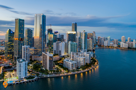
Reaching Miami
By Air
- Miami International Airport (MIA) is the primary gateway, located about 8 miles west of downtown Miami. It’s one of the busiest airports in the US with extensive international connections, particularly to Latin America and the Caribbean.
- Fort Lauderdale-Hollywood International Airport (FLL) is an alternative about 30 miles north of Miami, often offering cheaper flights and serving as a hub for budget airlines.
By Ground
Miami is accessible via major highways including I-95 (running north-south along the East Coast) and I-75 (connecting to central and northern Florida). Amtrak provides train service to Miami via the Silver Star and Silver Meteor routes from northeastern US cities. Greyhound and other bus companies offer intercity service to Miami’s central bus terminal.
Public Transportation System
Metrorail System:
Network Structure and Lines
Metrorail operates as Miami’s heavy rail rapid transit system, spanning 24.4 miles with 23 stations across two main lines:
- Orange Line is the primary trunk line running north-south through the heart of Miami-Dade County. It extends from Kendall Station in the south to Miami International Airport in the northwest, passing through key areas including South Miami, Coral Gables, downtown Miami, and the Health District. Major stations include Government Center (downtown hub), Brickell (financial district), Vizcaya (museum area), and Miami International Airport.
- Green Line branches off from the Orange Line at Earlington Heights Station, extending northwest to Palmetto Station. This line serves communities including Hialeah, with stops at major destinations like Palmetto Hospital and connects to several major bus routes for further distribution throughout northwest Miami-Dade.
Station Details and Connectivity
Government Center Station serves as the central hub where both lines intersect and connects directly to the Metromover system. This station provides access to downtown Miami’s business district, courts, and government offices.
Brickell Station connects to the Brickell Metromover loop and serves Miami’s financial district with its concentration of banking headquarters and high-rise condominiums.
Dadeland North and Dadeland South Stations anchor the southern end of the system, connecting to major shopping areas including Dadeland Mall and providing park-and-ride facilities.
Miami International Airport Station provides direct rail access to all airport terminals via the MIA Mover automated train system, eliminating the need for additional transfers.
Operating Schedule and Frequency
Metrorail operates daily from approximately 5:00 AM to midnight, with extended service until 2:00 AM on Fridays and Saturdays. During peak hours (weekday mornings and evenings), trains typically run every 6-8 minutes. Off-peak service operates every 10-15 minutes, while late evening and weekend service may extend to 15-20 minute intervals.
The system uses modern rail cars with air conditioning, digital displays showing next stations, and audio announcements in both English and Spanish. All stations feature elevators and are fully accessible for wheelchair users.
Park and Ride Facilities
Several Metrorail stations offer parking facilities, including Dadeland North, Dadeland South, South Miami, Kendall, Palmetto, and select other locations. These lots provide convenient options for suburban commuters to access the rail system.
Metrobus System
Route Categories and Service Types
Local Routes form the foundation of the Metrobus network with over 90 regular routes serving neighborhoods throughout Miami-Dade County. These routes typically make frequent stops and provide comprehensive coverage of residential and commercial areas.
Express Routes offer limited-stop service along major corridors, designed for longer-distance commuters. These routes connect suburban areas to downtown Miami, airport, and other major employment centers with faster travel times.
MAX (Metropolitan Area Express) routes provide bus rapid transit-style service with enhanced features including dedicated lanes in some areas, upgraded stations with real-time arrival information, more frequent service, and limited stops for faster travel.
Circulator Routes serve specific areas or communities with shorter, more frequent loops designed to connect residents to nearby Metrorail stations, shopping centers, or other transportation hubs.
Major Bus Corridors and Key Routes
Route 11 (Flagler Street) is one of the busiest routes, running east-west through the heart of Miami from downtown to western suburbs, operating with high frequency throughout the day.
Route 7 (27th Avenue/Palmetto Expressway) provides important north-south connectivity through central Miami-Dade, connecting multiple neighborhoods and commercial districts.
Route 3 (NW 7th Street) serves major east-west travel demand, connecting downtown Miami to Miami International Airport and beyond.
Route 38 (NW 41st Street/LeJeune Road) provides crucial connectivity between Miami Beach, downtown Miami, and Miami International Airport.
South Beach Local (Route 120) provides internal circulation within Miami Beach, connecting hotels, attractions, and residential areas with high frequency service.
Bus Rapid Transit and Enhanced Services
MAX Routes currently include several corridors with bus rapid transit features. These routes feature distinctive stations with weather protection, real-time arrival displays, level boarding platforms, and enhanced passenger amenities.
The South Dade Transitway operates along the former Florida East Coast Railway corridor, providing high-frequency bus service with dedicated lanes and enhanced stations, effectively functioning as bus rapid transit.
Service Frequency and Operating Hours
Most major Metrobus routes operate from early morning (around 4:30-5:30 AM) until late evening (10:00 PM-1:00 AM), with variations based on ridership demand and route characteristics. High-frequency routes may operate every 10-15 minutes during peak periods, while neighborhood routes typically run every 30-60 minutes.
Several routes provide 24-hour service, including major corridors serving Miami International Airport, downtown Miami, and Miami Beach. These overnight routes operate with reduced frequency but ensure continuous connectivity.
Transfer Points and Integration
Major Transfer Centers include Government Center (downtown), Dadeland North and South stations, Miami International Airport, and Aventura Mall. These locations provide convenient connections between multiple routes and other transportation modes.
The system is designed with timed transfers at major hubs, allowing passengers to efficiently connect between routes. Many bus routes are specifically designed to feed into Metrorail stations, extending the rapid transit system’s reach throughout the county.
Transportation Apps and Digital Tools
- GO Miami-Dade Transit App is the official app providing real-time bus and train arrival information, trip planning, service alerts, and mobile ticketing options. You can track vehicles in real-time and plan multimodal trips.
- Transit App offers comprehensive real-time information for Miami’s public transit, including Metrobus, Metrorail, and Metromover. It also integrates with ride-sharing and bike-share options.
- Citymapper provides detailed transit directions and real-time updates for Miami, combining multiple transportation modes in trip planning.
Ride-Sharing and Alternative Transportation
- Uber and Lyft operate extensively throughout Miami-Dade County, offering various service levels from economy to luxury options. Both apps provide estimated arrival times and fare estimates.
- Citi Bike Miami Beach is the bike-share system primarily serving Miami Beach and some mainland areas. The system has numerous docking stations where you can pick up and drop off bikes using the Citi Bike app.
- Freebee provides free electric shuttle service in specific zones including Miami Beach, Coral Gables, and downtown Miami. You can request rides through their app within designated service areas.
- Brightline is a higher-speed rail service connecting Miami to Fort Lauderdale, West Palm Beach, and Orlando, with stations at Miami Central and Aventura. This is useful for regional travel within Florida.
Helpful Websites and Resources
- miamidade.gov/transit is the official Miami-Dade Transit website with comprehensive route maps, schedules, service updates, and trip planning tools.
- miami-beach.fl.gov provides information about Miami Beach-specific transportation options including trolleys and parking.
- gobrightline.com offers schedules and booking for regional rail service.
Navigation and Traffic Apps
- Waze is particularly useful in Miami for real-time traffic updates and finding the fastest routes, especially important given the city’s traffic congestion.
- Google Maps provides comprehensive directions for all transportation modes including transit, walking, biking, and driving with real-time traffic information.
Specialized Transportation Services
Miami Trolley offers free circulator service in various neighborhoods including Coral Gables, Key Biscayne, and several other municipal areas. Each municipality operates its own trolley system with different routes and schedules.
Water Transportation includes the Miami Water Taxi service connecting various waterfront locations, and regular ferry service to Fisher Island for residents and authorized visitors.
Getting from Airports
From MIA, you can take the Metrorail Orange Line directly to downtown Miami and other destinations. The airport also has extensive bus connections via several Metrobus routes. Ride-sharing pickup areas are clearly marked at each terminal.
From FLL, public transit options include Broward County Transit buses connecting to Tri-Rail, which then connects to Miami-Dade Transit. Many visitors opt for ride-sharing or rental cars from FLL due to the longer public transit journey.
Tips for Using Miami Transportation
The EASY Card is Miami-Dade Transit’s reloadable fare card that works on all buses, Metrorail, and connecting services. You can purchase and reload cards at stations, online, or through the mobile app.
Miami traffic can be challenging, particularly during rush hours and tourist seasons. Public transportation often provides more predictable travel times than driving, especially to popular destinations like Miami Beach or downtown.
Many areas of Miami are walkable once you arrive, particularly Miami Beach, downtown Miami, and Coral Gables. The Metromover makes it easy to explore downtown and Brickell without additional transportation.
Service frequency varies significantly by route and time of day, so checking real-time information through apps is essential for efficient travel planning.

For more details visit: Metra, CTA
Getting to Chicago
By Air
O’Hare International Airport (ORD) – Chicago’s main international airport, located about 17 miles northwest of downtown
- Connected to downtown via CTA Blue Line (direct rail connection)
- Travel time to downtown: approximately 45 minutes by train
Midway International Airport (MDW) – Smaller airport serving primarily domestic flights, located about 10 miles southwest of downtown
- Connected to downtown via CTA Orange Line
- Travel time to downtown: approximately 30 minutes by train
By Train
Union Station – Chicago’s main intercity rail hub
- Serves Amtrak routes connecting to cities across the United States
- Located in the West Loop, easily accessible by CTA buses and the Blue Line
By Bus
Union Station and various terminals throughout the city serve intercity bus services like Greyhound and Megabus.
Chicago Public Transportation System
Chicago Transit Authority (CTA)
The CTA operates the nation’s second largest public transportation system and covers the City of Chicago and 40 surrounding suburbs. The system consists of:
CTA “L” Train System – Detailed Overview
The elevated rail system (nicknamed “The L”) is the backbone of Chicago’s public transit network. The system includes 35.8 miles of elevated route, 35.0 miles at grade level, 20.6 miles on embankments, and 11.4 miles of subway, making it one of the most extensive urban rail systems in North America.
Eight Color-Coded Lines with Detailed Routes:
Red Line – The spine of the system
- Operates 24/7 (only line with round-the-clock service)
- Runs north-south through the entire city
- Northern terminus: Howard (Rogers Park neighborhood)
- Southern terminus: 95th/Dan Ryan (Far South Side)
- Key stations: Howard, Belmont, Fullerton, Chicago, Grand, Lake, Jackson, Roosevelt, Sox-35th, 95th/Dan Ryan
- Serves major destinations: Wrigley Field area, Lincoln Park, downtown Loop, Chinatown, U.S. Cellular Field
- Connects with all other lines at various downtown stations
Intersections:
- Howard: Purple line, Yellow line and Buses
- Wilson: Purple line
- Belmont: Brown line, Purple line
- Fullerton: Brown line, Purple line
- Lake: Brown line, Purple line, Green line, Orange line, Pink line, Blue line
- Jackson: Brown line, Purple line, Orange line, Pink line, Blue line
- Roosevelt: Orange line, Green line
- Sox 35th: 35st / Lou Jones
Blue Line – Airport connector and cross-city route
- Two branches: O’Hare and Forest Park
- O’Hare Branch: Direct connection from O’Hare Airport to downtown (45-minute journey)
- Forest Park Branch: Serves west side neighborhoods
- Key stations: O’Hare, Rosemont, Jefferson Park, Logan Square, Damen, Division, Grand, Clark/Lake, LaSalle, Monroe, Forest Park
- Major destinations: O’Hare Airport, Wicker Park/Bucktown, downtown Loop, Medical District
- Runs 24/7 service
Intersections:
- Jefferson Park: Jefferson pk stn
- Montrose: Mayfair stn
- Clark/Lake: Brown line, Purple line, Green line, Orange line, Pink line
- Jackson: Brown line, Purple line, Orange line, Pink line, Red line
- Washington: Red Line
- LaSalle: LaSalle st stn
- Clinton: Union stn
Brown Line – North side neighborhood connector
- Operates from Kimball (Albany Park) to Loop downtown
- Express service during rush hours on some sections
- Key stations: Kimball, Western, Damen, Montrose, Irving Park, Addison, Belmont, Fullerton, Armitage, Chicago, Merchandise Mart
- Serves: Lincoln Square, North Center, Lakeview, Lincoln Park, River North
- Connects with Purple Line for express service during rush hours
Intersections:
- Belmont: Red line, Purple line
- Fullerton: Red line, Purple line
- Washington/Wells: Orange, Purple, Pink, Ogilvie Trnsp Ctr
- Quincy: Union Stn
- LaSalle/Van Buren: LaSalle St Stn
- Harold Washington Library-State/Van BurenAccessible station: Orange Line, Purple Line Express (rush periods, only), Pink Line, Blue Line subway (farecard required, Red Line (subway)
- Adams/Wabash: Green Line, Orange Line, Purple Line Express (rush periods, only, Pink
- Washington/Wabash: Millennium Stn
- State/Lake: Red Line
- Clark/Lake: Blue Line (subway), Green Line, Purple Line Express (rush periods, only), Orange Line, Pink Line
Green Line – West and south side service
- Two branches: Harlem/Lake (west) and Ashland/63rd-Cottage Grove (south)
- Harlem/Lake Branch serves west side neighborhoods and suburbs
- Ashland/63rd and Cottage Grove branches serve south side
- Key stations: Harlem/Lake, Oak Park, Austin, Garfield, Ashland/63rd, Cottage Grove
- Major destinations: Oak Park, West Town, Medical District, University of Chicago area
- Weekend service may be modified on certain branches
Intersections:
- Harlem/Lake: Metra UP-W Oak Park Station
- Ashland: Pink Line
- Clinton: Pink Line, Metra Ogilvie Transportation Center
- Clark/Lake: Orange Line ,Blue Line, Pink Line, Purple Line Express
- Washington/WabashAccessible station: Metra & South Shore Line Millennium Station
- Adams/Wabash: Orange Line, Pink Line, Purple Line Express, Brown Line
- Roosevelt: Red Line (subway)
- 35th-Bronzeville-IITAccessible station: Metra 35th Street/Lou Jones station
Orange Line – Midway Airport connector
- Connects Midway Airport to downtown Loop
- Southern terminus: Midway Airport
- Northern terminus: Loop downtown(Adams/Wabash)
- Key stations: Midway, Pulaski, Western, 35th/Archer, Roosevelt, LaSalle/Van Buren
- Travel time from airport to downtown: approximately 30 minutes
- Serves southwest neighborhoods and provides airport access
Pink Line – West side neighborhoods
- Operates from 54th/Cermak (Cicero) to Loop downtown(Washington/Well)
- Key stations: 54th/Cermak, Kostner, Pulaski, Damen, 18th, Polk, LaSalle/Van Buren
- Serves: Little Village, Pilsen, Near West Side
- Connects immigrants and Latino communities to downtown employment
Purple Line – Northern suburbs and express service
- Two services: Linden (all times) and Express (rush hours only)
- Linden service: Operates between Linden (Wilmette) and Howard, connecting with Red Line
- Express service: Direct service from northern suburbs to downtown during rush hours
- Key stations: Linden, Central, Davis (Evanston), Howard, downtown Loop (express only)
- Serves affluent northern suburbs including Evanston and Wilmette
- Northwestern University access via Davis station
Yellow Line – Short connector service
- Short spur line serving northern suburbs
- Operates between Dempster-Skokie and Howard (connects to Red/Purple lines)
- Only 5 miles long with 2 stations
- Serves Skokie community
- Sometimes called the “Skokie Swift”
Key Transfer Stations and Hubs:
Downtown Loop Stations:
- State/Lake – Red, Brown, Green, Orange, Pink, Purple lines
- Clark/Lake – Blue, Brown, Green, Orange, Pink, Purple lines
- Washington/Wells – Brown, Orange, Pink, Purple lines
- Jackson – Red Line with connections to Blue Line at Jackson/Dearborn
Major North Side Transfer Points:
- Fullerton – Red, Brown, Purple lines (major north side hub)
- Belmont – Red, Brown, Purple lines (Lakeview area)
- Howard – Red, Purple, Yellow lines (northern terminus)
Major Transfer Points:
- 95th/Dan Ryan – Red Line terminal with extensive bus connections
- Forest Park – Blue Line terminal with parking and bus connections
- Roosevelt – Red, Orange, Green lines (Near South Side)
Service Frequency:
- Rush hours (6:30-9:30 AM, 4:30-7:00 PM): Every 2-8 minutes depending on line
- Midday: Every 6-12 minutes
- Evenings and weekends: Every 10-20 minutes
- Late night: Every 15-30 minutes (Red and Blue lines maintain more frequent service)
Unique Features:
- Most stations are elevated, giving the system its “L” nickname
- Several subway sections, particularly downtown and on the Red Line
- Historic architecture at many stations, some dating to the 1890s
- Accessibility: All stations are ADA compliant with elevator access
- Real-time arrival information at all stations via electronic displays
CTA Bus System
The CTA operates an extensive bus network with over 127 routes covering the entire city and surrounding areas. Buses run frequently during peak hours and connect areas not served by the rail system.
Regional Transportation
Metra
Metra is the commuter rail system that extends Chicago’s public transportation reach far into the suburbs and neighboring counties. The longest line from the Metra is: UP-NW. This train line starts from Chicago Otc (Chicago) and ends at Harvard (Harvard). It covers over 101 km and has 21 stops.
Metra’s 11 Lines:
- BNSF Railway (BNSF) – Serves western suburbs, terminates at Union Station
- Heritage Corridor (HC) – Connects to southwest suburbs including Joliet
- Metra Electric (ME) – Services south and southeast suburbs, including South Shore connections
- Milwaukee District North (MD-N) – Serves northwest suburbs from Union Station
- Milwaukee District West (MD-W) – Extends west from Union Station to Elgin area
- North Central Service (NCS) – Connects northern suburbs from Union Station
- Rock Island District (RI) – Services southwest suburbs from LaSalle Street Station
- SouthWest Service (SWS) – Connects southwest suburbs from Union Station
- Union Pacific North (UP-N) – Serves affluent northern suburbs along Lake Michigan
- Union Pacific Northwest (UP-NW) – Extends to far northwest suburbs and Wisconsin border
- Union Pacific West (UP-W) – Services western suburbs to Geneva and Elburn
Main Chicago Terminals:
- Union Station – Located in the West Loop, serves 8 Metra lines
- Ogilvie Transportation Center – Downtown terminal for Union Pacific lines
- LaSalle Street Station – Terminal for Rock Island District line
- Millennium Station – Downtown terminal for Metra Electric and South Shore lines
Service Characteristics:
- Peak-direction service during rush hours (inbound morning, outbound evening)
- Reduced weekend service on most lines
- Inbound trains on every line at all times run through to their Chicago terminus, however, many outbound trains do not run through to their respective endpoints during off-peak hours
- Monthly passes available for regular commuters
- Bicycle racks available on most trains
Metra Apps and Technology:
- Ventra App integration for mobile ticketing
- The new metratracker.com gives you real-time tracking information for Metra trains, letting you know precisely when trains will arrive
- MetraCOPS app for emergency reporting
Coverage Area: Metra serves six counties in northeastern Illinois, extending up to 90 miles from downtown Chicago, connecting to communities in Wisconsin and Indiana.
Pace
Suburban bus system that complements CTA service, primarily serving areas outside Chicago city limits.
Payment and Fare System
Ventra Card System
Tap and board CTA and Pace trains and buses · Purchase passes and add transit value at CTA rail stations, through the Ventra app, participating retail locations, online or by phone.
How to Get a Ventra Card:
- Purchase at any CTA rail station
- Buy at participating retail locations
- Order online through the Ventra website
- Get through the Ventra mobile app
Types of Ventra Cards:
- Standard Ventra Card
- Reduced Fare Cards (for seniors, students, people with disabilities)
- Visitor passes for tourists
Essential Transportation Apps and Websites
Official CTA Resources
CTA Website: transitchicago.com
- Trip planning
- Service alerts and updates
- Route maps and schedules
- Real-time arrival information
CTA Train Tracker
- Real-time arrival predictions for all “L” stations
- Available on the CTA website and mobile-optimized
Ventra App
With a totally new trip planning tool, easier CTA and Pace account management, improved Metra mobile tickets and a user-friendly design, the new Ventra app was made with riders in mind.
Key Features:
- Account management for CTA, Metra, and Pace
- Mobile ticketing for Metra trains
- Trip planning across all three transit systems
- Real-time arrival information
- Add funds to your Ventra card
- Purchase passes and manage your account
Third-Party Apps
Citymapper
- Comprehensive trip planning with multiple transportation options
- Real-time updates and route optimization
- Includes walking, cycling, and ride-share options
Transit App
- Real-time arrivals for CTA buses and trains
- Trip planning with step-by-step directions
- Service alerts and disruptions
Google Maps
- Integrated public transit directions
- Real-time arrival information
- Walking directions to and from stations
Key Transportation Hubs
Downtown “Loop” Area
The central business district where multiple train lines converge:
- State/Lake – Red, Brown, Green, Orange, Pink, Purple lines
- Clark/Lake – Blue, Brown, Green, Orange, Pink, Purple lines
- Washington/Wells – Brown, Orange, Pink, Purple lines
Major Transfer Points
- Fullerton – Red, Brown, Purple lines
- Belmont – Red, Brown, Purple lines
- 95th/Dan Ryan – Red Line terminal with bus connections
Additional Transportation Options
Bike Sharing
Divvy Bikes: Chicago’s bike-sharing system with stations throughout the city
- Short-term rentals available
- Annual memberships for residents
- Electric bikes available at select stations
Ride-Sharing and Taxis
- Uber and Lyft operate throughout the city
- Traditional taxi service available
- Designated pickup areas at airports and Union Station
Walking and Cycling
Chicago is generally walkable in dense areas, with:
- Protected bike lanes on many major streets
- Lakefront Trail – 18-mile path along Lake Michigan
- Winter weather can impact walking and cycling conditions
For more details visit: RTA
Getting to New Orleans
By Air
Louis Armstrong New Orleans International Airport (MSY) – Located approximately 15 miles west of downtown New Orleans in Kenner, Louisiana
- Primary gateway for visitors arriving by air
- Well-connected to downtown via public transportation and ground services
By Train
New Orleans Union Passenger Terminal – Located in the Central Business District
- Serves Amtrak routes including the famous City of New Orleans, Sunset Limited, and Crescent
- Central location with easy access to streetcar and bus lines
By Bus
Union Passenger Terminal also serves as the intercity bus hub for services like Greyhound and Megabus
New Orleans Public Transportation System
Regional Transit Authority (RTA)
New Orleans RTA operates the following transit modes across the New Orleans area: ferry, bus and streetcar. In total, New Orleans RTA operates 2 ferry lines, 28 bus lines and 5 streetcar lines.
The RTA provides comprehensive public transportation throughout the New Orleans metropolitan area. The RTA has restored bus routes that were cut following Katrina and added frequency throughout the system, all while steering the agency to financial stability.
New Orleans Streetcar System
New Orleans boasts one of the most historic and extensive streetcar systems in the United States.
The Four Operating Streetcar Lines
- St. Charles Avenue Line – The Historic Line As the oldest continuously operating streetcar in the world, the St. Charles Streetcar was opened in 1835. The St. Charles Avenue Line is the only line that has operated continuously throughout New Orleans’ streetcar history.
- Route: Runs from Claiborne in the west to Canal in the east via South Carrollton Ave and St. Charles Ave, serving 64 stops of which 18 are only served in a single direction.
- Key Destinations: Garden District, Uptown, Audubon Park, Tulane and Loyola Universities, Lee Circle
- Historic Features: Antique wooden streetcars, oak-lined avenue, historic mansions
- Operating Hours: Approximately 5:00 AM to 1:30 AM daily
- Frequency: Every 10-15 minutes during peak hours, every 20-30 minutes during off-peak
- Canal Street Line – The Dual-Route Line The red Canal Streetcar Line takes locals and tourists to work and play each day on a 5.5-mile route from the foot of Canal Street through the Central Business District and into the Mid-City area.
This line operates two distinct routes:
- Cemeteries Route: One to the aboveground tombs at Metairie and Greenwood cemeteries.
- City Park Route: The other stops at the foot of City Park. Both lines start at the same spot, though, where Canal Street meets the Mississippi River.
- Key Destinations: French Quarter entrance, Mid-City, City Park, historic cemeteries, Canal Street shopping district
- Connection Points: Connects with other streetcar lines and numerous bus routes
- Service: Red-colored modern streetcars
- Riverfront Line
- Route: Runs along the Mississippi River from the French Market to Canal Street
- Key Destinations: French Market, Woldenberg Park, Aquarium of the Americas, Canal Street
- Features: Scenic river views, connection to French Quarter attractions
- Integration: The new Canal Streetcar Line tied into the existing Riverfront Streetcar Line from Esplanade Avenue to Canal Street.
- Rampart-Loyola Line (formerly Loyola Line) From the French Market terminal, it runs to Canal Street, then out Canal to University Place (Loyola Avenue), and out Loyola to the terminal at UPT.
- Route: Connects the French Market to the Biomedical District via Canal Street and Loyola Avenue
- Key Destinations: French Market, Canal Street, Bio-medical District, Union Passenger Terminal area
- Purpose: Provides connection between tourist areas and medical/institutional districts
RTA Bus System
With 34 bus lines running almost 24 hours, RTA Buses are a convenient way to get to neighborhoods stretching beyond the parameters of the streetcar routes or to connect to a streetcar or ferry.
Key Bus Routes and Services
Airport Connection: The RTA’s 202 Airport Express travels from the airport terminals to Elk Place at Canal Street in downtown New Orleans. The bus makes 9 daily trips to New Orleans.
Popular Bus Lines: According to Moovit Insights, the most popular lines for RTA are 84, 27, 91, 52, 80.
Service Characteristics:
- Routes and Hours: Buses generally run every 30 minutes, with shorter wait times in busy areas.
- Extensive network covering all neighborhoods not served by streetcars
- Night service available on major routes
- ADA-compliant vehicles with wheelchair accessibility
Ferry Service
The RTA operates ferry services connecting different parts of the metropolitan area across the Mississippi River.
Canal Street – Algiers Point Ferry: Canal St.–Algiers Point ferry now running extended summer schedule. Now running until 12:15 am every night!
- Connects downtown New Orleans with Algiers Point on the West Bank
- Provides scenic river crossing experience
- Popular with both commuters and tourists
- Extended hours during summer months
Payment System and Mobile Technology
Le Pass App – Official RTA App
Download Le Pass, the official app of the New Orleans RTA to see routes with live updates.
Key Features:
- Real-time tracking of buses and streetcars
- Route planning and trip scheduling
- Mobile payment options
- Service alerts and updates
- Interactive system maps
Payment Methods
- Cash (exact change required)
- Le Pass mobile app
- Jazzy Passes (day, weekly, monthly passes)
- Senior and disability discounts available
Third-Party Transportation Apps
Moovit
- Comprehensive trip planning for all RTA services
- Real-time arrival information
- Route optimization with multiple transportation options
- Integration with walking directions
Transit App
- Real-time tracking for RTA buses and streetcars
- Step-by-step navigation
- Service disruption alerts
- Departure times and route maps
Google Maps
- Integrated RTA route planning
- Real-time public transit information
- Walking directions to stops and stations
- Traffic-aware routing
Getting Around New Orleans – Neighborhood Accessibility
French Quarter and Downtown
- Best Access: Riverfront Streetcar, Rampart-Loyola Line, multiple bus routes
- Walking Friendly: Most attractions within walking distance
- Street Layout: Historic grid system with narrow streets
Garden District and Uptown
- Primary Access: St. Charles Avenue Streetcar
- Key Stops: Garden District mansions, Magazine Street shopping, university area
- Connections: Multiple bus routes for cross-town travel
Mid-City
- Primary Access: Canal Street Line (both routes)
- Destinations: City Park, New Orleans Museum of Art, historic cemeteries
- Features: More spread out, streetcar essential for efficient travel
Marigny and Bywater
- Access: Bus routes and short streetcar connections
- Character: Emerging neighborhoods with local culture and music venues
- Walking: Many attractions clustered along main streets
Alternative Transportation Options
Bike Share and Cycling
- Blue Bikes bike-share system throughout the city
- Bike lanes on some major streets
- Flat terrain in most areas makes cycling feasible
- Climate considerations for year-round cycling
Ride-Sharing and Taxis
- Uber and Lyft operate throughout the city
- Traditional taxi service available
- Pedicabs in French Quarter and downtown areas
- Hotel shuttle services to major attractions
Walking
- French Quarter and nearby areas very walkable
- Sidewalk conditions vary by neighborhood
- Heat and humidity can be challenging for long walks
- Many attractions clustered in walkable districts

For more details visit: ZMR
Getting to Zion National Park
By Air
Closest Airport: St. George Regional Airport (SGU)
- St. George Regional Airport (SGU) is the closest, at less than an hour from the park
- Limited flight options, primarily serving regional routes
- Smallest airport with fewer amenities but quickest access to Zion
Most Popular Airport: Harry Reid International Airport (LAS) – Las Vegas, Nevada
- The closest airport to Zion National Park is McCarran International Airport in Las Vegas, which is 170 miles from the park
- You’ll have to rent a car and drive about 2.5 hours to get to the park from here
- The cheapest airport to fly into with the lowest airfare for Zion National Park is Harry Reid International Airport (LAS) in Las Vegas
- Most flight options from major cities worldwide
- Full range of car rental services and amenities
Alternative Airport: Salt Lake City International Airport (SLC) – Utah
- Salt Lake City International Airport is the next closest, and it’s 311 miles from the park
- The drive is about 4 hours from Salt Lake City
- Good option for combining with other Utah attractions
- Major hub with numerous flight connections
By Car – Driving Routes
From Las Vegas (Most Common Route):
- Distance: 170 miles (approximately 2.5 hours)
- Route: Take I-15 North to Utah, then UT-9 West to Springdale/Zion
- Scenic drive through desert landscape
- Multiple services and gas stations along the route
From Salt Lake City:
- Distance: 311 miles (approximately 4 hours)
- Route: Take I-15 South through Utah to UT-9 West
- Some people will fly into Salt Lake City and see Utah’s capital city before driving south on I-15 to Zion
- Passes through diverse Utah landscapes
From Phoenix:
- Distance: Approximately 240 miles (4 hours)
- Route: Take I-17 North to I-40 West, then various state routes
- Alternative southwestern approach
From Denver:
- Distance: Approximately 350 miles (5.5 hours)
- Route: Take I-70 West to I-15 South
- Popular for multi-park road trips
By Bus and Shuttle Services
- Limited public transportation options to reach the park
- Some tour companies offer transportation from Las Vegas
- Shuttle services available from nearby airports (advance booking required)
Transportation Within Zion National Park
Zion Canyon Shuttle System
Mandatory Shuttle Service: Zion’s scenic drive is so popular that cars aren’t allowed most of the year. Instead, the park offers a free shuttle system that runs from March through late November
Operating Season:
- Zion National Park is beginning shuttle service on Sunday, March 2, 2025
- Runs from early March through late November
- This milestone marks 25 years of safeguarding park resources and accommodating millions of visitors with sustainable transportation
Shuttle Details:
- The Zion Canyon Shuttle is free and all visitors are required to utilize it to access the main sightseeing areas and trails in the Zion Canyon area
- It typically comes every 10-15 minutes, though schedules can vary based on the time of day and the season. There are nine stops, and it takes roughly 45 minutes
- Shuttles will depart from designated stops every seven to ten minutes during the middle of the day and approximately every 10-15 minutes in the morning and evening
Shuttle Route and Stops:
- The Zion Shuttle operates within Zion National Park, beginning at the visitor center, just north of the Springdale park entrance
- Nine stops total along Zion Canyon Scenic Drive
- Connects to all major trailheads and attractions
- Terminus at Temple of Sinawava (starting point for Narrows hike)
Springdale Town Shuttle
Free Town Transportation:
- You can always park in a public lot in Springdale, and use the Springdale Shuttle to get to the park entrance. This shuttle is also free of charge and is a great way to get to the park and enjoy some of the town’s other attractions, like dining and shopping
- Connects various parking areas in Springdale to park entrance
- Reduces parking pressure at the park entrance
- Provides access to local restaurants, shops, and accommodations
Parking and Access Strategy
Parking Challenges
- Limited parking at Zion National Park Visitor Center
- Parking fills up early, especially during peak season (March-November)
- Arrive early morning or late afternoon for best parking availability
Recommended Parking Strategy
- Park in Springdale town and use the town shuttle
- Stay in Springdale accommodations within walking distance
- Consider parking at shuttle stops outside the main village area
Peak Season Considerations
- Spring through fall sees highest visitation
- Summer months (June-August) extremely crowded
- Weekends and holidays particularly busy
- Early morning arrival (before 8 AM) recommended
Other Nearby Communities
- Hurricane, Utah (30 minutes)
- St. George, Utah (45 minutes)
- Cedar City, Utah (1 hour)
- Las Vegas, Nevada (2.5 hours) – often used as base for multi-day trips
Transportation Apps and Resources
Official Resources
- National Park Service Zion website
- NPS Zion mobile app
- Shuttle schedule updates: go.nps.gov/ZionShuttle
Navigation Apps
- Google Maps (reliable for driving directions)
- Waze (traffic and road condition updates)
- Apple Maps (good for general navigation)
Weather and Conditions
- Weather.gov for official forecasts
- Local news stations for road conditions
- Park service alerts for closures

Getting to Boston
By Air
Logan International Airport (BOS) is Boston’s primary airport, located about 3 miles from downtown. It’s well-connected to the city via multiple transportation options including the MBTA Blue Line subway, buses, taxis, and ride-sharing services.
Secondary Airports:
- T.F. Green Airport (PVD) in Providence, Rhode Island (about 1 hour south)
- Manchester-Boston Regional Airport (MHT) in New Hampshire (about 1 hour north)
By Train
South Station and North Station are Boston’s main rail terminals. Amtrak provides service along the Northeast Corridor connecting to New York, Philadelphia, and Washington D.C., as well as routes to Chicago and other destinations. The high-speed Acela service offers faster travel between major Northeast cities.
By Bus
Multiple bus companies serve Boston including Greyhound, Megabus, FlixBus, and regional carriers. Most intercity buses arrive at South Station Bus Terminal.
By Car
Boston is accessible via several major highways including I-95, I-93, and the Massachusetts Turnpike (I-90). However, driving in Boston can be challenging due to narrow streets, heavy traffic, and limited parking.
Boston’s Public Transportation System (MBTA – “The T”)
Overview
The Massachusetts Bay Transportation Authority (MBTA), known locally as “The T,” operates one of the oldest and most comprehensive public transit systems in the United States. The system includes subway lines, buses, commuter rail, and ferry services.
Subway System
- Red Line
Route and Coverage: The Red Line operates from Alewife Station in Cambridge to two southern terminals: Braintree and Ashmont. The line splits at JFK/UMass Station, creating a fork that serves both destinations.
Key Destinations and Neighborhoods:
- Alewife: Major park-and-ride facility, connection to bus routes
- Davis Square: Hip Somerville neighborhood with restaurants and nightlife
- Porter Square: Shopping and dining area with commuter rail connection
- Harvard Square: Harvard University campus, bookstores, street performers
- Central Square: MIT area, diverse dining and music venues
- Kendall/MIT: Massachusetts Institute of Technology, biotech companies
- Charles/MGH: Massachusetts General Hospital, Beacon Hill neighborhood
- Park Street: Historic Boston Common, shopping on Washington Street
- Downtown Crossing: Major shopping district, connection to Orange and Blue lines
- South Station: Major transportation hub with Amtrak and commuter rail
- Broadway: South Boston residential area
- Andrew: Gateway to South Boston neighborhoods
- JFK/UMass: University of Massachusetts Boston, connection point for Braintree/Ashmont branches
Braintree Branch: Serves Quincy and reaches Braintree, providing access to South Shore communities.
Ashmont Branch: Terminates at Ashmont with connection to the Mattapan High-Speed Line trolley service.
- Blue Line
Route and Coverage: The Blue Line is the shortest subway line, running from Bowdoin Station downtown to Wonderland Station in Revere, with a crucial connection to Logan International Airport.
Key Features:
- Government Center: Historic Faneuil Hall and Quincy Market area
- State Street: Financial district, close to historic sites
- Aquarium: New England Aquarium, harbor walks
- Maverick: East Boston neighborhood, close to airport
- Airport Station: Free shuttle connection to all Logan Airport terminals
- Suffolk Downs: Former horse racing track area
- Wonderland: Beach access, connection to bus routes serving North Shore
Airport Connection: The Blue Line provides the most direct public transit access to Logan Airport via Airport Station, where free shuttle buses connect to all terminals.
- Orange Line
Route and Coverage: The Orange Line runs north-south through Boston, from Oak Grove in Malden to Forest Hills in Jamaica Plain, passing through downtown and several diverse neighborhoods.
Northern Section:
- Oak Grove: Major parking facility, northern terminus
- Malden Center: City center with commuter rail connection
- Wellington: Assembly Row development area
- Sullivan Square: Charlestown neighborhood
- Community College: Bunker Hill Community College area
- North Station: TD Garden (sports arena), commuter rail hub
Central/Downtown Section:
- Haymarket: Near North End, Faneuil Hall
- State Street: Financial district, historic sites
- Downtown Crossing: Major transfer station, shopping district
- Chinatown: Vibrant Asian community, Theater District
- Tufts Medical Center: Medical facilities area
- Back Bay: Upscale shopping on Newbury Street, Victorian architecture
- Massachusetts Avenue: Berklee College of Music, Symphony Hall area
Southern Section:
- Ruggles: Northeastern University area, medical facilities
- Roxbury Crossing: Diverse residential neighborhood
- Jackson Square: Latino community center
- Stony Brook: Residential Jamaica Plain
- Green Street: Heart of Jamaica Plain arts district
- Forest Hills: Major bus terminal, connection to multiple routes
- Green Line
System Overview: The Green Line is the most complex subway line, operating as a light rail system with four branches (B, C, D, E) that converge in downtown Boston. Much of the system runs on surface streets in outer areas.
Central Trunk: All branches share track from Park Street to Kenmore (B, C, D branches) or to Copley (E branch).
Shared Downtown Stations:
- Park Street: Boston Common, major transfer hub
- Boylston: Public Garden area, shopping
- Arlington: Back Bay, upscale area
- Copley: Boston Public Library, Trinity Church, shopping
B Branch (Boston College):
- Runs along Commonwealth Avenue through Brighton
- Kenmore: Boston University area, Fenway Park nearby
- Boston University stops: Multiple stations serving BU campus
- Boston College: Terminus at prestigious university
C Branch (Cleveland Circle):
- Serves Brookline along Beacon Street
- Coolidge Corner: Vibrant Brookline center with shops and restaurants
- Cleveland Circle: Residential area, connection to bus routes
D Branch (Riverside):
- The only fully grade-separated Green Line branch
- Longwood: Medical area including Harvard Medical School
- Brookline Hills, Beaconsfield: Affluent residential areas
- Newton stations: Serves multiple Newton neighborhoods
- Riverside: Large park-and-ride facility, terminus
E Branch (Heath Street):
- Runs along Huntington Avenue through cultural district
- Prudential: Shopping center, Skywalk observatory
- Symphony: Boston Symphony Orchestra, cultural venues
- Northeastern: University area
- Museum of Fine Arts: World-class art museum
- Heath Street: Terminus in Jamaica Plain
Service Patterns and Operations
Operating Hours: The subway typically operates from approximately 5:00 AM to 12:30 AM on weekdays, with slightly reduced hours on weekends. Limited late-night service operates on Friday and Saturday nights.
Frequency: During peak hours, trains generally run every 3-6 minutes on most lines. Off-peak service runs every 8-15 minutes, with less frequent service on weekends and evenings.
Accessibility: Most stations built or renovated since the 1990s are fully accessible. Older stations may have limited accessibility, though ongoing improvements continue system-wide.
Bus System
The MBTA operates an extensive bus network with over 170 routes covering Greater Boston. Buses complement the subway system by serving areas not directly accessible by rail and providing crosstown connections.
Key Bus Categories:
- Local routes serving neighborhoods and connecting to subway stations
- Express routes for longer-distance commuting
- Silver Line Bus Rapid Transit serving South Boston, Logan Airport, and Chelsea
Commuter Rail
The MBTA Commuter Rail is one of the largest commuter rail systems in the United States, serving 141 stations across 398 route miles. The system radiates from two major terminals in downtown Boston: North Station and South Station.
North Station Lines
- Fitchburg Line
Route: Extends northwest from North Station through Cambridge, Belmont, Waltham, and smaller communities to Fitchburg.
Key Stops:
Porter Square: Cambridge, connection to Red Line subway
Belmont: Affluent suburban community
Waltham: Historic industrial city, Watch City
Concord: Revolutionary War history, Walden Pond nearby
Fitchburg: Former industrial center, outdoor recreation access
Service: Operates throughout the day with enhanced rush-hour frequency.
- Lowell Line
Route: Serves communities northwest of Boston including Medford, Winchester, and Lowell.
Notable Features:
Winchester: Historic suburban community
Woburn: Mixed residential and commercial development
Lowell: Historic textile city, national park designation
- Haverhill Line
Route: The longest commuter rail line, extending north through Reading, Lawrence, and Haverhill.
Service Patterns: Offers both express and local service during peak hours, with some trains continuing to New Hampshire.
- Newburyport/Rockport Line
Route: Splits into two branches serving the North Shore coastal communities.
Newburyport Branch:
Salem: Historic seaport, witch trial history
Beverly: Coastal community
Newburyport: Charming historic seaport
Rockport Branch:
Lynn: Diverse urban community
Swampscott: Coastal residential area
Gloucester: Working fishing port
Rockport: Picturesque artist community, popular tourist destination
South Station Lines
- Providence/Stoughton Line
Route: The busiest commuter rail line, serving communities south of Boston.
Providence Service: Express trains to Providence, Rhode Island, with connections to T.F. Green Airport and Amtrak’s Northeast Corridor.
Local Stops: Include Hyde Park, Canton, Sharon, and other suburban communities.
- Franklin Line
Route: Serves southwestern suburbs through Dedham, Norwood, and Franklin.
Character: Primarily serves residential suburban communities with park-and-ride facilities.
- Needham Line
Route: Short line serving Needham and surrounding communities.
Features: Connects to affluent residential areas with easy downtown access.
- Worcester Line
Route: Extends west through Newton, Wellesley, Framingham, and Worcester.
Key Communities:
Newton stations: Multiple stops serving different Newton neighborhoods
Wellesley: Prestigious college town
Framingham: Major suburban center
Worcester: Second-largest city in Massachusetts
- Greenbush Line
Route: Serves South Shore communities including Quincy, Weymouth, and Scituate.
Coastal Access: Provides access to beaches and coastal recreation areas.
- Kingston/Plymouth Line
Route: Serves South Shore communities with terminus in Plymouth.
Historical Significance: Plymouth stop provides access to Mayflower II and Plymouth Rock.
- Middleborough/Lakeville Line
Route: Serves southeastern communities with connections to Cape Cod transportation.
Commuter Rail Service Characteristics
Zone-Based Fare System: Commuter rail uses a zone-based fare structure, with higher costs for longer distances. Zones range from 1A (closest to Boston) to Zone 10 (furthest stations).
Peak vs. Off-Peak Service: Rush-hour service offers more frequent trains and express options. Off-peak service typically runs every 1-2 hours, with reduced weekend service on most lines.
Express Service: Several lines offer express trains during peak hours, making limited stops for faster downtown access.
Integration with Other Services
Subway Connections: Multiple commuter rail stations connect with subway lines, including Porter (Red Line), North Station (Orange/Green), South Station (Red/Silver), and Back Bay (Orange).
Bus Connections: Most commuter rail stations offer connections to local and express bus routes, extending the reach of the system.
Parking: Many suburban stations offer park-and-ride facilities, though spaces can fill up early during weekdays.
Ferry Services
MBTA operates seasonal ferry services connecting downtown Boston to various harbor islands and waterfront communities including Charlestown, East Boston, and Hull.
Essential Transportation Apps and Websites
Official MBTA Resources
- MBTA.com – The official website provides comprehensive information including schedules, maps, service alerts, and trip planning tools.
- MBTA Mobile App – The official app offers real-time arrival information, trip planning, service alerts, and mobile ticketing for commuter rail and ferry services.
Third-Party Apps
- Transit App – Provides real-time information for multiple transportation modes including MBTA services, Bluebikes bike share, ride-sharing options, and walking directions. Highly rated for its accuracy and user-friendly interface.
- Citymapper – Offers detailed multimodal trip planning with real-time data, alternative route suggestions, and integration with various transportation options including public transit, bike share, and ride-sharing.
- Google Maps – Provides comprehensive transit directions with real-time updates, walking directions to stations, and estimated arrival times.
- Moovit – Another popular transit app offering real-time information, trip planning, and service alerts for Boston public transportation.
Ride-Sharing and Taxi Apps
- Uber and Lyft – Both services operate extensively throughout Boston and surrounding areas.
- Curb – For traditional taxi services, allowing you to hail and pay for licensed taxi rides.
Payment Methods and Fare Systems
CharlieCard and CharlieTicket
The MBTA uses a fare system based on CharlieCards (reusable plastic cards) and CharlieTickets (paper tickets). CharlieCards offer slightly lower fares and can be reloaded with money or monthly passes.
Mobile Ticketing
The MBTA mobile app supports mobile ticketing for commuter rail and ferry services. Some bus routes also accept mobile payments.
Contactless Payment
Many MBTA services now accept contactless payment methods including smartphones and contactless credit/debit cards.
Alternative Transportation Options
Bike Share System
Bluebikes is Boston’s bike share system with hundreds of stations throughout Boston, Cambridge, Somerville, and Brookline. Users can rent bikes for short trips using the Bluebikes app or at station kiosks.
Car Sharing
Zipcar operates throughout the Boston area, providing access to cars for hourly or daily rentals. Vehicles are parked in dedicated spots throughout the city.
Ride-Sharing
In addition to Uber and Lyft, Boston has various ride-sharing options including traditional taxis and specialized services.
For more details visit: CKW
Getting to Key West
By Air
Key West International Airport (EYW) is the primary airport serving Key West, located about 3 miles from downtown. This small but modern airport offers direct flights from several major U.S. cities including Miami, Fort Lauderdale, Tampa, Orlando, Atlanta, and New York.
Alternative Airports:
- Miami International Airport (MIA) – About 160 miles northeast, largest selection of flights
- Fort Lauderdale-Hollywood International Airport (FLL) – About 180 miles northeast
- Florida Keys Marathon Airport (MTH) – Smaller regional airport serving the Middle Keys
By Car
The Overseas Highway (US Route 1) is the only road connecting Key West to the mainland. This scenic 113-mile drive from Miami takes approximately 3-4 hours, passing through all the Florida Keys. The route includes famous bridges like the Seven Mile Bridge and offers stunning ocean views throughout the journey.
Key Driving Points:
- Mile markers count down from 126 in Florida City to 0 in Key West
- Limited passing opportunities on most of the route
- Several toll bridges along the way
- Heavy traffic during peak tourist seasons and weekends
By Bus
Greyhound provides intercity bus service to Key West from various mainland Florida cities. The bus follows the same Overseas Highway route as cars, making several stops throughout the Keys.
Miami-Dade Transit operates Route 301 runs from Miami to Marathon, providing public transit access partway down the Keys.
Key West Public Transportation System
System Administration and Contact Information
Anyone seeking bus schedules, route information, or real-time arrival/departure updates is encouraged to call the city’s automated information system at 305-809-3945 for public transit services or visit the map to access functions online at Key West Transit. The City of Key West Transit Department operates a comprehensive public transportation network serving both residents and visitors.
Fleet and Accessibility Features
The Key West transit system operates with modern, accessible vehicles designed to serve all passengers. Every bus is equipped with a bike rack, making it easy to bring your pedal power anywhere, allowing cyclists to combine biking with bus transportation for longer trips or when weather conditions are unfavorable.
Detailed Route Information
Duval Loop – Free Downtown Circulator
Service Overview
The Duval Loop is Key West’s newest free bus loop! The route features 18 popular destination stops and runs both day and night. The Duval Loop is funded partly by parking meter rates and provides easy access to restaurants, galleries, gift shops, and theatres. Just park once and forget it.
Operating Schedule
Duval Loop’s colorful pink & blue buses run every 15 minutes from 10 a.m. to midnight and every 30 minutes from 6 to 10 a.m. The Duval Loop runs year-round, seven days a week, with service paused only on Thanksgiving, Christmas, and New Year’s Day.
Route Coverage and Stops
The Duval Loop serves Key West’s primary tourist and entertainment district, connecting major attractions, hotels, restaurants, and shopping areas. The 18 stops are strategically placed to provide convenient access to:
– Historic Seaport District
– Duval Street entertainment corridor
– Mallory Square and sunset celebration area
– Major hotels and resorts
– Shopping districts
– Restaurant clusters
– Art galleries and theaters
– Parking facilities
North Route – Residential and Community Services
Service Area Coverage
The North Route connects Key West’s northern residential neighborhoods with downtown areas, providing essential transportation links for both residents and visitors staying in accommodations outside the main tourist district.
Key Destinations Served
– Northern residential neighborhoods
– Shopping centers and grocery stores
– Medical facilities and healthcare services
– Government offices and municipal services
– Educational institutions
– Airport area connections
– Employment centers
South Route – Southern Key West Access
Geographic Coverage
The South Route serves the southern portions of Key West island, connecting residential areas with downtown and providing access to attractions and amenities in the southern sections.
Major Service Points
– Southern residential neighborhoods
– Beach access points
– Tourist attractions outside downtown
– Recreational facilities
– Shopping and dining areas
– Hotel and accommodation clusters
Key West Rides On Demand Service
Service Innovation
For City Routes (Key West and Stock Island) see Key West Rides On Demand Bus Service. This represents a newer approach to public transportation, providing more flexible routing based on passenger demand rather than fixed routes.
Stock Island Service
The service began on June 5, 2023. There are now three morning trips about every hour and 45-minutes in each direction, and then another three trips in the late afternoon. Each trip from Stock Island will take about 40 minutes and from New Town about 30 minutes.
App-Based Booking
It is as simple as scheduling a ride through Key West Rides app. to Hurricane Hole Marina or US 1 & 3rd Street to connect with the Lower Keys Shuttle, providing seamless integration between different transportation services.
Lower Keys Shuttle – Regional Connectivity
Route and Distance Coverage
The Lower Keys Shuttle (LKS) connects Key West Old Town to Mile Marker 53.5 in Marathon, providing a safe and hassle-free way to enjoy yourself downtown. This service bridges the gap between Key West and the Middle Keys, serving communities that would otherwise have limited public transportation options.
Service Frequency and Schedule
There are 10 trips back and forth daily, with many of those lining up with the Miami Dade Route 301 that connects Marathon to Homestead. LKS bus route operates everyday. Regular schedule hours: 5:40 AM-5:59 PM.
Strategic Connections
4 of those lining up with the Miami Dade bus that connects Marathon to Homestead, creating a continuous public transportation corridor from Key West to the mainland Florida transportation network.
Stop Locations and Communities Served
The Lower Keys Shuttle makes multiple stops along US Highway 1, serving:
– Key West Old Town (multiple pickup points)
– Stock Island community
– Big Coppitt Key residential areas
– Saddlebunch Keys communities
– Summerland Key
– Big Pine Key (major community hub)
– Little Torch Key
– Ramrod Key
– Marathon (Mile Marker 53.5 terminus)
The best Key West stop depends where your hotel is. The first stop past the 7 mile bridge in Marathon is at 11th Street where you can walk to Lazy Days South or Burdine’s for lunch. You can also look at other stops in Marathon and use google maps to see what’s in the area.
Connection Points and Transfer Opportunities
US 1 & 3rd Street to connect with the Lower Keys Shuttle serves as a major transfer point. The Hurricane Hole Marina stop provides another key connection point for passengers transferring between different services.
Payment Systems and Fare Structure
Payment Methods
Transit accepts cash payments and Token Transit. Please note that bus drivers are unable to refund cash to riders. The Token Transit system provides a digital payment option for regular users, while cash remains accepted for occasional riders.
Fare Structure
While specific pricing isn’t detailed here, the system operates with different fare levels for different services:
– Duval Loop: Free service
– City routes: Standard local transit pricing
– Lower Keys Shuttle: Distance-based pricing reflecting the longer routes served
– On-demand services: App-based pricing structure
Regional Transportation Services
Lower Keys Shuttle
Additionally, there is one route for the Lower Keys Shuttle, which travels between Key West and Marathon (mile marker 53.5). The Lower Keys Shuttle is provided by the City of Key West and services stops along US1 from Key West to Marathon. This service provides crucial connectivity between Key West and the middle Keys, serving communities that would otherwise have limited public transportation options.
Conch Connect Micro-Transit
On Monday, July 15 2024 Monroe County is rolling out a new on-demand, Uber-like micro-transit service called “Conch Connect” on the islands of Key West and Stock Island. It will be run by the Freebee company which operates in 40 cities, mostly across mainland Florida. This newer service provides app-based, on-demand transportation similar to ride-sharing services but operated as a public transit option.
Transportation Apps and Websites
Official Transit Resources
- City of Key West Transit Department – The official website at cityofkeywest-fl.gov provides schedule of public transportation bus service and bus route maps with current schedules and route information.
- Monroe County Transit – The county website (monroecounty-fl.gov) offers information about regional bus services and connections between different Keys communities.
Ride-Sharing and Taxi Services
- Uber and Lyft both operate in Key West, though availability may be more limited than in larger cities. The following Transportation Network Companies (TNC) are available for passenger pickup at the airport and throughout the island.
- Local Taxi Companies – Several local taxi companies serve Key West, providing traditional taxi service for visitors and residents.
Navigation Apps
- Google Maps – Provides real-time transit information for Key West buses and walking directions throughout the island.
- Apple Maps – Offers transit directions and real-time updates for local bus services.
- Freebee App – Required for using the Conch Connect micro-transit service, allowing users to request on-demand rides.
Airport Transportation Options
From Key West International Airport
A variety of ground transportation options are available for easy access throughout Key West and the Florida Keys. TNC vehicles will meet customers at the passenger pickup area along the blue curb, which is located outside, and to the right, of the Arrivals/ Bag Claim Area.
Shuttle Services:
- Keys Airport Shuttle provides daily door to door shuttle service to and from Key West & the Florida Keys & Miami & Ft Lauderdale airports
- Keys Shuttle is Florida’s premier door-to-door airport transportation services for Miami Airport, Ft. Lauderdale Airport and Key West Airport
Hotel Shuttles: Crown Plaza (airport shuttle), Reach Resort (airport shuttle available for a fee), Casa Marina (airport shuttle available for a fee) and other hotels offer shuttle services for their guests.
From Miami/Fort Lauderdale Airports
For travelers flying into Miami or Fort Lauderdale airports, several shuttle services provide direct transportation to Key West:
Keys Shuttle – Offers scheduled shuttle service from both Miami and Fort Lauderdale airports directly to Key West hotels and destinations.
Private Shuttle Services – Multiple companies provide shared and private shuttle options for the journey from mainland airports to Key West.
Getting Around the Florida Keys
Inter-Island Transportation
Keys Shuttle and Similar Services – Professional shuttle companies provide transportation between different Keys islands and to mainland Florida.
Rental Cars – Having a rental car provides the most flexibility for exploring multiple islands in the Keys, though traffic can be heavy during peak seasons.
Bus Services – The Lower Keys Shuttle and Miami-Dade Transit Route 301 provide public transportation options for traveling between different Keys communities.