

Grand Canyon National Park, Arizona
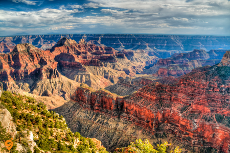
Grand Canyon National Park represents far more than just a massive hole in the ground – it’s essentially a natural time machine that reveals two billion years of Earth’s geological history through its exposed rock layers. When you approach the South Rim, which remains open year-round and receives most visitors, you’ll find yourself standing at an elevation of about 7,000 feet looking down into a chasm that could easily swallow several cities.
The canyon stretches 277 river miles long, up to 18 miles wide, and plunges more than a mile deep at its deepest point. The Colorado River, which carved this masterpiece over millions of years, appears as a thin ribbon from the rim viewpoints but actually measures 300 feet wide and flows with tremendous power below. The layered rock formations create a natural timeline, with the oldest rocks at the bottom dating back nearly two billion years, while the youngest rim rocks formed around 270 million years ago. For travelers, this means you can literally walk through geological epochs by hiking down trails like the Bright Angel or South Kaibab, though these require serious preparation since the return journey involves climbing back up that mile of elevation.
The North Rim, open only from mid-May through October due to snow, offers a completely different perspective from 1,000 feet higher elevation and provides a more secluded experience with cooler temperatures and different vegetation zones.
Central Park
Central Park stands as New York’s crown jewel, attracting over 40 million visitors annually and earning consistently high ratings for its 843 acres of green space in the heart of Manhattan. This magnificent park offers something for everyone throughout the year, from ice skating at Wollman Rink in winter to outdoor concerts at SummerStage, while famous spots like Bethesda Terrace, Bow Bridge, and Strawberry Fields provide iconic photo opportunities and peaceful retreats from urban intensity.
Address
- Central Park stretches from 59th Street to 110th Street, between Fifth Avenue and Central Park West
- Main entrances: Fifth Avenue/59th Street (Southeast), Columbus Circle/59th Street (Southwest), 72nd Street entrances, 86th Street entrances, 96th Street entrances, 110th Street (North)
Opening Hours
- Open 24 hours a day, 365 days a year
- Most attractions within the park have specific hours
Subway Transportation
Nearest Subway Stations:
- 59 Street Columbus Circle (Southwest entrance) – A, B, C, D, 1 lines
- Fifth Avenue/59th Street – N, R, W lines
- 68th Street/Hunter College – 6 line
- 72nd Street – B, C lines (West side)
- 81st Street-Museum of Natural History – B, C lines
- 86th Street – 4, 5, 6 lines (East side)
- 96th Street – B, C lines (West side)
- 103rd Street – B, C lines
- 110th Street/Cathedral Parkway – B, C lines
Other Connecting Lines:
- Subway lines serving Central Park area: 1, 4, 5, 6, A, B, C, D, N, Q, R, W
Bus Transportation
Nearby Stops:
- Central Park North/Malcolm X Blvd
- Central Park North/Adam C Powell Blvd
- Central Park North/Central Park West
- Central Park North/5 Ave
Lines: M2, M3, M4
Train Transportation
- Metro-North lines: Harlem, Hudson, New Haven (connecting via Grand Central Terminal)
- Long Island Rail Road (LIRR) – connects via Penn Station or Grand Central
- PATH train connections available
Parking Options
Street Parking:
- Metered parking available on surrounding streets
- Central Park West, Fifth Avenue, and cross streets
- Limited availability, especially on weekends
Parking Garages:
- Multiple garages on Fifth Avenue between 59th-110th Streets
- Central Park West garage options
- Columbus Circle area garages
- Upper East Side garages (Lexington Avenue area)
- SpotHero recommended for advance booking
Other Transportation Methods
Walking:
- 29-minute walk from Penn Station
- 15-20 minute walk from Times Square
- 10-15 minute walk from Grand Central Terminal
Taxi/Rideshare:
- Uber, Lyft, traditional yellow taxis
- Drop-off points at park entrances
- Citi Bike stations around park perimeter
Bicycle:
- Citi Bike stations at multiple park entrances
- Central Park drives have designated bike lanes
- Bike rental shops nearby
Transportation Companies
- MTA (Metropolitan Transportation Authority) – subway and buses
- Metro-North Railroad
- Long Island Rail Road (LIRR)
- NYC Taxi & Limousine Commission
- Uber, Lyft
- Citi Bike (bike sharing)
Central Park Nearby Attractions
MUSEUMS (Within Walking Distance)
East Side (Fifth Avenue – Museum Mile):
- Metropolitan Museum of Art – Located on the border of Central Park on Museum Mile, one of the largest and most comprehensive art museums in the world
– Address: 1000 Fifth Avenue (at 82nd Street)
– Distance: Directly across from Central Park
– Features: Egyptian art, European paintings, American wing, rooftop garden
- Guggenheim Museum
– Address: 1071 Fifth Avenue (at 89th Street)
– Distance: 2 blocks from Central Park
– Features: Frank Lloyd Wright spiral architecture, modern art collection
- Neue Galerie
– Address: 1048 Fifth Avenue (at 86th Street)
– Distance: Directly across from Central Park
– Features: German and Austrian art, Café Sabarsky
- Jewish Museum
– Address: 1109 Fifth Avenue (at 92nd Street)
– Distance: 3 blocks from Central Park
- Cooper Hewitt Smithsonian Design Museum
– Address: 2 East 91st Street
– Distance: 2 blocks from Central Park
West Side:
- American Museum of Natural History – Near Columbus Circle area
– Address: Central Park West at 79th Street
– Distance: Directly across from Central Park
– Features: Dinosaurs, planetarium, IMAX theater, Hope Diamond
- New-York Historical Society
– Address: 170 Central Park West (at 77th Street)
– Distance: Directly across from Central Park
PERFORMING ARTS VENUES
Lincoln Center Complex:
- Location: 10 Lincoln Center Plaza (65th Street and Broadway)
- Distance: 6 blocks southwest of Central Park
- Venues Include:
– Metropolitan Opera House
– David Geffen Hall (New York Philharmonic)
– David H. Koch Theater (New York City Ballet)
– Vivian Beaumont Theater
– Alice Tully Hall
– Juilliard School
Carnegie Hall
- Address: 881 Seventh Avenue (at 57th Street)
- Distance: 4 blocks south of Central Park
SHOPPING DESTINATIONS
Columbus Circle Area:
- The Shops at Columbus Circle – In the heart of Manhattan, an iconic indoor destination attracting more than 16 million visitors annually
– Address: 10 Columbus Circle
– Distance: Southwest corner of Central Park
– Features: Upscale shopping mall in Time Warner Center
Fifth Avenue Shopping:
- Distance: Directly along Central Park’s eastern border
- Stores Include:
– Apple Store Fifth Avenue (24/7)
– Tiffany & Co.
– Bergdorf Goodman
– Saks Fifth Avenue
– FAO Schwarz
– Trump Tower
Madison Avenue:
- Distance: 2-3 blocks east of Central Park
- Features: Designer boutiques, luxury shopping
ICONIC LANDMARKS NEAR CENTRAL PARK
Columbus Circle
- Features: Christopher Columbus statue, Time Warner Center
- Distance: Southwest corner of Central Park
Plaza Hotel
- Address: Fifth Avenue and 59th Street
- Distance: Southeast corner of Central Park
- Features: Historic luxury hotel, shopping plaza
Trump Tower
- Address: 725 Fifth Avenue
- Distance: 2 blocks from Central Park
Rockefeller Center
- Distance: 10 blocks south of Central Park
- Features: Top of the Rock observation deck, Radio City Music Hall
WITHIN CENTRAL PARK ATTRACTIONS
Major Highlights:
- Strawberry Fields – Internationally funded tribute to John Lennon, located near Dakota Apartment Building at 72nd St. and Central Park West
- Bethesda Fountain and Terrace – Major highlight for first-time visitors
- Belvedere Castle – Must-see attraction for visitors
- Bow Bridge – Featured in walking tours
- The Ramble – Natural area popular with visitors
- Central Park Zoo
- Alice in Wonderland Statue – Famous attraction within the park
- Balto Statue – Popular attraction
- The Mall and Literary Walk
- Sheep Meadow
- Great Lawn
- Jacqueline Kennedy Onassis Reservoir
- Conservatory Garden
NEARBY NEIGHBORHOODS
Upper East Side
- Features: Luxury residential area, additional museums, upscale dining
- Distance: Directly east of Central Park
Upper West Side
- Features: Cultural institutions, residential area, diverse dining
- Distance: Directly west of Central Park
Midtown
- Features: Theater District, Times Square, business district
- Distance: South of Central Park
SEASONAL ATTRACTIONS
- Winter: Ice skating at Wollman Rink (in Central Park)
- Summer: Shakespeare in the Park, SummerStage concerts
- Fall: Foliage viewing throughout the park
- Spring: Cherry blossoms, outdoor activities resume
Times Square
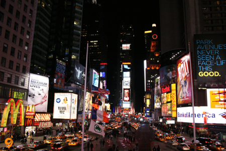
Times Square draws approximately 50 million visitors yearly, making it one of the most visited places on Earth despite mixed reviews about crowds and commercialization. The overwhelming spectacle of massive digital billboards, Broadway theater marquees, and constant human energy creates an undeniably iconic New York experience that visitors consistently describe as essential, even if briefly overwhelming.
Address
- Located at the intersection of 42nd Street, Seventh Avenue, and Broadway, in Midtown Manhattan
- Core area: 42nd to 47th Streets between Sixth and Eighth Avenues
- Main hub: Times Square-42nd Street subway complex
Opening Hours
- Times Square offers 24/7 service with businesses operating around the clock
- Street area is always accessible
- Individual attractions and stores have varying hours
- Broadway theaters typically have evening and matinee performances
Subway Transportation
Main Station Complex:
- Times Square-42nd Street Station – Major subway station complex located under Times Square
- Lines Serving Times Square: N, Q, R, 1, 2, 3, 7, S (42nd Street Shuttle)
- Additional Lines: W train during weekdays
Connected Stations:
- 42nd Street-Port Authority Bus Terminal – Connects to 42nd Street, Times Square station
- Lines: A, C, E
- 316 yards away, 4 min walk
Nearby Stations:
- 42nd Street-Bryant Park (B, D, F, M lines)
- 49th Street (N, Q, R, W lines)
- 50th Street (1, 2 lines)
- 47-50th Streets-Rockefeller Center (B, D, F, M lines)
Bus Transportation
Nearby Stops:
- New York, NY (201 West 37th St. (ON West 37th St.), adjacent to Fed Ex)
- 7 Av/W 44 St
- W 42nd St & 7th Ave
Lines: M7, M20, M104, M42
Parking Options
Commercial Parking:
- Port Authority Bus Terminal has 1,250 car parking spaces
- Multiple parking garages in Times Square area
- Icon Parking, Central Parking, Edison ParkFast locations
- Kinney Systems parking facilities
Street Parking:
- Limited metered parking on side streets
- Extremely challenging during peak hours and events
- Higher rates in Times Square core area
Other Transportation Methods
Taxi and Rideshare:
- New York’s iconic taxis run frequently through Times Square
- Uber, Lyft, Via services available
- Designated taxi stands around Times Square
Walking:
- Central location makes walking feasible from many Manhattan areas
- 10-15 minutes from Penn Station
- 10-15 minutes from Grand Central Terminal
- 5-10 minutes from Bryant Park
Bicycle:
- Citi Bike stations throughout Times Square area
- Protected bike lanes on nearby avenues
- Bike rental shops in the vicinity
Nearby Major Attractions
Broadway Theaters:
- Hub of the Broadway Theater District
- Historic theaters including Majestic Theatre and Shubert Theatre
- 40+ Broadway theaters within walking distance
- TKTS booth for discounted tickets
Entertainment Venues:
- Museum of Broadway – Interactive and experiential museum celebrating Broadway’s rich history
- Madame Tussauds New York
- Ripley’s Believe It or Not!
- National Geographic Encounter
Shopping Destinations:
- Diverse range of shopping options, from flagship stores to international retail
- M&M’s World (3 floors)
- Hershey’s Chocolate World
- Forever 21 flagship store
- H&M flagship store
- Disney Store
Iconic Landmarks:
- Red Stairs in Times Square
- George M. Cohan Statue, Father Duffy statue
- TKTS Red Steps
- Times Square Ball (New Year’s Eve location)
- Naked Cowboy performance area
Nearby Attractions (Walking Distance):
Rockefeller Center (3 blocks north)
- Top of the Rock observation deck
- Radio City Music Hall
- NBC Studios
Bryant Park (2 blocks east)
- Seasonal activities and events
- New York Public Library
Hell’s Kitchen (west of Times Square) - Restaurant row on 46th Street
- Diverse dining options
Garment District (south of Times Square) - Fashion industry hub
- Macy’s Herald Square
The Empire State Building
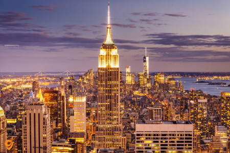
The Empire State Building maintains its position as one of the most beloved and frequently visited attractions, with its Art Deco architecture and observatory decks on the 86th and 102nd floors providing spectacular panoramic views of the city. Visitors consistently rate the experience highly, particularly for sunset and evening visits when the city lights create magical urban landscapes stretching to the horizon.
Address
- Located at 34th Street and Fifth Avenue, the Empire State Building is at the heart of Manhattan
- Exact address: 350 Fifth Avenue, New York, NY 10118
- Main entrance: Fifth Avenue between 33rd and 34th Streets
Opening Hours
- The Empire State Building observatory is open 365 days a year, from 9 a.m. to around 12 a.m., with the last elevator going up at 11:15 p.m.
- Observatory hours can vary from month to month
- Building lobby and retail spaces have extended hours
- Restaurant and bar hours vary by establishment
Subway Transportation
Closest Subway Stations:
- 34th Street-Herald Square (B, D, F, M, N, Q, R, W lines)
- Distance: 2 blocks west of Empire State Building
- Under Broadway & Sixth Avenue
34th Street-Penn Station (A, C, E lines) - Served by the A and E trains at all times, and by the C train at all times except late nights
- Distance: 3 blocks west of Empire State Building
33rd Street (6 line) - Distance: 1 block south and 2 blocks east
- Park Avenue South station
Additional Nearby Stations:
- 28th Street (N, Q, R, W, 6 lines)
- 42nd Street-Bryant Park (B, D, F, M, 7 lines)
- Grand Central-42nd Street (4, 5, 6, 7, S lines)
Bus Transportation
Nearby Stops:
- W 34 St/5 Ave
- 5 Av/W 35 St
- E 34 St/5 Av
Lines: QM10, QM12, QM15, QM16, QM17, QM18, QM24, SIM23, SIM24, M34, M34A SBS, X27, X28, X37, X38
Parking Options
Nearby Parking Facilities:
- You can find street parking or nearby garages to park your vehicle
- Multiple parking garages within 2-3 blocks
- Icon Parking locations nearby
- Central Parking facilities
- Edison ParkFast locations
- SpotHero app for advance reservations
Street Parking:
- Metered parking on surrounding streets
- Limited availability during business hours
- Higher rates in this busy area
Other Transportation Methods
Taxi and Rideshare:
- Uber, Lyft, Via services readily available
- NYC yellow taxis frequent the area
- Multiple taxi stands nearby
Walking:
- Central Manhattan location makes walking feasible
- 8-10 blocks from Times Square (10-15 minutes)
- 6-8 blocks from Grand Central (10-12 minutes)
- 3 blocks from Penn Station (5-7 minutes)
Bicycle:
- Citi Bike stations throughout the area
- Bike lanes on nearby avenues
- Several bike rental shops in vicinity
Nearby Major Attractions
Within 2-3 Blocks:
- Macy’s Herald Square – At Herald Square on Sixth Avenue and 34th Street
– World’s largest department store
– Distance: 2 blocks west
- Koreatown – On 32nd Street between Madison and Sixth avenues
– Korean business district with restaurants and businesses
– Distance: 2 blocks south
- Madison Square Garden – Close to other midtown Manhattan landmarks, including the Empire State Building
– Just a few blocks from the Empire State Building
– Sports arena and concert venue
– Distance: 3 blocks west
Within Walking Distance:
- Bryant Park (6 blocks north)
– New York Public Library
– Seasonal activities and events
- High Line (8 blocks west)
– Elevated park and walkway
- Flatiron Building (8 blocks south)
– Historic triangular building
- Murray Hill – To the east of the Empire State Building
– Residential neighborhood with restaurants
- Garment District (north and west)
– Fashion industry hub
The Statue of Liberty and Ellis Island
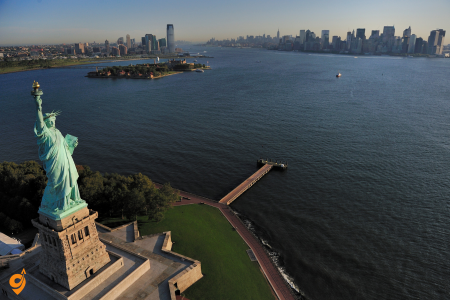
The Statue of Liberty and Ellis Island together create one of America’s most meaningful tourist experiences, requiring ferry rides that add to the adventure while providing historical education about immigration and American ideals. These attractions receive exceptional ratings from visitors who appreciate both the symbolic significance and the comprehensive museum experiences that tell the stories of millions of immigrants who entered America through New York Harbor.
Ferry Transportation (ONLY Official Access)
- Statue City Cruises is the ONLY vendor authorized to provide tickets and transportation to Liberty and Ellis Islands
- Ferries operate 7 days a week, from approximately 9:30am to 5:00pm
- Ferries depart approximately every 20-30 minutes depending upon the departure point
- Website: StatueCityCruises.com
Departure Points
Manhattan – Battery Park (Primary Location)
- Address: Castle Clinton National Monument, Battery Park, New York, NY 10004
- Exact Location: Located at the southern tip of Manhattan Island
- Ticket Office: Castle Clinton in Battery Park
New Jersey – Liberty State Park
- Address: Liberty State Park, Jersey City, NJ 07305
- Ferry Departure Point: Liberty State Park ferry terminal
Subway Transportation to Battery Park
- Nearest Station: Bowling Green (2-minute walk away)
- Subway Lines to Battery Park:
– Lines 1, 4, 5, W stop near Castle Clinton National Monument
– State Street station serves 4 and 5 subway lines
– Line R and W to Whitehall St-South Ferry
– Line 1 to South Ferry
Bus Transportation
- Bus Lines to Battery Park: 120, BXM18, M15-SBS, M20, M55, QM25
- Peter Minuit Plaza serves as intermodal transport hub
Other Transportation Options
- Taxi/Uber/Lyft: Direct drop-off at Battery Park
- Walking: Accessible from Financial District
- Ferry from Staten Island: Staten Island Ferry to Whitehall Terminal (then walk to Battery Park)
Parking Near Battery Park
- Nearby Parking: Parking garage available at 1 New York Plaza
- Stone Street area parking garages
- FDR Drive area parking facilities
- Limited street parking (metered)
Operating Hours
- Ferry Schedule: Daily departures starting around 9:30 AM
- Last Ferry: Approximately 5:00 PM
- Seasonal Variations: Check current schedule for winter/summer adjustments
- Holiday Schedule: Modified schedules on major holidays
Nearby Attractions
- Battery Park: SeaGlass Carousel with bioluminescent design
- Castle Clinton National Monument
- Stone Street Historic District
- South Street Seaport
- National Museum of the American Indian
- Charging Bull statue
- Brooklyn Bridge (walking distance)
- Trinity Church
- Federal Hall
- Wall Street
Brooklyn Bridge
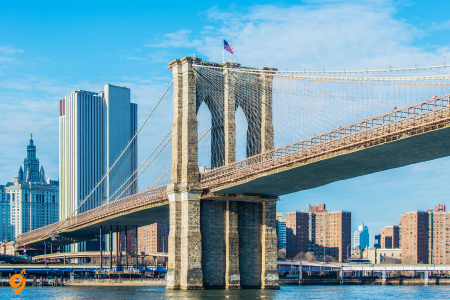
Brooklyn Bridge earns outstanding reviews as both a functional piece of infrastructure and a spectacular pedestrian experience, where the elevated walkway provides stunning views of Manhattan’s skyline, the East River, and Brooklyn’s waterfront. The bridge attracts millions of visitors who appreciate its Gothic Revival architecture, engineering marvel status, and the satisfaction of walking between two boroughs on a structure that has served New York for over 140 years.
Addresses and Access Points
Manhattan Side Access
The entrance to the bridge for pedestrians is just across the street from City Hall in Manhattan. From Manhattan, the entrance begins just across from the northeast corner of City Hall Park along Centre Street. The entrance is well-marked with signs and is easily identifiable as a walkway leading upward to the bridge level.
Brooklyn Side Access
Pedestrian access to the bridge from the Brooklyn side is from either the median of Adams Street at its intersection with Tillary Street or a staircase near Prospect Street between Cadman Plaza East and West. This gives visitors multiple entry points depending on their approach to the area.
Subway Transportation
Manhattan Side Subway Stations
The closest subway stops are via the 4, 5, and 6 trains at Brooklyn Bridge–City Hall station; the J or Z train at the Chambers Street station; or the R train at City Hall station. The entrance to the pedestrian path entrance is about a quarter of a mile (400 meters) north from this subway station, but there are helpful signs to point you in the right direction.
Specific Lines:
- Lines 4, 5, 6: Brooklyn Bridge–City Hall station
- Lines J, Z: Chambers Street station
- Line R: City Hall station
- Lines 2, 3: Park Place or Fulton Street stations (slightly farther)
Brooklyn Side Subway Stations
Brooklyn Entrance Directions: take the R train from Whitehall Street to Court Street or the 4/5 train from Bowling Green to Borough Hall station.
Specific Lines:
- Lines R, W: Court Street–Borough Hall station
- Lines 4, 5: Borough Hall station
- Lines 2, 3: Hoyt Street station
- Line F: Jay Street–MetroTech station
Bus Transportation
Nearby Stops:
- Pearl St/Frankfort St
- Pearl St/Peck Slip
- Pearl St/Pearl St
- Front St/York St
- Old Fulton St/Hicks St
- Old Fulton St/Elizabeth Pl
- Old Fulton St/Prospect St
Lines: M15, SIM5, SIM15, SIM35, BM1, BM2, BM3, BM4, QM7, QM11, QM25, QM65, B25
Ferry Transportation
Visitors can also arrive via the NYC Ferry at Fulton Ferry Landing and Pier 6. The NYC Ferry service connects various waterfront locations throughout the city, providing a scenic approach to the bridge area.
Parking Options
Manhattan Side Parking
- Municipal parking garages near City Hall
- Street parking (metered and time-limited)
- Private parking garages in the Financial District
- South Street Seaport area parking facilities
Brooklyn Side Parking
Brooklyn Bridge Park does not offer on-site parking. The closest parking is at 128 Columbia Heights, New York. See more here. The closest free parking is located at 109 Columbia Heights, New York. Parking is more likely to be found on Pierrepont, Montague, and Remsen streets as Clark Street and points north tend to be occupied due to their proximity to the Brooklyn Bridge and Cadman Plaza.
Specific Parking Areas:
- There are a number of garages on the Brooklyn side. One is near Cadman Plaza
- Columbia Heights area garages
- Pierrepont Street parking options
- Montague Street parking facilities
- Remsen Street parking areas
Operating Hours
- Bridge Access: 24 hours daily, 7 days a week
- Pedestrian Walkway: Always open
- Best Walking Times: Early morning or late afternoon for fewer crowds
- Sunset Views: Particularly popular in evening hours
Nearby Attractions
Manhattan Side
- City Hall and City Hall Park
- South Street Seaport Historic District
- Stone Street Historic District
- Federal Hall National Memorial
- Trinity Church
- 9/11 Memorial and Museum (walking distance)
- Wall Street Financial District
- Charging Bull statue
Brooklyn Side
- Brooklyn Bridge Park (waterfront park with multiple piers)
- DUMBO (Down Under the Manhattan Bridge Overpass) neighborhood
- Brooklyn Heights Promenade
- Jane’s Carousel
- Time Out Market Brooklyn
- Brooklyn Historical Society
- Cadman Plaza Park
- Empire Stores shopping complex
The High Line
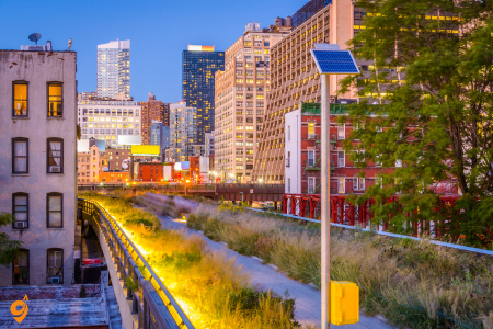
The High Line transformed from an abandoned elevated railway into one of New York’s most innovative and popular attractions, earning exceptional reviews for its unique combination of urban park design, art installations, and creative reuse of industrial infrastructure. This linear park attracts millions of visitors who praise its creative landscaping, rotating art exhibits, and the way it provides a completely different perspective on Manhattan’s Meatpacking District and Chelsea neighborhoods.
Overview and Location
The High Line is located on the west side of New York City along 10th Avenue between 8th & 34th Streets in the Chelsea and Meatpacking District neighborhoods. The park runs from Gansevoort Street—three blocks below 14th Street—through Chelsea to the northern edge of the West Side Yard on 34th Street near the Javits Center. This elevated park stretches 1.45 miles and is built on a former freight rail line.
Operating Hours
The High Line is open 7 am to 10 pm daily (7 am to 11 pm during summer; 7 am to 7 pm during winter). Hours may vary depending on the time of year, so it’s best to check the official website before your visit. The park is open year-round and admission is completely free.
Main Entrance Points and Access
Southern Access Points (Meatpacking District)
- Gansevoort Street Entrance: Main southern entrance point near the Whitney Museum
- 14th Street Entrance: The closest subway stop is at 14th St/ 8 Av. This is approximately 2 blocks from the High Line entrance
Central Access Points (Chelsea)
- 16th Street Entrance: Mid-point access with elevator available
- 18th Street Entrance: Stair access
- 20th Street Entrance: Stair access
- 23rd Street Entrance: Major access point with elevator and stair options
Northern Access Points (Hudson Yards)
- 30th Street Entrance: Park-level access is also available at 30th Street at Hudson Yards
- Hudson Yards/34th Street: 31st Street and Dyer Avenue at the High Line Moynihan Connector
Subway Transportation
Key Subway Lines and Stations
Several subway lines take you close to the High Line, including the A/C to 14th Street, 23rd Street, and 34th Street – Penn Station; the L to 14th Street – 8th Avenue; and the 7 to 34th Street – Hudson Yards
Detailed Subway Access:
- Lines A, C, E: 14th Street-8th Avenue (closest to southern entrance)
- Lines A, C, E: 23rd Street (central access)
- Line L: 14th Street-8th Avenue (most convenient for Meatpacking District entrance)
- Lines 1, 2, 3: 14th Street-7th Avenue (short walk to entrance)
- Lines 1, 2, 3: 23rd Street-7th Avenue (central access)
- Line 7: 34th Street-Hudson Yards (northern entrance)
- Lines A, C, E: 34th Street-Penn Station (northern access)
Bus Transportation
- M11: Runs along 9th/10th Avenue, multiple stops near High Line entrances
- M14A/D: Cross-town service along 14th Street
- M23: Cross-town service along 23rd Street
- M34: Cross-town service along 34th Street
- M12: North-south service in the area
Ferry Service
- NYC Ferry: Connects to Battery Park City/West Side terminals
- Water taxi services: Available from various Manhattan waterfront locations
Parking Information
Street Parking
- Limited metered parking available on side streets
- Chelsea area streets have various parking regulations
- Weekend parking typically easier than weekdays
Parking Garages and Lots
- Chelsea Market Area: Multiple parking facilities near 15th Street and 9th Avenue
- Meatpacking District: Several parking options near Gansevoort Street
- Hudson Yards Area: Large parking facilities near 34th Street entrance
- Icon Parking: Multiple locations throughout Chelsea
- SpotHero: Advance parking reservations available
Nearby Attractions
Meatpacking District (Southern Section)
- Whitney Museum of American Art: Located directly adjacent to High Line southern entrance
- Chelsea Market: Historic market building with food vendors and shops
- Standard Hotel: Iconic hotel that straddles the High Line
- Gansevoort Plaza: Public space and events area
Chelsea (Central Section)
- Chelsea Market: Major food hall and shopping destination
- Google NYC Headquarters: Modern office complex
- Chelsea Piers: Sports and entertainment complex
- Hudson River Park: Waterfront park system
Hudson Yards (Northern Section)
- Hudson Yards Shopping Center: Major retail and dining destination
- Vessel: Distinctive honeycomb-like structure (currently closed)
- Edge: Outdoor observation deck
- Javits Center: Major convention center
Art Galleries and Museums
- David Zwirner Gallery: Contemporary art gallery
- Gagosian Gallery: International art gallery
- Paula Cooper Gallery: Historic Chelsea gallery
- Multiple smaller galleries: Throughout the Chelsea Gallery District
The 9/11 Memorial and Museum
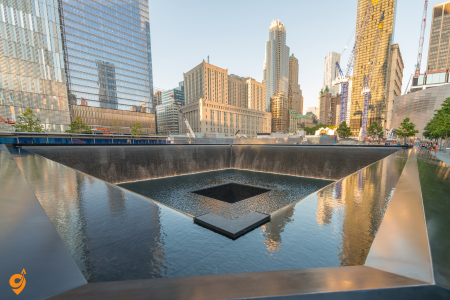
The 9/11 Memorial and Museum consistently receives the highest ratings from visitors who describe it as a profoundly moving and essential experience that honors the victims of September 11th while providing comprehensive historical context. The twin reflecting pools marking the footprints of the original World Trade Center towers, combined with the museum’s extensive collection of artifacts and personal stories, create an educational and emotional experience that visitors consistently rate as meaningful and important.
Address
180 Greenwich Street, Lower Manhattan, New York City
Opening Hours
- Museum: Wednesday through Monday, 9 a.m. to 7 p.m. (last entry 5:30 p.m.)
- Select Tuesdays also open
- Memorial: Open until 8 p.m.
- Closed on Thanksgiving Day and Christmas Day
- Closed to general public on September 11
Subway Transportation
- Nearest Stations:
– WTC Cortlandt Station (1 min walk)
– Cortlandt St Station (6 min walk)
- Subway Lines:
– 2, 3, C, R, W lines
Bus Transportation
Nearest Bus Stops:
- South End Ave & Rector Pl
- W Thames & South End Ave
Lines: M9, M20
Parking Options
- On-street parking extremely limited in Lower Manhattan
- Memorial does not provide parking
- Recommended Parking Garages:
– Battery Parking Garage at 70 Greenwich Street
– Several pay-to-park garages just outside World Trade Center campus
- Some local partners offer discounts for Museum ticket holders
Nearby Attractions
- One World Trade Center (Freedom Tower)
- One World Observatory
- Stone Street Historic District
- South Street Seaport
- Battery Park
- Statue of Liberty Ferry Terminal
- Brooklyn Bridge
- Trinity Church
- Federal Hall
- Wall Street
- Stone Street restaurants and bars
The Metropolitan Museum of Art
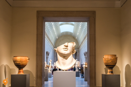
The Metropolitan Museum of Art stands as one of the world’s great cultural institutions, attracting over 6 million visitors annually who consistently give it outstanding reviews for its vast collections spanning 5,000 years of art from every part of the globe. The museum’s highlights include Egyptian artifacts, European paintings, American art, and special exhibitions that make repeat visits rewarding, while the suggested admission policy makes it accessible to visitors with varying budgets.
Broadway Shows
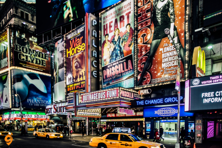
Broadway Shows collectively represent one of New York’s most celebrated attractions, with the Theater District’s approximately 40 professional theaters consistently selling millions of tickets annually to productions that receive rave reviews from both critics and audiences. The concentration of world-class musical and dramatic productions creates an unmatched theater experience where you can see award-winning shows, famous performers, and innovative productions that often set global entertainment standards.
Galata Tower and Neighborhood
One World Observatory at One World Trade Center provides the newest and most technologically advanced observation experience in New York, consistently earning exceptional reviews for its high-speed elevators, interactive exhibits, and breathtaking 360-degree views from the 100th to 102nd floors. Visitors praise the observatory’s modern design, the emotional significance of its location, and the comprehensive views that extend to all five boroughs and beyond, making it a worthy complement to older observation decks like the Empire State Building.
Niagara Falls
Niagara Falls consists of three waterfalls – the American Falls, Bridal Veil Falls, and the massive Horseshoe Falls on the Canadian side – that together create one of North America’s most powerful and visually stunning natural attractions. The falls generate approximately 6 million cubic feet of water flowing over the precipice every minute during peak flow periods, creating a thunderous roar that you can hear from miles away and mist that rises hundreds of feet into the air, creating rainbows on sunny days.
The experience begins before you even see the falls, as the sound of rushing water builds gradually as you approach, creating anticipation that reaches its climax when you first glimpse the massive curtain of water plunging 167 feet at Horseshoe Falls. The Maid of the Mist boat tours, operating since 1846, take you directly into the mist and spray at the base of the falls, providing an immersive experience where you feel the power of millions of gallons of water crashing around you while wearing provided rain gear that becomes absolutely necessary.
Address & Location
- Niagara Falls State Park is located in Niagara Falls, NY
- Niagara Falls Convention Center located on Old Falls Street between First and Third streets
Opening Hours
- Niagara Falls State Park is always open, 24 hours a day, 7 days a week, year-round
- Park attractions are seasonal and have their own schedules
Airport Transportation
- Buffalo Niagara International Airport (BUF) – Primary airport
- FlixBus operates bus service from Buffalo Niagara International Airport to Niagara Falls USA 5 times daily (50-minute journey)
- Metro Bus service from Buffalo Niagara International Airport serves downtown Buffalo and Niagara Falls
- OurBus also services this route once daily
Train Transportation
- Amtrak Station – Niagara Falls station
- Station served by Empire Service and Maple Leaf train, connecting to east coast and Canada
- Amtrak has several lines from Boston, Chicago, Washington, and Toronto to Niagara Falls
- Train journey from Buffalo Airport to Niagara Falls takes approximately 1 hour 18 minutes
Bus Transportation
- Local Bus Terminal:
– Metro Bus terminal located at 343 4th Street (1KM/0.6 miles from Niagara Falls)
- Bus Companies:
– FlixBus
– Greyhound
– New York Trailways
– Adirondack Trailways
– Trailways Inc. (service to Buffalo NY)
Shuttle Services
- Discover Niagara Shuttle – free seasonal shuttle service connecting Niagara Falls, Lewiston, Youngstown, and Lockport
- WEGO Niagara Falls bus – hop-on hop-off visitor transportation connecting major attractions and hotels
- Metro’s Trolley Bus Service to participating Niagara Falls hotels and motels (seasonal, begins May 23)
Parking Options
- State Park Parking:
– RV parking available but limited (no RVs/trailers over 40 feet)
– Parking lot open year-round with fees charged Friday-Monday and holidays 8:30am-5pm (May 23-September 1)
– No parking fees September 2 through May 21
- Downtown Parking:
– Multiple paid parking lots and garages available
– Street parking available throughout the city
Transportation Companies
- NFTA (Niagara Frontier Transportation Authority) – Operates Buffalo Metro Rail and bus system
- Amtrak – Train service
- FlixBus – Intercity bus service
- Greyhound – Bus service
- New York Trailways – Bus service
- Adirondack Trailways – Bus service
- Uber/Lyft – Ride-sharing services
- Local taxi companies
Getting Around Locally
- Line 40 bus connects various locations within Niagara Falls area
- Bus 40 connects downtown Buffalo to Niagara Falls
- Walking paths throughout State Park
- Bicycle rentals available
Nearby Attractions
- Maid of the Mist boat tours
- Cave of the Winds
- Niagara Falls State Park Observation Tower
- American Falls
- Horseshoe Falls
- Bridal Veil Falls
- Whirlpool State Park
- Old Fort Niagara
- Lewiston-Queenston Bridge
- Fashion Outlets of Niagara Falls USA
- Seneca Niagara Casino
- Niagara Falls Underground Railroad Heritage Center
- Aquarium of Niagara
- Castellani Art Museum
Cross-Border Access
- Rainbow Bridge – Pedestrian and vehicle border crossing to Canada
- Whirlpool Rapids Bridge – Vehicle crossing
- Peace Bridge (via Buffalo) – Vehicle crossing
- Passport required for border crossings
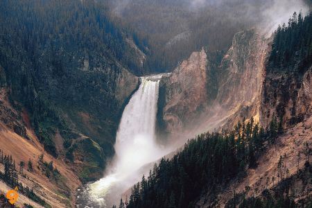
Yellowstone National Park operates as a massive active volcano sitting atop a supervolcano caldera, creating the world’s largest collection of geothermal features in a landscape that spans 3,472 square miles across three states. The park contains over half of all the world’s geysers, with Old Faithful being just the most famous among more than 500 predictable and unpredictable hot water eruptions. The underlying Yellowstone Caldera, measuring roughly 34 by 45 miles, last erupted catastrophically about 640,000 years ago, and today’s geothermal activity represents the ongoing geological processes that make this one of the most geologically active places on Earth.
The Grand Prismatic Spring, larger than a football field and deeper than a ten-story building, demonstrates how heat-loving bacteria create rainbow colors in the mineral-rich waters, with different bacterial species thriving at different temperatures and creating distinct colored rings from the center outward. Wildlife viewing reaches exceptional levels here because the park’s ecosystem remains largely intact, supporting the largest free-roaming bison herd in America alongside populations of grizzly bears, black bears, wolves, elk, and mountain goats that roam freely across diverse habitats from grasslands to alpine zones.
The park’s figure-eight road system, called the Grand Loop Road, connects major attractions across 142 miles of paved roads, though wildlife jams frequently slow travel as animals cross roadways or graze nearby.
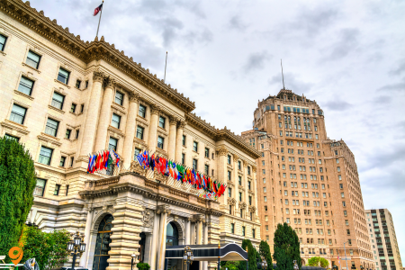
Golden Gate Bridge
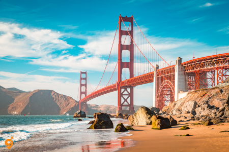
Golden Gate Bridge stands as San Francisco’s most iconic landmark, attracting over 15 million visitors each year who come to experience this Art Deco suspension bridge that spans 1.7 miles across the Golden Gate strait. The bridge connects San Francisco to Marin County through an engineering achievement that was completed in 1937 after overcoming tremendous challenges including strong winds, dense fog, and treacherous tides.
Visitors can walk or bike across the bridge itself, experiencing the structure from within while enjoying spectacular views of the bay, city skyline, and Pacific Ocean. Multiple viewing areas provide different perspectives, from Crissy Field at the base to Battery Spencer in the Marin Headlands, allowing photographers and sightseers to capture the bridge in various lighting conditions and weather patterns.
Address & Location
- Located on US Highway 101 between San Francisco and Marin County
- No physical street address but easily found on Google Maps
- The southern end accessible daily from 5:30 a.m. to midnight
Operating Hours
- Bridge open 24/7 for vehicles
- Parking lots: 7am – 9pm daily
- Southern end public transit access: 5:30 a.m. to midnight
- Sidewalk closures possible during construction – one hour early at 8 pm during Pacific Daylight Time
Transportation Options
By Public Transit
- San Francisco Muni Line 28 – serves southern end near toll plaza and parking lot
- Golden Gate Transit buses – regional service connecting San Francisco, Marin, and Sonoma counties
- Presidio GO Shuttle (free) – connects to BART and Transbay Terminal
By Bus
Nearby Stops:
- Golden Gate Bridge Toll Plaza
- Golden Gate Br Tunnel/Merchant Rd
Lines: 101, 114, 130, 132, 150, 154, 164, 172, 172X, 28
By Car/Private Vehicle
- Follow US Highway 101 north from San Francisco or south from Marin County
- Recommend using navigation apps like Waze for real-time traffic updates
- Electronic toll collection system (FasTrak or other non-cash options)
By Rideshare
- Uber and Lyft services available
- Recommended due to limited parking
By Tour Bus
- Various tour companies provide guided visits
- Bus stalls available in southeast parking lot
Parking Locations
Southeast Side Visitor Parking Lot (San Francisco Side)
- 37 total spaces (26 general, 6 bus stalls, 3 accessible)
- $5 per hour with maximum 3-hour consecutive parking
- Hours: 7am – 9pm daily (including holidays)
- Payment via parking meters or Parkmobile app
- Includes visitor services, gift center, gardens, scenic vistas
Northeast Side Parking Lot (Marin County Side)
- Free parking with 4-hour limit
- Basic amenities (restrooms only)
- Access requires crossing bridge and doubling back from San Francisco
Additional Parking Areas
- Weekend/holiday satellite lot on southwest side (when available)
- Presidio parking areas (not shown on main bridge map)
- Crissy Field parking area
Transportation Companies
- Golden Gate Transit (bus service)
- Golden Gate Ferry (connecting ferry service)
- San Francisco Municipal Transportation Agency (Muni)
- Uber/Lyft (rideshare)
- Various tour bus operators
- Local bike rental companies
Nearby Attractions
- Golden Gate Bridge Welcome Center
- Vista Points (southeast and northeast)
- Presidio of San Francisco
- Crissy Field
- Baker Beach
- Marin Headlands
- Battery Spencer
- Fort Point National Historic Site
Nearby Transit Stations
- Muni bus stops along routes serving the bridge
- Golden Gate Transit stops in San Francisco and Marin
- BART connection via Presidio GO Shuttle
- Ferry connections through Golden Gate Ferry system
Alcatraz Island
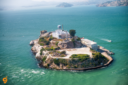
Alcatraz Island draws approximately 1.7 million visitors annually who take ferry rides to this 22-acre island that served as a federal prison from 1934 to 1963. The island housed some of America’s most notorious criminals, including Al Capone and Robert Stroud, known as the “Birdman of Alcatraz.” The preserved prison facilities include individual cells, the dining hall, recreation yard, and solitary confinement areas that remain exactly as they appeared during the prison’s operational years.
The comprehensive audio tour features narratives from former inmates and guards who share firsthand accounts of daily life, escape attempts, and the harsh conditions that made Alcatraz America’s most secure federal prison.
Fisherman’s Wharf
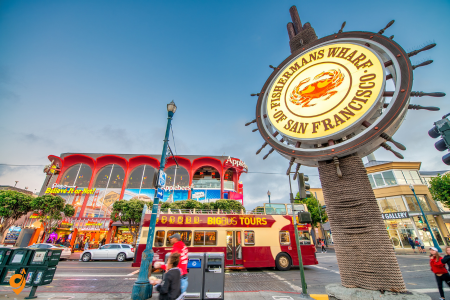
Fisherman’s Wharf encompasses a waterfront district that attracts over 12 million visitors yearly to its concentration of maritime attractions, restaurants, shops, and entertainment venues. Pier 39 serves as the district’s centerpiece, featuring hundreds of California sea lions that arrived after the 1989 earthquake and have made the floating docks their permanent home.
The area includes historic ships like the USS Pampanito submarine and SS Jeremiah O’Brien Liberty ship, along with departure points for bay cruises, fishing charters, and tours to Alcatraz. Street performers entertain crowds throughout the day, while seafood restaurants serve fresh Dungeness crab, clam chowder in sourdough bowls, and other local specialties.
Address & Location
- Main area centered around Pier 39 and The Embarcadero
- 350 Beach Street (specific parking location)
- Located between Pier 33 and Pier 45 along the San Francisco waterfront
- Bounded by Van Ness Avenue, Hyde Street, and The Embarcadero
Transportation Options
By Public Transit
F-Market & Wharves Historic Streetcar Line
- Daily service every 10-12 minutes from about 7 a.m. to 9 p.m.
- Route runs from Castro Street via Market Street, Embarcadero, Jefferson, Jones to Beach Street
- 30 stations total, first stop at 17th St & Castro St, last stop at Jones St & Beach St
- Direct connection to downtown and Castro District
Cable Cars
- Powell-Hyde line on Hyde & Beach Streets (near Ghirardelli Square)
- Powell-Mason line on Taylor & Bay Streets (middle of Fisherman’s Wharf area, near Pier 45)
- Both Powell cable lines link Union Square area to Fisherman’s Wharf
Muni Bus Lines
- Multiple bus routes serve the area
- Direct connections to various San Francisco neighborhoods
- Network includes fuel-efficient buses, light rail Metro trains, historic streetcars and cable cars
Nearby Stops:
- Beach St & Stockton St
- Powell St & Beach St
- Beach & Mason
- The Embarcadero & Stockton St
Lines: L Owl, 39
By Ferry
- Golden Gate Ferry Service operates between Larkspur/Sausalito and San Francisco at Embarcadero Ferry Building
- Connect to F-Line streetcar directly in front of Ferry Building
- Blue & Gold Fleet ferries to Alcatraz Island and other bay destinations
By Car/Private Vehicle
- Access via The Embarcadero, Lombard Street, or Bay Street
- No need to rent a car while staying in Fisherman’s Wharf area
- Multiple driving routes from north, south, east, and west directions
Parking Locations
Commercial Parking Lots
- Fisherman’s Wharf Parking at 350 Beach Street
- Pier 39 parking garage
- Various surface lots throughout the area
- Some lots attended on weekends year-round and weekdays July-September from 11 AM to 6 PM
Street Parking
- Limited street parking available more towards the Golden Gate side
- Parking options in some piers between Bay Bridge and Pier 39
- Metered parking along The Embarcadero and side streets
Operating Hours
- F-line streetcar service approximately 7 am-11 pm daily
- Cable car service varies by season and weather
- Most attractions and shops open daily with varying hours
- Restaurants and entertainment venues often open late
Nearby Attractions
- Pier 39 with shops, restaurants, and sea lions
- Maritime National Historical Park
- Alcatraz Island (ferry departure point)
- Ghirardelli Square
- Aquarium of the Bay
- Musée Mécanique
- Hyde Street Pier Historic Ships
- Crissy Field and Golden Gate Bridge views
- North Beach (Little Italy)
- Lombard Street (crookedest street)
Nearby Transit Stations
- Embarcadero Ferry Building (F-line and ferry hub)
- Various Muni bus stops along The Embarcadero
- Cable car turnarounds at Hyde & Beach and Taylor & Bay
- Ferry terminals at Pier 33 and Pier 41
- BART connection via F-line to downtown stations
Lombard Street
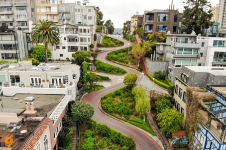
Lombard Street attracts millions of visitors who come to experience “the world’s most crooked street,” where eight hairpin turns navigate a steep 27-degree grade over a single city block. This unique street design was created in the 1920s to make the hill between Hyde and Leavenworth Streets safe for vehicle traffic, resulting in a serpentine roadway bordered by carefully maintained gardens that bloom with different flowers throughout the seasons. The brick-paved street allows one-way downhill traffic while pedestrians can use staircases on either side to walk the route and enjoy close-up views of the landscaping and panoramic city vistas.
Address & Location
- 1000-1099 Lombard Street, San Francisco, CA 94133, Russian Hill
- Famous curved section between Hyde Street and Leavenworth Street
- Known as “The Crookedest Street in the World”
- Features eight sharp turns with a 27-degree incline
Transportation Options
By Cable Car (Most Recommended)
- Cable cars are the best option according to many visitors
- Powell-Hyde line passes directly by Lombard Street
- Starts from Powell Station at Powell and Market Streets near Union Square
- Powell-Hyde turnaround at Hyde and Beach Streets near Ghirardelli Square
- Perfect for reaching the top of Lombard Street to walk down
By Public Transit (Muni Bus)
- Bus lines 30 and 91 stop at Columbus Ave & Lombard St
- Bus lines 41 and 45 stop at Union St & Leavenworth St
- Walk north on Leavenworth Street from Union Street stop
By Car/Private Vehicle
- Curvy portion runs one-way eastbound only
- Access from Van Ness Avenue, turning east on Lombard Street
- Experienced drivers only recommended
- Traffic can be heavy, especially during tourist season
Parking Locations
Street Parking
- Free parking available but may be harder to find depending on timing
- Limited street parking on Hyde Street at the top
- Some parking on Leavenworth Street at the bottom
- Metered parking on surrounding streets
Nearby Parking Structures
- Russian Hill area parking garages
- North Beach neighborhood parking lots
- Fisherman’s Wharf parking (short walk)
- Park Smart recommended when exploring the neighborhood
Parking Restrictions
- Time limits vary by location
- Residential parking permits required in some areas
- No stopping zones along the curved section
- Heavy traffic enforcement during peak tourist times
Operating Hours
- Street accessible 24/7
- Please respect residents and be quiet at night
- Best visited during daylight hours for photos
- Cable car service varies by season (typically 6:30 AM – 12:30 AM)
Nearby Attractions
- Ghirardelli Square
- Hyde Street Pier and Aquatic Park
- The Cannery shopping center
- Fisherman’s Wharf
- Russian Hill Park
- Views of Coit Tower, Alcatraz Island, and San Francisco Bay
- North Beach (Little Italy)
- Telegraph Hill and Coit Tower
- Fort Mason Center
Nearby Transit Stations
- Powell Station (Powell-Hyde cable car start point)
- Hyde & Beach cable car turnaround
- Multiple Muni bus stops on surrounding streets
- Van Ness Avenue transit corridor
- Union Street bus stops
Union Square
Union Square serves as San Francisco’s premier shopping and cultural district, welcoming millions of visitors to its central plaza surrounded by major department stores, boutique shops, art galleries, and theaters. The square’s location at the intersection of several cable car lines makes it a natural transportation hub, while its concentration of hotels, restaurants, and entertainment venues creates a compact area where visitors can accomplish multiple activities within walking distance. The central plaza hosts seasonal events, art installations, and performances throughout the year, making it a dynamic gathering place that reflects the city’s cultural energy.
Address & Location
- Located in downtown San Francisco, bounded by Powell, Post, Stockton, and Geary Streets
- Central shopping and business district
- Most renowned source of retail therapy in San Francisco
- Heart of San Francisco featuring iconic landmarks, world-class retailers, and top-notch restaurants
Transportation Options
By BART (Bay Area Rapid Transit)
- Powell Street station serves BART Red, Yellow, Green, and Blue lines
- Located under Market Street between 4th Street and 5th Street
- Direct connection to Union Square/Market Street Station via underground concourse
- Exit options: Ellis Street, Stockton Street, or O’Farrell Streets for Union Square Park and major department stores
By Muni Metro
- Powell Street station serves Muni Metro J Church, K Ingleside, L Taraval, M Ocean View, N Judah, and S Shuttle lines
- T Third line connects via underground concourse to Powell Street Station
- Multiple bus lines serve the area
By Cable Car
- Powell and Market Cable Car Turnaround located at intersection
- Powell-Hyde line serves Union Square area
- Powell-Mason line also available
- Powell-Hyde cable car line provides access to Union Square
- Both lines connect to Fisherman’s Wharf and other tourist destinations
By Car/Private Vehicle
- Access via major downtown streets: Powell, Stockton, Geary, Post Streets
- Multiple entry points from Highway 101 and Interstate 80
- Traffic congestion common, especially during peak hours and shopping seasons
By Public Bus
Nearby Stops:
- Stockton St & Geary St
- Post St & Powell St
- Geary St & Powell St
Lines: 8, 8AX, 8BX, 30, 45, 91, TBUS, 2, 38, 38R
Parking Locations
Underground Parking Garages
- Union Square Garage (under the square itself)
- Sutter-Stockton Garage
- Ellis-O’Farrell Garage
- Direct access to Union Square Park and major department stores from underground exits
Commercial Parking Lots
- Multiple surface lots throughout the area
- Hotel parking garages (some offer public parking)
- Department store parking facilities
Street Parking
- Limited metered street parking on surrounding streets
- Time restrictions vary by location
- Higher demand during shopping hours and events
BART Station Parking
- No parking available at Powell Street BART station
- Other San Francisco BART stations offer parking alternatives
Operating Hours
- Union Square area accessible 24/7
- Shopping centers and department stores typically open 10 AM – 9 PM (varies by store)
- Cable car service operates throughout the day with high demand and long lines
- BART and Muni service varies by line (typically 5 AM – midnight)
Nearby Attractions
- World-class shopping including major department stores
- Macy’s, Saks, Neiman Marcus, Barneys
- Westfield San Francisco Centre, Bloomingdale’s, Nordstrom
- Union Square Park with Victory Monument
- Theatre District (Curran Theatre, ACT, Orpheum Theatre)
- Chinatown (short walk)
- Financial District
- Nob Hill
- Various art galleries and museums
- High-end hotels and restaurants
Nearby Transit Stations
- Powell Street BART/Muni Metro station (directly adjacent)
- Union Square/Market Street Station (T Third line)
- Montgomery Street BART station (Financial District)
- Civic Center/UN Plaza BART station
- Powell and Market Cable Car Turnaround
- Multiple Muni bus stops throughout the area
Chinatown
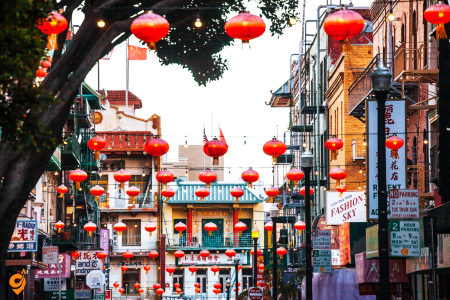
Chinatown represents the oldest and largest Chinese community outside of Asia, attracting visitors to explore 24 blocks of traditional architecture, authentic markets, temples, and restaurants that maintain cultural traditions dating back to the 1840s Gold Rush era. Grant Avenue serves as the main tourist corridor with its distinctive dragon gate entrance and souvenir shops, while Stockton Street functions as the community’s commercial heart where locals shop for fresh produce, herbs, and traditional goods. Visitors can explore Buddhist and Taoist temples, participate in tea ceremonies, and experience dim sum dining in restaurants that have served the community for generations.
Address & Location
- Chinatown is centrally located and adjacent to North Beach, Nob Hill, Union Square, and the Financial District
- Main entrance through Dragon’s Gate on Grant Avenue
- Bounded roughly by Broadway, Bush Street, Kearny Street, and Powell Street
Public Transportation
BART (Bay Area Rapid Transit)
- Montgomery Street Station – closest BART stop
- Trains run underground along Market Street with Montgomery being nearest to Chinatown
- Service every 10 minutes from Civic Center/UN Plaza to Montgomery Street
MUNI (San Francisco Municipal Transportation)
- Lines 1, 30, and 45 serve the area
- 30 Stockton and 45 Union/Stockton continue regular operations
- T Third Street/Central Subway with Chinatown-Rose Pak Station
- Cable car lines accessible from nearby areas
Bus Lines
- 30 Stockton – main bus line through Chinatown
- 45 Union/Stockton
- 1 California
- Various other MUNI lines serve surrounding areas
Driving & Parking
Major Parking Garages
- Portsmouth Square Garage: 733 Kearny Street, 456 vehicle spaces, 6’8″ height clearance
- St. Mary’s Square Garage: 433 Kearny Street with after-hours access on Kearny Street side
- Golden Gateway Garage: 250 Clay Street (weekend service)
Street Parking
- Metered parking from 9am-6pm with dynamic pricing based on demand
- Sunday parking is free for all metered spots in Chinatown
- Average parking rates start at $3 per hour with daily maximum of $30
Nearby Attractions
- Dragon’s Gate (main entrance)
- Portsmouth Square Park
- St. Mary’s Square
- Grant Avenue shopping district
- Stockton Street markets
- Chinese temples and cultural centers
- Traditional herb shops and tea houses
- Authentic restaurants and dim sum parlors
Getting Around Within Chinatown
- Most attractions within walking distance
- Steep hills in some areas
- Grant Avenue – main tourist street
- Stockton Street – local shopping and markets
- Narrow streets with limited vehicle access in some areas
Golden Gate Park
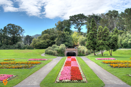
Golden Gate Park spans 1,017 acres and attracts over 25 million visitors annually to its diverse collection of gardens, museums, lakes, and recreational facilities. The park contains several world-class attractions including the Japanese Tea Garden with its traditional architecture and landscaping, the Conservatory of Flowers housing tropical plants in a Victorian glass structure, and the de Young Museum featuring American art and international exhibitions. The California Academy of Sciences combines an aquarium, planetarium, natural history museum, and rainforest dome under a living roof covered with native plants, creating an innovative educational experience that demonstrates environmental sustainability.
Address & Location
- Golden Gate Park is a 1,017-acre, three-mile-long urban park that stretches from the famed Haight-Ashbury neighborhood to Ocean Beach to the west
- Eastern entrance: Stanyan Street and Fulton Street
- Western boundary: Great Highway and Ocean Beach
- Northern boundary: Fulton Street
- Southern boundary: Lincoln Way
Public Transportation
MUNI Bus Lines
San Francisco Municipal Transportation Agency (SFMTA) serves Golden Gate Park via these lines:
- N Judah
- 5 Fulton
- 6 Haight/Parnassus
- 7 Haight/Noriega
- 18 46th Avenue
- 21 Hayes
- 28 19th Avenue
- 29 Sunset
- 31 Balboa
- 33 Ashbury/18th
- 37 Corbett
- 43 Masonic
- 44 O’Shaughnessy
- 91 3rd Street/19th Avenue Owl
Golden Gate Park Free Shuttle
- The free Golden Gate Park Shuttle operates 7 days per week, 365 days per year
- Runs on weekends and holidays, from the eastern end of the park to the middle at Transverse Drive, along JFK Drive
- The shuttle will run some evenings during special events
MUNI Light Rail
- N Judah line: Van Ness Station Outbound to Judah St & 9th Ave every 15 minutes, journey takes 18 minutes
Driving & Parking
Main Parking Facilities
- Music Concourse Garage: Access at Concourse Drive and Martin Luther King Dr. inside the park
- Open seven days a week from 7 a.m. to 7 p.m. year-round
- The 800-space Music Concourse garage can be reached via Fulton St. at 10th Avenue and is open every day from 7AM to 7PM
Additional Parking Areas
- Nancy Pelosi Dr.: 3- and 4-hour weekday and all-day parking on weekends between MLK Dr. and JFK Dr.
- Blue Heron Lake Dr.: All-day parking around Blue Heron Lake
- Golden Gate Bandshell Parking Lot (blue zone only): 20 free, accessible blue zone parking spaces
- Parking is also available along roadways throughout the park
Car-Free Areas
- The car-free route runs from Stanyan Street at the east end of the park to Ocean Beach and the Great Highway at the west end
- The east end includes portions of the JFK Promenade and Conservatory Drive; the west end includes Overlook Drive, Middle Drive, and portions of MLK Drive
Major Attractions Within the Park
- California Academy of Sciences
- de Young Museum
- Japanese Tea Garden
- San Francisco Botanical Garden
- Conservatory of Flowers
- Buffalo Paddock
- Stow Lake
- Golden Gate Park Carousel
- AIDS Memorial Grove
- Hippie Hill
- Polo Fields
- Beach Chalet
- Golden Gate Park Golf Course
- Tennis courts and sports facilities
Nearby Neighborhoods & Access Points
- Haight-Ashbury (eastern entrance)
- Richmond District (northern side)
- Sunset District (southern side)
- Ocean Beach (western end)
- Inner Richmond
- Cole Valley
- Panhandle
Park Hours & Operations
- Park is open 24 hours daily
- Music Concourse Garage: 7 a.m. to 7 p.m. daily year-round
- Individual attractions have varying hours
- Some areas may have restricted access during events
Getting Around Within the Park
- Free shuttle service on weekends and holidays
- Extensive walking and biking paths
- Car access to most major attractions
- Multiple entrance and exit points
- Clear signage and wayfinding throughout
Nob Hill
Nob Hill draws visitors seeking panoramic city views, historic architecture, and cultural attractions from one of San Francisco’s most elevated neighborhoods. Grace Cathedral, an Episcopal cathedral built in Gothic Revival style, features labyrinth walks, stained glass windows, and bronze doors cast from the same molds used for the Gates of Paradise in Florence, Italy. The Cable Car Museum preserves the mechanical systems that power San Francisco’s historic cable car lines while providing educational exhibits about this unique transportation system that has operated continuously since the 1870s.
Address & Location
- Nob Hill is bounded roughly by Bush Street, Larkin Street, Broadway, and Stockton Street
- Summit area around California Street and Powell Street
- On the south side, it borders Union Square and to the southwest, Nob Hill melts into the Tenderloin and is generally referred to as the Tendernob
Public Transportation
Cable Car Lines
- Choose from three cable car lines – two start at Powell and Market and continue to the Fisherman’s Wharf area; one starts at California and Market and continues to Van Ness Avenue
- California Street line runs only on California Street, running at first uphill to the summit of Nob Hill, then more gently downhill to a terminus at Van Ness Avenue
- Luckily you can reach by cable car
- Powell-Hyde and Powell-Mason lines also serve the area
MUNI Bus Lines
- Bus: 1, 101, 49, 90, 130, 150, 12, 19, 27
- There are bus or trolley lines along most of the streets in the neighborhood, specifically Hyde, Clay, Sacramento, and Pacific
- San Francisco Municipal Transportation Agency operates a bus from South Van Ness Ave & Market St to Van Ness Ave & Clay St every 10 minutes
BART Access
- BART: BLUE, GREEN, YELLOW
- Closest BART stations: Montgomery Street and Powell Street
- Transfer to cable cars or buses from BART stations
Nearby Stations & Stops
- Sacramento St & Van Ness Ave; California St & Polk St; Van Ness Ave & Sacramento St; Polk St & Sacramento St
- Powell Street Station (cable car turntable)
- California Street & Market Street (cable car terminus)
- Van Ness Avenue & California Street
Driving & Parking
Parking Facilities
- Various parking garages throughout the neighborhood
- After hours access on Fern Street of the garage. Please have your parking ticket with you and enter the ticket number on the keypad for access
- Street parking available with meters
Parking Considerations
- Steep hills require careful parking
- Limited street parking due to cable car tracks
- Hotel valet parking available at luxury hotels
- Public parking garages near major attractions
Major Attractions in Nob Hill
- Fairmont Hotel, the famous Top of the Mark in the Mark Hopkins Hotel, Huntington Park and Grace Cathedral and the San Francisco Cable Car Museum
- SF Masonic Auditorium
- Grace Cathedral
- Huntington Park
- Pacific-Union Club
- Luxury hotels and fine dining establishments
- Historic mansions and architecture
Access from Different Areas
- From Downtown: Cable cars from Market Street
- From Fisherman’s Wharf: Powell-Hyde or Powell-Mason cable cars
- From Union Square: Short walk or cable car
- From Chinatown: Walking distance or local bus lines
- From Financial District: Various bus lines or short taxi ride
Getting Around Within Nob Hill
- Most attractions within walking distance despite hills
- Cable car stops strategically located near major hotels and attractions
- Local bus service for longer distances within the neighborhood
- Valet services available at luxury hotels
Twin Peaks
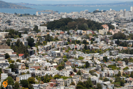
Twin Peaks attracts visitors to its 922-foot elevation that provides 360-degree panoramic views of San Francisco, the bay, and surrounding regions from the city’s second-highest point. The twin summits, known to early Spanish settlers as “Los Pechos de la Chola,” offer easily accessible viewpoints reached by car or public transportation, making spectacular photography opportunities available to visitors of all physical abilities. The surrounding grasslands support native plant communities and provide habitat for various bird species, while clear days allow views extending to Mount Diablo in the East Bay and Mount Tamalpais in Marin County.
Address & Location
- Main viewpoint address: 100 Christmas Tree Point Road, San Francisco
- 501 Twin Peaks Boulevard, San Francisco, California
- Two hills rise almost 1000 feet above the City and sit just about in its geographical center
Public Transportation
MUNI Bus Lines
- 37 Corbett Muni bus – closest public transportation to the base of the peak, then hike up to the top
- 37 Corbett bus line to the 74 Crestline stop, which is across the street to a pathway up to Twin Peaks
- Bus lines serving nearby areas: 36, 37, 48, 52
- San Francisco Municipal Transportation Agency operates a bus from 14th St & Church St to Corbett Ave & Iron Aly every 30 minutes
BART Access
- BART: GREEN line
- First you’ll want to get to Castro Street station and then either hike from there or take the 37 Corbett bus from there
Nearby Stations & Stops
- 74 Crestline Dr; Marview Way & Panorama Dr; Carl St & Cole St; Forest Hill; 17th St & Castro St
- Castro Street BART Station
- Various MUNI bus stops in surrounding neighborhoods
Driving & Parking
Vehicle Access
- Twin Peaks is now accessible by car only via Portola Road. In 2020, the access from Clarendon Road on the other side was permanently closed to cars
- Main parking lot on the North side of the attraction
Parking Facilities
- Free Twin Peaks viewpoint with parking available
- It is a very busy point, with many buses and cars, so sometimes a parking space is difficult to find
- Northern parking lot recommended for after-dark visits
Operating Hours
- Park Hours: 5 a.m. to Midnight
- Twin Peaks is open from 5 am to midnight daily
- You can visit any night of the year before midnight to get those amazing sunset photos or take in the dazzling city lights
Major Attractions & Features
- Amazing views of San Francisco and the Bay Area from atop Twin Peaks
- It’s one of San Francisco’s best free attractions
- The Pink Triangle representing LGBTQ+ community (which can be seen from way below)
- Twin Peaks also hosts a large reservoir holding 300 million gallons, installed on the peaks after the 1906 quake as a water supply for fighting fires
Nearby Neighborhoods
- Castro District (closest BART access)
- Cole Valley
- Glen Park
- Forest Hill
- Diamond Heights
Getting Around Twin Peaks
- Walking paths to viewpoints from parking areas
- Multiple viewing areas available
- Accessible areas for different mobility levels
- Photography spots throughout the park
Coit Tower
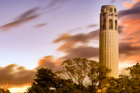
Coit Tower on Telegraph Hill welcomes visitors to its 210-foot Art Deco tower that provides spectacular views of the bay, city, and surrounding hills from its observation deck accessible by elevator. Built in 1933 with funds bequeathed by Lillie Hitchcock Coit to beautify San Francisco, the tower contains Depression-era murals created by local artists that depict California’s agricultural and industrial workers. The surrounding Telegraph Hill neighborhood features steep streets, gardens, and the famous wild parrots that escaped from captivity and established thriving flocks that have become part of the area’s charm and ecological diversity.
The Strip and Its Iconic Casinos
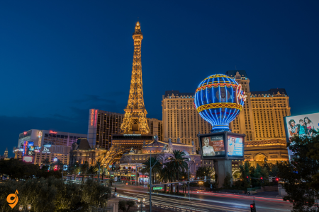
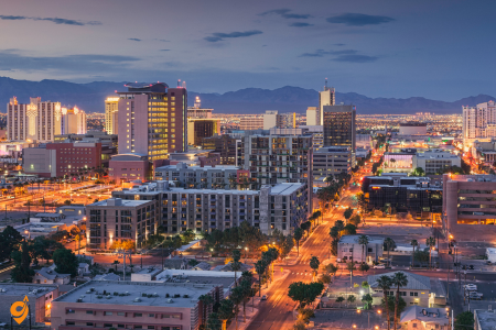
The Strip and Its Iconic Casinos form the heart of what makes Las Vegas legendary, with each major resort offering unique experiences that draw visitors from around the world. These massive entertainment complexes represent decades of investment in creating immersive environments that transport guests into different worlds, from ancient Rome to modern Paris.
Address & Location
- Main stretch: Las Vegas Boulevard (Nevada State Route 604)
- Spans approximately 4-mile (6-km) portion of Las Vegas Boulevard
- Coordinates: 36.1146° N, 115.1729° W
Public Transportation
Bus System (RTC)
- The Deuce is Las Vegas’ public transportation operated by the Regional Transportation Commission
- Deuce on the Strip will stop at just about every resort
- Operates 24/7
- Wheelchair accessible
- Limited luggage storage space
Las Vegas Monorail System
Operating Hours
- Monday: 7 am – 12, Tuesday-Thursday: 7 am – 2 am, Friday: 7 am – 3 am, Saturday: 7 am – 3 am, Sunday: 7 am – 3 am
Monorail Stations (North to South)
- SAHARA Las Vegas station (northern terminus)
- Westgate Las Vegas Resort & Casino
- Las Vegas Convention Center
- Harrah’s/The LINQ
- Flamingo/Caesars Palace
- Bally’s/Paris Las Vegas
- MGM Grand station (southern terminus) – 3799 S Las Vegas Blvd
Parking Options
Free Parking Locations
- Sahara garages (free parking with direct monorail access)
- Westgate (free parking unless big events)
- OYO Hotel (requires crossing Tropicana Avenue)
Paid Parking Areas
- Harrah’s/LINQ, Flamingo, and Horseshoe/Paris all charge for self-park and valet park
- Most major Strip hotels charge parking fees
- Valet parking available at all major casinos
Major Casino Locations & Attractions
South Strip
- MGM Grand – 3799 S Las Vegas Blvd
- Luxor – 3900 S Las Vegas Blvd
- Mandalay Bay – 3950 S Las Vegas Blvd
- Excalibur – 3850 S Las Vegas Blvd
Mid Strip
- Bellagio – 3600 S Las Vegas Blvd
- Caesars Palace – 3570 S Las Vegas Blvd
- The Venetian – 3355 S Las Vegas Blvd
- Palazzo – 3325 S Las Vegas Blvd
- Flamingo – 3555 S Las Vegas Blvd
North Strip
- Wynn – 3131 S Las Vegas Blvd
- Encore – 3121 S Las Vegas Blvd
- SAHARA – 2535 S Las Vegas Blvd
- Stratosphere – 2000 S Las Vegas Blvd
Nearby Attractions
- M&M’s World, Adventure dome and the Fashion Show Mall
- High Roller (550-foot-tall observation wheel)
- Brooklyn Bowl (music and bowling venue)
- Fountains of Bellagio
- CityCenter complex
- The LINQ Promenade
Transportation Companies
Major Operators
- Bell Trans (airport shuttles)
- Prime Time Shuttle
- GO Airport Shuttle
- Regional Transportation Commission (RTC) – public buses
- Las Vegas Monorail Company
- Various limousine and private car services
Operating Notes
- Monorail runs every 4 to 8 minutes with station announcements
- Most casinos operate 24/7
- Public transportation reduced during overnight hours
- Heavy traffic during peak tourist seasons and special events
Fountains of Bellagio
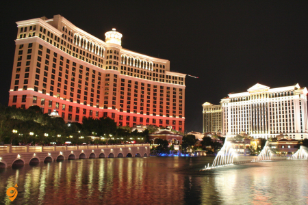
Fountains of Bellagio stand as perhaps the most iconic free attraction in Las Vegas, drawing crowds every 15-30 minutes throughout the day and evening. This choreographed water display features over 1,200 fountains that dance to carefully selected musical pieces, creating an emotional experience that visitors consistently describe as magical. The engineering behind this spectacle involves computer-controlled water jets that can shoot water up to 460 feet in the air, synchronized with lighting effects that enhance the visual impact. What makes this attraction so universally beloved is how it combines technical precision with artistic expression, creating moments of genuine beauty in the middle of a bustling casino environment.
Fremont Street Experience
Fremont Street Experience in downtown Las Vegas offers a completely different but equally captivating atmosphere that represents the city’s historical roots. This pedestrian mall features a massive LED canopy overhead called Viva Vision, which creates immersive light shows every hour after dark using 12.5 million LED modules. The area buzzes with street performers, live music, and a more authentic Vegas vibe that many visitors prefer over the polished Strip experience. Understanding why this area resonates so strongly with visitors requires recognizing how it preserves the original spirit of Las Vegas while incorporating modern technology.
Address & Location
- Main location: Fremont Street between 3rd Street and 4th Street, Downtown Las Vegas
- Coordinates: Fremont Street, Las Vegas, NV 89101
- Fremont Street Parking Garage located on the corner of 4th St. and Carson St.
Opening Hours
- Fremont Street, Las Vegas is open for visitors 24 hours, 7 days a week
- Street access available continuously
- Individual attractions and shows have varying schedules
Public Transportation
The Deuce Bus Route
- Regional Transportation Commission (RTC) runs the “Deuce on The Strip” line, which is a 24-hour bus line that goes from the South Strip Transit Terminal all the way up to the Fremont Street Experience in downtown Las Vegas
- The Las Vegas Deuce bus runs 24 hours a day and covers the Las Vegas Strip and downtown, all the way to Fremont Street
- Grab a seat on the top floor of the double-decker bus
- Services depart every 10 minutes, and operate every day. The journey takes approximately 29 min
Downtown Loop (Free Shuttle)
- The Downtown Loop is a freeshuttle service that will take you to all the biggest attractions in the area
- Fremont Street Experience (stops at Circa and Main Street & Ogden)
- Operates Sunday through Thursday from 11 a.m. to 6 p.m., and Friday and Saturday from 3 to 10 p.m.
- Loop runs continuously during operating hours
CX Bus Route (Airport Connection)
- The CX bus line runs just about every 15 – 20 minutes, and $6 is the entire cost of the ride
- Direct connection from Harry Reid International Airport to Fremont Street
Bus Stops & Stations
Major Bus Stop Locations
- Fremont Street Experience bus stop
- Nb 4th After Carson
- Eb Carson After 4th
- Sls Station
Available Bus Routes
- Bus: 207, 208, CX, DEUCE, DVX, 401, DOWNTOWN LOOP, 106, 214, BHX
Nearby Parking Structures
Primary Parking Options
- Fremont Street Parking Garage | Corner of 4th St. & Carson St.
- Fremont Experience Parking Plaza, at 4th Street and Carson, where you can leave your car for free for up to five hours
- Container Park Lot 118 S. 7th Street
- Downtowner Lot 108 N. 8th Street
Alternative Parking Areas
- Llama parking located just a block away at 910 Fremont Street
- Various downtown casino parking structures
- City Hall Garage at 495 S. Main St.
Nearby Major Attractions
On Fremont Street Experience
- SlotZilla Zipline
- Viva Vision canopy
- Free nightly light shows on the state-of-the-art Viva Vision screen, boasting 16.4 million brilliant pixels
- Downtown Las Vegas casinos
Adjacent Areas
- Fremont East District
- Neon Museum (more info), located at the east end of Fremont Street
- Downtown Container Park
- The Mob Museum
- 18b Arts District
The High Roller Observation Wheel
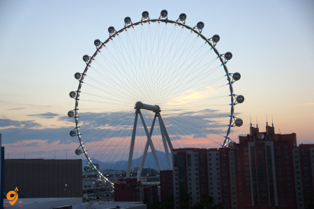
The High Roller Observation Wheel provides breathtaking panoramic views of the entire Las Vegas Valley, offering a perspective that helps visitors comprehend the true scale of this desert metropolis. Standing 550 feet tall, this giant Ferris wheel offers 30-minute rides in climate-controlled cabins that can accommodate up to 40 people each. Visitors frequently describe the sunset and nighttime rides as transformative experiences that put the city’s scale and beauty into perspective. The engineering achievement here involves creating a smooth, stable ride experience at this height while providing unobstructed views through floor-to-ceiling windows.
Red Rock Canyon National Conservation Area
Red Rock Canyon National Conservation Area surprises many visitors who expect Las Vegas to be entirely urban, demonstrating how this region’s natural beauty extends far beyond the famous Strip. Located just 20 minutes west of the Strip, this natural wonder features stunning red sandstone formations created over millions of years through geological processes. The 13-mile scenic drive receives exceptional reviews from those seeking a peaceful contrast to the city’s energy. Understanding the geological history here helps visitors appreciate how these dramatic rock formations developed through layers of sediment deposited in ancient seas, then uplifted and carved by erosion.
Address & Location
- 1000 Scenic Loop Drive Las Vegas
- Located approximately 17 miles west of Las Vegas Strip
- Nevada State Route 159 (SR 159) is the most convenient way in and out of the conservation area
Opening Hours
- The Visitor Center and Elements Book and Gift Store open at 8:00am and close at 4:30pm
- Scenic Drive hours vary by season
Public Transportation Status
Important Transportation Note
- Unfortunately there are no public transportation services that can take you from Las Vegas to Red Rock Canyon. Most visitors drive their own vehicles or rent a vehicle to enjoy Red Rock Canyon. Shuttle service is not available around
Limited Public Transit Options
- RTC Southern Nevada operates a bus from Bonneville Transit Center Bay 6 to SB Pavilion Center after Charleston every 20 minutes
- The best way to get from Las Vegas Strip to Red Rock Canyon National Conservation Area without a car is to line 203 bus and taxi which takes 55 min
- Bus service only goes partway – requires taxi or ride service for final portion
Bus Route Information
- The RTC 203 – Spring Mtn. / Desert Inn / Lamb bus serves 83 bus stops in the Las Vegas area
- From westbound Sahara Avenue, travel north on Fort Apache Road, west on Charleston and continue on route to Red Rock Resort
- Route 203 connects to Charleston Boulevard area
Nearby Parking Facilities
Visitor Center Parking
- Large paved parking area at Red Rock Canyon Visitor Center
- Free parking available at visitor center
- Additional parking along Scenic Drive at various viewpoints and trailheads
- Overflow parking areas during peak seasons
Alternative Access Points
- Parking at individual trailheads along Scenic Drive
- Calico Hills parking areas
- Various pullout areas along the 13-mile scenic loop
Nearby Attractions & Points of Interest
Within Red Rock Canyon
- 13-mile Scenic Drive loop
- Red Rock Canyon Visitors Center. This beautiful LEED certified facility
- Calico Hills area
- Keystone Thrust area
- Various hiking trails and rock formations
Nearby Area Attractions
- Red Rock Casino Resort & Spa
- Fashion Show Mall (connection point for some shuttle services)
- Desert hiking trails
- Rock climbing areas
Valley of Fire State Park
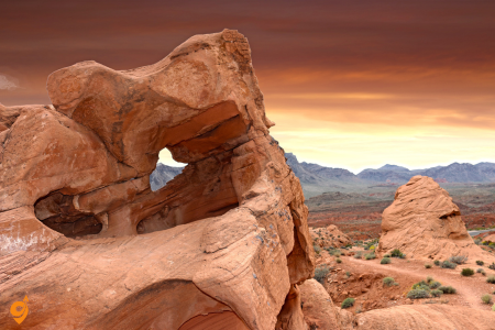
Valley of Fire State Park extends the natural beauty experience beyond Red Rock Canyon, offering even more dramatic geological formations that showcase the region’s ancient history. Located about an hour northeast of Las Vegas, this park features red rock formations, ancient petroglyphs created by Native American peoples, and hiking opportunities that range from easy walks to challenging climbs. Day trips here consistently earn five-star reviews from visitors seeking outdoor adventures. The park’s name comes from the brilliant red Aztec sandstone formations that appear to be on fire when reflecting the sun’s rays.
ADDRESS & CONTACT
- 29450 Valley of Fire Road, Overton, Nevada 89040
- Phone: (702) 397-2088
- Located 50 miles northeast of Las Vegas
OPENING HOURS
- Open daily from 8:30 AM to 4:30 PM (visitor center)
- Closed Christmas Day
- Park open sunrise to sunset with 24-hour access to campgrounds
PUBLIC TRANSPORTATION
- No direct public transportation available
- Limited bus + taxi combination options:
– RTC Line 113 bus + taxi (approximately 1 hour 41 minutes)
– RTC Line 203 bus + taxi from Las Vegas Strip (approximately 2 hours 19 minutes)
– From airport: Line 109 + Line 113 buses + taxi (approximately 2 hours 53 minutes)
DRIVING DIRECTIONS
- Take Interstate 15 North from Las Vegas Strip area for 30-35 miles
- Total driving distance: approximately 55.6 miles
- Driving time: approximately 1 hour 11 minutes
PARKING
- On-site parking available at visitor center
- Parking at various trailheads throughout the park
- Multiple roadside stops with parking areas
NEARBY ATTRACTIONS
- Lake Mead National Recreation Area
- Hoover Dam
- Stop on road trips to other national parks
- Red Rock Canyon (different direction from Las Vegas)
- Zion National Park (further north)
PARK HIGHLIGHTS
- Nevada’s oldest state park, established 1935
- Covers over 42,000 acres
- Visitor center with park information
- Popular trails: Seven Wonders Trail, Pastel Canyon Trail, White Domes Trail
- Fire Wave – main attraction
- 72 first-come, first-served campsites available
The Forum Shops at Caesars Palace
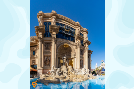
The Forum Shops at Caesars Palace revolutionized shopping mall design with its Roman-themed architecture, painted sky ceiling that changes from dawn to dusk, and animatronic shows featuring Roman gods. Beyond shopping, visitors praise the immersive environment that makes browsing feel like exploring an ancient city. The combination of luxury retail and theatrical presentation creates a unique experience that demonstrates how Las Vegas transforms ordinary activities into entertainment spectacles.
Hoover Dam
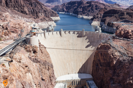
Hoover Dam represents an engineering marvel that showcases human ingenuity during one of America’s most challenging historical periods. Located about 45 minutes southeast of the city, this Depression-era construction project continues to inspire visitors with its massive scale and historical significance. Tours of the facility consistently receive high ratings for their educational value and the impressive views of Lake Mead. Understanding the dam’s construction helps visitors appreciate how thousands of workers overcame extreme desert conditions to create this concrete arch-gravity structure that still provides power and water to millions of people across the Southwest.
ADDRESS & LOCATION
- Located 30 miles southeast of Las Vegas, on the Nevada-Arizona border
- The Dam does not have a street address, simply enter “Hoover Dam”
- Hoover Dam Access Road, Boulder City, NV 89005
- Located near Boulder City, Nevada
OPENING HOURS
- Visitor Center: Open daily 9:00 AM – 5:00 PM
- Doors close at 4:15 PM
- Last guided tour departs at 3:45 PM
- Closed Thanksgiving and Christmas Day
PUBLIC TRANSPORTATION
- RTC buses from South Strip Transit Terminal Bay 15 to Boulder City area
- Journey including transfers takes approximately 2 hours 47 minutes
- From Las Vegas Airport: RTC bus services to SB Eastern after Serene station
- RTC Transit serves Boulder City as part of the Las Vegas Valley system
- Limited direct public transit to the dam itself – buses serve Boulder City area
PARKING
- Parking garage located on the Nevada side
- Garage parking open daily 8:00 AM – 5:15 PM
- Parking Lot 9: Surface lot closest to the dam on Arizona side
- Paid parking available
- Stroller parking available on the plaza
NEARBY ATTRACTIONS
- Mike O’Callaghan-Pat Tillman Memorial Bridge – 890 feet above Colorado River
- Alan Bible Visitor Center with Lake Mead National Recreation Area map
- Hemenway Park in Boulder City – desert bighorn sheep viewing
- Historic Boulder Dam Hotel
- Lake Mead National Recreation Area
BRIDGE ACCESS
- View from Mike O’Callaghan-Pat Tillman Memorial Bridge at 900 feet above Colorado River
- World’s tallest concrete arch span bridge walkway
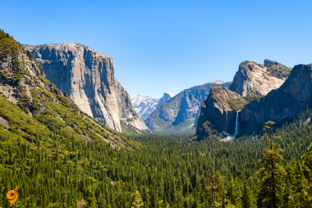
Yosemite National Park showcases granite formations carved by glacial action over millions of years, creating vertical cliff faces, hanging valleys, and cascading waterfalls that define some of America’s most iconic wilderness scenery. The park’s crown jewel, Yosemite Valley, represents just eight square miles of the park’s total 1,200 square miles, yet contains the most famous attractions including Half Dome, El Capitan, and Yosemite Falls within an easily accessible valley floor.
Half Dome’s distinctive shape results from glacial erosion that carved away the rock’s eastern face, creating a nearly vertical granite wall that rises 4,737 feet above sea level and challenges rock climbers from around the world. El Capitan stands as a 3,000-foot vertical granite monolith that has become the ultimate test for rock climbers, with ascents taking anywhere from a few hours for world-class climbers to several days for most people attempting the challenging routes.
Yosemite Falls, North America’s tallest waterfall, drops 2,425 feet in three sections, with spring snowmelt creating the most spectacular flows that gradually diminish through summer and may completely dry up by late fall. The park’s giant sequoia groves, particularly the Mariposa Grove, contain trees over 2,000 years old and up to 30 feet in diameter, creating cathedral-like spaces where you can walk among some of the largest living organisms on Earth. The park’s elevation ranges from 2,000 feet in the western foothills to over 13,000 feet in the high country, creating diverse ecosystems that support everything from oak woodlands to alpine meadows filled with wildflowers during the brief mountain summer.
The National Mall and Memorial Parks
The National Mall and Memorial Parks stands as the heart of American democracy and history. This expansive green space stretches from the Capitol Building to the Lincoln Memorial, creating what many consider the most important two miles in America. Think of it as an outdoor museum where each monument and building tells a different chapter of the American story.
Visitors are drawn here because it offers an unparalleled concentration of monuments and museums, allowing you to walk through centuries of American history in a single afternoon. The Mall’s design itself teaches us about democratic ideals – it’s completely open to the public, free to access, and designed so that no single monument dominates the others, reflecting the principle that in democracy, no one person or idea should overshadow the collective story.
Address & General Information
- National Mall and Memorial Parks, Washington, DC 20024
- Open 24 hours daily, year-round
- Free admission to the National Mall area
- Individual museums and monuments may have specific hours
Public Transportation
Metro Rail (Metrorail)
Nearby Metro Stations:
- Archives-Navy Memorial Penn Quarter Station – 6-minute walk from National Gallery West Building
- L’Enfant Plaza Station – Central location for Mall access
- Smithsonian Station – Blue/Orange/Silver Lines
- Federal Triangle Station – Blue/Orange/Silver Lines
- Union Station – Red Line (eastern end near Capitol)
- Foggy Bottom Station – Blue/Orange/Silver Lines (western end)
Metro Lines Serving the Area:
- Blue Line
- Orange Line
- Silver Line
- Red Line
- Green Line
- Yellow Line
Bus Transportation
Metrobus:
- Regular Metrobus service stops along Constitution Avenue NW
Nearby Stops:
- 3rd St & Pennsylvania Ave
- CONSTITUTION AVE & 3RD ST NW wb
- Pennsylvania Av NW & Constitution Av NW
- 7th St & Constitution Av, NW
Lines: 681, 881, 883, 884, 885, 886, 230, 250, 735, 850, 32, 36, 70, 74, D1X, D40, D60, 335, 345
DC Circulator:
- National Mall Route connects Washington Monument, National Air and Space Museum, National Gallery, and Lincoln Memorial
- Multiple circulator routes throughout DC
Parking Options
Street Parking:
- General visitor parking available along Ohio Drive, SW between Lincoln and Thomas Jefferson Memorials
- Limited metered street parking around the Mall perimeter
- Constitution Avenue and Independence Avenue (limited spaces)
Parking Limitations:
- No public parking facility at the Smithsonian on the National Mall
- National Gallery has limited parking spaces for vehicles with disability parking permits only
- Most museums recommend public transportation
Nearby Parking Garages:
- Ronald Reagan Building garage
- Union Station garage
- Private parking lots in surrounding areas
Transportation Companies
- Washington Metropolitan Area Transit Authority (WMATA) – Metro system
- DC Circulator – City bus service
- Metrobus – Regional bus service
- Capital Bikeshare – Bike sharing system
- Various private taxi companies
- Uber and Lyft rideshare services
Nearby Major Attractions
- Smithsonian Museums (Natural History, Air & Space, American History)
- National Gallery of Art
- Washington Monument
- Lincoln Memorial
- Jefferson Memorial
- U.S. Capitol Building
- White House
- Vietnam Veterans Memorial
- Korean War Veterans Memorial
- World War II Memorial
- Reflecting Pool
- Tidal Basin
Access Points
Highway Access:
- Interstate 395 from the South
- Interstate 66 from the West
- Interstate 495 (Beltway) connections
- New York Avenue from the Northeast
- Route 50 from the East
The Lincoln Memorial
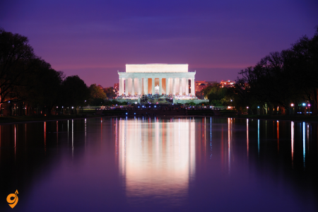
The Lincoln Memorial represents more than just a monument to our 16th president. Its strategic positioning at the western end of the National Mall, combined with its role in pivotal moments like Martin Luther King Jr.’s “I Have a Dream” speech, makes it a pilgrimage site for those seeking to understand American ideals of freedom and equality. The memorial’s design teaches us about the power of symbolism – Lincoln sits in a chair resembling a throne, but his posture is contemplative rather than commanding, suggesting that true leadership comes from thoughtful consideration rather than authoritarian power. The inscribed speeches on the walls aren’t just decorative text, but carefully chosen words that continue to challenge visitors to think about what equality and unity really mean in practice.
Address & General Information
- 2 Lincoln Memorial Circle NW, Washington, DC 20037
- Located at SW & Daniel Chester French Dr. SW
- Open 24 hours a day, every day of the year
- Rangers are on duty from 9:30 a.m. to 10 p.m. daily
- Free admission
Public Transportation
Metro Rail (Metrorail)
Nearest Metro Stations:
- Foggy Bottom Station – Orange, Blue and Silver lines: Approximately 0.7 miles (10-15 minute walk)
- Smithsonian Station – Orange, Blue and Silver lines: Approximately 0.8 miles (15-20 minute walk)
- Foggy Bottom Station is the closest to the Lincoln Memorial
Bus Transportation
Metrobus:
Nearby Stops:
- Constitution Ave NW & 22nd St NW
Lines: 3F, A49, 16Y
DC Circulator:
- Circulator usually arrives at its various stops every 10 minutes
- Hours of operation are from 7 am to 7 pm on weekdays and 9 am to 7 pm on weekends
- National Mall Route serves Lincoln Memorial
Parking Options
Free Parking:
- General visitor parking is available along Ohio Drive, SW between the Lincoln and Thomas Jefferson Memorials
- Parking on-site on Ohio Drive, located south of Lincoln Memorial, is free
Metered Street Parking:
- Limited street parking near Lincoln Memorial, on 22nd and 23rd Street, costs $2.30 when meters are in effect
- On-street spots along Ohio Drive SW with 3-hour time limit
Parking Garages:
- Ronald Reagan Building garage at 1300 Pennsylvania Avenue NW
- Main entrance is on 14th Street between Constitution and Pennsylvania Avenues
- Lincoln Memorial parking garage rates range from $10-$15 an hour
Nearby Attractions (Walking Distance)
- Reflecting Pool
- World War II Memorial
- Vietnam Veterans Memorial
- Korean War Veterans Memorial
- Washington Monument
- Jefferson Memorial
- Franklin Delano Roosevelt Memorial
- Martin Luther King Jr. Memorial
- Tidal Basin
- Constitution Gardens
- National Mall
Highway Access
- Interstate 66 from Virginia
- Interstate 395 from the South
- George Washington Memorial Parkway
- Constitution Avenue NW
- Independence Avenue SW
- 23rd Street NW
The Washington Monument
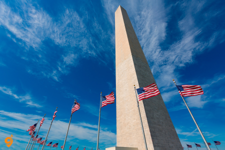
The Washington Monument serves as the city’s most recognizable landmark, offering visitors a literal and figurative high point of their visit. The recently renovated elevator ride to the top provides breathtaking 360-degree views that help visitors grasp the city’s careful urban planning and architectural harmony. From this vantage point, you can see how the city’s designers created sight lines that connect different monuments and buildings, reinforcing the idea that American government and history are interconnected. The monument’s simple obelisk design contrasts sharply with the ornate memorials around it, teaching us that sometimes the most powerful statements are the most understated ones.
The United States Capitol Building

The United States Capitol Building functions as both a working government building and a symbol of democratic governance. Tours consistently receive high marks because they combine architectural beauty with the excitement of potentially witnessing democracy in action, as visitors sometimes encounter lawmakers conducting the nation’s business. The building’s dome, visible from throughout the city, serves as a constant reminder that in a democracy, government should be transparent and accessible to the people. The Capitol’s architecture itself tells the story of American growth – you can see how the building has been expanded and renovated over time, much like the democracy it houses has evolved and adapted to changing circumstances.
The White House and White House Visitor Center

The White House and White House Visitor Center represents the ultimate intersection of history and current events. While security restrictions limit access to the building itself, the visitor center provides context that helps people understand both the presidency as an institution and the building as a living piece of history. The visitor center does something particularly clever – it shows how the White House serves multiple functions simultaneously as a family home, executive office, ceremonial space, and symbol of American democracy. This helps visitors understand the complex nature of democratic leadership, where public servants must balance personal lives with enormous public responsibilities.
The Jefferson Memorial
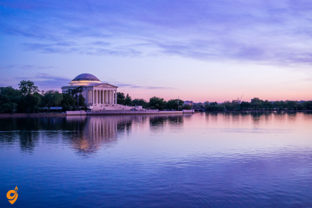
The Jefferson Memorial offers a more contemplative experience than its larger counterparts. Positioned beautifully along the Tidal Basin, it’s particularly celebrated during cherry blossom season, when the combination of natural beauty and architectural elegance creates an almost meditative atmosphere. The memorial’s circular design, inspired by the Pantheon in Rome, reflects Jefferson’s belief in the perfectibility of democratic institutions. The carefully selected quotations from Jefferson’s writings that adorn the walls don’t just honor the man, but challenge visitors to think about concepts like religious freedom, education, and the pursuit of happiness that remain relevant today.
Address & General Information
- 16 E Basin Dr. SW, Washington, DC 20242
- Open 24 hours a day
- Rangers are available daily from 9:30 AM to 10:00 PM, except on Christmas Day
- Located on the Tidal Basin
- Free admission
Public Transportation
Metro Rail (Metrorail)
Nearest Metro Stations:
- L’Enfant Station {Approximately 0.8 miles (15-20 minute walk)} – one of the easiest places from which to get to the Jefferson Memorial
- Smithsonian Station{ Approximately 1.0 mile (20-25 minute walk)} – along with L’Enfant Station, one of the easiest places to get to the Jefferson Memorial
- Capitol South Station
- Federal Center SW Station
DC Circulator:
- National Mall Route provides service to the area
- Connects multiple monuments and memorials
- Regular service during operating hours
Parking Options
Free Parking:
- On-street spots along Ohio Drive SW with 3-hour time limit
- Lots A, B, and C behind the Jefferson Memorial
- Free general parking available on Ohio Drive SW next to the Potomac River
- West Basin Drive parking
- Tidal Basin parking lot along Maine Ave., SW
Nearby Attractions (Walking Distance)
- Franklin Delano Roosevelt Memorial
- Martin Luther King Jr. Memorial
- Tidal Basin Cherry Blossoms
- George Mason Memorial
- Korean War Veterans Memorial
- Lincoln Memorial
- Washington Monument
- World War II Memorial
- Reflecting Pool
- Bureau of Engraving and Printing
- Holocaust Memorial Museum
Highway Access
- Interstate 395 from the South
- Interstate 66 from Virginia
- George Washington Memorial Parkway
- Independence Avenue SW
- Maine Avenue SW
- 14th Street SW
- Ohio Drive SW
The World War II Memorial
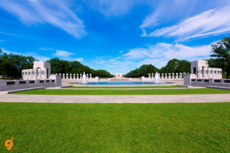
The World War II Memorial serves as a masterclass in how to honor collective sacrifice while maintaining individual dignity. Located strategically between the Washington Monument and Lincoln Memorial, it represents America’s role in the global struggle against fascism during the 1940s. What makes this memorial particularly powerful is how it balances national pride with solemn remembrance – the design celebrates victory while never forgetting the enormous cost of that victory. The memorial features 56 pillars representing U.S. states and territories, demonstrating how the war effort required participation from every corner of the nation. The Freedom Wall with its 4,048 gold stars, each representing 100 American military deaths, provides a stark visual reminder that freedom often comes at an enormous price. The memorial’s fountains and reflecting pools create spaces for quiet reflection, encouraging visitors to consider not just what was won, but what was lost, and how those lessons apply to contemporary challenges.
The Kennedy Center
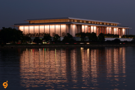
The Kennedy Center rounds out this list by representing America’s commitment to arts and culture. Its multiple theaters and concert halls, combined with free daily performances, demonstrate how cultural institutions can serve both as entertainment venues and as symbols of a society’s values. The Center’s position along the Potomac River, slightly removed from the main government buildings, suggests that while arts and culture are essential to democracy, they flourish best when they maintain some independence from political power. The building’s modern design contrasts with the classical architecture of most D.C. monuments, reflecting how American culture continues to evolve and embrace new forms of expression.
Pearl Harbor National Memorial on Oahu
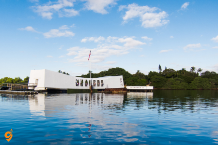
Pearl Harbor National Memorial on Oahu stands as Hawaii’s most visited historical site, drawing over 1.8 million visitors annually. This memorial complex teaches us about one of the most pivotal moments in American history through multiple interconnected experiences. The USS Arizona Memorial, built directly over the sunken battleship, creates a profound emotional connection by allowing visitors to stand above the final resting place of 1,177 sailors and Marines. What makes this site particularly powerful is how it transforms a tragic historical event into a learning experience about resilience, remembrance, and the importance of peace. The memorial doesn’t just tell you what happened on December 7, 1941, but helps you understand how that single day changed the course of world history and continues to influence international relations today.
Waikiki Beach on Oahu
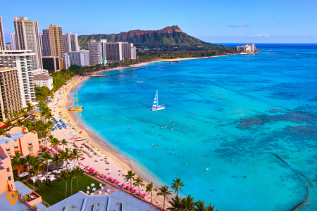
Waikiki Beach on Oahu represents the perfect introduction to Hawaiian beach culture, combining natural beauty with cultural accessibility. This two-mile stretch of sand receives millions of visitors because it successfully balances the authentic Hawaiian experience with modern conveniences. Think of Waikiki as Hawaii’s classroom for beginners – the waves are gentle enough for first-time surfers, the beach is wide enough to accommodate large crowds without feeling cramped, and the surrounding area offers everything from traditional Hawaiian music to world-class dining. The beach’s consistent popularity stems from its ability to deliver the classic Hawaiian experience while providing the infrastructure that makes visitors feel comfortable and safe.
Termessos Ancient CitHaleakala National Park on Maui
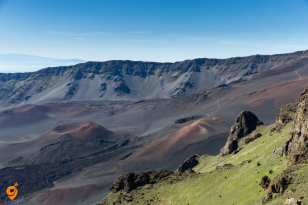
Haleakala National Park on Maui offers one of the world’s most dramatic sunrise experiences, where visitors witness the sun emerging from above a sea of clouds at 10,023 feet above sea level. This dormant volcano teaches us about geological time scales that dwarf human history – the crater you’re looking into was formed over millions of years through volcanic activity and erosion. The park’s popularity comes from how it makes the abstract concept of deep time tangible and immediate. When you stand at the rim watching sunrise paint the crater walls in shifting colors, you’re not just seeing a pretty view, but witnessing the same daily cycle that has played out for millions of years, helping you understand your place in the larger story of our planet.
Volcanoes National Park on the Big Island
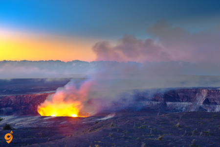
Volcanoes National Park on the Big Island provides the rare opportunity to witness the Earth actively creating new land through ongoing volcanic activity. This park consistently ranks among Hawaii’s top destinations because it offers something truly unique – the chance to see our planet’s creative forces at work. The park teaches us about the dynamic nature of Earth’s surface and helps us understand how the Hawaiian Islands themselves were born from the ocean floor through volcanic activity. When you walk across hardened lava fields or see glowing lava meeting the ocean, you’re witnessing the same geological processes that created every piece of land on Earth, just happening at a speed humans can actually observe and comprehend.
The Road to Hana on Maui
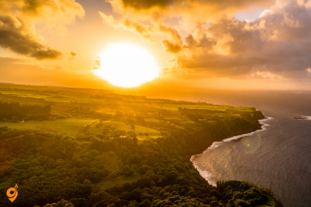
The Road to Hana on Maui represents one of the world’s most scenic drives, featuring 64 miles of winding coastal highway with over 600 curves and 54 bridges. This journey consistently receives top ratings because it transforms travel from a means to an end into an experience worthy of a full day. The road teaches patience and mindfulness – you can’t rush this drive, and attempting to do so means missing waterfalls, beaches, and viewpoints that make the journey worthwhile. Think of the Road to Hana as a moving meditation on the relationship between journey and destination, where the winding path through tropical rainforest and along dramatic coastlines becomes as important as any single stop along the way.
Diamond Head State Monument on Oahu
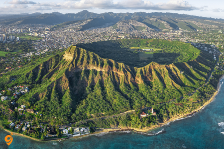
Diamond Head State Monument on Oahu offers the perfect combination of moderate physical challenge and spectacular reward. This extinct volcanic crater provides 360-degree views of Honolulu, Waikiki, and the Pacific Ocean after a manageable hike that takes most visitors 30-45 minutes. The monument’s popularity stems from its accessibility – it’s challenging enough to feel like an accomplishment but not so difficult that it excludes casual hikers. Diamond Head teaches us about the relationship between effort and reward, demonstrating how a relatively small investment of energy can yield disproportionately large benefits in terms of perspective and understanding of place.
Lanikai Beach on Oahu
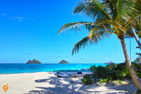
Lanikai Beach on Oahu consistently ranks among the world’s most beautiful beaches due to its powder-soft white sand, crystal-clear turquoise water, and backdrop of dramatic mountains. This beach receives top ratings because it delivers the postcard-perfect Hawaiian beach experience without the commercial development that characterizes many other popular beaches. Lanikai teaches us about the importance of preservation – its beauty persists because it remains relatively undeveloped, showing how natural spaces can maintain their appeal when protected from excessive human intervention. The beach’s consistent perfection helps visitors understand what makes Hawaiian beaches special and why they’re worth protecting.
Na Pali Coast State Park on Kauai
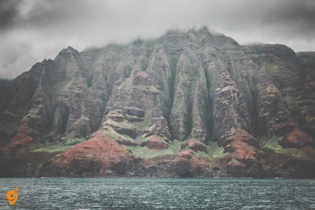
Na Pali Coast State Park on Kauai showcases some of the most dramatic coastal scenery in the world, with towering cliffs, hidden beaches, and lush valleys accessible only by hiking, boat, or helicopter. This coastline consistently receives top ratings because it represents Hawaii in its most pristine, untouched state. The Na Pali Coast teaches us about the power of isolation to preserve natural beauty – because much of this coastline remains inaccessible by car, it maintains the wild character that once defined all of Hawaii. When you experience these cliffs and valleys, you’re seeing Hawaii as it existed before human development, helping you understand both what has been lost elsewhere and what can be preserved for future generations.
Polynesian Cultural Center on Oahu
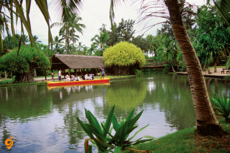
Polynesian Cultural Center on Oahu provides comprehensive education about Pacific Island cultures through authentic demonstrations, performances, and interactive experiences. This center consistently ranks among Hawaii’s top attractions because it addresses a crucial gap in many visitors’ understanding – while people come to Hawaii for its natural beauty, they often leave without understanding the rich cultural heritage that gives these islands their unique character. The center teaches us about the diversity within Polynesian culture and helps visitors understand that Hawaii’s appeal goes far beyond beaches and volcanoes to include sophisticated traditions of navigation, agriculture, art, and social organization that sustained Pacific Island societies for thousands of years.
South Beach and Ocean Drive
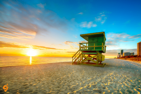
South Beach and Ocean Drive represents Miami’s most iconic destination, where Art Deco architecture meets pristine Atlantic coastline. This area consistently receives top ratings because it successfully combines multiple experiences into one walkable neighborhood. Think of South Beach as Miami’s stage where the city performs its most famous act – the intersection of Latin culture, international glamour, and American beach lifestyle. The beach itself stretches for miles with soft white sand and clear blue water, but what makes it truly special is how it integrates with the surrounding cultural landscape. Ocean Drive’s pastel-colored Art Deco buildings from the 1930s create a unique architectural backdrop that you won’t find anywhere else in America, teaching us how preservation of historic districts can enhance rather than conflict with modern tourism and nightlife.
Address & Location
- South Beach (Art Deco District) spans from 5th Street to 15th Street, between Ocean Drive and Washington Avenue, Miami Beach, FL 33139
- Distance from Miami International Airport: 12.5 miles (20.12 kilometers)
- Distance from Downtown Miami: 8 miles (13 kilometers)
Operating Hours
- Miami Beach Trolley: 8 a.m. to 11 p.m. daily
- Beach Bus Route 150: 6 a.m. – 11:40 p.m. daily
- Parking garages: Generally 24/7 availability
- Street parking: Various time restrictions apply
Public Transportation
Miami Beach Trolley (Free)
- Operates 15 hours daily (8 a.m. to 11 p.m.), 7 days a week
- Approximately 20-minute service frequency
- Free service with stops throughout South Beach and Collins Avenue to Mid-Beach and North Beach neighborhoods
Miami Beach Circulator Bus
- Travels through the Art Deco District with stops at over 20 points of interest
- Bi-directional route on Washington and West Avenues from South Pointe to 17th Street/Convention Center
Beach Bus Route 150
- Runs every 30 minutes from 6 a.m. – 11:40 p.m., seven days a week
- Connects Miami International Airport Metrorail station to Miami Beach (41st Street to South Pointe Drive)
Metrobus System
Nearby Stops:
- Washington Av & 13 St
- Washington Av & 13 St
- Washington Av & 15 St
Lines: 14, 100, 150,
Parking Facilities
Municipal Parking
- 27 Municipal Parking Lots and 9 Parking Garages in South Beach
- Combined offer over 7,000 parking spaces
- City manages 66 surface parking lots and 12 garages citywide
Major Parking Garages
- Fifth & Alton Garage (about 20-minute walk from beach)
- Sunset Harbour Garage (19th Street and Bay Road)
- 42nd Street Garage (between Royal Palm and Sheridan Avenues)
Parking Apps & Booking
- SpotHero – For advance parking reservations
- SpotAngels – For finding free parking spots
ParkWhiz (parking bookings)
- Various parking apps available for rate comparison
Nearby Attractions
- Ocean Drive (iconic Art Deco architecture)
- South Beach (world-famous beach)
- Lincoln Road (pedestrian shopping mall)
- Art Deco Historic District
- Versace Mansion
- Bass Museum of Art
- Miami Beach Botanical Garden
- South Pointe Park
- Lummus Park
Art Deco Historic District
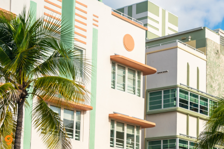
Art Deco Historic District extends beyond just Ocean Drive to encompass the world’s largest collection of Art Deco architecture, with over 800 buildings representing this distinctive 1930s design movement. This district receives exceptional ratings because it transforms an entire neighborhood into an outdoor museum where visitors can experience how design philosophy shaped urban living. The Art Deco style here teaches us about optimism during difficult times – these buildings were constructed during the Great Depression, yet their bright colors, geometric patterns, and futuristic elements expressed hope and confidence in the future. When you walk through these streets, you’re not just admiring pretty buildings, but learning how communities can use design and architecture to create identity and maintain morale during challenging periods.
Vizcaya Museum and Gardens
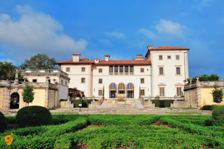
Vizcaya Museum and Gardens offers visitors the chance to experience European-style opulence in a tropical setting through this early 20th-century mansion and its elaborate formal gardens. This destination consistently ranks among Miami’s top attractions because it provides historical context for understanding how Miami developed from a small frontier town into an international destination. Vizcaya teaches us about the Gilded Age mentality that shaped much of Florida’s development, when wealthy industrialists like James Deering created lavish winter retreats that demonstrated American prosperity and cultural sophistication. The mansion’s 34 rooms filled with European antiques and the ten-acre formal garden show us how landscape design can create outdoor rooms that extend living spaces into natural settings.
Address & Location
- 3251 South Miami Avenue, Miami, FL 33129
- Located 2 miles southwest of Brickell City Centre
- Situated on Biscayne Bay in the Coconut Grove neighborhood
Opening Hours
- Wednesday through Monday beginning at 9:30 a.m.; last admission is at 4:30 p.m.
- The Main House is open until 5:00 p.m. and the gardens until 5:30 p.m.
- Closed on Tuesdays
Public Transportation
Metrorail
- Take the Metrorail to the Vizcaya station, and from there, it’s just a short walk to the museum grounds
- Walk about 15 minutes from Vizcaya Station to the museum
- Easy access from the Vizcaya Metrorail station
Metrobus
Nearby Stops:
- S Miami Av & Samana Dr
- Vizcaya Metrorail station
- S Miami Av & 3251 (Op Museum)
- S Miami Av & SE 32 Rd
Lines:12, 17, 24, Coral Way, 12, Brickell
Parking Facilities
- Free parking available on-site
- Parking is available on-site
- Use the parking lot from South Miami Avenue
- On-site parking lot with direct access to museum entrance
Transportation Companies
- Miami-Dade Transit (Metrorail and Metrobus)
- Gray Line Miami (tour services)
- Musement (transportation with admission packages)
Nearby Attractions
- Ermita de la Caridad
- American Museum of the Cuban
- Coconut Grove neighborhood attractions
- Biscayne Bay waterfront activities
- Sailing Adventure in Miami’s Biscayne Bay National Park
- Peacock Park
- CocoWalk shopping and dining complex
- Miami Marine Stadium (historic venue)
Nearby Transportation Hubs
- Vizcaya Metrorail Station (closest rail access)
- Coconut Grove Metrorail Station
- Brickell City Centre area (multiple transport options)
- Downtown Miami transit connections
Museum Features
- A National Historic Landmark, 1916 waterfront estate home with 32 decorated rooms and 10 acres of formal gardens
- Extensive Italian Renaissance gardens, native woodland landscape, and a historic village outbuildings compound
- Bayfront location with scenic views
Wynwood Walls and Arts District

Wynwood Walls and Arts District has transformed from an industrial warehouse district into the world’s premier outdoor street art museum, featuring works by internationally renowned muralists and graffiti artists. This area receives top ratings because it demonstrates how art can completely revitalize urban neighborhoods while creating new forms of cultural expression. Wynwood teaches us about the evolution of art from traditional gallery spaces to public walls where artists can create works at enormous scale for massive audiences. The district shows how street art has matured from underground rebellion to legitimate artistic movement, helping visitors understand how cultural boundaries shift over time and how communities can embrace change while maintaining authentic character.
Address & Location
- Main entrance: 266 NW 26th Street – Welcome Center
- 2520 Northwest 2nd Avenue
- Alternative address: 2214 NW 1st Place, Miami, FL 33127
Opening Hours
- 10AM – 7PM (Tuesday through Sunday)
- Closed Mondays (except for special events)
- Timed and ticketed system – advance booking recommended
Public Transportation
Metrobus
Nearby Stops:
- NW 20 St & NW 2 Av
- NW 2 Av & NW 20 St
- NW 2 Av & NW 22 St
- NW 2 Av & NW 25 St
Lines: 2, 20, 32
Metromover Connections
- Free rides on Metromover
- $2.25 transfer fee to Metrorail or Metrobus
- 20 conveniently-located stations, one about every two blocks
- Connect at Omni Terminal station
Parking Options
Street Parking
- Metered parking available throughout Wynwood
- Check time limits and payment requirements
Parking Garages & Lots
- LAZ Parking – advance reservation available
- Private lots throughout the district
- Valet parking at some venues
Nearby Parking Facilities
- NW 2nd Avenue area
- NW 1st Place vicinity
- Various private parking companies
Nearby Attractions
- Wynwood galleries and boutiques
- Monthly Art Walk showcasing neighborhood’s best galleries
- Design District (adjacent neighborhood)
- Midtown Miami
- American Airlines Arena
- Bayside Market Place
- Miami-Dade College campuses
Getting Around Within Wynwood
- Easily accessible by public transportation
- Walkable neighborhood
- Street art spread all around the area
- Multiple entrance points to the district
Little Havana and Calle Ocho
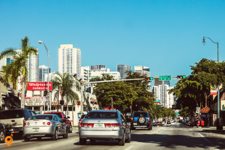
Little Havana and Calle Ocho provides an immersive experience in Cuban-American culture, where visitors can observe daily life in Miami’s most famous immigrant community. This neighborhood consistently receives high ratings because it offers authentic cultural experiences rather than manufactured tourist attractions. Little Havana teaches us about the American immigrant experience through the specific lens of Cuban exile community that has maintained its cultural identity while adapting to life in the United States. When you watch dominoes games in Maximo Gomez Park or listen to live music at local venues, you’re witnessing how displaced communities recreate home in new places while contributing their traditions to the broader American cultural landscape.
Address & Main Location
- Main reference address: 1501 SW 8th Street, Miami FL 33135
- Heart of Little Havana: SW 8th Street (Calle Ocho)
- Domino Park: 1444 SW 8 ST, Miami 33135
- Corner of SW 8th Street (Calle Ocho) and 15th Avenue
Opening Hours
- Domino Park: 9 am – 6 pm daily
- Street (Calle Ocho): Open 24/7 for walking and viewing
- Businesses: Individual hours vary – mostly 9 AM – 10 PM
- Best visiting times: Early morning or around sunset
Public Transportation
Metrobus
Nearby Stops:
- SW 8 St & SW 5 Av
- SW 7 St & SW 5 Av
Lines: 8, 208, 207, MIAHAVA
Miami Trolley
- Service along SW 8th St from SW 37th Ave to SW 4th Ave
- Eastbound service uses SW 1st St
- Free trolley service available
Parking Options
Street Parking
- Metered parking on the road
- Metered parking spots along Calle Ocho
- Street-parking only in Little Havana
Nearby Attractions
- Máximo Gómez Park (Domino Park) – hidden gem on historic Calle Ocho
- Domino games daily from sunrise to sunset
- Tower Theater
- Little Havana Visitor Center near Domino Park
- Cuban Memorial Boulevard
- Bay of Pigs Museum
- José Martí Park
- Cuban restaurants and cigar shops along Calle Ocho
- Ball & Chain (historic venue)
- Azucar Ice Cream Company
Getting Around Within Little Havana
- Easiest and most convenient way is by transit or walking
- Calle Ocho is a fun and easy stroll
- Walkable neighborhood – main attractions within walking distance
- Pick up neighbourhood maps at Little Havana Visitor Center
Bayside Marketplace and Port of Miami
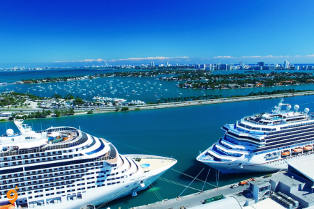
Bayside Marketplace and Port of Miami serves as the gateway to Miami’s maritime culture, where visitors can shop, dine, and catch boats to various destinations throughout Biscayne Bay and beyond. This destination receives top ratings because it successfully combines commerce with access to Miami’s aquatic lifestyle. Bayside teaches us about Miami’s role as a major international port and how water access has shaped the city’s development and character. The marketplace demonstrates how waterfront development can create public spaces that serve both residents and tourists while maintaining access to the water that makes Miami unique among American cities.
Address & Location
- 401 Biscayne Blvd, Miami, FL 33122
- (305) 577-3344
- Located in the epicenter in the heart of downtown Miami
Opening Hours
- Monday-Thursday: 10:00AM-10:00PM
- Friday-Saturday: 10:00AM-11:00PM
- Sunday: 11:00AM-9:00PM
- Individual store and restaurant hours vary and may differ
Public Transportation to Bayside
Metromover Access
- Bayside Marketplace is directly connected to Metromover stations
- 20 conveniently-located Metromover stations, one about every two blocks
- Cars arrive every 90 seconds during rush hours and every 3 minutes during off-peak hours
- Bayfront Park Station (closest to Bayside)
Metrobus Routes
Nearby Stops:
- Biscayne Blvd & NE 4 St
Lines: 3, 100, 101, 203, CoralWay, MIABIS
Parking at Bayside Marketplace
- Use parking apps like SpotHero, ParkWhiz, or ParkMobile to find and reserve parking in advance
- Arrive early: Beat the crowds by arriving before noon, especially on weekends
- Consider weekdays: Weekdays are less crowded, making parking easier and cheaper
- On-site parking available
- Street parking in downtown area
Transportation Companies
- Miami-Dade Transit (Metromover, Metrobus)
- Brightline (high-speed rail)
- SpotHero (parking reservations)
- ParkWhiz (parking bookings)
- ParkMobile (parking app)
- Port of Miami Transportation
- Express Shuttle Miami
- Uber/Lyft
Nearby Attractions
Near Bayside Marketplace
- Skyviews Miami Observation Wheel
- American Airlines Arena
- Arsht Performing Arts Center
- Cultural Plaza (Miami Art Museum, Historical Museum of Southern Florida, Miami Main Library)
- Mary Brickell Village
- Museum Park (Perez Art Museum Miami, Frost Science Museum)
- Bayfront Park
- Downtown Miami shopping and dining
Near Port of Miami
- Easy access from Miami International Airport and Fort Lauderdale-Hollywood International Airport
- Downtown Miami (short distance)
- Bayside Marketplace (nearby)
- Miami Beach (short drive)
Key Biscayne and Crandon Park
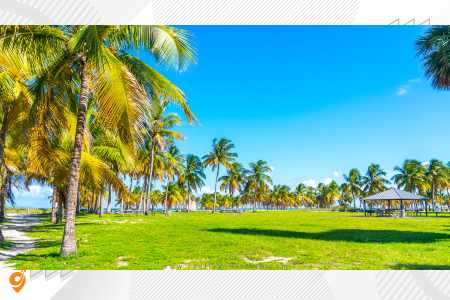
Key Biscayne and Crandon Park provides access to some of Miami’s most pristine beaches and natural areas, where visitors can experience South Florida’s coastal environment without the intensive development that characterizes much of Miami Beach. This destination consistently receives high ratings because it offers the natural Florida experience that many visitors seek but can’t find in more developed areas. Key Biscayne teaches us about barrier island ecology and how these natural formations protect mainland areas from storm damage while providing habitat for wildlife and recreation opportunities for humans. The park’s beaches, nature trails, and preserved areas show visitors what South Florida looked like before large-scale development and help them understand the environmental systems that make this region unique.
Address & Location
- Crandon Park: 6747 Crandon Boulevard, Key Biscayne
- Key Biscayne: Located on the idyllic barrier island of Key Biscayne, right on Biscayne Bay
- Connected to mainland Miami via the Rickenbacker Causeway
- 808-acre (3.27 km²) urban park occupying the northern part of Key Biscayne
Opening Hours
- Crandon Park: Daily access (specific hours vary by season)
- Park facilities: Individual hours vary for different amenities
- Beach access: Generally sunrise to sunset
Public Transportation
Metrobus Route 102
- Local service seven days a week. Travels from Brickell Metrorail / Metromover station to Key Biscayne along the Rickenbacker Causeway and Crandon Blvd
- The 102 is the last Bus that goes to Crandon Park Beach in Key Biscayne. It stops nearby at 11:08 PM
- The 102 is the first Bus that goes to 3501 Rickenbacker Causeway in Key Biscayne. It stops nearby at 6:10 AM
- Key Biscayne Via Crandon (Updated) – route 102
Nearby Stops:
- Crandon Blvd & Arthur Lamb JR Rd
- Crandon Blvd & 951 Us.Post Office
- Crandon Blvd & E Wood Dr
Lines: 26
Metrorail/Metromover Connection
- Travels from Brickell Metrorail / Metromover station
- Connect at Brickell Station to access Route 102
- Metrorail parking is available to Transit customers only. You must board Metrorail or Metrobus to park at a Metrorail facility
Parking Options
Crandon Park Parking
- Crandon Park has two entrances to two huge parking lots, picnic areas, and the beach–the North Entrance and the South Entrance
- Multiple parking lots throughout the park
- Crandon Park 6747 Crandon Boulevard parking lot
- Crandon Park – Lot 3 6747 Crandon Boulevard
Street Parking
- Limited street parking available on Key Biscayne
- Residential area parking restrictions apply
Nearby Attractions
Within Crandon Park
- Beautiful beach, rich coastal environment, unique fossilized mangrove reef, protected wetlands, birding sites
- Beaches, hiking and biking trails, a tennis center, golf course and marina
- Various ecosystems of the Key including the dunes, mangroves, and coastal hammock and seagrass beds
- Observe herons, ospreys
- Kayaking, biking, restaurants, barbecuing, and hiking
Key Biscayne Area
- Bill Baggs Cape Florida State Park
- Cape Florida Lighthouse
- Rickenbacker Causeway Beach
- Crandon Park Marina
- Bear Cut
- Village of Key Biscayne (shopping and dining)
Design District

Design District has evolved into Miami’s premier destination for luxury fashion, cutting-edge art galleries, and innovative architecture, where international brands create flagship stores that double as cultural attractions. This district receives exceptional ratings because it represents Miami’s emergence as a global cultural capital rather than just a beach destination. The Design District teaches us about the relationship between commerce and culture, showing how retail spaces can become venues for artistic expression and community gathering. The district’s transformation from industrial area to luxury destination demonstrates how cities can reinvent neighborhoods while maintaining their essential character and creating new economic opportunities.
Everglades National Park
Everglades National Park provides access to one of the world’s most unique ecosystems, where visitors can experience the largest subtropical wilderness in the United States through multiple interconnected habitats including sawgrass prairies, cypress swamps, and mangrove forests. This destination consistently receives top ratings because it offers something increasingly rare in modern America – vast expanses of undeveloped natural landscape where wildlife thrives according to ancient patterns. The Everglades teaches us about the concept of a watershed ecosystem, where water flows slowly across nearly flat terrain, creating conditions that support an incredible diversity of plant and animal life. When you take an airboat tour through the sawgrass or walk the Anhinga Trail observing alligators and wading birds, you’re witnessing ecological relationships that have remained essentially unchanged for thousands of years, helping you understand how natural systems function when given adequate space and protection.
Park Entrances & Addresses
Main Entrance (Homestead)
- Ernest F. Coe Visitor Center: 40001 State Road 9336, Homestead, FL 33034
- About one hour South-West from Miami, in Florida City near Homestead
- The Homestead entrance is open 24 hours a day
- The visitor center is open from 9:00 AM – 5:00 PM
Shark Valley Entrance
- Address: 36000 SW 8th Street Miami, Florida 33194
- Visitor Center: 9:00AM – 5:00PM
- The entrance to the park is gated and not open to vehicles until 8:30 AM
Flamingo Entrance
- Located at the southern tip of the park
- Access through main Homestead entrance
- Flamingo and Long Pine Key are among the most popular camping destinations in the Everglades
Public Transportation
Limited Public Transit
- There is public transportation only as far as the Ernest F. Coe Visitor Center and Royal Palm, but nowhere else in the park
- To get to Everglades National Park in southern Florida, you can embark on an epic road trip or fly (then drive) to access one of three park entrances
Driving Directions from Miami
To Homestead Entrance
- Take Florida Turnpike South (Homestead Extension)
- Note that there is a small toll for using the Florida Turnpike
- Exit at SW 328th Street (North Homestead)
- Follow signs to Everglades National Park
To Shark Valley Entrance
- Take US-41 West (Tamiami Trail)
- Private companies line the Tamiami Trail (Hwy 41)
- Drive approximately 25 miles west from Miami
- Look for park entrance signs
Parking Options
Homestead Entrance Parking
- If you are coming in your own vehicle, there is free parking available at the Ernest F Coe Visitor Center
- Multiple parking areas throughout the park
- Free parking at visitor centers
Shark Valley Parking
- The parking lot is very small, and cars are only allowed in when one leaves
- During my visit, I arrived at 9:30 and waited approximately 25 minutes before the ranger allowed me into the parking area
- Later, when I was leaving, a long queue of cars was waiting to enter the park
Flamingo Parking
- Free parking at Flamingo campground and marina
- Additional parking at trailheads
Nearby Attractions
Near Homestead Entrance
- The Anhinga Trail,
- Royal Palm Visitor Center
- Everglades Outpost, a wildlife refuge in Homestead. Its exact location is: 35601 SW
- Homestead Historic Downtown
- Florida City outlets
Near Shark Valley
- The Shark Valley area is also the place to get your airboat rides
- Miccosukee Indian Village
- Shark Valley Tram Tours provide a unique look at one of the most incredible ecosystems in the world
Flamingo Area
- Head down to Flamingo to bike the Rowdy Bend Trail and Snake Bight Trail
- Check out the eco-tents in Flamingo for a truly unique glamping experience
- Florida Bay access
- Flamingo Marina
Activities & Transportation Within Park
Biking
- Some of the best places to bike in the Everglades are at Shark Valley and Long Pine Key Natural Trail in Homestead
- Bike rentals available at Shark Valley
Tram Tours
- Everglades National Park Tours in Shark Valley provide a unique look at one of the most incredible ecosystems in the world
- Learn about Everglades ecology and history from Park-trained naturalists
Walking Trails
- Multiple hiking trails throughout the park
- Boardwalks at various locations
Millennium Park
Millennium Park serves as Chicago’s crown jewel and the perfect starting point for understanding the city’s approach to public space and contemporary art. This 24.5-acre park consistently receives the highest ratings because it demonstrates how cities can transform underutilized areas into destinations that serve both residents and visitors. The park teaches us about the concept of “placemaking” – how thoughtful design can create spaces that become central to a city’s identity. Cloud Gate, affectionately known as “The Bean,” functions as more than just a sculpture; it’s a mirror that reflects both the Chicago skyline and the people experiencing it, creating an interactive artwork that changes throughout the day and seasons.
The Crown Fountain, with its digital faces of Chicago residents projected onto glass towers, shows us how technology can humanize public art by literally putting the faces of the community into the landscape.
Address
- 201 E. Randolph St., Chicago, IL
Opening Hours
- Open Daily: 6 a.m. – 11 p.m.
- Welcome Center: 9 a.m. – 7 p.m. (open until end of performance on event nights)
- Admission: FREE
Public Transportation
Metra Train
- Millennium Park Station located directly above the park at Michigan Avenue and Randolph Street
- Access to Metra Electric District and South Shore Line trains
CTA (Chicago Transit Authority)
- Nearby Stops:
- Randolph & Michigan
- Washington & Wabash
Lines: 4, 60, 124, X4, 3, 6, 20, 26, 66, 143, 147, 151, 157, J14
- CTA ‘L’ Lines: Green, Pink, Orange, Brown, and Purple Lines
Additional Transportation Options
- Access to downtown pedway system
- Divvy bike sharing system with thousands of bikes and hundreds of stations throughout the city
Parking
Millennium Park Garage
- Located directly under the park
- Accessible parking spaces available for vehicles with disability placards or plates
Bike Parking
- Bike parking available on the perimeter of Grant and Millennium Parks
- Close to the Chicago Cultural Center
Nearby Attractions
Within Millennium Park
- Cloud Gate statue (aka “The Bean”)
- Interactive fountains
- Tranquil gardens
- Public art installations
- Skating rinks
- Rock climbing facilities
- Green spaces
- Jay Pritzker Pavilion
- Crown Fountain
- Lurie Garden
Connected Areas
- BP Pedestrian Bridge connecting to other parts of Grant Park
- Nichols Bridgeway
- Maggie Daley Park (formerly Daley Bicentennial Plaza) connected via serpentine BP Pedestrian Bridge
Transportation Companies
Public Transit
- CTA (Chicago Transit Authority) – buses and ‘L’ trains
- Metra – commuter rail service
- Ventra – fare payment system (visit www.ventrachicago.com)
Bike Sharing
- Divvy – Chicago’s official bike sharing system
Navy Pier
Navy Pier attracts millions of visitors annually because it successfully combines entertainment, dining, cultural attractions, and stunning lakefront views into a single destination that appeals to people with widely varying interests. This pier teaches us about adaptive reuse – how cities can transform industrial infrastructure into public amenities that serve contemporary needs. Originally built as a shipping and warehousing facility during World War I, Navy Pier now demonstrates how waterfront development can create economic opportunities while maintaining public access to natural resources like Lake Michigan. The pier’s mix of attractions, from the Centennial Wheel offering panoramic city views to the Chicago Children’s Museum providing educational experiences, shows us how successful destinations layer multiple functions to serve diverse audiences throughout different seasons and times of day.
Address
- 600 E Grand Ave, Chicago, IL 60611
Opening Hours
- Opens at 10 am daily
- Open year-round
Public Transportation
CTA Buses
Nearby Stops:
- Navy Pier Terminal(758)
- Grand & Streeter(759)
- Illinois & Lake Shore(756)
Lines: 29, 65, 2, 66, 124
Metra Train Connection
- Transfer from Metra train to CTA buses and travel directly to Navy Pier
- Use CTA bus 124 from Union Station, Ogilvie Station, and Millennium Station
- Use CTA bus 29 from LaSalle Street Station and Millennium Station
Regional Transportation Authority (RTA)
- RTA trip planner makes it easy to use CTA, Metra, and Pace buses and trains with real-time next-bus and next-train travel information
Driving Directions
- From the north, take Lake Shore Drive (US 41) to the Grand Avenue exit and follow to Navy Pier
- Try to work around rush hour traffic – generally 3-6pm on weekdays
Parking
On-Site Parking
- Navy Pier has two on-site parking garages
- Parking can be costly during peak hours
Alternative Parking Options
- Consider parking in downtown garages and taking a short CTA, taxi, NFAA shuttle bus, or rideshare ride to the pier for more affordable parking
Special Entry
- Theater’s dedicated parking entrance at Entrance 1, about halfway down the Pier
Nearby Attractions
On Navy Pier
- Centennial Wheel – breathtaking views from Navy Pier
- Centennial Wheel – nearly 200 feet high, provides 360-degree views of the city and lake
- Pepsi Wave Swinger
- Remote Control Boats
- Carousel
- Light Tower Ride
- Mini-golf course
- Exhibits
- Host of amusements and rides
- Fireworks every Wednesday at 9 p.m. and Saturday at 10 p.m.
Navy Pier Features
- More than fifty acres of parks, gardens, shops, restaurants, family attractions and exhibition facilities
- 3,300-foot-long pier on Lake Michigan shoreline
- Located in Streeterville neighborhood of Near North Side
- Live theaters
- Polk Bros Park
Willis Tower and Skydeck
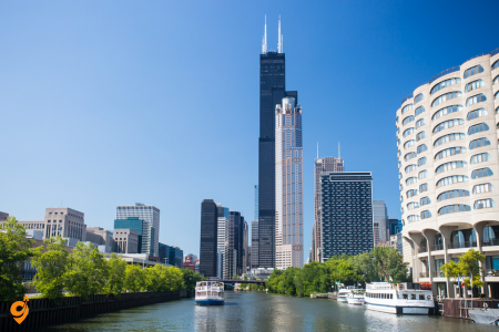
Willis Tower and Skydeck provides visitors with the ultimate perspective on Chicago’s relationship to the Great Lakes region and the vast American Midwest. This experience consistently receives top ratings because it transforms abstract geographic concepts into immediate, visceral understanding. When you step onto the glass ledges extending from the 103rd floor, you’re not just getting a thrill – you’re gaining perspective on how Chicago’s location at the southern tip of Lake Michigan made it the natural hub for transportation, commerce, and industry that connected the East Coast with the developing American interior. The tower teaches us about the economics of height in urban development, showing how skyscrapers allow cities to accommodate growth while maintaining relatively compact footprints that preserve surrounding land for other uses.
Lincoln Park Zoo
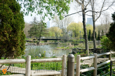
Lincoln Park Zoo stands out among American zoos because it maintains free admission while providing world-class animal care and conservation education. This approach teaches us about the democratic principles underlying public institutions – the idea that access to education and cultural enrichment should not depend on ability to pay. The zoo’s success demonstrates how institutions can balance multiple missions simultaneously, serving as entertainment destinations for families while conducting serious scientific research and conservation work. When you observe the Great Ape House or the Farm-in-the-Zoo, you’re learning about animal behavior and agricultural practices, but you’re also experiencing how educational institutions can make complex scientific concepts accessible to general audiences through careful exhibit design and interpretive programming.
Address
- 2001 N Clark St, Chicago, Illinois
- Parking lot entrance at Fullerton Parkway and Cannon Drive (2400 N. Cannon Drive)
Opening Hours
- Open 10 AM to 5 PM Monday through Friday
- Open until 7 PM on weekends
- Open every day from 10 a.m. to 5 p.m.
Public Transportation
CTA Buses
Nearby Stops:
- Stockton & Webster(1143, 1082, 1142)
- Stockton & Dickens(1083)
- Clark & Armitage(1907)
Lines: 151, 156, 22,36
Chicago ‘L’ Train
- Closest ‘L’ stop is Fullerton Red Line station (about a mile west of the zoo)
Parking
On-Site Parking
- Parking lot entrance at Fullerton Parkway and Cannon Drive (2400 N. Cannon Drive)
- Parking lot opens at 6 a.m. and closes at 11 p.m.
- Free parking for the first half hour
Street Parking
- Occasionally street parking available in the area
Alternative Parking Services
- SpotHero parking reservations available for special events like Zoo Lights and BrewLights
Nearby Attractions
Within Lincoln Park
- Alfred Caldwell Lily Pool
- Lincoln Park Conservatory & Gardens
- North Pond Nature Sanctuary
Lincoln Park Zoo Features
- 35 acres of beautiful scenery
- Various animal habitats and natural attractions
- Exotic animals from all over the world
- Barnyard creatures
Lincoln Park Area
- Steps from Chicago’s Lake Michigan waterfront
- Located at Lake Shore Drive and Fullerton Parkway
Chicago Riverwalk
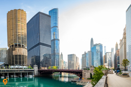
The Chicago Riverwalk transforms the Chicago River from a primarily industrial waterway into a linear park that showcases the city’s architectural heritage while providing recreational opportunities in the urban core. This destination receives excellent ratings because it teaches visitors about urban planning and the relationship between transportation infrastructure and quality of life. The Riverwalk demonstrates how cities can reclaim waterways for public use while maintaining their functional roles in urban systems. As you walk along the river, you’re learning about Chicago’s history through its buildings – the architectural styles visible from the Riverwalk tell the story of the city’s growth from frontier town through industrial powerhouse to contemporary global city.
Grant Park and Buckingham Fountain
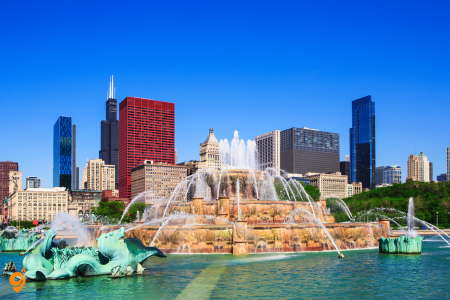
Grant Park and Buckingham Fountain provides Chicago’s “front yard,” offering expansive green space in the heart of downtown while showcasing one of the world’s largest decorative fountains. This park teaches us about the City Beautiful movement of the early 20th century, when urban planners believed that beautiful public spaces could improve both individual lives and social conditions. Buckingham Fountain, modeled after the Latona Fountain at Versailles but twice as large, demonstrates how American cities adapted European design principles to create public amenities on a scale appropriate to the New World. The park’s role as the site of major festivals and events shows us how public spaces can serve multiple functions, providing daily recreational opportunities for residents while accommodating large-scale celebrations that bring the entire community together.
Museum of Science and Industry
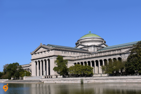
Museum of Science and Industry occupies a unique position among American museums by focusing on interactive learning experiences that help visitors understand how scientific principles apply to everyday life and industrial processes. This museum consistently receives high ratings because it makes abstract scientific concepts tangible and immediate. The museum teaches us about the relationship between pure scientific research and practical applications that improve human life. When you walk through a replica coal mine or explore a captured German U-boat, you’re not just seeing interesting objects – you’re learning about the scientific principles that make modern industrial society possible. The museum’s approach demonstrates how educational institutions can use immersive experiences to help people understand complex systems that usually remain invisible in daily life.
Address
- 5700 S Lake Shore Dr, Chicago
- Located in Jackson Park, Hyde Park neighborhood between Lake Michigan and The University of Chicago
Opening Hours
- Open 7 days a week from 9:30 AM to 5:30 PM and 9:30 AM TO 9 PM On Sundays.
Public Transportation
CTA Buses
Nearby Stops:
- S Hyde Park & 56th Street(1517)
- Stony Island & 57th Drive(1515)
Lines: 6, 28, 55, 2, 15, 28, 171
Metra Train
- Train from Van Buren St. to 55th – 56th – 57th St. takes 13 minutes including transfers
- Departs every 20 minutes
- Direct train departing from Millennium Station and arriving at 55th – 56th – 57th St.
- Services depart every 30 minutes, and operate every day
- Journey takes approximately 16 minutes
Parking
On-Site Parking
- MSI has on-site parking at their underground garage
- Access entrance from E 57th Street and South Cornell Avenue
Parking Garage Hours
- Museum Garage is open 5:00 am – midnight
- No entry after 11:00 pm Sunday – Thursday
- On busy days (weekends and vacation periods), garage may fill to capacity
Alternative Parking
- SpotHero parking reservations available
Location Details
- Located in Chicago’s beautiful Hyde Park neighborhood
- Easily accessible by car, bus or train
Museum Features
- One of the largest science centers in the Western Hemisphere
- Western Hemisphere’s largest science museum, with 14 acres of exhibits
- Established in 1933
- Housed in the Palace of Fine Arts from the 1893 World’s Columbian Exposition
The Magnificent Mile
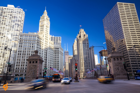
The Magnificent Mile represents Chicago’s premier shopping and commercial district, stretching along North Michigan Avenue from the Chicago River to Oak Street. This destination consistently receives top ratings because it demonstrates how cities can create pedestrian-friendly commercial corridors that serve multiple functions simultaneously. The Magnificent Mile teaches us about the concept of “mixed-use development” – how successful urban districts integrate retail, dining, hotels, and residential spaces to create vibrant neighborhoods that remain active throughout different times of day and seasons. When you walk along Michigan Avenue, you’re witnessing how urban commercial districts can maintain their vitality by constantly adapting to changing consumer preferences while preserving their essential character.
The mile showcases Chicago’s architectural heritage through buildings like the Chicago Water Tower, one of the few structures to survive the Great Chicago Fire of 1871, which now serves as both a historical landmark and a visitor information center. The district’s success demonstrates how cities can balance the needs of tourists and residents, creating spaces that serve both populations without becoming exclusively oriented toward either group.
For more details visit: Magnificient Mile
Address & Location
- Michigan Avenue from the Chicago River to Oak Street on the Near North Side of Chicago, Illinois
- Approximately one-mile-long stretch of Michigan Avenue
- Divides the neighborhood of Streeterville on its east from River North on its west
- 13-block stretch of North Michigan Avenue that runs from the banks of the Chicago River in the south to Oak Street to the north
Opening Hours
- Public area – accessible 24/7
- Individual shops and attractions have varying hours
- More than 460 retailers and three shopping centers
Public Transportation
CTA Services
Nearby Stops:
- Michigan & Chestnut(1127)
- Michigan & Pearson(1098)
- Michigan & Chicago(33913)
- Michigan & Delaware/Walton(1128)
Lines: 143, 146, 147, 148, 151, 10, 125, 8, 3, 26, 850
Parking
Parking Garages
- The One Magnificent Mile garage is a covered, valet attended garage
- Conveniently located near 900 N. Michigan Avenue Shops, Water Tower Shopping Mall, and the John Hancock Center
- ROW Parking located at the corner of Rush & Ohio St (0.1 Miles from Chicago Marriott Downtown Magnificent Mile)
- Electric Car Charging Station available
Street Parking
- Free Magnificent Mile parking available on Ontario Street, Huron Street, and Chicago Avenue
- Parking at meters along these streets can help with cheap Magnificent Mile parking
- Free spots are few and far between
Alternative Parking
- Row Parking Garage, just one block away from Chicago Riverwalk
Nearby Attractions
Within The Magnificent Mile
- Museum of Contemporary Art
- The famous Skydeck located in the Willis Tower
- The historic DuSable Bridge
- TILT – Located at historic 875 North Michigan Ave—formerly the John Hancock Center—”Chicago’s highest thrill ride” literally tilts you out and over
Shopping & Entertainment
- One of the world’s most iconic shopping districts
- Luxury brands, fine dining, exciting events
- Top shopping, dining, and designer labels
Historic & Cultural Sites
- Heart of Chicago’s famous dining scene & offers visitors a delectable spread of places to dine
- Chicago is arguably America’s best architectural city with famous buildings in The Magnificent Mile district
Chicago Theatre District
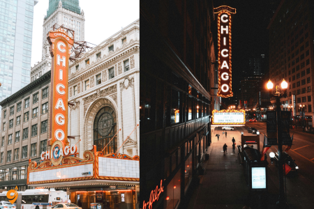
Chicago Theatre District encompasses multiple venues throughout the Loop that collectively represent one of America’s most vibrant live performance scenes. This concentration of theaters consistently receives exceptional ratings because it offers visitors the chance to experience everything from Broadway touring productions to experimental works by local companies. The theater district teaches us about the relationship between cultural institutions and urban vitality, showing how performing arts venues can anchor downtown districts and create economic activity that extends far beyond show times. The Chicago Theatre, with its iconic marquee sign, serves as the symbolic heart of this district and demonstrates how individual buildings can become symbols that represent entire cities. When you attend performances in venues like the Cadillac Palace Theatre or the Oriental Theatre, you’re experiencing how historic buildings can be adapted for contemporary use while maintaining their architectural integrity and cultural significance.
Address
- 175 N. State Street Chicago 60601
Opening Hours
- Performance-specific hours – varies by show
- Box office hours vary by performance schedule
Public Transportation
CTA ‘L’ Train
- Red Line: Exit at Lake Street
- Brown, Green, Pink, Orange, and Purple Line Express: Exit at State/Lake Street
- Blue Line: Exit at Washington and walk one block east on Washington and one and a half blocks north on State Street
- State/Lake Station is served by CTA Orange Line, CTA Pink Line, CTA Purple Line, CTA Brown Line, CTA Green Line
CTA Buses
Nearby Stops:
- State & Lake
- State/Lake
Lines: 2, 10, 29, 146, 148, 36. 62, 6
Metra Train
- Metra service available with connections to CTA
Parking
Nearby Parking Options
- SpotHero parking reservations available at convenient garages, lots & valets near the theatre
Parking Validation
- Pre-paid parking passes are valid starting 3 hours prior to performance start time and last 12 hours from the start of the reservation
- Examples: Enter parking garage at 4:30 PM for 7:30 PM shows, 5 PM for 8 PM shows, 11 AM for 2 PM shows, 10 AM for 1 PM shows
Parking Garages
- Millennium Park Garage (closest to theatre area)
- Lakeside Garage
- Grant Park North Garage
- Grant Park South Garage
- Millennium Park Garage is open 24 hours a day, 7 days a week
- InterPark Self-Park at 20 E. Randolph (across the street from Macy’s)
- Entrance on Wabash near the corner of Randolph
Nearby Attractions
Loop District
- Located in the Loop area of Chicago, Illinois
- Chicago Loop
- New Eastside (Chicago)
The French Quarter
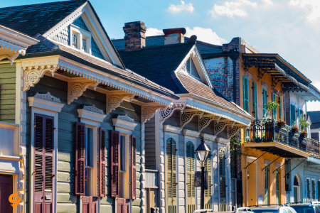
The French Quarter stands as the crown jewel of New Orleans tourism, and for good reason. This historic neighborhood, dating back to the 1700s, serves as the beating heart of the city’s cultural identity. When you walk through its narrow streets lined with Creole cottages and Spanish colonial buildings, you’re literally stepping through centuries of history. The wrought-iron balconies overhead and the sounds of jazz spilling from doorways create an atmosphere unlike anywhere else in America.
Address & Location
- The French Quarter, also known as the Vieux Carré, is the oldest neighborhood in the city of New Orleans
- The district as a whole has been designated as a National Historic Landmark
Opening Hours
- Public area – accessible 24/7
- Individual businesses, restaurants, and attractions have varying hours
- Many restaurants and cafes open daily with varying hours (example: 8am-8pm, 7am-7pm, 11:30am-10pm)
Public Transportation
RTA Streetcar
- The RTA ferry runs from Algiers Point directly to the festival
- Streetcar Routes: 11 Magazine, 12 St.
- Streetcar: 12
- Streetcar: 46
RTA Buses
Nearby Stops:
- Rampart St. at St. Ann St.
- Rampart at Toulouse
Lines: 8, 55, 91
Ferry Service
- Ferry: 1
- The RTA ferry runs from Algiers Point directly to the festival
Parking
Street Parking
- Parking is prohibited at meters in designated rush hour zones from 7 a.m. – 9 a.m. and 4 p.m. – 7 p.m.
- Broken meters are not free passes and could land you a ticket
Parking Lots & Garages
- Parking can be tricky, so arrive early
- There are additional paid parking lots within walking distance
- Premium Parking makes it easy to find convenient parking in the French Quarter
Transportation Companies
Public Transit
- RTA (Regional Transportation Authority) – streetcars, buses, and ferry
- Jefferson Transit Authority (JET) – airport connections
Nearby Attractions
Within French Quarter
- Bourbon Street – New Orleans’ most famous street home to numerous bars, clubs, restaurants, live local music, colorful nightlife scene, and annual Mardi Gras parade
- Jackson Square – The National Landmark and highly recognizable backdrop earned its name for one of three bronze statues of Andrew Jackson located in the center of the square
Major Destinations
- St. Louis Cathedral
- Café du Monde
- French Market
- Preservation Hall
- Historic Voodoo Museum
- Cabildo and Presbytère museums
Bourbon Street
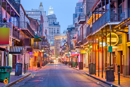
Bourbon Street within the French Quarter deserves its own mention as the most famous street in New Orleans. While it’s known for its nightlife and can get quite rowdy, understanding its appeal helps you grasp why New Orleans attracts so many visitors. This street represents the uninhibited spirit of the city, where music, food, and celebration blend together in a way that’s both authentic to local culture and accessible to tourists.
Jackson Square
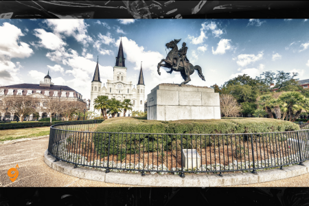
Jackson Square offers a perfect introduction to New Orleans’ layered history. This public square, originally designed as a military parade ground, now serves as a gathering place where you can observe the city’s artistic soul. Street performers, artists selling their work, and the stunning St. Louis Cathedral create a scene that captures both the sacred and secular aspects of New Orleans culture.
The Garden District
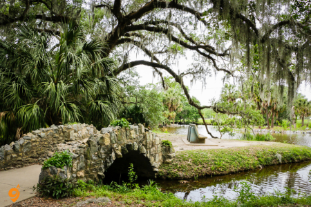
The Garden District deserves much deeper exploration because it represents one of America’s most intact collections of antebellum architecture. This neighborhood developed in the 1830s and 1840s when wealthy American merchants and plantation owners wanted to establish their own enclave separate from the Creole French Quarter. Walking through the Garden District is like stepping into a living museum of 19th-century wealth and taste.
The mansions here weren’t just homes but statements of power and cultural identity. Take the Commander’s Palace restaurant area on Washington Avenue, where you can see how these grand homes have been adapted for modern use while maintaining their historical integrity. The massive oak trees, some over 200 years old, create natural canopies that have shaped the neighborhood’s character. Magazine Street, which runs along the district’s edge, shows how this area has evolved from exclusive residential space to a vibrant mix of shopping, dining, and living. The streetcar line that runs through the district isn’t just transportation but a moving timeline, allowing you to observe how architectural styles changed as the city expanded upriver from the original French Quarter.
Address
– General Area: Bounded by Magazine Street, Louisiana Avenue, St. Charles Avenue, and Jackson Avenue
– Central Location: Along St. Charles Avenue between Jackson Avenue and Louisiana Avenue
Operating Hours
– Garden District: Accessible 24/7 (public streets and sidewalks)
– Streetcar Service: Typically 6:00 AM – 12:00 AM
– Bus Service: Varies by route, generally 5:00 AM – 11:00 PM
– Parking Meters: Usually enforced Monday-Saturday, 8:00 AM – 6:00 PM
Public Transportation
Streetcar(Line 12)
– St. Charles Streetcar Line: Runs 13 miles from Canal Street to Carrollton Avenue, cutting through the Garden District
Bus Service
Nearby Stops:
- O C Haley at M L King
- Camp St. at Thalia St.
- Camp St. at Terpsichore St.
Lines: 91, 11
Parking Options
Dedicated Parking Facilities
– Garden District Parking: Located at 1220 S Peters St
– SpotHero Platform: Reserve Garden District parking through SpotHero with convenient garages, lots & valets
Nearby Parking Lots
– Piccolo Lot: 619 South Peters Street
– Unipark Garage: 145 Roosevelt Way
– Villere Lot: 1539 Canal Street
Nearby Attractions
– Commander’s Palace Restaurant
– Lafayette Cemetery No. 1
– Magazine Street Shopping District
– Antebellum Mansions (historic homes)
– Audubon Park (nearby)
– Tulane University (nearby)
– Loyola University (nearby)
St. Louis Cathedral
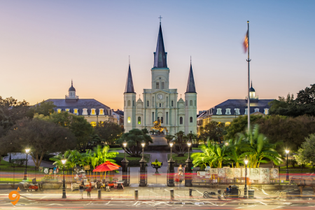
St. Louis Cathedral stands as the spiritual and architectural centerpiece of Jackson Square, representing the oldest continuously active Roman Catholic cathedral in the United States. When you approach this magnificent structure, you’re looking at the third church built on this site, with the current building dating to the 1850s. The cathedral’s three spires dominate the New Orleans skyline and serve as a navigation point throughout the French Quarter. What makes this cathedral particularly significant is how it reflects the city’s complex religious heritage. Unlike many American cities where Protestant denominations dominated, New Orleans maintained its Catholic character through French and Spanish colonial periods. The cathedral witnessed countless yellow fever epidemics, Civil War occupation, and hurricane devastation, yet it has remained a constant in the city’s ever-changing landscape
. Inside, you’ll find beautiful stained glass windows and religious art that tell the story of a city where faith and celebration have always intertwined. The cathedral’s bells still ring throughout the French Quarter, connecting modern visitors to centuries of daily life in this historic neighborhood.
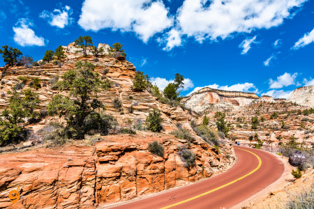
Zion National Park showcases red and white Navajo sandstone formations carved by the Virgin River over millions of years, creating narrow slot canyons, towering cliff faces, and hanging gardens that support diverse plant and animal communities in the high desert of southwestern Utah. The park’s main canyon, carved by the Virgin River, creates a narrow corridor where canyon walls rise up to 2,000 feet on either side, with the river continuing its erosive work as it flows year-round through this dramatic landscape. The famous Narrows hike requires you to wade and sometimes swim through the Virgin River itself as it flows between canyon walls that narrow to just 20 feet wide in some sections, creating a hiking experience where the river serves as your trail through sculpted sandstone corridors that filter sunlight into ethereal beams. Zion’s elevation ranges from 3,666 feet at the canyon floor to 8,726 feet at Horse Ranch Mountain, creating diverse ecosystems that support everything from desert plants like prickly pear cactus to hanging gardens fed by seeping water that nurture ferns, columbines, and other moisture-loving plants growing directly from cliff faces.
The park’s shuttle system, required during busy seasons, eliminates private vehicle traffic in the main canyon and provides convenient access to trailheads while allowing visitors to appreciate the dramatic scenery without the distraction of traffic and parking concerns. Rock formations here tell the story of ancient sand dunes that were compressed into stone over 200 million years ago, then uplifted and carved by water and wind into the sculptural landscape visitors see today, where colors shift from deep red to pale pink to cream depending on the time of day and angle of sunlight.
Design District
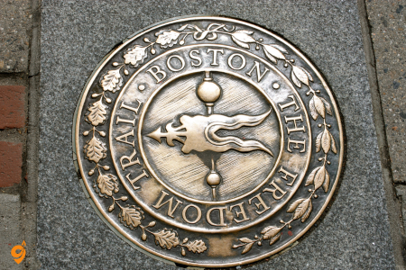
The Freedom Trail functions as Boston’s masterpiece of urban storytelling. Imagine a city-sized museum where the exhibits are actual buildings and streets where history unfolded. This 2.5-mile red-brick path connects 16 sites, from Boston Common to the Bunker Hill Monument, creating a narrative arc that takes visitors through the entire American Revolution.
The trail’s genius lies in its simplicity—you literally follow red bricks or paint on sidewalks, making navigation effortless while the historical weight of each stop builds cumulatively. Sites like the Old State House, where the Boston Massacre occurred, and the Old North Church, where Paul Revere received his famous signal, transform abstract historical events into tangible experiences. The trail receives its highest ratings because it solves the common tourist problem of “what should I see first?” by providing a logical sequence that tells America’s founding story chronologically.
Trail Overview
– Length: 2.5 mile, brick-lined route that leads you to 16 historically significant sites
– Format: Self-guided walking trail marked with red brick line
– Multiple Entry Points: Trail can be started at various locations
Main Starting Points & Addresses
Primary Starting Point
– Boston Common: Established in 1634, Boston Common is America’s oldest public park
– Location: Park Street MBTA station at the intersection of Park and Tremont Streets
Visitor Information Centers
– Boston Common: Main starting point
– Faneuil Hall: Mid-trail information center
– Charlestown Navy Yard: End point information center
Operating Hours
– Trail Access: 24/7 (outdoor public spaces)
– Individual Historic Sites: Vary by location
– Visitor Centers: Generally 9:00 AM – 5:00 PM (varies seasonally)
Public Transportation (MBTA)
Subway/T Stations
– Park Street Station: Primary access point for Boston Common start
– Lines: Red Line, Green Line
– Location: Park and Tremont Streets intersection
– Government Center: Access to Faneuil Hall area
– Lines: Blue Line, Green Line
– State Street: Access to Old State House
– Lines: Blue Line, Orange Line
– Haymarket: Access to North End sites
– Lines: Orange Line, Green Line
– Community College: Access to Charlestown Navy Yard
– Lines: Orange Line
Bus Routes
Nearby Stops:
- Beacon St opp Walnut St
- Charles St @ Beacon St
- Tremont St @ Boylston Station
- Tremont St opp Temple Pl
Lines: 43, 15, 39, 57, SL5
Parking Options
MBTA Park & Ride
– Various MBTA Stations: MBTA parking available at stations and rates
– Suburban Stations: Park at outer stations and take T into downtown
Downtown Parking
– Boston Common Garage: Underground parking beneath the Common
– Government Center Garage: Near Faneuil Hall
– Numerous Private Garages: Throughout downtown Boston
– Street Parking: Limited and metered in downtown area
Transportation Companies
Public Transit
– MBTA (Massachusetts Bay Transportation Authority): Public transit in the Greater Boston region
– Subway (The T)
– Bus Service
– Commuter Rail
Ride-Sharing & Taxi
– Uber
– Lyft
– Boston Taxi Companies
Transportation Apps & Resources
– MBTA App: Real-time transit information
– Freedom Trail App: Official trail guide
– Google Maps: Walking directions between sites
– Parking Apps: SpotHero, ParkWhiz for reserving parking
Key Trail Sites & Nearby Attractions
– Boston Common: 44 acres, America’s oldest public park
– Massachusetts State House: Designed by Charles Bulfinch, seat of Massachusetts government since 1798
– Park Street Church
– Granary Burying Ground
– King’s Chapel
– Boston Latin School
– Old Corner Bookstore
– Old South Meeting House
– Old State House
– Boston Massacre Site
– Faneuil Hall
– Paul Revere House
– Old North Church
– Copp’s Hill Burying Ground
– USS Constitution
– Bunker Hill Monument
Fenway Park
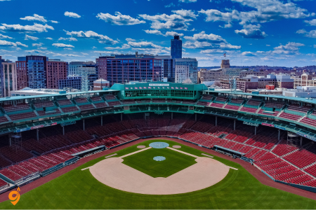
Fenway Park represents more than just a baseball stadium—it’s a pilgrimage site for understanding American sports culture. Built in 1912, this ballpark survived the era when most historic stadiums were demolished, making it a living museum of baseball’s golden age. The famous Green Monster, a 37-foot-tall left-field wall, creates unique game dynamics you won’t find anywhere else. Visitors rate it so highly because it offers multiple layers of experience: the architectural beauty of an early 20th-century ballpark, the intense atmosphere of Red Sox Nation, and the sensory experience of eating Fenway Franks while watching America’s pastime in its most authentic setting. Even during off-season, tours reveal how the intimate scale of the park creates an emotional connection between fans and players that modern stadiums struggle to replicate.
Address & Basic Information
- Address: 4 Yawkey Way, Boston, MA 02215
- General Hours: Varies by event schedule; typically gates open 1.5-2 hours before game time
- Box Office Hours: Monday-Friday 9 AM – 5 PM, Saturday 10 AM – 4 PM
Public Transportation (MBTA)
Green Line (Subway)
- Kenmore Station: 0.2 miles walk to Fenway Park
- Fenway Station: 0.3 miles walk to Fenway Park
- Green Line branches: B, C, and D lines all stop at Kenmore
Commuter Rail
- Yawkey Station(Lansdowne): 0.1 miles walk (closest station)
- Back Bay Station: 1.2 miles away
- South Station: Downtown connection point
Bus Routes
Nearby Stops:
- Brookline Ave @ Jersey St
- Brookline Ave opp Jersey St
- Ipswich St @ Lansdowne St
- Ipswich St opp Lansdowne St
Lines: 8,19, 60, 65, 55
Driving & Parking
Major Highways
- I-90 (Mass Pike): Exit 22 (Prudential Center/Copley Square)
- I-93: Connect to I-90 West
- Route 1: Connect to I-93 South
- Storrow Drive: Exit at Fenway/Kenmore
Nearby Parking Facilities
- Fenway Park Official Parking: Limited spaces, arrive early
- Brookline Avenue Parking: Multiple lots along Brookline Avenue
- Kenmore Square Parking: Various commercial lots
- Prudential Center Garage: 1 mile away, shuttle service available
- Back Bay Station Garage: 1.2 miles away
- Copley Place Garage: 1.5 miles away
- Street Parking: Limited 2-hour meters in surrounding neighborhoods
Taxi & Rideshare Services
- Uber: Available throughout Boston area
- Lyft: Available throughout Boston area
- Boston Taxi: Traditional taxi service
- Cambridge Taxi: Serves greater Boston area
- Metro Cab: Local taxi company
Nearby Attractions
Sports & Entertainment
- House of Blues Boston: 0.3 miles away
- Berklee College of Music: 0.5 miles away
- Boston University: 0.8 miles away
- Northeastern University: 1.2 miles away
Shopping & Dining
- Kenmore Square: Shopping and restaurants
- Newbury Street: 1 mile away, premier shopping district
- Prudential Center: 1 mile away, shopping mall
- Copley Place: 1.5 miles away, upscale shopping
Cultural Attractions
- Museum of Fine Arts: 1.5 miles away
- Isabella Stewart Gardner Museum: 1.8 miles away
- Symphony Hall: 1.2 miles away
- Boston Public Library: 1.5 miles away
Parks & Recreation
- Back Bay Fens: Adjacent to Fenway Park
- Charles River Esplanade: 1.5 miles away
- Boston Common: 2 miles away
- Public Garden: 2 miles away
Quincy Market and Faneuil Hall
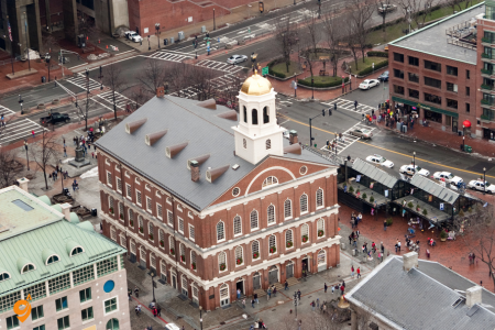
Quincy Market and Faneuil Hall demonstrate how historical preservation can create vibrant modern experiences. Built in 1826 as a response to Boston’s growing commercial needs, this complex now serves as a model for adaptive reuse of historic buildings. Faneuil Hall, known as the “Cradle of Liberty,” hosted the meetings that led to the American Revolution, while Quincy Market became the prototype for the modern food court concept. Visitors rate this destination highly because it satisfies multiple needs simultaneously: historical education, dining variety, shopping, and entertainment. The cobblestone courtyards and 19th-century architecture create an atmosphere that feels both authentic and accessible, avoiding the sterile feeling of many modern shopping centers.
Address & Basic Information
- Faneuil Hall Address: 4 South Market Street, Boston, MA 02109
- Quincy Market Address: 206 South Market Street, Boston, MA 02109
- Phone: (617) 523-1300
- Faneuil Hall Hours: Daily 10 AM – 9 PM (varies by season)
- Quincy Market Hours: Monday-Saturday 10 AM – 9 PM, Sunday 11 AM – 7 PM
- Individual Shop Hours: Vary by vendor and restaurant
- Historic Tours: Available daily, check Boston National Historical Park website
Public Transportation (MBTA)
Blue Line (Subway)
- Government Center Station: 0.2 miles walk to Faneuil Hall
- State Street Station: 0.3 miles walk to Quincy Market
- Aquarium Station: 0.4 miles walk to Faneuil Hall
Orange Line (Subway)
- State Street Station: 0.3 miles walk (Orange/Blue Line connection)
- Downtown Crossing: 0.5 miles walk
- Haymarket Station: 0.3 miles walk
Green Line (Subway)
- Government Center Station: 0.2 miles walk
- Park Street Station: 0.6 miles walk
- Haymarket Station: 0.3 miles walk
Red Line (Subway)
- Park Street Station: 0.6 miles walk
- Downtown Crossing: 0.5 miles walk (connection to Orange Line)
- South Station: 0.8 miles walk
Bus Routes
Nearby Stops:
- Congress St @ North St
- Aquarium – State St opp McKinley Sq
- Congress St @ State St
Lines: 4, 15, 39, 57, 95, 93
Commuter Rail
- North Station: 0.5 miles walk
- South Station: 0.8 miles walk
Water Transportation
- Boston Harbor Cruises: Departs from Long Wharf (0.3 miles)
- MBTA Ferry: Seasonal service to various harbor destinations
- Water Taxi: Connects to Logan Airport and harbor islands
- Rowes Wharf: 0.5 miles away, water taxi service
Driving & Parking
Major Highways
- I-93: Exit 24A (Government Center/Faneuil Hall)
- I-90 (Mass Pike): Connect to I-93 North
- Route 1: Connect to I-93 South
- Route 3: Connect to I-93 North
- Storrow Drive: Exit at Government Center
Nearby Parking Facilities
- Government Center Parking Garage: 0.2 miles away
- Quincy Market Parking: Limited spaces beneath market
- Boston Common Parking Garage: 0.6 miles away
- Haymarket Parking: Street level parking
- Post Office Square Parking: 0.4 miles away
- 75 State Street Parking: 0.3 miles away
- Millennium Place Parking: 0.5 miles away
- One Beacon Street Parking: 0.4 miles away
- Street Parking: Limited metered spaces in surrounding area
Nearby Attractions
Historic Sites
- Boston Tea Party Ships & Museum: 0.6 miles away
- Old State House: 0.2 miles away
- King’s Chapel: 0.3 miles away
- Granary Burying Ground: 0.4 miles away
- Paul Revere House: 0.4 miles away in North End
- Old North Church: 0.5 miles away in North End
- Boston Massacre Site: 0.2 miles away
- Freedom Trail: Passes directly through Faneuil Hall
Museums & Cultural Sites
- Boston Children’s Museum: 0.8 miles away
- New England Aquarium: 0.4 miles away
- Institute of Contemporary Art: 1.2 miles away
- USS Constitution Museum: 1 mile away
- Boston Tea Party Ships Museum: 0.6 miles away
Entertainment & Shopping
- Newbury Street: 1.5 miles away
- Prudential Center: 1.8 miles away
- Copley Place: 1.5 miles away
- Downtown Crossing: 0.5 miles away
- North End Markets: 0.4 miles away
- Haymarket: 0.3 miles away (outdoor market)
Parks & Recreation
- Boston Common: 0.6 miles away
- Public Garden: 1 mile away
- Rose Kennedy Greenway: 0.2 miles away
- Christopher Columbus Park: 0.3 miles away
- Boston Harbor Islands: Accessible via ferry
Neighborhoods
- North End: 0.4 miles away (Italian heritage district)
- Financial District: Adjacent area
- Beacon Hill: 0.8 miles away
- Back Bay: 1.5 miles away
- South End: 1.8 miles away
USS Constitution
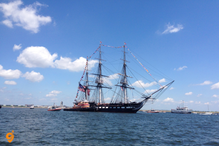
USS Constitution offers visitors a chance to step aboard a piece of living naval history. Commissioned in 1797, this ship earned the nickname “Old Ironsides” during the War of 1812 when British cannonballs bounced off its strong oak hull. The ship’s appeal lies in its authenticity—this isn’t a replica but the actual vessel that fought in America’s early naval battles. Visitors rate it highly because it provides a tangible connection to maritime history, allowing them to experience the cramped quarters, massive cannons, and intricate rigging that defined naval warfare in the age of sail. The adjacent USS Constitution Museum enhances the experience by providing historical context and interactive exhibits that help visitors understand daily life aboard a warship.
Address & Basic Information
- Address: Charlestown Navy Yard, Building 22, Charlestown, MA 02129
- Ship Hours: Tuesday-Sunday 10 AM – 6 PM (April-October), Tuesday-Sunday 10 AM – 4 PM (November-March)
- Museum Hours: Daily 9 AM – 6 PM (April-October), Daily 9 AM – 5 PM (November-March)
- Visitor Center Hours: Daily 9 AM – 5 PM
- Closed: Mondays (except federal holidays), Thanksgiving, Christmas, New Year’s Day
- Free Admission: Both ship and museum are free to visit
Public Transportation (MBTA)
Orange Line (Subway)
- Community College Station: 0.8 miles walk to USS Constitution
- Sullivan Square Station: 1.2 miles walk
- North Station: 1.3 miles walk
Blue Line (Subway)
- Aquarium Station: 1.1 miles walk across Charlestown Bridge
- State Street Station: 1.4 miles walk
- Government Center Station: 1.5 miles walk
Green Line (Subway)
- North Station Station: 1.3 miles walk
- Government Center Station: 1.5 miles walk
- Haymarket Station: 1.4 miles walk
MBTA Ferry
- Charlestown Navy Yard Ferry: Direct service from Long Wharf (downtown)
- Operating Season: May through October
- Frequency: Every 15-30 minutes during operating hours
- Route: Connects Long Wharf to Charlestown Navy Yard Pier
Bus Routes
Nearby Stops:
- Chelsea St @ Constitution Rd
- Chelsea St @ Fifth St
- Chelsea St @ Warren St
Lines: 93
Commuter Rail
- North Station: 1.3 miles walk
- Malden Center: 2.5 miles away, connect via bus
Water Transportation
- MBTA Ferry: Long Wharf to Charlestown Navy Yard (seasonal)
- Boston Harbor Cruises: Various tours include Constitution stop
- Water Taxi: Private service to Navy Yard
- Harbor Islands Ferry: Some routes stop at Navy Yard
- Private Boat: Pier facilities available for private vessels
Driving & Parking
Major Highways
- I-93: Exit 28 (Sullivan Square/Charlestown)
- Route 1: Connect to I-93 South
- Route 99: Direct access to Charlestown
- Route 16: Connect via local roads
- Tobin Bridge: Connect from East Boston
Nearby Parking Facilities
- Charlestown Navy Yard Parking: On-site parking lots
- Constitution Road Parking: Street parking near Navy Yard
- Sullivan Square Parking: 1.2 miles away
- Spaulding Rehabilitation Hospital Parking: 0.5 miles away
- Bunker Hill Community College Parking: 0.8 miles away
- Thompson Square Parking: 0.6 miles away
- Street Parking: Limited metered spaces in Charlestown
Nearby Attractions
Historic Sites
- USS Constitution Museum: Adjacent to the ship
- Bunker Hill Monument: 0.5 miles away
- USS Cassin Young: Adjacent destroyer ship
- Charlestown Navy Yard: Historic naval shipyard
- Boston Marine Society: 0.3 miles away
- Winthrop Square: 0.4 miles away
- Freedom Trail: Passes through Navy Yard
- City Square Park: 0.6 miles away
Museums & Cultural Sites
- USS Constitution Museum: Interactive exhibits about the ship
- Boston National Historical Park: Navy Yard is part of the park
- Charlestown Navy Yard Visitor Center: Historical information
- USS Cassin Young Museum: World War II destroyer
- Boston Tea Party Ships & Museum: 1.2 miles away via ferry
Neighborhoods
- Charlestown: Historic waterfront community
- North End: 0.8 miles away via Charlestown Bridge
- West End: 1.2 miles away
- East Boston: 1.5 miles away via Tobin Bridge
- Downtown Boston: 1.1 miles away via ferry
Parks & Recreation
- Charlestown Navy Yard Park: Surrounding green space
- Bunker Hill Park: 0.5 miles away
- Paul Revere Park: 0.8 miles away
- City Square Park: 0.6 miles away
- Charlestown Waterfront Park: 0.4 miles away
- Harbor Walk: Continuous waterfront path
Waterfront Activities
- Harbor Tours: Multiple companies operate from Navy Yard
- Sailing: Boston Sailing Center nearby
- Kayaking: Harbor access points
- Fishing: Pier fishing opportunities
- Photography: Scenic harbor and city views
Boston Common
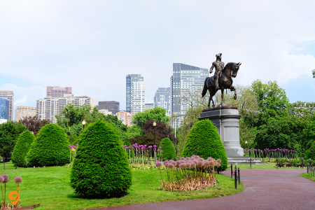
Boston Common functions as the city’s central gathering place and serves as a perfect introduction to understanding Boston’s urban development. Established in 1634, this 50-acre park has witnessed everything from cattle grazing to civil rights demonstrations. Its significance lies not just in its age but in its continuous role as a democratic space where citizens gather for both recreation and political expression. Visitors appreciate the Common because it provides a peaceful respite from urban intensity while offering activities year-round—from swan boat rides in summer to ice skating in winter. The park’s location as the starting point for the Freedom Trail makes it many visitors’ first impression of Boston, and its success in that role contributes to its consistently high ratings.
North End
North End represents Boston’s most successful example of cultural preservation within urban development. This neighborhood maintains its Italian-American character while embracing its role as a tourist destination, creating an authentic cultural experience that doesn’t feel artificially preserved. Visitors rate the North End highly because it offers multiple layers of experience: historical sites like the Old North Church and Paul Revere House, authentic Italian restaurants and bakeries, and the general atmosphere of a functioning neighborhood where residents actually live and work. The narrow, winding streets create an intimate urban environment that contrasts sharply with Boston’s more formal downtown areas, while events like the annual Feast of St. Anthony maintain community traditions that visitors can observe and sometimes participate in.
Design District
Key West represents the southernmost point in the continental United States, a 4-by-2-mile island connected to mainland Florida by the famous Overseas Highway, which spans 113 miles across 42 bridges including the spectacular Seven Mile Bridge. This unique location, closer to Havana, Cuba than to Miami, creates a laid-back island atmosphere where the pace of life slows dramatically and the concept of “island time” becomes a practical reality rather than just a vacation mindset. The island’s famous sunset celebration at Mallory Square brings together street performers, local artisans, and visitors from around the world to applaud the sun as it disappears into the Gulf of Mexico, creating a daily ritual that emphasizes the natural rhythms that govern life in this tropical paradise. Key West’s architectural heritage includes distinctive “Conch Houses,” built by Bahamian craftsmen in the 19th century using techniques adapted to the tropical climate, featuring wraparound porches, metal roofs, and elevated construction designed to capture cooling breezes and survive hurricane-force winds.
The Ernest Hemingway House preserves the author’s former home where he wrote some of his most famous works while living among the descendants of his famous six-toed cats, who still roam the property and carry on the genetic trait that fascinated the Nobel Prize-winning writer. The surrounding waters of the Florida Keys National Marine Sanctuary protect the only living coral reef system in the continental United States, where you can snorkel or dive among tropical fish, sea turtles, and coral formations that create underwater gardens just minutes from shore, making Key West a gateway to both literary history and marine wilderness experiences.


1 thought on “Best Places to visit in USA”
Comments are closed.