
Sagrada Familia

Antoni Gaudí’s unfinished masterpiece represents the pinnacle of Modernist architecture. Construction began in 1882 and continues today, with completion expected around 2026. The basilica’s exterior features intricate facades depicting the Nativity and Passion of Christ, while the interior astounds visitors with soaring columns designed to resemble a stone forest, with light filtering through stained glass windows in a rainbow of colors.
The geometric precision and natural inspirations throughout the structure reveal Gaudí’s mathematical genius and spiritual vision. Visitors should book tickets well in advance and consider the audio guide to fully appreciate the symbolism and architectural innovations.
Connectivity:
By Metro (Subway)
The metro is the most convenient public transportation option:
- Line 2 (Purple): Get off at “Sagrada Familia” station
- Line 5 (Blue): Get off at “Sagrada Familia” station
- Both lines connect at this station, which has exits leading directly to the basilica
By Bus
Several bus lines stop near the Sagrada Familia:
- Bus lines 19, 33, 34, 50, and 51: All have stops within a short walking distance
- Barcelona Tourist Bus (hop-on-hop-off): Has a dedicated Sagrada Familia stop
- Bus H10: Stops on Mallorca street, very close to the basilica
By Taxi
Taxis are readily available throughout Barcelona. Simply ask the driver to take you to “La Sagrada Familia.” There are designated taxi stands near the basilica where you can easily find a taxi for your return journey.
By Car
If you’re driving, be aware that parking near Sagrada Familia can be challenging. Your best options are:
- Saba Parking Sagrada Familia: Underground parking located at Carrer de Mallorca, 412-420, just 2 minutes walk from the basilica
- BAMSA Sagrada Familia: Another underground parking facility at Carrer Sardenya, 311
- BSM Plaça de la Sagrada Familia: Public parking at Plaza de la Sagrada Familia
- ApparkB zones: Blue or green marked street parking spaces (payable via app or parking meters)
Remember that traffic in this area is often congested, especially during peak tourist seasons.
Important Details
- Address: Carrer de Mallorca, 401, 08013 Barcelona, Spain
- GPS Coordinates: 41.4036° N, 2.1744° E
- Opening Hours: Generally 9:00 AM to 6:00 PM (varies by season)
- Advance Tickets: Highly recommended to avoid long queues
- Best Entrance: The Nativity Façade (eastern side) is often less crowded
Park Güell
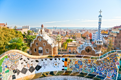
Another Gaudí masterpiece, this public park was originally conceived as a residential development but later transformed into a municipal garden. The park showcases Gaudí’s signature style with organic shapes, colorful mosaics, and integration with the natural landscape. The famous mosaic salamander (known as “el drac”) greets visitors at the entrance, while the undulating bench encircling the main terrace offers panoramic views of Barcelona and the Mediterranean.
The park blends architectural elements with nature in a way that feels both whimsical and harmonious, demonstrating Gaudí’s belief that architecture should mirror the natural world.this elevation makes transportation planning important. Here’s a comprehensive guide to reaching this iconic park.
Connectivity:
By Metro (Subway)
The metro doesn’t reach Park Güell directly, but there are stations within walking distance:
- Line 3 (Green): Get off at “Lesseps” station or “Vallcarca” station
- From Lesseps: About a 15-minute uphill walk (800 meters). Follow the green footprints painted on the sidewalk that guide visitors to the park.
- From Vallcarca: Also about a 15-minute walk but with escalators to help with the steep sections, making it often the easier route despite being slightly farther.
- Line 3 (Green): Get off at “Lesseps” station or “Vallcarca” station
By Bus
Several bus lines offer stops closer to the park entrances than the metro:
- Bus 24: Stops directly at one of the park entrances (Carretera del Carmel entrance)
- Bus H6: Stops near the main entrance on Carrer d’Olot
- Bus 92: Stops at the upper part of the park
- Barcelona Tourist Bus (Blue Route): Has a dedicated Park Güell stop
The bus is often the most convenient public transportation option as it brings you much closer to the entrances than the metro.
By Taxi
Taxis in Barcelona are readily available and can drop you off at the main entrance on Carrer d’Olot or the Carretera del Carmel entrance. Using ride-sharing apps like Cabify (Uber has limited service in Barcelona) is also an option.
Expect to pay approximately €10-15 from the city center, depending on traffic conditions.
By Car
If you’re driving, be aware that parking near Park Güell can be extremely challenging due to narrow streets and limited spaces:
- BSM Park Güell: The official parking facility at Carrer de Sant Josep de la Muntanya, 25. Small but convenient, about a 5-minute walk to the main entrance.
- Parking Carretera del Carmel: Located closer to the upper entrance of the park.
- Street parking: Limited blue zone (regulated paid parking) spots are available in the surrounding streets, but they fill up quickly, especially during peak tourist season.
The neighborhood has many steep, narrow one-way streets, which can be stressful to navigate. Public transportation is strongly recommended unless you’re familiar with driving in Barcelona.
Important Details for Your Visit
- Address: Carrer d’Olot, 5, 08024 Barcelona, Spain
- GPS Coordinates: 41.4145° N, 2.1527° E
- Main Entrances:
- Carrer d’Olot entrance (main entrance, lower part of the park)
- Carretera del Carmel entrance (upper part of the park)
- Sant Josep de la Muntanya entrance (eastern side)
- Main Entrances:
- Opening Hours: Generally 9:30 AM to sunset (varies by season)
- Ticket Information: Only the Monumental Zone requires paid entry, which includes Gaudí’s famous works like the Dragon Stairway and Hypostyle Room. The surrounding park area is free to enter.
- Advance Tickets: Highly recommended to secure your preferred time slot, as daily visitor numbers are restricted.
Gothic Quarter (Barri Gòtic)

The historic heart of Barcelona dates back to Roman times and features a labyrinth of narrow medieval streets and atmospheric squares. As you wander through this pedestrian-friendly district, you’ll encounter the impressive Barcelona Cathedral, hidden plazas like Plaça del Rei and Plaça Sant Felip Neri, and remnants of the ancient Roman city walls.
The quarter houses numerous small shops, traditional bars, and restaurants where you can sample authentic Catalan cuisine. The area comes alive particularly in the evening, when locals and visitors gather at outdoor terraces to enjoy tapas and local wines.
Connectivity:
By Metro
- Line 4 (Yellow): Jaume I station – directly in the Gothic Quarter
- Exit toward Carrer de l’Argenteria for fastest access
- Operating hours: 5:00 AM – midnight (Sun-Thurs), 5:00 AM – 2:00 AM (Fri), 24 hours (Sat)
- Line 4 (Yellow): Jaume I station – directly in the Gothic Quarter
- Line 3 (Green): Liceu station – western edge of the Quarter
- Exit toward La Rambla/Plaça Reial
- Connected to several bus routes
- Line 3 (Green): Liceu station – western edge of the Quarter
- Line 1 (Red) or Line 3 (Green): Catalunya station – northern edge
- Major interchange station with suburban trains
- Connected to Aerobus services from the airport
- Line 1 (Red) or Line 3 (Green): Catalunya station – northern edge
By Bus
- Tourist Bus (Barcelona Bus Turístic): Stops at Plaça Catalunya and Port Vell
- Airport Bus (Aerobus): A1 and A2 lines terminate at Plaça Catalunya
- Night Buses (Nitbus): N8, N9, N12, and N15 serve the area after regular service ends
- Regular Routes: 14, 17, 19, 40, 45, 59, 91, 120, V15, V17, and D20
- Bus 59 is particularly useful as it runs down Via Laietana with stops at both Jaume I and Correos
- Regular Routes: 14, 17, 19, 40, 45, 59, 91, 120, V15, V17, and D20
By Train
- Renfe Rodalies: Barcelona Plaça Catalunya station
- Serves R1, R3, R4, and R7 suburban lines
- Direct connection to El Prat Airport (R2 Nord)
- Renfe Rodalies: Barcelona Plaça Catalunya station
- FGC (Ferrocarrils de la Generalitat): Plaça Catalunya station
- Serves lines L6, L7, S1, S2, S5, S6, and S7
- Underground connection to Metro system
- FGC (Ferrocarrils de la Generalitat): Plaça Catalunya station
Detailed Parking Information
- SABA Cathedral Parking:
- Address: Av. de la Catedral, 6
- 385 spaces, 24/7 operation
- Daily rates around €30-35
- Pre-booking available via app
- SABA Cathedral Parking:
- BSM Moll d’Espanya:
- 750 spaces, slightly cheaper rates
- Good option for approaching from the port
- BSM Moll d’Espanya:
- BAMSA La Gardunya:
- Near La Boqueria Market
- 428 spaces on multiple levels
- Recently renovated facility
- BAMSA La Gardunya:
- Smaller parkings:
- Plaça George Orwell (limited spaces)
- Parking Palau de la Música (good for approaching from northern side)
- Smaller parkings:
Recommended Entry Points & Routes
- For first-time visitors: Enter via Plaça Nova/Barcelona Cathedral for the most impressive introduction
- For shopping: Enter from Portal de l’Àngel shopping street
- For food lovers: Enter via La Boqueria market and walk through Las Ramblas
- For architecture enthusiasts: Enter via Via Laietana to appreciate the contrast between Gothic and modernist styles
Navigation Tips
- Many streets change names frequently as they progress through the quarter
- Plaça Sant Jaume (with City Hall and Palau de la Generalitat) serves as a good central reference point
- The main spine of the quarter runs from Plaça Nova (Cathedral) to Plaça Reial
- Mobile reception can be spotty in some of the narrowest streets – download offline maps in advance
La Rambla and Mercat de la Boqueria

La Rambla is Barcelona’s most famous boulevard, a tree-lined pedestrian street stretching from Plaça de Catalunya to the Columbus Monument at Port Vell. This vibrant promenade bustles with street performers, flower stalls, and outdoor cafés. Along this cultural artery, you’ll find the magnificent Gran Teatre del Liceu opera house and the entrance to Mercat de la Boqueria, one of Europe’s finest food markets.
Inside the market, colorful stalls display an astonishing variety of fresh fruits, vegetables, seafood, meats, cheeses, and local specialties like jamón ibérico. The market offers both a feast for the eyes and an opportunity to sample authentic Catalan gastronomy.
Connectivity:
La Rambla
Address: La Rambla, 08002 Barcelona, Spain
Mercat de la Boqueria (La Boqueria Market)
Located just off La Rambla, this is one of Barcelona’s most famous food markets.
Address: La Rambla, 91, 08001 Barcelona, Spain
Opening Hours:
- Monday to Saturday: 8:00 AM – 8:30 PM
- Sundays and Public Holidays: Closed
- Many stalls may close earlier (around 8:00 PM)
- Some vendors take afternoon breaks (typically 2:00 PM – 5:00 PM)
By Metro
- Liceu Station (Line 3 – Green): Located directly on La Rambla, closest to La Boqueria
- Exit the station and La Boqueria is approximately 100 meters north
- Operating hours: 5:00 AM – midnight (Sun-Thurs), 5:00 AM – 2:00 AM (Fri), 24 hours (Sat)
- Liceu Station (Line 3 – Green): Located directly on La Rambla, closest to La Boqueria
- Drassanes Station (Line 3 – Green): Southern end of La Rambla
- Catalunya Station (Lines 1 & 3 – Red & Green): Northern end of La Rambla
- Major interchange station with connections to regional trains
- Catalunya Station (Lines 1 & 3 – Red & Green): Northern end of La Rambla
By Bus
- Lines serving La Rambla area: 14, 59, 91, 120, V13, D20
- Tourist Bus (Barcelona Bus Turístic): Blue and Red routes stop at Plaça Catalunya
- Airport Bus (Aerobus): A1 and A2 lines terminate at Plaça Catalunya
- Night Buses: N9, N12, N15 serve the area after regular service hours
By Train
- Barcelona Plaça Catalunya Station:
- Serves Renfe commuter lines (R1, R3, R4, R7)
- Connects to Barcelona El Prat Airport via R2 Nord
- Barcelona Plaça Catalunya Station:
- FGC Station at Plaça Catalunya:
- Serves lines L6, L7, S1, S2, S5, S6, S7
- FGC Station at Plaça Catalunya:
By Taxi/Ride-Share
- Taxi stands located at:
- Plaça Catalunya (northern end of La Rambla)
- Liceu Theater (middle of La Rambla)
- Columbus Monument (southern end)
- Taxi stands located at:
- Ride-sharing apps operate throughout Barcelona
Parking Options
Public Parking Garages
- SABA La Rambla:
- Address: La Rambla, 80
- Directly on La Rambla, closest to La Boqueria
- 24/7 operation
- 429 spaces
- Daily rates around €30-35
- SABA La Rambla:
- BAMSA La Gardunya:
- Address: Plaça de la Gardunya (behind La Boqueria)
- Recently renovated facility
- 428 spaces
- Slightly more affordable than La Rambla parking
- BAMSA La Gardunya:
- BSM Moll d’Espanya:
- Near Port Vell (southern end of La Rambla)
- 750 spaces
- Good option for approaching from the port area
- BSM Moll d’Espanya:
- Parking Raval – Centre d’Art Santa Mònica:
- Near the Columbus Monument
- 165 spaces
- Parking Raval – Centre d’Art Santa Mònica:
Walking Access
- From Gothic Quarter: Multiple access points along the eastern side of La Rambla
- From El Raval: La Boqueria is on the western side of La Rambla
- From Port Vell: Walk north on La Rambla for approximately 15 minutes
- From Plaça Catalunya: Walk south on La Rambla for approximately 10 minutes
Practical Tips
- Best times to visit La Boqueria:
- Early morning (8:00 AM – 10:00 AM) for the freshest products and fewer crowds
- Avoid peak hours (11:00 AM – 2:00 PM) when tourist groups are most common
- Best times to visit La Boqueria:
- Navigation landmarks:
- La Boqueria’s main entrance is marked by a distinctive modernist iron and stained glass sign
- Look for the Canaletas Fountain at the northern end of La Rambla
- The Liceu Opera House is a major landmark near La Boqueria
Casa Batlló and Passeig de Gràcia

Located on the elegant Passeig de Gràcia boulevard, Casa Batlló represents another of Gaudí’s architectural masterpieces. This extraordinary building, redesigned by Gaudí in 1904, features a façade that appears to be made from skulls and bones (the balconies) and is topped with a roof resembling a dragon’s back.
Inside, the building continues to surprise with its absence of straight lines, marine-inspired details, and ingenious use of light. The surrounding Passeig de Gràcia itself deserves exploration as Barcelona’s most luxurious shopping avenue, home to additional Modernist buildings like Casa Milà (La Pedrera) and high-end boutiques.
Connectivity:
Casa Batlló
Address: Passeig de Gràcia, 43, 08007 Barcelona, Spain
Opening Hours:
- Daily: 9:00 AM – 8:00 PM (last entry at 7:00 PM)
- Extended hours during summer season (usually until 9:00 PM)
- Open 365 days a year, including holidays
Official Website: casabatllo.es
Passeig de Gràcia
Transportation Options
By Metro
- Passeig de Gràcia Station (Lines 2, 3, 4 – Purple, Green, Yellow):
- Main interchange station directly serving the area
- Take Exit “Passeig de Gràcia – Casa Batlló” for the most direct route
- Operating hours: 5:00 AM – midnight (Sun-Thurs), 5:00 AM – 2:00 AM (Fri), 24 hours (Sat)
- Passeig de Gràcia Station (Lines 2, 3, 4 – Purple, Green, Yellow):
- Diagonal Station (Lines 3, 5 – Green, Blue): Northern end of Passeig de Gràcia
By Bus
- Regular Routes: 7, 22, 24, V15, H10, D50 all stop near Casa Batlló
- Tourist Bus (Barcelona Bus Turístic):
- Blue Route stops at “Passeig de Gràcia – La Pedrera”
- Daily service from 9:00 AM – 7:00 PM (winter) or 8:00 PM (summer)
- Tourist Bus (Barcelona Bus Turístic):
- Night Buses: N4, N5, N6 serve Passeig de Gràcia after regular service hours
By Train
- Passeig de Gràcia Station:
- Serves Renfe commuter lines (R2, R2 Nord, R2 Sud, R11, R13, R14, R15, R16)
- Direct connection to Barcelona El Prat Airport via R2 Nord
- High-speed AVE trains also stop here
- Passeig de Gràcia Station:
By Taxi/Ride-Share
- Taxi stands located at:
- In front of Casa Batlló
- Corner of Passeig de Gràcia and Carrer d’Aragó
- Corner of Passeig de Gràcia and Gran Via
- Taxi stands located at:
- Ride-sharing apps operate throughout Barcelona
Parking Options
Public Parking Garages
- SABA Passeig de Gràcia:
- Address: Passeig de Gràcia, 56
- Only 300 meters from Casa Batlló
- 24/7 operation
- 443 spaces
- Premium rates (approximately €3.60-4.00/hour)
- SABA Passeig de Gràcia:
- BSM Plaça de Catalunya:
- Address: Plaça de Catalunya, 1
- 10-minute walk to Casa Batlló
- 939 spaces
- Slightly more affordable than Passeig de Gràcia parking
- BSM Plaça de Catalunya:
- SABA Rambla Catalunya:
- Address: Rambla de Catalunya, 15
- 5-minute walk to Casa Batlló
- 273 spaces
- SABA Rambla Catalunya:
- NN Valencia:
- Address: Carrer de València, 243
- 5-minute walk from Casa Batlló
- 409 spaces
- NN Valencia:
Additional Information
The “Block of Discord”
Casa Batlló is part of the famous “Illa de la Discòrdia” (Block of Discord), which features buildings by different modernist architects:
- Casa Batlló by Antoni Gaudí
- Casa Amatller by Josep Puig i Cadafalch
- Casa Lleó Morera by Lluís Domènech i Montaner All are within 100 meters of each other on Passeig de Gràcia
Nearby Attractions
- Casa Milà (La Pedrera): Another Gaudí masterpiece, 550 meters north on Passeig de Gràcia
- Plaça Catalunya: Major city square, 900 meters south
- Fundació Antoni Tàpies: Contemporary art museum, 300 meters away
- Luxury Shopping: High-end boutiques including Chanel, Louis Vuitton, Gucci, and Prada
Montjuïc Hill

Rising prominently above the city’s southwestern edge, Montjuïc Hill offers a delightful escape from urban bustle while providing some of Barcelona’s most important cultural institutions. Visitors can ascend via cable car for spectacular panoramic views of the city and Mediterranean Sea.
The hill houses the impressive National Art Museum of Catalonia (MNAC), featuring one of the world’s finest collections of Romanesque art. The area also contains the 1992 Olympic facilities, the Magic Fountain that performs choreographed water shows set to music and lights, beautiful botanical gardens, and Montjuïc Castle, an old military fortress with centuries of history.
The various attractions are connected by peaceful walking paths through lush gardens, making Montjuïc perfect for combining cultural experiences with natural beauty.
Connectivity:
General Information
Location: Southwest of Barcelona’s city center, rising 173 meters above sea level
Access Hours:
- The hill itself is accessible 24/7
- Individual attractions have their own opening hours (detailed below)
- Most gardens are open from sunrise to sunset
Major Attractions on Montjuïc
Montjuïc Castle (Castell de Montjuïc)
- Hours: Daily 10:00 AM – 8:00 PM (April-October), 10:00 AM – 6:00 PM (November-March)
- Address: Carretera de Montjuïc, 66
Magic Fountain (Font Màgica)
- Hours: Light shows typically Thursday-Sunday evenings (schedule varies by season)
- Location: Plaça de Carles Buïgas
National Art Museum of Catalonia (MNAC)
- Hours: Tuesday-Saturday 10:00 AM – 8:00 PM, Sundays 10:00 AM – 3:00 PM, Closed Mondays
- Address: Palau Nacional, Parc de Montjuïc
Joan Miró Foundation
- Hours: Tuesday-Saturday 10:00 AM – 6:00 PM (8:00 PM in summer), Sundays 10:00 AM – 3:00 PM, Closed Mondays
- Address: Parc de Montjuïc
Olympic Ring
- Hours: Olympic Stadium exterior accessible anytime, Olympic Museum hours vary
- Address: Passeig Olímpic, 15-17
Botanical Garden (Jardí Botànic)
- Hours: Daily 10:00 AM – 7:00 PM (April-October), 10:00 AM – 6:00 PM (November-March)
- Address: Carrer Doctor Font i Quer, 2
Transportation Options
By Metro
- Line 1 (Red): Espanya station – Main access point to Montjuïc
- Line 2 (Purple): Espanya station
- Line 3 (Green): Espanya station or Poble Sec station (northern side access)
- Line 8 (Pink): Espanya station
By Funicular & Cable Car
- Montjuïc Funicular:
- Connects from Paral·lel metro station (Lines 2 & 3) to halfway up Montjuïc
- Operating hours: Same as metro system
- Included in standard metro tickets/passes
- Montjuïc Funicular:
- Montjuïc Cable Car (Telefèric de Montjuïc):
- Continues from the funicular’s top station to near the castle
- Hours: 10:00 AM – 7:00 PM (winter), 10:00 AM – 9:00 PM (summer)
- Separate ticket required (approximately €14 round-trip)
- Montjuïc Cable Car (Telefèric de Montjuïc):
- Port Cable Car (Telefèric del Port):
- Connects Barceloneta with Montjuïc
- Separate from the Montjuïc Cable Car system
- Hours: 11:00 AM – 5:30 PM (winter), 10:30 AM – 8:00 PM (summer)
- Ticket: approximately €12 one-way, €19 round-trip
- Port Cable Car (Telefèric del Port):
By Bus
- Regular Bus Lines:
- Line 55: From Plaça Catalunya to various Montjuïc locations
- Line 150: Circular route around Montjuïc hill
- Regular Bus Lines:
- Montjuïc Bus (Line 150):
- Circular route hitting all major Montjuïc attractions
- Frequency: Every 20-30 minutes
- Hours: Approximately 7:00 AM – 9:00 PM
- Montjuïc Bus (Line 150):
- Tourist Bus (Barcelona Bus Turístic):
- Red Route includes several stops on Montjuïc
- Daily service from 9:00 AM – 7:00 PM (winter) or 8:00 PM (summer)
- Tourist Bus (Barcelona Bus Turístic):
By Car
- Access via Avinguda Paral·lel, Avinguda de Miramar, or Carrer Lleida
- Navigation can be challenging due to winding roads and one-way systems
- GPS coordinates for castle: 41.3636° N, 2.1658° E
Parking Options
Free Parking Areas
- Street parking along Passeig Olímpic (limited spaces)
- Street parking near Joan Miró Foundation (limited spaces)
Paid Parking Garages
- BSM Poble Espanyol:
- Located near the Poble Espanyol attraction
- Approximately 300 spaces
- BSM Poble Espanyol:
- SABA Fira Barcelona Montjuïc:
- Address: Avinguda Reina Maria Cristina
- Near Plaça Espanya entrance to Montjuïc
- 800+ spaces
- SABA Fira Barcelona Montjuïc:
- BSM Rius i Taulet:
- Near MNAC and Magic Fountain
- 204 spaces
Barceloneta Beach and Port Olympic

Barcelona uniquely combines urban sophistication with seaside relaxation. Barceloneta Beach, the city’s most popular and accessible stretch of sand, lies just minutes from downtown. This vibrant beach offers golden sands, beach volleyball courts, outdoor gym equipment, and numerous chiringuitos (beach bars) serving refreshing drinks and seafood. The wide promenade is perfect for walking, jogging, or cycling along the Mediterranean.
Adjacent to the beach, Port Olympic was developed for the 1992 Olympics and now houses upscale restaurants, nightclubs, and a large marina filled with luxury yachts. The area is anchored by the iconic twin skyscrapers Hotel Arts and Torre Mapfre, with Frank Gehry’s massive golden fish sculpture (“El Peix”) glimmering between them—a modern landmark that has become symbolic of Barcelona’s coastal identity.
Connectivity:
By Metro (Subway)
The metro provides the most straightforward public transportation option to reach both areas:
For Barceloneta Beach:
- Line 4 (Yellow): Get off at “Barceloneta” station. From here, it’s approximately a 10-minute walk to the beach through the charming Barceloneta neighborhood. As you exit the station, follow signs toward “Platja” (beach in Catalan) or simply walk toward the sea along Passeig de Joan de Borbó.
For Port Olympic:
- Line 4 (Yellow): Get off at “Ciutadella | Vila Olímpica” station. This station is located just a 5-minute walk from Port Olympic. When you exit, head east toward the sea along Carrer de Salvador Espriu.
Both stations are connected by Line 4, making it easy to visit both locations in one day. The journey between these two stations takes only about 5 minutes.
By Bus
Several bus lines serve the coastal areas of Barcelona:
- Bus V21: Runs along the coastline, stopping at both Barceloneta Beach and Port Olympic
- Bus H16: Connects Passeig de Colom (near Barceloneta) to Port Olympic
- Bus 45: Stops near Barceloneta Beach
- Bus 59: Serves Port Olympic
- Bus 36: Stops near both areas
- Barcelona Tourist Bus (Red Route): Has stops at both Barceloneta and Port Olympic
These buses generally run every 10-15 minutes during the day, with reduced service in the evening and at night.
By Tram
- Trambesòs Line T4: Get off at “Ciutadella | Vila Olímpica” stop, which is very close to Port Olympic. This is a convenient option if you’re coming from the northern parts of Barcelona.
By Car
Driving to these areas is possible but not recommended due to limited parking and frequent congestion:
Parking Options for Barceloneta:
- BSM Passeig de Joan de Borbó: Underground parking near the Barceloneta neighborhood
- SABA Port Vell: Large underground parking facility at the nearby Port Vell
- Blue Zone street parking: Limited paid street parking in the area (difficult to find during summer months)
Parking Options for Port Olympic:
- BSM Port Olímpic: Underground parking beneath Port Olympic itself
- Centre de la Vila Shopping Center: Parking garage within walking distance
- Marina Port Olímpic: Parking for visitors to the marina
Expect to pay approximately €3-4 per hour for parking in these facilities. During summer weekends, these car parks fill up quickly, so arriving early is advisable.
By Taxi or Ride-Sharing
Taxis in Barcelona are plentiful and can drop you directly at your preferred entrance to either Barceloneta or Port Olympic. A taxi ride from the city center (Plaça Catalunya) to these areas typically costs around €10-15 depending on traffic. Cabify operates in Barcelona (Uber has limited service), and can be a convenient alternative to traditional taxis.
By Cable Car
For a more scenic approach:
- Teleférico del Puerto: This cable car runs from Montjuïc to Barceloneta, offering spectacular aerial views of the harbor and city. It departs from the Miramar station on Montjuïc and arrives at the Torre San Sebastián in Barceloneta. From there, it’s a short walk to the beach.
Walking Distances from Popular Areas
- From Gothic Quarter: 15-20 minute walk to Barceloneta Beach
- From La Rambla: 20-25 minute walk to Barceloneta Beach
- From Arc de Triomf: 20-minute walk to Port Olympic
- From Sagrada Familia: 35-40 minute walk to Port Olympic
- Between Barceloneta Beach and Port Olympic: 15-20 minute walk along the beachfront promenade
Connecting to Other Barcelona Attractions
Both Barceloneta and Port Olympic are well-positioned for combining with visits to other attractions:
- La Ciutadella Park: Adjacent to Port Olympic
- Barcelona Zoo: Near Port Olympic
- Maremagnum Shopping Center: Close to Barceloneta
- Maritime Museum: Near the Port Vell end of Barceloneta
Tibidabo Amusement Park and Sacred Heart Church

Perched atop Tibidabo Mountain, the highest point of the Collserola Ridge, this unique destination combines century-old amusement park charm with spectacular views and spiritual significance. The Tibidabo Amusement Park, opened in 1901, is one of Europe’s oldest functioning parks, featuring a blend of historic rides (including a museum-worthy carousel and Ferris wheel) and modern attractions.
Adjacent to the park stands the striking neo-Gothic Temple of the Sacred Heart (Temple Expiatori del Sagrat Cor), crowned by a massive statue of Christ with arms outstretched toward the city below. Visitors can take the funicular railway or the vintage Tramvia Blau (Blue Tram) up the mountain, experiencing a nostalgic journey before reaching the summit that offers the most comprehensive views of Barcelona, the Mediterranean, and the surrounding mountains—a truly breathtaking perspective that reveals the city’s geographic context.
Connectivity:
Tibidabo Funicular (The Classic Route)
The most iconic way to reach Tibidabo is via the historic funicular railway that has been operating since 1901:
The complete journey typically involves three stages:
- Metro: Take the L7 (Brown Line) from Plaça Catalunya to “Avinguda Tibidabo” station (the final stop).
- Tramvia Blau or Bus 196: From Avinguda Tibidabo, you historically would take the charming blue tram (Tramvia Blau) up the hill, but it’s currently undergoing renovation. Instead, Bus 196 now serves this route.
- Funicular de Tibidabo: The final leg is the funicular railway that climbs steeply up the mountain to the amusement park and church.
Direct Bus (The Convenient Option)
The T2A (Tibibus) offers the most straightforward route to Tibidabo:
- Bus T2A: Departs directly from Plaça Catalunya (near the corner with Rambla Catalunya).
- Schedule: Runs only on days when the amusement park is open, typically weekends, holidays, and daily during summer seasons.
- Frequency: Usually departs every 20-30 minutes.
- Journey Time: Approximately 25-30 minutes to reach the summit.
- Tickets: Can be purchased from the driver or online. The fare includes a discount on the amusement park entrance fee.
This is by far the most convenient option when it’s operating, as it requires no transfers and drops you directly at the park entrance.
By Public Bus (The Economical Option)
For a more economical approach using regular public transportation:
- Bus 196: From “Avinguda Tibidabo” metro station (L7), take Bus 196 to the “Tibidabo funicular” stop, where you can catch the funicular for the final ascent.
- Bus 111: An alternative route from “Vallvidrera Superior” (reached via FGC train from Plaça Catalunya to “Peu del Funicular,” then the Vallvidrera funicular). This bus will take you all the way to the summit, bypassing the need for the Tibidabo funicular.
The fare for these buses is covered by the standard T-Casual and other integrated Barcelona transport tickets, making it more economical than the dedicated Tibibus.
By Car (The Flexible Option)
Driving to Tibidabo provides flexibility but comes with challenges:
- Route: Follow signs to Collserola Park and then Tibidabo. The main approach is via Carretera de Vallvidrera al Tibidabo.
- Journey Time: Approximately 20-25 minutes from central Barcelona in light traffic.
- Caution: The road involves multiple switchbacks and can be challenging for those not accustomed to mountain driving.
Parking Options:
- Main Tibidabo Car Park: Located near the amusement park entrance with approximately 500 spaces. Costs around €5-8 for the day, depending on the season.
- Overflow Parking Areas: During peak times, additional parking is available along designated areas of the access road.
- Carretera de les Aigües Parking: Located partway up the mountain with shuttle service to the top during busy periods.
Driving is recommended primarily during off-peak times, as parking can become very limited on summer weekends and holidays.
By Taxi or Ride-Share
A taxi or ride-share service (like Cabify, as Uber has limited service in Barcelona) provides a direct route:
- Availability: Easily arranged from anywhere in the city.
- Cost: Expect to pay approximately €25-35 from the city center, depending on traffic.
- Return Journey: Be aware that finding a taxi for the return trip can be challenging, especially after closing time. Consider arranging a pickup in advance or using the Tibibus for your return journey.
Important Visitor Information
Opening Hours and Best Times to Visit:
- Amusement Park: Generally open from 11:00 AM to 7:00 PM on weekends year-round, with extended hours and daily operation during summer and school holidays. Always check the official website for current schedule.
- Sacred Heart Church: Usually open daily from 10:00 AM to 6:00 PM (8:00 PM in summer).
Museo del Prado

The Göreme Open-Air Museum stands as Cappadocia’s most visited attraction and for good reason. This UNESCO World Heritage site preserves a monastic complex dating from the 10th-12th centuries, when Cappadocia served as an important Byzantine religious center. Within a compact area, you’ll find more than 30 rock-cut churches and chapels, many containing remarkably preserved Byzantine frescoes.
The most impressive spaces include the Dark Church (Karanlık Kilise), whose name comes from the small window that limited light exposure, helping to preserve its vibrant frescoes depicting scenes from the life of Christ. The Apple Church (Elmalı Kilise) features striking reds and greens in its paintings, while the Snake Church (Yılanlı Kilise) contains a fascinating depiction of St. George slaying the dragon.
What makes this site particularly valuable is how it demonstrates the evolution of Byzantine religious art over centuries. The earliest churches feature simple red ochre designs with geometric patterns, while later ones display increasingly sophisticated figurative paintings with complex narratives and emotional expressiveness. Walking through these spaces, you’re witnessing the development of an artistic tradition that would eventually influence the Renaissance.
Address
Göreme Open-Air Museum (Göreme Açık Hava Müzesi) Merkez Mahallesi, Müze Caddesi 50180 Göreme/Nevşehir, Turkey
Opening Hours
- Summer Season (April 1 – October 31): 8:00 AM – 7:00 PM
- Winter Season (November 1 – March 31): 8:00 AM – 5:00 PM
- Open seven days a week
- Last entry is approximately 30 minutes before closing time
Getting to Göreme Open-Air Museum
From Major Cities in Turkey
By Air
The closest airports to Göreme are:
- Nevşehir Kapadokya Airport (NAV)
- Located approximately 40 km (25 miles) from Göreme
- Airlines serving this airport include Turkish Airlines and AnadoluJet
- Transfer options from the airport:
- Airport shuttle services (need to be pre-booked)
- Taxis available outside the terminal
- Car rental services available at the airport
- Kayseri Erkilet Airport (ASR)
- Located approximately 80 km (50 miles) from Göreme
- Served by more airlines including Turkish Airlines, Pegasus, and SunExpress
- Transfer options similar to Nevşehir Airport, though journey time is longer
By Bus
Turkey has an extensive intercity bus network connecting Cappadocia to major cities:
- From Istanbul: 10-12 hour journey, overnight buses available
- From Ankara: 4-5 hour journey
- From Antalya: 8-9 hour journey
- From Izmir: 10-11 hour journey
Major bus companies serving these routes include:
- Metro Turizm
- Kamil Koç
- Nevşehir Seyahat
- Süha Turizm
All these companies drop passengers at Göreme Bus Station (Otogar), from where you can take local transport to the museum.
From Göreme Town Center
Walking
- The Open-Air Museum is located approximately 1.5 km east of Göreme town center
- Walking time is about 20-25 minutes along a mostly uphill but well-marked path
- This is a popular option as the walk offers beautiful views of the surrounding landscape
By Taxi
- Taxis are readily available in Göreme town center
- Journey time is approximately 5 minutes
- You can ask your accommodation to call a taxi for you
By Dolmuş (Minibus)
- Local minibuses run between Göreme town center and Nevşehir
- These pass by the Open-Air Museum
- Frequency: Every 30 minutes during high season
- Journey time: Approximately 5-7 minutes from town center
By Rental Vehicle
- Numerous car and scooter rental services in Göreme town
- Scooters and ATVs are popular for exploring the region’s terrain
- Companies include Ride in Cappadocia, Göreme Scooter Rental, and Cappadocia Riders
From Other Towns in Cappadocia
From Ürgüp
- Distance: 10 km (6.2 miles)
- By Dolmuş: Minibuses run between Ürgüp and Göreme, stop at the museum on request
- By Taxi: Approximately 15-minute journey
From Avanos
- Distance: 9 km (5.6 miles)
- By Dolmuş: Take minibuses heading to Göreme and ask to be dropped at the museum
- By Taxi: Approximately 15-minute journey
From Nevşehir (Provincial Capital)
- Distance: 13 km (8 miles)
- By Dolmuş: Regular minibuses between Nevşehir and Göreme pass by the museum
- By Taxi: Approximately 20-minute journey
Parking Facilities
- Main Museum Parking Lot: Located directly across from the museum entrance
- Capacity for approximately 50 cars and 10 buses
- Usually fills up quickly during peak season mornings
- Overflow Parking Area: About 200 meters before the main entrance
- Used primarily during high season
- Can accommodate additional 30-40 vehicles
- Göreme Town Parking: For those who prefer to walk to the museum
- Several public parking areas available in town
- Walking distance: 20-25 minutes to museum
Transportation Companies & Services
Airport Shuttle Services
- Argeus Tourism: Offers shared and private transfers from both airports
- Contact: +90 384 341 46 88
- Website: https://argeus.com/
- Heritage Travel: Specializes in airport transfers to Göreme
- Contact: +90 384 271 2687
- Website: www.goreme.com
Local Transportation Services
- Göreme Tourism Office: Can arrange local transportation
- Located in town center
- Contact: +90 384 271 2166
Rental Services
- Ride in Cappadocia: Scooters, bicycles, and cars
- Avis: Car rental in Göreme town
- ZDK Rent a Car: Local car rental company
Nearby Attractions
Within Walking Distance (Less than 30 minutes)
- El Nazar Church: 10-minute walk from the museum
- Features impressive biblical scenes in fresco form
- Zemi Valley: Starts near the museum
- Beautiful hiking trail with interesting rock formations
- Göreme Panorama Point: 15-minute walk uphill from the museum
- Offers spectacular views of Göreme valley and the town
Short Drive Away (5-15 minutes)
- Love Valley: Famous for its distinctive fairy chimneys
- 5-minute drive from the museum
- Pasabag (Monks Valley): Notable for multi-headed fairy chimneys
- 10-minute drive
- Site of St. Simeon’s hermitage
- Devrent Valley (Imagination Valley): Rock formations resembling animals
- 15-minute drive
- Avanos: Town famous for pottery-making tradition
- 15-minute drive
- Located along the Red River (Kızılırmak)
Further Afield (15-30 minutes)
- Uçhisar Castle: Highest point in the region
- 15-minute drive
- Panoramic views of Cappadocia
- Ortahisar Castle: Rock fortress in traditional village
- 20-minute drive
- Underground Cities:
- Kaymaklı Underground City: 30-minute drive
- Derinkuyu Underground City: 35-minute drive
- Multi-level ancient underground settlements
Retiro Park (Parque del Buen Retiro)

This magnificent 350-acre park once belonged to the Spanish monarchy before becoming a public space in the late 19th century. The park offers a peaceful retreat from urban life with its artificial lake where visitors can rent rowboats, formal gardens, and tree-lined walks. The Crystal Palace (Palacio de Cristal), a stunning glass structure inspired by London’s Crystal Palace, hosts temporary art exhibitions and stands as one of the park’s architectural highlights.
Connectivity:
Park Overview
Address: Plaza de la Independencia, 7, 28001 Madrid, Spain Total Area: 118 hectares (approximately 292 acres)
Opening Hours
- Daily Hours:
- Summer (April-September): 6:00 AM – 12:00 AM (midnight)
- Winter (October-March): 6:00 AM – 10:00 PM
- Daily Hours:
- Free Public Access: Entire park
- Special Areas Operating Hours:
- Crystal Palace: Tuesday-Sunday, 10:00 AM – 8:00 PM
- Boat Lake: 10:00 AM – 8:00 PM (weather permitting)
- Special Areas Operating Hours:
By Metro
- Closest Stations:
- Retiro Station (Line 2)
- Direct entrance to park
- Minimal walking distance
- Retiro Station (Line 2)
- Atocha Station (Line 1)
- 5-minute walk through scenic route
- Atocha Station (Line 1)
- Banco de España Station (Line 2)
- 10-minute walk, passes major city landmarks
- Banco de España Station (Line 2)
- Closest Stations:
By Bus
- Direct Routes:
- Lines 2, 9, 14, 19, 20, 26, 27, 32, 37, 45, 51, 52, 53, 74
- Stop at Paseo del Prado or Plaza de la Independencia
- Direct Routes:
- Frequency: Every 5-10 minutes during peak hours
By Train
- Nearest Train Stations:
- Madrid Atocha (High-Speed Train Hub)
- Cercanías Atocha (Commuter Train)
- Nearest Train Stations:
- Both within walking distance
Parking Options
Public Parking Garages
- Plaza de la Independencia Parking
- Address: Plaza de la Independencia, 1
- 24/7 operation
- Approximately 250 spaces
- Rates: €3-4 per hour
- Plaza de la Independencia Parking
- Atocha Parking
- Address: Glorieta de Carlos V, s/n
- Near train station
- Approximately 500 spaces
- Rates: €2.80-3.50 per hour
- Atocha Parking
- Street Parking
- Limited free parking around park perimeter
- Time-restricted zones
- Pay attention to parking signs
- Street Parking
Park Attractions
Must-Visit Locations
- Boat Lake (Estanque del Retiro)
- Rowboat rentals available
- Iconic monument of Alfonso XII
- Picturesque photography spot
- Boat Lake (Estanque del Retiro)
- Crystal Palace (Palacio de Cristal)
- Historic glass exhibition hall
- Free entry
- Hosts contemporary art exhibitions
- Crystal Palace (Palacio de Cristal)
- Monument to Alfonso XII
- Massive statue overlooking Boat Lake
- Architectural marvel
- Monument to Alfonso XII
- Rose Garden (Rosaleda)
- Over 4,000 rose bushes
- Best visited in May-June during blooming season
- Rose Garden (Rosaleda)
- Statue Gardens
- Multiple sculptural installations
- Historical and contemporary works
- Statue Gardens
Nearby Attractions
- Prado Museum
- Thyssen-Bornemisza Museum
- Royal Botanical Garden
- Atocha Train Station
Plaza Mayor

Though no longer the royal family’s residence, this opulent baroque palace remains Spain’s official royal residence for ceremonial functions. With over 3,000 rooms, it ranks among Europe’s largest palaces. Visitors can tour lavishly decorated state rooms, the Royal Armory, and the Royal Pharmacy. The changing of the guard ceremony, performed on the first Wednesday of each month, provides a glimpse into Spain’s royal traditions.
Connectivity:
Royal Palace Overview
Address: Calle de Bailén, s/n, 28071 Madrid, Spain
Official Name: Palacio Real de Madrid
Historical Significance: Official residence of the Spanish Royal Family (though now used primarily for state ceremonies)
Opening Hours and Visiting Information
- General Public Hours:
- October to March: 10:00 AM – 6:00 PM
- April to September: 10:00 AM – 8:00 PM
- General Public Hours:
- Closed Days:
- January 1
- May 1
- December 24, 25, 31
- Closed Days:
Ticket Information
- Full Price: €13
- Reduced Price: €6.50 (students, seniors)
- Free Entry:
- Children under 5
- EU citizens on certain days
- Persons with disabilities
- Free Entry:
Transportation Options
Metro (Subway)
- Nearest Stations:
- Opera Station (Lines 2, 3, and R)
- Closest station
- Direct exit near palace entrance
- Walking distance: 2 minutes
- Opera Station (Lines 2, 3, and R)
- Santo Domingo Station (Line 2)
- 5-minute walk
- Santo Domingo Station (Line 2)
- Ópera Station (Line R)
- Regional train connection
- Ópera Station (Line R)
- Nearest Stations:
Bus Routes
- Direct Stop Routes:
- Lines 3, 25, 39, 50, 60, 148
- Stop at “Palacio Real” or nearby “Plaza de Oriente”
- Direct Stop Routes:
- Frequency: Every 10-15 minutes during daytime
- Tourist Buses: All major tourist routes include the Royal Palace
Train
- Nearest Train Stations:
- Príncipe Pío Station
- Commuter and regional trains
- 10-minute walk from palace
- Príncipe Pío Station
- Atocha Station
- High-speed and long-distance trains
- Connects via metro or bus
- Atocha Station
- Nearest Train Stations:
Parking Options
Public Parking Garages
- Plaza de la Villa Parking
- Address: Plaza de la Villa, 2
- 24/7 operation
- Approximately 200 spaces
- Rates: €3-4 per hour
- Plaza de la Villa Parking
- Cibeles Parking
- Address: Plaza de Cibeles, 1
- Near City Hall
- Approximately 300 spaces
- Rates: €3-4 per hour
- Cibeles Parking
- Opera Parking
- Address: Calle del Cabo Noval, 1
- Underground garage
- Approximately 250 spaces
- Rates: €2.50-3.50 per hour
- Opera Parking
Street Parking
- Limited street parking
- Strict time restrictions
- Pay attention to parking signs and zones
Nearby Attractions
- Plaza de Oriente
- Almudena Cathedral
- Sabatini Gardens
- Teatro Real (Royal Theater)
Gran Vía

Madrid’s most famous avenue cuts through the heart of the city, showcasing early 20th-century architecture and serving as the commercial and entertainment hub. Often compared to Broadway in New York, Gran Vía features theaters, cinemas, and flagship stores of international brands. The street’s impressive buildings represent various architectural styles, from Art Deco to Neo-Baroque, creating a visually stunning urban corridor.
Connectivity:
Gran Vía Overview
Location: Central Madrid’s primary commercial and entertainment street
Length: Approximately 1.3 kilometers
Historical Significance: Constructed between 1910-1934, representing Madrid’s modernization era
Nickname: “The Street That Never Sleeps”
Transportation Options
Metro (Subway) Access
- Direct Metro Stations:
- Gran Vía Station (Line 1 and Line 5)
- Located precisely on the street
- Most convenient access point
- Frequency: Trains every 3-5 minutes
- Gran Vía Station (Line 1 and Line 5)
- Callao Station (Line 3 and Line 5)
- Adjacent to central Gran Vía section
- Multiple entry/exit points
- Callao Station (Line 3 and Line 5)
- Direct Metro Stations:
- Nearby Stations:
- Plaza de España Station (Lines 3 and 10)
- Tribunal Station (Line 1)
- Banco de España Station (Line 2)
- Nearby Stations:
Bus Routes
- Comprehensive Bus Coverage:
- Lines 1, 2, 5, 15, 20, 44, 46, 51, 52, 53, 74, 146
- Multiple stops along entire Gran Vía stretch
- Frequent service during day and night
- Comprehensive Bus Coverage:
Parking Options
Public Parking Garages
- Plaza del Callao Parking
- Underground facility
- Approximately 350 spaces
- Rates: €3-4 per hour
- 24/7 operation
- Plaza del Callao Parking
- Plaza de España Parking
- Large underground parking
- Approximately 500 spaces
- Rates: €2.50-3.50 per hour
- Convenient for multiple attractions
- Plaza de España Parking
- Suggested Private Parking:
- Parking Saba Gran Vía
- Plaza de las Cortes Parking
- Multiple hourly and daily rate options
- Suggested Private Parking:
Street Parking
- Limited and strictly regulated
- Blue Zone (Zona Azul) parking
- Time restrictions and payment required
- Recommended to use public garages
Nearby Attractions
- Puerta del Sol
- Plaza Mayor
- Royal Palace
- Retiro Park
Temple of Debod

An authentic ancient Egyptian temple in the middle of Madrid might seem incongruous, but this 2nd-century BCE structure was gifted to Spain by Egypt in 1968 as thanks for Spanish assistance in saving antiquities threatened by the Aswan Dam project. Reassembled in Parque del Oeste, the temple offers both cultural interest and one of Madrid’s most spectacular sunset views over the city’s western horizon.
Connectivity:
Location and Historical Context
Official Name: Templo de Debod
Address: Paseo de Rosales, s/n, 28008 Madrid, Spain
Location: Oeste Park (Parque del Oeste), Madrid’s western district
Transportation Options
Metro (Subway) Access
- Closest Metro Stations:
- Ventura Rodríguez (Line 3): Most convenient station
- Plaza de España (Lines 3 and 10): Alternative route
- Moncloa (Lines 3 and 6): Additional option
- Moncloa (Lines 3 and 6): Additional option
- Closest Metro Stations:
Bus Transportation
- Recommended Bus Lines:
- Line 33: Direct route near the temple
- Line 65: Connects multiple central districts
- Line 121: Provides good coverage
- Line 202: Alternative route to the area
- Line 202: Alternative route to the area
- Recommended Bus Lines:
Parking Information
Nearby Parking Options
- Underground Parking Garages:
- Parking Plaza de España
- Parking Princesa
- Parking Ventura Rodríguez
- Nearby street parking with restricted zones
- Nearby street parking with restricted zones
- Underground Parking Garages:
Visitor Information
Opening Hours
- Tuesday to Sunday: 10:00 AM – 8:00 PM (Summer)
- Tuesday to Sunday: 10:00 AM – 6:00 PM (Winter)
- Closed: Mondays
- Free Entry
- Free Entry
Surrounding Attractions
- Oeste Park
- Royal Palace
- Princesa area
- Botanical Garden
- Scenic Madrid viewpoints
The Alhambra

The Alhambra stands as the crown jewel of Granada and arguably one of the most magnificent architectural complexes in the world. This vast fortress-palace ensemble represents the pinnacle of Islamic art in Europe, constructed primarily during the Nasrid dynasty (13th-15th centuries).
What makes the Alhambra truly remarkable is its integration of architecture with its natural surroundings. The complex comprises several distinct sections: the Alcazaba (military fortress), the Nasrid Palaces, and the Generalife gardens. Within the Nasrid Palaces, visitors encounter spaces of breathtaking beauty—the Court of the Lions with its famous fountain, the Hall of the Ambassadors with its intricate geometric ceiling, and the Court of the Myrtles with its reflective pool that mirrors the surrounding architecture.
The delicate stucco work features Arabic calligraphy, primarily verses from the Quran and poetry, while the geometric patterns in the tilework demonstrate the mathematical sophistication of Islamic art. The clever use of water throughout—in fountains, channels, and pools—creates not only physical cooling but also produces soothing sounds and mesmerizing reflections that enhance the sensory experience.
Remember that tickets often sell out weeks in advance, so planning ahead is essential.
Connectivity:
Location and Historical Significance
Official Name: Alhambra Palace and Fortress Complex
Address: Calle Real de la Alhambra, s/n, 18009 Granada, Spain
Transportation Options to Granada and the Alhambra
Getting to Granada
By Train
- High-Speed Train (AVE):
- Direct connections from Madrid
- Journey time: Approximately 3.5 hours
- Terminus: Granada Train Station
- High-Speed Train (AVE):
- Regional Trains:
- Connections from major Spanish cities
- Operated by Renfe
- Regional Trains:
Local Transportation in Granada
Bus Transportation
- Local Bus Routes:
- Line C30: Connects city center to the Alhambra
- Local Bus Routes:
Parking at the Alhambra
- Official Parking Facilities:
- On-site parking available
- Limited spaces
- Recommended to book in advance
- Rates: Approximately €5-€10 per day
- Official Parking Facilities:
- Alternative Parking Options:
- Parking areas near the visitor center
- Street parking in nearby residential areas
- Public parking lots in Granada city center
- Alternative Parking Options:
Visitor Information
Opening Hours
- General Visits:
- Summer (April to September): 8:30 AM – 8:00 PM
- Winter (October to March): 8:30 AM – 6:00 PM
- General Visits:
- Closed: Certain days during holidays
- Night Visits: Special evening tours available
Ticket Information
- Advance Booking Strongly Recommended
- Ticket Types:
- General Admission: €16-€25 (varies by season)
- Reduced Tickets: Students, seniors
- Free Entry: Children under 12, disabled visitors
- Ticket Types:
Ticket Includes
- Access to Nasrid Palaces
- Alcazaba Fortress
- Generalife Gardens
- Charles V Palace
- Museum exhibits
- Museum exhibits
Nearby Attractions
- Albaicín Neighborhood
- Granada Cathedral
- Royal Chapel
- Generalife Gardens
- Sierra Nevada Mountains
The Albaicín Quarter

Directly across from the Alhambra lies the ancient Moorish quarter of Albaicín, a UNESCO World Heritage site that preserves the medieval Islamic urban design. Walking through this labyrinthine neighborhood feels like stepping back in time, with its narrow, winding cobblestone streets, white-washed houses, and hidden carmenes (traditional houses with walled gardens).
The quarter’s intricate network of streets evolved organically over centuries, designed to provide shade during hot summers and protection from cold winds in winter. Many homes feature traditional elements like interior courtyards with fountains—architectural solutions perfectly adapted to Granada’s climate.
The most magical spot in the Albaicín is undoubtedly the San Nicolás viewpoint (Mirador de San Nicolás), which offers the most iconic panorama of the Alhambra set against the backdrop of the Sierra Nevada mountains. Watching the sunset here, as the Alhambra’s walls gradually transform from golden to deep red in the changing light, creates an unforgettable memory.
Connectivity:
Location
Official Name: Barrio del Albaicín (Albaicín Neighborhood)
Location: Historic Quarter of Granada, Northern Hill Facing the Alhambra
Public Transportation
Metro
- Metro Stations:
- Limited metro system in Granada
- Closest station: Méndez Núñez
- Requires additional bus or walking connection
- Metro Stations:
Bus Transportation
- Recommended Bus Lines:
- Line C1: Connects city center to Albaicín
- Line C2: Alternative route
- Line C30: Serves the historic area
- Frequent service throughout the day
- Recommended Bus Lines:
Parking Considerations
- Parking Options:
- Limited street parking
- Public parking lots:
- Parking near Plaza Nueva
- Parking near Carrera del Darro
- Public parking lots:
- Recommended strategies:
- Park in city center and walk
- Use public transportation
- Take a taxi
- Recommended strategies:
- Parking Options:
Visitor Information
Must-See Locations
- Mirador de San Nicolás
- Panoramic views of Alhambra
- Perfect sunset location
- Street musicians often perform
- Mirador de San Nicolás
- Historic Churches:
- Iglesia de San Salvador
- Iglesia de Santa Ana
- Historic Churches:
- Historic Carmens (Traditional Houses)
- Moorish-style homes with interior gardens
- Some open for guided tours
- Historic Carmens (Traditional Houses)
Cultural Experiences
Architectural Highlights
- Moorish Urban Design
- Narrow, winding streets
- Whitewashed houses
- Hidden plazas
- Intricate street patterns
- Moorish Urban Design
Cultural Sites
- Moorish fountains
- Traditional tea houses
- Artisan workshops
- Street art and graffiti
- Local craft markets
Nearby Attractions
- Alhambra Palace
- Generalife Gardens
- Granada Cathedral
- Royal Chapel
- Carrera del Darro
- Plaza Nueva
The Cathedral and Royal Chapel

Granada’s Cathedral represents one of Spain’s masterpieces of Spanish Renaissance architecture, begun in 1518 shortly after the Christian reconquest. The imposing structure features a spectacular façade designed by Alonso Cano and a soaring interior with massive columns.
Adjacent to the Cathedral lies the Royal Chapel (Capilla Real), commissioned by Catholic Monarchs Ferdinand and Isabella as their final resting place. Their ornate marble tombs lie within, symbolizing the culmination of the Reconquista and the unification of Spain. The sacristy houses a small but impressive museum containing Queen Isabella’s personal art collection, including works by Flemish and Italian masters.
What makes this complex particularly fascinating is how it embodies Spain’s transition from medieval to Renaissance ideals, built literally upon the foundations of the city’s former main mosque—a physical manifestation of the cultural transformation that Granada underwent in the 16th century.
Location and Historical Significance
Official Name:
- Cathedral of the Incarnation (Catedral de la Encarnación)
- Royal Chapel (Capilla Real)
Address:
- Cathedral: Plaza de la Catedral, s/n, 18001 Granada, Spain
- Royal Chapel: Calle Oficios, s/n, 18001 Granada, Spain
Transportation Options
Metro
- Closest Metro Stations:
- Méndez Núñez Station
- Limited metro system in Granada
- Requires additional walking or bus connection
- Closest Metro Stations:
Bus Transportation
- Recommended Bus Lines:
- Line C1: Serves city center
- Line C2: Connects key historic areas
- Line C30: Stops near cathedral
- Recommended Bus Lines:
Parking Considerations
- Parking Options:
- Limited street parking
- Nearby Public Parking:
- Plaza Nueva Parking
- Parking near Carrera del Darro
- Underground parking in city center
- Nearby Public Parking:
- Parking Options:
Visitor Information
Opening Hours
Cathedral
- Summer (April to September):
- Monday to Saturday: 10:30 AM – 6:30 PM
- Sunday: 1:30 PM – 6:30 PM
- Summer (April to September):
- Winter (October to March):
- Monday to Saturday: 10:30 AM – 5:30 PM
- Sunday: 1:30 PM – 5:30 PM
- Winter (October to March):
Royal Chapel
- Summer (April to September):
- Monday to Saturday: 10:30 AM – 6:30 PM
- Sunday: 11:00 AM – 6:30 PM
- Summer (April to September):
- Winter (October to March):
- Monday to Saturday: 10:30 AM – 5:30 PM
- Sunday: 11:00 AM – 5:30 PM
- Winter (October to March):
Ticket Information
- Combined Ticket (Cathedral and Royal Chapel):
- Adults: €5-€7 (varies by season)
- Reduced: Students, seniors
- Free: Children under 12, disabled visitors
- Combined Ticket (Cathedral and Royal Chapel):
What’s Included
- Full access to cathedral interior
- Royal Chapel museum
- Tombs of Catholic Monarchs
- Audio guide (multiple languages)
- Guided tour options
Nearby Attractions
- Albaicín Quarter
- Alhambra Palace
- Generalife Gardens
- Plaza Nueva
- Granada City Center
The Seville Cathedral and La Giralda

The Seville Cathedral stands as the largest Gothic cathedral in the world and the third-largest church overall. What many visitors don’t initially realize is that this massive structure was deliberately built to demonstrate Christian power, constructed directly atop the site of the city’s former grand mosque after the Reconquista. The cathedral’s builders reportedly aimed to create something so magnificent that “future generations would think them mad.
The most fascinating aspect of this complex is La Giralda, the bell tower that was originally the minaret of the mosque. Rather than destroying this Islamic architectural masterpiece, the Christians incorporated it into their cathedral, adding Renaissance elements to its top. This architectural palimpsest perfectly encapsulates Seville’s layered history. The tower’s internal structure features ramps rather than stairs, designed so that muezzins could ride horseback to the top to issue the call to prayer.
Inside the cathedral, you’ll find Christopher Columbus’s elaborate tomb, carried by figures representing the four kingdoms of Spain. The treasury houses an extraordinary collection of religious art, including works by Murillo and Goya. The Capilla Mayor (main chapel) features the largest altarpiece in the world, containing over 1,000 carved biblical figures covered in gold leaf—a testament to the wealth flowing into Spain from the Americas during the 16th century.
Location and Address
Address: Avenida de la Constitución, s/n, 41004 Sevilla, Spain
Transportation Options
- Metro
- Nearest Metro Station: Puerta de Jerez (Line 1)
- Distance from station: Approximately 5-10 minutes walking
- Metro
- Bus
- Multiple bus lines serve the area:
- Lines C1, C2, and C4 stop near the cathedral
- Lines 3, 5, 6, 7, and 10 also provide convenient access
- Multiple bus lines serve the area:
- Bus
- Tram
- MetroCentro Line connects major points in the city center
- Stops near the cathedral at Plaza Nueva
- Tram
Parking Options
- Nearby Parking Garages
- Parking Plaza Nueva
- Address: Plaza Nueva, s/n
- Capacity: Approximately 400 spaces
- Open 24/7
- Rates: Varies by duration (typically €2-4 per hour)
- Parking Plaza Nueva
- Nearby Parking Garages
Visiting Details
Opening Hours
- Summer (April to September)
- Monday to Saturday: 10:30 AM – 5:00 PM
- Sunday: 2:30 PM – 6:00 PM
- Summer (April to September)
- Winter (October to March)
- Monday to Saturday: 11:00 AM – 5:00 PM
- Sunday: 2:30 PM – 6:00 PM
- Winter (October to March)
Ticket Information
- Admission Prices
- Adult: €10
- Reduced (students, seniors): €5
- Children under 12: Free
- Admission Prices
- Ticket Types
- General Cathedral Entry
- Cathedral + Tower (La Giralda) Access
- Combined ticket with Royal Alcázar
Nearby Attractions
- Royal Alcázar of Seville
- Plaza de España
- Torre del Oro
- Archive of the Indies
Real Alcázar

The Real Alcázar represents one of the world’s most outstanding examples of Mudéjar architecture—a style developed by Muslims working under Christian rule that blends Islamic artistic elements with European Christian influences. What makes this palace complex truly extraordinary is that it remains Europe’s oldest royal residence still in use, with the Spanish royal family occupying the upper levels when visiting Seville.
The palace evolved over nearly a millennium, with each successive ruler adding their own architectural contributions. The heart of the complex is the Palace of Pedro I, built in the 14th century by a Christian king who, paradoxically, employed Muslim artisans to create an Islamic-style palace more magnificent than those of his Muslim rivals in Granada. The resulting spaces—particularly the breathtaking Courtyard of the Maidens with its reflecting pool—demonstrate how cultural exchange often transcended religious and political boundaries.
The gardens of the Alcázar deserve special attention. They combine formal Renaissance designs with Islamic water features and incorporate plants from the Americas—a horticultural record of Spain’s imperial connections. The hydraulic systems that feed the numerous fountains and pools represent sophisticated engineering knowledge transmitted from Islamic civilization.
Location and Address
Address: Patio de Banderas, s/n, 41004 Sevilla, Spain
Transportation Options
- Metro
- Nearest Metro Station: Puerta de Jerez (Line 1)
- Distance from station: Approximately 10-15 minutes walking
- Metro
- Bus
- Convenient bus lines:
- Line C1: Connects major tourist areas
- Lines 3, 5, 6, 7, and 10: Provide access to the city center
- Stops near Plaza del Triunfo and Avenida de la Constitución
- Convenient bus lines:
- Bus
- Tram
- MetroCentro Line serves the historic city center
- Stops near Plaza Nueva, a short walk from the Alcázar
- Tram
Parking Options
- Nearby Parking Garages
- Parking Plaza Nueva
- Address: Plaza Nueva, s/n
- Capacity: Approximately 400 spaces
- Open 24/7
- Rates: €2-4 per hour
- Parking Plaza Nueva
- Nearby Parking Garages
Visiting Details
Opening Hours
- Summer (April to September)
- Monday to Sunday: 9:30 AM – 7:00 PM
- Last entry: 6:00 PM
- Summer (April to September)
- Winter (October to March)
- Monday to Sunday: 9:30 AM – 5:00 PM
- Last entry: 4:00 PM
- Winter (October to March)
Ticket Information
- Admission Prices
- Adult: €14.50
- Reduced (students, seniors): €7.25
- Children under 12: Free
- Admission Prices
- Ticket Types
- General Alcázar Entry
- Guided Tour
- Combined ticket with Cathedral
Nearby Attractions
- Seville Cathedral
- La Giralda Tower
- Plaza de España
- Archive of the Indies
Plaza de España

Built for the Ibero-American Exposition of 1929, the Plaza de España represents an architectural love letter to Spain’s diverse regions and its historical connections to its former colonies. The massive semi-circular complex combines elements of Renaissance Revival, Art Deco, and Neo-Mudéjar styles, creating a uniquely Spanish architectural statement.
What makes this plaza particularly special are the 48 alcoves along its curved wall, each dedicated to a different Spanish province and decorated with painted ceramic tiles (azulejos) depicting historical scenes from that region. These vibrant ceramic depictions serve as a national atlas and historical encyclopedia, inviting visitors to learn about Spain’s regional diversity.
The canal that runs through the plaza, crossed by four bridges representing the ancient kingdoms of Spain, allows visitors to rent small boats—a romantic touch inspired by Venice but reinterpreted in a distinctly Spanish manner. The Plaza exemplifies Spain’s early 20th-century efforts to redefine its national identity following the loss of its last colonies while celebrating its cultural heritage.
Location and Address
Address: Plaza de España, s/n, 41013 Sevilla, Spain
Location: Maria Luisa Park (Parque de María Luisa)
Transportation Options
- Metro
- Nearest Metro Station: Plaza de Cuba (Line 1)
- Distance from station: Approximately 15-20 minutes walking
- Alternative: Puerta de Jerez Station
- Metro
- Bus
- Convenient bus lines:
- C1, C2: Direct routes to Maria Luisa Park
- Lines 3, 5, 6, 7, 10: Provide access to the area
- Specific stops:
- Plaza de Cuba
- Avda. María Luisa
- Paseo de las Delicias
- Specific stops:
- Convenient bus lines:
- Bus
- Tram
- MetroCentro Line serves the city center
- Closest stop: Plaza Nueva
- Short walk through the historic center
- Tram
Parking Options
- Nearby Parking Garages
- Parking Plaza Nueva
- Address: Plaza Nueva, s/n
- Capacity: Approximately 400 spaces
- Open 24/7
- Rates: €2-4 per hour
- Parking Plaza Nueva
- Parking near Maria Luisa Park
- Underground parking facilities
- Multiple options within walking distance
- Parking near Maria Luisa Park
- Nearby Parking Garages
Visiting Details
Access and Hours
- Open to Public
- 24 hours a day
- Free entry to the plaza and surrounding park areas
- Open to Public
Nearby Attractions
- Royal Alcázar of Seville
- Seville Cathedral
- Torre del Oro
- Archaeological Museum of Seville
Barrio Santa Cruz

The former Jewish quarter of Seville, Barrio Santa Cruz, presents a fascinating window into medieval urban design. Following the Christian reconquest and subsequent persecution of Jews, this neighborhood underwent significant transformations, yet it retains the intimate scale and organic layout characteristic of medieval Mediterranean cities.
What makes Santa Cruz particularly enchanting is how practical solutions to Seville’s intense climate created spaces of remarkable beauty. The narrow, winding streets—so tight in places that they’re called “kissing lanes” because balconies nearly touch across them—were designed to provide shade during scorching summers. Small plazas with orange trees and fountains create microclimate cooling effects. Whitewashed walls reflect sunlight while interior courtyards (patios) hidden behind ornate iron gates provide private garden retreats.
This neighborhood contains numerous important historical sites, including the Hospital de los Venerables, originally built to care for elderly priests and now housing an important art collection. However, the greatest pleasure comes from wandering without a strict itinerary, discovering hidden squares like Plaza de Doña Elvira with its tiled benches and fragrant orange trees, or stumbling upon small churches containing unexpected artistic treasures.
Location and Historical Context
Area: Historic Jewish Quarter of Seville
Geographical Boundaries:
- North: Calle Alemanes
- South: Plaza de la Virgen de los Reyes
- East: Seville Cathedral
- West: Royal Alcázar
Transportation Options
- Metro
- Nearest Metro Stations:
- Puerta de Jerez (Line 1)
- Plaza de Cuba (Line 1)
- Nearest Metro Stations:
- Walking distance: 10-15 minutes from both stations
- Bus
- Convenient bus lines serving the area:
- C1, C2: Connects major tourist attractions
- Lines 3, 5, 6, 7, 10: Provide extensive city center coverage
- Stops near:
- Plaza de la Virgen de los Reyes
- Avenida de la Constitución
- Stops near:
- Convenient bus lines serving the area:
- Bus
- Tram
- MetroCentro Line
- Stops near:
- Plaza Nueva
- Cathedral area
- Stops near:
- Tram
Parking Options
- Nearby Parking Garages
- Parking Plaza Nueva
- Address: Plaza Nueva, s/n
- Capacity: 400 spaces
- Open 24/7
- Rates: €2-4 per hour
- Parking Plaza Nueva
- Underground Parking near Cathedral
- Multiple facilities within walking distance
- Rates vary (€2-5 per hour)
- Underground Parking near Cathedral
- Nearby Parking Garages
Nearby Attractions
- Royal Alcázar
- Seville Cathedral
- Plaza de España
- Torre del Oro
The Metropol Parasol (Las Setas)

Completed in 2011 and commonly known as “Las Setas” (The Mushrooms) due to its distinctive form, the Metropol Parasol provides a contemporary counterpoint to Seville’s historical architecture. This massive wooden structure—claimed to be the largest wooden building in the world—consists of six parasol-shaped forms that create shade over the Plaza de la Encarnación.
What makes this modern intervention particularly significant is how it bridges Seville’s ancient past with its future. The structure was built above an archaeological site containing Roman and Moorish ruins, which are preserved and displayed in an underground museum. The architects solved the challenge of protecting these ruins while creating a vibrant new public space that has revitalized a formerly declining neighborhood.
The elevated walkway that winds across the top of the structure offers spectacular panoramic views of Seville’s historical center, allowing visitors to comprehend the urban layout and architectural relationships between the city’s major monuments. This bird’s-eye perspective reveals patterns of development that shaped the city over centuries, from Roman grid planning to medieval organic growth.
Location and Architectural Marvel
Address: Plaza de la Encarnación, s/n, 41003 Sevilla, Spain
Architect: Jürgen Mayer Hermann Completed: 2011
Transportation Options
- Metro
- Nearest Metro Station: Plaza de la Encarnación (Line 1)
- Walking Distance: Immediate access
- Travel Time from City Center: 5-10 minutes
- Metro
- Bus
- Convenient Bus Lines:
- C1, C2: Direct routes to city center
- Lines 3, 5, 6, 7, 10: Comprehensive city coverage
- Specific Stops:
- Plaza de la Encarnación
- Avenida de la Constitución
- Specific Stops:
- Convenient Bus Lines:
- Bus
- Tram
- MetroCentro Line
- Closest Stop: Plaza Nueva
- Short walking distance (10-15 minutes)
- Tram
Parking Options
- Nearby Parking Facilities
- Underground Parking at Plaza de la Encarnación
- Capacity: Approximately 300 spaces
- Open 24/7
- Rates: €2-4 per hour
- Underground Parking at Plaza de la Encarnación
- Additional Nearby Parking:
- Parking Plaza Nueva
- Multiple underground parking facilities in historic center
- Additional Nearby Parking:
- Nearby Parking Facilities
Visiting Details
Opening Hours
- Observation Deck and Museum
- Summer (April to September):
- Monday to Sunday: 10:00 AM – 11:00 PM
- Last entry: 10:30 PM
- Summer (April to September):
- Winter (October to March):
- Monday to Sunday: 10:00 AM – 8:00 PM
- Last entry: 7:30 PM
- Winter (October to March):
- Observation Deck and Museum
Ticket Information
- Admission Prices
- Adult: €8
- Reduced (students, seniors): €4
- Children under 12: Free
- Admission Prices
- Ticket Types
- Observation Deck Access
- Museum and Archaeological Site
- Combined Ticket with Panoramic Walk
Nearby Attractions
- Seville Cathedral
- Royal Alcázar
- Barrio Santa Cruz
- Plaza de España
City of Arts and Sciences (Ciudad de las Artes y las Ciencias)

This futuristic architectural complex is Valencia’s most distinctive landmark. Designed by Santiago Calatrava and Félix Candela, it stretches along what was once the riverbed of the Turia River. The complex includes several striking buildings:
- The Hemisfèric: A planetarium and IMAX cinema shaped like a giant eye
- The Oceanogràfic: Europe’s largest aquarium with different marine environments
- The Príncipe Felipe Science Museum: A hands-on science center with interactive exhibits
- The Palau de les Arts Reina Sofía: An opera house and performing arts center
- The Umbracle: An open-air garden with indigenous plants and contemporary sculptures
The contrast between these ultra-modern structures and Valencia’s historic center illustrates the city’s evolution from ancient Roman settlement to forward-thinking Mediterranean metropolis.
Location and Overview
Address: Avinguda del Professor López Piñero (Arquitecto Calatrava), 7, 46013 Valencia, Spain
Architect: Santiago Calatrava and Félix Candela Established: 1998-2005
Transportation Options
- Metro
- Nearest Metro Stations:
- Transparent Blue Line (Line 4):
- Alameda Station
- Doctor Waksman Station
- Transparent Blue Line (Line 4):
- Walking distance: 10-15 minutes
- Frequent trains connecting to city center
- Nearest Metro Stations:
- Metro
- Bus
- Convenient Bus Lines:
- Line 1: Direct route to City of Arts and Sciences
- Lines 18, 95, 99: Provide comprehensive coverage
- Specific Stops:
- Ciudad de las Artes y las Ciencias
- Paseo de Valencia
- Specific Stops:
- Convenient Bus Lines:
- Bus
- Tram
- Line 8 (Metropolitano de Valencia)
- Stops near the complex
- Connects to city center and surrounding areas
- Tram
Parking Options
- Parking Facilities
- Main Parking Area
- Underground parking beneath the complex
- Capacity: Approximately 500 spaces
- Rates: €1-3 per hour
- Open 24/7
- Main Parking Area
- Additional Nearby Parking:
- Public parking lots in Turia Gardens
- Street parking with time restrictions
- Additional Nearby Parking:
- Parking Facilities
Visiting Details
Opening Hours and Operating Times
Note: Hours vary for individual attractions within the complex
- General Complex
- Open daily
- Recommended visit times: 10:00 AM – 6:00 PM
- General Complex
- Specific Attractions
- L’Hemisfèric (IMAX Cinema and Planetarium)
- Shows: Multiple daily sessions
- First show: 11:00 AM
- Last show: 9:00 PM
- L’Hemisfèric (IMAX Cinema and Planetarium)
- Oceanogràfic (Marine Park)
- Summer (April-September): 10:00 AM – 7:00 PM
- Winter (October-March): 10:00 AM – 6:00 PM
- Oceanogràfic (Marine Park)
- Principe Felipe Science Museum
- Daily: 10:00 AM – 7:00 PM
- Extended hours during summer and holidays
- Principe Felipe Science Museum
- Specific Attractions
Ticket Information
- Comprehensive Ticket Options
- Full Complex Pass
- Adult: €45
- Children (4-12): €35
- Includes entry to all attractions
- Full Complex Pass
- Individual Attraction Tickets
- L’Hemisfèric: €8
- Oceanogràfic: €30
- Principe Felipe Science Museum: €8
- Individual Attraction Tickets
- Comprehensive Ticket Options
Nearby Attractions
- Turia Gardens
- Valencia Cathedral
- Central Market of Valencia
- Historic City Center
Tourist Information
- Valencia Tourist Office
- Phone: +34 963 51 99 00
- Website: www.visitvalencia.com
Mercado Central (Central Market)

One of Europe’s oldest and largest fresh food markets, the Mercado Central is housed in a stunning modernist building completed in 1928. With its stained glass, domes, and intricate ironwork, it’s an architectural marvel even before you consider what’s inside.
The market contains nearly 400 stalls selling everything from fresh seafood and produce to local specialties like horchata (a sweet tiger nut milk) and jamón ibérico. It provides a perfect opportunity to experience local culture and sample authentic Valencian cuisine. The vibrant colors, aromas, and sounds make it a feast for all senses.
Location
Address: Plaza del Mercado, 1, 46001 Valencia, Spain
Architectural Style: Modernist (Modernisme)
Year Built: 1928
Architectural Designers: Francesc de Paula Goerlich Lleó
Cultural Status: National Historic Monument
Transportation Options
- Metro
- Nearest Metro Stations:
- Colón Station (Lines 3, 5, 7, 9)
- Xàtiva Station (Lines 3, 5, 7, 9)
- Walking Distance: 5-10 minutes
- Nearest Metro Stations:
- Bus
- Convenient Bus Lines:
- Lines 11, 17, 27, 64: Direct routes to historic center
- Stops near:
- Plaza del Mercado
- Plaza de la Reina
- City Hall
- Convenient Bus Lines:
- Tram
- MetroValencia Tram Lines
- Closest Stops:
- Colón
- Xàtiva
- Short walking distance to market
Parking Options
- Underground Parking Facilities
- Parking Plaza del Mercado
- Capacity: Approximately 250 spaces
- Rates: €2-3 per hour
- 24/7 access
- Parking Plaza de la Reina
- Capacity: 250 spaces
- Rates: €2-3 per hour
- Convenient location
- Parking Plaza del Mercado
Visiting Details
Opening Hours
- Market Operations
- Monday to Saturday: 7:30 AM – 3:00 PM
- Closed on Sundays and public holidays
Nearby Attractions
- Valencia Cathedral
- Silk Exchange (La Lonja)
- Plaza de la Virgen
- Central Historic District
Valencia Cathedral and El Miguelete

The Valencia Cathedral (Catedral de Valencia) dates primarily from the 13th to 15th centuries and blends Romanesque, Gothic, and Baroque architectural styles. The cathedral houses what many believe to be the Holy Grail—the chalice used by Jesus at the Last Supper.
El Miguelete, the cathedral’s bell tower, offers one of the best panoramic views of Valencia. Climbing its 207 steps rewards visitors with a spectacular vista of the historic center, the port, and on clear days, the surrounding mountains.
Location and Historical Significance
Address: Plaza de la Virgen, 1, 46001 Valencia, Spain
Historical Designation: Cathedral of Santa María la Mayor
Transportation Options
- Metro
- Nearest Metro Stations:
- Colón Station (Line 3, 5, 7, 9)
- Xàtiva Station (Line 3, 5, 7, 9)
- Nearest Metro Stations:
- Walking Distance: 10-15 minutes
- Metro
- Bus
- Convenient Bus Lines:
- Lines 11, 17, 27, 64: Direct routes to historic center
- Stops near:
- Plaza de la Virgen
- Plaza de la Reina
- Stops near:
- Convenient Bus Lines:
- Bus
- Tram
- MetroValencia Tram Lines
- Closest Stops:
- Colón
- Xàtiva
- Closest Stops:
- Short walking distance to cathedral
- Tram
Parking Options
- Underground Parking Facilities
- Parking Plaza de la Virgen
- Capacity: Approximately 300 spaces
- Rates: €2-4 per hour
- 24/7 access
- Parking Plaza de la Virgen
- Parking Plaza de la Reina
- Capacity: 250 spaces
- Rates: €2-3 per hour
- Convenient location
- Parking Plaza de la Reina
- Underground Parking Facilities
- Street Parking
- Limited availability
- Strictly regulated
- Metered zones with time restrictions
- Recommended to use underground parking
- Street Parking
Visiting Details
Opening Hours
- Cathedral
- Summer (April to September):
- Monday to Saturday: 10:00 AM – 6:30 PM
- Sunday: 2:00 PM – 6:30 PM
- Summer (April to September):
- Winter (October to March):
- Monday to Saturday: 10:00 AM – 5:30 PM
- Sunday: 2:00 PM – 5:30 PM
- Winter (October to March):
- Cathedral
- El Miguelete Tower
- Guided Tours:
- Tuesday to Saturday: 10:30 AM, 11:30 AM, 12:30 PM
- Limited daily access
- Advance booking recommended
- Guided Tours:
- El Miguelete Tower
Ticket Information
- Admission Prices
- Cathedral Entry:
- Adults: €7
- Reduced (students, seniors): €4
- Children under 12: Free
- Cathedral Entry:
- El Miguelete Tower:
- Additional €2 to cathedral ticket
- Limited to 8 people per tour
- Physical fitness required (curved stairs)
- El Miguelete Tower:
- Admission Prices
Nearby Attractions
- Central Market of Valencia
- Silk Exchange (La Lonja)
- Plaza de la Virgen
- Royal Gardens (Jardines del Real)
Jardín del Turia (Turia Gardens)

After a devastating flood in 1957, Valencia diverted the Turia River and transformed the old riverbed into a 9-kilometer park that winds through the city. This urban garden is now a verdant oasis where locals exercise, picnic, and relax.
The park features athletic fields, playgrounds, cycling paths, fountains, and ponds. As you stroll through, you’ll pass under 18 bridges that once spanned the river, each with its own architectural style. The contrast between these historic bridges and the lush garden setting creates a uniquely Valencian experience.
Location and Geographical Details
Address: Extends from the Bioparc to the City of Arts and Sciences
Location: Runs through the center of Valencia, Spain
Transportation Options
- Metro
- Multiple Access Points Along the Gardens:
- Colón Station (Lines 3, 5, 7, 9)
- Xàtiva Station (Lines 3, 5, 7, 9)
- Túria Station (Line 5)
- Multiple Access Points Along the Gardens:
- Walking Distance: Direct access from multiple stations
- Metro
- Bus
- Convenient Bus Lines:
- Lines 11, 17, 27, 64: Connect various points along the gardens
- Multiple stops along the route
- Convenient Bus Lines:
- Bus
- Tram
- MetroValencia Tram Lines
- Multiple Access Points:
- Colón
- Xàtiva
- Near major attractions along the gardens
- Multiple Access Points:
- Tram
Parking Options
- Parking Facilities Near Garden Sections
- Underground Parking Near City of Arts and Sciences
- Capacity: Approximately 500 spaces
- Rates: €2-4 per hour
- 24/7 access
- Underground Parking Near City of Arts and Sciences
- Parking Near Bioparc
- Capacity: 250 spaces
- Rates: €2-3 per hour
- Parking Near Bioparc
- Parking Facilities Near Garden Sections
Visiting Details
Accessibility and Hours
- Garden Access
- Open 24 hours a day
- Free public access
- Well-lit sections during evening hours
- Garden Access
Garden Sections and Features
- Ecological Diversity
- Native Mediterranean plant species
- Diverse landscaping
- Multiple recreational zones
- Sports facilities
- Children’s playgrounds
- Ecological Diversity
- Major Sections
- Bioparc Section
- City of Arts and Sciences Section
- Historic City Center Section
- Sports and Recreation Areas
- Botanical Gardens
- Major Sections
Recreational Opportunities
- Cycling paths
- Running tracks
- Skateboarding areas
- Outdoor exercise equipment
- Picnic zones
- Children’s playgrounds
- Sports courts
Nearby Attractions
- City of Arts and Sciences
- Bioparc Valencia
- Valencia Cathedral
- Central Market
- Historic City Center
La Concha Beach (Playa de la Concha)

La Concha Beach derives its name from its distinctive shell-like shape and stands as one of Europe’s most beautiful urban beaches. What makes this beach extraordinary isn’t just its aesthetic appeal but how it functions as the heart of San Sebastián’s social fabric.
Unlike many coastal cities where beaches exist as separate entities from urban centers, La Concha seamlessly integrates with the city itself. The elegant Belle Époque promenade that runs along its edge was developed during the late 19th century when Spanish royalty chose San Sebastián as their summer retreat. This historical choice transformed what was once a fishing town into a sophisticated resort destination.
When you stand on La Concha, you’re experiencing the result of deliberate urban planning that preserved public access to natural beauty while developing a dignified architectural identity. The white railings along the promenade have become iconic symbols of the city, featured in countless photographs. These railings were designed by Juan Rafael Alday in 1910 and represent the city’s commitment to thoughtful design even in its most functional elements.
The beach itself experiences significant tidal variations, sometimes losing up to 40 meters of sand during high tide. This natural rhythm creates different experiences throughout the day—from extensive sandy expanses to intimate swimming areas. The relatively calm waters result from the bay’s protective geography, which shields swimmers from the often rough Bay of Biscay.
Location and Address
Address: Paseo de la Concha, s/n, 20007 San Sebastián (Donostia), Gipuzkoa, Spain
Transportation Options
- Bus
- Local Bus Lines: Several San Sebastian city buses stop near the beach
- Lines 5, 6, and 9 have stops close to the beach promenade
- Donostia Bus Station is approximately 1 km from the beach
- Local Bus Lines: Several San Sebastian city buses stop near the beach
- Train
- Nearest Train Stations:
- Amara RENFE Station: 1.5 km from the beach
- Donostia-San Sebastian Station: 2 km from the beach
- Nearest Train Stations:
- Both stations offer connections to regional and national train networks
- Train
- Tram
- Euskotren (Local Tram System)
- Stops near the city center with short walking distance to the beach
- Convenient for tourists and locals alike
- Euskotren (Local Tram System)
- Tram
Driving and Parking
Parking Options:
- Street Parking
- Limited metered street parking available
- Time restrictions and payment required during peak hours
- Street Parking
- Parking Garages
- Parking Easo
- Address: Calle Easo, 20, 20006 San Sebastián
- Closest major parking facility to the beach
- Hourly and daily rates available
- Parking Easo
- Parking Boulevard
- Address: Calle Urdaneta, 5, 20006 San Sebastián
- Additional parking option near the beach area
- Parking Boulevard
- Parking Garages
Nearby Attractions
- Monte Urgull (Historic hill with panoramic views)
- Old Town (Parte Vieja)
- San Telmo Museum
- Zurriola Beach (popular surfing spot)
Parte Vieja (Old Town)

The Parte Vieja represents much more than a picturesque historic district—it’s where San Sebastián’s gastronomic heritage reaches its highest expression through the pintxo culture. Understanding this area requires recognizing how food in Basque culture transcends mere sustenance to become a sophisticated art form and social ritual.
The narrow streets follow a grid pattern established after the 1813 fire when Anglo-Portuguese forces fighting Napoleon burned the original medieval city. This destruction became an opportunity for planned rebuilding, resulting in the organized layout we see today. The street names offer historical insights—Calle 31 de Agosto (August 31st Street) commemorates the last street standing after the devastating fire.
The true magic of the Parte Vieja emerges in the evening during the txikiteo (pintxo crawl). This social custom involves moving from bar to bar, sampling one or two specialties at each establishment along with a small glass of wine or cider before moving on. This practice reflects the Basque emphasis on communal experiences and quality over quantity. Each pintxo bar specializes in certain creations, and locals know precisely which establishments excel at specific dishes.
The Plaza de la Constitución at the heart of the Old Town reveals its past as a bullring through the numbered balconies surrounding it. These numbers once designated viewing boxes for bullfights. Today, this square hosts important civic celebrations, including the drumming ceremony that marks the start of the city’s main festival, Semana Grande.
Location and Overview
Address: Parte Vieja, 20003 San Sebastián (Donostia), Gipuzkoa, Spain
Transportation Options
- Bus Services
- Multiple city bus lines serve the Old Town area
- Lines 5, 6, and 9 have stops near key locations
- Frequent service connecting different parts of the city
- Multiple city bus lines serve the Old Town area
- Key Bus Stops:
- Plaza de la Constitución
- San Vicente Church
- Old Town main square
- Key Bus Stops:
- Bus Services
- Train Connections
- Nearest Train Stations:
- Amara RENFE Station: 1.5 km from Old Town
- Donostia-San Sebastian Station: 2 km away
- Easy connections via local buses or short taxi ride
- Nearest Train Stations:
- Train Connections
- Tram
- Euskotren (Local Tram System)
- Stops near the city center
- Convenient for tourists exploring multiple attractions
- Connects Old Town with other city districts
- Euskotren (Local Tram System)
- Tram
Driving and Parking
Parking Options:
- Underground Parking Facilities
- Parking Boulevard
- Address: Calle Urdaneta, 5, 20006 San Sebastián
- Close proximity to Old Town
- Hourly and daily rates available
- Parking Boulevard
- Parking Easo
- Address: Calle Easo, 20, 20006 San Sebastián
- Convenient location
- Secure parking with reasonable rates
- Parking Easo
- Underground Parking Facilities
Visitor Information
Operating Hours
- Neighborhood Accessibility: Open 24/7
- Typical Business Hours:
- Shops: 10:00 AM – 8:00 PM (varies by establishment)
- Restaurants and Pintxos Bars: 12:00 PM – 11:00 PM
- Museums: Usually 10:00 AM – 6:00 PM
- Typical Business Hours:
Key Attractions
- Plaza de la Constitución
- Historical main square
- Center of social and cultural activities
- Plaza de la Constitución
- Santa Maria del Coro Church
- Baroque-style architectural marvel
- Historical significance
- Santa Maria del Coro Church
- San Vicente Church
- Ancient parish church
- Architectural landmark
- San Vicente Church
Nearby Attractions
- La Concha Beach
- Monte Urgull
- San Telmo Museum
- Zurriola Beach
Monte Igueldo

Monte Igueldo provides more than scenic views—it offers historical context for understanding San Sebastián’s development. This mountain has served as a strategic lookout point since the 16th century when a watchtower was built to spot approaching ships.
The funicular railway accessing the summit, opened in 1912, represents an early tourism infrastructure development. Its wooden cars have remained largely unchanged since their inception, preserving an authentic Belle Époque experience. The decision to build this railway coincided with San Sebastián’s growing prominence as a resort destination, making previously inaccessible viewpoints available to visitors.
The small amusement park at the summit dates from 1911 and maintains vintage attractions that create a nostalgic atmosphere. The wooden roller coaster, constructed in 1928, offers not just excitement but panoramic sea views during the ride—an unusual combination of thrills and scenic appreciation.
From Igueldo’s summit, you can comprehend how San Sebastián’s geography constrained and directed its development. The city expanded in a specific pattern dictated by its three hills and the Urumea River, creating distinct neighborhoods with different characters. This vantage point reveals San Sebastián’s adaptation to its natural setting rather than domination over it—a principle that reflects broader Basque values about human relationships with the environment.
Location and Overview
Address: Monte Igueldo, 20008 San Sebastián (Donostia), Gipuzkoa, Spain
Transportation Options
- Funicular Railway
- Monte Igueldo Funicular
- Starting Point: Base of Monte Igueldo
- Most unique and recommended way to reach the summit
- Historic funicular operating since 1912
- Scenic ride offering spectacular views during ascent
- Monte Igueldo Funicular
- Funicular Railway
- Bus Services
- Local Bus Routes
- Line E21: Connects city center to Monte Igueldo
- Nearest bus stops:
- Igueldo Auzoa
- Funicular Station
- Nearest bus stops:
- Operated by Dbus (San Sebastian Municipal Transport)
- Local Bus Routes
- Bus Services
- Train and Tram Connections
- Nearest Train Stations:
- Amara RENFE Station: 4 km from Monte Igueldo
- Donostia-San Sebastian Station: 5 km away
- Nearest Train Stations:
- Connections available via local buses or taxi services
- Train and Tram Connections
Driving and Parking
Parking Options:
- Dedicated Parking Areas
- Monte Igueldo Parking Lot
- Located near the Funicular Station
- Capacity for approximately 50-60 vehicles
- Charges apply during peak tourist seasons
- Monte Igueldo Parking Lot
- Dedicated Parking Areas
Visitor Information
Operating Hours
- Funicular Railway
- Summer Season (June-September)
- Operating Hours: 10:30 AM – 8:00 PM
- Frequent departures every 15-20 minutes
- Summer Season (June-September)
- Winter Season (October-May)
- Operating Hours: 11:00 AM – 6:00 PM
- Less frequent departures
- Winter Season (October-May)
- Funicular Railway
- Amusement Park and Viewpoint
- Open daily during tourist season
- Some attractions may have seasonal variations
- Amusement Park and Viewpoint
Ticket Information
- Funicular Railway
- Round Trip Ticket: €3.50 (Adults)
- One-Way Ticket: €2.50
- Children and Senior Discounts Available
- Funicular Railway
- Amusement Park
- Separate ticket required
- Various package deals available
- Amusement Park
Nearby Attractions
- La Concha Beach
- Parte Vieja (Old Town)
- Miramar Palace
- San Telmo Museum
San Telmo Museum

The San Telmo Museum functions as a critical lens for interpreting everything else you’ll experience in San Sebastián. Without understanding Basque cultural identity—central to this museum’s mission—many aspects of the city remain merely picturesque rather than meaningful.
Housed in a 16th-century Dominican monastery with a modern extension, the building itself tells a story of preservation and innovation. The juxtaposition of the historic structure with contemporary architecture by Nieto Sobejano mirrors the Basque ability to maintain traditional identity while embracing modernity.
The museum’s permanent collection documents the evolution of Basque society through archaeological finds, ethnographic displays, and art. Particularly significant are the José María Sert murals in the former church space, which depict pivotal moments in Basque history. Completed between 1929 and 1936, these works were commissioned specifically for this space, transforming a religious building into a secular temple of cultural identity.
What makes this museum exceptional is how it contextualizes the Basque experience. You’ll learn about traditional rural lifestyles centered around the baserri (farmhouse) system, understand the importance of the sea in Basque economy and identity, and discover how industrialization transformed the region in the late 19th and early 20th centuries. This knowledge enhances everything else you’ll experience in San Sebastián—from the food you eat to the language you hear spoken.
Location and Overview
Address: Plaza Zuloaga, 1, 20003 San Sebastián (Donostia), Gipuzkoa, Spain
Transportation Options
- Bus Services
- Local Bus Lines:
- Line 5: Direct route to Old Town
- Line 6: Connects major city areas
- Line 9: Serves tourist locations
- Local Bus Lines:
- Nearest Bus Stops:
- Plaza Zuloaga
- Old Town (Parte Vieja) stops
- Nearest Bus Stops:
- Bus Services
- Train Connections
- Nearest Train Stations:
- Amara RENFE Station: 1.5 km from museum
- Donostia-San Sebastian Station: 2 km away
- Nearest Train Stations:
- Easy transfer via local buses or short taxi ride
- Train Connections
- Tram
- Euskotren (Local Tram System)
- Stops near city center
- Short walking distance to museum
- Euskotren (Local Tram System)
- Tram
Driving and Parking
Parking Options:
- Nearby Parking Facilities
- Parking Boulevard
- Address: Calle Urdaneta, 5, 20006 San Sebastián
- Closest major parking garage
- Hourly and daily rates available
- Parking Boulevard
- Parking Easo
- Address: Calle Easo, 20, 20006 San Sebastián
- Additional parking option
- Secure and monitored
- Parking Easo
- Nearby Parking Facilities
Visitor Information
Museum Operating Hours
- Regular Hours:
- Tuesday-Sunday: 10:00 AM – 8:00 PM
- Closed on Mondays (except public holidays)
- Regular Hours:
Ticket Information
- Admission Prices:
- Adults: €6
- Reduced Rate (Students, Seniors): €3
- Children under 12: Free
- Free entry on specific days (typically first Sunday of each month)
- Admission Prices:
Nearby Attractions
- Parte Vieja (Old Town)
- La Concha Beach
- Monte Urgull
- Plaza de la Constitución
Guggenheim Museum Bilbao

The Guggenheim Museum Bilbao stands as the primary catalyst for what urban planners now call the “Bilbao Effect”—when a single architectural project transforms an entire city’s economy and reputation. Completed in 1997 and designed by Frank Gehry, this titanium-clad structure revolutionized not just Bilbao but our global understanding of how architecture can revitalize cities.
To truly understand the Guggenheim’s significance, we need to consider its context. It was built on former industrial land along the Nervión River as part of a comprehensive urban renewal plan following the collapse of Bilbao’s traditional manufacturing and shipbuilding industries in the 1980s. The city made a bold decision to invest in culture and design rather than attempting to resurrect its industrial past.
The building’s design responds directly to Bilbao’s specific geography and industrial heritage. The titanium exterior panels reference the city’s shipbuilding history, while the curvaceous forms echo the surrounding hills and the meandering river. These seemingly random curves are actually precisely calculated using advanced computer modeling that was groundbreaking at the time of construction.
When you approach the museum, you’ll notice how it changes appearance depending on the weather and time of day. The titanium panels reflect light differently under various conditions—sometimes appearing golden, sometimes silver, and occasionally taking on a bluish hue. This changeability mirrors Bilbao’s own transformation from industrial workhorse to dynamic cultural center.
Inside, the museum’s soaring atrium demonstrates how architecture can create emotional experiences through space and light. The galleries were designed specifically to house monumental contemporary artworks that wouldn’t fit in conventional museums. When examining the permanent collection, pay special attention to works by Basque artists which provide insight into the region’s distinctive cultural identity.
Location and Address
Address: Abandoibarra Etorbidea, 2, 48009 Bilbo, Bizkaia, Spain
Transportation Options
- Metro
- Nearest Metro Stations:
- Moyua Station (Line 1): Approximately 10-minute walk
- Abandoibarra Station (Line 1): Closest station, just 5 minutes from the museum
- Nearest Metro Stations:
- Metro
- Bus
- Bilbobus Routes serving the museum:
- Routes 01, 06, 09, and 11 stop near the museum
- Bus stops located on Abandoibarra Avenue and nearby streets
- Bilbobus Routes serving the museum:
- Bus
- Tram
- Nearby Tram Stops:
- Guggenheim Stop: Directly in front of the museum
- Moyua Stop: Close to the museum, convenient alternative
- Nearby Tram Stops:
- Tram
Driving and Parking
- Parking Options
- Guggenheim Museum Parking
- Underground parking directly at the museum
- Capacity: Approximately 350 vehicles
- Rates: Typically €4-6 per hour (confirm current pricing)
- Guggenheim Museum Parking
- Nearby Public Parking Locations
- Parking Abandoibarra
- Plaza Euskadi Parking
- ZABALBIDE Parking
- Nearby Public Parking Locations
- Parking Options
- Driving Directions
- Located in the Abandoibarra area of Bilbao
- Easily accessible from the BI-631 and BI-637 highways
- Driving Directions
Museum Details
Opening Hours
- Summer Season (June-September)
- Tuesday-Sunday: 10:00 AM – 8:00 PM
- Closed: Mondays (except holidays)
- Summer Season (June-September)
- Winter Season (October-May)
- Tuesday-Sunday: 10:00 AM – 7:00 PM
- Closed: Mondays (except holidays)
- Winter Season (October-May)
Ticket Information
- Ticket Prices (as of 2024, subject to change)
- Adults: €16
- Reduced Rate (students, seniors): €10
- Children under 12: Free
- Online booking recommended to avoid queues
- Ticket Prices (as of 2024, subject to change)
Nearby Attractions
- Bilbao Fine Arts Museum
- Arriaga Theatre
- Mercado de la Ribera (River Market)
- Doña Casilda Iturrizar Park
Casco Viejo (Old Town)

Bilbao’s Casco Viejo offers a profound contrast to the ultramodern Guggenheim, demonstrating the city’s ability to preserve its heritage while embracing innovation. This medieval quarter, known locally as “Las Siete Calles” (The Seven Streets), constitutes Bilbao’s original urban core, founded in 1300.
To truly appreciate the Casco Viejo, consider that these narrow streets survived devastating floods in 1983 that submerged the district under more than five meters of water. The subsequent restoration reflects Bilbao’s resilience and commitment to preserving its historical identity even while pursuing modernization elsewhere in the city.
The Plaza Nueva, a neoclassical square completed in 1851, serves as the social heart of the Old Town. The square’s uniform facades with elegant arcades demonstrate 19th-century urban planning principles that sought to create harmonious public spaces. On Sundays, a market fills this plaza, continuing a tradition that dates back to the square’s original purpose as a commercial center.
The Ribera Market at the edge of the Casco Viejo merits special attention. Recently renovated, this riverfront market represents the largest covered market in Europe. Beyond merely selling food, it functions as a cultural institution where traditional Basque culinary practices are preserved and celebrated. The market’s prominent location along the river reflects Bilbao’s historical connection to both maritime trade and the agricultural bounty of the surrounding countryside.
As you explore the narrow streets, notice how traditional bars serving pintxos (Basque tapas) coexist with contemporary boutiques, illustrating Bilbao’s talent for integrating past and present. Many of these establishments have been family-owned for generations, preserving recipes and techniques that form an essential part of Basque cultural heritage.
Location and Overview
Area: Historic District of Bilbao
Boundaries: Bounded by the Nervión River and Plaza Circular
Transportation Options
- Metro
- Nearest Metro Stations:
- Casco Viejo Station (Line 1): Directly in the heart of the old town
- Arriaga Station: Adjacent to the old town area
- Moyua Station: Close connection to the old town
- Nearest Metro Stations:
- Metro
- Bus
- Bilbobus Routes serving Casco Viejo:
- Routes 01, 06, 09, and 11 stop near or within the old town
- Multiple bus stops throughout the area
- Bilbobus Routes serving Casco Viejo:
- Bus
- Tram
- Nearby Tram Stops:
- Arriaga Stop: Right at the edge of Casco Viejo
- Plaza Circular Stop: Convenient access point
- Nearby Tram Stops:
- Tram
Driving and Parking
- Parking Options
- Public Parking Locations
- Parking Plaza Nueva
- Parking Santiago
- Parking Askao
- Underground parking near Plaza Moyua
- Public Parking Locations
- Parking Options
- Driving Considerations
- Narrow, historic streets
- Many areas are pedestrian-only
- Best explored on foot
- Driving Considerations
Nearby Attractions
- Guggenheim Museum
- Bilbao Fine Arts Museum
- Doña Casilda Iturrizar Park
- Ribera Market
Azkuna Zentroa (Alhóndiga Bilbao)

The Azkuna Zentroa exemplifies Bilbao’s approach to adaptive reuse—transforming industrial heritage rather than erasing it. Originally built in 1909 as a wine warehouse, this massive structure sat abandoned for years before being reimagined by designer Philippe Starck and reopened in 2010 as a multidisciplinary cultural center.
What makes this building extraordinary is the contrast between its preserved historical exterior and its dramatically transformed interior. When you enter, you’ll encounter 43 distinctive columns supporting the structure—each uniquely designed by Starck in different materials and styles ranging from brick to marble, from bronze to wood, from classical to whimsical. These columns serve as a metaphorical United Nations of world cultures, suggesting Bilbao’s openness to global influences while maintaining its own identity.
The complex includes a public library, cinema, fitness center, restaurants, exhibition spaces, and an elevated glass-bottomed swimming pool that creates an unusual spatial experience for both swimmers and visitors below. This multifunctional approach reflects contemporary ideas about public space as places where cultural consumption, creation, leisure, and learning can coexist.
The rooftop terrace offers an important perspective on Bilbao’s urban landscape, revealing how the city sits in a valley surrounded by green mountains—a geographical context that often surprises visitors who arrive expecting only urban environments. This view helps explain why Bilbao’s residents maintain such strong connections to the natural environment despite living in a major city.
Location and Overview
Address: Plaza Arriquibar, 4, 48010 Bilbao, Bizkaia, Spain
Designed by: Philippe Starck
Transportation Options
- Metro
- Nearest Metro Stations:
- Moyua Station (Line 1): Directly adjacent to Azkuna Zentroa
- Abando Station: Short walking distance (10 minutes)
- Nearest Metro Stations:
- Metro
- Bus
- Bilbobus Routes:
- Routes serving nearby areas:
- Routes 01, 06, 08, 09, 11
- Routes serving nearby areas:
- Stops on Plaza Moyua and surrounding streets
- Bilbobus Routes:
- Bus
- Tram
- Nearby Tram Stops:
- Moyua Stop: Immediate proximity to the center
- Plaza Circular Stop: Alternative access point
- Nearby Tram Stops:
- Tram
Driving and Parking
- Parking Options
- Nearby Public Parking Locations
- Parking Plaza Moyua
- Parking Indautxu
- Underground parking at Plaza Arriquibar
- Plaza Euskadi Parking
- Nearby Public Parking Locations
- Parking Tips
- Limited street parking
- Recommended to use nearby public parking facilities
- Parking rates typically range from €2-4 per hour
- Parking Tips
- Parking Options
Visitor Information
Opening Hours
- General Hours
- Monday-Sunday: 10:00 AM – 9:00 PM
- Closed: Some holidays (check official website)
- General Hours
- Library Hours
- Monday-Friday: 9:00 AM – 8:30 PM
- Saturday: 10:00 AM – 2:00 PM
- Sunday: Closed
- Library Hours
Ticket and Entry Information
- Admission
- Most areas free to enter
- Specific exhibitions or events may have separate ticket prices
- Cultural activities often require prior registration
- Admission
Nearby Attractions
- Moyua Square
- Gran Vía de Don Diego López de Haro
- Bilbao Fine Arts Museum
- Dona Casilda Park
Special Programs
- Cultural workshops
- Movie screenings
- Fitness classes
- Art exhibitions
- Educational programs
Abandoibarra Riverfront Promenade

Bilbao’s relationship with the Nervión River has fundamentally changed over the past three decades, and nowhere is this transformation more evident than along the Abandoibarra riverfront. Once lined with shipyards and industrial facilities that physically and psychologically separated citizens from the water, this area has been reclaimed as public space through thoughtful urban planning.
When walking this promenade, consider that you’re traversing what was once inaccessible industrial land. The creation of this pedestrian-friendly riverfront was part of a comprehensive plan that included cleaning the heavily polluted river—a process that has been so successful that fish have returned to waters that were once biologically dead.
The pathway connects several architectural landmarks beyond the Guggenheim, including the Zubizuri Bridge designed by Santiago Calatrava. This white pedestrian bridge, whose name means “white bridge” in Basque, features a glass walkway and curving structural elements that have become another symbol of the new Bilbao. The bridge demonstrates how even functional infrastructure can become artistic expression and tourist attraction.
As you stroll along the river, notice how public art has been integrated throughout the area. “Puppy,” Jeff Koons’ monumental floral sculpture outside the Guggenheim, and “Maman,” Louise Bourgeois’ giant spider sculpture, have become beloved landmarks that residents identify with just as much as visitors. This integration of contemporary art into public space reflects Bilbao’s commitment to making cultural experiences accessible rather than exclusive.
The riverfront also reveals Bilbao’s commitment to sustainable transportation through its efficient tram system that runs parallel to portions of the promenade, reducing car dependency while connecting key city destinations. This emphasis on pedestrian spaces and public transit represents a fundamental shift from the industrial city’s previous prioritization of functional infrastructure over human-centered design. I’ll create a comprehensive guide to visiting the Abandoibarra Riverfront Promenade in Bilbao.
Location and Overview
Area: Modern urban waterfront district
Length: Approximately 2.5 kilometers
Location: Along the Nervión River in central Bilbao
Transportation Options
- Metro
- Nearest Metro Stations:
- Abandoibarra Station (Line 1): Directly on the promenade
- Guggenheim Station: Adjacent to the promenade
- Moyua Station: Close walking distance
- Nearest Metro Stations:
- Metro
- Bus
- Bilbobus Routes:
- Routes serving Abandoibarra:
- Routes 01, 06, 09, 11
- Routes serving Abandoibarra:
- Multiple stops along the riverfront
- Convenient access from city center
- Bilbobus Routes:
- Bus
- Tram
- Nearby Tram Stops:
- Guggenheim Stop
- Abandoibarra Stop
- Direct access to the promenade
- Nearby Tram Stops:
- Tram
Driving and Parking
- Parking Options
- Nearby Parking Facilities
- Guggenheim Museum Parking
- Abandoibarra Parking
- Plaza Euskadi Underground Parking
- Multiple street and underground parking options
- Nearby Parking Facilities
- Parking Tips
- Ample parking near major attractions
- Rates typically €2-4 per hour
- Parking meters and underground garages available
- Parking Tips
- Parking Options
- Driving Directions
- Easily accessible from city center
- Close to major highways BI-631 and BI-637
- Driving Directions
Nearby Attractions
- Guggenheim Museum
- Iberdrola Tower
- Doña Casilda Iturrizar Park
- San Mamés Stadium
- Bilbao Fine Arts Museum
Artxanda Funicular and Viewpoint

To fully comprehend Bilbao, one must see it from above, and the Artxanda Funicular provides this essential perspective. Operating since 1915, this historic cable railway carries passengers to a viewing platform that reveals the city’s unique topography—a relatively narrow valley with development concentrated along the river and climbing partway up the surrounding hills.
The three-minute journey itself represents an important piece of Bilbao’s transportation history. The funicular was built to give city residents easy access to cleaner air and recreation areas above the once-polluted industrial valley. Today, it continues to serve both practical and touristic purposes, demonstrating how historical infrastructure can remain relevant through changing urban contexts.
From the viewpoint, you can observe how Bilbao’s development has been constrained and shaped by its geography. The linear arrangement of the city following the river’s path becomes apparent, as does the greenbelt that surrounds the urban area—an important factor in maintaining quality of life despite industrial history.
This panorama also reveals the distinct neighborhoods that comprise Bilbao, from the medieval Casco Viejo to the 19th-century Ensanche (expansion district) with its grid pattern, to newer developments along the river. The view illustrates how Bilbao’s various urban planning approaches across different historical periods have created a layered city rather than one with a single dominant character.
During clear days, you can also glimpse the sea in the distance, reminding you of Bilbao’s historical connection to maritime trade that fueled its initial industrial growth. This visual connection to the Bay of Biscay helps explain the city’s historical and ongoing relationship with global commerce and influences.
The Artxanda viewpoint area itself features restaurants serving traditional Basque cuisine, creating an opportunity to connect the visual understanding of the city with its culinary culture. The outdoor recreation areas nearby demonstrate the Basque appreciation for maintaining connections to natural environments even when developing urban spaces.
Location and Overview
Address: Funicular de Artxanda, Calle Esperanza, 4, 48007 Bilbao, Bizkaia, Spain
Elevation: Rises approximately 250 meters above Bilbao
Transportation Options
Funicular Transportation
- Funicular Details
- Starting Point: Base station in Santutxu neighborhood
- Destination: Artxanda Viewpoint
- Travel Time: Approximately 3-4 minutes
- Frequency: Every 15-20 minutes
- Funicular Details
Reaching Funicular Base Station
- Public Transportation
- Metro
- Santutxu Station (Line 1): Directly adjacent to funicular base station
- Urbinaga Station: Alternative access point
- Metro
- Bus
- Bilbobus Routes:
- Routes 01, 06, 09 stop near the funicular
- Specific stops: Santutxu and Esperanza Street
- Bilbobus Routes:
- Bus
- Public Transportation
- Driving and Parking
- Parking Options
- Street parking near base station
- Nearby public parking lots
- Limited parking at funicular base
- Recommended to use public transportation
- Parking Options
- Driving and Parking
Visitor Information
Funicular and Viewpoint Details
- Operating Hours
- Summer (April-September)
- Monday-Sunday: 10:00 AM – 9:00 PM
- Summer (April-September)
- Winter (October-March)
- Monday-Sunday: 10:00 AM – 7:00 PM
- Winter (October-March)
- Operating Hours
- Ticket Information
- Single Journey
- Adults: €3.50
- Children (4-12 years): €1.75
- Seniors (65+): €1.75
- Children under 4: Free
- Single Journey
- Round Trip
- Adults: €5.50
- Reduced rates available
- Round Trip
- Ticket Information
Nearby Attractions
- Natural Attractions
- Artxanda Park
- Hiking trails
- Picnic areas
- Mountain bike routes
- Natural Attractions
- Cultural Sites
- Mount Artxanda Botanical Gardens
- Local historical markers
- Traditional Basque farmhouses
- Cultural Sites
Toledo Cathedral (Catedral Primada Santa María de Toledo)

Toledo Cathedral isn’t just another European church—it represents the pinnacle of Spanish Gothic architecture and serves as a three-dimensional textbook of Spain’s religious and artistic evolution.
Construction began in 1226 but continued for 267 years, resulting in a building that incorporates multiple architectural styles. While primarily Gothic, you’ll notice Mudéjar elements (influenced by Islamic design) in the triforium gallery and Renaissance features in later chapels. This stylistic mixing reflects Toledo’s multicultural character.
What makes this cathedral particularly significant is its status as Spain’s religious center—the seat of the Primate of Spain—which gave Toledo enormous ecclesiastical power throughout history. When you enter the cathedral, you’re walking into what was once one of the most influential religious institutions in the Christian world.
The cathedral’s interior contains several treasures of remarkable significance. The transparent, an elaborate Baroque altarpiece with an opening that allows natural light to illuminate it, represents a technical and artistic marvel that solved the problem of bringing light into a specific part of the otherwise dark cathedral. This innovative solution exemplifies how architectural problems were approached with both technical ingenuity and artistic sensibility.
The sacristy functions as a mini-museum housing masterpieces by El Greco, Goya, and Velázquez. When viewing El Greco’s works, remember that he lived in Toledo, and the elongated figures and dramatic lighting of his paintings were influenced by the city’s unique quality of light and the spiritual atmosphere of Counter-Reformation Toledo.
Location and Overview
Address: Plaza del Ayuntamiento, s/n, 45002 Toledo, Spain
Transportation Options
- Train
- Nearest Train Stations:
- Toledo Station (RENFE)
- Direct connections from Madrid (30-minute high-speed train)
- Regular regional train services
- Nearest Train Stations:
- Train
- Bus
- Bus Stations:
- Toledo Bus Station
- Multiple regional and national bus routes
- Connections from Madrid and nearby cities
- Bus Stations:
- Bus
- Metro and Local Transport
- Limited local public transport in Toledo
- Recommended: Walking or taxi within the city
- Frequent bus connections within city center
- Metro and Local Transport
Driving and Parking
- Parking Options
- Nearby Parking Facilities:
- Parking Plaza de Zocodover
- Underground parking near City Hall
- Street parking with time limitations
- Public parking areas around historic center
- Nearby Parking Facilities:
- Parking Options
Visitor Information
Opening Hours
- Summer Season (April-September)
- Monday-Saturday: 10:00 AM – 6:30 PM
- Sunday: 2:00 PM – 6:30 PM
- Summer Season (April-September)
- Winter Season (October-March)
- Monday-Saturday: 10:00 AM – 5:30 PM
- Sunday: 2:00 PM – 5:30 PM
- Winter Season (October-March)
- Closed:
- Some religious holidays
- During special events
- Check official website for current schedule
- Closed:
Ticket Information
- Admission Prices
- General Admission: €10
- Reduced Rate (students, seniors): €8
- Children under 12: Free
- Guided Tour: Additional €5
- Audio Guide: €3
- Admission Prices
Cathedral Highlights
- Must-See Areas
- Main Altar
- Choir Stalls
- Chapel of the New Monarchs
- Treasury
- Chapter House
- Sacristy
- Must-See Areas
Nearby Attractions
- Historical Sites
- Alcázar of Toledo
- Synagogue of Santa María la Blanca
- Monastery of San Juan de los Reyes
- Toledo City Hall
- Historical Sites
- Museums
- El Greco Museum
- Santa Cruz Museum
- Toledo Museum of History
- Museums
Alcázar of Toledo

The Alcázar exemplifies how a single building can embody numerous historical transitions. Originally a Roman palace, then a Visigothic fortress, later an Islamic citadel, and eventually a Spanish royal residence, the structure you see today has been repeatedly destroyed and rebuilt, most recently after the Spanish Civil War.
The building’s strategic position on Toledo’s highest point explains why every power that controlled the city prioritized holding this fortress. From its location, you can understand why Toledo was considered one of the most defensible cities in Spain, with the Tagus River forming a natural moat around three sides of the city.
What makes the Alcázar particularly significant is its role in the Spanish Civil War. During the 1936 Siege of the Alcázar, Nationalist forces held out against Republican troops for 70 days despite being outnumbered, creating a powerful propaganda narrative that bolstered Franco’s cause. The bullet marks still visible on some exterior walls serve as visceral reminders of this relatively recent conflict.
Today, the building houses the Army Museum, which documents Spanish military history from the Middle Ages to the present. When exploring this museum, consider how its narrative presentation of Spanish military history reflects changing perspectives on Spain’s imperial past and the complicated legacy of the Civil War.
The Alcázar’s multiple reconstructions and repurposings mirror Spain’s own complex history—a continuous process of cultural layering rather than simple progression from one era to another. This palimpsest quality characterizes much of Toledo and helps explain why the city feels simultaneously ancient and alive.
Location and Overview
Address: Calle Unión, s/n, 45001 Toledo, Spain
Historical Significance: Iconic symbol of Toledo’s military and cultural history
Detailed Visitor Information
Opening Hours
- Summer Season (April-September)
- Tuesday-Saturday: 10:00 AM – 6:30 PM
- Sunday: 10:00 AM – 3:00 PM
- Monday: Closed
- Summer Season (April-September)
- Winter Season (October-March)
- Tuesday-Saturday: 10:00 AM – 5:30 PM
- Sunday: 10:00 AM – 3:00 PM
- Monday: Closed
- Winter Season (October-March)
- Holidays and Special Events
- Hours may vary
- Check official website for current schedule
- Holidays and Special Events
Ticket Information
- Admission Prices (as of 2024)
- General Admission: €5
- Reduced Rate (students, seniors): €3.50
- Children under 12: Free
- Guided Tour: Additional €2
- Audio Guide: €2
- Admission Prices (as of 2024)
Alcázar Highlights
- Architectural Features
- Imposing fortress design
- Multiple historical architectural layers
- Panoramic views of Toledo
- Significant military museum
- Restored historical interiors
- Architectural Features
- Museum Sections
- Military history exhibition
- Spanish Civil War memorial
- Historical artifacts
- Weaponry collections
- Multimedia presentations
- Museum Sections
Nearby Attractions
- Historical Sites
- Catedral Primada Santa María
- Monastery of San Juan de los Reyes
- Sinagoga del Tránsito
- Santa María la Blanca Synagogue
- Historical Sites
- Museums
- El Greco Museum
- Santa Cruz Museum
- Toledo Museum of History
- Museums
Mirador del Valle (Valley Viewpoint)

While technically not a building or museum, this panoramic viewpoint provides the most comprehensive understanding of Toledo’s urban development and geographical context. Located across the Tagus River, this vantage point reveals why Toledo was considered nearly impregnable throughout much of its history.
From this perspective, several key features become apparent. First, you’ll notice how the city occupies a rocky promontory almost entirely encircled by the Tagus River, creating a natural defensive position that determined Toledo’s historical importance as a fortress city. Second, the compact nature of development within the old city walls demonstrates how limited space shaped urban planning, resulting in the narrow, winding streets that characterize historic Toledo.
The view also reveals the city’s architectural hierarchy. The Cathedral and Alcázar dominate the skyline, their prominence reflecting the dual powers of church and state that governed medieval life. The distributed pattern of church towers throughout the cityscape indicates how parishes organized social life in pre-modern Spain.
Visiting at different times of day transforms the experience—morning light highlights the eastern facades, while sunset bathes the city in golden light that explains why El Greco painted Toledo with such dramatic illumination. This changing quality of light has inspired artists for centuries and helps explain Toledo’s enduring appeal to painters and photographers.
Understanding Toledo from this external perspective helps make sense of the labyrinthine interior experience. When you later navigate the narrow streets, you’ll appreciate how the city’s unusual topography necessitated its distinctive urban form.
Mallorca

Palma Cathedral (La Seu)
This magnificent Gothic cathedral dominates Palma’s skyline and represents one of Spain’s most impressive religious buildings. Construction began in 1229 but wasn’t completed until 1601, spanning nearly four centuries of architectural evolution.
The interior houses 61 stained glass windows, including the spectacular eastern rose window known as the “Gothic Eye” which, when morning sunlight passes through it, creates a mesmerizing light show called “the eight festival.”
Antoni Gaudí contributed to a renovation between 1904-1914, adding elements like a massive crown-of-thorns canopy above the altar. The cathedral sits atop what was once a mosque, and some Islamic architectural elements remain visible in its structure.
Serra de Tramuntana
This UNESCO-protected mountain range runs 90km along Mallorca’s northwestern coast, reaching heights of 1,445 meters at Puig Major. The landscape features dramatic limestone formations, terraced hillsides originally built by Arab settlers, and ancient olive groves with trees over 1,000 years old.
The mountains create their own microclimate, often significantly cooler and wetter than the rest of the island. Historic manor houses called “possessions” dot the landscape, many now converted to boutique hotels.
The GR221 “Dry Stone Route” offers a multi-day hiking experience connecting the range’s most beautiful villages, including Valldemossa (where Chopin and George Sand famously spent a winter) and Deià (longtime home to poet Robert Graves).
Cuevas del Drach (Dragon Caves)
These spectacular limestone caves extend for 1.2km and descend to a depth of 25 meters below ground. Their formation began during the Miocene epoch, roughly 5.3 to 23 million years ago. The highlight is Lake Martel, one of the world’s largest underground lakes at 115 meters long and 30 meters wide.
Daily classical music concerts are performed by musicians on illuminated boats that glide across the lake, creating a magical atmosphere enhanced by the caves’ extraordinary acoustics. The caves maintain a constant temperature of 21°C and humidity of 80% year-round.
The name “Dragon” derives from a medieval legend claiming a dragon lived within who protected a treasure.
Sóller and the Vintage Train
The wooden vintage train connecting Palma to Sóller was inaugurated in 1912 to transport citrus fruits from the fertile Sóller valley to Palma’s port. The journey spans 27.3km, passing through 13 tunnels and across several viaducts. The carriages maintain their original early 20th-century wooden interiors. Sóller itself sits in a natural bowl surrounded by mountains, creating its unique microclimate ideal for citrus cultivation.
The town’s architecture shows distinctive Modernist influences due to returning emigrants who had made fortunes in France. The adjoining Port de Sóller, connected by a historic tram, features a horseshoe bay with warm, shallow waters perfect for families. The valley produces distinctive sweet oranges used in the local Angel d’Or liqueur.
Alcúdia Old Town
Surrounded by medieval walls that stretch for 1.5km and feature 26 towers and two main gates, Alcúdia offers one of the best-preserved historic centers in Mallorca. The walls were built in the 14th century after King Jaume II ordered the creation of a fortified town to protect northern Mallorca.
The town grid follows the original Roman layout of the ancient city of Pollentia, established in 123 BCE, whose ruins lie just outside the walls. The weekly market, held since medieval times, takes over the old town every Tuesday and Sunday, filling the narrow streets with stands selling local produce, crafts, and clothing.
Nearby Alcúdia Bay features a 3.4km white sandy beach with shallow waters.
Cala Mondragó
This natural park encompasses 785 hectares of protected land, established in 1992 to preserve one of Mallorca’s most pristine coastal areas. The park contains various ecosystems including wetlands that attract over 70 bird species, Mediterranean forest, and coastal formations.
The two main beaches, S’Amarador and Mondragó, are connected by a wooden walkway that follows the coastline. The unusual white sand comes from crushed seashells rather than quartz. Between the beaches rises a limestone headland honeycombed with caves once used by smugglers.
Inland freshwater pools form during rainy seasons, creating critical habitats for amphibians including the endangered Mallorcan midwife toad, which exists nowhere else on Earth.
Menorca

Ciutadella
This former capital exudes aristocratic charm through its network of medieval streets and elegant noble houses with distinctive Italianate architecture. The city was founded by Carthaginians in the 4th century BCE. Its most dramatic historical moment came in 1558 when Ottoman pirates sacked the city, enslaving thousands of residents.
The Plaça des Born, once used for medieval tournaments, now forms the elegant heart of the old quarter with its 19th-century obelisk commemorating defenders against Turkish invasions. The Gothic cathedral, built on the site of a mosque, contains an ornate organ with 3,000 pipes dating from 1800.
Ciutadella’s port is actually a narrow, 1km-long natural inlet carved by water erosion over millennia, creating a fjord-like appearance rare in the Mediterranean.
Naveta des Tudons
This megalithic burial chamber resembles an upturned boat (“naveta” means “little ship”) and dates from 1200 BCE, making it one of Europe’s oldest intact buildings. The structure stands 4.5 meters high and 14.5 meters long, constructed entirely without mortar using precisely fitted stones weighing up to 2 tons.
When excavated in 1975, archaeologists discovered the remains of at least 100 individuals inside, along with bronze bracelets, pottery, and buttons carved from bone. The naveta represents the advanced engineering capabilities of the Talayotic culture, Menorca’s prehistoric inhabitants. The site’s astronomical alignment suggests it had calendrical significance beyond its funerary purpose, with its entrance oriented to capture the midwinter sunset.
Monte Toro
Rising 358 meters, this is Menorca’s highest point and has been considered a sacred site since prehistoric times. According to legend, a bull (toro) led monks to the summit where they discovered a statue of the Virgin Mary.
The current sanctuary dates from the 17th century, though religious buildings have existed on the site since at least the 13th century. The monastery was once home to Augustinian monks until religious orders were expelled from Spain in 1835. The summit offers 360-degree views encompassing the entire island – on clear days, Mallorca is visible to the west and, occasionally, the Catalonian mainland.
The site includes a 19th-century defensive tower used during the Napoleonic Wars and Spanish Civil War.
Cala Macarella and Macarelleta
These twin coves represent the postcard image of Menorca’s southern coast. Macarella, the larger bay, features white sand composed of rounded quartz particles that give the water its intense turquoise color. Macarelleta, accessible via a 15-minute cliff path, is smaller and more intimate, nestled between 30-meter limestone cliffs.
The surrounding forests contain wild olive trees estimated to be over 500 years old. The area has strict environmental protections – in summer, access is limited and must be reserved in advance to prevent overcrowding. The waters between these coves host extensive Posidonia oceanica meadows, a flowering underwater plant crucial for Mediterranean marine life that releases large amounts of oxygen, earning it the nickname “the lungs of the Mediterranean.”
Mahón Harbor
This natural port stretches 5.5km inland and reaches depths of up to 30 meters, making it the Mediterranean’s deepest natural harbor. The harbor’s strategic value led to British occupation from 1708-1756 and 1763-1782, during which they established the naval base that influenced the town’s Georgian architecture – buildings with sash windows and distinctive doorways remain from this period.
The unusual English influence is also evident in Mahón’s traditional food, including mayonnaise (which may originate from here as “salsa mahonesa”) and gin production. The harbor contains several islands, including Isla del Rey with its former British military hospital now being restored as a cultural center, and Isla de Lazareto, a quarantine station built in a perfect octagon.
Ibiza
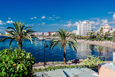
Dalt Vila (Ibiza Old Town)
This UNESCO World Heritage fortified acropolis sits on a hill overlooking Ibiza Town and the Mediterranean. The impressive Renaissance walls, built between 1554-1585 to defend against Ottoman pirates and French attacks, extend for 2.5km and incorporate seven bastions.
The defensive system was designed by Italian engineer Giovanni Battista Calvi under orders from King Felipe II, representing the latest military architecture of its time. Within the walls, layers of history are visible: Phoenician settlement remains (founded in 654 BCE), Roman artifacts, Islamic street patterns, and medieval structures.
The former Governor’s House now contains a fascinating archaeological museum with Punic and Roman artifacts discovered throughout the island. The Cathedral of Our Lady of the Snows at the summit contains Gothic, Baroque, and Neoclassical elements, reflecting centuries of reconstruction.
Es Vedrà
This uninhabited limestone monolith rises dramatically 382 meters from the sea and generates countless legends. Some claim it’s the tip of the lost continent of Atlantis, while others identify it as the island of the Sirens from Homer’s Odyssey. The rock has a high concentration of minerals that creates magnetic anomalies, reportedly affecting compasses and electronic equipment nearby.
Declared a nature reserve in 2002, the islet hosts a unique ecosystem including rare Eleonora’s falcons, wild goats descended from a population introduced in the 1930s, and endemic lizards found nowhere else.
The best viewing points are from Cala d’Hort beach or the Torre des Savinar, a 16th-century watchtower. Mystical properties attributed to Es Vedrà have attracted spiritual seekers, with the area considered an energy vortex similar to Sedona or Machu Picchu.
Las Salinas Beach
This iconic 1.5km stretch of fine white sand forms part of the Ses Salines Natural Park, which encompasses valuable salt flats that have been harvested since Phoenician times (7th century BCE). The salt industry shaped Ibiza’s economy and culture for centuries, with the salt considered among the Mediterranean’s finest.
Behind the beach, pine forests containing trees over 200 years old provide shade and habitat for numerous bird species. The beach gained international fame in the 1960s as a hippy gathering spot, and later evolved into a fashionable destination with beach clubs like Sa Trinxa playing distinctive Balearic beat music that influenced global electronic music trends.
The crystal-clear waters contain especially high salinity, providing exceptional buoyancy for swimmers and nurturing extensive Posidonia seagrass meadows that create the water’s remarkable clarity.
Cala d’Hort
This small but dramatic beach faces directly toward Es Vedrà, creating one of the Mediterranean’s most photographed views. The beach combines golden sand with pebbles and features unusually clear water due to the rocky seabed. Traditional fishermen’s huts called “varaderos” line one side of the cove, with some still actively used by local fishing families who serve their catch in simple restaurants directly behind the beach.
Archaeological remains of a Punic-Roman settlement and necropolis discovered nearby indicate this cove has attracted human settlement for over 2,000 years. The clifftop area contains a prehistoric site called Ses Païsses de Cala d’Hort with stone ruins dating to the Bronze Age, suggesting this viewpoint toward Es Vedrà held spiritual significance for ancient inhabitants.
Santa Eulària des Riu
This sophisticated town is centered around Ibiza’s only river, which made it historically important for water-powered mills (five restored mills can be visited along a riverside walk). The town’s symbolic center is Puig de Missa, a fortified hill crowned by a blindingly white 16th-century church that served as a refuge during pirate attacks.
Within the church complex, the Ethnographic Museum displays traditional island crafts, clothing, and a complete reconstruction of a traditional farmhouse interior. The town became a literary and artistic colony in the 1930s, with writers like Walter Benjamin spending time here. Las Dalias hippy market, established in 1954, has grown into one of the island’s major attractions, featuring over 200 stalls selling handmade jewelry, clothing, and artwork every Saturday throughout the year.
Formentera

Ses Illetes Beach
This extraordinary sandbar stretches north toward Ibiza, creating a double-sided beach where visitors can experience sunrise on the east side and sunset on the west without moving more than 100 meters. The area forms part of the Ses Salines Natural Park shared with southern Ibiza. The sand is composed of crushed seashells and fragments of Posidonia seagrass balls that wash ashore, giving it a uniquely soft texture.
The water clarity is exceptional, with visibility often exceeding 30 meters due to the absence of plankton in these nutrient-poor waters. The beach can only be reached by bicycle, foot, or public bus, as private vehicles are restricted to preserve its natural condition.
Small wooden chiringuito beach bars serve fresh fish and traditional dishes using ingredients that must be brought daily from the main port, as no permanent structures are permitted within the protected area.
La Mola Lighthouse
Standing on 120-meter cliffs at Formentera’s eastern end, this lighthouse was built in 1861. Its dramatic setting inspired Jules Verne’s novel “Hector Servadac,” in which he described it as “the lighthouse at the end of the world” (although this nickname is more commonly associated with a lighthouse in Tierra del Fuego that Verne never visited). The current structure replaced an earlier lighthouse destroyed by lightning.
The surrounding plateau of La Mola contains some of the island’s oldest settlements and distinctive architecture including circular stone huts called “casetes de vinya” once used by vineyard workers. A traditional craft market operates nearby on Wednesdays and Sundays, founded by hippies who settled in this remote area in the 1960s, drawn by its isolation and spectacular natural beauty.
Ses Salines Natural Park
This protected area encompasses 3,000 hectares of land and sea across southern Ibiza and northern Formentera, connected by an underwater plateau where the Posidonia oceanica seagrass meadows reach their most developed state worldwide (recognized by UNESCO as World Heritage). These underwater “forests” can live for thousands of years – some existing colonies began growing 8,000 years ago – making them potentially Earth’s oldest living organisms.
The park’s salt pans produce around 12,000 tons of salt annually using methods largely unchanged since Phoenician times. The hypersaline conditions attract over 200 bird species, including substantial flamingo populations that create spectacular pink displays during migration seasons.
The underwater ecosystem supports over 400 plant species and 1,000 animal species, many of them endangered Mediterranean endemics found nowhere else.
Es Pujols
This is Formentera’s only purpose-built resort, yet it maintains a distinctive laid-back character compared to larger Mediterranean destinations. The town centers around a small fishing harbor that continues to support working fishermen who supply the waterfront restaurants with daily catches.
The main street transforms into a pedestrian market each evening during summer, with artisans displaying handcrafted leather goods, jewelry, and clothing that reflect Formentera’s bohemian heritage. The surrounding beaches feature unusual rock formations called “marès” – fossilized sand dunes from the Quaternary period that have solidified into porous limestone used in traditional buildings across the island.
Es Pujols became an early center for European tourism in the 1960s, attracting musicians including Pink Floyd and Chris Rea, who wrote songs inspired by the island’s atmosphere.
Cap de Barbaria Lighthouse
This remote lighthouse marks Formentera’s southernmost point, where Europe ends – the next land is Algeria, 100 miles across the Mediterranean. Built in 1971, the lighthouse itself is less impressive than its setting: a flat, windswept limestone landscape reminiscent of lunar terrain, punctuated by twisted juniper trees shaped by constant winds.
Prehistoric remains discovered nearby include a Bronze Age settlement dating to 1600 BCE. Several scenes from Julio Medem’s film “Sex and Lucia” were filmed here, bringing the location international recognition. Near the lighthouse, a small hole in the ground leads to a natural cave called “the cave of faxes” that opens onto the cliff face, offering a framed view of the Mediterranean from within the earth.
Sunset here is particularly memorable as the sun appears to sink directly into the open sea with no land on the horizon.
- Cabrera Archipelago
Cabrera National Park – Spain’s only maritime-terrestrial national park encompasses a 19-island archipelago that has served as a military zone for most of its modern history, preserving it from development.
Human habitation has been limited to a small garrison and occasional prisoners – during the Napoleonic Wars, 9,000 French prisoners were abandoned here, with only 3,600 surviving the harsh conditions. This troubled history contrasts with extraordinary natural values: the islands host 450 plant species including 30 endemics found nowhere else. The surrounding waters contain exceptional marine biodiversity with coral formations typically found much deeper in other parts of the Mediterranean.
The Blue Cave (Cova Blava) creates an otherworldly blue illumination when sunlight refracts through an underwater entrance. Byzantine ruins on the main island include a 5th-century basilica, while a 14th-century castle built to combat piracy dominates the harbor. Strict visitor quotas (maximum 300 people daily) preserve the island’s pristine condition.